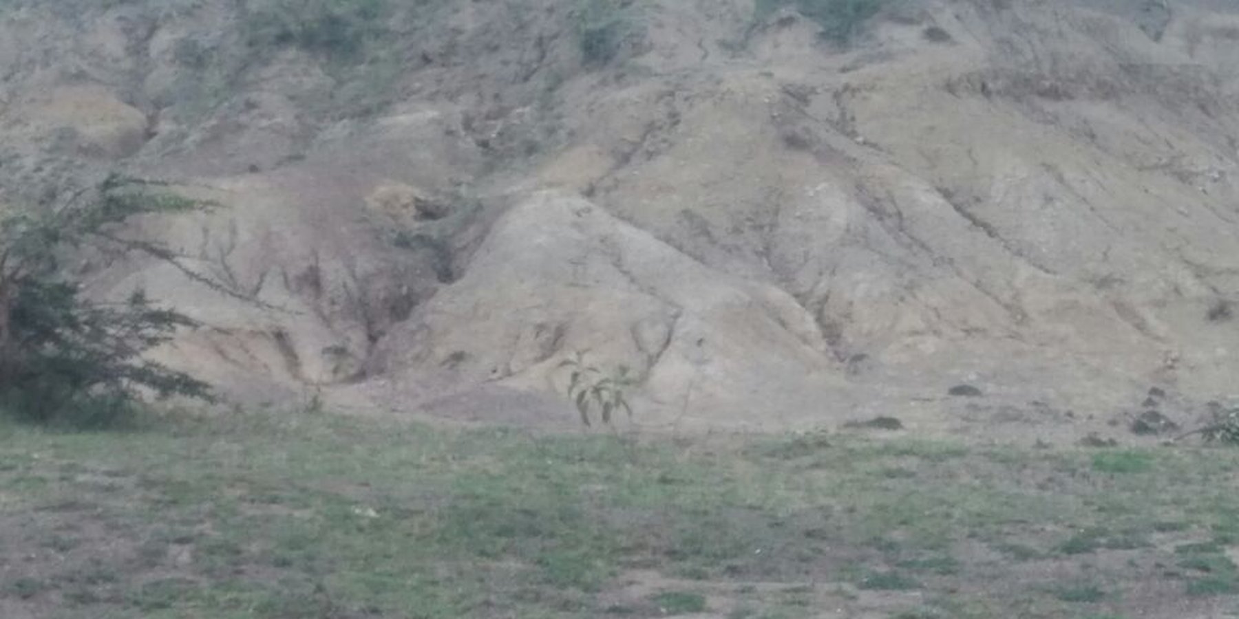
Social Tenure Domain Model (STDM) [Kenya]
- Création :
- Mise à jour :
- Compilateur : Ken Otieno
- Rédacteur : –
- Examinateur : Rima Mekdaschi Studer
STDM
technologies_3318 - Kenya
- Résumé complet en PDF
- Résumé complet en PDF pour impression
- Résumé complet dans le navigateur
- Résumé complet (non formaté)
- Modèle de domaine sur le régime foncier social (STDM): 5 juillet 2018 (inactive)
- Modèle de domaine sur le régime foncier social (STDM): 7 mai 2019 (public)
- Social Tenure Domain Model (STDM): 28 juin 2018 (inactive)
- Social Tenure Domain Model (STDM): 4 juin 2018 (inactive)
- Social Tenure Domain Model (STDM): 19 mai 2018 (inactive)
- Social Tenure Domain Model (STDM): 5 mars 2018 (inactive)
Voir les sections
Développer tout Réduire tout1. Informations générales
1.2 Coordonnées des personnes-ressources et des institutions impliquées dans l'évaluation et la documentation de la Technologie
Personne(s)-ressource(s) clé(s)
Spécialiste GDT:
1.3 Conditions relatives à l'utilisation par WOCAT des données documentées
Quand les données ont-elles été compilées (sur le terrain)?
11/12/2017
Le compilateur et la(les) personne(s) ressource(s) acceptent les conditions relatives à l'utilisation par WOCAT des données documentées:
Oui
1.4 Déclaration sur la durabilité de la Technologie décrite
Est-ce que la Technologie décrite ici pose problème par rapport à la dégradation des terres, de telle sorte qu'elle ne peut pas être déclarée comme étant une technologie de gestion durable des terres?
Non
Commentaires:
The technology has demonstrated SLM.
2. Description de la Technologie de GDT
2.1 Courte description de la Technologie
Définition de la Technologie:
Social Tenure Domain Model (STDM) is about people and their relationships with land. The tool as applied secures tenure through the recognition of tenure diversity and social contexts. STDM recognizes that secure tenure builds confidence among the resource users and therefore promotes investments confidence at different levels including; small scale, large scale both urban and rural investors who all need secure tenure.
2.2 Description détaillée de la Technologie
Description:
Background
The Rangelands Initiative Africa is a programme of the International Land Coalition (ILC) that is working to make rangelands more tenure secure. Resource Conflict Institute (RECONCILE) hosts and coordinates the Africa component while ILRI hosts and coordinates the Global component. Rangelands Initiatives existence recognizes that rangelands diverse resources and interests transcends across different stakeholders and therefore learning within these groups is important for strategic interventions and responses. As such, the programme supports ILC members and partners in upscaling their initiatives, documenting good practices and creating spaces for lessons sharing and learning.
RECONCILE seeks to demonstrate the application the Social Tenure Domain Model (STDM) in a rural setting has been able to secure social tenure rights for increased production among smallholder farmers. This land management and tenure security programme sought to address the dynamics around common resources in Bomet. Recognizing that there are multiple claims to common resources; the technology uses the people as the central nexus in land administration. As such, an extensive range of systems and processes to manage land through effective and accurate planning and management.
Context
Land as a factor of production attracts interests from stakeholders. As such, secure access to land, whether through formal, informal, customary or other means, is necessary for rural households to enjoy sustainable livelihoods, and is an important part of sustainable development. Securing access by rural poor people to land and water rights is key to the reduction of extreme poverty and hunger, since land and water are among the most important assets that poor rural women, youths and men have. Kenya has legal, policy and institutional frameworks and governance systems that presents options and opportunities.
The process of the technology
STDM process involves, problem identification, stakeholder analysis, training, community enumeration, data collection both socio-economic and spatial data and total data management. The process allows an understanding and testing the extent STDM technology responded to gaps and how best they could be applied to cater for needs of all stakeholders within the rural, agricultural, communal land settings. The application of the technology demands complete data sets that are consolidated through total census of both resources users and resources.
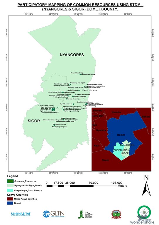
In piloting the STDM in the county, 44 rangelands common resources identified, mapped and documented included; water points, grazing areas and cattle dips. These resources have a direct bearing on sustainable rangelands use and management supporting livelihoods system. Using a census survey with pre-tested structured questionnaires, 498 rangelands users (smallholder farmers) interviewed using participatory enumeration in Sugumerga. There were many constraints but of significance; the changing land use patterns, which introduced fencing off communally, used resources like water points, access routes. The agro-pastoralists and other rangelands users specifically have challenges in accessing common grazing lands.
2.3 Photos de la Technologie
Remarques générales concernant les photos:
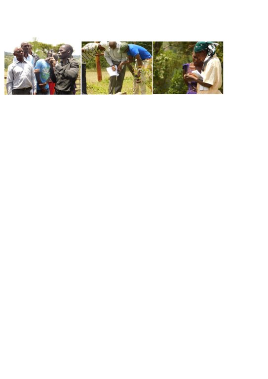
This activity was done to complement the social economic data collected and create the ability to understand the social tenure relationship between farmers and the common resources.
2.5 Pays/ région/ lieux où la Technologie a été appliquée et qui sont couverts par cette évaluation
Pays:
Kenya
Région/ Etat/ Province:
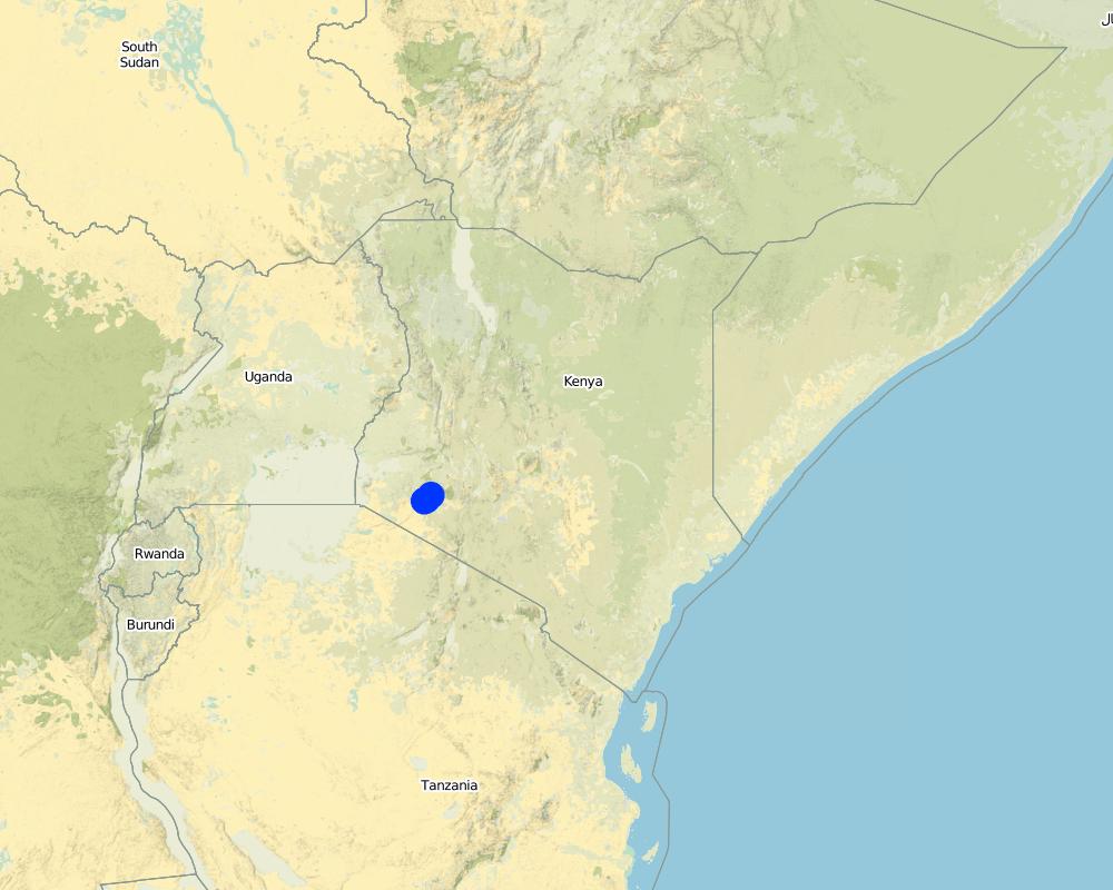
Bomet county
Autres spécifications du lieu:
Kembu sub-county
Map
×2.6 Date de mise en œuvre de la Technologie
Indiquez l'année de mise en œuvre:
2016
2.7 Introduction de la Technologie
Spécifiez comment la Technologie a été introduite: :
- par le biais de projets/ d'interventions extérieures
3. Classification de la Technologie de GDT
3.1 Principal(aux) objectif(s) de la Technologie
- améliorer la production
- réduire, prévenir, restaurer les terres dégradées
- préserver l'écosystème
- protéger un bassin versant/ des zones situées en aval - en combinaison avec d'autres technologies
3.2 Type(s) actuel(s) d'utilisation des terres, là où la Technologie est appliquée

Pâturages
Pâturage extensif:
- Semi-nomadisme/ pastoralisme
Pâturage intensif/ production fourragère :
- Affouragement en vert/ zéro-pâturage
Principales espèces animales et principaux produits:
The cattle kept in Ndaraweta are mainly up-graded cows from the friesian and Ayrshire. The communitoes are currently in grade 3 of the upgrade but still keeps the short horned zebu cows as well.

Mixte (cultures/ pâturages/ arbres), incluant l'agroforesterie
- Agro-pastoralisme
Principaux produits/ services:
The cattle are kept for multi uses including milk, meat, hide and skin. equally, the communities grow hay for local use and sale within.
Commentaires:
The technology did therefore help the communities to appreciate the common resources that support the livestock keeping.
Si l'utilisation des terres a changé en raison de la mise en œuvre de la Technologie, indiquez l'utilisation des terres avant la mise en œuvre de la Technologie:
Before the mapping exercise, most common resources were not given much attention. After participatory mapping and documenting these resources and establishment of information, communities have taken up the management of the resources more seriously and therefore increase of tenure security for both rangelands and resources therein.
3.3 Informations complémentaires sur l'utilisation des terres
Approvisionnement en eau des terres sur lesquelles est appliquée la Technologie:
- pluvial
Nombre de période de croissance par an: :
- 2
Précisez:
April to October and November through March
Densité d'élevage/ chargement (si pertinent):
NA
3.4 Groupe de GDT auquel appartient la Technologie
- gestion des forêts naturelles et semi-naturelles
- pastoralisme et gestion des pâturages
- gestion intégrée cultures-élevage
3.5 Diffusion de la Technologie
Spécifiez la diffusion de la Technologie:
- répartie uniformément sur une zone
Si la Technologie est uniformément répartie sur une zone, indiquez la superficie couverte approximative:
- 10-100 km2
Commentaires:
The technology is applicable in both. It can be customized to fit any use. The best outcome though is total area social enumeration and spatial mapping.
3.6 Mesures de GDT constituant la Technologie

modes de gestion
- M1: Changement du type d’utilisation des terres
- M2: Changement du niveau de gestion / d'intensification
- M3: Disposition/plan en fonction de l'environnement naturel et humain
3.7 Principaux types de dégradation des terres traités par la Technologie

dégradation hydrique
- Hs: changement de la quantité d’eau de surface
- Hw: réduction de la capacité tampon des zones humides

autre
Commentaires:
Land degradation in rangelands is a problem that is being experienced and other challenges especially in the areas where agro-pastoralism is practiced include sustainable land use and management. The mapping process while not having direct response to these issues, it demonstrated that the communities can use sustainable means in land use through land use planning.
3.8 Prévention, réduction de la dégradation ou réhabilitation des terres dégradées
Spécifiez l'objectif de la Technologie au regard de la dégradation des terres:
- réduire la dégradation des terres
- s'adapter à la dégradation des terres
4. Spécifications techniques, activités, intrants et coûts de mise en œuvre
4.1 Dessin technique de la Technologie
4.2 Spécification/ explications techniques du dessin technique
The overall space or measurements for the project areas were within the range of 25 to 75 KM2.
4.3 Informations générales sur le calcul des intrants et des coûts
Spécifiez la manière dont les coûts et les intrants ont été calculés:
- par superficie de la Technologie
Indiquez la taille et l'unité de surface:
Each project area 25 km2 (Project areas of three Sub-Counties 75 km2)
Indiquez la monnaie utilisée pour le calcul des coûts:
- dollars US
Indiquer le taux de change du dollars en monnaie locale (si pertinent): 1 USD= :
101,0
Indiquez le coût salarial moyen de la main d'œuvre par jour:
between Ksh. 2000 to 3000 depending on the kind of labour required and can go down to a compromised rate of ksh. 1000
4.4 Activités de mise en place/ d'établissement
| Activité | Type de mesures | Calendrier | |
|---|---|---|---|
| 1. | Enumeration of at least 1000 farmers | Autres mesures | 9 months |
| 2. | Mapping of communal resources | Structurel | 9 months |
| 3. | Mapping of private resources | Structurel | 9 months |
| 4. | Data Management | Modes de gestion | 3 months |
| 5. | Preparation of data collection including testing of the tools | Autres mesures | 1 month |
| 6. | Dialogue sessions with community leaders | Modes de gestion | 2 months |
| 7. | Negotiations on the methodology for data collection and the kind of information to be collected/asked | Structurel | 1 month |
| 8. | Technical reviews and reflection with project team and partners | Modes de gestion | 1 month |
Commentaires:
The kind of tasks undertaken in this process is more project oriented combined with advocacy and policy processes.
4.5 Coûts et intrants nécessaires à la mise en place
| Spécifiez les intrants | Unité | Quantité | Coûts par unité | Coût total par intrant | % des coût supporté par les exploitants des terres | |
|---|---|---|---|---|---|---|
| Main d'œuvre | Enumerators | persons | 90,0 | 50,0 | 4500,0 | |
| Main d'œuvre | Consultants | Persons | 6,0 | 1000,0 | 6000,0 | |
| Main d'œuvre | Technical Staff contribution and time | persons | 5,0 | 750,0 | 3750,0 | |
| Main d'œuvre | Data processing and management | persons | 24,0 | 60,0 | 1440,0 | |
| Equipements | Data entry and analysis | persons | 20,0 | 40,0 | 800,0 | |
| Equipements | GPS hiring | 120,0 | 55,0 | 6600,0 | ||
| Equipements | GPS purchase | 5,0 | 320,0 | 1600,0 | ||
| Equipements | Computers | 4,0 | 750,0 | 3000,0 | ||
| Equipements | Conferences | 9,0 | 1500,0 | 13500,0 | ||
| Autre | Administrative costs | 9 months | 9,0 | 1400,0 | 12600,0 | |
| Autre | Logistical support | 36,0 | 600,0 | 21600,0 | ||
| Autre | Preliminary activities including targeted dialogue etc | Travels and associated costs | 5,0 | 300,0 | 1500,0 | |
| Autre | Documentation of the project (to be finalized) | Video documentary | 2,0 | 3000,0 | 6000,0 | |
| Coût total de mise en place de la Technologie | 82890,0 | |||||
Si le coût n'est pas pris en charge à 100% par l'exploitant des terres, indiquez qui a financé le coût restant:
UNHABITAT, RECONCILE, Smallholder Dairy Commercialization Programme (SDCP)
Commentaires:
The project was supported by the UNHABITAT with contributions from RECONCILE and partners. the community contribution in kind is not included since it has not been tabulated in terms of cash.
4.6 Activités d'entretien/ récurrentes
| Activité | Type de mesures | Calendrier/ fréquence | |
|---|---|---|---|
| 1. | NA | ||
| 2. | NA | ||
| 3. | NA |
Commentaires:
The project did not have physical structures developed. However, as a result of the work structures like cattle dips have been rehabilitated and are currently being maintained by the the communities themselves. This does not need recurrent costs for maintenance or otherwise by the project.
4.8 Facteurs les plus importants affectant les coûts
Décrivez les facteurs les plus importants affectant les coûts :
The technology costs are dependent on the size and number of resources targeted by the process. It will therefore define the costs accordingly.
5. Environnement naturel et humain
5.1 Climat
Précipitations annuelles
- < 250 mm
- 251-500 mm
- 501-750 mm
- 751-1000 mm
- 1001-1500 mm
- 1501-2000 mm
- 2001-3000 mm
- 3001-4000 mm
- > 4000 mm
Spécifications/ commentaires sur les précipitations:
The area is semi arid
Indiquez le nom de la station météorologique de référence considérée:
Kenya Meteorological department
Zone agro-climatique
- semi-aride
The average temperature in Bomet is 17.5 °C. Precipitation here averages 1247 mm.
5.2 Topographie
Pentes moyennes:
- plat (0-2 %)
- faible (3-5%)
- modéré (6-10%)
- onduleux (11-15%)
- vallonné (16-30%)
- raide (31-60%)
- très raide (>60%)
Reliefs:
- plateaux/ plaines
- crêtes
- flancs/ pentes de montagne
- flancs/ pentes de colline
- piémonts/ glacis (bas de pente)
- fonds de vallée/bas-fonds
Zones altitudinales:
- 0-100 m
- 101-500 m
- 501-1000 m
- 1001-1500 m
- 1501-2000 m
- 2001-2500 m
- 2501-3000 m
- 3001-4000 m
- > 4000 m
Indiquez si la Technologie est spécifiquement appliquée dans des:
- non pertinent
5.3 Sols
Profondeur moyenne du sol:
- très superficiel (0-20 cm)
- superficiel (21-50 cm)
- modérément profond (51-80 cm)
- profond (81-120 cm)
- très profond (>120 cm)
Texture du sol (de la couche arable):
- grossier/ léger (sablonneux)
Texture du sol (> 20 cm sous la surface):
- grossier/ léger (sablonneux)
5.4 Disponibilité et qualité de l'eau
Profondeur estimée de l’eau dans le sol:
5-50 m
Disponibilité de l’eau de surface:
moyenne
5.5 Biodiversité
Diversité des espèces:
- moyenne
Diversité des habitats:
- faible
5.6 Caractéristiques des exploitants des terres appliquant la Technologie
Sédentaire ou nomade:
- Sédentaire
- Semi-nomade
Orientation du système de production:
- mixte (de subsistance/ commercial)
Revenus hors exploitation:
- 10-50% de tous les revenus
Niveau relatif de richesse:
- moyen
Individus ou groupes:
- groupe/ communauté
- coopérative
Niveau de mécanisation:
- travail manuel
- traction animale
Genre:
- femmes
- hommes
Age des exploitants des terres:
- jeunes
- personnes d'âge moyen
5.7 Superficie moyenne des terres détenues ou louées par les exploitants appliquant la Technologie
- < 0,5 ha
- 0,5-1 ha
- 1-2 ha
- 2-5 ha
- 5-15 ha
- 15-50 ha
- 50-100 ha
- 100-500 ha
- 500-1 000 ha
- 1 000-10 000 ha
- > 10 000 ha
Cette superficie est-elle considérée comme de petite, moyenne ou grande dimension (en se référant au contexte local)?
- petite dimension
5.8 Propriété foncière, droits d’utilisation des terres et de l'eau
Propriété foncière:
- communauté/ village
- individu, avec titre de propriété
Droits d’utilisation des terres:
- communautaire (organisé)
- individuel
Droits d’utilisation de l’eau:
- accès libre (non organisé)
- communautaire (organisé)
5.9 Accès aux services et aux infrastructures
santé:
- pauvre
- modéré
- bonne
éducation:
- pauvre
- modéré
- bonne
assistance technique:
- pauvre
- modéré
- bonne
emploi (par ex. hors exploitation):
- pauvre
- modéré
- bonne
marchés:
- pauvre
- modéré
- bonne
énergie:
- pauvre
- modéré
- bonne
routes et transports:
- pauvre
- modéré
- bonne
eau potable et assainissement:
- pauvre
- modéré
- bonne
services financiers:
- pauvre
- modéré
- bonne
6. Impacts et conclusions
6.1 Impacts sur site que la Technologie a montrés
Impacts socio-économiques
Production
production fourragère
Commentaires/ spécifiez:
The production in the farms increased for milk
qualité des fourrages
Commentaires/ spécifiez:
The size of fodder producers also increased. the production trend is stable based on the number of farmers involved.
production animale
Revenus et coûts
revenus agricoles
Commentaires/ spécifiez:
Resulting from the proper land use and increased milk production based on more pasture, costs increased.
Impacts écologiques
Réduction des risques de catastrophe et des risques climatiques
impacts de la sécheresse
6.2 Impacts hors site que la Technologie a montrés
disponibilité de l'eau
flux des cours d'eau fiables et stables en saison sèche
capacité tampon/de filtration
impact des gaz à effet de serre
6.3 Exposition et sensibilité de la Technologie aux changements progressifs et aux évènements extrêmes/catastrophes liés au climat (telles que perçues par les exploitants des terres)
Changements climatiques progressifs
Changements climatiques progressifs
| Saison | Type de changements/ extrêmes climatiques | Comment la Technologie fait-elle face à cela? | |
|---|---|---|---|
| précipitations annuelles | décroît | modérément |
Autres conséquences liées au climat
Autres conséquences liées au climat
| Comment la Technologie fait-elle face à cela? | |
|---|---|
| réduction de la période de croissance | modérément |
6.4 Analyse coûts-bénéfices
Quels sont les bénéfices comparativement aux coûts de mise en place (du point de vue des exploitants des terres)?
Rentabilité à court terme:
positive
Rentabilité à long terme:
très positive
Quels sont les bénéfices comparativement aux coûts d'entretien récurrents (du point de vue des exploitants des terres)?
Rentabilité à court terme:
neutre / équilibrée
Rentabilité à long terme:
positive
6.5 Adoption de la Technologie
- plus de 50%
Si disponible, quantifiez (nombre de ménages et/ou superficie couverte):
The technology covered around 500 individual farmers
Parmi tous ceux qui ont adopté la Technologie, combien d'entre eux l'ont fait spontanément, à savoir sans recevoir aucune incitation matérielle ou aucun paiement?
- 10-50%
Commentaires:
The technology application did not attract any material gains or incentives but, the process was community centered thus the adoption.
6.6 Adaptation
La Technologie a-t-elle été récemment modifiée pour s'adapter à l'évolution des conditions?
Oui
Spécifiez l'adaptation de la Technologie (conception, matériaux/ espèces, etc.):
The technology was more of the urban oriented tool but had to be modified to adopt to the local demands.
6.7 Points forts/ avantages/ possibilités de la Technologie
| Points forts/ avantages/ possibilités du point de vue de l'exploitant des terres |
|---|
|
Ability to define spatial space and common and private resources including those resources associated with milk production such as milk coolers, water points, cattle dips, food stores, grazing areas, salt licks, crush, animal corridors, forest e.t.c Establish the carrying capacity of communal shared resources. |
|
Establishment of the Land tenure system of shared communal resources and issues arising. Status (management) of private resources within the rangelands. Production and income generated against household size. |
| Points forts/ avantages/ possibilités du point de vue du compilateur ou d'une autre personne ressource clé |
|---|
|
The nature of the problem required innovative use in the mapping of the land and natural resources. The technology addressed immediate need and provide a foundation for future updates and demands. The technology benefited from the existing data and improved delivery of output without exerting any impediments. |
|
The technology bridged the gap through skills transfer and capacity building and in facilitating dialogue on issues affecting the community (Maps, reports). Ability to adapt the technology in a simplicity manner that the users can relate with and find value in their use contributed immense success Introduced even a more user friendly of the mobile and smartphone use. The quick win could be seen in the transformation of mobile phones into data collection tools and the data can be seen, verified and shared replacing the tedious and manual process which many were struggling with. |
|
STDM database accommodate inclusion of social economic and spatial data that can be maintained, accessed and update by the communities anytime. Provided visual representation of available resources and their distribution and people can relate to spatial information on the map. |
| Ownership of technology by local people who are now leading on data collection, customizing the template, developing reports and innovating on its use. |
6.8 Faiblesses/ inconvénients/ risques de la Technologie et moyens de les surmonter
| Faiblesses/ inconvénients/ risques du point de vue de l’exploitant des terres | Comment peuvent-ils être surmontés? |
|---|---|
|
The design of the tool was a more urban oriented and took time to be adopted for rural use especially where land is communal and customs are key. |
Created more awareness. |
| Faiblesses/ inconvénients/ risques du point de vue du compilateur ou d'une autre personne ressource clé | Comment peuvent-ils être surmontés? |
|---|---|
|
Difficult to setup the server environment where no internet is available. Engaging other service providers may be difficult and takes time (Internet service provider need to authorize setting up additional server). Appropriate devices for capturing data may necessity additional budget. |
The internet component remains a challenge Technology is evolving and needs systematic information channels even with the community members. The process requires proper funding in order not to have a break in between. |
7. Références et liens
7.1 Méthodes/ sources d'information
- visites de terrain, enquêtes sur le terrain
900
- interviews/entretiens avec les exploitants des terres
900
- interviews/ entretiens avec les spécialistes/ experts de GDT
2
- compilation à partir de rapports et d'autres documents existants
7.3 Liens vers les informations pertinentes disponibles en ligne
Titre/ description:
RECONCILE end of project report and other progress reports are available for sharing
Titre/ description:
Food security in Bomet county
URL:
awsc.uonbi.ac.ke/sites/default/files/chss/arts/.../Bomet-final.doc
Liens et modules
Développer tout Réduire toutLiens
Aucun lien
Modules
Aucun module trouvé


