Pond development in wetland areas [Laos]
- Création :
- Mise à jour :
- Compilateur : kang phanvongsa
- Rédacteurs : Bounthanom Bouahom, Pasalath Khounsy
- Examinateurs : Nicole Harari, Oulaytham Lasasimma, Alexandra Gavilano
technologies_2905 - Laos
Voir les sections
Développer tout Réduire tout1. Informations générales
1.2 Coordonnées des personnes-ressources et des institutions impliquées dans l'évaluation et la documentation de la Technologie
Personne(s)-ressource(s) clé(s)
exploitant des terres:
Inphet Amthae
Laos
exploitant des terres:
keosonghueang tulan
Laos
Nom du projet qui a facilité la documentation/ l'évaluation de la Technologie (si pertinent)
Scaling-up SLM practices by smallholder farmers (IFAD)Nom du ou des institutions qui ont facilité la documentation/ l'évaluation de la Technologie (si pertinent)
National Agriculture and Forestry Research Institute (NAFRI) - Laos1.3 Conditions relatives à l'utilisation par WOCAT des données documentées
Le compilateur et la(les) personne(s) ressource(s) acceptent les conditions relatives à l'utilisation par WOCAT des données documentées:
Oui
1.4 Déclaration sur la durabilité de la Technologie décrite
Est-ce que la Technologie décrite ici pose problème par rapport à la dégradation des terres, de telle sorte qu'elle ne peut pas être déclarée comme étant une technologie de gestion durable des terres?
Non
2. Description de la Technologie de GDT
2.1 Courte description de la Technologie
Définition de la Technologie:
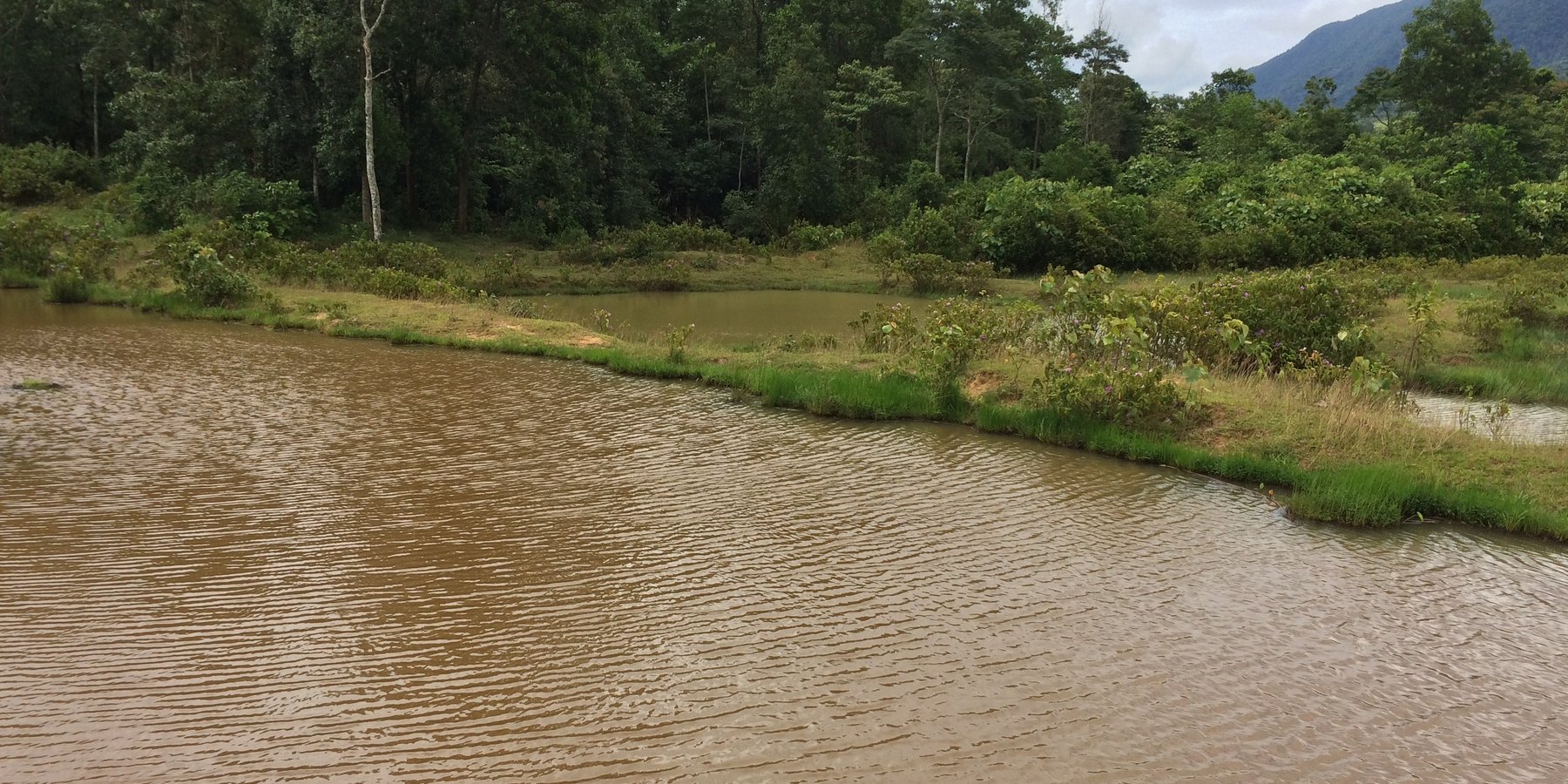
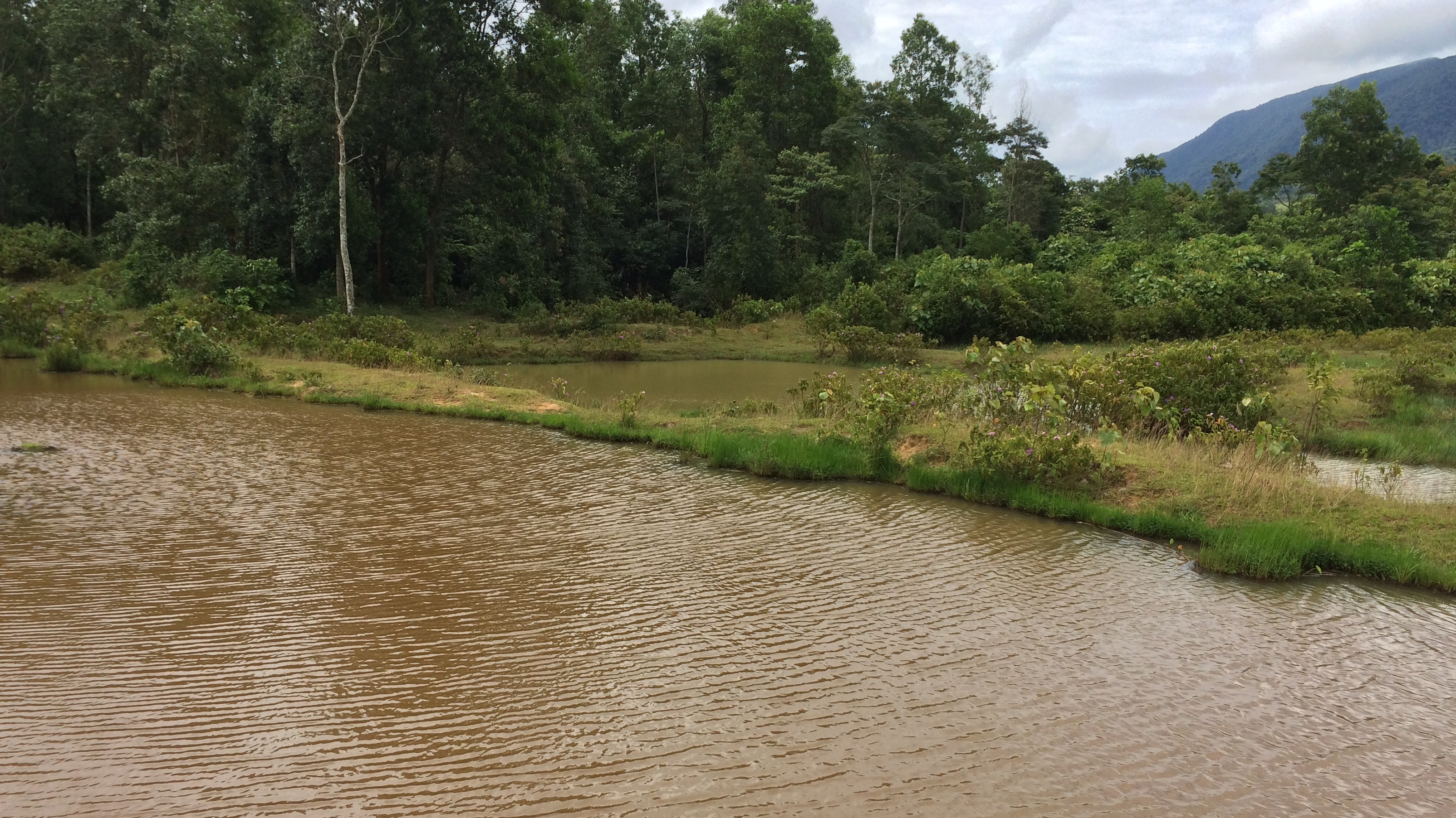
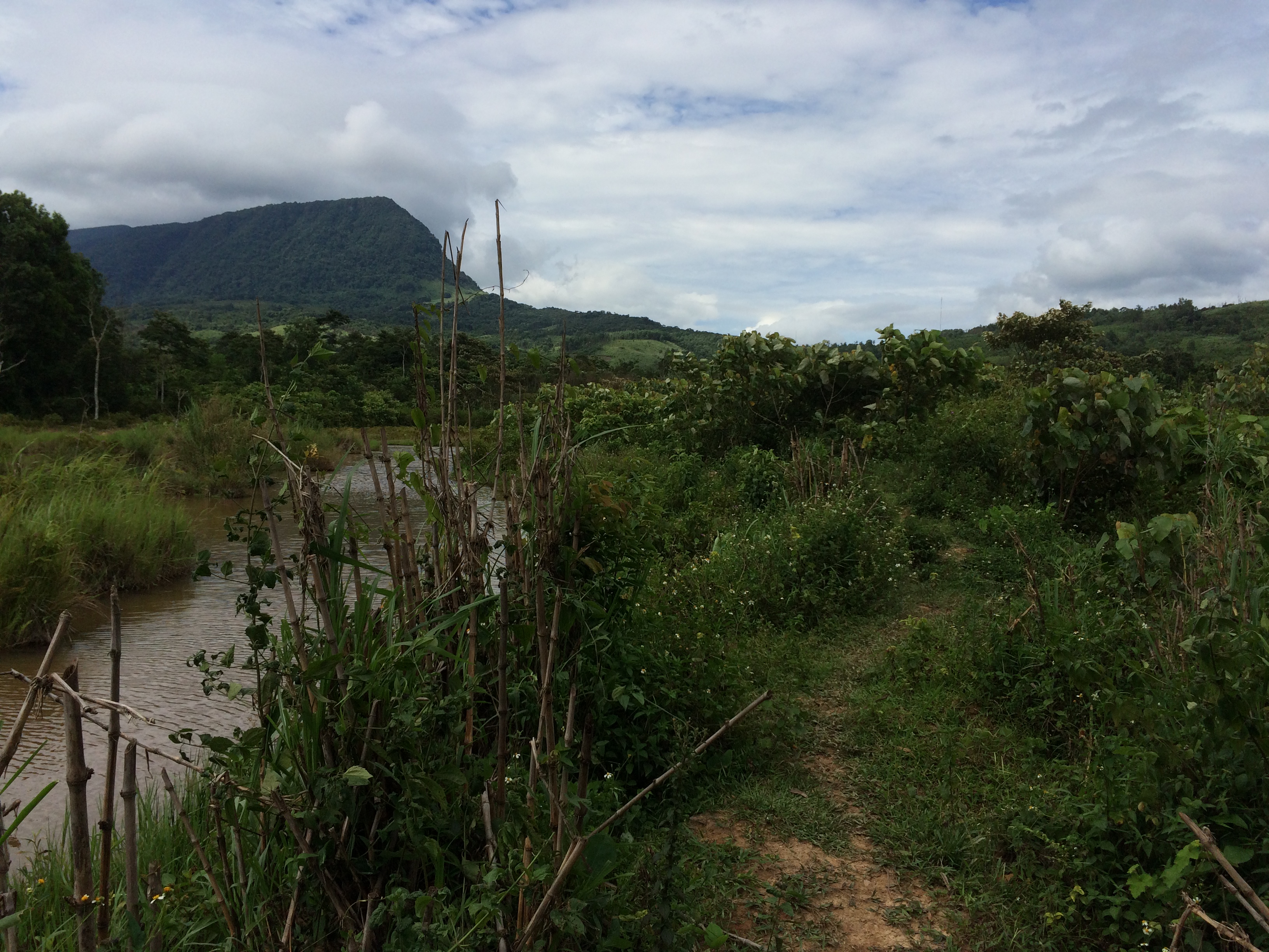
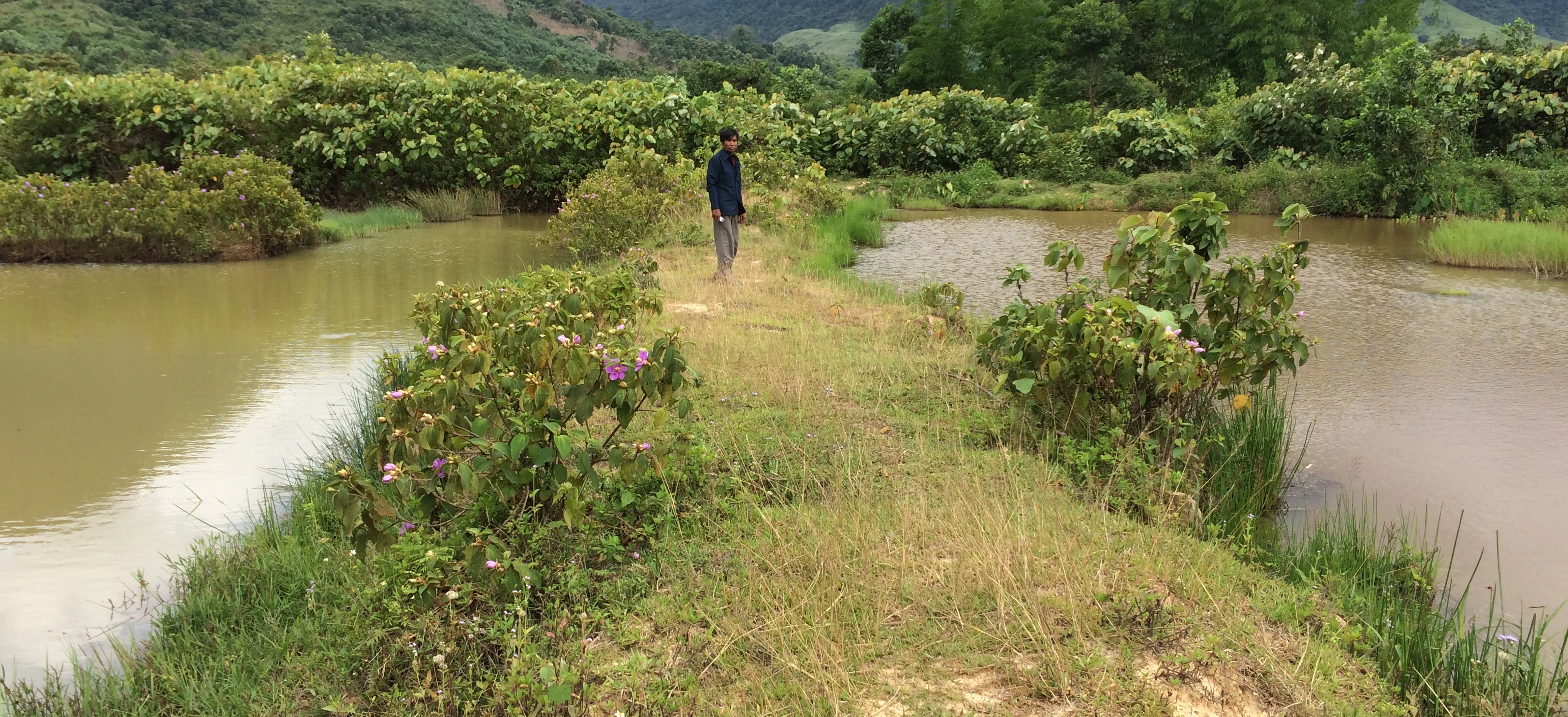
Conversion of wetland plots into fishpond.
2.2 Description détaillée de la Technologie
Description:
At Asoy village and its neighboring villages in the Salavan Province of Lao PDR some rice fields were regularly flood prone during rainy season (August ̶ October) because of a newly constructed road containing culverts leading first through the rice fields and then into natural water ways. Therefore, in 2005 one of the village's land users spread the idea to convert this regularly damaged and increasingly unproductive rice land into fish ponds. The soil texture in this area is mostly clayey and therefore also generally not very suitable for agriculture, but certainly appropriate for water holding throughout the year. Thus, the main objective of these pond constructions was the raising of fishes for income generation and for getting water for household purposes during dry season; e.g. for gardening, fodder production, and for banana and bamboo cultivation along the edges of the pond dikes. The fishpond should also provide water for livestock such as cattle, buffalo, and poultry farming. The construction of the ponds in the case documented here started by shutting off the culvert at the inlets by using sawn wood and clay to close the concrete pipe (Ø80 cm) crossing the road. After, vegetation clearance was required by using a bulldozer. A backhoe then was applied to excavate an area of 1.5 ha to create a first big pond (150 m long and 100 m wide). The excavated soil was used directly for the dike construction. The dikes were around 2.5 m high and 2 m wide. For the first big pond only two dikes had to be shaped because the other two sides were road and fallow. At completion of the big pond, two smaller ponds have been constructed also by backhoe directly next to it. The first of them encompasses an area of 2,000 square meters (20 m x 100 m) and the second 3,000 square meters (30 m x 100 m). After this, four new Ø40 cm drainage pipes were installed; a first one throughout the road leading into the first pond, two of them connecting the ponds and the last pipe is needed to lead the water finally into the natural water way. The pipes have to be installed at a height of 50 cm from the edges. To stabilize the ponds Napier grass, banana, and bamboo can be cultivated on the top of the dikes. Maintenance of the pond requires regular cutting of the Napier grass, which is done by hand. Also regular weeding of the dike’s edges is required, as well as the stabilization of the embankments by using timber and soil. Where repair is required, the timber can be placed vertically, and then filled out with soil. The ponds are hold and maintained individually by the land owner and the benefit of them is considerable. The annual fish production is approximately 1 ton , equivalent to 15 million Kip . The ponds also store water for utilization during dry season especially for the animals (cattle, buffalos, and poultries). The grass growing on the edges can serve as fodder for animals. Banana and bamboo shoots can be consumed and sold for income generation. Material from branches of bamboo trees is used for handicrafts such as baskets and bamboo sheets for house walls, etc. The fishpond improves the aquatic ecosystem habitats in the area. The pond provides spawning areas for a large variety of fish, shrimp, crab, and frog species. However, with changing climate and rainfall patterns it happened that the ponds dried up and the soil became hard with rapidly growing weed around the ponds. Plants such as Napier and banana that are cultivated on the edge of the dikes can die. On the other hand in particular years, there flash floods occur that can affect the dikes due to rapid water runoff; in consequence also fish and other aquatic species can be lost and crops can be damaged. Nonetheless, the land owners at Asoy village prefer this technology and want to expand and improve it, when they have capability or when support from external institutions can be expected (e.g. training in fish breeding and required equipment such as hapa fish net for fish nursery, air pump, dip nets and harvesting net). Finally, the fishponds have been expanded to neighboring villages as well.
2.3 Photos de la Technologie
Galerie Médias
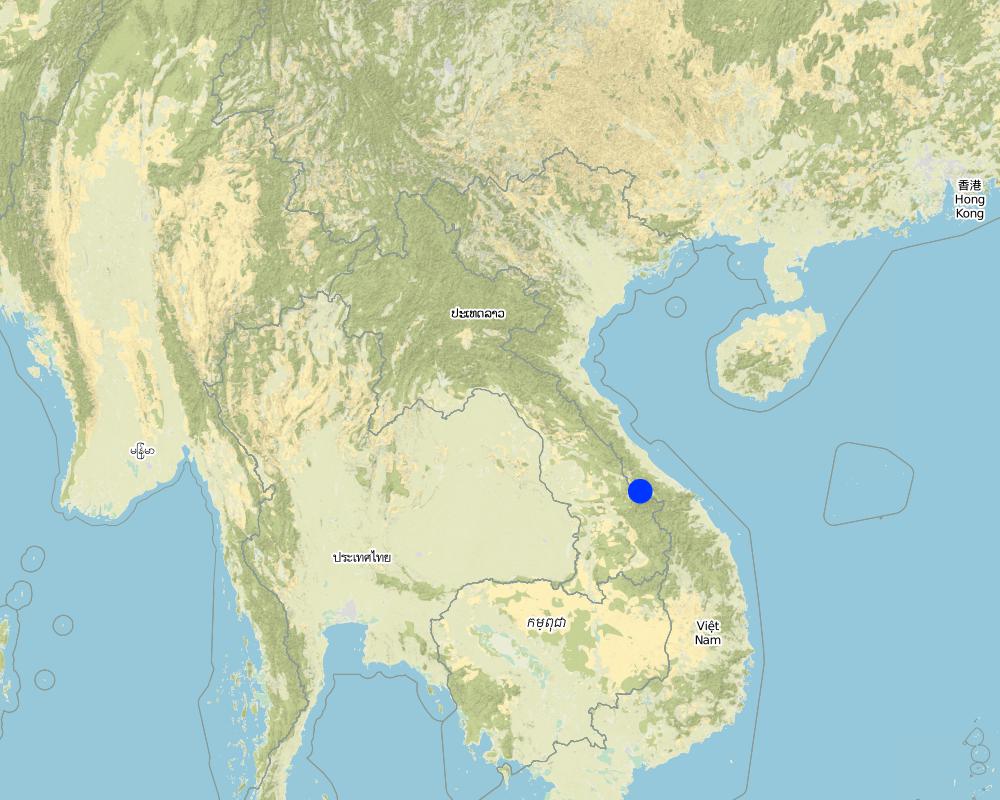
2.5 Pays/ région/ lieux où la Technologie a été appliquée et qui sont couverts par cette évaluation
Pays:
Laos
Région/ Etat/ Province:
Samoaui district, Salavan province
Autres spécifications du lieu:
Asoy village
Spécifiez la diffusion de la Technologie:
- appliquée en des points spécifiques ou concentrée sur une petite surface
Map
×2.6 Date de mise en œuvre de la Technologie
Indiquez l'année de mise en œuvre:
2005
Si l'année précise est inconnue, indiquez la date approximative: :
- il y a entre 10-50 ans
2.7 Introduction de la Technologie
Spécifiez comment la Technologie a été introduite: :
- grâce à l'innovation d'exploitants des terres
3. Classification de la Technologie de GDT
3.1 Principal(aux) objectif(s) de la Technologie
- améliorer la production
- réduire, prévenir, restaurer les terres dégradées
- créer un impact économique positif
3.2 Type(s) actuel(s) d'utilisation des terres, là où la Technologie est appliquée

Voies d'eau, plans d'eau, zones humides
- Etangs, barrages, retenues d'eau
Principaux produits/ services:
Fishs
Commentaires:
Number of growing seasons per year: 1
Livestock density : 5 buffalo, 7 goats, 30 pigs, 7 cows
3.3 Est-ce que l’utilisation des terres a changé en raison de la mise en œuvre de la Technologie ?
Est-ce que l’utilisation des terres a changé en raison de la mise en œuvre de la Technologie ?
- Oui (Veuillez remplir les questions ci-après au regard de l’utilisation des terres avant la mise en œuvre de la Technologie)

Autre
Précisez:
Wetland
Commentaires:
Before implementation of the Technology this land was a wetland that is unsuitable for agricultural activities
3.4 Approvisionnement en eau
Approvisionnement en eau des terres sur lesquelles est appliquée la Technologie:
- pluvial
3.5 Groupe de GDT auquel appartient la Technologie
- récupération/ collecte de l'eau
- apiculture, aquaculture, élevage de volailles, de lapins, du ver à soie, etc.
3.6 Mesures de GDT constituant la Technologie

structures physiques
- S5: Barrages/retenues, micro-bassins, étangs
3.7 Principaux types de dégradation des terres traités par la Technologie

érosion hydrique des sols
- Wg: ravinement/ érosion en ravines

dégradation hydrique
- Hw: réduction de la capacité tampon des zones humides
3.8 Prévention, réduction de la dégradation ou réhabilitation des terres dégradées
Spécifiez l'objectif de la Technologie au regard de la dégradation des terres:
- s'adapter à la dégradation des terres
4. Spécifications techniques, activités, intrants et coûts de mise en œuvre
4.1 Dessin technique de la Technologie
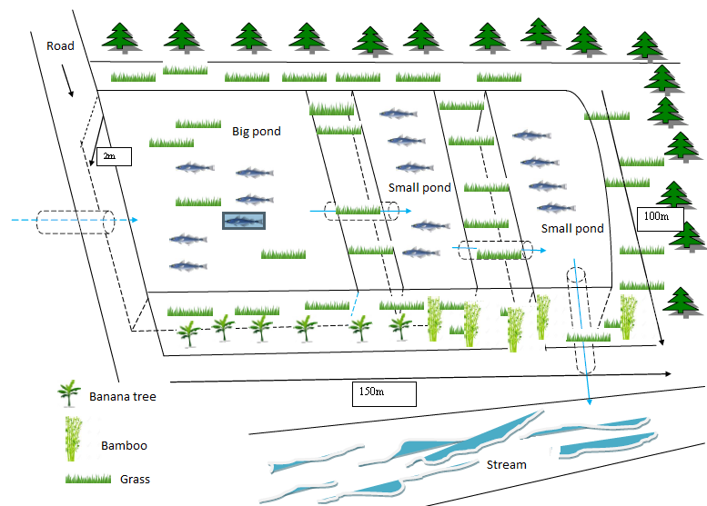
Spécifications techniques (associées au dessin technique):
- The dykes height is approximately 2.5m, and the water level from the bottom to the drainage pipe is 2 meters, and the canal width is 3 meters.
- The total size is 100m x150m
- Slope 3-5 %
- Water storage capacity 30,000m3
- Water storage area 1.5 ha
- Development inputs include land, concrete pipes, and sawn woods
- Fish species include: tilapia, grass fish, and crab
Auteur:
Phonesyli phanvongsa
Date:
05/07/2017
4.2 Informations générales sur le calcul des intrants et des coûts
Spécifiez la manière dont les coûts et les intrants ont été calculés:
- par entité de la Technologie
Précisez l'unité:
1.5 ha
autre/ monnaie nationale (précisez):
kip
Indiquez le taux de change des USD en devise locale, le cas échéant (p.ex. 1 USD = 79.9 réal brésilien): 1 USD = :
8500,0
Indiquez le coût salarial moyen de la main d'œuvre par jour:
50,000
4.3 Activités de mise en place/ d'établissement
| Activité | Calendrier des activités (saisonnier) | |
|---|---|---|
| 1. | Close up the stream | before on set of rain |
| 2. | Exaction works at the bog wetland or seasonal flood prone area | |
| 3. | Build dykes (use backhoe) |
4.4 Coûts et intrants nécessaires à la mise en place
| Spécifiez les intrants | Unité | Quantité | Coûts par unité | Coût total par intrant | % du coût supporté par les exploitants des terres | |
|---|---|---|---|---|---|---|
| Main d'œuvre | labour | person-day | 50,0 | 50000,0 | 2500000,0 | 100,0 |
| Main d'œuvre | excavator | machine | 1,0 | 3000000,0 | 3000000,0 | 100,0 |
| Equipements | hoe | piece | 20,0 | 50000,0 | 1000000,0 | 100,0 |
| Equipements | shovel | piece | 20,0 | 30000,0 | 600000,0 | 100,0 |
| Equipements | knife | piece | 5,0 | 20000,0 | 100000,0 | 100,0 |
| Matériel végétal | fodder | bunch | 3,0 | 20000,0 | 60000,0 | 100,0 |
| Autre | Fry | Fry | 2400,0 | 1000,0 | 2400000,0 | 100,0 |
| Coût total de mise en place de la Technologie | 9660000,0 | |||||
| Coût total de mise en place de la Technologie en dollars américains (USD) | 1136,47 | |||||
Commentaires:
The costs for the driver is included in the hiring costs the excavator of the pond.
4.5 Activités d'entretien/ récurrentes
| Activité | Calendrier/ fréquence | |
|---|---|---|
| 1. | Canal maintenance | yearly |
| 2. | Canal reparation | yearly |
| 3. | Canal reparation | yearly |
4.6 Coûts et intrants nécessaires aux activités d'entretien/ récurrentes (par an)
| Spécifiez les intrants | Unité | Quantité | Coûts par unité | Coût total par intrant | % du coût supporté par les exploitants des terres | |
|---|---|---|---|---|---|---|
| Main d'œuvre | labour | person | 6,0 | 50000,0 | 300000,0 | |
| Equipements | hoe | piece | 1,0 | 50000,0 | 50000,0 | |
| Equipements | shovel | piece | 2,0 | 30000,0 | 60000,0 | |
| Equipements | knife | piece | 1,0 | 20000,0 | 20000,0 | |
| Equipements | trolley | piece | 2,0 | 250000,0 | 500000,0 | |
| Coût total d'entretien de la Technologie | 930000,0 | |||||
| Coût total d'entretien de la Technologie en dollars américains (USD) | 109,41 | |||||
4.7 Facteurs les plus importants affectant les coûts
Décrivez les facteurs les plus importants affectant les coûts :
Cost for labour and backhoe service is the most important input.
5. Environnement naturel et humain
5.1 Climat
Précipitations annuelles
- < 250 mm
- 251-500 mm
- 501-750 mm
- 751-1000 mm
- 1001-1500 mm
- 1501-2000 mm
- 2001-3000 mm
- 3001-4000 mm
- > 4000 mm
Spécifiez la pluviométrie moyenne annuelle (si connue), en mm:
2000,00
Spécifications/ commentaires sur les précipitations:
Rainy season from May to November, highest rainfall between July to October. dry season from December to March April (rainfall)
Indiquez le nom de la station météorologique de référence considérée:
Samoui Agriculture Office
Zone agro-climatique
- humide
5.2 Topographie
Pentes moyennes:
- plat (0-2 %)
- faible (3-5%)
- modéré (6-10%)
- onduleux (11-15%)
- vallonné (16-30%)
- raide (31-60%)
- très raide (>60%)
Reliefs:
- plateaux/ plaines
- crêtes
- flancs/ pentes de montagne
- flancs/ pentes de colline
- piémonts/ glacis (bas de pente)
- fonds de vallée/bas-fonds
Zones altitudinales:
- 0-100 m
- 101-500 m
- 501-1000 m
- 1001-1500 m
- 1501-2000 m
- 2001-2500 m
- 2501-3000 m
- 3001-4000 m
- > 4000 m
Indiquez si la Technologie est spécifiquement appliquée dans des:
- situations convexes
5.3 Sols
Profondeur moyenne du sol:
- très superficiel (0-20 cm)
- superficiel (21-50 cm)
- modérément profond (51-80 cm)
- profond (81-120 cm)
- très profond (>120 cm)
Texture du sol (de la couche arable):
- fin/ lourd (argile)
Texture du sol (> 20 cm sous la surface):
- moyen (limoneux)
- fin/ lourd (argile)
Matière organique de la couche arable:
- moyen (1-3%)
5.4 Disponibilité et qualité de l'eau
Profondeur estimée de l’eau dans le sol:
5-50 m
Disponibilité de l’eau de surface:
bonne
Qualité de l’eau (non traitée):
eau potable
La salinité de l'eau est-elle un problème? :
Non
La zone est-elle inondée?
Oui
Régularité:
fréquemment
5.5 Biodiversité
Diversité des espèces:
- moyenne
Diversité des habitats:
- moyenne
5.6 Caractéristiques des exploitants des terres appliquant la Technologie
Sédentaire ou nomade:
- Sédentaire
Orientation du système de production:
- subsistance (auto-approvisionnement)
Revenus hors exploitation:
- 10-50% de tous les revenus
Niveau relatif de richesse:
- moyen
Individus ou groupes:
- individu/ ménage
Niveau de mécanisation:
- travail manuel
Genre:
- hommes
Age des exploitants des terres:
- jeunes
- personnes d'âge moyen
5.7 Superficie moyenne des terres utilisées par les exploitants des terres appliquant la Technologie
- < 0,5 ha
- 0,5-1 ha
- 1-2 ha
- 2-5 ha
- 5-15 ha
- 15-50 ha
- 50-100 ha
- 100-500 ha
- 500-1 000 ha
- 1 000-10 000 ha
- > 10 000 ha
Cette superficie est-elle considérée comme de petite, moyenne ou grande dimension (en se référant au contexte local)?
- moyenne dimension
5.8 Propriété foncière, droits d’utilisation des terres et de l'eau
Propriété foncière:
- individu, avec titre de propriété
Droits d’utilisation des terres:
- individuel
Droits d’utilisation de l’eau:
- individuel
5.9 Accès aux services et aux infrastructures
santé:
- pauvre
- modéré
- bonne
éducation:
- pauvre
- modéré
- bonne
assistance technique:
- pauvre
- modéré
- bonne
emploi (par ex. hors exploitation):
- pauvre
- modéré
- bonne
marchés:
- pauvre
- modéré
- bonne
énergie:
- pauvre
- modéré
- bonne
routes et transports:
- pauvre
- modéré
- bonne
eau potable et assainissement:
- pauvre
- modéré
- bonne
services financiers:
- pauvre
- modéré
- bonne
6. Impacts et conclusions
6.1 Impacts sur site que la Technologie a montrés
Impacts socio-économiques
Production
production agricole
Commentaires/ spécifiez:
After ponds construction various crops can be planted on the dike of the ponds.
production animale
Quantité avant la GDT:
Very rare
Quantité après la GDT:
1 ton of fish
Commentaires/ spécifiez:
Before, only small amount of fish was captured because the fish came only from natural water bodies. The farmer also increased the poultry due to the fish ponds.
risque d'échec de la production
Commentaires/ spécifiez:
Before, only small amount of fish was captured because the fish came only from natural water bodies. The farmer also increased the poultry due to the fish ponds.
gestion des terres
Quantité avant la GDT:
No management (bog wetland)
Quantité après la GDT:
fish farm management
Commentaires/ spécifiez:
water harvesting and fish production
Disponibilité et qualité de l'eau
disponibilité de l'eau pour l'élevage
Commentaires/ spécifiez:
Before they was only a not very suitable natural bog area that accumulated peat from dead plant material and contained only shallow water. After the pond construction the water was deep enough for fish production, drinking water for livestock and also for crop irrigation.
Revenus et coûts
dépenses pour les intrants agricoles
Commentaires/ spécifiez:
After completion of the pond the farmer has to buy costly fish breed every year from Vietnam (1000 kip/fry)
revenus agricoles
Commentaires/ spécifiez:
Before the pond construction the farmer produced only for reaching self sufficiency without any income from the agricultural production. After implementation of the technology the farmer got income from fish, crop and fruit at around 15 million kip/year.
diversité des sources de revenus
Commentaires/ spécifiez:
Previously there is not any income from agriculture produce, after pond have been complete, they have many kind of produce for sell such as banana, vegetation, fish
charge de travail
Commentaires/ spécifiez:
Previously the farmer relied on natural wetland without substantial maintenance work. Then after completing the ponds the farmer has to spend quite a lot of work time to maintain them properly.
Impacts socioculturels
sécurité alimentaire/ autosuffisance
Commentaires/ spécifiez:
After pond construction the family was able to increase food sedcurity and self-sufficiency as they got supplmentary fish, fruits and other crops for self-consumption. Futher, they were able to sale the products and by this getting money when required.
possibilités de loisirs
Commentaires/ spécifiez:
The pond serves now as recreational site for fishing and swimming.
Impacts écologiques
Cycle de l'eau/ ruissellement
récolte/ collecte de l'eau
Commentaires/ spécifiez:
Before, the water streamed though the land without beeing harvested. Since the creation of the ponds - which were surrounded by dykes - the water were collected and stored easily for different already mentioned purposes.
ruissellement de surface
Commentaires/ spécifiez:
Soil surface runoff and accumulate in down stream. the ponds can control and reduced runoff by by overflow, the sediment are accumulated on pond bottom
Biodiversité: végétale, animale
espèces bénéfiques
Commentaires/ spécifiez:
There are many kind of animals in the area including prey ( rats, fish, frogs...) and predators ( snakes, snake fish, bird...), all acting as a small food chain elements.
diversité des habitats
Commentaires/ spécifiez:
The increase in animal types and animal species in the area indicates the increase of the habitat diversity.
6.3 Exposition et sensibilité de la Technologie aux changements progressifs et aux évènements extrêmes/catastrophes liés au climat (telles que perçues par les exploitants des terres)
Changements climatiques progressifs
Changements climatiques progressifs
| Saison | Augmentation ou diminution | Comment la Technologie fait-elle face à cela? | |
|---|---|---|---|
| températures annuelles | augmente | modérément | |
| températures saisonnières | saison sèche | augmente | bien |
| précipitations annuelles | augmente | modérément | |
| précipitations saisonnières | saison des pluies/ humide | décroît | modérément |
Extrêmes climatiques (catastrophes)
Catastrophes météorologiques
| Comment la Technologie fait-elle face à cela? | |
|---|---|
| pluie torrentielle locale | très bien |
| averse de grêle locale | très bien |
Catastrophes climatiques
| Comment la Technologie fait-elle face à cela? | |
|---|---|
| sécheresse | bien |
Catastrophes hydrologiques
| Comment la Technologie fait-elle face à cela? | |
|---|---|
| crue éclair | bien |
Catastrophes biologiques
| Comment la Technologie fait-elle face à cela? | |
|---|---|
| infestation par des insectes/ vers | modérément |
Autres conséquences liées au climat
Autres conséquences liées au climat
| Comment la Technologie fait-elle face à cela? | |
|---|---|
| prolongement de la période de croissance | modérément |
6.4 Analyse coûts-bénéfices
Quels sont les bénéfices comparativement aux coûts de mise en place (du point de vue des exploitants des terres)?
Rentabilité à court terme:
neutre / équilibrée
Rentabilité à long terme:
légèrement positive
Quels sont les bénéfices comparativement aux coûts d'entretien récurrents (du point de vue des exploitants des terres)?
Rentabilité à court terme:
légèrement positive
Rentabilité à long terme:
légèrement positive
6.5 Adoption de la Technologie
- > 50%
De tous ceux qui ont adopté la Technologie, combien d'entre eux l'ont fait spontanément, à savoir sans recevoir aucune incitation matérielle, ou aucune rémunération? :
- 91-100%
6.6 Adaptation
La Technologie a-t-elle été récemment modifiée pour s'adapter à l'évolution des conditions?
Non
6.7 Points forts/ avantages/ possibilités de la Technologie
| Points forts/ avantages/ possibilités du point de vue de l'exploitant des terres |
|---|
| Increased aquatic resources with a variety of species including crabs, shrimps, fishes, snails |
| Suitable to carry out agricultural activities all year-round including crops and animal raising |
| Increased food security and cash crop production |
| Points forts/ avantages/ possibilités du point de vue du compilateur ou d'une autre personne ressource clé |
|---|
| Having sufficient food for the whole year from agriculture production such as crops and animals |
| Able to produce fry for individual ponds and distribute to others |
| Able to store water for agricultural activities (cultivation and animal feeding) during dry season |
| Able to generate income for households from integrated fishing practices |
6.8 Faiblesses/ inconvénients/ risques de la Technologie et moyens de les surmonter
| Faiblesses/ inconvénients/ risques du point de vue de l’exploitant des terres | Comment peuvent-ils être surmontés? |
|---|---|
| Lack of fund to maintain the ponds | Producing fry by themselves for sale. By this, creating fund for solid maintenance work. |
| Occasional floods cause repair work of the pond dykes | |
| Some times, occurring droughts run the ponds dry. |
| Faiblesses/ inconvénients/ risques du point de vue du compilateur ou d'une autre personne ressource clé | Comment peuvent-ils être surmontés? |
|---|---|
| Lack of expertise in fish raising and breeding | provide fish breeding training activities for local people |
| Lack of fund for fish raising and fish breeding (purchase of juvenile fish is needed) | provide equipment or fish breeds |
7. Références et liens
7.1 Méthodes/ sources d'information
- visites de terrain, enquêtes sur le terrain
1 place
- interviews/entretiens avec les exploitants des terres
2 persons
Quand les données ont-elles été compilées (sur le terrain)?
04/07/2017
Liens et modules
Développer tout Réduire toutLiens
Aucun lien
Modules
Aucun module trouvé