Adapted management of organic soils [Allemagne]
- Création :
- Mise à jour :
- Compilateur : Johanna Fick
- Rédacteur : –
- Examinateurs : Fabian Ottiger, David Streiff, Alexandra Gavilano
technologies_1697 - Allemagne
Voir les sections
Développer tout Réduire tout1. Informations générales
1.2 Coordonnées des personnes-ressources et des institutions impliquées dans l'évaluation et la documentation de la Technologie
Spécialiste GDT:
Baum Sarah
Thünen Institute of Rural Studies
Allemagne
Nom du projet qui a facilité la documentation/ l'évaluation de la Technologie (si pertinent)
Book project: Making sense of research for sustainable land management (GLUES)Nom du projet qui a facilité la documentation/ l'évaluation de la Technologie (si pertinent)
Climate Change - Land Use Strategies (CC-LandStraD / GLUES)Nom du ou des institutions qui ont facilité la documentation/ l'évaluation de la Technologie (si pertinent)
Thünen Institute (Thünen Institute) - Allemagne1.3 Conditions relatives à l'utilisation par WOCAT des données documentées
Le compilateur et la(les) personne(s) ressource(s) acceptent les conditions relatives à l'utilisation par WOCAT des données documentées:
Oui
1.5 Référence au(x) Questionnaires sur les Approches de GDT (documentées au moyen de WOCAT)
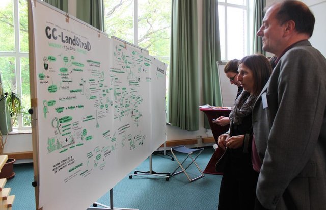
Open dialogue platform on sustainable land management [Allemagne]
Establishing a dialogue platform on sustainable land management which is open to all stakeholders
- Compilateur : Johanna Fick
2. Description de la Technologie de GDT
2.1 Courte description de la Technologie
Définition de la Technologie:
Re-wetting of organic soils and following adapted management suitable for wet conditions like extensive grazing land or paludiculture.
2.2 Description détaillée de la Technologie
Description:
In peat lands, formed over centuries, reducing the ground water level leads to min-eralization: this results in greenhouse gas (GHG) emissions and leaching of dis-solved organic nutrients into adjacent water bodies. Furthermore, drainage leads to the destruction of highly specialized ecosystems. Re-wetting, by removing of drain-age systems (etc.), means the restoration of a higher ground water level which can reduce GHG emissions in the long term. Re-wetting to a water-level of 10 cm below the soil surface is ideal for reducing GHG emissions and preventing peat mineraliza-tion. One prerequisite for re-wetting is that soil degradation and peat mineralization are not too advanced. An adequate water supply must be available. Re-wetting also affects adjacent areas so possible impacts such as flooding of settlements and in-frastructure must be considered.
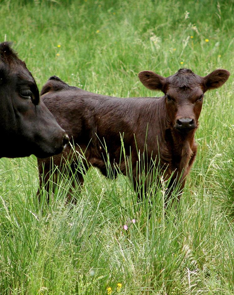
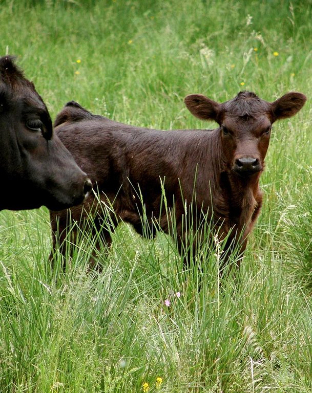
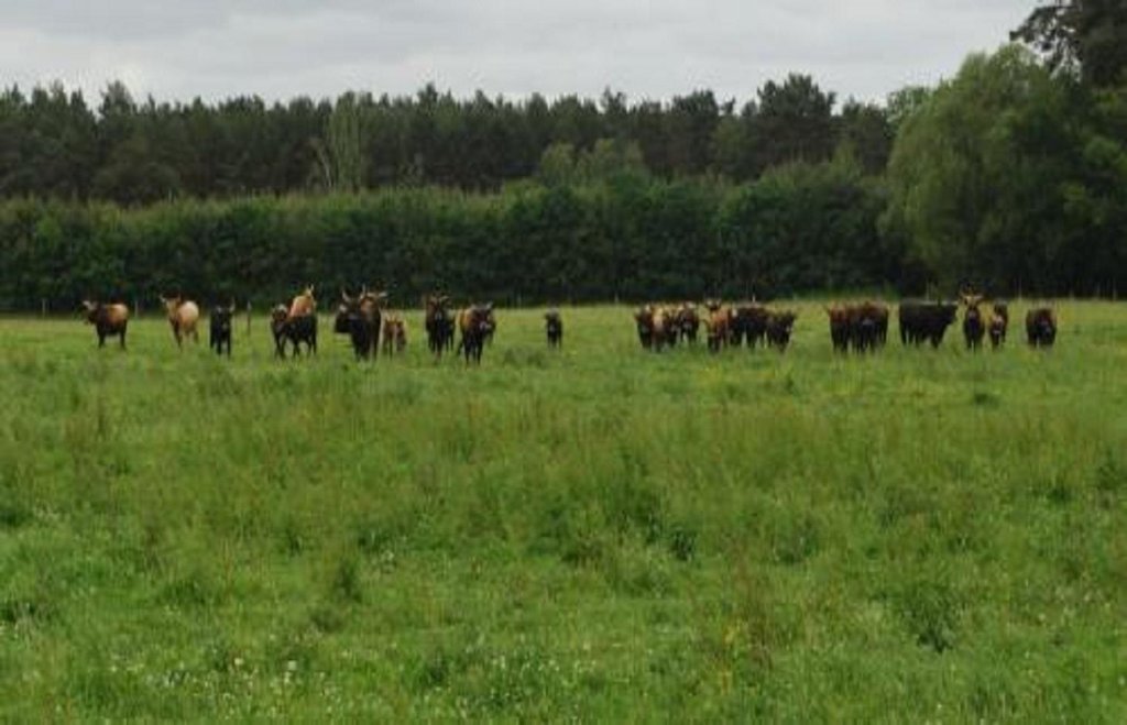
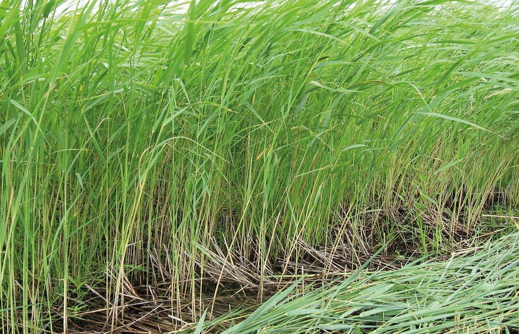
Purpose of the Technology: Land uses suitable for the soil conditions after re-wetting are extensive grazing, or paludiculture. Paludiculture is the cultivation of wet organic soils by preserving or renewing peat by planting and harvesting specific trees (e.g. alder), reeds and sedges. On fens, alder trees (for wood /biomass production) or plant species grown for their products (e.g. for thatch) or bioenergy, including the common reed, reed canary grass or cat’s-tail, can be cultivated. On peat bogs sphagnum farming as a peat substitute in horticulture, or as a medicinal plant, is possible. The first harvest of the common reed can take place four years post-establishment; thereafter annually. Alternatively, extensive livestock grazing with water buffalo or suitable breeds of cattle like Galloway or Heck has potential for re-wetted land. Year-round grazing is possible with a carrying capacity of up to 0.7 livestock units/ha.
Establishment / maintenance activities and inputs: Apart from avoiding huge amounts of GHG emissions and bringing land into alter-native production, further aims of re-wetting and adapting land use are:
-soil protection (soil structure, water content, peat protection);
-water protection (water quality, buffering / filtering water);
-protection of the landscape’s water regime and material balance (solute transport);
-biodiversity protection (retaining a sensitive ecosystem with specialized/ threatened species); and
-flood protection (organic soils can quickly absorb large amount of water).
There are many advantages for the environment while still creating a (modest) in-come for land users. Unlike most other bioenergy production chains (e.g. maize, rapeseed) which do not have these environmental co-benefits, paludiculture with the common reed can become a sustainable production system.
Natural / human environment: The Altmark region is located on the North German Plain. The region is predomi-nantly characterized by agriculture but has many forests too. Because of the high proportion of grassland, cattle are important. The use of biomass for bioenergy was increasing and many biogas plants were established in the last few years. Fens are mostly located in Altmark-County Salzwedel. Here, the average population density (42.7 inhabitants km2) is relatively low in the German context and the annual precipi-tation of 466mm is also below the overall German average.
2.3 Photos de la Technologie
2.5 Pays/ région/ lieux où la Technologie a été appliquée et qui sont couverts par cette évaluation
Pays:
Allemagne
Région/ Etat/ Province:
Germany, Saxony-Anhalt
Autres spécifications du lieu:
Altmarkkreis Salzwedel and district Stendal (total area of region: 4744 km²)
Commentaires:
Total area covered by the SLM Technology is 288 km2.
Potential area: 288 km2 (~ 6% of the region). The area stated is the area that is potentially usable for the technology due to available geographical data; requirements: fen (Nieder- und Anmoor), area under agricultural land use, outside of nature protection areas (national parc, nature reserve, FFH area, SPA area, Ramsar). Due to re-wetting restrictions by factors like nowadays water level in the area, settlements etc., the effective area suitable will be lower.
Boundary points of the Technology area: 52.842906; 10.760956
52.351751; 11.858462
52.541514; 12.187856
52.870405; 12.231025
53.050502; 11.633261
2.6 Date de mise en œuvre de la Technologie
Si l'année précise est inconnue, indiquez la date approximative: :
- il y a moins de 10 ans (récemment)
2.7 Introduction de la Technologie
Spécifiez comment la Technologie a été introduite: :
- au cours d'expérimentations / de recherches
Commentaires (type de projet, etc.) :
answer refers to re-wetting
3. Classification de la Technologie de GDT
3.2 Type(s) actuel(s) d'utilisation des terres, là où la Technologie est appliquée
Les divers types d'utilisation des terres au sein du même unité de terrain: :
Oui
Précisez l'utilisation mixte des terres (cultures/ pâturages/ arbres):
- Agropastoralisme (y compris les systèmes culture-élevage intégrés)

Terres cultivées
- Cultures annuelles
Nombre de période de croissance par an: :
- 1
Précisez:
Longest growing period in days: 234Longest growing period from month to month: Spring-autumn

Pâturages
Pâturage extensif:
- Ranching
Type d'animal:
- buffles
- cattle
Commentaires:
Main species: Water buffalo, adapted cattles (e.g. Heck cattle, Galloway)
Major land use problems (compiler’s opinion): Drainage causes mineralization, sagging and reduction of organic matter of organic soils as well as high GHG emissions, disturbed water regimes, destruction of valuable ecosystems and loss of ecosystem services.
Major land use problems (land users’ perception): Long term use of drained organic soils leads to soil degradation and lower productivity. Thus, more fertilizer is needed. Due to sagging of organic soils, ditches and drainages need to be renewed every 10-15 years.
Ranching: Water buffalo, adapted cattles (e.g. Heck cattle, Galloway)
Grazingland comments: extensive grassland use with mowing and/or grazing; or paludiculture (e.g. Common Reed)
Future (final) land use (after implementation of SLM Technology): Grazing land: Ge: Extensive grazing land
Type of grazing system comments: extensive grassland use with mowing and/or grazing; or paludiculture (e.g. Common Reed)
Livestock density: 50-100 LU /km2
3.3 Est-ce que l’utilisation des terres a changé en raison de la mise en œuvre de la Technologie ?
Est-ce que l’utilisation des terres a changé en raison de la mise en œuvre de la Technologie ?
- Oui (Veuillez remplir les questions ci-après au regard de l’utilisation des terres avant la mise en œuvre de la Technologie)

Terres cultivées
- Cultures annuelles
3.4 Approvisionnement en eau
Commentaires:
Water supply: rainfed, rainfed
3.5 Groupe de GDT auquel appartient la Technologie
- gestion/ protection des zones humides
- Re-wetting of organic soils
3.6 Mesures de GDT constituant la Technologie

pratiques végétales
- V2: Herbes et plantes herbacées pérennes
- V5: Autres

structures physiques
- S11: Autres

modes de gestion
- M1: Changement du type d’utilisation des terres
- M2: Changement du niveau de gestion / d'intensification
- M3: Disposition/plan en fonction de l'environnement naturel et humain
Commentaires:
Main measures: vegetative measures, structural measures, management measures
Specification of other vegetative measures: paludiculture
Specification of other structural measures: removal of drainage system, dykes, etc. allowing rise in groundwater level
Type of vegetative measures: in blocks
3.7 Principaux types de dégradation des terres traités par la Technologie

dégradation chimique des sols
- Cn: baisse de la fertilité des sols et réduction du niveau de matière organique (non causée par l’érosion)

dégradation physique des sols
- Pc: compaction
- Ps: affaissement des sols organiques, tassement des sols
- Pu: perte de la fonction de bio-production en raison d’autres activités

dégradation biologique
- Bh: perte d’habitats
- Bs: baisse de la qualité et de la composition/ diversité des espèces

dégradation hydrique
- Ha: aridification
- Hg: changement du niveau des nappes phréatiques (eaux souterraines) et des aquifères
- Hq: baisse de la qualité des eaux souterraines
- Hw: réduction de la capacité tampon des zones humides
Commentaires:
Main type of degradation addressed: Pc: compaction, Ps: subsidence of organic soils, settling of soil, Pu: loss of bio-productive function due to other activities
Secondary types of degradation addressed: Cn: fertility decline and reduced organic matter content, Bh: loss of habitats, Bs: quality and species composition /diversity decline, Ha: aridification, Hg: change in groundwater / aquifer level, Hq: decline of groundwater quality, Hw: reduction of the buffering capacity of wetland areas
Main causes of degradation: soil management (drainage), disturbance of water cycle (infiltration / runoff) (drainage)
Secondary causes of degradation: crop management (annual, perennial, tree/shrub) (ploughing, fertilization)
3.8 Prévention, réduction de la dégradation ou réhabilitation des terres dégradées
Spécifiez l'objectif de la Technologie au regard de la dégradation des terres:
- réduire la dégradation des terres
Commentaires:
Main goals: mitigation / reduction of land degradation
4. Spécifications techniques, activités, intrants et coûts de mise en œuvre
4.1 Dessin technique de la Technologie
Spécifications techniques (associées au dessin technique):
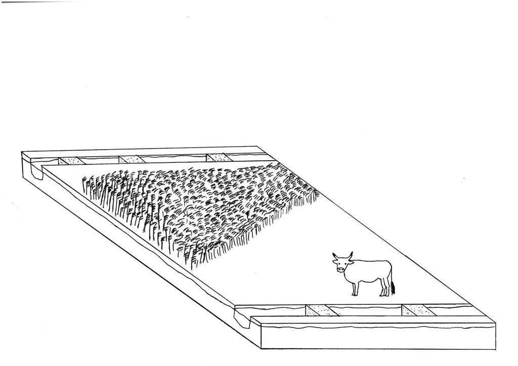
Re-wetting of a fen with adapted agricultural land use afterwards: extensive grazing with cattle and paludiculture in Common Reed production.
Date: 07/2015
Technical knowledge required for field staff / advisors: high
Technical knowledge required for land users: high
Technical knowledge required for planners: high (Re-wetting concerns large areas)
Main technical functions: increase in organic matter, increase / maintain water stored in soil, increase of groundwater level / recharge of groundwater, improvement of water quality, buffering / filtering water
In blocks
Vegetative material: G : grass, O : other
Number of plants per (ha): G: full coverage, O: 5000
Vertical interval within rows / strips / blocks (m): O: 2m
Width within rows / strips / blocks (m): O: 1m
Grass species: Grasses for extensive grassland use
Other species: Paludicultures like Common reed, Reed Canary grass
Slope (which determines the spacing indicated above): ~0%
Gradient along the rows / strips: ~0%
Structural measure: close/chamber ditches for groundwater level rise
Change of land use type: Crop land or intensive grassland to extensive grassland or paludiculture: see 2.5.2.2
Change of land use practices / intensity level: extensification
Layout change according to natural and human environment: Closed and chambered ditches/removed drainage systems: see 2.5.3.2
Auteur:
Sarah Baum, Thünen Institute of Rural Studies, Bundesallee 50, D-38116, Braunschweig, Germany
4.3 Activités de mise en place/ d'établissement
| Activité | Calendrier des activités (saisonnier) | |
|---|---|---|
| 1. | For fen re-wetting, removal or blocking of drainage systems like ditches, pumping stations, dykes or drainages is necessary. Extent depends strongly on local site conditions! (examples chosen from Landesumweltamt Brandenburg (2004)). | |
| 2. | Extensive grassland or paludiculture | |
| 3. | Extensive grassland: if field is not already used as grassland but as cropland: grassland sowing | July/August |
| 4. | Extensive grassland: natural spread: no input | |
| 5. | Paludiculture: planting Common Reed | Spring |
4.4 Coûts et intrants nécessaires à la mise en place
| Spécifiez les intrants | Unité | Quantité | Coûts par unité | Coût total par intrant | % des coût supporté par les exploitants des terres | |
|---|---|---|---|---|---|---|
| Main d'œuvre | Labour | ha | 1,0 | 300,0 | 300,0 | 100,0 |
| Equipements | Machine use | ha | 1,0 | 400,0 | 400,0 | 100,0 |
| Matériel végétal | Seedling | ha | 1,0 | 2500,0 | 2500,0 | 100,0 |
| Autre | Removal of drainage | ha | 1,0 | 200,0 | 200,0 | 100,0 |
| Autre | Ditch filling | ha | 1,0 | 100,0 | 100,0 | 100,0 |
| Autre | Make-ready and set-up cost | ha | 1,0 | 2500,0 | 2500,0 | 100,0 |
| Coût total de mise en place de la Technologie | 6000,0 | |||||
| Coût total de mise en place de la Technologie en dollars américains (USD) | 6000,0 | |||||
4.5 Activités d'entretien/ récurrentes
| Activité | Calendrier/ fréquence | |
|---|---|---|
| 1. | water level management: weir control ~once a week: efforts depends strongly on local conditions. Control is also necessary when weirs are used to ensure controlled water level. | |
| 2. | extensive grassland: mowing | 2 times per year |
| 3. | extensive grassland: grazing with water buffalo, adapted cattles (e.g. Heck cattle, Galloway) | year round |
| 4. | paludiculture (Common Reed): harvesting | Winter (ideally: frozen ground)/first harvest 4 years after establishment, thereafter annually |
| 5. | management | yearly |
4.6 Coûts et intrants nécessaires aux activités d'entretien/ récurrentes (par an)
| Spécifiez les intrants | Unité | Quantité | Coûts par unité | Coût total par intrant | % des coût supporté par les exploitants des terres | |
|---|---|---|---|---|---|---|
| Main d'œuvre | Labour | ha | 1,0 | 250,0 | 250,0 | 100,0 |
| Equipements | Machine use | ha | 1,0 | 600,0 | 600,0 | 100,0 |
| Autre | Management | ha | 1,0 | 150,0 | 150,0 | 100,0 |
| Coût total d'entretien de la Technologie | 1000,0 | |||||
| Coût total d'entretien de la Technologie en dollars américains (USD) | 1000,0 | |||||
Commentaires:
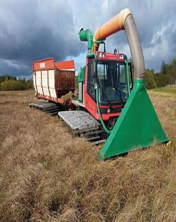
Machinery/ tools: paludiculture: harvest in winter (frozen soil): normal machinery. If soil is not frozen: special machinery: snow groomer (crawler chain) modified as harvester
4.7 Facteurs les plus importants affectant les coûts
Décrivez les facteurs les plus importants affectant les coûts :
Only rough estimates on costs and income can be given due to the very new and innovative technology. The technology is still in the introductory phase at present
5. Environnement naturel et humain
5.1 Climat
Précipitations annuelles
- < 250 mm
- 251-500 mm
- 501-750 mm
- 751-1000 mm
- 1001-1500 mm
- 1501-2000 mm
- 2001-3000 mm
- 3001-4000 mm
- > 4000 mm
Spécifications/ commentaires sur les précipitations:
Annual rainfall: 500-750 mm, 750-1000 mm, 1000-1500 mm, 1500-2000 mm
250-500mm: This only characterises the Altmark region (average 460mm); more rainfall is possible!
Zone agro-climatique
- humide
- subhumide
Thermal climate class: temperate. Altmark region
5.2 Topographie
Pentes moyennes:
- plat (0-2 %)
- faible (3-5%)
- modéré (6-10%)
- onduleux (11-15%)
- vallonné (16-30%)
- raide (31-60%)
- très raide (>60%)
Reliefs:
- plateaux/ plaines
- crêtes
- flancs/ pentes de montagne
- flancs/ pentes de colline
- piémonts/ glacis (bas de pente)
- fonds de vallée/bas-fonds
Zones altitudinales:
- 0-100 m
- 101-500 m
- 501-1000 m
- 1001-1500 m
- 1501-2000 m
- 2001-2500 m
- 2501-3000 m
- 3001-4000 m
- > 4000 m
Commentaires et précisions supplémentaires sur la topographie:
Altitudinal zone: 0-100 m a.s.l. (this only characterises the Altmark region), 500-1000 m a.s.l., 1000-1500 m a.s.l.
5.3 Sols
Profondeur moyenne du sol:
- très superficiel (0-20 cm)
- superficiel (21-50 cm)
- modérément profond (51-80 cm)
- profond (81-120 cm)
- très profond (>120 cm)
Matière organique de la couche arable:
- abondant (>3%)
Si disponible, joignez une description complète du sol ou précisez les informations disponibles, par ex., type de sol, pH/ acidité du sol, capacité d'échange cationique, azote, salinité, etc.
Soil depth on average: shallow (21-50 cm) (refers to histic layer), moderately deep (51-80 cm), deep (81-120 cm), very deep (> 120 cm)
Soil fertility is very low-low
Soil drainage/infiltration is good
Soil water storage capacity is very high
5.4 Disponibilité et qualité de l'eau
Profondeur estimée de l’eau dans le sol:
en surface
Disponibilité de l’eau de surface:
excès
Qualité de l’eau (non traitée):
uniquement pour usage agricole (irrigation)
Commentaires et précisions supplémentaires sur la qualité et la quantité d'eau:
Seasonal fluctuations (surface water): Wet conditions throughout the year.
5.5 Biodiversité
Diversité des espèces:
- élevé
Commentaires et précisions supplémentaires sur la biodiversité:
Not high in number but in quality! Highly specified species. Depends on definition of Biodiversity
5.6 Caractéristiques des exploitants des terres appliquant la Technologie
Orientation du système de production:
- commercial/ de marché
Individus ou groupes:
- groupe/ communauté
Niveau de mécanisation:
- mécanisé/ motorisé
Genre:
- femmes
- hommes
Indiquez toute autre caractéristique pertinente des exploitants des terres:
Population density: 10-50 persons/km2
Annual population growth: negative
Market orientation of production system: nature conservation
Market orientation of cropland production system: Comercial/market (cows for dairy farming and reed sold for bioenergy and thatching)
Market orientation of grazing land production system: Comercial/market (Grazing, mowing; paludiculture )
5.7 Superficie moyenne des terres utilisées par les exploitants des terres appliquant la Technologie
- < 0,5 ha
- 0,5-1 ha
- 1-2 ha
- 2-5 ha
- 5-15 ha
- 15-50 ha
- 50-100 ha
- 100-500 ha
- 500-1 000 ha
- 1 000-10 000 ha
- > 10 000 ha
5.8 Propriété foncière, droits d’utilisation des terres et de l'eau
Propriété foncière:
- état
- communauté/ village
- NGO
Droits d’utilisation des terres:
- individuel
Droits d’utilisation de l’eau:
- individuel
Commentaires:
Land owners can re-wet their land and manage it suitable for wet conditions afterwards. The state or NGO, for example, can buy land and re-wet it; normally followed by nature protection. This technology can not be done by one land user. It has major impacts off-sites and reflects normally more then one farmer.
6. Impacts et conclusions
6.1 Impacts sur site que la Technologie a montrés
Impacts socio-économiques
Production
production agricole
production fourragère
qualité des fourrages
production animale
risque d'échec de la production
surface de production
gestion des terres
Disponibilité et qualité de l'eau
demande pour l'eau d'irrigation
Revenus et coûts
dépenses pour les intrants agricoles
Commentaires/ spécifiez:
Thorugh extensification
revenus agricoles
diversité des sources de revenus
Commentaires/ spécifiez:
possibly
disparités économiques
charge de travail
Commentaires/ spécifiez:
Thorugh extensification
Impacts écologiques
Cycle de l'eau/ ruissellement
quantité d'eau
qualité de l'eau
ruissellement de surface
nappes phréatiques/ aquifères
Sols
humidité du sol
couverture du sol
Commentaires/ spécifiez:
In terms of former cropland
perte en sol
compaction du sol
cycle/ recharge des éléments nutritifs
Commentaires/ spécifiez:
Extensive usage
matière organique du sol/ au dessous du sol C
Biodiversité: végétale, animale
diversité végétale
diversité animale
diversité des habitats
Réduction des risques de catastrophe et des risques climatiques
émissions de carbone et de gaz à effet de serre
Quantité avant la GDT:
15-30
Quantité après la GDT:
0.8
Commentaires/ spécifiez:
Before conserv.: Ca. 15-30 tCO2eq/ha*a quantify (indicate unit) after conserv.: 0-8 tCO2equ/ha*a specify: mean reduction potential peat bogs: 15tCO2equ/ha*a; fens: 30tCO2equ/ha*a
Autres impacts écologiques
Value for nature conservation/relevant species
6.2 Impacts hors site que la Technologie a montrés
flux des cours d'eau fiables et stables en saison sèche
Commentaires/ spécifiez:
Perhaps
inondations en aval
pollution des rivières/ nappes phréatiques
capacité tampon/de filtration
dommages sur les champs voisins
Commentaires/ spécifiez:
Re-wetting is only possible on larger scales
6.3 Exposition et sensibilité de la Technologie aux changements progressifs et aux évènements extrêmes/catastrophes liés au climat (telles que perçues par les exploitants des terres)
Changements climatiques progressifs
Changements climatiques progressifs
| Saison | Augmentation ou diminution | Comment la Technologie fait-elle face à cela? | |
|---|---|---|---|
| températures annuelles | augmente | pas bien |
Extrêmes climatiques (catastrophes)
Catastrophes météorologiques
| Comment la Technologie fait-elle face à cela? | |
|---|---|
| pluie torrentielle locale | bien |
| tempête de vent locale | pas connu |
Catastrophes climatiques
| Comment la Technologie fait-elle face à cela? | |
|---|---|
| sécheresse | pas bien |
Catastrophes hydrologiques
| Comment la Technologie fait-elle face à cela? | |
|---|---|
| inondation générale (rivière) | bien |
Autres conséquences liées au climat
Autres conséquences liées au climat
| Comment la Technologie fait-elle face à cela? | |
|---|---|
| réduction de la période de croissance | bien |
6.4 Analyse coûts-bénéfices
Quels sont les bénéfices comparativement aux coûts de mise en place (du point de vue des exploitants des terres)?
Rentabilité à court terme:
très négative
Rentabilité à long terme:
négative
Quels sont les bénéfices comparativement aux coûts d'entretien récurrents (du point de vue des exploitants des terres)?
Rentabilité à court terme:
très négative
Rentabilité à long terme:
négative
Commentaires:
Depends strongly on subsidies and other incentive mechanisms as well as opportunity costs (regionally different). Further, if re-wetting is not financed by the land user the economic benefit is greater but even less as before re-wetting.
6.5 Adoption de la Technologie
De tous ceux qui ont adopté la Technologie, combien d'entre eux l'ont fait spontanément, à savoir sans recevoir aucune incitation matérielle, ou aucune rémunération? :
- 0-10%
Commentaires:
100% of land user families have adopted the Technology with external material support
There is no trend towards spontaneous adoption of the Technology
Comments on adoption trend: There is no increasing trend to adopt the technology as it is not economically attractive for farmer. But for environment groups (NGOs), without an economical interest, this measure can be interesting.
6.7 Points forts/ avantages/ possibilités de la Technologie
| Points forts/ avantages/ possibilités du point de vue du compilateur ou d'une autre personne ressource clé |
|---|
|
By re-wetting organic soil huge amounts of GHG emissions can be avoided on a relatively small area How can they be sustained / enhanced? Financial incentives for farmers are needed e.g. based on GHG-mitigation potential. Alternatively, areas can be bought by e.g. NGOs or government for re-wetting/ nature protection |
|
Paludiculture on re-wetted soils allows an adapted agricultural land use How can they be sustained / enhanced? Financial incentives (e.g. subside payments) for farmers are needed |
|
Extensive grassland cultivation on re-wetted soils allows an adapted agricultural land use (grazing/mowing) How can they be sustained / enhanced? Financial incentives (e.g. subside payments) for farmers are needed |
| The use of fertilizer and manure inputs leads to pollution of water bodies. The water quality will be enhanced by less fertilizer/manure input through this technology compared to intensive agriculture. |
| Due to the technology, higher water retention, flood prevention and biodiversity can increase compared to use of drained organic soils. |
6.8 Faiblesses/ inconvénients/ risques de la Technologie et moyens de les surmonter
| Faiblesses/ inconvénients/ risques du point de vue de l’exploitant des terres | Comment peuvent-ils être surmontés? |
|---|---|
| On re-wetted soil land use options are very restricted due to wet soil conditions. | Financial incentives for farmers are needed. |
| Faiblesses/ inconvénients/ risques du point de vue du compilateur ou d'une autre personne ressource clé | Comment peuvent-ils être surmontés? |
|---|---|
| High opportunity cost for land users: income from intensive cropland on drained soils is higher than income from re-wetted soils with extensive land use. | The technology could be economically attractive if farmers get financial incentives for applying it (re-wetting and adapted extensive usage). It would become even more attractive if no incentives were paid for e.g. maize production on drained organic soils (those incentives are actually paid if the maize is used for bioenergy production). |
7. Références et liens
7.1 Méthodes/ sources d'information
7.2 Références des publications disponibles
Titre, auteur, année, ISBN:
Bonn A, et al. (2014) Klimaschutz durch Wiedervernässung von kohlenstoffreichen Böden. In: Naturkapital und Klimapolitik-Synergien und Konflikte.
Disponible à partir d'où? Coût?
Naturkapital Deutschland TEEB DE Report. Technische Universität Berlin Helmholtz-Zentrum für Umweltforschung-UFZ, Berlin, Leipzig
Titre, auteur, année, ISBN:
Wichtmann W, Wichmann S (2011) Environmental, Social and Economic Aspects of a Sustainable Biomass Production.
Disponible à partir d'où? Coût?
Journal of Sustainable Energy & Environment, Special Issue (2011):77-81
7.3 Liens vers les informations pertinentes en ligne
URL:
http://www.duene-greifswald.de/de/projekte.php_enim.php
URL:
http://www.naturkapital-teeb.de/publikationen/projekteigene-publikationen.html
URL:
http://daten.ktbl.de/feldarbeit/home.html
URL:
https://www.stmelf.bayern.de/idb/default.html
URL:
ttps://www.google.de/search?q=Leitfaden+zur+Renaturierung+von+Feuchtgebieten+in+Brandenburg.+&ie=utf-8&oe=utf-8&gws_rd=cr&ei=btyoVebdJcGYsAH4tpWoCA
Liens et modules
Développer tout Réduire toutLiens

Open dialogue platform on sustainable land management [Allemagne]
Establishing a dialogue platform on sustainable land management which is open to all stakeholders
- Compilateur : Johanna Fick
Modules
Aucun module trouvé


