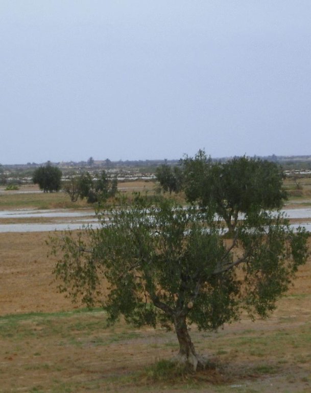
Tabia [ប្រទេសទុយនីស៊ី]
- ការបង្កើត៖
- បច្ចុប្បន្នភាព
- អ្នកចងក្រង៖ Mongi Ben Zaied
- អ្នកកែសម្រួល៖ –
- អ្នកត្រួតពិនិត្យ Deborah Niggli
technologies_1420 - ប្រទេសទុយនីស៊ី
ពិនិត្យមើលគ្រប់ផ្នែក
ពង្រីកមើលទាំងអស់ បង្រួមទាំងអស់1. ព័ត៌មានទូទៅ
1.2 ព័ត៌មានលម្អិតពីបុគ្គលសំខាន់ៗ និងស្ថាប័នដែលចូលរួមក្នុងការវាយតម្លៃ និងចងក្រងឯកសារនៃបច្ចេកទេស
បុគ្គលសំខាន់ម្នាក់ (ច្រើននាក់)
អ្នកជំនាញឯកទេស SLM:
Sghaier Mongi
+216 75 633 005
Institut des Régions Arides IRA
4119- medenine north tunisia
ប្រទេសទុយនីស៊ី
អ្នកជំនាញឯកទេស SLM:
Chniter Mongi
+216 75 633 005
Commissariats Régionaux au Développement Agricole CRDA
4100 Medenine, Tunisia
ប្រទេសទុយនីស៊ី
អ្នកជំនាញឯកទេស SLM:
ឈ្មោះគម្រោងដែលបានចងក្រងឯកសារ/ វាយតម្លៃលើបច្ចេកទេស (បើទាក់ទង)
DESIRE (EU-DES!RE)ឈ្មោះអង្គភាពមួយ (ច្រើន) ដែលបានចងក្រងឯកសារ/ វាយតម្លៃបច្ចេកទេស (បើទាក់ទង)
Institut des Régions Arides de Médenine (Institut des Régions Arides de Médenine) - ប្រទេសទុយនីស៊ីឈ្មោះអង្គភាពមួយ (ច្រើន) ដែលបានចងក្រងឯកសារ/ វាយតម្លៃបច្ចេកទេស (បើទាក់ទង)
Commissariats Régionaux au Développement Agricole (CRDA) - ប្រទេសទុយនីស៊ី1.3 លក្ខខណ្ឌទាក់ទងទៅនឹងការប្រើប្រាស់ទិន្នន័យដែលបានចងក្រងតាមរយៈ វ៉ូខេត
តើពេលណាដែលទិន្នន័យបានចងក្រង (នៅទីវាល)?
05/07/2011
អ្នកចងក្រង និង(បុគ្គលសំខាន់ៗ)យល់ព្រមទទួលយកនូវលក្ខខណ្ឌនានាទាក់ទងទៅនឹងការប្រើប្រាស់ទិន្នន័យដែលបានចងក្រងតាមរយៈវ៉ូខេត:
បាទ/ចា៎
1.5 ការយោងទៅលើកម្រងបញ្ជីសំណួរនៃវិធីសាស្ត្រផ្សព្វផ្សាយ SLM
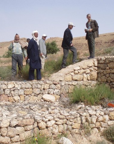
Dryland watershed management approach [ប្រទេសទុយនីស៊ី]
Integrated land and water management approach, including vegetative, management, and agronomic measure
- អ្នកចងក្រង៖ Naceur Mahdi
2. ការពណ៌នាពីបច្ចេកទេស SLM
2.1 ការពណ៌នាដោយសង្ខេបពីបច្ចេកទេស
និយមន័យបច្ចេកទេស:
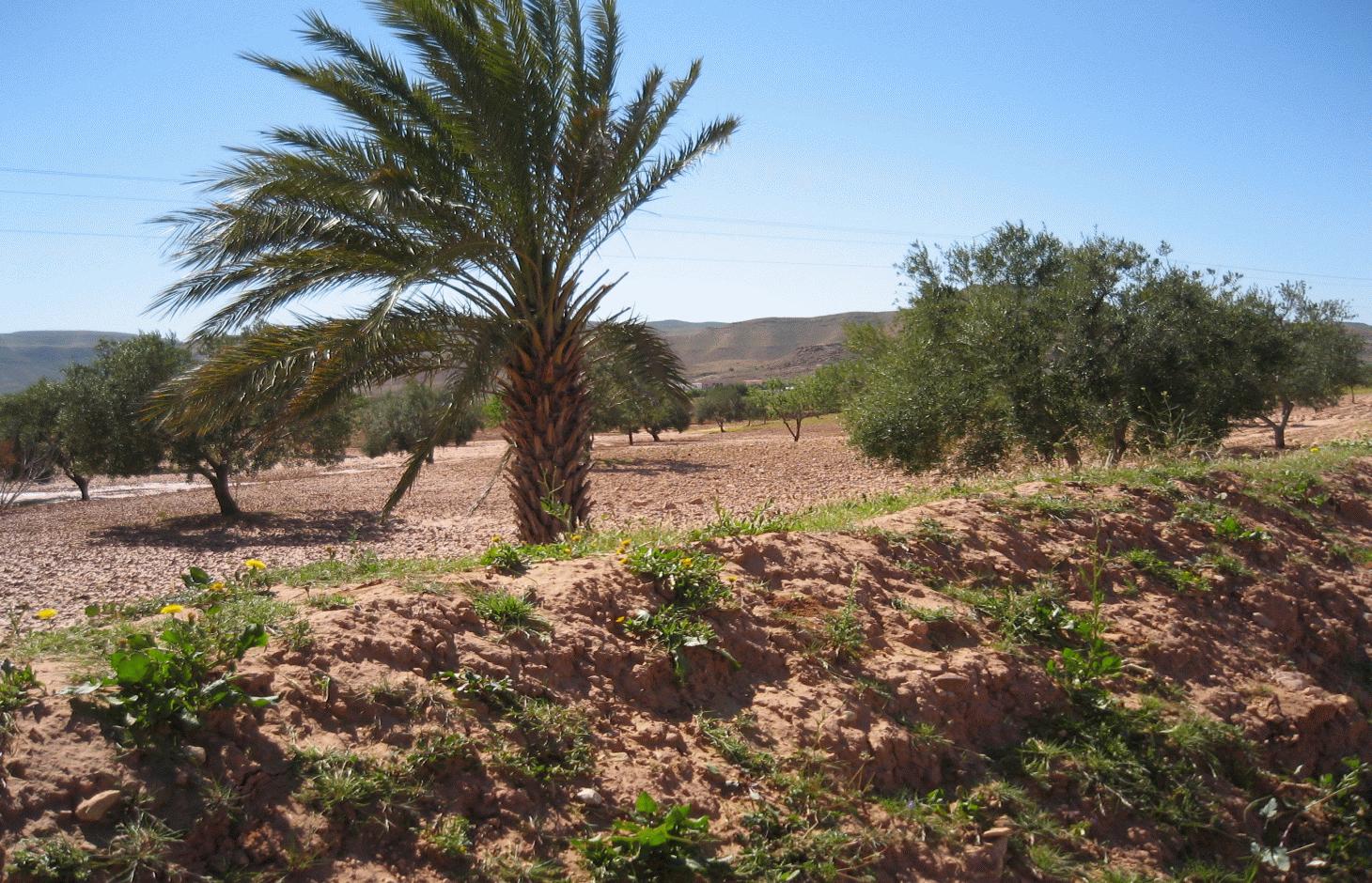
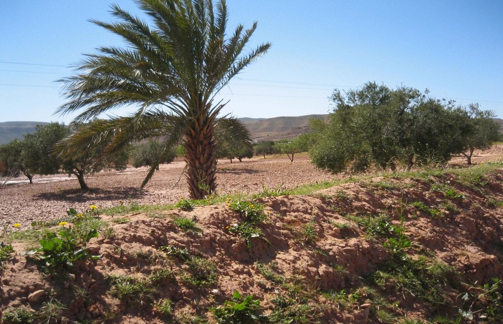
The tabia earthen dyke is a water harvesting technique used in the foothill and piedmont areas.
2.2 ការពណ៌នាលម្អិតពីបច្ចេកទេស
ការពណ៌នា:
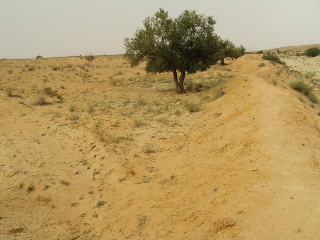
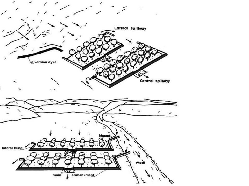
The tabia technology is similar to the jessour system but is used in the gently-sloping foothill and piedmont areas. It is considered to be a relatively new technique, developed by mountain dwellers who migrated to the plains. Tabias, like jessour, comprise an earthen dyke (50-150 m in length, 1-2 m in height), a spillway (central and/or lateral) and an associated water harvesting area. The ratio between the area where water is applied (cropped area) and the total area from which water is collected varies from 1:6 to 1:20. The differences between the tabia and the jessour systems are that the former contains two additional lateral bunds (up to 30 m long) and sometimes a small flood diversion dyke (mgoud). Small tabia are constructed manually using shovels, pickles and carts. Larger constructions are done mechanically using tractors and bulldozers.
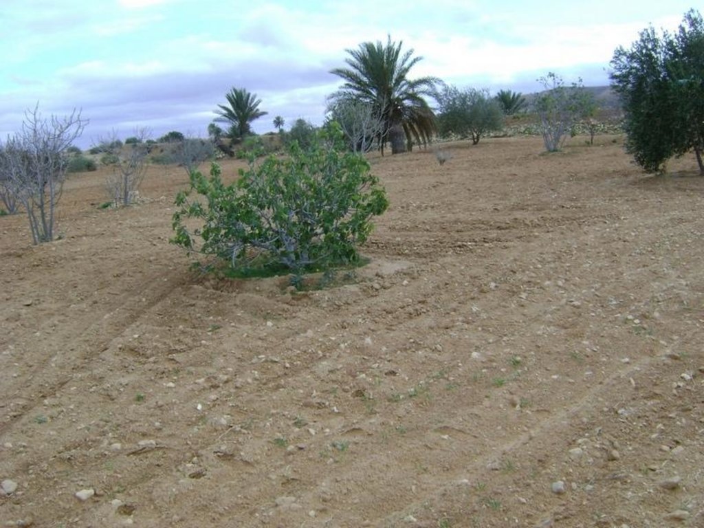
Purpose of the Technology: Tree products and annual crops are commonly grown using tabia. Besides their water harvesting qualities, tabias also have a positive effect on soil erosion and groundwater recharge.
Natural / human environment: The tabia runoff-water harvesting technique is widely practised in central Tunisia. Tabias are usually installed on the piedmont, where the slope does not exceed 3% and where the soil is relatively deep. Ancient remnants of tabias have been found in the region of Gafsa (south west Tunisia). The system has been adopted by people living in the neighbouring foothills and plains of the central and southeastern regions (Jeffara) of the country, following the transformation of their pasture to cultivated fields.
2.3 រូបភាពនៃបច្ចេកទេស
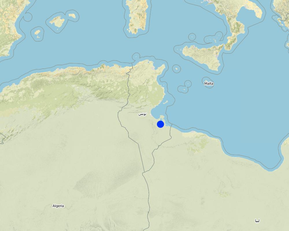
2.5 ប្រទេស/តំបន់/ទីតាំងកន្លែង ដែលបច្ចេកទេសត្រូវបានអនុវត្ត និងបានគ្រប់ដណ្តប់ដោយការវាយតម្លៃនេះ
ប្រទេស:
ប្រទេសទុយនីស៊ី
តំបន់/រដ្ឋ/ខេត្ត:
Medenine
បញ្ជាក់បន្ថែមពីលក្ខណៈនៃទីតាំង:
Medenine nord
Map
×2.6 កាលបរិច្ឆេទនៃការអនុវត្ត
ប្រសិនបើមិនច្បាស់ឆ្នាំ សូមបញ្ជាក់កាលបរិច្ឆេទដែលប្រហាក់ប្រហែល:
- 10-50 ឆ្នាំ
2.7 ការណែនាំពីបច្ចេកទេស
សូមបញ្ជាក់តើបច្ចេកទេសត្រូវបានណែនាំឱ្យអនុវត្តដោយរបៀបណា:
- តាមរយៈគម្រោង / អន្តរាគមន៍ពីខាងក្រៅ
3. ចំណាត់ថ្នាក់នៃបច្ចេកទេស SLM
3.2 ប្រភេទដីប្រើប្រាស់មួយប្រភេទ (ច្រើនប្រភេទ) ដែលបានអនុវត្តបច្ចេកទេស

ដីដាំដំណាំ
- ប្រភេទដើមឈើធំៗ និងដើមឈើតូចៗ

ដីសម្រាប់ចិញ្ចឹមសត្វ
មតិយោបល់:
Major land use problems (compiler’s opinion): soil erosion by water, runoff and soil loss
Major land use problems (land users’ perception): overgrazing
3.3 ព័ត៌មានបន្ថែមអំពីអ្នកប្រើប្រាស់ដី
មតិយោបល់:
Water supply: rainfed, mixed rainfed - irrigated
ចំនួនសារដែលដាំដំណាំក្នុងមួយឆ្នាំ:
- 1
សូមបញ្ជាក់:
Longest growing period in days: 180Longest growing period from month to month: Oct - Apr
3.4 ក្រុម SLM ដែលបច្ចេកទេសស្ថិតនៅក្នុង
- ការស្តុកទុកទឹក
3.5 ការសាយភាយនៃបច្ចេកទេស
បញ្ជាក់ពីការសាយភាយនៃបច្ចេកទេស:
- ត្រូវបានផ្សព្វផ្សាយត្រឹមតំបន់មួយ
ប្រសិនបើបច្ចេកទេសត្រូវបានសាយភាយពាសពេញតំបន់ណាមួយ សូមកំណត់ទំហំផ្ទៃដីអនុវត្តន៍:
- 10-100 គម2
3.6 វិធានការ SLM ដែលបញ្ចូលនូវបច្ចេកទេស

វិធានការរចនាស័ម្ពន្ធ
- S2: ភ្លឺ ច្រាំង
មតិយោបល់:
Main measures: structural measures
3.7 កំណត់ប្រភេទនៃការធ្លាក់ចុះគុណភាពដីសំខាន់ៗដែលបច្ចេកទេសនេះបានដោះស្រាយ

ការហូរច្រោះដីដោយសារទឹក
- Wt: ការបាត់ដីស្រទាប់លើដោយការហូរច្រោះ
- Wg: ការកកើតឡើងនូវកំទេចកំទីដីស្រទាប់ក្រោម
មតិយោបល់:
Main type of degradation addressed: Wt: loss of topsoil / surface erosion
Secondary types of degradation addressed: Wg: gully erosion / gullying
Main causes of degradation: Heavy / extreme rainfall (intensity/amounts), land tenure
Secondary causes of degradation: overgrazing, population pressure
3.8 ការពារ កាត់បន្ថយ ឬស្តារឡើងវិញនៃការធ្លាក់ចុះគុណភាពដី
បញ្ជាក់ពីគោលដៅរបស់បច្ចេកទេស ដែលផ្តោតទៅការធ្លាក់ចុះគុណភាពដី:
- ការការពារការធ្លាក់ចុះគុណភាពដី
- ការកាត់បន្ថយការធ្លាក់ចុះគុណភាពដី
មតិយោបល់:
Main goals: prevention of land degradation
Secondary goals: mitigation / reduction of land degradation
4. បច្ចេកទេសជាក់លាក់ សកម្មភាពអនុវត្ត ធាតុចូល និងថ្លៃដើម
4.1 គំនូសបច្ចេកទេសនៃបច្ចេកទេសនេះ
4.2 លក្ខណៈពិសេសនៃបច្ចេកទេស/ ពណ៌នាពីគំនូរបច្ចេកទេស
Tabia with natural water collection area (upper) and tabia on an expanded system with additional flood water diversions (lower). (Adapted from Alaya et al. 1993)
Found in flatter areas, tabia can accommodate more trees on the terrace especially when it can receive additional water from floods.
south east Tunisia
Date: January 2009
Technical knowledge required for field staff / advisors: moderate
Technical knowledge required for land users: moderate
Main technical functions: control of concentrated runoff: retain / trap
Secondary technical functions: increase of infiltration, water harvesting / increase water supply, water spreading
Diversion ditch/ drainage
Height of bunds/banks/others (m): 2
Width of bunds/banks/others (m): 2-5
Length of bunds/banks/others (m): 10-30
Spillway
Height of bunds/banks/others (m): 1
Width of bunds/banks/others (m): 5
Length of bunds/banks/others (m): 2-4
Bund/ bank: graded
Vertical interval between structures (m): 3
Spacing between structures (m): 100
Height of bunds/banks/others (m): 2
Width of bunds/banks/others (m): 2-5
Length of bunds/banks/others (m): 50-150
Construction material (earth): Main dyke
Construction material (stone): Spillway
Construction material (concrete): Spillway
Construction material (other): Gabion: Diversion dyke
Lateral gradient along the structure: 1%
For water harvesting: the ratio between the area where the harvested water is applied and the total area from which water is collected is: 1:4
4.3 ព័ត៌មានទូទៅដែលពាក់ព័ន្ធនឹងការគណនាធាតុចូល និងថ្លៃដើម
ផ្សេងៗ/ រូបិយប័ណ្ណជាតិ (បញ្ជាក់):
TND
កំណត់អត្រាប្តូរប្រាក់ពីដុល្លាទៅរូបិយប័ណ្ណតំបន់ (បើទាក់ទង)៖ 1 ដុល្លារ =:
1,3
កំណត់ថ្លៃឈ្នួលជាមធ្យមនៃការជួលកម្លាំងពលកម្មក្នុងមួយថ្ងៃ:
10.00
4.4 សកម្មភាពបង្កើត
| សកម្មភាព | ប្រភេទវិធានការ | ពេលវេលា | |
|---|---|---|---|
| 1. | Diversion channel | រចនាសម្ព័ន្ធ | in the case of tabia on spreading system |
| 2. | Plantation | រចនាសម្ព័ន្ធ | |
| 3. | Spillway construction | រចនាសម្ព័ន្ធ | |
| 4. | Terracing | រចនាសម្ព័ន្ធ |
4.5 ថ្លៃដើម និងធាតុចូលដែលត្រូវការសម្រាប់ការបង្កើតបច្ចេកទេស
| បញ្ជាក់ពីធាតុចូល | ឯកតា | បរិមាណ | ថ្លៃដើមក្នុងមួយឯកតា | ថ្លៃធាតុចូលសរុប | % នៃថ្លៃដើមដែលចំណាយដោយអ្នកប្រើប្រាស់ដី | |
|---|---|---|---|---|---|---|
| កម្លាំងពលកម្ម | Labour | ha | 1,0 | 500,0 | 500,0 | 100,0 |
| សម្ភារៈសាងសង់ | ha | 1,0 | 170,0 | 170,0 | 100,0 | |
| ថ្លៃដើមសរុបក្នុងការបង្កើតបច្ចេកទេស | 670,0 | |||||
មតិយោបល់:
Duration of establishment phase: 1 month(s)
4.6 សកម្មភាពថែទាំ
| សកម្មភាព | ប្រភេទវិធានការ | ពេលវេលា/ ភាពញឹកញាប់ | |
|---|---|---|---|
| 1. | Dyke and spillway maintenance | រចនាសម្ព័ន្ធ | Annually |
| 2. | Reconstruction | រចនាសម្ព័ន្ធ |
4.7 កំណត់ថ្លៃដើមសម្រាប់ការថែទាំ/ សកម្មភាពរបស់បច្ចេកទេស (ក្នុងរយៈពេលមួយឆ្នាំ)
| បញ្ជាក់ពីធាតុចូល | ឯកតា | បរិមាណ | ថ្លៃដើមក្នុងមួយឯកតា | ថ្លៃធាតុចូលសរុប | % នៃថ្លៃដើមដែលចំណាយដោយអ្នកប្រើប្រាស់ដី | |
|---|---|---|---|---|---|---|
| កម្លាំងពលកម្ម | Labour | ha | 1,0 | 150,0 | 150,0 | 100,0 |
| សម្ភារៈសាងសង់ | ha | 1,0 | 50,0 | 50,0 | 100,0 | |
| ថ្លៃដើមសរុបសម្រាប់ការថែទាំដំណាំតាមបច្ចេកទេស | 200,0 | |||||
មតិយោបល់:
The technology establishment and maintenance costs met by the land users are 100% if executed on a private basis, but it can range from 10 to 50% when the site is part of a publicly-funded programme.
4.8 កត្តាសំខាន់បំផុតដែលមានឥទ្ធិពលដល់ការចំណាយ
ពណ៌នាពីកត្តាប៉ះពាល់ចម្បងៗទៅលើថ្លៃដើម:
Labour is the most determining factor affecting the costs.
5. លក្ខណៈបរិស្ថានធម្មជាតិ និងមនុស្ស
5.1 អាកាសធាតុ
បរិមាណទឹកភ្លៀងប្រចាំឆ្នាំ
- < 250 មម
- 251-500 មម
- 501-750 មម
- 751-1,000 មម
- 1,001-1,500 មម
- 1,501-2,000 មម
- 2,001-3,000 មម
- 3,001-4,000 មម
- > 4,000 មម
តំបន់កសិអាកាសធាតុ
- ស្ងួត
Thermal climate class: subtropics
5.2 សណ្ឋានដី
ជម្រាលជាមធ្យម:
- រាបស្មើ (0-2%)
- ជម្រាលតិចតួច (3-5%)
- មធ្យម (6-10%)
- ជម្រាលខ្ពស់បន្តិច (11-15%)
- ទីទួល (16-30%)
- ទីទួលចោត (31-60%)
- ទីទួលចោតខ្លាំង (>60%)
ទម្រង់ដី:
- ខ្ពង់រាប
- កំពូលភ្នំ
- ជម្រាលភ្នំ
- ជម្រាលទួល
- ជម្រាលជើងភ្នំ
- បាតជ្រលងភ្នំ
តំបន់តាមរយៈកម្ពស់ :
- 0-100 ម
- 101-500 ម
- 501-1,000 ម
- 1,001-1,500 ម
- 1,501-2,000 ម
- 2,001-2,500 ម
- 2,501-3,000 ម
- 3,001-4,000 ម
- > 4,000 ម
5.3 ដី
ជម្រៅដីជាមធ្យម:
- រាក់ខ្លាំង (0-20 សម)
- រាក់ (21-50 សម)
- មធ្យម (51-80 សម)
- ជ្រៅ (81-120 សម)
- ជ្រៅខ្លាំង (> 120 សម)
វាយនភាពដី (ស្រទាប់លើ):
- មធ្យម (ល្បាយ, ល្បាប់)
សារធាតុសរីរាង្គនៅស្រទាប់ដីខាងលើ:
- ទាប (<1%)
បើអាចសូមភ្ជាប់ការពណ៌នាពីដីឱ្យបានច្បាស់ ឬព័ត៌មានដែលអាចទទួលបាន ឧ. ប្រភេទដី, pH ដី/ ជាតិអាស៊ីត, សមត្ថភាពផ្លាស់ប្តូរកាចុង, វត្តមាននីត្រូសែន, ភាពប្រៃ ។ល។:
Soil fertility is: very low
Soil drainage/infiltration is: medium
Soil water storage is: medium
5.4 ទឹកដែលអាចទាញមកប្រើប្រាស់បាន និងគុណភាពទឹក
នីវ៉ូទឹកក្រោមដី:
5-50 ម
ទឹកលើដីដែលអាចទាញយកប្រើប្រាស់បាន:
កម្រិតមធ្យម
គុណភាពទឹក (មិនបានធ្វើប្រត្តិកម្ម):
ទឹកពិសារដែលគ្មានគុណភាព (តម្រូវឱ្យមានការសំអាត)
មតិយោបល់ និងលក្ខណៈពិសេសផ្សេងៗទៀតលើគុណភាព និងបរិមាណទឹក :
Water quality (untreated): Poor drinking water (treatement required/medium quality)
5.5 ជីវៈចម្រុះ
ភាពសម្បូរបែបនៃប្រភេទ:
- កម្រិតមធ្យម
5.6 លក្ខណៈនៃអ្នកប្រើប្រាស់ដីដែលអនុវត្តបច្ចេកទេស
ទីផ្សារនៃប្រព័ន្ធផលិតកម្ម:
- ពាក់កណ្តាលពាណិជ្ជកម្ម (ផ្គត់ផ្គង់ខ្លួនឯង/ ពាណិជ្ជកម្ម
ចំណូលក្រៅកសិកម្ម:
- ច្រើនជាង 50% នៃចំណូល
កម្រិតជីវភាព:
- មិនល្អ
- មធ្យម
ឯកជន ឬក្រុម:
- ធ្វើខ្លួនឯង/ គ្រួសារ
យេនឌ័រ:
- បុរស
សូមបញ្ជាក់ពីលក្ខណៈពាក់ព័ន្ធផ្សេងទៀតអំពីអ្នកប្រើប្រាស់ដី:
Land users applying the Technology are mainly common / average land users
Difference in the involvement of women and men: Outdoor hard works are generally performed by men.
Population density: 10-50 persons/km2
Annual population growth: 0.5% - 1%
10% of the land users are rich and own 10% of the land.
70% of the land users are average wealthy and own 75% of the land.
20% of the land users are poor and own 15% of the land.
5.7 ទំហំផ្ទៃដីជាមធ្យមនៃដីផ្ទាល់ខ្លួន ឬជួលគេដែលបានអនុវត្តបច្ចេកទេស
- < 0.5 ហិកតា
- 0.5-1 ហិកតា
- 1-2 ហិកតា
- 2-5 ហិកតា
- 5-15 ហិកតា
- 15-50 ហិកតា
- 50-100 ហិកតា
- 100-500 ហិកតា
- 500-1,000 ហិកតា
- 1,000-10,000 ហិកតា
- > 10,000 ហិកតា
តើផ្ទៃដីនេះចាត់ទុកជាទំហំកម្រិតណាដែរ ខ្នាតតូច មធ្យម ឬខ្នាតធំ (ធៀបនឹងបរិបទតំបន់)?
- ខ្នាតតូច
5.8 ភាពជាម្ចាស់ដី កម្មសិទ្ធប្រើប្រាស់ដី និងកម្មសិទ្ធប្រើប្រាស់ទឹក
ភាពជាម្ចាស់ដី:
- ឯកជន មិនមានកម្មសិទ្ធ
- ឯកជន មានកម្មសិទ្ធ
កម្មសិទ្ធិប្រើប្រាស់ដី:
- ឯកជន
កម្មសិទ្ធប្រើប្រាស់ទឹក:
- ឯកជន
5.9 ការប្រើប្រាស់សេវាកម្ម និងហេដ្ឋារចនាសម្ព័ន្ធ
សុខភាព:
- មិនល្អ
- មធ្យម
- ល្អ
ការអប់រំ:
- មិនល្អ
- មធ្យម
- ល្អ
ជំនួយបច្ចេកទេស:
- មិនល្អ
- មធ្យម
- ល្អ
ការងារ (ឧ. ការងារក្រៅកសិដ្ឋាន):
- មិនល្អ
- មធ្យម
- ល្អ
ទីផ្សារ:
- មិនល្អ
- មធ្យម
- ល្អ
ថាមពល:
- មិនល្អ
- មធ្យម
- ល្អ
ផ្លូវ និងការដឹកជញ្ជូន:
- មិនល្អ
- មធ្យម
- ល្អ
ទឹកផឹក និងអនាម័យ:
- មិនល្អ
- មធ្យម
- ល្អ
សេវាកម្មហិរញ្ញវត្ថុ:
- មិនល្អ
- មធ្យម
- ល្អ
6. ផលប៉ះពាល់ និងការសន្និដ្ឋាន
6.1 ផលប៉ះពាល់ក្នុងបរិវេណអនុវត្តបច្ចេកទេសដែលកើតមាន
ផលប៉ះពាល់លើសេដ្ឋកិច្ចសង្គម
ផលិតផល
ផលិតកម្មដំណាំ
ហានិភ័យនៃភាពបរាជ័យរបស់ផលិតកម្ម
ចំណូល និងថ្លៃដើម
ចំណូលក្នុងកសិដ្ឋាន
ផលប៉ះពាល់ទៅលើសេដ្ឋកិច្ចសង្គមផ្សេងៗ
Grazing land
ផលប៉ះពាល់ទៅលើវប្បធម៌សង្គម
សន្តិសុខស្បៀង/ ភាពគ្រប់គ្រាន់ខ្លួនឯង
ចំណេះដឹង SLM / ការធ្លាក់ចុះគុណភាពដី
ការកាត់បន្ថយជម្លោះ
Improved livelihoods and human well-being
ផលប៉ះពាល់ទៅលើអេកូឡូស៊ី
វដ្តទឹក/លំហូរ
ការប្រមូលស្តុកទុកទឹក
លំហូរទឹកលើផ្ទៃដី
នីវ៉ូទឹកក្រោមដី/ ដង្ហើមទឹក
រំហួត
ដី
ការបាត់បង់ដី
6.2 ផលប៉ះពាល់ក្រៅបរិវេណអនុវត្តបច្ចេកទេសដែលកើតមាន
ទឹកដែលអាចទាញមកប្រើប្រាស់បាន
លំហូរទឹកដែលអាចប្រើប្រាស់បាននៅរដូវប្រាំង
ទឹកជំនន់ខ្សែទឹកខាងក្រោម
កំណកល្បាប់ខ្សែទឹកខាងក្រោម
ខូចខាតដល់ហេដ្ឋារចនាសម្ព័ន្ធសាធារណៈ/ឯកជន
6.3 ភាពប្រឈម និងភាពរួសនៃបច្ចេកទេសទៅនឹងការប្រែប្រួលអាកាសធាតុ និងគ្រោះអាកាសធាតុ/ គ្រោះមហន្តរាយ (ដែលដឹងដោយអ្នកប្រើប្រាស់ដី)
ការប្រែប្រួលអាកាសធាតុ
ការប្រែប្រួលអាកាសធាតុ
| រដូវកាល | ប្រភេទនៃការប្រែប្រួលអាកាសធាតុ/ព្រឹត្តិការណ៍ | លក្ខណៈឆ្លើយតបនៃបច្ចេកទេសទៅនឹងការប្រែប្រួលអាកាសធាតុ | |
|---|---|---|---|
| សីតុណ្ហភាពប្រចាំឆ្នាំ | កើនឡើង | ល្អ |
គ្រោះអាកាសធាតុ (មហន្តរាយ)
គ្រោះមហន្តរាយធម្មជាតិ
| លក្ខណៈឆ្លើយតបនៃបច្ចេកទេសទៅនឹងការប្រែប្រួលអាកាសធាតុ | |
|---|---|
| ព្យុះភ្លៀងតាមតំបន់ | ល្អ |
| ព្យុះកំបុតត្បូងតាមតំបន់ | ល្អ |
គ្រោះមហន្តរាយអាកាសធាតុ
| លក្ខណៈឆ្លើយតបនៃបច្ចេកទេសទៅនឹងការប្រែប្រួលអាកាសធាតុ | |
|---|---|
| រាំងស្ងួត | មិនល្អ |
គ្រោះមហន្តរាយទឹក
| លក្ខណៈឆ្លើយតបនៃបច្ចេកទេសទៅនឹងការប្រែប្រួលអាកាសធាតុ | |
|---|---|
| ទឹកជំនន់ទូទៅ (ទន្លេ) | មិនល្អ |
ផលវិបាកដែលទាក់ទងនឹងបរិយាកាសផ្សេងៗទៀត
ផលវិបាកដែលទាក់ទងនឹងបរិយាកាសផ្សេងៗទៀត
| លក្ខណៈឆ្លើយតបនៃបច្ចេកទេសទៅនឹងការប្រែប្រួលអាកាសធាតុ | |
|---|---|
| កាត់បន្ថយពេលដាំដុះ | ល្អ |
6.4 ការវិភាគថ្លៃដើម និងអត្ថប្រយោជន៍
តើផលចំណេញ និងថ្លៃដើមត្រូវបានប្រៀបធៀបគ្នាយ៉ាងដូចម្តេច (ទស្សនៈរបស់អ្នកប្រើប្រាស់ដី)?
រយៈពេលខ្លី:
អវិជ្ជមាន
រយៈពេលវែង:
វិជ្ជមានខ្លាំង
តើផលចំណេញ និងការថែទាំ/ ជួសជុលត្រូវបានប្រៀបធៀបគ្នាយ៉ាងដូចម្តេច (ទស្សនៈរបស់អ្នកប្រើប្រាស់ដី)?
រយៈពេលខ្លី:
វិជ្ជមាន
រយៈពេលវែង:
វិជ្ជមានខ្លាំង
6.5 ការទទួលយកបច្ចេកទេស
ក្នុងចំណោមគ្រួសារទាំងអស់ដែលអនុវត្តបច្ចេកទេស តើមានប៉ុន្មានគ្រួសារដែលចង់ធ្វើដោយខ្លួនឯង ដោយមិនទទួលបានសម្ភារៈលើកទឹកចិត្ត/ប្រាក់ឧបត្ថម្ភ?:
- 50-90%
មតិយោបល់:
35% of land user families have adopted the Technology with external material support
65% of land user families have adopted the Technology without any external material support
There is a strong trend towards spontaneous adoption of the Technology
6.7 ភាពខ្លាំង/ គុណសម្បត្តិ/ ឱកាសនៃបច្ចេកទេស
| ភាពខ្លាំង/ គុណសម្បត្តិ/ ឱកាសនៅកន្លែងរបស់អ្នកប្រើប្រាស់ដី |
|---|
| Improved production and expansion of cropping land. |
| ភាពខ្លាំង/ គុណសម្បត្តិ/ ឱកាស ទស្សនៈរបស់បុគ្គលសំខាន់ៗ |
|---|
|
This technique allows a rapid expansion of cropping lands in the piedmont and flat areas How can they be sustained / enhanced? encourage maintenance of existing structure. |
|
Allows crop production in very dry environments (with less than 200 mm of rainfall) How can they be sustained / enhanced? encourage maintenance of existing structure. |
|
Collects and accumulates water, soil and nutrients behind the tabia and makes it available to crops How can they be sustained / enhanced? encourage maintenance of existing structure. |
|
Reduced damage by flooding How can they be sustained / enhanced? encourage maintenance of existing structure. |
6.8 ភាពខ្សោយ/ គុណវិបត្តិ/ ហានិភ័យនៃបច្ចេកទេស និងវិធីសាស្ត្រដោះស្រាយ
| ភាពខ្សោយ/ គុណវិបត្តិ/ ហានិភ័យ ទស្សនៈរបស់អ្នកប្រើប្រាស់ដី | តើបច្ចេកទេសទាំងនោះបានដោះស្រាយបញ្ហាដូចម្តេច? |
|---|---|
| Expansion is done at the expense of natural grazing land. |
| ភាពខ្សោយ/ គុណវិបត្តិ/ ហានិភ័យ ទស្សនៈរបស់អ្នកចងក្រងឬបុគ្គលសំខាន់ៗ | តើបច្ចេកទេសទាំងនោះបានដោះស្រាយបញ្ហាដូចម្តេច? |
|---|---|
| Risks related to the climatic changes | it needs to be combined with supplementary irrigation. |
| Drought spells | Supplemental irrigation. |
| Land ownership fragmentation | new land access / agrarian reform. |
| Productivity of the land is very low | development of alternative income generation activities. |
| Risk of local know-how disappearance | training of new generations. |
7. ឯកសារយោង និងវេបសាយ
7.2 ឯកសារយោងដែលបានចេញផ្សាយ
ចំណងជើង អ្នកនិពន្ធ ឆ្នាំ ISBN:
Alaya, K., Viertmann, W., Waibel, Th. 1993. Les tabias. Imprimerie Arabe de Tunisie, Tunis, Tunisia. 192 pp.
មានប្រភពមកពីណា? ថ្លៃដើមប៉ុន្មាន?
IRA
ចំណងជើង អ្នកនិពន្ធ ឆ្នាំ ISBN:
Ben Mechlia, N., Ouessar, M. 2004. Water harvesting systems in Tunisia. In: Oweis, T., Hachum, A., Bruggeman, A. (eds). Indigenous water harvesting in West Asia and North Africa, , ICARDA, Aleppo, Syria, pp: 21-41
មានប្រភពមកពីណា? ថ្លៃដើមប៉ុន្មាន?
IRA, ICARDA
ចំណងជើង អ្នកនិពន្ធ ឆ្នាំ ISBN:
Ennabli, N. 1993. Les aménagements hydrauliques et hydro-agricoles en Tunisie. Imprimerie Officielle de la République Tunisienne, Tunis, 255 pp.
មានប្រភពមកពីណា? ថ្លៃដើមប៉ុន្មាន?
IRA, INAT
ចំណងជើង អ្នកនិពន្ធ ឆ្នាំ ISBN:
Genin, D., Guillaume, H., Ouessar, M., Ouled Belgacem, A., Romagny, B., Sghaier, M., Taamallah, H. (eds) 2006. Entre la désertification et le développement : la Jeffara tunisienne. CERES, Tunis, 351 pp.
មានប្រភពមកពីណា? ថ្លៃដើមប៉ុន្មាន?
IRA, IRD
ចំណងជើង អ្នកនិពន្ធ ឆ្នាំ ISBN:
Nasri, S. 2002. Hydrological effects of water harvesting techniques. Ph.D. thesis, Lund University, Sweden, 104 pp.
មានប្រភពមកពីណា? ថ្លៃដើមប៉ុន្មាន?
IRA, INRGREF
ចំណងជើង អ្នកនិពន្ធ ឆ្នាំ ISBN:
Sghaier, M., Mahdhi, N., De Graaff, J., Ouessar, M. 2002. Economic assessment of soil and water conservation works: case of the wadi Oum Zessar watershed in south-eastern Tunisia.TRMP paper n° 40, Wageningen University, The Netherlands, pp: 101-113.
មានប្រភពមកពីណា? ថ្លៃដើមប៉ុន្មាន?
IRA
ចំណងជើង អ្នកនិពន្ធ ឆ្នាំ ISBN:
Ouessar M. 2007. Hydrological impacts of rainwater harvesting in wadi Oum Zessar watershed (Southern Tunisia). Ph.D. thesis, Faculty of Bioscience Engineering, Ghent University, Ghent, Belgium, 154 pp.
មានប្រភពមកពីណា? ថ្លៃដើមប៉ុន្មាន?
IRA
ការតភ្ជាប់ និងម៉ូឌុល
ពង្រីកមើលទាំងអស់ បង្រួមទាំងអស់ការតភ្ជាប់

Dryland watershed management approach [ប្រទេសទុយនីស៊ី]
Integrated land and water management approach, including vegetative, management, and agronomic measure
- អ្នកចងក្រង៖ Naceur Mahdi
ម៉ូឌុល
គ្មានម៉ូឌុល


