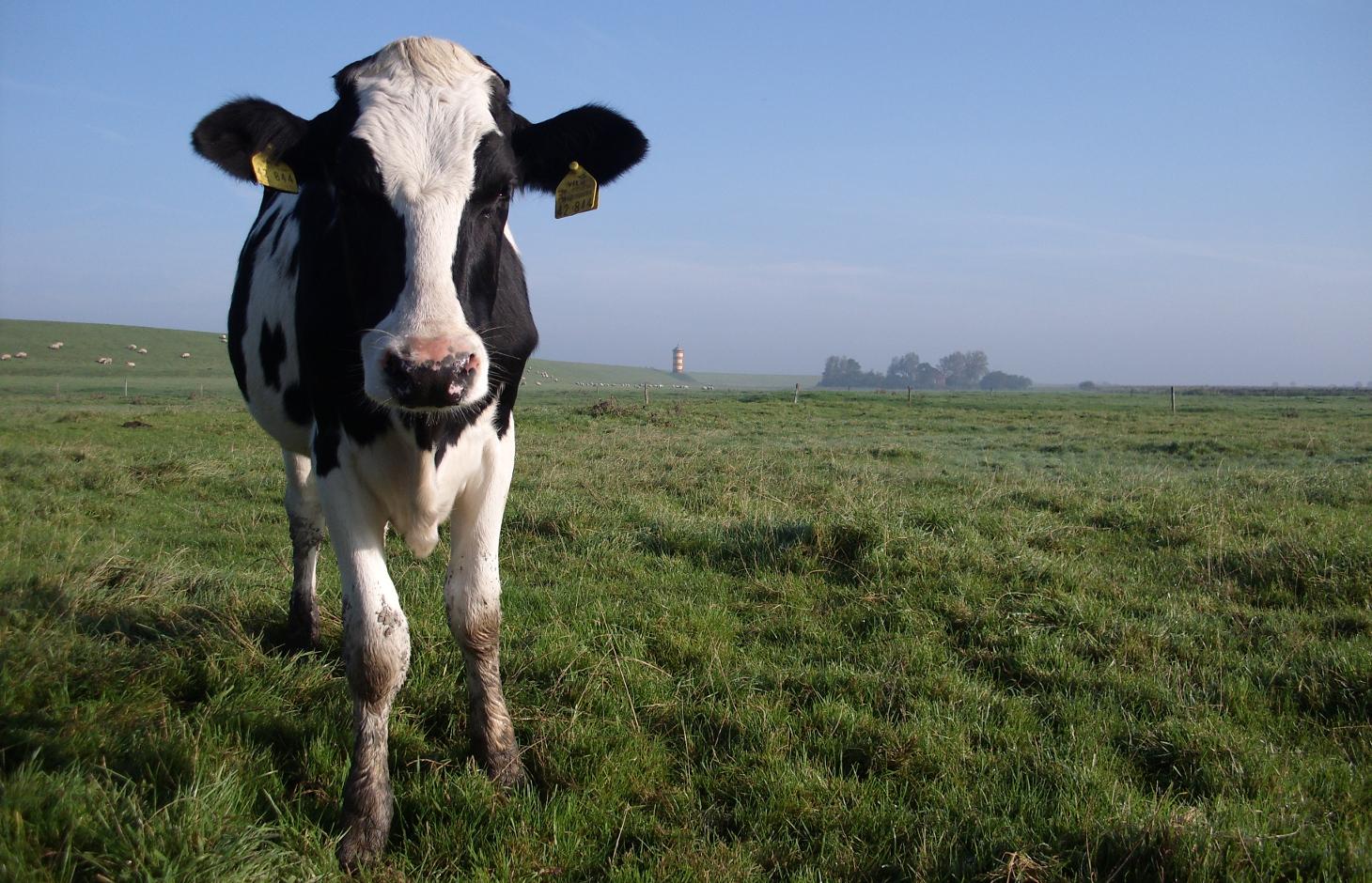
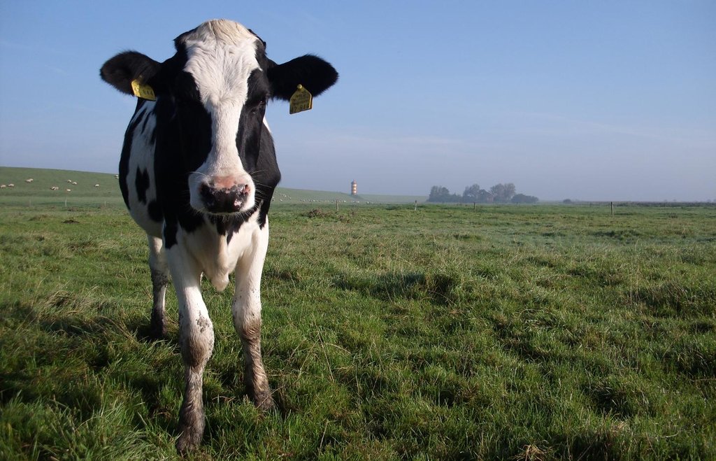
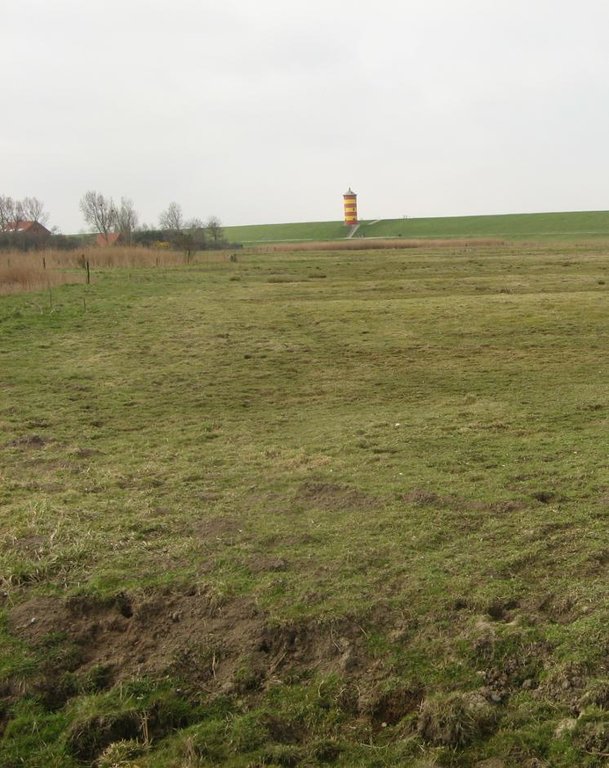
Drainage of coastal areas in north- western Germany [ប្រទេសអាល្លឺម៉ង់]
- ការបង្កើត៖
- បច្ចុប្បន្នភាព
- អ្នកចងក្រង៖ Martin Maier
- អ្នកកែសម្រួល៖ –
- អ្នកត្រួតពិនិត្យច្រើនទៀត៖ Fabian Ottiger, David Streiff, Alexandra Gavilano
Tiefliegenden Küstenlandschaften mit künstlicher Entwässerung in Nordwestdeutschland
technologies_1714 - ប្រទេសអាល្លឺម៉ង់
ពិនិត្យមើលគ្រប់ផ្នែក
ពង្រីកមើលទាំងអស់ បង្រួមទាំងអស់1. ព័ត៌មានទូទៅ
1.2 ព័ត៌មានលម្អិតពីបុគ្គលសំខាន់ៗ និងស្ថាប័នដែលចូលរួមក្នុងការវាយតម្លៃ និងចងក្រងឯកសារនៃបច្ចេកទេស
បុគ្គលសំខាន់ម្នាក់ (ច្រើននាក់)
អ្នកជំនាញឯកទេស SLM:
Kleyer Michael
University of Oldenburg
ប្រទេសអាល្លឺម៉ង់
អ្នកជំនាញឯកទេស SLM:
Karrasch Leena
University of Oldenburg
ប្រទេសអាល្លឺម៉ង់
អ្នកជំនាញឯកទេស SLM:
Mayer Martin
University of Oldenburg
ប្រទេសអាល្លឺម៉ង់
ឈ្មោះគម្រោងដែលបានចងក្រងឯកសារ/ វាយតម្លៃលើបច្ចេកទេស (បើទាក់ទង)
Book project: Making sense of research for sustainable land management (GLUES)ឈ្មោះគម្រោងដែលបានចងក្រងឯកសារ/ វាយតម្លៃលើបច្ចេកទេស (បើទាក់ទង)
Sustainable Coastal Land Management (COMTESS / GLUES)ឈ្មោះអង្គភាពមួយ (ច្រើន) ដែលបានចងក្រងឯកសារ/ វាយតម្លៃបច្ចេកទេស (បើទាក់ទង)
University of Oldenburg (University of Oldenburg) - ប្រទេសអាល្លឺម៉ង់1.3 លក្ខខណ្ឌទាក់ទងទៅនឹងការប្រើប្រាស់ទិន្នន័យដែលបានចងក្រងតាមរយៈ វ៉ូខេត
អ្នកចងក្រង និង(បុគ្គលសំខាន់ៗ)យល់ព្រមទទួលយកនូវលក្ខខណ្ឌនានាទាក់ទងទៅនឹងការប្រើប្រាស់ទិន្នន័យដែលបានចងក្រងតាមរយៈវ៉ូខេត:
បាទ/ចា៎
2. ការពណ៌នាពីបច្ចេកទេស SLM
2.1 ការពណ៌នាដោយសង្ខេបពីបច្ចេកទេស
និយមន័យបច្ចេកទេស:
Land reclaimed from the sea – ‘the coastal region in north-western Germany needs to be artificially drained, and this will be an increasing challenge with climate change.
2.2 ការពណ៌នាលម្អិតពីបច្ចេកទេស
ការពណ៌នា:
In some coastal locations of north-western Germany, during the 19th and 20th century, land was reclaimed from the sea: at present, the land lies below sea level. It is protected from the sea by a wall called ‘dyke’. The reason for reclamation by drainage and walls was to make use of the fertile soil for intensive cropland or pastures. In the Landkreis Aurich region, agriculture is the most important form of land use: it is the main source of income, supplemented by tourism.
Purpose of the Technology: However, in anticipation of the expected increase in winter precipitation due to climate change, extra freshwater discharge will need to be dealt with. Furthermore, the periods when natural discharge of freshwater into the sea can occur is likely to become shorter, due to the sea level rising – again as a result of climate change. Consequently, in autumn and winter, more freshwater will have to be pumped into the sea rather than being discharged naturally during low tides.
Establishment / maintenance activities and inputs: A dense drainage network enables intensive agriculture on the landward side of the primary sea wall. In total, one third of the Krummhörn community’s land is used for crops and one third as pasture. Drainage water from land which lies below sea level is pumped into the main drainage channels - which are at higher elevations and discharge naturally into the sea during low tides.
Natural / human environment: During storm tides when the sea level is high, large amounts of excess drainage water need to be pumped into the sea instead of naturally discharging. However, with climate change the present drainage network will no longer be capable of discharging all of the excess freshwater as a result of increased precipitation and sea level rise. This will require considerable investments in higher pumping capacities and an adapted drainage system with increased dimensions of ditches, as well as additional ditches in areas with a high flooding risk.
2.3 រូបភាពនៃបច្ចេកទេស
2.5 ប្រទេស/តំបន់/ទីតាំងកន្លែង ដែលបច្ចេកទេសត្រូវបានអនុវត្ត និងបានគ្រប់ដណ្តប់ដោយការវាយតម្លៃនេះ
ប្រទេស:
ប្រទេសអាល្លឺម៉ង់
តំបន់/រដ្ឋ/ខេត្ត:
Germany, Lower Saxony
បញ្ជាក់បន្ថែមពីលក្ខណៈនៃទីតាំង:
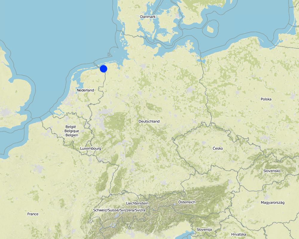
Landkreis Aurich
មតិយោបល់:
Total area covered by the SLM Technology is 33.7 km2.
Map
×2.6 កាលបរិច្ឆេទនៃការអនុវត្ត
ប្រសិនបើមិនច្បាស់ឆ្នាំ សូមបញ្ជាក់កាលបរិច្ឆេទដែលប្រហាក់ប្រហែល:
- ច្រើនជាង 50 ឆ្នាំមុន (ប្រពៃណី)
2.7 ការណែនាំពីបច្ចេកទេស
សូមបញ្ជាក់តើបច្ចេកទេសត្រូវបានណែនាំឱ្យអនុវត្តដោយរបៀបណា:
- ជាផ្នែកនៃប្រព័ន្ធប្រពៃណី (> 50 ឆ្នាំ)
មតិយោបល់ (ប្រភេទនៃគម្រោង ។ល។):
Traditional land use with dense drainage network to enable intensive agricultural land use in low elevated coastal landscapes.
3. ចំណាត់ថ្នាក់នៃបច្ចេកទេស SLM
3.2 ប្រភេទដីប្រើប្រាស់មួយប្រភេទ (ច្រើនប្រភេទ) ដែលបានអនុវត្តបច្ចេកទេស
ដីប្រើប្រាស់ចម្រុះនៅលើដីតែមួយ:
បាទ/ចា៎
បញ្ជាក់ពីប្រភេទដីច្រើនប្រភេទ (ដីដាំដំណាំ/ដីចិញ្ចឹមសត្វ/ដីព្រៃឈើ):
- Agro-pastoralism ( រួមបញ្ចូលទាំងដំណាំ និងចិញ្ចឹមសត្វ)

ដីដាំដំណាំ
- ដំណាំប្រចាំឆ្នាំ
ដំណាំប្រចាំឆ្នាំ - បញ្ជាក់ប្រភេទដំណាំ:
- ធញ្ញជាតិ - ស្រូវ
- ធញ្ញជាតិ - ពោត
- wheat
ចំនួនសារដែលដាំដំណាំក្នុងមួយឆ្នាំ:
- 1
សូមបញ្ជាក់:
Longest growing period in days: 240 Longest growing period from month to month: March to October

ដីសម្រាប់ចិញ្ចឹមសត្វ
ដីវាលស្មៅតូចៗ/ ផលិតកម្មចំណី:
- កាត់ និងជញ្ជូន/ គ្មានវាលស្មៅសម្រាប់ចិញ្ចឹមសត្វ
- បង្កើនវាលស្មៅ
ប្រភេទសត្វ:
- សត្វពាហនៈ - សត្វចិញ្ចឹមយកទឹកដោះ
- សត្វពាហនៈ - សត្វចិញ្ចឹមមិនយកទឹកដោះតែសម្រាប់យកសាច់
ផលិតផល និងសេវាកម្ម:
- សាច់
- ទឹកដោះគោ
មតិយោបល់:
Major land use problems (compiler’s opinion): Flood events and droughts may substantially disrupt the current land use system in the future and lead to higher drainage costs and higher economic risks for agricultural production. This will reduce the ecological and economic viability of the current intensive and highly productive land use under a changing climate.
Major land use problems (land users’ perception): There is no awareness of risks due to climate change.
Livestock density: > 100 LU /km2
3.3 បន្ទាប់ពីអនុវត្តបច្ចេកទេស តើដីប្រើប្រាស់មានការប្រែប្រួលដែររឺទេ?
បន្ទាប់ពីអនុវត្តបច្ចេកទេស តើដីប្រើប្រាស់មានការប្រែប្រួលដែររឺទេ?
- ទេ (បន្តទៅសំណួរ 3.4)
មតិយោបល់:
Mixed: Mp: Agro-pastoralism
3.4 ការផ្គត់ផ្គង់ទឹក
ការផ្គត់ផ្គង់ទឹកនៅកន្លែងអនុវត្តបច្ចេកទេស:
- ទឹកភ្លៀង និងប្រព័ន្ធស្រោចស្រព
មតិយោបល់:
Water supply: rainfed, mixed rainfed - irrigated
3.5 ក្រុម SLM ដែលបច្ចេកទេសស្ថិតនៅក្នុង
- ការបែងចែកទឹក និងប្រព័ន្ធបង្ហូរ
- ការគ្រប់គ្រងទឹកលើដី (ទឹកធ្លាក់ ទន្លេ បឹង សមុទ្រ)
3.6 វិធានការ SLM ដែលបញ្ចូលនូវបច្ចេកទេស

វិធានការរចនាស័ម្ពន្ធ
- S3: កម្ពស់ភ្លឺ ប្រឡាយ ផ្លូវទឹក
មតិយោបល់:
Main measures: structural measures
3.7 កំណត់ប្រភេទនៃការធ្លាក់ចុះគុណភាពដីសំខាន់ៗដែលបច្ចេកទេសនេះបានដោះស្រាយ

ការបាត់បង់ទឹក
- Hg: ការប្រែប្រួលបរិមាណទឹកនៅក្រោមដី
មតិយោបល់:
Main type of degradation addressed: Hg: change in groundwater / aquifer level
Main causes of degradation: change of seasonal rainfall (Climate change, higher rainfall in winter, lower in summer), Heavy / extreme rainfall (intensity/amounts) (Heavy rainfall in winter due to climate change expected), floods (Flooding due to heavy rainfall in winter)
Secondary causes of degradation: droughts (Droughts due to less rainfall in summer (climate change))
4. បច្ចេកទេសជាក់លាក់ សកម្មភាពអនុវត្ត ធាតុចូល និងថ្លៃដើម
4.1 គំនូសបច្ចេកទេសនៃបច្ចេកទេសនេះ
លក្ខណៈពិសេសនៃបច្ចេកទេស (ទាក់ទងនឺងគំនូរបច្ចេកទេស):
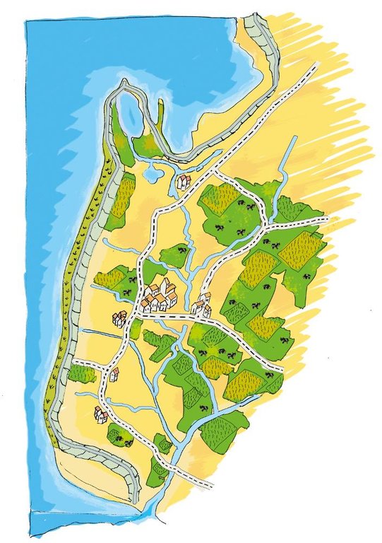
The figure shows the study region, located on the North Sea coast. The whole area is protected by a sea wall (grey). Crop fields (yellow), grasslands (green) and the drainage system (light blue) characterize the region. The traditional dense drainage network sometimes lacks the capacity to drain the lower land. This leads to flooding and limits agricultural productivity. It is expected that this flooding will increase with climate change. Agricultural production is faced with increased risks of crop failure in the future, unless the drainage system is strengthened.
Location: Krummhörn. County of Aurich, Lower Saxony
Technical knowledge required for land users: moderate
Main technical functions: decrease groundwater level by artificial drainage
Construction material (earth): digged in soil, no specific material needed
ឈ្មោះអ្នកនិពន្ធ:
Udo Schotten
4.2 ព័ត៌មានទូទៅដែលពាក់ព័ន្ធនឹងការគណនាធាតុចូល និងថ្លៃដើម
ផ្សេងៗ/ រូបិយប័ណ្ណជាតិ (បញ្ជាក់):
EURO
បើពាក់ព័ន្ធសូមកំណត់អត្រាប្តូរប្រាក់ពីដុល្លាទៅរូបិយប័ណ្ណតំបន់ (ឧ. 1 ដុល្លារ = 79.9 រៀលនៃរូបិយប័ណ្ណប្រេស៊ីល) ៖ 1 ដុល្លារ =:
0,94
កំណត់ថ្លៃឈ្នួលជាមធ្យមនៃការជួលកម្លាំងពលកម្មក្នុងមួយថ្ងៃ:
100.00
4.4 ថ្លៃដើម និងធាតុចូលដែលត្រូវការសម្រាប់ការបង្កើតបច្ចេកទេស
មតិយោបល់:
Duration of establishment phase: 3 month(s)
4.5 សកម្មភាពថែទាំ
| សកម្មភាព | ពេលវេលា/ ភាពញឹកញាប់ | |
|---|---|---|
| 1. | Maintenance of drainage system (ditches) | once per year |
4.6 កំណត់ថ្លៃដើមសម្រាប់ការថែទាំ/ សកម្មភាពរបស់បច្ចេកទេស (ក្នុងរយៈពេលមួយឆ្នាំ)
| បញ្ជាក់ពីធាតុចូល | ឯកតា | បរិមាណ | ថ្លៃដើមក្នុងមួយឯកតា | ថ្លៃធាតុចូលសរុប | % នៃថ្លៃដើមដែលចំណាយដោយអ្នកប្រើប្រាស់ដី | |
|---|---|---|---|---|---|---|
| ផ្សេងៗ | Maintenance cost pre km ditch | km ditch | 2270,7 |
4.7 កត្តាសំខាន់បំផុតដែលមានឥទ្ធិពលដល់ការចំណាយ
ពណ៌នាពីកត្តាប៉ះពាល់ចម្បងៗទៅលើថ្លៃដើម:
Cost are affected by soil types and cost of labour. The calculation is based on the mean costs over many years. This gives a mean annual cost of Euro 2,270 per km ditch per year. With 1,145 km of ditches this totals Euro 2,600,000 per year for the whole area (approx. 49,000 ha).
5. លក្ខណៈបរិស្ថានធម្មជាតិ និងមនុស្ស
5.1 អាកាសធាតុ
បរិមាណទឹកភ្លៀងប្រចាំឆ្នាំ
- < 250 មម
- 251-500 មម
- 501-750 មម
- 751-1,000 មម
- 1,001-1,500 មម
- 1,501-2,000 មម
- 2,001-3,000 មម
- 3,001-4,000 មម
- > 4,000 មម
តំបន់កសិអាកាសធាតុ
- សើម
Thermal climate class: temperate
5.2 សណ្ឋានដី
ជម្រាលជាមធ្យម:
- រាបស្មើ (0-2%)
- ជម្រាលតិចតួច (3-5%)
- មធ្យម (6-10%)
- ជម្រាលខ្ពស់បន្តិច (11-15%)
- ទីទួល (16-30%)
- ទីទួលចោត (31-60%)
- ទីទួលចោតខ្លាំង (>60%)
ទម្រង់ដី:
- ខ្ពង់រាប
- កំពូលភ្នំ
- ជម្រាលភ្នំ
- ជម្រាលទួល
- ជម្រាលជើងភ្នំ
- បាតជ្រលងភ្នំ
តំបន់តាមរយៈកម្ពស់ :
- 0-100 ម
- 101-500 ម
- 501-1,000 ម
- 1,001-1,500 ម
- 1,501-2,000 ម
- 2,001-2,500 ម
- 2,501-3,000 ម
- 3,001-4,000 ម
- > 4,000 ម
5.3 ដី
ជម្រៅដីជាមធ្យម:
- រាក់ខ្លាំង (0-20 សម)
- រាក់ (21-50 សម)
- មធ្យម (51-80 សម)
- ជ្រៅ (81-120 សម)
- ជ្រៅខ្លាំង (> 120 សម)
វាយនភាពដី (ស្រទាប់លើ):
- ម៉ត់/ ធ្ងន់ (ឥដ្ឋ)
សារធាតុសរីរាង្គនៅស្រទាប់ដីខាងលើ:
- ខ្ពស់ (>3%)
បើអាចសូមភ្ជាប់ការពណ៌នាពីដីឱ្យបានច្បាស់ ឬព័ត៌មានដែលអាចទទួលបាន ឧ. ប្រភេទដី, pH ដី/ ជាតិអាស៊ីត, សមត្ថភាពផ្លាស់ប្តូរកាចុង, វត្តមាននីត្រូសែន, ភាពប្រៃ ។ល។:
Soil fertility is high
Soil drainage/infiltration is medium
Soil water storage capacity is high
5.4 ទឹកដែលអាចទាញមកប្រើប្រាស់បាន និងគុណភាពទឹក
នីវ៉ូទឹកក្រោមដី:
< 5 ម
ទឹកលើដីដែលអាចទាញយកប្រើប្រាស់បាន:
ល្អ
គុណភាពទឹក (មិនបានធ្វើប្រត្តិកម្ម):
ទឹកសម្រាប់តែការធ្វើកសិកម្ម (ស្រោចស្រព)
5.5 ជីវៈចម្រុះ
ភាពសម្បូរបែបនៃប្រភេទ:
- ទាប
5.6 លក្ខណៈនៃអ្នកប្រើប្រាស់ដីដែលអនុវត្តបច្ចេកទេស
ទីផ្សារនៃប្រព័ន្ធផលិតកម្ម:
- ពាណិជ្ជកម្ម/ ទីផ្សារ
ចំណូលក្រៅកសិកម្ម:
- 10-50% នៃចំណូល
កម្រិតជីវភាព:
- មធ្យម
ឯកជន ឬក្រុម:
- មានបុគ្គលិក (ក្រុមហ៊ុន, រដ្ឋ)
កម្រិតប្រើប្រាស់គ្រឿងយន្ត:
- គ្រឿងយន្ត/ ម៉ាស៊ីន
យេនឌ័រ:
- ស្ត្រី
- បុរស
សូមបញ្ជាក់ពីលក្ខណៈពាក់ព័ន្ធផ្សេងទៀតអំពីអ្នកប្រើប្រាស់ដី:
Land users applying the Technology are mainly common / average land users
Population density: 50-100 persons/km2
Annual population growth: < 0.5%
1% of the land users are very rich and own 1% of the land.
49% of the land users are rich and own 24% of the land.
50% of the land users are average wealthy and own 50% of the land.
and own 15% of the land.
Off-farm income specification: Many farmers do additional work in companies
5.7 ទំហំផ្ទៃដីជាមធ្យមនៃដីប្រើប្រាស់ដោយអ្នកប្រើប្រាស់ដី ក្នុងការអនុវត្តបច្ចេកទេស
- < 0.5 ហិកតា
- 0.5-1 ហិកតា
- 1-2 ហិកតា
- 2-5 ហិកតា
- 5-15 ហិកតា
- 15-50 ហិកតា
- 50-100 ហិកតា
- 100-500 ហិកតា
- 500-1,000 ហិកតា
- 1,000-10,000 ហិកតា
- > 10,000 ហិកតា
តើផ្ទៃដីនេះចាត់ទុកជាទំហំកម្រិតណាដែរ ខ្នាតតូច មធ្យម ឬខ្នាតធំ (ធៀបនឹងបរិបទតំបន់)?
- ខ្នាតធំ
មតិយោបល់:
Average area of land owned or leased by land users applying the Technology: 5-15 ha, 15-50 ha, 50-100 ha, 100-500 ha
5.8 ភាពជាម្ចាស់ដី កម្មសិទ្ធប្រើប្រាស់ដី និងកម្មសិទ្ធប្រើប្រាស់ទឹក
ភាពជាម្ចាស់ដី:
- ឯកជន មិនមានកម្មសិទ្ធ
កម្មសិទ្ធិប្រើប្រាស់ដី:
- ឯកជន
5.9 ការប្រើប្រាស់សេវាកម្ម និងហេដ្ឋារចនាសម្ព័ន្ធ
សុខភាព:
- មិនល្អ
- មធ្យម
- ល្អ
ការអប់រំ:
- មិនល្អ
- មធ្យម
- ល្អ
ជំនួយបច្ចេកទេស:
- មិនល្អ
- មធ្យម
- ល្អ
ការងារ (ឧ. ការងារក្រៅកសិដ្ឋាន):
- មិនល្អ
- មធ្យម
- ល្អ
ទីផ្សារ:
- មិនល្អ
- មធ្យម
- ល្អ
ថាមពល:
- មិនល្អ
- មធ្យម
- ល្អ
ផ្លូវ និងការដឹកជញ្ជូន:
- មិនល្អ
- មធ្យម
- ល្អ
ទឹកផឹក និងអនាម័យ:
- មិនល្អ
- មធ្យម
- ល្អ
សេវាកម្មហិរញ្ញវត្ថុ:
- មិនល្អ
- មធ្យម
- ល្អ
6. ផលប៉ះពាល់ និងការសន្និដ្ឋាន
6.1 ផលប៉ះពាល់ក្នុងបរិវេណអនុវត្តបច្ចេកទេសដែលកើតមាន
ផលប៉ះពាល់លើសេដ្ឋកិច្ចសង្គម
ផលិតផល
ផលិតកម្មដំណាំ
ផលិតកម្មចំណីសត្វ
គុណភាពចំណីសត្វ
ហានិភ័យនៃភាពបរាជ័យរបស់ផលិតកម្ម
ផ្ទៃដីផលិតកម្ម
ទឹកដែលអាចទាញមកប្រើប្រាស់បាន និងគុណភាពទឹក
ទឹកបរិភោគដែលអាចទាញយកមកប្រើប្រាស់បាន
ទឹកប្រើប្រាស់សម្រាប់ស្រោចស្រព
ចំណូល និងថ្លៃដើម
ចំណូលក្នុងកសិដ្ឋាន
ផលប៉ះពាល់ទៅលើវប្បធម៌សង្គម
ឱកាសនៃការបង្កើតថ្មី
ផលប៉ះពាល់ទៅលើអេកូឡូស៊ី
វដ្តទឹក/លំហូរ
បរិមាណទឹក
គុណភាពទឹក
លំហូរទឹកលើផ្ទៃដី
នីវ៉ូទឹកក្រោមដី/ ដង្ហើមទឹក
ដី
ភាពប្រៃ
សារធាតុសរីរាង្គដី/ការបូនក្រោមដី
ជីវចម្រុះ៖ ដំណាំ, សត្វ
ភាពសម្បូរបែបនៃរុក្ខជាតិ
មតិយោបល់/ ការបញ្ជាក់:
Reduced crop diversity
ភាពសម្បូរបែបនៃទីជំរក
មតិយោបល់/ ការបញ្ជាក់:
Increased habitat fragmentation
6.2 ផលប៉ះពាល់ក្រៅបរិវេណអនុវត្តបច្ចេកទេសដែលកើតមាន
ទឹកជំនន់ខ្សែទឹកខាងក្រោម
ខូចខាតដល់ស្រែអ្នកជិតខាង
ខូចខាតដល់ហេដ្ឋារចនាសម្ព័ន្ធសាធារណៈ/ឯកជន
Excess water
Hazard towards adverse events
6.3 ភាពប្រឈម និងភាពរួសនៃបច្ចេកទេសទៅនឹងការប្រែប្រួលអាកាសធាតុ និងគ្រោះអាកាសធាតុ/ គ្រោះមហន្តរាយ (ដែលដឹងដោយអ្នកប្រើប្រាស់ដី)
ការប្រែប្រួលអាកាសធាតុ
ការប្រែប្រួលអាកាសធាតុ
| រដូវកាល | កើនឡើង ឬថយចុះ | លក្ខណៈឆ្លើយតបនៃបច្ចេកទេសទៅនឹងការប្រែប្រួលអាកាសធាតុ | |
|---|---|---|---|
| សីតុណ្ហភាពប្រចាំឆ្នាំ | កើនឡើង | ល្អ |
គ្រោះអាកាសធាតុ (មហន្តរាយ)
គ្រោះមហន្តរាយធម្មជាតិ
| លក្ខណៈឆ្លើយតបនៃបច្ចេកទេសទៅនឹងការប្រែប្រួលអាកាសធាតុ | |
|---|---|
| ព្យុះភ្លៀងតាមតំបន់ | មិនល្អ |
| ព្យុះកំបុតត្បូងតាមតំបន់ | មិនល្អ |
គ្រោះមហន្តរាយអាកាសធាតុ
| លក្ខណៈឆ្លើយតបនៃបច្ចេកទេសទៅនឹងការប្រែប្រួលអាកាសធាតុ | |
|---|---|
| រាំងស្ងួត | ល្អ |
គ្រោះមហន្តរាយទឹក
| លក្ខណៈឆ្លើយតបនៃបច្ចេកទេសទៅនឹងការប្រែប្រួលអាកាសធាតុ | |
|---|---|
| ទឹកជំនន់ទូទៅ (ទន្លេ) | មិនល្អ |
ផលវិបាកដែលទាក់ទងនឹងបរិយាកាសផ្សេងៗទៀត
ផលវិបាកដែលទាក់ទងនឹងបរិយាកាសផ្សេងៗទៀត
| លក្ខណៈឆ្លើយតបនៃបច្ចេកទេសទៅនឹងការប្រែប្រួលអាកាសធាតុ | |
|---|---|
| កាត់បន្ថយពេលដាំដុះ | មិនស្គាល់ |
| climate change | មិនល្អ |
6.4 ការវិភាគថ្លៃដើម និងអត្ថប្រយោជន៍
តើផលចំណេញ និងថ្លៃដើមត្រូវបានប្រៀបធៀបគ្នាយ៉ាងដូចម្តេច (ទស្សនៈរបស់អ្នកប្រើប្រាស់ដី)?
រយៈពេលខ្លី:
អវិជ្ជមានខ្លាំង
រយៈពេលវែង:
វិជ្ជមាន
តើផលចំណេញ និងការថែទាំ/ ជួសជុលត្រូវបានប្រៀបធៀបគ្នាយ៉ាងដូចម្តេច (ទស្សនៈរបស់អ្នកប្រើប្រាស់ដី)?
រយៈពេលខ្លី:
វិជ្ជមាន
រយៈពេលវែង:
វិជ្ជមានខ្លាំង
មតិយោបល់:
Development of dense drainage network is very cost intensive but last for very long time. Maintainance cost are quite low compared to the benefits of intensive land use.
6.5 ការទទួលយកបច្ចេកទេស
ក្នុងចំណោមគ្រួសារទាំងអស់ដែលបានអនុវត្តបច្ចេកទេស តើមានប៉ុន្មានគ្រួសារដែលចង់ធ្វើដោយខ្លួនឯង ដោយមិនទទួលបានសម្ភារៈលើកទឹកចិត្ត/ប្រាក់ឧបត្ថម្ភ?:
- 91-100%
មតិយោបល់:
100% of land user families have adopted the Technology without any external material support
Comments on spontaneous adoption: Well established technology in the whole region.
6.7 ភាពខ្លាំង/ គុណសម្បត្តិ/ ឱកាសនៃបច្ចេកទេស
| ភាពខ្លាំង/ គុណសម្បត្តិ/ ឱកាសនៅកន្លែងរបស់អ្នកប្រើប្រាស់ដី |
|---|
|
Optimal for agricultural production How can they be sustained / enhanced? Invest in infrastructure to maintain the system |
| ភាពខ្លាំង/ គុណសម្បត្តិ/ ឱកាស ទស្សនៈរបស់បុគ្គលសំខាន់ៗ |
|---|
|
High agricultural production How can they be sustained / enhanced? Strengthen the drainage system to adapt to climate change |
6.8 ភាពខ្សោយ/ គុណវិបត្តិ/ ហានិភ័យនៃបច្ចេកទេស និងវិធីសាស្ត្រដោះស្រាយ
| ភាពខ្សោយ/ គុណវិបត្តិ/ ហានិភ័យ ទស្សនៈរបស់អ្នកចងក្រងឬបុគ្គលសំខាន់ៗ | តើបច្ចេកទេសទាំងនោះបានដោះស្រាយបញ្ហាដូចម្តេច? |
|---|---|
| High drainage costs | Development of water retention areas ( see A_GER001_en, A_GER002_en and A_GER003_en) |
| Landscape vulnerable to climate change | Development of water retention areas (see A_GER001_en, A_GER002_en and A_GER003_en) |
7. ឯកសារយោង និងវេបសាយ
7.1 វិធីសាស្ត្រ/ ប្រភពនៃព័ត៌មាន
7.2 ឯកសារយោងដែលបានចេញផ្សាយ
ចំណងជើង អ្នកនិពន្ធ ឆ្នាំ ISBN:
http://www.comtess.uni-oldenburg.de/
7.3 ការភ្ជាប់ទៅកាន់ព័ត៌មានពាក់ព័ន្ធលើប្រព័ន្ធអនឡាញ
ចំណងជើង/ ពណ៌នា:
http://www.comtess.uni-oldenburg.de/
ការតភ្ជាប់ និងម៉ូឌុល
ពង្រីកមើលទាំងអស់ បង្រួមទាំងអស់ការតភ្ជាប់
គ្មានការតភ្ជាប់
ម៉ូឌុល
គ្មានម៉ូឌុល


