Detention ponds [ប្រទេសអាល្លឺម៉ង់]
- ការបង្កើត៖
- បច្ចុប្បន្នភាព
- អ្នកចងក្រង៖ Felix Witing
- អ្នកកែសម្រួល៖ Michael Strauch, Mona Pauer
- អ្នកត្រួតពិនិត្យច្រើនទៀត៖ William Critchley, Rima Mekdaschi Studer
Rückhaltebecken
technologies_6265 - ប្រទេសអាល្លឺម៉ង់
ពិនិត្យមើលគ្រប់ផ្នែក
ពង្រីកមើលទាំងអស់ បង្រួមទាំងអស់1. ព័ត៌មានទូទៅ
1.2 ព័ត៌មានលម្អិតពីបុគ្គលសំខាន់ៗ និងស្ថាប័នដែលចូលរួមក្នុងការវាយតម្លៃ និងចងក្រងឯកសារនៃបច្ចេកទេស
អ្នកជំនាញឯកទេស SLM:
អ្នកជំនាញឯកទេស SLM:
អ្នកជំនាញឯកទេស SLM:
Schürz Christoph
Helmholtz Centre for Environmental Research (UFZ)
ប្រទេសអាល្លឺម៉ង់
ឈ្មោះគម្រោងដែលបានចងក្រងឯកសារ/ វាយតម្លៃលើបច្ចេកទេស (បើទាក់ទង)
OPtimal strategies to retAIN and re-use water and nutrients in small agricultural catchments across different soil-climatic regions in Europe (OPTAIN)ឈ្មោះអង្គភាពមួយ (ច្រើន) ដែលបានចងក្រងឯកសារ/ វាយតម្លៃបច្ចេកទេស (បើទាក់ទង)
Helmholtz Centre for Environmental Research (UFZ) - ប្រទេសអាល្លឺម៉ង់1.3 លក្ខខណ្ឌទាក់ទងទៅនឹងការប្រើប្រាស់ទិន្នន័យដែលបានចងក្រងតាមរយៈ វ៉ូខេត
អ្នកចងក្រង និង(បុគ្គលសំខាន់ៗ)យល់ព្រមទទួលយកនូវលក្ខខណ្ឌនានាទាក់ទងទៅនឹងការប្រើប្រាស់ទិន្នន័យដែលបានចងក្រងតាមរយៈវ៉ូខេត:
បាទ/ចា៎
1.4 សេចក្តីប្រកាសស្តីពីចីរភាពនៃការពណ៌នាពីបច្ចេកទេស
តើបច្ចេកទេសដែលបានពណ៌នានេះមានបញ្ហាដែលផ្តោតលើការធ្លាក់ចុះគុណភាពដី, បើដូច្នេះវាមិនអាចត្រូវបានប្រកាសថាជាបច្ចេកទេសនៃការគ្រប់គ្រងប្រកបដោយចីរភាពទេ?
ទេ
2. ការពណ៌នាពីបច្ចេកទេស SLM
2.1 ការពណ៌នាដោយសង្ខេបពីបច្ចេកទេស
និយមន័យបច្ចេកទេស:
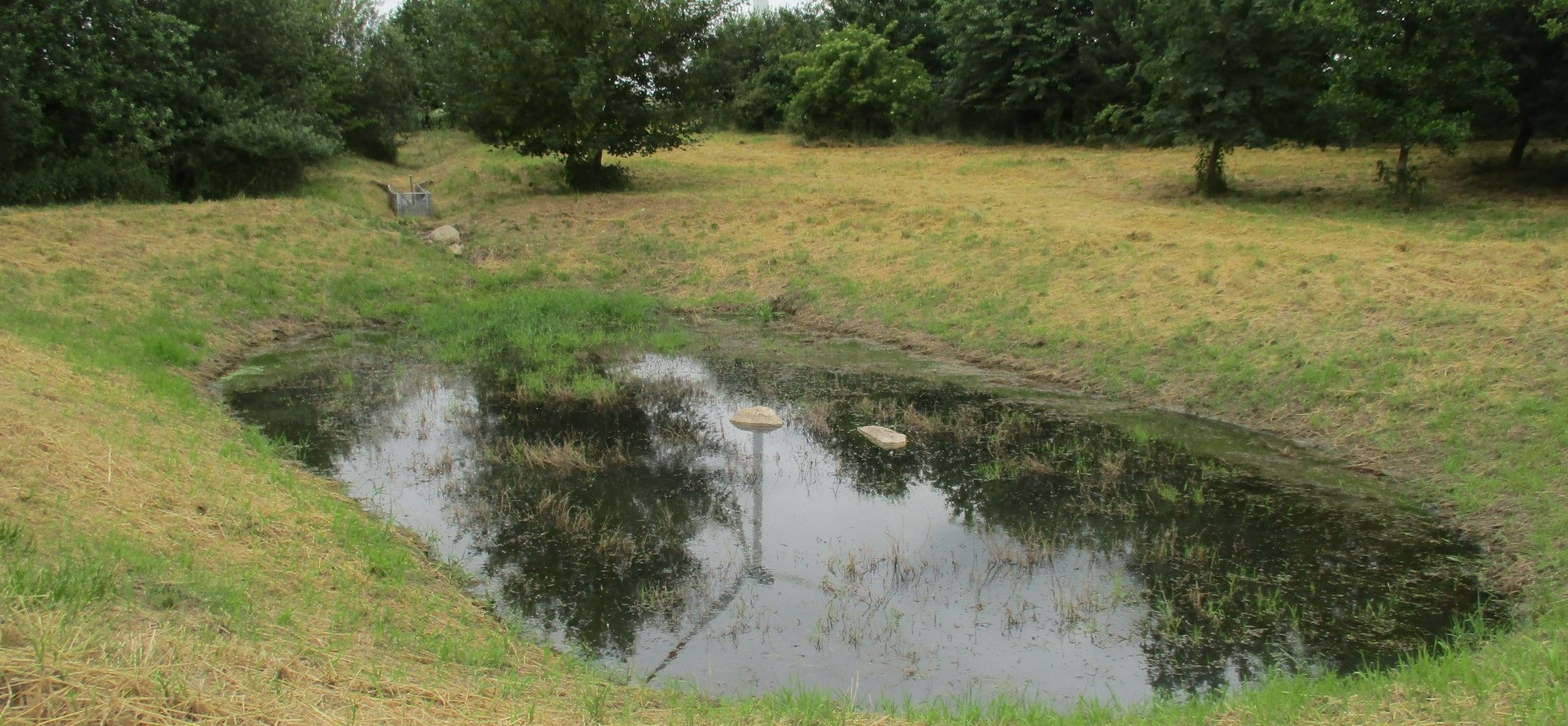
Detention ponds are artificially excavated basins that collect stormwater runoff and eroded sediment from the upstream catchment. The water stored in these ponds is slowly released into a water body or it infiltrates into the groundwater – or both. Their primary functions are flood control, erosion control and water quality improvement.
2.2 ការពណ៌នាលម្អិតពីបច្ចេកទេស
ការពណ៌នា:
This documentation focuses on a detention basin constructed to hold surface runoff at the lowest point of an agricultural catchment. A well-designed detention pond is an effective flood control and landscape management measure. It stores surface runoff and releases it through controlled flow, infiltration, or evaporation (or a combination), and reduces nutrient inputs to the adjacent water body by filtering out sediment and nutrients through particle deposition, or nutrient uptake by plants. On average, water treatment in a detention pond can remove about 50-60% of suspended solids, 30-35% of total phosphorus and total nitrogen, and 25-65% of metals. Ponds also provide habitat for terrestrial, riparian and aquatic species. In addition to their ecological impact, they have an aesthetic and cultural value to society, for example, as a demonstration of effective sustainable water management.
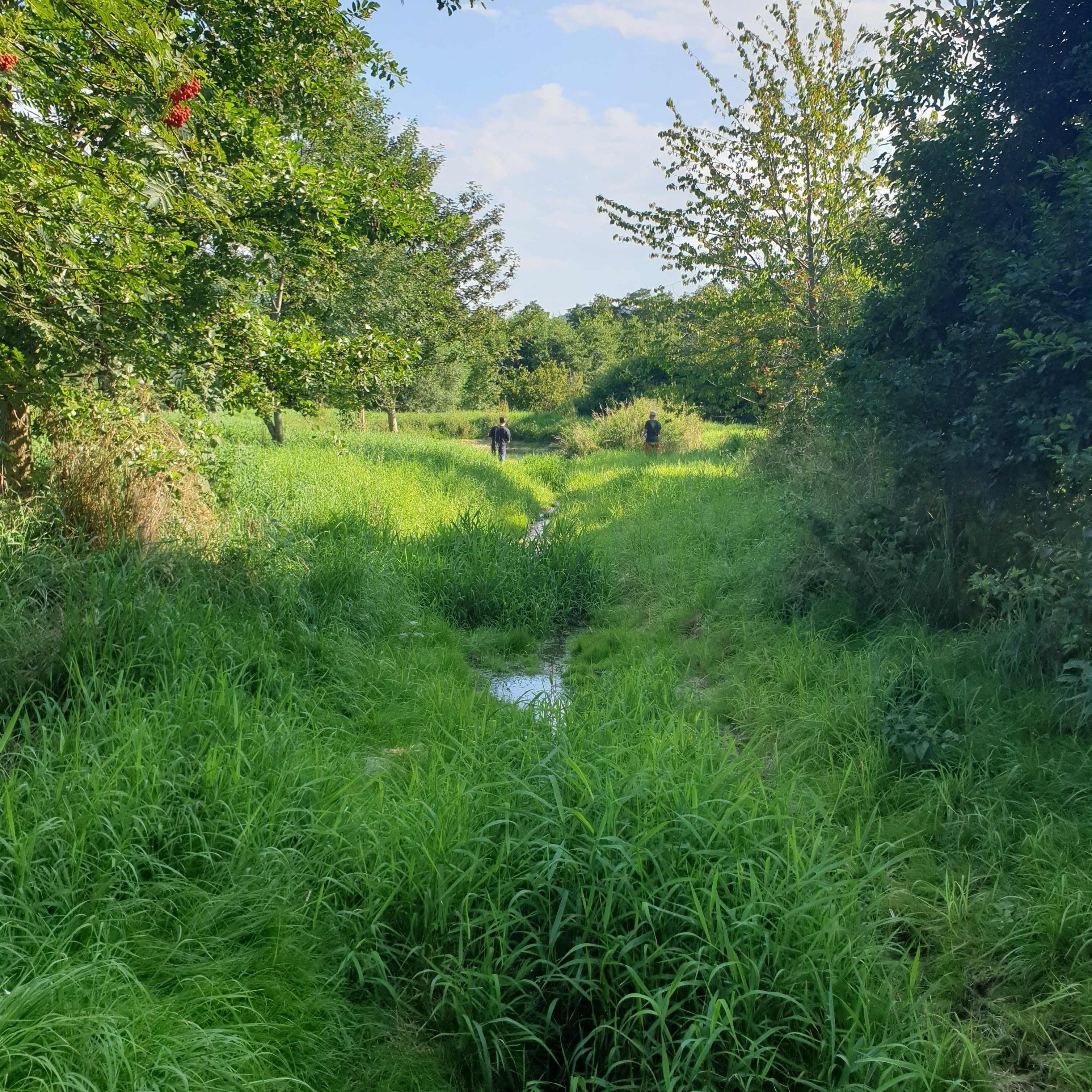
The detention basin described here was constructed by excavating a new depression and ditch system. It consists of a 450 m long inlet channel, a 250 m² pond, and an overflow channel that diverts excess water downstream to the nearest river (Schwarzer Schöps). However, there are no outlet structures for draining water that is captured in the pond (apart from the overflow). All the collected water seeps into the ground and soil particles settle. As a general rule, the size of such a pond should be 3-7% of the upstream catchment and should be able to hold at least the precipitation of a 1 in 30 year rainfall event. However, as the infiltration of the collected water is rather slow, the efficiency is reduced for successive events and overflowing is common. The depth should be between 1.2 m and 2.0 m. A deeper pond can lead to stratification and anoxic conditions, while a shallower pond may cause algal blooms and high biological activity in the summer. Water stored in the pond should remain for at least 20 days to ensure biological treatment.
The construction of the detention pond in this documentation was initiated as a compensation and replacement measure for the construction of a new road in 2016. Accordingly, the road construction authority, the landscape conservation association and a farmer were involved in the implementation.
As usual with such measures there are drawbacks as well as positive impact for landowners. The measure consumes a lot of land, which automatically results in yield losses. It is expensive to build and not easy to construct - and requires the help of an engineering firm while also being time-consuming to maintain. Maintenance is required to sustain the benefits of the technology. For a pond such as that documented here, the following maintenance activities are necessary: during the first three years, maintenance includes mowing the surrounding green area and the dried out pond and channel three times per year. After the fourth year, maintenance includes (a) an annual function check, (b) a check for pest infestation every two years, and (c) suppression of excess woody growth every eight to ten years. Twice a year (mid-June and late August), the grass around the pond and in the intake channel is mowed and the clippings are removed. Shrubs and woody plants are maintained, especially by pruning woody plants (every 8 to 10 years) and coppicing sections of shrubs (every 10 to 15 years). In the long term, it may be necessary to remove the deposited sediments in order to maintain the retention capacity.
2.3 រូបភាពនៃបច្ចេកទេស
វិចិត្រសាលប្រព័ន្ធផ្សព្វផ្សាយ
2.5 ប្រទេស/តំបន់/ទីតាំងកន្លែង ដែលបច្ចេកទេសត្រូវបានអនុវត្ត និងបានគ្រប់ដណ្តប់ដោយការវាយតម្លៃនេះ
ប្រទេស:
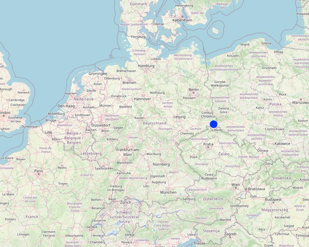
ប្រទេសអាល្លឺម៉ង់
តំបន់/រដ្ឋ/ខេត្ត:
Saxony
បញ្ជាក់បន្ថែមពីលក្ខណៈនៃទីតាំង:
Reichenbach
បញ្ជាក់ពីការសាយភាយនៃបច្ចេកទេស:
- អនុវត្តនៅកន្លែងជាក់លាក់មួយ/ ប្រមូលផ្តុំនៅតំបន់តូចៗ
តើបច្ចេកទេស (មួយ ឬច្រើន) ទាំងនោះស្ថិតនៅក្នុងតំបន់ការពារជាអចិន្ត្រៃយ៍ណាមួយដែរឬទេ?
ទេ
Map
×2.6 កាលបរិច្ឆេទនៃការអនុវត្ត
ប្រសិនបើមិនច្បាស់ឆ្នាំ សូមបញ្ជាក់កាលបរិច្ឆេទដែលប្រហាក់ប្រហែល:
- 10-50 ឆ្នាំ
2.7 ការណែនាំពីបច្ចេកទេស
- Compensation measure
មតិយោបល់ (ប្រភេទនៃគម្រោង ។ល។):
The construction of the detention pond was initiated as a compensation measure for the construction for the road construction project "S70 OU Reichenbach 2. BA".
3. ចំណាត់ថ្នាក់នៃបច្ចេកទេស SLM
3.1 គោលបំណងចម្បង (១ ឬច្រើន) នៃបច្ចេកទេសនេះ
- កាត់បន្ថយ, បង្ការ, ស្តារឡើងវិញនូវការធ្លាក់ចុះគុណភាពដី
- អភិរក្សប្រព័ន្ធអេកូឡូស៊ី
- ការពារតំបន់ទីជម្រាល/តំបន់ខ្សែទឹកខាងក្រោមបញ្ចូលជាមួយបច្ចេកទេសផ្សេងទៀត
- កាត់បន្ថយហានិភ័យនៃគ្រោះមហន្តរាយ
- បង្កើតផលប្រយោជន៍សង្គម
3.2 ប្រភេទដីប្រើប្រាស់មួយប្រភេទ (ច្រើនប្រភេទ) ដែលបានអនុវត្តបច្ចេកទេស
ដីប្រើប្រាស់ចម្រុះនៅលើដីតែមួយ:
ទេ

ផ្សេងៗ
សូមបញ្ជាក់:
extensively farmed grassland
3.3 បន្ទាប់ពីអនុវត្តបច្ចេកទេស តើដីប្រើប្រាស់មានការប្រែប្រួលដែររឺទេ?
បន្ទាប់ពីអនុវត្តបច្ចេកទេស តើដីប្រើប្រាស់មានការប្រែប្រួលដែររឺទេ?
- ទេ (បន្តទៅសំណួរ 3.4)
3.4 ការផ្គត់ផ្គង់ទឹក
ការផ្គត់ផ្គង់ទឹកនៅកន្លែងអនុវត្តបច្ចេកទេស:
- ទឹកភ្លៀង
3.5 ក្រុម SLM ដែលបច្ចេកទេសស្ថិតនៅក្នុង
- ការស្តុកទុកទឹក
- កាត់បន្ថយហានិភ័យនៃបញ្ហាលើប្រព័ន្ធអេកូឡូស៊ី
3.6 វិធានការ SLM ដែលបញ្ចូលនូវបច្ចេកទេស

វិធានការរចនាស័ម្ពន្ធ
- S5: ទំនប់ ថ្លុក ស្រះ
3.7 កំណត់ប្រភេទនៃការធ្លាក់ចុះគុណភាពដីសំខាន់ៗដែលបច្ចេកទេសនេះបានដោះស្រាយ

ការហូរច្រោះដីដោយសារទឹក
- Wt: ការបាត់ដីស្រទាប់លើដោយការហូរច្រោះ
- Wg: ការកកើតឡើងនូវកំទេចកំទីដីស្រទាប់ក្រោម

ការបាត់បង់ទឹក
- Hs: ការប្រែប្រួលបរិមាណទឹកនៅលើផ្ទៃដី
- Hg: ការប្រែប្រួលបរិមាណទឹកនៅក្រោមដី
3.8 ការពារ កាត់បន្ថយ ឬស្តារឡើងវិញនៃការធ្លាក់ចុះគុណភាពដី
បញ្ជាក់ពីគោលដៅរបស់បច្ចេកទេស ដែលផ្តោតទៅការធ្លាក់ចុះគុណភាពដី:
- ការកាត់បន្ថយការធ្លាក់ចុះគុណភាពដី
- ការជួសជុល/ ស្តារឡើងវិញនៃឱនភាពដីធ្ងន់ធ្ងរ
4. បច្ចេកទេសជាក់លាក់ សកម្មភាពអនុវត្ត ធាតុចូល និងថ្លៃដើម
4.1 គំនូសបច្ចេកទេសនៃបច្ចេកទេសនេះ

លក្ខណៈពិសេសនៃបច្ចេកទេស (ទាក់ទងនឺងគំនូរបច្ចេកទេស):
Securing dam stability by willow sticks.
ឈ្មោះអ្នកនិពន្ធ:
LISt Gesellschaft für Verkehrswesen und ingenieurtechnische Dienstleistungen mbH, Bereich Kompensationsmaßnahmenmanagement
កាលបរិច្ឆេទ:
29/02/2016

លក្ខណៈពិសេសនៃបច្ចេកទេស (ទាក់ទងនឺងគំនូរបច្ចេកទេស):
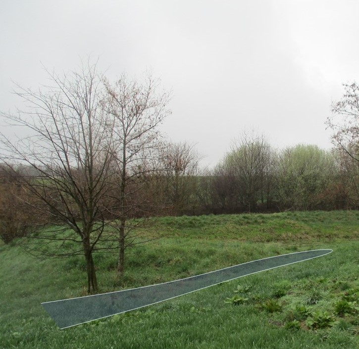
A detention pond (in genreral) consists of a sediment forebay (pretreatment system), a permanent pool that is intended to remain wet throughout the year (but may dry out), a temporary storage pond for flood attenuation, and a shallow zone or aquatic bench along the edge of the permanent pool to support wetland planting that provides ecological and safety benefits. It should be wedge-shaped with a length to width ratio of between 3:1 and 5:1. The side slope shouldn’t be steeper than 1:3 for public safety and maintenance access.
ឈ្មោះអ្នកនិពន្ធ:
Hunt et al. (2020)
កាលបរិច្ឆេទ:
20/02/2020
4.2 ព័ត៌មានទូទៅដែលពាក់ព័ន្ធនឹងការគណនាធាតុចូល និងថ្លៃដើម
កំណត់របៀបនៃការគណនាថ្លៃដើម និងធាតុចូល:
- ក្នុងឯកតាបច្ចេកទេស
បញ្ជាក់ឯកតា:
Detention pond (as documented here)
បញ្ជាក់ពីទំហំនៃឯកតា (បើពាក់ព័ន្ធ):
225 m², ca. 337,5 m³ (water depth of 1,5m)
ផ្សេងៗ/ រូបិយប័ណ្ណជាតិ (បញ្ជាក់):
€
បើពាក់ព័ន្ធសូមកំណត់អត្រាប្តូរប្រាក់ពីដុល្លាទៅរូបិយប័ណ្ណតំបន់ (ឧ. 1 ដុល្លារ = 79.9 រៀលនៃរូបិយប័ណ្ណប្រេស៊ីល) ៖ 1 ដុល្លារ =:
0,91
កំណត់ថ្លៃឈ្នួលជាមធ្យមនៃការជួលកម្លាំងពលកម្មក្នុងមួយថ្ងៃ:
18.70 € per hour
4.3 សកម្មភាពបង្កើត
| សកម្មភាព | រយៈពេល (រដូវកាល) | |
|---|---|---|
| 1. | remove topsoil | |
| 2. | profile water body according to site plan (Standing water 1.5 m deep, ditch 0.5-1.5m deep) | |
| 3. | installing of inlet channel | |
| 4. | installing erosion protection on embankments | |
| 5. | cover the topsoil / terrain profiling | |
| 6. | planting of shrubs & aquatic plants along the shoreline | |
| 7. | ditch connection to Schwarzer-Schöps | |
| 8. | reprofiling ditches (90m) | |
| 9. | desilting of drainage ditch to Schwarzer-Schöps | |
| 10. | subsequent installation of a spillway (beak structure: 'Schnabelbauwerk') and willow sticks as an erosion control measure for the ditch connection to Schwarzer-Schöps. |
4.4 ថ្លៃដើម និងធាតុចូលដែលត្រូវការសម្រាប់ការបង្កើតបច្ចេកទេស
ប្រសិនបើមិនអាចបំបែកតម្លៃដើមក្នុងតារាងខាងក្រោមទេ សូមផ្តល់នូវតម្លៃប៉ាន់ស្មានសរុបក្នុងការបង្កើតបច្ចេកទេសនោះ:
25250,0
ប្រសិនបើអ្នកប្រើប្រាស់ដីមិនមានថ្លៃដើម 100% សូមបញ្ជាក់ថានរណាដែលចំណាយថ្លៃដើមដែលនៅសល់:
The costs were covered by the road construction authority (compensation measure for the construction of a new road)
មតិយោបល់:
based on estimated average costs (nwrm.eu)
4.5 សកម្មភាពថែទាំ
| សកម្មភាព | ពេលវេលា/ ភាពញឹកញាប់ | |
|---|---|---|
| 1. | completion and development maintenance (mowing of the green area and the water-free water body) | first three years: three times per year |
| 2. | functional check | after the fourth year: every year |
| 3. | check for pest infestation | after the fourth year : every other year |
| 4. | check to suppress unwanted woody growth | after the fourth year: every 8 to 10 years |
| 5. | grass around the pond and in the intake channel is mowed and the clippings are removed | after the fourth year: twice a year (mid-June and late August) |
| 6. | pruning woody plants | every 8 to 10 years |
| 7. | putting sections of shrubs on stock | every 10 to 15 years |
4.6 កំណត់ថ្លៃដើមសម្រាប់ការថែទាំ/ សកម្មភាពរបស់បច្ចេកទេស (ក្នុងរយៈពេលមួយឆ្នាំ)
ប្រសិនបើមិនអាចបំបែកតម្លៃដើមក្នុងតារាងខាងក្រោមទេ សូមផ្តល់នូវតម្លៃប៉ាន់ស្មានសរុបក្នុងការថែទាំបច្ចេកទេសនោះ:
618,0
ប្រសិនបើអ្នកប្រើប្រាស់ដីមិនមានថ្លៃដើម 100% សូមបញ្ជាក់ថានរណាដែលចំណាយថ្លៃដើមដែលនៅសល់:
The costs are covered by the road construction authority (compensation measure for the construction of a new road)
មតិយោបល់:
estimated average costs (nwrm.eu)
4.7 កត្តាសំខាន់បំផុតដែលមានឥទ្ធិពលដល់ការចំណាយ
ពណ៌នាពីកត្តាប៉ះពាល់ចម្បងៗទៅលើថ្លៃដើម:
From the government perspective: A budget must be set aside annually for necessary maintenance to ensure functional efficiency.
5. លក្ខណៈបរិស្ថានធម្មជាតិ និងមនុស្ស
5.1 អាកាសធាតុ
បរិមាណទឹកភ្លៀងប្រចាំឆ្នាំ
- < 250 មម
- 251-500 មម
- 501-750 មម
- 751-1,000 មម
- 1,001-1,500 មម
- 1,501-2,000 មម
- 2,001-3,000 មម
- 3,001-4,000 មម
- > 4,000 មម
លក្ខណៈពិសេស/ មតិយោបល់លើរដូវភ្លៀង:
Average annual rainfall in mm: 750.82 mm/a
Name of the meteorological station: https://whh-kliwes.de/mapview
តំបន់កសិអាកាសធាតុ
- មានភ្លៀងមធ្យម
Length of growing period (LGP): 209 days
(https://www.umwelt.sachsen.de/dauer-der-vegetationsperiode-30631.html)
5.2 សណ្ឋានដី
ជម្រាលជាមធ្យម:
- រាបស្មើ (0-2%)
- ជម្រាលតិចតួច (3-5%)
- មធ្យម (6-10%)
- ជម្រាលខ្ពស់បន្តិច (11-15%)
- ទីទួល (16-30%)
- ទីទួលចោត (31-60%)
- ទីទួលចោតខ្លាំង (>60%)
ទម្រង់ដី:
- ខ្ពង់រាប
- កំពូលភ្នំ
- ជម្រាលភ្នំ
- ជម្រាលទួល
- ជម្រាលជើងភ្នំ
- បាតជ្រលងភ្នំ
តំបន់តាមរយៈកម្ពស់ :
- 0-100 ម
- 101-500 ម
- 501-1,000 ម
- 1,001-1,500 ម
- 1,501-2,000 ម
- 2,001-2,500 ម
- 2,501-3,000 ម
- 3,001-4,000 ម
- > 4,000 ម
បញ្ជាក់ថាតើបច្ចេកទេសនេះត្រូវបានអនុវត្តន៍នៅក្នុង:
- សណ្ឋានដីផត
5.3 ដី
ជម្រៅដីជាមធ្យម:
- រាក់ខ្លាំង (0-20 សម)
- រាក់ (21-50 សម)
- មធ្យម (51-80 សម)
- ជ្រៅ (81-120 សម)
- ជ្រៅខ្លាំង (> 120 សម)
វាយនភាពដី (ស្រទាប់លើ):
- គ្រើម/ មានពន្លឺ (ខ្សាច់)
- មធ្យម (ល្បាយ, ល្បាប់)
វាយនភាពដី (> 20 សម ស្រទាប់ក្នុង):
- មធ្យម (ល្បាយ, ល្បាប់)
សារធាតុសរីរាង្គនៅស្រទាប់ដីខាងលើ:
- ខ្ពស់ (>3%)
បើអាចសូមភ្ជាប់ការពណ៌នាពីដីឱ្យបានច្បាស់ ឬព័ត៌មានដែលអាចទទួលបាន ឧ. ប្រភេទដី, pH ដី/ ជាតិអាស៊ីត, សមត្ថភាពផ្លាស់ប្តូរកាចុង, វត្តមាននីត្រូសែន, ភាពប្រៃ ។ល។:
Luvisol (German soil classification system: Parabraunerde)
5.4 ទឹកដែលអាចទាញមកប្រើប្រាស់បាន និងគុណភាពទឹក
នីវ៉ូទឹកក្រោមដី:
< 5 ម
ទឹកលើដីដែលអាចទាញយកប្រើប្រាស់បាន:
មិនមាន/ គ្មាន
គុណភាពទឹក (មិនបានធ្វើប្រត្តិកម្ម):
ទឹកពិសារដែលគ្មានគុណភាព (តម្រូវឱ្យមានការសំអាត)
គុណភាពទឹក គឺផ្តោតទៅលើ៖:
ទឹកលើផ្ទៃដី
តើមានបញ្ហាភាពទឹកប្រៃហូរចូលមកដែរឬទេ?
ទេ
តើទឹកជំនន់កំពុងកើតមាននៅតំបន់នេះដែររឺទេ?
ទេ
5.5 ជីវៈចម្រុះ
ភាពសម្បូរបែបនៃប្រភេទ:
- កម្រិតមធ្យម
ភាពសម្បូរបែបនៃទីជម្រក:
- ខ្ពស់
5.6 លក្ខណៈនៃអ្នកប្រើប្រាស់ដីដែលអនុវត្តបច្ចេកទេស
នៅមួយកន្លែង ឬពនេចរ :
- នៅមួយកន្លែង
ចំណូលក្រៅកសិកម្ម:
- តិចជាង 10% នៃចំណូល
កម្រិតជីវភាព:
- មាន
ឯកជន ឬក្រុម:
- ជាក្រុម/ សហគមន៍
- មានបុគ្គលិក (ក្រុមហ៊ុន, រដ្ឋ)
កម្រិតប្រើប្រាស់គ្រឿងយន្ត:
- គ្រឿងយន្ត/ ម៉ាស៊ីន
យេនឌ័រ:
- ស្ត្រី
- បុរស
អាយុរបស់អ្នកប្រើប្រាស់ដី:
- វ័យកណ្តាល
5.7 ទំហំផ្ទៃដីជាមធ្យមនៃដីប្រើប្រាស់ដោយអ្នកប្រើប្រាស់ដី ក្នុងការអនុវត្តបច្ចេកទេស
- < 0.5 ហិកតា
- 0.5-1 ហិកតា
- 1-2 ហិកតា
- 2-5 ហិកតា
- 5-15 ហិកតា
- 15-50 ហិកតា
- 50-100 ហិកតា
- 100-500 ហិកតា
- 500-1,000 ហិកតា
- 1,000-10,000 ហិកតា
- > 10,000 ហិកតា
មតិយោបល់:
The technology was not built and is not maintained by a land user, but by a public authority (road construction authority).
5.8 ភាពជាម្ចាស់ដី កម្មសិទ្ធប្រើប្រាស់ដី និងកម្មសិទ្ធប្រើប្រាស់ទឹក
ភាពជាម្ចាស់ដី:
- រដ្ឋ
កម្មសិទ្ធិប្រើប្រាស់ដី:
- ឯកជន
កម្មសិទ្ធប្រើប្រាស់ទឹក:
- ជាក្រុម (មានដែនកំណត់)
តើកម្មសិទ្ធប្រើប្រាស់ដី គឺផ្អែកលើប្រព័ន្ធច្បាប់បែបបុរាណ?
ទេ
5.9 ការប្រើប្រាស់សេវាកម្ម និងហេដ្ឋារចនាសម្ព័ន្ធ
សុខភាព:
- មិនល្អ
- មធ្យម
- ល្អ
ការអប់រំ:
- មិនល្អ
- មធ្យម
- ល្អ
ជំនួយបច្ចេកទេស:
- មិនល្អ
- មធ្យម
- ល្អ
ការងារ (ឧ. ការងារក្រៅកសិដ្ឋាន):
- មិនល្អ
- មធ្យម
- ល្អ
ទីផ្សារ:
- មិនល្អ
- មធ្យម
- ល្អ
ថាមពល:
- មិនល្អ
- មធ្យម
- ល្អ
ផ្លូវ និងការដឹកជញ្ជូន:
- មិនល្អ
- មធ្យម
- ល្អ
ទឹកផឹក និងអនាម័យ:
- មិនល្អ
- មធ្យម
- ល្អ
សេវាកម្មហិរញ្ញវត្ថុ:
- មិនល្អ
- មធ្យម
- ល្អ
6. ផលប៉ះពាល់ និងការសន្និដ្ឋាន
6.1 ផលប៉ះពាល់ក្នុងបរិវេណអនុវត្តបច្ចេកទេសដែលកើតមាន
ផលប៉ះពាល់លើសេដ្ឋកិច្ចសង្គម
ទឹកដែលអាចទាញមកប្រើប្រាស់បាន និងគុណភាពទឹក
ទឹកប្រើប្រាស់សម្រាប់ស្រោចស្រព
ចំណូល និងថ្លៃដើម
ការចំណាយលើធាតុចូលកសិកម្ម
មតិយោបល់/ ការបញ្ជាក់:
not on agricultural inputs, but establishment and maintenance consume a lot of money.
បន្ទុកការងារ
ផលប៉ះពាល់ទៅលើអេកូឡូស៊ី
វដ្តទឹក/លំហូរ
គុណភាពទឹក
មតិយោបល់/ ការបញ្ជាក់:
Improved water quality of subsequent river Schwarzer-Schöps.
ប្រព័ន្ធបង្ហូរទឹក
ដី
សំណើមដី
មតិយោបល់/ ការបញ្ជាក់:
Soil moisture next to the retention pond increased due to infiltration.
ជីវចម្រុះ៖ ដំណាំ, សត្វ
ភាពសម្បូរបែបនៃរុក្ខជាតិ
មតិយោបល់/ ការបញ្ជាក់:
More plant diversity compared to normal farmed grassland.
ភាពសម្បូរបែបនៃសត្វ
ភាពសម្បូរបែបនៃទីជំរក
ការកាត់បន្ថយហានិភ័យនៃគ្រោះមហន្តរាយ និងគ្រោះអាកាសធាតុ
ផលប៉ះពាល់នៃទឹកជំនន់
បញ្ជាក់ពីការប៉ាន់ស្មាននៃផលប៉ះពាល់ក្នុងបរិវេណអនុវត្តបច្ចេកទេស (វាស់វែង):
The assessment is based on expert judgements. It is not based on on-site measurements.
6.2 ផលប៉ះពាល់ក្រៅបរិវេណអនុវត្តបច្ចេកទេសដែលកើតមាន
ទឹកដែលអាចទាញមកប្រើប្រាស់បាន
ទឹកក្រោមដី/ ការបំពុលទឹកទន្លេ
វាយតម្លៃផលប៉ះពាល់ក្រៅបរិវេណអនុវត្តបច្ចេកទេស (វាស់វែង):
The assessment is based on the expertise of the compilers and not on measurements in the case study.
6.3 ភាពប្រឈម និងភាពរួសនៃបច្ចេកទេសទៅនឹងការប្រែប្រួលអាកាសធាតុ និងគ្រោះអាកាសធាតុ/ គ្រោះមហន្តរាយ (ដែលដឹងដោយអ្នកប្រើប្រាស់ដី)
ការប្រែប្រួលអាកាសធាតុ
ការប្រែប្រួលអាកាសធាតុ
| រដូវកាល | កើនឡើង ឬថយចុះ | លក្ខណៈឆ្លើយតបនៃបច្ចេកទេសទៅនឹងការប្រែប្រួលអាកាសធាតុ | |
|---|---|---|---|
| បរិមាណទឹកភ្លៀងប្រចាំឆ្នាំ | ថយចុះ | ល្អ |
គ្រោះអាកាសធាតុ (មហន្តរាយ)
គ្រោះមហន្តរាយធម្មជាតិ
| លក្ខណៈឆ្លើយតបនៃបច្ចេកទេសទៅនឹងការប្រែប្រួលអាកាសធាតុ | |
|---|---|
| ព្យុះភ្លៀងតាមតំបន់ | ល្អណាស់ |
គ្រោះមហន្តរាយអាកាសធាតុ
| លក្ខណៈឆ្លើយតបនៃបច្ចេកទេសទៅនឹងការប្រែប្រួលអាកាសធាតុ | |
|---|---|
| រលកកម្តៅ | ល្អ |
មតិយោបល់:
In past summers there was little or no water left in the pond.
6.4 ការវិភាគថ្លៃដើម និងអត្ថប្រយោជន៍
តើផលចំណេញ និងថ្លៃដើមត្រូវបានប្រៀបធៀបគ្នាយ៉ាងដូចម្តេច (ទស្សនៈរបស់អ្នកប្រើប្រាស់ដី)?
រយៈពេលខ្លី:
អវិជ្ជមានខ្លាំង
រយៈពេលវែង:
អវិជ្ជមាន
តើផលចំណេញ និងការថែទាំ/ ជួសជុលត្រូវបានប្រៀបធៀបគ្នាយ៉ាងដូចម្តេច (ទស្សនៈរបស់អ្នកប្រើប្រាស់ដី)?
រយៈពេលខ្លី:
អវិជ្ជមានតិចតួច
រយៈពេលវែង:
ប៉ះពាល់តិចតួចបំផុត
6.5 ការទទួលយកបច្ចេកទេស
- តែមួយករណី /ពិសោធន៍
6.6 ការបន្សុំា
តើថ្មីៗនេះ បច្ចេកទេសនេះត្រូវបានកែតម្រូវដើម្បីបន្ស៊ាំទៅនឹងស្ថានភាពប្រែប្រួលដែរឬទេ?
ទេ
6.7 ភាពខ្លាំង/ គុណសម្បត្តិ/ ឱកាសនៃបច្ចេកទេស
| ភាពខ្លាំង/ គុណសម្បត្តិ/ ឱកាសនៅកន្លែងរបស់អ្នកប្រើប្រាស់ដី |
|---|
| temporary water-bearing habitat |
| biotopic network |
| buffer effect |
| ភាពខ្លាំង/ គុណសម្បត្តិ/ ឱកាស ទស្សនៈរបស់បុគ្គលសំខាន់ៗ |
|---|
| effective flood control and landscape management measure |
| Stores surface runoff, slows it down, and releases it incrementally through controlled runoff, infiltration, or evaporation. Reduces nutrient inputs to adjacent water bodies. |
| aesthetic and cultural value for the society |
6.8 ភាពខ្សោយ/ គុណវិបត្តិ/ ហានិភ័យនៃបច្ចេកទេស និងវិធីសាស្ត្រដោះស្រាយ
| ភាពខ្សោយ/ គុណវិបត្តិ/ ហានិភ័យ ទស្សនៈរបស់អ្នកប្រើប្រាស់ដី | តើបច្ចេកទេសទាំងនោះបានដោះស្រាយបញ្ហាដូចម្តេច? |
|---|---|
| Danger of siltation and succession if not maintained regularly and professionally. | |
| Difficult maintenance due to inaccessible terrain. |
| ភាពខ្សោយ/ គុណវិបត្តិ/ ហានិភ័យ ទស្សនៈរបស់អ្នកចងក្រងឬបុគ្គលសំខាន់ៗ | តើបច្ចេកទេសទាំងនោះបានដោះស្រាយបញ្ហាដូចម្តេច? |
|---|---|
| Consumes a lot of land, which means a loss of yield. | |
| expensive to build and not easy to construct | |
| requires the help of an engineering firm | |
| time-consuming to maintain |
7. ឯកសារយោង និងវេបសាយ
7.1 វិធីសាស្ត្រ/ ប្រភពនៃព័ត៌មាន
- តាមការចុះទីវាល ការស្រាវជ្រាវនៅទីវាល
1
- ការសម្ភាសន៍ជាមួយអ្នកប្រើប្រាស់ដី
1
តើពេលណាដែលទិន្នន័យបានចងក្រង (នៅទីវាល)?
14/09/2021
7.3 ការភ្ជាប់ទៅកាន់ព័ត៌មានពាក់ព័ន្ធលើប្រព័ន្ធអនឡាញ
ចំណងជើង/ ពណ៌នា:
Hunt et al. (2020): Plant Selection for Infiltrating Wet Ponds in North Carolina
វេបសាយ:
https://content.ces.ncsu.edu/plant-selection-for-infiltrating-wet-ponds-in-north-carolina
ចំណងជើង/ ពណ៌នា:
nwrm.eu: Individual NWRM, retention pond
វេបសាយ:
http://nwrm.eu/index.php/measure/retention-ponds
ការតភ្ជាប់ និងម៉ូឌុល
ពង្រីកមើលទាំងអស់ បង្រួមទាំងអស់ការតភ្ជាប់
គ្មានការតភ្ជាប់
ម៉ូឌុល
គ្មានម៉ូឌុល