Agroforestry and Reforestation for Improved Livelihoods and Ecosystem Services [ប្រទេសឥណ្ឌូណេស៊ី]
- ការបង្កើត៖
- បច្ចុប្បន្នភាព
- អ្នកចងក្រង៖ Siti Indriani
- អ្នកកែសម្រួល៖ –
- អ្នកត្រួតពិនិត្យច្រើនទៀត៖ William Critchley, Rima Mekdaschi Studer
Tree Planting or Agroforestry
technologies_7142 - ប្រទេសឥណ្ឌូណេស៊ី
ពិនិត្យមើលគ្រប់ផ្នែក
ពង្រីកមើលទាំងអស់ បង្រួមទាំងអស់1. ព័ត៌មានទូទៅ
1.2 ព័ត៌មានលម្អិតពីបុគ្គលសំខាន់ៗ និងស្ថាប័នដែលចូលរួមក្នុងការវាយតម្លៃ និងចងក្រងឯកសារនៃបច្ចេកទេស
ឈ្មោះគម្រោងដែលបានចងក្រងឯកសារ/ វាយតម្លៃលើបច្ចេកទេស (បើទាក់ទង)
Land Use Based Mitigation for Resilient Climate Pathways (LANDMARC)ឈ្មោះអង្គភាពមួយ (ច្រើន) ដែលបានចងក្រងឯកសារ/ វាយតម្លៃបច្ចេកទេស (បើទាក់ទង)
Sustainability & Resilience company (su-re.co) - ប្រទេសឥណ្ឌូណេស៊ី1.3 លក្ខខណ្ឌទាក់ទងទៅនឹងការប្រើប្រាស់ទិន្នន័យដែលបានចងក្រងតាមរយៈ វ៉ូខេត
អ្នកចងក្រង និង(បុគ្គលសំខាន់ៗ)យល់ព្រមទទួលយកនូវលក្ខខណ្ឌនានាទាក់ទងទៅនឹងការប្រើប្រាស់ទិន្នន័យដែលបានចងក្រងតាមរយៈវ៉ូខេត:
បាទ/ចា៎
1.4 សេចក្តីប្រកាសស្តីពីចីរភាពនៃការពណ៌នាពីបច្ចេកទេស
តើបច្ចេកទេសដែលបានពណ៌នានេះមានបញ្ហាដែលផ្តោតលើការធ្លាក់ចុះគុណភាពដី, បើដូច្នេះវាមិនអាចត្រូវបានប្រកាសថាជាបច្ចេកទេសនៃការគ្រប់គ្រងប្រកបដោយចីរភាពទេ?
ទេ
មតិយោបល់:
It can be declared a sustainable land management technology
2. ការពណ៌នាពីបច្ចេកទេស SLM
2.1 ការពណ៌នាដោយសង្ខេបពីបច្ចេកទេស
និយមន័យបច្ចេកទេស:
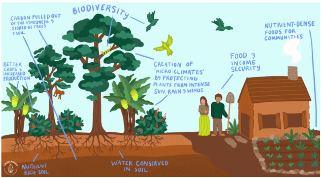
Approximately 20,000 hectares of degraded land is being rehabilitated land using assisted natural regeneration, enrichment planting and agroforestry. The resultant secondary forests and agroforests will have high values for ecotourism, sequester substantial amounts of carbon, produce a range of in-demand commodities (e.g., coffee, spices), generate bioenergy, and offer improved ecosystem services.
2.2 ការពណ៌នាលម្អិតពីបច្ចេកទេស
ការពណ៌នា:
A partnership of local communities and governments is, in collaboration with international and national development organizations, donors and investors, rehabilitating approximately 20,000 hectares of degraded forest and agricultural land using assisted natural regeneration, enrichment planting and agroforestry. The resultant secondary forests and agroforests will have high values for ecotourism, sequester substantial amounts of carbon, produce a range of in-demand commodities (e.g., coffee, spices), and generate bioenergy. They will also offer improved ecosystem services to Bali as a whole, which will be very valuable for the tourism industry, representing an opportunity for investment and payment for ecosystem services (PES).
In the first 20 hectares, around 1,600 trees were planted per hectare, consisting of Coffee Arabica Katimor and Local Avocado trees. In between, shrubs such as local cassava and root species already existed. The spacing followed recommendations from ICCRI (Indonesian Coffee and Cacao Research Institute) whereby 2-3 meters distance are placed in between coffee trees, with much further distances for the shade trees. For fertilization, local goat manure is primarily used and filled in the planting holes the size of 30cm x 30cm x 30cm.
Northeast Bali, Indonesia — which includes the Batur UNESCO Global Geopark — features approximately 135,000 ha of degraded land in the Government’s Forest Estate (‘Kawasan Hutan’), which is managed by the provincial government’s Forestry and Environment Agency (Dinas Kehutanan Dan Lingkungan Hidup Provinsi Bali/DKLH).
The vegetation, soils and water resources are designated as ‘potentially’ to ‘very severely’ degraded on 463,500 hectares. This is steadily increasing owing to unsustainable forestry and farming practices. Local communities within and surrounding the Kawasan Hutan — among the poorest in Bali — are affected by droughts, flash floods, landslides and poor water quality.
The Geopark in Northeast Bali was established in 2012 on the active volcanic landscape of Mt Batur, which features not only unique and dramatic geological formations, protected forests and endemic flora and fauna but also 15 villages. Approximately 90% of the Geopark is classified as severely degraded owing to a lack of post-eruption rehabilitation and unsustainable farming practices. The Geopark received almost one million visitors in 2019.
The ten-year project will be implemented by a consortium consisting of Sustainability and Resilience Co. (a local NGO), Indonesian government (through DKLH), local university (Udayana), international research-in-development organization (CIFOR-ICRAF), specialist national research organizations, intergovernmental organization, larger private sector and investment partners, each bringing a specific set of skills and expertise.
The work will be carried out through four major components.
1. Establishment of a coordinated enabling environment through a multistakeholder forum of local governments, national and provincial government agencies, communities, larger private sector and project consortium members.
2. Co-designing and co-implementing models of integrated ecosystem and livelihoods restoration that suit local socio-economic and environmental conditions with staged expansion over the ten years.
3. Training communities, local small businesses and Government staff in co-design, establishment and management of restored, productive ecosystems and value chains.
4. Strengthening and further introducing partnerships between the community, public and private sectors in all aspects of the landscape, including co-developing and co-implementing an enabling investment environment for continuing financial flows.
2.3 រូបភាពនៃបច្ចេកទេស
2.4 វីដេអូនៃបច្ចេកទេស
ការពណ៌នាសង្ខេប:
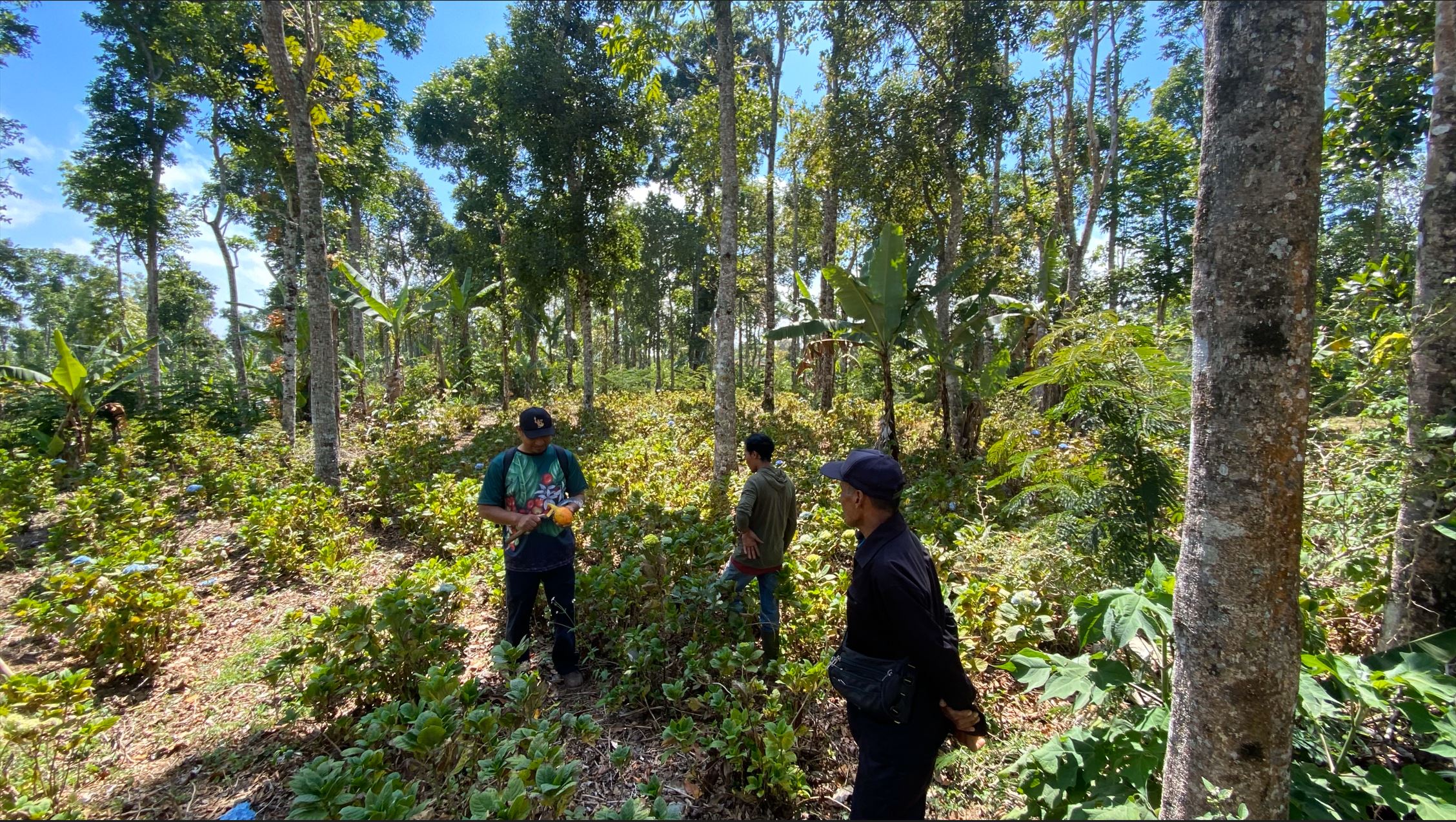
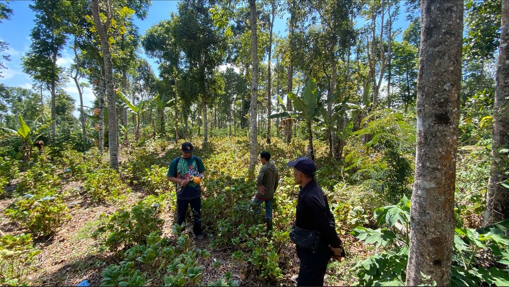
Degraded area in Wanagiri, Bali, as a pilot location
កាលបរិច្ឆេទ:
04/06/2024
ទីតាំង:
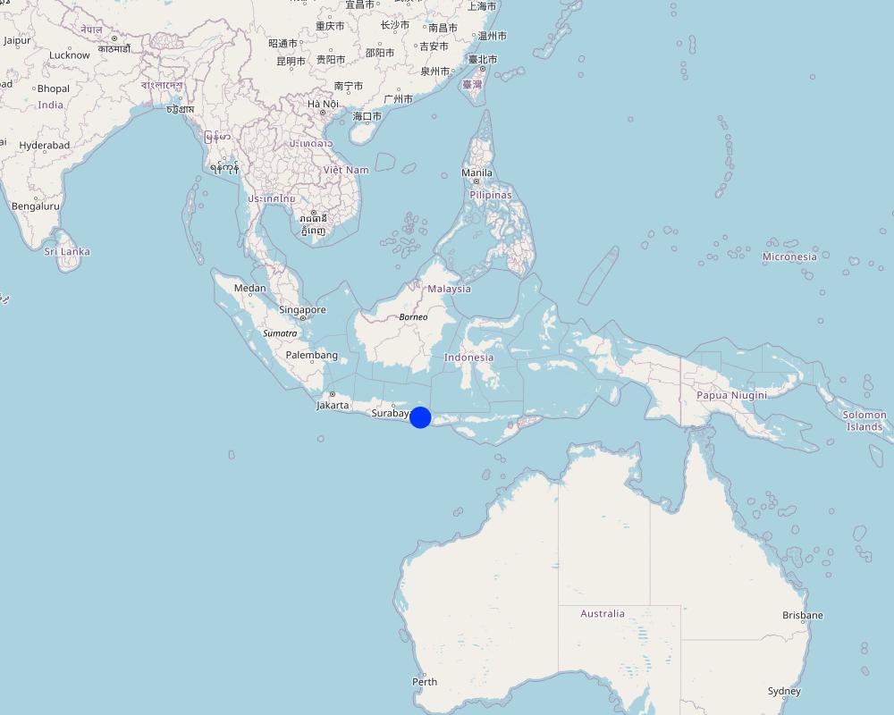
Wanagiri, Bali, Indonesia
ឈ្មោះអ្នកថតវីឌីអូ:
Fabian Wiropranoto
2.5 ប្រទេស/តំបន់/ទីតាំងកន្លែង ដែលបច្ចេកទេសត្រូវបានអនុវត្ត និងបានគ្រប់ដណ្តប់ដោយការវាយតម្លៃនេះ
ប្រទេស:
ប្រទេសឥណ្ឌូណេស៊ី
តំបន់/រដ្ឋ/ខេត្ត:
Bali
បញ្ជាក់បន្ថែមពីលក្ខណៈនៃទីតាំង:
Wanagiri, Northeast Bali
បញ្ជាក់ពីការសាយភាយនៃបច្ចេកទេស:
- ត្រូវបានផ្សព្វផ្សាយត្រឹមតំបន់មួយ
ប្រសិនបើមិនច្បាស់ពីទំហំផ្ទៃដី សូមធ្វើការប៉ាន់ប្រម៉ាណ:
- 0.1-1 គម2
តើបច្ចេកទេស (មួយ ឬច្រើន) ទាំងនោះស្ថិតនៅក្នុងតំបន់ការពារជាអចិន្ត្រៃយ៍ណាមួយដែរឬទេ?
បាទ/ចា៎
បើបាទ/ច៎ា សូមបញ្ជាក់:
Batur UNESCO Global Geopark
មតិយោបល់:
Batur UNESCO Global Geopark
Map
×2.6 កាលបរិច្ឆេទនៃការអនុវត្ត
បង្ហាញឆ្នាំនៃការចុះអនុវត្ត:
2024
ប្រសិនបើមិនច្បាស់ឆ្នាំ សូមបញ្ជាក់កាលបរិច្ឆេទដែលប្រហាក់ប្រហែល:
- តិចជាង 10ឆ្នាំមុន (ថ្មី)
2.7 ការណែនាំពីបច្ចេកទេស
សូមបញ្ជាក់តើបច្ចេកទេសត្រូវបានណែនាំឱ្យអនុវត្តដោយរបៀបណា:
- តាមរយៈគម្រោង / អន្តរាគមន៍ពីខាងក្រៅ
មតិយោបល់ (ប្រភេទនៃគម្រោង ។ល។):
Training communities, local small businesses, and Government staff in the co-design, establishment, and management of restored, productive ecosystems and value chains.
3. ចំណាត់ថ្នាក់នៃបច្ចេកទេស SLM
3.1 គោលបំណងចម្បង (១ ឬច្រើន) នៃបច្ចេកទេសនេះ
- កាត់បន្ថយ, បង្ការ, ស្តារឡើងវិញនូវការធ្លាក់ចុះគុណភាពដី
- អភិរក្ស/ធ្វើឱ្យប្រសើរឡើងជីវចម្រុះ
- កាត់បន្ថយការប្រែប្រួលអាកាសធាតុ និងផលប៉ះពាល់របស់វា
- បង្កើតផលប្រយោជន៍សេដ្ឋកិច្ច
- បង្កើតផលប្រយោជន៍សង្គម
3.2 ប្រភេទដីប្រើប្រាស់មួយប្រភេទ (ច្រើនប្រភេទ) ដែលបានអនុវត្តបច្ចេកទេស
ដីប្រើប្រាស់ចម្រុះនៅលើដីតែមួយ:
បាទ/ចា៎
បញ្ជាក់ពីប្រភេទដីច្រើនប្រភេទ (ដីដាំដំណាំ/ដីចិញ្ចឹមសត្វ/ដីព្រៃឈើ):
- កសិរុក្ខកម្ម

ដីព្រៃ/ដីដាំដើមឈើ
- ព្រៃ (ពាក់កណ្តាល) ធម្មជាតិ/ ដីព្រៃ
ព្រៃ (ពាក់កណ្តាល) ធម្មជាតិ / ដីព្រៃ៖ បញ្ជាក់ប្រភេទនៃការគ្រប់គ្រង:
- កាប់តែព្រៃប្រណិត
ប្រភេទព្រៃ (ពាក់កណ្តាល) ធម្មជាតិ:
- សារពើរុក្ខជាតិនៅតាមប្រព័ន្ធភ្នំធម្មជាតិតំបន់ត្រូពិច
ប្រភេទឈើ:
- Acacia species
- Leucaena leucocephala
- Swietenia macrophylla
តើប្រភេទឈើខាងលើជាប្រភេទឈើក្នុងព្រៃល្បោះ ឬស្រោង?
- ព្រៃស្រោង
ផលិតផល និងសេវាកម្ម:
- ឈើហ៊ុប
- ផ្លែឈើ និងគ្រាប់ធញ្ញជាតិ
- ការអភិរក្ស/ការការពារធម្មជាតិ
- ការកំសាន្ត/ទេសចរណ៍
មតិយោបល់:
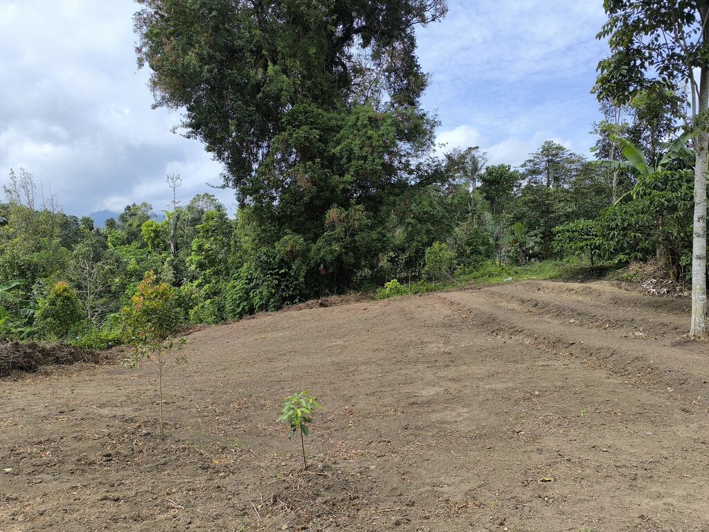
Degraded or unproductive land in Wanagiri, Bali, Indonesia
3.3 បន្ទាប់ពីអនុវត្តបច្ចេកទេស តើដីប្រើប្រាស់មានការប្រែប្រួលដែររឺទេ?
បន្ទាប់ពីអនុវត្តបច្ចេកទេស តើដីប្រើប្រាស់មានការប្រែប្រួលដែររឺទេ?
- បាទ/ច៎ា (សូមបំពេញសំណួរខាងក្រោមពីស្ថានភាពដីប្រើប្រាស់មុនពេលអនុវត្តបច្ចេកទេស)
ដីប្រើប្រាស់ចម្រុះនៅលើដីតែមួយ:
បាទ/ចា៎
បញ្ជាក់ពីប្រភេទដីច្រើនប្រភេទ (ដីដាំដំណាំ/ដីចិញ្ចឹមសត្វ/ដីព្រៃឈើ):
- កសិរុក្ខកម្ម

ដីខ្សោះជីជាតិ
សូមបញ្ជាក់:
Underutilized forest land
មតិយោបល់:
Agroforestry
3.4 ការផ្គត់ផ្គង់ទឹក
ការផ្គត់ផ្គង់ទឹកនៅកន្លែងអនុវត្តបច្ចេកទេស:
- ទឹកភ្លៀង
3.5 ក្រុម SLM ដែលបច្ចេកទេសស្ថិតនៅក្នុង
- កសិរុក្ខកម្ម
3.6 វិធានការ SLM ដែលបញ្ចូលនូវបច្ចេកទេស

វិធានការក្សេត្រសាស្ត្រ
- A1: ដំណាំ/គម្របដី
- A2: សារធាតុសរីរាង្គ/ជីជាតិដី
- A5: ការគ្រប់គ្រងគ្រាប់ពូជ បង្កើនប្រភេទពូជ

វិធានការរុក្ខជាតិ
- V1: ឈើធំៗ និងដើមឈើតូចៗ
- V3: ការកាប់ឆ្ការរុក្ខជាតិ
- V5: ផ្សេងៗ

វិធានការរចនាស័ម្ពន្ធ
- S6: ជញ្ជាំង, របាំង, របងឈើខ្ពស់ៗ
- S9: រោងដំណាំ និងរោងចិញ្ចឹមសត្វ

វិធានការគ្រប់គ្រង
- M1: ការផ្លាស់ប្តូរប្រភេទដីប្រើប្រាស់
- M2: ការផ្លាស់ប្តូរការគ្រប់គ្រង/ កម្រិតអាំងតង់ស៊ីតេ
មតិយោបល់:
Agroforestry practices
3.7 កំណត់ប្រភេទនៃការធ្លាក់ចុះគុណភាពដីសំខាន់ៗដែលបច្ចេកទេសនេះបានដោះស្រាយ

ការហូរច្រោះដីដោយសារទឹក
- Wt: ការបាត់ដីស្រទាប់លើដោយការហូរច្រោះ

ការធ្លាក់ចុះជីវសាស្ត្រនៃដី
- Bc: ការថយចុះនូវគម្របរុក្ខជាតិ
3.8 ការពារ កាត់បន្ថយ ឬស្តារឡើងវិញនៃការធ្លាក់ចុះគុណភាពដី
បញ្ជាក់ពីគោលដៅរបស់បច្ចេកទេស ដែលផ្តោតទៅការធ្លាក់ចុះគុណភាពដី:
- ការជួសជុល/ ស្តារឡើងវិញនៃឱនភាពដីធ្ងន់ធ្ងរ
- ការបន្ស៊ាំទៅនឹងការធ្លាក់ចុះគុណភាពដី
4. បច្ចេកទេសជាក់លាក់ សកម្មភាពអនុវត្ត ធាតុចូល និងថ្លៃដើម
4.1 គំនូសបច្ចេកទេសនៃបច្ចេកទេសនេះ
លក្ខណៈពិសេសនៃបច្ចេកទេស (ទាក់ទងនឺងគំនូរបច្ចេកទេស):
In the first 20 hectares, around 1,600 trees were planted per hectare, consisting of coffee arabica Katimor and local avocado trees. In between, shrubs such as local cassava and root species already existed. The spacing followed recommendations from ICCRI (Indonesian Coffee and Cacao Research Institute) whereby 2-3 meters distance are placed in between coffee trees, with much further distances for the shade trees. For fertilization, local goat manure is primarily used and filled in the planting holes the size of 30cm x 30cm x 30cm
20 ha is the pilot area
Spacing between plants [m]
Avocado: 5x5
Coffee: 3x3
Vertical vegetative measures [m]
Avocado:
Coffee:
Lateral gradient of structures
Density of plants per ha
Avocado: 20
Coffee: 50
ឈ្មោះអ្នកនិពន្ធ:
Bruno Bordoni
កាលបរិច្ឆេទ:
30/05/2024
4.2 ព័ត៌មានទូទៅដែលពាក់ព័ន្ធនឹងការគណនាធាតុចូល និងថ្លៃដើម
កំណត់របៀបនៃការគណនាថ្លៃដើម និងធាតុចូល:
- ក្នុងតំបន់អនុវត្តបច្ចេកទេស
កំណត់ទំហំ និងឯកត្តាផ្ទៃដី:
20 ha as the pilot case
បើសិនប្រើឯកតាតាមតំបន់ សូមបញ្ជាក់តម្លៃបម្លែងវាទៅជាហិកតា (ឧ. 1 ហិកតា = 2.47 អា)៖ 1 ហិកតា =:
1 ha = 2.47 acres
កំណត់រូបិយប័ណ្ណសម្រាប់ថ្លៃដើម:
- ដុល្លារ
បើពាក់ព័ន្ធសូមកំណត់អត្រាប្តូរប្រាក់ពីដុល្លាទៅរូបិយប័ណ្ណតំបន់ (ឧ. 1 ដុល្លារ = 79.9 រៀលនៃរូបិយប័ណ្ណប្រេស៊ីល) ៖ 1 ដុល្លារ =:
600,0
4.3 សកម្មភាពបង្កើត
| សកម្មភាព | រយៈពេល (រដូវកាល) | |
|---|---|---|
| 1. | Survey | Month 1-2 |
| 2. | Stakeholders Engagement | Month 3-4 |
| 3. | Climate Field School | Month 4 |
| 4. | Nursing Establishment | Month 5-7 |
| 5. | Initial Tree Plantation | Month 8 |
| 6. | Fertilizing and Biocides | Month 8 |
| 7. | Maintenance | Month 9-12 |
| 8. | Tree Planting | Month 13 |
| 9. | Fertilizing and Biocides | Month 13 |
| 10. | Maintenance | Month 14-17 |
4.4 ថ្លៃដើម និងធាតុចូលដែលត្រូវការសម្រាប់ការបង្កើតបច្ចេកទេស
| បញ្ជាក់ពីធាតុចូល | ឯកតា | បរិមាណ | ថ្លៃដើមក្នុងមួយឯកតា | ថ្លៃធាតុចូលសរុប | % នៃថ្លៃដើមដែលចំណាយដោយអ្នកប្រើប្រាស់ដី | |
|---|---|---|---|---|---|---|
| កម្លាំងពលកម្ម | Workers and Researchers | 1000 | 20,0 | 1000,0 | 20000,0 | |
| សម្ភារៈដាំដុះ | Seedlings | 500 | 40,0 | 500,0 | 20000,0 | |
| ជី និងសារធាតុពុល | Organic fertilizer | 60 | 100,0 | 60,0 | 6000,0 | |
| សម្ភារៈសាងសង់ | Nursery | 1000 | 14,0 | 1000,0 | 14000,0 | |
| ថ្លៃដើមសរុបក្នុងការបង្កើតបច្ចេកទេស | 60000,0 | |||||
| ថ្លៃដើមសរុបក្នុងការបង្កើតបច្ចេកទេសគិតជាដុល្លារ | 100,0 | |||||
ប្រសិនបើមិនអាចបំបែកតម្លៃដើមក្នុងតារាងខាងក្រោមទេ សូមផ្តល់នូវតម្លៃប៉ាន់ស្មានសរុបក្នុងការបង្កើតបច្ចេកទេសនោះ:
60000,0
ប្រសិនបើអ្នកប្រើប្រាស់ដីមិនមានថ្លៃដើម 100% សូមបញ្ជាក់ថានរណាដែលចំណាយថ្លៃដើមដែលនៅសល់:
Project donors and grants will cover all costs
4.5 សកម្មភាពថែទាំ
| សកម្មភាព | ពេលវេលា/ ភាពញឹកញាប់ | |
|---|---|---|
| 1. | Fertilizer | Once per year |
| 2. | Transportation, accommodation for fertilizing and stakeholders engagement | Once per year |
4.6 កំណត់ថ្លៃដើមសម្រាប់ការថែទាំ/ សកម្មភាពរបស់បច្ចេកទេស (ក្នុងរយៈពេលមួយឆ្នាំ)
| បញ្ជាក់ពីធាតុចូល | ឯកតា | បរិមាណ | ថ្លៃដើមក្នុងមួយឯកតា | ថ្លៃធាតុចូលសរុប | % នៃថ្លៃដើមដែលចំណាយដោយអ្នកប្រើប្រាស់ដី | |
|---|---|---|---|---|---|---|
| កម្លាំងពលកម្ម | Transportation, accommodation in the 1st year | Package | 1,0 | 250,0 | 250,0 | |
| កម្លាំងពលកម្ម | Transportation, accommodation in the 2nd year | Package | 1,0 | 250,0 | 250,0 | |
| កម្លាំងពលកម្ម | Transportation, accommodation in the 2nd year | Package | 1,0 | 250,0 | 250,0 | |
| ជី និងសារធាតុពុល | Goat manure in the 1st year | kg | 400,0 | 0,2 | 80,0 | |
| ជី និងសារធាតុពុល | Chicken manure in the 1st year | kg | 400,0 | 0,1 | 40,0 | |
| ជី និងសារធាតុពុល | Goat manure in the 2nd year | kg | 400,0 | 0,2 | 80,0 | |
| ជី និងសារធាតុពុល | Chicken manure in the 2nd year | kg | 400,0 | 0,1 | 40,0 | |
| ជី និងសារធាតុពុល | Goat manure in the 3rd year | kg | 400,0 | 0,2 | 80,0 | |
| ជី និងសារធាតុពុល | Chicken manure in the 3rd year | kg | 400,0 | 0,1 | 40,0 | |
| ថ្លៃដើមសរុបសម្រាប់ការថែទាំដំណាំតាមបច្ចេកទេស | 1110,0 | |||||
| ថ្លៃដើមសរុបសម្រាប់ការថែទាំដំណាំតាមបច្ចេកទេសគិតជាដុល្លារ | 1,85 | |||||
ប្រសិនបើមិនអាចបំបែកតម្លៃដើមក្នុងតារាងខាងក្រោមទេ សូមផ្តល់នូវតម្លៃប៉ាន់ស្មានសរុបក្នុងការថែទាំបច្ចេកទេសនោះ:
1110,0
ប្រសិនបើអ្នកប្រើប្រាស់ដីមិនមានថ្លៃដើម 100% សូមបញ្ជាក់ថានរណាដែលចំណាយថ្លៃដើមដែលនៅសល់:
The project donors and grants will cover all the cost
4.7 កត្តាសំខាន់បំផុតដែលមានឥទ្ធិពលដល់ការចំណាយ
ពណ៌នាពីកត្តាប៉ះពាល់ចម្បងៗទៅលើថ្លៃដើម:
Climate or seasonal change will affect the fertilizing time and will affect the annual cost for fertilizer
5. លក្ខណៈបរិស្ថានធម្មជាតិ និងមនុស្ស
5.1 អាកាសធាតុ
បរិមាណទឹកភ្លៀងប្រចាំឆ្នាំ
- < 250 មម
- 251-500 មម
- 501-750 មម
- 751-1,000 មម
- 1,001-1,500 មម
- 1,501-2,000 មម
- 2,001-3,000 មម
- 3,001-4,000 មម
- > 4,000 មម
បញ្ជាក់ឈ្មោះឯកសារយោងនៃស្ថានីយឧតុនិយម:
Staklim Bali
តំបន់កសិអាកាសធាតុ
- សើម
Lenght of Growing Period > 270
Tropical
Oct-March: wet season
April-Sept: dry season
5.2 សណ្ឋានដី
ជម្រាលជាមធ្យម:
- រាបស្មើ (0-2%)
- ជម្រាលតិចតួច (3-5%)
- មធ្យម (6-10%)
- ជម្រាលខ្ពស់បន្តិច (11-15%)
- ទីទួល (16-30%)
- ទីទួលចោត (31-60%)
- ទីទួលចោតខ្លាំង (>60%)
ទម្រង់ដី:
- ខ្ពង់រាប
- កំពូលភ្នំ
- ជម្រាលភ្នំ
- ជម្រាលទួល
- ជម្រាលជើងភ្នំ
- បាតជ្រលងភ្នំ
តំបន់តាមរយៈកម្ពស់ :
- 0-100 ម
- 101-500 ម
- 501-1,000 ម
- 1,001-1,500 ម
- 1,501-2,000 ម
- 2,001-2,500 ម
- 2,501-3,000 ម
- 3,001-4,000 ម
- > 4,000 ម
បញ្ជាក់ថាតើបច្ចេកទេសនេះត្រូវបានអនុវត្តន៍នៅក្នុង:
- មិនពាក់ព័ន្ធទាំងអស់
5.3 ដី
ជម្រៅដីជាមធ្យម:
- រាក់ខ្លាំង (0-20 សម)
- រាក់ (21-50 សម)
- មធ្យម (51-80 សម)
- ជ្រៅ (81-120 សម)
- ជ្រៅខ្លាំង (> 120 សម)
វាយនភាពដី (ស្រទាប់លើ):
- មធ្យម (ល្បាយ, ល្បាប់)
វាយនភាពដី (> 20 សម ស្រទាប់ក្នុង):
- ម៉ត់/ ធ្ងន់ (ឥដ្ឋ)
សារធាតុសរីរាង្គនៅស្រទាប់ដីខាងលើ:
- ខ្ពស់ (>3%)
បើអាចសូមភ្ជាប់ការពណ៌នាពីដីឱ្យបានច្បាស់ ឬព័ត៌មានដែលអាចទទួលបាន ឧ. ប្រភេទដី, pH ដី/ ជាតិអាស៊ីត, សមត្ថភាពផ្លាស់ប្តូរកាចុង, វត្តមាននីត្រូសែន, ភាពប្រៃ ។ល។:
Andosols (volcanic soil)
Rich organic matter
Highly porous
Dark coloured
Developed from parent material of volcanic origin
Low pH
High porosity
5.4 ទឹកដែលអាចទាញមកប្រើប្រាស់បាន និងគុណភាពទឹក
នីវ៉ូទឹកក្រោមដី:
5-50 ម
ទឹកលើដីដែលអាចទាញយកប្រើប្រាស់បាន:
កម្រិតមធ្យម
គុណភាពទឹក (មិនបានធ្វើប្រត្តិកម្ម):
ទឹកពិសារដែលគ្មានគុណភាព (តម្រូវឱ្យមានការសំអាត)
គុណភាពទឹក គឺផ្តោតទៅលើ៖:
ទឹកក្រោមដី
តើមានបញ្ហាភាពទឹកប្រៃហូរចូលមកដែរឬទេ?
ទេ
តើទឹកជំនន់កំពុងកើតមាននៅតំបន់នេះដែររឺទេ?
ទេ
5.5 ជីវៈចម្រុះ
ភាពសម្បូរបែបនៃប្រភេទ:
- ខ្ពស់
ភាពសម្បូរបែបនៃទីជម្រក:
- កម្រិតមធ្យម
មតិយោបល់ និងលក្ខណៈពិសេសផ្សេងទៀតលើជីវចម្រុះ:
Wanagiri forest
67 plant species
Agroforestry systems involve growing crops and trees together, which can increase the overall biodiversity of the area.
5.6 លក្ខណៈនៃអ្នកប្រើប្រាស់ដីដែលអនុវត្តបច្ចេកទេស
នៅមួយកន្លែង ឬពនេចរ :
- នៅមួយកន្លែង
ទីផ្សារនៃប្រព័ន្ធផលិតកម្ម:
- ពាក់កណ្តាលពាណិជ្ជកម្ម (ផ្គត់ផ្គង់ខ្លួនឯង/ ពាណិជ្ជកម្ម)
ចំណូលក្រៅកសិកម្ម:
- 10-50% នៃចំណូល
- ច្រើនជាង 50% នៃចំណូល
កម្រិតជីវភាព:
- មិនល្អ
- មធ្យម
ឯកជន ឬក្រុម:
- ជាក្រុម/ សហគមន៍
កម្រិតប្រើប្រាស់គ្រឿងយន្ត:
- ប្រើកម្លាំងពលកម្ម
យេនឌ័រ:
- ស្ត្រី
- បុរស
អាយុរបស់អ្នកប្រើប្រាស់ដី:
- វ័យកណ្តាល
- មនុស្សចាស់
5.7 ទំហំផ្ទៃដីជាមធ្យមនៃដីប្រើប្រាស់ដោយអ្នកប្រើប្រាស់ដី ក្នុងការអនុវត្តបច្ចេកទេស
- < 0.5 ហិកតា
- 0.5-1 ហិកតា
- 1-2 ហិកតា
- 2-5 ហិកតា
- 5-15 ហិកតា
- 15-50 ហិកតា
- 50-100 ហិកតា
- 100-500 ហិកតា
- 500-1,000 ហិកតា
- 1,000-10,000 ហិកតា
- > 10,000 ហិកតា
តើផ្ទៃដីនេះចាត់ទុកជាទំហំកម្រិតណាដែរ ខ្នាតតូច មធ្យម ឬខ្នាតធំ (ធៀបនឹងបរិបទតំបន់)?
- ខ្នាតមធ្យម
5.8 ភាពជាម្ចាស់ដី កម្មសិទ្ធប្រើប្រាស់ដី និងកម្មសិទ្ធប្រើប្រាស់ទឹក
ភាពជាម្ចាស់ដី:
- រដ្ឋ
កម្មសិទ្ធិប្រើប្រាស់ដី:
- ជាក្រុម (មានដែនកំណត់)
កម្មសិទ្ធប្រើប្រាស់ទឹក:
- អាស្រ័យផលសេរី (មិនមានការកំណត់)
តើកម្មសិទ្ធប្រើប្រាស់ដី គឺផ្អែកលើប្រព័ន្ធច្បាប់បែបបុរាណ?
ទេ
5.9 ការប្រើប្រាស់សេវាកម្ម និងហេដ្ឋារចនាសម្ព័ន្ធ
សុខភាព:
- មិនល្អ
- មធ្យម
- ល្អ
ការអប់រំ:
- មិនល្អ
- មធ្យម
- ល្អ
ជំនួយបច្ចេកទេស:
- មិនល្អ
- មធ្យម
- ល្អ
ការងារ (ឧ. ការងារក្រៅកសិដ្ឋាន):
- មិនល្អ
- មធ្យម
- ល្អ
ទីផ្សារ:
- មិនល្អ
- មធ្យម
- ល្អ
ថាមពល:
- មិនល្អ
- មធ្យម
- ល្អ
ផ្លូវ និងការដឹកជញ្ជូន:
- មិនល្អ
- មធ្យម
- ល្អ
ទឹកផឹក និងអនាម័យ:
- មិនល្អ
- មធ្យម
- ល្អ
សេវាកម្មហិរញ្ញវត្ថុ:
- មិនល្អ
- មធ្យម
- ល្អ
មតិយោបល់:
52.64% primary education
35.51% lower secondary and upper secondary
11.85% undergraduate and graduate school
Technical assistance
Employment
Markets
Energy
Road and transport
Drinking water and sanitation
6. ផលប៉ះពាល់ និងការសន្និដ្ឋាន
6.1 ផលប៉ះពាល់ក្នុងបរិវេណអនុវត្តបច្ចេកទេសដែលកើតមាន
ផលប៉ះពាល់លើសេដ្ឋកិច្ចសង្គម
ផលិតផល
ការគ្រប់គ្រងដី
គុណភាពមុន SLM:
0 ha
គុណភាពក្រោយ SLM:
20 ha
មតិយោបល់/ ការបញ្ជាក់:
This is calculated per 20 ha of the pilot area.
ចំណូល និងថ្លៃដើម
ភាពសម្បូរបែបប្រភពប្រាក់ចំណូល
គុណភាពមុន SLM:
1 income source
គុណភាពក្រោយ SLM:
2 income sources
មតិយោបល់/ ការបញ្ជាក់:
Per 20 ha
ផលប៉ះពាល់ទៅលើវប្បធម៌សង្គម
ឱកាសវប្បធម៍
គុណភាពមុន SLM:
0 activity
គុណភាពក្រោយ SLM:
3 activities
មតិយោបល់/ ការបញ្ជាក់:
Traditional rituals in 20 ha of the pilot area
ផលប៉ះពាល់ទៅលើអេកូឡូស៊ី
ជីវចម្រុះ៖ ដំណាំ, សត្វ
ដំណាំគម្រប
គុណភាពមុន SLM:
30%
គុណភាពក្រោយ SLM:
75%
ភាពសម្បូរបែបនៃរុក្ខជាតិ
គុណភាពមុន SLM:
5 types
គុណភាពក្រោយ SLM:
10 types
ការកាត់បន្ថយហានិភ័យនៃគ្រោះមហន្តរាយ និងគ្រោះអាកាសធាតុ
ការបំភាយនៃកាបូន និងឧស្ម័នផ្ទះកញ្ចក់
6.2 ផលប៉ះពាល់ក្រៅបរិវេណអនុវត្តបច្ចេកទេសដែលកើតមាន
Organisational Support
គុណភាពមុន SLM:
0 organisation
គុណភាពក្រោយ SLM:
10 organisations
មតិយោបល់/ ការបញ្ជាក់:
Per 20 ha
6.3 ភាពប្រឈម និងភាពរួសនៃបច្ចេកទេសទៅនឹងការប្រែប្រួលអាកាសធាតុ និងគ្រោះអាកាសធាតុ/ គ្រោះមហន្តរាយ (ដែលដឹងដោយអ្នកប្រើប្រាស់ដី)
ការប្រែប្រួលអាកាសធាតុ
ការប្រែប្រួលអាកាសធាតុ
| រដូវកាល | កើនឡើង ឬថយចុះ | លក្ខណៈឆ្លើយតបនៃបច្ចេកទេសទៅនឹងការប្រែប្រួលអាកាសធាតុ | |
|---|---|---|---|
| បរិមាណទឹកភ្លៀងប្រចាំឆ្នាំ | ថយចុះ | មធ្យម |
គ្រោះអាកាសធាតុ (មហន្តរាយ)
គ្រោះមហន្តរាយអាកាសធាតុ
| លក្ខណៈឆ្លើយតបនៃបច្ចេកទេសទៅនឹងការប្រែប្រួលអាកាសធាតុ | |
|---|---|
| រាំងស្ងួត | មធ្យម |
ផលវិបាកដែលទាក់ទងនឹងបរិយាកាសផ្សេងៗទៀត
ផលវិបាកដែលទាក់ទងនឹងបរិយាកាសផ្សេងៗទៀត
| លក្ខណៈឆ្លើយតបនៃបច្ចេកទេសទៅនឹងការប្រែប្រួលអាកាសធាតុ | |
|---|---|
| កាត់បន្ថយពេលដាំដុះ | មិនស្គាល់ |
6.4 ការវិភាគថ្លៃដើម និងអត្ថប្រយោជន៍
តើផលចំណេញ និងថ្លៃដើមត្រូវបានប្រៀបធៀបគ្នាយ៉ាងដូចម្តេច (ទស្សនៈរបស់អ្នកប្រើប្រាស់ដី)?
រយៈពេលខ្លី:
ប៉ះពាល់តិចតួចបំផុត
រយៈពេលវែង:
វិជ្ជមាន
តើផលចំណេញ និងការថែទាំ/ ជួសជុលត្រូវបានប្រៀបធៀបគ្នាយ៉ាងដូចម្តេច (ទស្សនៈរបស់អ្នកប្រើប្រាស់ដី)?
រយៈពេលខ្លី:
ប៉ះពាល់តិចតួចបំផុត
រយៈពេលវែង:
វិជ្ជមាន
មតិយោបល់:
Enabling environment for investment in tree-product supply chains
Readily investable business plans and economically viable restoration models targeting profitable species, such as Pongamia, Bamboo, Coffee
Carbon credits
A landscape of integrated restoration, bioenergy, and payment for ecosystem services.
At least 10,000 male and female farmers trained in assisted natural regeneration, enrichment planting, climate-smart agroforestry, bioenergy and other productive practices.
6.5 ការទទួលយកបច្ចេកទេស
- 11-50%
ក្នុងចំណោមគ្រួសារទាំងអស់ដែលបានអនុវត្តបច្ចេកទេស តើមានប៉ុន្មានគ្រួសារដែលចង់ធ្វើដោយខ្លួនឯង ដោយមិនទទួលបានសម្ភារៈលើកទឹកចិត្ត/ប្រាក់ឧបត្ថម្ភ?:
- 11-50%
មតិយោបល់:
Yes, they voluntarily did the tree planting
6.6 ការបន្សុំា
តើថ្មីៗនេះ បច្ចេកទេសនេះត្រូវបានកែតម្រូវដើម្បីបន្ស៊ាំទៅនឹងស្ថានភាពប្រែប្រួលដែរឬទេ?
បាទ/ចា៎
បើឆ្លើយបាទ/ ចា៎ សូមកំណត់ថាតើស្ថានភាពប្រែប្រួលមួយណាត្រូវបានបន្ស៊ាំ:
- បម្រែបម្រួលទីផ្សារ
បញ្ជាក់ពីការបន្ស៊ាំនៃបច្ចេកទេស (ការរៀបចំ, ឧបករណ៍/ប្រភេទ ។ល។):
By applying intercropping, farmers will have more products variants, e.g. potatoes, chillies
6.7 ភាពខ្លាំង/ គុណសម្បត្តិ/ ឱកាសនៃបច្ចេកទេស
| ភាពខ្លាំង/ គុណសម្បត្តិ/ ឱកាសនៅកន្លែងរបស់អ្នកប្រើប្រាស់ដី |
|---|
| Quality germplasm from commercially viable nurseries (coffee, avocado, cassava, jackfruit, lamtoro) |
| Landscape restoration |
| ភាពខ្លាំង/ គុណសម្បត្តិ/ ឱកាស ទស្សនៈរបស់បុគ្គលសំខាន់ៗ |
|---|
| Community engagement |
| Carbon credits |
6.8 ភាពខ្សោយ/ គុណវិបត្តិ/ ហានិភ័យនៃបច្ចេកទេស និងវិធីសាស្ត្រដោះស្រាយ
| ភាពខ្សោយ/ គុណវិបត្តិ/ ហានិភ័យ ទស្សនៈរបស់អ្នកប្រើប្រាស់ដី | តើបច្ចេកទេសទាំងនោះបានដោះស្រាយបញ្ហាដូចម្តេច? |
|---|---|
| Reduced crops production due to lack of capacity and resources to maintain | Monitoring, evaluation, and maintenance |
| ភាពខ្សោយ/ គុណវិបត្តិ/ ហានិភ័យ ទស្សនៈរបស់អ្នកចងក្រងឬបុគ្គលសំខាន់ៗ | តើបច្ចេកទេសទាំងនោះបានដោះស្រាយបញ្ហាដូចម្តេច? |
|---|---|
| Natural Disaster | Risk Mitigation |
7. ឯកសារយោង និងវេបសាយ
7.1 វិធីសាស្ត្រ/ ប្រភពនៃព័ត៌មាន
- តាមការចុះទីវាល ការស្រាវជ្រាវនៅទីវាល
30
- ការសម្ភាសន៍ជាមួយអ្នកប្រើប្រាស់ដី
20
- ការសម្ភាសន៍ជាមួយអ្នកជំនាញ/ ឯកទេស
10
តើពេលណាដែលទិន្នន័យបានចងក្រង (នៅទីវាល)?
21/10/2024
7.2 ឯកសារយោងដែលបានចេញផ្សាយ
ចំណងជើង អ្នកនិពន្ធ ឆ្នាំ ISBN:
N/A
7.3 ការភ្ជាប់ទៅកាន់ព័ត៌មានពាក់ព័ន្ធលើប្រព័ន្ធអនឡាញ
ចំណងជើង/ ពណ៌នា:
Let's restore 43,000 ha of Bali
វេបសាយ:
https://www.su-re.co/tree-planting
7.4 មតិយោបល់ទូទៅ
Envision a revitalized Bali where degraded lands bloom once more, fostering sustainable farming, robust ecotourism, and enhanced ecosystem services.
ការតភ្ជាប់ និងម៉ូឌុល
ពង្រីកមើលទាំងអស់ បង្រួមទាំងអស់ការតភ្ជាប់
គ្មានការតភ្ជាប់
ម៉ូឌុល
គ្មានម៉ូឌុល


