Dug-out sunken pond cum countour bund [ອິນເດຍ]
- ການສ້າງ:
- ປັບປູງ:
- ຜູ້ສັງລວມຂໍ້ມູນ: Unknown User
- ບັນນາທິການ: –
- ຜູ້ທົບທວນຄືນ: Fabian Ottiger
Buda Gata with Adibandha
technologies_1086 - ອິນເດຍ
ເບິ່ງພາກສ່ວນ
ຂະຫຍາຍທັງໝົດ ຍຸບທັງໝົດ1. ຂໍ້ມູນທົ່ວໄປ
1.2 ຂໍ້ມູນ ການຕິດຕໍ່ພົວພັນ ຂອງບຸກຄົນທີ່ສໍາຄັນ ແລະ ສະຖາບັນ ທີ່ມີສ່ວນຮ່ວມ ໃນການປະເມີນເອກກະສານ ເຕັກໂນໂລຢີ
ບັນດາຜູ້ຕອບແບບສອບຖາມທີ່ສໍາຄັນ ()
ຜຸ້ຊ່ຽວຊານ ດ້ານການຄຸ້ມຄອງ ທີ່ດິນແບບຍືນຍົງ:
Mohanty Rajib Kumar
ອິນເດຍ
1.3 ເງື່ອນໄຂ ກ່ຽວກັບ ການນໍາໃຊ້ຂໍ້ມູນເອກະສານ ທີ່ສ້າງຂື້ນ ໂດຍຜ່ານ ອົງການພາບລວມຂອງໂລກ ທາງດ້ານແນວທາງ ແລະ ເຕັກໂນໂລຢີ ຂອງການອານຸລັກ ທໍາມະຊາດ (WOCAT)
ເມື່ອໃດທີ່ໄດ້ສັງລວມຂໍ້ມູນ (ຢູ່ພາກສະໜາມ)?
17/12/2004
ຜູ້ປ້ອນຂໍ້ມູນ ແລະ ບຸກຄົນສຳຄັນ ທີ່ໃຫ້ຂໍ້ມູນ (ຫຼາຍ) ຍິນຍອມ ຕາມເງື່ອນໄຂ ໃນການນຳໃຊ້ຂໍ້ມູນ ເພື່ອສ້າງເປັນເອກກະສານຂອງ WOCAT:
ແມ່ນ
1.5 ອ້າງອີງເຖິງແບບສອບສອບຖາມ (ຫຼາຍ) ທາງດ້ານວິທີການ ໃນການຄຸ້ມຄອງ ທີ່ດິນແບບຍືນຍົງ
Community based sustainable livelihoods [ອິນເດຍ]
Sustainable livelihoods enhanced through people's organisations by linking with other resource organisations prticularly for resource poor.
- ຜູ້ສັງລວມຂໍ້ມູນ: Unknown User
2. ການອະທິບາຍ ເຕັກໂນໂລຢີ ຂອງການຄຸ້ມຄອງ ທີ່ດິນແບບຍືນຍົງ
2.1 ຄໍາອະທິບາຍສັ້ນຂອງ ເຕັກໂນໂລຢີ
ການກຳໜົດຄວາມໝາຍ ຂອງເຕັກໂນໂລຢີ:
It can be defined as combination of structural & vegetative measures where contour bunds are constructed from the excavated sandy loam soil of cultivated wastelands in semi-arid climatic(?) zone with moderate slope in medium soil depth conditions in order to link with self-subsistance & market oriented production systems from private lands.
2.2 ການອະທິບາຍ ລາຍລະອຽດ ຂອງເຕັກໂນໂລຢີ
ການພັນລະນາ:
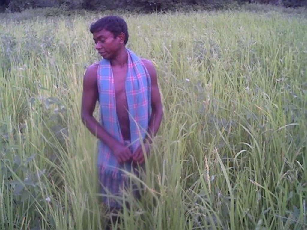
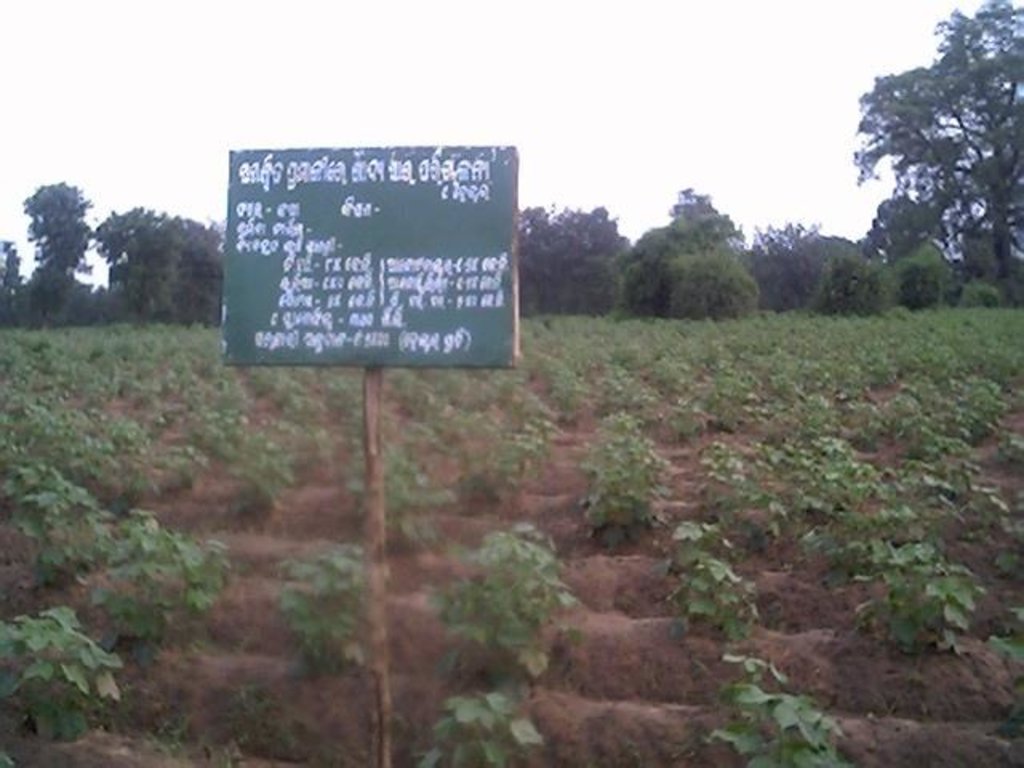
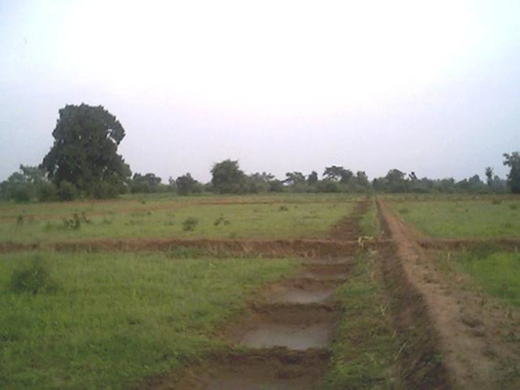
The area is located at the foot-slopes & hill slopes area where run-off is at peaks very often at the time of rainy season. Therefore, sand casting came as a first order priorities by the farmers of this patch. At the outset, a livelihood focused micro-plan had been prepared by the villagers stating the details of the base-line data along with problems & alternative solutions. The patch was identified to be the worst affected, concentraton of poor people (defined by villagers), people of this patch ready to contibute at least 20% of the cost. In the mean time project sent the PIA to BAIF, Bangalore to study the linking of farm ponds & its relevance in this context of our situation. As a demonstration, PIA & other technical team facilitated the villagers. One water harvesting structure was constructed by line deptt of soil conservation just at the down hills to harvest rain water & protect the lands below from sand casting. But there were no alternatives for the land users of that patch about the optimum utilisation recharged water. The surrounding area was totally unbunded with sandy loam soil. Therefore, land users are of opinion to go fo field bunding. Earlier the practice was to dig a trench at upper gadient & put a bund below it out of the excavated soil from trench. But the requirement of land users was to get some water in each farmers land to protect the Kharif & some early rabi crop.(june-dec). By which the lands where, farmers take up only minor millets for their subsistance, that too less production & land So the main purpose of this technology was to convert the land into bunded lands along with to fetch some water at the time of dry spell in between the monsoon period. A four days in field training was conducted by the project to community link workers(SWC), particularly on patch treatment, use of levelling instruments like A-frame, proper planning, design, lay-out of different type of structure in a map & ground. After many rounds of discussion with the land users, one of them ( rich farmers with more land) was ready to do it in his own land. But, the SWC specialist did a detail transact along with land users, although results of first round tansact was mentioned in the micro-plan. The main pupose was to looking at problems & demarkating on the map. After that estimate was prepared & lay-out of key contour was done by SWC specialist with the help of community link workers & land users. The work was implemented by by the labourers with the supervision of the respective User's group leade & monitoring was done by the SWC specialist. The prioty ranking by the land users vegetaive measures like vertiver & Sabai (grass plantation on the bund along the side of the bund. For that, the necessary requirement like nursery, seedling collection was done by agriculture specialist. Training was conducted on the probable alternatives of agronomic measures like taking of crop which is of little longer duration, intercrops & cash crops etc. The vegetaive & structructural measures are subsidised by the project & the agronomic measures was taken up on loan basis. The development fund was also generated out of contribution from the land users which was deposited in a separate account for future maintainance cost.
2.3 ຮູບພາບຂອງເຕັກໂນໂລຢີ
2.5 ປະເທດ / ເຂດ / ສະຖານທີ່ບ່ອນທີ່ ເຕັກໂນໂລຢີ ໄດ້ຮັບການນໍາໃຊ້ ແລະ ທີ່ຖືກປົກຄຸມດ້ວຍການປະເມີນຜົນ
ປະເທດ:
ອິນເດຍ
ພາກພື້ນ / ລັດ / ແຂວງ:
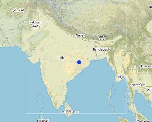
Orissa
ຂໍ້ມູນເພີ່ມເຕີມຂອງສະຖານທີ່:
Khaparakhol
Map
×2.6 ວັນທີໃນການຈັດຕັ້ງປະຕິບັດ
ຖ້າຫາກວ່າ ບໍ່ຮູ້ຈັກ ປີທີ່ຊັດເຈນ ແມ່ນໃຫ້ປະມານ ວັນທີເອົາ:
- ຕໍ່າກວ່າ 10 ປີ ຜ່ານມາ (ມາເຖິງປະຈຸບັນ)
2.7 ການນໍາສະເໜີ ເຕັກໂນໂລຢີ
ໃຫ້ລະບຸ ເຕັກໂນໂລຢີ ໄດ້ຖືກຈັດຕັ້ງປະຕິບັດຄືແນວໃດ?
- ໂດຍຜ່ານໂຄງການ / ການຊ່ວຍເຫຼືອຈາກພາຍນອກ
ຄວາມຄິດເຫັນ (ປະເພດ ໂຄງການ ແລະ ອື່ນໆ):
A group of SWC proffessionals were sent to BAIF Karnatka to study the replication of ' Linking of farm ponds models. After a detail study we concluded that the climate in particular & rainfall in general of our area is not fit for that technolgy. When SWC specialist share their experience to land users, some of the farmers agreed to have a experimentation of the technology. Therefore, modification has been done by the SWC specialists as per the suitability & requirement of the land users.
3. ການໃຈ້ແຍກ ເຕັກໂນໂລຢີ ໃນການຄຸ້ມຄອງ ດິນແບບຍືນຍົງ
3.1 ຈຸດປະສົງຫຼັກ (ຫຼາຍ) ຂອງເຕັກໂນໂລຢີ
- ຫຼຸດຜ່ອນ, ປ້ອງກັນ, ຟື້ນຟູ ການເຊື່ອມໂຊມຂອງດິນ
3.2 ປະເພດການນໍາໃຊ້ທີ່ດິນ ໃນປະຈຸບັນ() ທີ່ເຕັກໂນໂລຢີ ໄດ້ຖືກນໍາໃຊ້

ດິນທີ່ປູກພືດ
- ການປູກພືດປະຈໍາປີ
ການປູກພືດຫຼັກ (ທີ່ສາມາດສ້າງລັບຮັບ ເປັນເງິນສົດ ແລະ ເປັນພືດສະບຽງອາຫານ):
Major cash crop: Ground nut
Major food crop: Paddy/minormillets
Major other crop: Cotton

ປະສົມປະສານ (ການປູກພືດ / ທົ່ງຫຍ້າລ້ຽງສັດ / ຕົ້ນໄມ້), ລວມທັງ ປ່າໄມ້ ແບບປະສົມປະສານ
- ກະສິກຳ-ທົ່ງຫຍ້າ
- ປ່າໄມ້-ທົ່ງຫຍ້າ
ຜະລິດຕະພັນຫຼັກ / ບໍລິການ:
Major cash crop: Fruit like mango/Custard apple
ຄວາມຄິດເຫັນ:
Major land use problems (compiler’s opinion): This patch of the land is poor in the nutrient status in comparison to other lands of the village, with high concentration of marginal farmer. Heavy top soil erosion over the years yields to decreasing of productivity of land. The main requirement of water is in the dry spell in between the monsoon period.
Major land use problems (land users’ perception): 1. Run-off was severe at the time of rainy season which causes heavy soil erosion. 2. Sand casting on down below lands . 3. Long duration crops is not possible, ex- Ground nut, paddy, cotton etc. 3. Lands was not levelled for smoothening of ploughing operation. 4. The uncultivated wasteland(according the record of rights) was distributed to some landless persons who are unable to take up any productive cultivation in these lands.
Ranching: Although technolgy is not directly applied, but indirect effect is there on grazing.
Grazingland comments: The major cause of loss in livestock is that there is no option for the villagers for stall feeding. Example- in summer no availability of green fodder or less availabity.
Type of cropping system and major crops comments: Minor Millets/ Paddy(june-Sept)- Black gram or pulses(Sep-Dec) or cotton as the sole crop for nine months.
3.3 ຂໍ້ມູນເພີ່ມເຕີມກ່ຽວກັບການນໍາໃຊ້ທີ່ດິນ
ການສະໜອງນໍ້າ ໃນພື້ນທີ່ ທີ່ໄດ້ນໍາໃຊ້ ເຕັກໂນໂລຢີ:
- ນໍ້າຝົນ
ຈໍານວນ ລະດູການ ປູກໃນປີໜຶ່ງ:
- 2
ລະບຸ ຊະນິດ:
Longest growing period in days: 90Longest growing period from month to month: Jun - SepSecond longest growing period in days: 75Second longest growing period from month to month: Sep - Dec
3.4 ການນໍາໃຊ້ເຕັກໂນໂລຢີ ທີ່ຢູ່ໃນກຸ່ມການຄຸ້ມຄອງ ທີ່ດິນແບບຍືນຍົງ
- ມາດຕະການ ຕັດຂວາງ ກັບຄວາມຄ້ອຍຊັນ
- ການເກັບກັກນໍ້າ
3.5 ການຂະຫຍາຍເຕັກໂນໂລຢີ
ໃຫ້ລະບຸ ການແຜ່ຂະຫຍາຍ ເຕັກໂນໂລຢີ:
- ແຜ່ຂະຫຍາຍຢ່າງໄວວາໃນພື້ນທີ່
ຖ້າຫາກວ່າ ເຕັກໂນໂລຢີ ໄດ້ແຜ່ຂະຫຍາຍທົ່ວພື້ນທີ່ືື ຢ່າງສະໜ່ຳສະເໝີ, ໃຫ້ລະບຸ ເນື້ອທີ່ ໂດຍການຄາດຄະເນ:
- 0.1-1 ກມ 2
ຄວາມຄິດເຫັນ:
Total area covered by the SLM Technology is 0.7 km2.
The concerned watershed is a subsidiary system of the Suktel river drainage sytem. The area of operation is micro watershed , i.e. 500 hac as a unit of the tributary of the Suktel river.
3.6 ມາດຕະການ ການຄຸ້ມຄອງ ທີ່ດິນແບບຍືນຍົງ ປະກອບດ້ວຍ ເຕັກໂນໂລຢີ
3.7 ປະເພດດິນເຊື່ອມໂຊມ ຫຼັກທີ່ໄດ້ນໍາໃຊ້ ເຕັກໂນໂລຢີ

ດິນເຊາະເຈື່ອນ ໂດຍນໍ້າ
- Wt: ການສູນເສຍຊັ້ນໜ້າດິນ / ການເຊາະເຈື່ອນຜິວໜ້າດິນ
- Wg: ການເຊາະເຈື່ອນຮ່ອງນ້ຳ / ຫ້ວຍ
- Wm: ການເຄື່ອນຍ້າຍອິນຊີວັດຖຸ / ດິນເຈື່ອນ
- Wo: ຜົນກະທົບ ຂອງການເຊື່ອມໂຊມ ຕໍ່ພື້ນທີ່ພາຍນອກ
ຄວາມຄິດເຫັນ:
Main type of degradation addressed: Wt: loss of topsoil / surface erosion, Wg: gully erosion / gullying
Secondary types of degradation addressed: Wo: offsite degradation effects
Main causes of degradation: other human induced causes (specify) (agricultural causes - Suitable alternatives which will yield more benefit with less investments.), education, access to knowledge and support services (Knowledge sustainable livelihoods framework)
Secondary causes of degradation: deforestation / removal of natural vegetation (incl. forest fires) (Maintainance & responsibility sharing for protection), over-exploitation of vegetation for domestic use (Particularly vegetation which yields non-timber forest produce.), overgrazing (Uncontrolled & free grazing at the period Dec-June restricts the land users to go for second crop.), other natural causes (avalanches, volcanic eruptions, mud flows, highly susceptible natural resources, extreme topography, etc.) specify (Frequent drought occurs in every alternative 3rd year.), poverty / wealth (Initiation of any activities for sustainance of livelihoods need some capital)
3.8 ການປ້ອງກັນ, ການຫຼຸດຜ່ອນ, ຫຼືການຟື້ນຟູຂອງການເຊື່ອມໂຊມຂອງດິນ
ໃຫ້ລະບຸ ເປົ້າໝາຍ ເຕັກໂນໂລຢີ ທີ່ພົວພັນ ກັບຄວາມເຊື່ອມໂຊມຂອງດິນ:
- ການຟື້ນຟູ / ຟື້ນຟູດິນທີ່ຊຸດໂຊມ
ຄວາມຄິດເຫັນ:
Secondary goals: prevention of land degradation, mitigation / reduction of land degradation
4. ຂໍ້ກໍາໜົດ, ກິດຈະກໍາການປະຕິບັດ, ວັດຖຸດິບ, ແລະຄ່າໃຊ້ຈ່າຍ
4.2 ການແຕ້ມແຜນວາດອະທິບາຍເຕັກນິກ
Technical knowledge required for field staff / advisors: low
Technical knowledge required for land users: low
Main technical functions: control of dispersed runoff: retain / trap
Secondary technical functions: control of concentrated runoff: impede / retard, control of concentrated runoff: drain / divert, reduction of slope length
Better crop cover
Material/ species: paddy, minor millets, groundnut, vegetables
Quantity/ density: Average
Relay cropping
Material/ species: pulses after minor millets or short duration paddy
Mixed cropping / intercropping
Material/ species: Ground nut, green gram & fibre crop(Jute)
Remarks: Line sowing- 5 lines of green gram with one line of green gram & jute on the fence of the land.
Contour planting / strip cropping
Material/ species: Cotton as a demonstation practice.
Manure / compost / residues
Material/ species: The silt deposits in the sunken pond is used in the nearby land.
Rotations / fallows
Material/ species: After paddy the land is used for pulse
Minimum tillage
Remarks: Previously unbunded, now bunded upland rquires minimum tillage.
Pits
Remarks: Thecontour bunds & field bunds constructed out the excavated soil from the pits.
Agronomic measure: Soil moisture condition
Remarks: It is enhanced due to the technology
Aligned: -contour
Vegetative material: T : trees / shrubs
Number of plants per (ha): 40
Spacing between rows / strips / blocks (m): 15-20 ft
Aligned: -graded strips
Vegetative material: G : grass
Number of plants per (ha): 1250
Spacing between rows / strips / blocks (m): 6 inches
Vertical interval within rows / strips / blocks (m): 6 inches
Trees/ shrubs species: Teak
Fruit trees / shrubs species: Mango, Custard Apple
Grass species: Vertiver & Sabai
Slope (which determines the spacing indicated above): 5.00%
Bund/ bank: semi-circular/V shaped trapezoidal
Spacing between structures (m): 50 ft
Depth of ditches/pits/dams (m): 6 ft
Width of ditches/pits/dams (m): 25 ft
Length of ditches/pits/dams (m): 25 ft
Height of bunds/banks/others (m): 2 ft
Width of bunds/banks/others (m): 2 ft
Length of bunds/banks/others (m): 50ft
Construction material (earth): The earth from the dug-out sunken pond is used for the construction of contour bunding
Construction material (stone): Stone is used at the weak point for stabilisation
Change of land use type: Minor millets, long duration upland paddy, Grount nut, pulses after paddy/millets or cotton etc.
Change of land use practices / intensity level: After harvest of first crop like minor millets/ paddy, next crop is taken up by land users along with some vegetables(Horticulture crop).
Layout change according to natural and human environment: Grazing was restricted in these areas & land was optimally used, like bund cultivation.
Major change in timing of activities: Tthese lands were last option for the land users.But now the activities like summer plough has changed the time.
Control / change of species composition: Earlier sole crop, like only minor millets/Upland paddy. But now land users have started intercropping systems.
4.3 ຂໍ້ມູນທົ່ວໄປກ່ຽວກັບການຄິດໄລ່ປັດໃຈຂາເຂົ້າໃນການຜະລິດ ແລະ ມູນຄ່າອື່ນໆ
ສະກຸນເງິນອື່ນໆ / ປະເທດອື່ນໆ (ລະບຸ):
Rupee
ລະບຸ ອັດຕາແລກປ່ຽນ ຈາກໂດລາ ເປັນເງິນຕາທ້ອງຖີ່ນ (ຖ້າກ່ຽວຂ້ອງ): 1 ໂດລາ =:
50.0
4.4 ການສ້າງຕັ້ງກິດຈະກໍາ
| ກິດຈະກໍາ | ປະເພດ ມາດຕະການ | ໄລຍະເວລາ | |
|---|---|---|---|
| 1. | Survey & alignment of key Contour & lay-out of tanks | ການບໍາລຸງລ້ຽງ | Beginning of rainy season |
| 2. | Digging of pits for grass, fruit plants & timber | ການບໍາລຸງລ້ຽງ | June |
| 3. | Collection of Vertiver & Sabai grass from external source | ການບໍາລຸງລ້ຽງ | july |
| 4. | Collection of seedling of Trees/Plants | ການບໍາລຸງລ້ຽງ | July |
| 5. | Survey & contour demarkation | ໂຄງສ້າງ | April-May |
| 6. | Demarkation on map | ໂຄງສ້າງ | April-May |
| 7. | Estimate & lay-Out | ໂຄງສ້າງ | April-May |
| 8. | Implementation of work | ໂຄງສ້າງ | June |
| 9. | Survey & Key Contour line demarkation at 75 ft interval | ການຈັດການຄຸ້ມຄອງ | June |
| 10. | Digging of Sunken ponds | ການຈັດການຄຸ້ມຄອງ | July |
| 11. | Top level dressing of bund | ການຈັດການຄຸ້ມຄອງ | July |
| 12. | Water-way with connection Dug-out sunken ponds | ການຈັດການຄຸ້ມຄອງ | August |
4.5 ຕົ້ນທຶນ ແລະ ປັດໄຈຂາເຂົ້າທີ່ຈໍາເປັນໃນຈັດຕັ້ງປະຕິບັດ
| ລະບຸ ປັດໃຈ ນໍາເຂົ້າ ໃນການຜະລີດ | ຫົວໜ່ວຍ | ປະລິມານ | ຕົ້ນທຶນ ຕໍ່ຫົວໜ່ວຍ | ຕົ້ນທຶນທັງໝົດ ຂອງປັດໃຈຂາເຂົ້າ ໃນການຜະລິດ | % ຂອງຕົ້ນທຶນທັງໝົດ ທີ່ຜູ້ນໍາໃຊ້ທີ່ດິນ ໃຊ້ຈ່າຍເອງ | |
|---|---|---|---|---|---|---|
| ແຮງງານ | Labour | ha | 1.0 | 90.0 | 90.0 | 20.0 |
| ອຸປະກອນ | Animal traction | ha | 1.0 | 5.0 | 5.0 | 20.0 |
| ວັດສະດຸໃນການປູກ | Seedlings | ha | 1.0 | 25.0 | 25.0 | |
| ຕົ້ນທຶນທັງໝົດ ໃນການຈັດຕັ້ງປະຕິບັດ ເຕັກໂນໂລຢີ | 120.0 | |||||
ຄວາມຄິດເຫັນ:
Duration of establishment phase: 12 month(s)
4.6 ບໍາລຸງຮັກສາ / ແຜນຈັດຕັ້ງປະຕິບັດ ກິດຈະກໍາ
| ກິດຈະກໍາ | ປະເພດ ມາດຕະການ | ໄລຍະເວລາ / ຄວາມຖີ່ | |
|---|---|---|---|
| 1. | Ploughing | ພືດ | April-May / annual |
| 2. | Intercultural operation with manure application | ພືດ | June / annual |
| 3. | Sowing | ພືດ | July & sep for two crops / each cropping season |
| 4. | weeding & intercultural operation, if required. | ພືດ | July / annual |
| 5. | Harvesting of paddy or minor millets or ground nut | ພືດ | Aug-sep / annual |
| 6. | Sowing of pulses as relay crop | ພືດ | Aug-sep / each cropping season |
| 7. | Harvesting of pulses | ພືດ | Nov-Dec / each cropping season |
| 8. | Collapsing of bunds may damage th evegetation | ການບໍາລຸງລ້ຽງ | Rainy Season /annual |
| 9. | Checking against free grazing | ການບໍາລຸງລ້ຽງ | Jan-June / |
| 10. | Watering to plants | ການບໍາລຸງລ້ຽງ | Dec-May /annual |
| 11. | Management of surplus water | ໂຄງສ້າງ | Rainy Season/Once in Year |
| 12. | Collapsing of bund | ໂຄງສ້າງ | |
| 13. | Tanks must be desilted | ໂຄງສ້າງ | Dry season/Once in Year |
| 14. | Control of surplus water-flow | ການຈັດການຄຸ້ມຄອງ | Rainy season / once a year |
| 15. | Stabilisation of bund at weak points | ການຈັດການຄຸ້ມຄອງ | August / once a year |
| 16. | Desiltation of ponds | ການຈັດການຄຸ້ມຄອງ |
4.7 ຄ່າໃຊ້ຈ່າຍ ແລະ ປັດໄຈນໍາເຂົ້າທີ່ຈໍາເປັນສໍາລັບການບໍາລຸງຮັກສາກິດຈະກໍາ / ແຜນປະຕິບັດ (ຕໍ່ປີ)
| ລະບຸ ປັດໃຈ ນໍາເຂົ້າ ໃນການຜະລີດ | ຫົວໜ່ວຍ | ປະລິມານ | ຕົ້ນທຶນ ຕໍ່ຫົວໜ່ວຍ | ຕົ້ນທຶນທັງໝົດ ຂອງປັດໃຈຂາເຂົ້າ ໃນການຜະລິດ | % ຂອງຕົ້ນທຶນທັງໝົດ ທີ່ຜູ້ນໍາໃຊ້ທີ່ດິນ ໃຊ້ຈ່າຍເອງ | |
|---|---|---|---|---|---|---|
| ແຮງງານ | Labour | ha | 1.0 | 4.0 | 4.0 | 100.0 |
| ວັດສະດຸໃນການປູກ | Seedlings | ha | 1.0 | 3.0 | 3.0 | 100.0 |
| ຕົ້ນທຶນທັງໝົດ ທີ່ໃຊ້ໃນການບໍາລຸງຮັກສາ ເຕັກໂນໂລຢີ | 7.0 | |||||
ຄວາມຄິດເຫັນ:
Machinery/ tools: in a typical area of 5 hac, around 30,000 has been spent in which 20% of the establishment cost is borned by the land users.
There are two types of dug-out sunken pits of specifications. The sunken pit was dug & the earth from the sunken pit was put on a contour bund. So the earth-work was calculated as per cubic ft. The seedlings were bought from nursery & planted with 20% contribution of labour.
4.8 ປັດໄຈ ທີ່ສໍາຄັນ ທີ່ສົ່ງຜົນກະທົບ ຕໍ່ຄ່າໃຊ້ຈ່າຍ
ໃຫ້ອະທິບາຍ ປັດໃຈ ທີ່ສົ່ງຜົນກະທົບ ຕໍ່ຕົ້ນທຶນ ໃນການຈັດຕັ້ງປະຕິບັດ:
Soil depth is very less, hard soil with slope variation because of undulating lands. The labour was also not sufficiently available at the time of establishment, because the work was implemented at time of main growing season. At that time land users are busy in their own field because of cultivation work.
5. ສະພາບແວດລ້ອມທໍາມະຊາດ ແລະ ມະນຸດ
5.1 ອາກາດ
ປະລິມານນໍ້າຝົນປະຈໍາປີ
- < 250 ມີລິແມັດ
- 251-500 ມີລິແມັດ
- 501-750 ມີລິແມັດ
- 751-1,000 ມີລິແມັດ
- 1,001-1,500 ມີລິແມັດ
- 1,501-2,000 ມີລິແມັດ
- 2,001-3,000 ມີລິແມັດ
- 3,001-4,000 ມີລິແມັດ
- > 4,000 ມີລິແມັດ
ຂໍ້ມູນສະເພາະ / ຄວາມເຫັນກ່ຽວກັບ ປະລິມານນໍ້າຝົນ:
1000-1500 mm: Ranked 1, Avg rainfall from liz kiff report. The study of 20 years of rainfall data shows that, drought comes in every alternative 3 years. The rainfall varies from a minimum of 715.6 mm to maximum of 1863 mm
500-750 mm: Ranked 2
1500-2000 mm: Ranked 3
ເຂດສະພາບອາກາດກະສິກໍາ
- ເຄີ່ງຄວາມຊຸ່ມ
- ເຄິ່ງແຫ້ງແລ້ງ
5.2 ພູມິປະເທດ
ຄ່າສະເລ່ຍ ຄວາມຄ້ອຍຊັນ:
- ພື້ນທີ່ຮາບພຽງ (0-2%)
- ອ່ອນ (3-5 %)
- ປານກາງ (6-10 %)
- ມ້ວນ (11-15 %)
- ເນີນ(16-30%)
- ໍຊັນ (31-60%)
- ຊັນຫຼາຍ (>60%)
ຮູບແບບຂອງດິນ:
- ພູພຽງ / ທົ່ງພຽງ
- ສັນພູ
- ເປີ້ນພູ
- ເນີນພູ
- ຕີນພູ
- ຮ່ອມພູ
ເຂດລະດັບສູງ:
- 0-100 ແມັດ a.s.l.
- 101-500 ແມັດ a.s.l.
- 501-1,000 ແມັດ a.s.l.
- 1,001-1,500 ແມັດ a.s.l.
- 1,501-2,000 ແມັດ a.s.l.
- 2,001-2,500 ແມັດ a.s.l.
- 2,501-3,000 ແມັດ a.s.l.
- 3,001-4,000 ແມັດ a.s.l.
- > 4,000 ແມັດ a.s.l.
ຄຳເຫັນ ແລະ ຂໍ້ມູນສະເພາະ ເພີ່ມເຕີມ ກ່ຽວກັບ ພູມີປະເທດ:
Altitudinal zone: 101-500 m a.s.l. (as per the record in the topo-sheet No-64 P/1 with scale1:50,000)
Slopes on average: Gentle (As the stretch of land is at the hill slopes. The slope firstly from 5-8% where as the land where dug-out sunken ponds were dug is of slope 2-5%, ranked 1) and moderate (ranked 2)
5.3 ດິນ
ຄວາມເລິກ ຂອງດິນສະເລ່ຍ:
- ຕື້ນຫຼາຍ (0-20 ຊັງຕີແມັດ)
- ຕື້ນ (21-50 ຊຕມ)
- ເລີກປານກາງ (51-80 ຊຕມ)
- ເລິກ (81-120 ຊມ)
- ເລິກຫຼາຍ (> 120 cm)
ເນື້ອດິນ (ໜ້າດິນ):
- ຫຍາບ / ເບົາ (ດິນຊາຍ)
- ປານກາງ (ດິນໜຽວ, ດິນໂຄນ)
ຊັ້ນອິນຊີວັດຖຸ ເທິງໜ້າດິນ:
- ປານກາງ (1-3 %)
- ຕໍາ່ (<1 %)
ຖ້າເປັນໄປໄດ້ ແມ່ນໃຫ້ຕິດຄັດ ການພັນລະນາດິນ ຫຼື ຂໍ້ມູນສະເພາະຂອງດິນ, ຕົວຢ່າງ, ຄຸນລັກສະນະ ປະເພດຂອງດິນ, ຄ່າຄວາມເປັນກົດ / ເປັນດ່າງຂອງດິນ, ສານອາຫານ, ດິນເຄັມ ແລະ ອື່ນໆ.
Soil depth on average: Shallow (ranked 1, due to continuos soil erosion the topsoil eroded completely which resulted into varied soil depth where only deep rooted crops & plants are possible) and moderately deep
Soil texture: Coarse/light (Ranked 1, the soil is basically reddish in colour with sandy loam texture) and medium (ranked 2)
Soil fertility: Low (ranked 1, the soil fertility of uplands is very low where the said technology is established. But the lands near to it some what medium land with medium soil fertility) and medium (ranked 2)
Soil drainage/infiltration: Good (the watershed map from the topo-sheet shows that there only one drainage line where two contributaries are there. That is the perinneal stream where water from the lands drain out to main drainage lei, ranked 1) and poor (ranked 2)
Soil water storage capacity: Low (the soil texture being the sandy loam category, the storage capacity is very low. Therefore, after monsoon rainfall the soil is unable to maintain the water requirement at the dry spell to high percol, ranked 1) and medium (ranked 2)
5.6 ຄຸນລັກສະນະ ຂອງຜູ້ນໍາໃຊ້ທີ່ດິນ ທີ່ໄດ້ນໍາໃຊ້ເຕັກໂນໂລຢີ
ລະບົບ ການຕະຫຼາດ ແລະ ຜົນຜະລິດ:
- ກຸ້ມຕົນເອງ (ພໍພຽງ)
- ປະສົມ (ກຸ້ມຕົນເອງ / ເປັນສິນຄ້າ
ລາຍຮັບ ທີ່ບໍ່ໄດ້ມາຈາກ ການຜະລິດ ກະສິກໍາ:
- 10-50 % ຂອງລາຍຮັບທັງໝົດ
ລະດັບຄວາມຮັ່ງມີ:
- ທຸກຍາກຫຼາຍ
- ສະເລ່ຍ
ລະດັບ ການຫັນເປັນກົນຈັກ:
- ການໃຊ້ແຮງງານຄົນ
- ສັດລາກແກ່
ໃຫ້ລະບຸ ຄຸນລັກສະນະ ຂອງຜູ້ນໍາໃຊ້ທີ່ດິນ:
Population density: > 500 persons/km2
Annual population growth: 0.5% - 1%
20% of the land users are very rich (1-2 farmers having more than 10-15 acre of land).
30% of the land users are average wealthy (land users having upto 5 acres(Little less in comparison to first categ).
50% of the land users are poor (land users having only0-2 acres(more in No. in this patch)).
Off-farm income specification: Others have also activities like NTFP collection, keeping small ruminants like goats, chicks etc.
Level of mechanization: Animal traction (ranked 1, wooden plough) and manual labour (ranked 2)
Market orientation cropland: subsistence (self-supply, minor millets/paddy/pulses, ranked 1) and mixed (ground nut & vegetables, ranked 2)
5.7 ພື້ນທີ່ສະເລ່ຍຂອງທີ່ດິນ ຫຼື ເຊົ່າໂດຍຜູ້ໃຊ້ທີ່ດິນການນໍາໃຊ້ ເຕັກໂນໂລຢີ
- <0.5 ເຮັກຕາ
- 0.5-1 ເຮັກຕາ
- 1-2 ເຮັກຕາ
- 2-5 ເຮັກຕາ
- 5-15 ເຮັກຕາ
- 15-50 ເຮັກຕາ
- 50-100 ເຮັກຕາ
- 100-500 ເຮັກຕາ
- 500-1,000 ເຮັກຕາ
- 1,000-10,000 ເຮັກຕາ
- > 10,000 ເຮັກຕາ
ຄວາມຄິດເຫັນ:
Cropland: 1-2 ha (micro-plan)
Grazing land: 0.5-1 ha (130 Households with 25 hac of grazing lands)
5.8 ເຈົ້າຂອງທີ່ດິນ, ສິດໃຊ້ທີ່ດິນ, ແລະ ສິດທິການນໍາໃຊ້ນໍ້າ
ເຈົ້າຂອງດິນ:
- ບຸກຄົນ, ທີ່ມີຕໍາແໜ່ງ
ສິດທິ ໃນການນໍາໃຊ້ທີ່ດິນ:
- ຊຸມຊົນ (ທີ່ມີການຈັດຕັ້ງ)
- ບຸກຄົນ
6. ຜົນກະທົບ ແລະ ລາຍງານສະຫຼຸບ
6.1 ການສະແດງຜົນກະທົບ ພາຍໃນພື້ນທີ່ ທີ່ໄດ້ຈັດຕັ້ງປະຕິບັດ ເຕັກໂນໂລຢີ
ຜົນກະທົບທາງເສດຖະກິດສັງຄົມ
ການຜະລິດ
ການຜະລິດພືດ
ຄວາມຄິດເຫັນ / ລະບຸແຈ້ງ:
Per hac production/economic cost.
ການຜະລິດອາຫານສັດ
ຄວາມຄິດເຫັນ / ລະບຸແຈ້ງ:
Vertiver as fodder on bund.
ຄຸນນະພາບຂອງອາຫານສັດ
ຄວາມຄິດເຫັນ / ລະບຸແຈ້ງ:
Vertiver as fodder on bund.
ຜົນຜະລິດໄມ້
ຄວາມຄິດເຫັນ / ລະບຸແຈ້ງ:
Teak plants has been planted this year. The yeild is yet to come.
ເນື້ອທີ່ການຜະລິດ
ຄວາມຄິດເຫັນ / ລະບຸແຈ້ງ:
Land users believe that some land is wastage due the structure.
ການຈັດການຄຸ້ມຄອງທີ່ດິນ
ຄວາມຄິດເຫັນ / ລະບຸແຈ້ງ:
Ploughing operation.
ລາຍໄດ້ ແລະ ຄ່າໃຊ້ຈ່າຍ
ລາຍຮັບ ຈາກການຜະລີດ
ຄວາມຄິດເຫັນ / ລະບຸແຈ້ງ:
Resource rich & resource poor land users accrued double benefit by changing the crop.
ຄວາມຫຼາກຫຼາຍ ຂອງແຫຼ່ງລາຍຮັບ
ຄວາມຄິດເຫັນ / ລະບຸແຈ້ງ:
Farm employment at lean period. Income through labour
ຜົນກະທົບທາງດ້ານເສດຖະກິດສັງຄົມອື່ນໆ
Field Demonstration- living institution
ຄວາມຄິດເຫັນ / ລະບຸແຈ້ງ:
Alternatives to mitigate drought.
ຜົນກະທົບດ້ານວັດທະນາທໍາສັງຄົມ
ສະຖາບັນ ການຈັດຕັ້ງຊຸມຊົນ
ຄວາມຄິດເຫັນ / ລະບຸແຈ້ງ:
Contribution labour from land users because of convincing benefit from the technology. The women also contributed in plantation activities.
ສະຖາບັນແຫ່ງຊາດ
ຄວາມຄິດເຫັນ / ລະບຸແຈ້ງ:
Members from other areas of district also learnt the technology through exposure visit.
ຄວາມຮູ້ກ່ຽວກັບ ການຄຸ້ມຄອງ ທີ່ດິນແບບຍືນຍົງ / ການເຊື່ອມໂຊມຂອງດິນ
ຄວາມຄິດເຫັນ / ລະບຸແຈ້ງ:
Some of the land users of other patch of the village decided to take up similar activity.
ການຫຼຸດຜ່ອນ ຂໍ້ຂັດແຍ່ງ
ຄວາມຄິດເຫັນ / ລະບຸແຈ້ງ:
Transparency: The details of activity is shared amongst all the villagers.
ສະຖານະການຂອງສັງຄົມ ແລະ ກຸ່ມດ້ອຍໂອກາດທາງເສດຖະກິດ
ຄວາມຄິດເຫັນ / ລະບຸແຈ້ງ:
Land users having land below 1 hac are getting more benefit out this technology.
ຜົນກະທົບຕໍ່ລະບົບນິເວດ
ວົງຈອນນໍ້າ / ນໍ້າ
ການໄຫຼ ຂອງນໍ້າໜ້າດິນ
ປະລິມານ ກ່ອນການຈັດຕັ້ງປະຕິບັດ ການຄຸ້ມຄອງ ທີ່ດິນແບບຍືນຍົງ:
50
ປະລີມານ ຫຼັງການຈັດຕັ້ງປະຕິບັດ ການຄຸ້ມຄອງ ທີ່ດິນແບບຍືນຍົງ:
10
ການລະບາຍນໍ້າ
ຄວາມຄິດເຫັນ / ລະບຸແຈ້ງ:
Earthen hume pipes.
ດິນ
ຄວາມຊຸ່ມຂອງດິນ
ຄວາມຄິດເຫັນ / ລະບຸແຈ້ງ:
This condition help the land users to take up second crop.
ການປົກຄຸມຂອງດິນ
ຄວາມຄິດເຫັນ / ລະບຸແຈ້ງ:
Particularly top-soil.
ການສູນເສຍດິນ
ປະລິມານ ກ່ອນການຈັດຕັ້ງປະຕິບັດ ການຄຸ້ມຄອງ ທີ່ດິນແບບຍືນຍົງ:
30
ປະລີມານ ຫຼັງການຈັດຕັ້ງປະຕິບັດ ການຄຸ້ມຄອງ ທີ່ດິນແບບຍືນຍົງ:
20
ຊີວະນານາພັນ: ສັດ, ພືດ
ຄວາມຫຼາກຫຼາຍຂອງພືດ
ຄວາມຫຼາກຫຼາຍຂອງສັດ
ຄວາມຫຼາກຫຼາຍ ທາງດ້ານທີ່ຢູ່ອາໃສ ຂອງສິ່ງທີ່ມີຊີວິດ
ຜົນກະທົບຕໍ່ລະບົບນິເວດອື່ນໆ
Soil fertility
ຄວາມຄິດເຫັນ / ລະບຸແຈ້ງ:
Production/ Economic benefit becomes double.
Water availability in dry spell
6.2 ຜົນກະທົບທາງອ້ອມ ຈາກການນໍາໃຊ້ເຕັກໂນໂລຢີ
ການໄຫຼຂອງນໍ້າໃນລະດູແລ້ງ
ນໍ້າຖ້ວມຢູ່ເຂດລຸ່ມນໍ້າ
ການທັບຖົມ ຂອງດິນຕະກອນ ຢູ່ເຂດລຸ່ມນໍ້າ
6.4 ການວິເຄາະຕົ້ນທຶນ ແລະ ຜົນປະໂຫຍດ
ຈະເຮັດປະໂຫຍດເພື່ອປຽບທຽບກັບຄ່າໃຊ້ຈ່າຍກັບສິ່ງກໍ່ສ້າງ (ຈາກທັດສະນະຂອງຜູ້ນຳໃຊ້ທີ່ດິນ) ໄດ້ແນວໃດ?
ຜົນຕອບແທນ ໃນໄລຍະສັ້ນ:
ຜົນກະທົບທາງບວກ
ຜົນຕອບແທນ ໃນໄລຍະຍາວ:
ຜົນກະທົບທາງບວກ
ຈະໄດ້ຮັບຜົນປະໂຫຍດເມື່ອປຽບທຽບກັບ / ຄ່າໃຊ້ຈ່າຍໃນການບຳລຸງຮັກສາທີເ່ກີດຂື້ນອິກ (ຈາກທັດສະນະຄະຕິຂອງຜູ້ນຳໃຊ້ທີ່ດິນ) ໄດ້ແນວໃດ?
ຜົນຕອບແທນ ໃນໄລຍະສັ້ນ:
ຜົນກະທົບທາງບວກ
ຜົນຕອບແທນ ໃນໄລຍະຍາວ:
ຜົນກະທົບທາງບວກ
6.5 ການປັບຕົວຮັບເອົາເຕັກໂນໂລຢີ
ຖ້າຫາກວ່າມີ, ປະລິມານ (ຈໍານວນຂອງຄົວເຮືອນ / ເນື້ອທີ່ການຄຸ້ມຄອງ):
19
ທັງໝົດນັ້ນ ແມ່ນໃຜ ທີ່ເປັນຜູ້ປັບຕົວ ໃນການນໍາໃຊ້ ເຕັກໂນໂລຢີ, ມີຈັກຄົນ ທີ່ສາມາດເຮັດເອງໄດ້, ຕົວຢ່າງ, ປາດສະຈາກ ການຊ່ວຍເຫຼືອ ທາງດ້ານອຸປະກອນ / ການຈ່າຍເປັນເງິນ?
- 0-10%
ຄວາມຄິດເຫັນ:
100% of land user families have adopted the Technology with external material support
19 land user families have adopted the Technology with external material support
Comments on acceptance with external material support: survey results
There is a moderate trend towards spontaneous adoption of the Technology
Comments on adoption trend: Many farmers & SWC specialists visited the spot for the learning purpose. All we cannot say that it is a spontaneous adoption, but they have started taking up this technology in their own area.
6.7 ຈຸດແຂງ / ຂໍ້ດີ / ໂອກາດ ໃນການນໍາໃຊ້ ເຕັກໂນໂລຢີ
| ຈຸດແຂງ / ຂໍ້ດີ / ໂອກາດໃນການນໍາໃຊ້ທີ່ດິນ |
|---|
|
Maintainance is very less How can they be sustained / enhanced? Only timely care is needed. |
|
Land users can have water in their field other than rain water to be used for different purpose. How can they be sustained / enhanced? Some demos agriculture was done in this patch which has to be repeated for the second year for confidence building of the land users. |
| ຈຸດແຂງ / ຈຸດດີ / ໂອກາດ ຈາກທັດສະນະຂອງຜູ້ປ້ອນຂໍ້ມູນ ຫຼື ບຸກຄົນສຳຄັນ |
|---|
|
Water availability in the dry spell How can they be sustained / enhanced? If the land users will desilt the pond timely & care to plants grass on the bund. |
|
The land where only one crop is possible, vegetable & pulse crop can be taken up as second crop How can they be sustained / enhanced? Some methodology is to be applied to keep water in the pond for longer duration. |
6.8 ຈຸດອ່ອນ / ຂໍ້ເສຍ / ຄວາມສ່ຽງ ໃນການນໍາໃຊ້ ເຕັກໂນໂລຢີ ແລະ ວິທີການແກ້ໄຂບັນຫາ
| ຈຸດອ່ອນ / ຂໍ້ເສຍ / ຄວາມສ່ຽງໃນມຸມມອງຂອງຜູ້ນໍາໃຊ້ທີ່ດິນ | ມີວິທີການແກ້ໄຂຄືແນວໃດ? |
|---|---|
| Ploughing operation will be difficult. | This is although difficult but th benefit is more, therefore land users will compromise with this type of difficulty. |
| Water availability in dry period & desiltaion process. | This can be overcomed by planting vertiver on the sides of the pond & low cost polythene can be used for prolonging percolation rate of water in sandy loam soil. |
| ຈຸດອ່ອນ/ຂໍ້ບົກຜ່ອງ/ຄວາມສ່ຽງ ຈາກທັດສະນະຂອງຜູ້ປ້ອນຂໍ້ມູນ ຫຼື ບຸກຄົນສຳຄັນ | ມີວິທີການແກ້ໄຂຄືແນວໃດ? |
|---|---|
| The farmers started taking up cotton & paddy in stead of minor millets | Improved variety of minor millets is supplied to farmers for better yield in comparison to country variety. |
| Diversion of surplus water | The land users have to dig atleast one more feet & earthen pipes will be used for the diversion of surplus water. |
ຂໍ້ມູນການເຊື່ອມຕໍ່ ແລະ ເນື້ອໃນ
ຂະຫຍາຍທັງໝົດ ຍຸບທັງໝົດການເຊື່ອມຕໍ່

Community based sustainable livelihoods [ອິນເດຍ]
Sustainable livelihoods enhanced through people's organisations by linking with other resource organisations prticularly for resource poor.
- ຜູ້ສັງລວມຂໍ້ມູນ: Unknown User
ເນື້ອໃນ
ບໍ່ມີເນື້ອໃນ


