Drainage of coastal areas in north- western Germany [ເຢຍລະມັນ]
- ການສ້າງ:
- ປັບປູງ:
- ຜູ້ສັງລວມຂໍ້ມູນ: Martin Maier
- ບັນນາທິການ: –
- ຜູ້ທົບທວນຄືນ: Fabian Ottiger, David Streiff
Tiefliegenden Küstenlandschaften mit künstlicher Entwässerung in Nordwestdeutschland
technologies_1714 - ເຢຍລະມັນ
ເບິ່ງພາກສ່ວນ
ຂະຫຍາຍທັງໝົດ ຍຸບທັງໝົດ1. ຂໍ້ມູນທົ່ວໄປ
1.2 ຂໍ້ມູນ ການຕິດຕໍ່ພົວພັນ ຂອງບຸກຄົນທີ່ສໍາຄັນ ແລະ ສະຖາບັນ ທີ່ມີສ່ວນຮ່ວມ ໃນການປະເມີນເອກກະສານ ເຕັກໂນໂລຢີ
ບັນດາຜູ້ຕອບແບບສອບຖາມທີ່ສໍາຄັນ ()
ຜຸ້ຊ່ຽວຊານ ດ້ານການຄຸ້ມຄອງ ທີ່ດິນແບບຍືນຍົງ:
Kleyer Michael
+49 441 7980
michael.kleyer@uni-oldenburg.de
University of Oldenburg
Ammerländer Heerstraße 114, 26129 Oldenburg, Germany
ເຢຍລະມັນ
ຜຸ້ຊ່ຽວຊານ ດ້ານການຄຸ້ມຄອງ ທີ່ດິນແບບຍືນຍົງ:
Karrasch Leena
+49 441 7980
University of Oldenburg
Ammerländer Heerstraße 114, 26129 Oldenburg, Germany
ເຢຍລະມັນ
ຜຸ້ຊ່ຽວຊານ ດ້ານການຄຸ້ມຄອງ ທີ່ດິນແບບຍືນຍົງ:
Mayer Martin
+49 441 798 3075
martin.maier@uni-oldenburg.de
University of Oldenburg
Ammerländer Heerstraße 114, 26129 Oldenburg, Germany
ເຢຍລະມັນ
ຊື່ໂຄງການ ທີ່ອໍານວຍຄວາມສະດວກ ໃນການສ້າງເອກກະສານ/ປະເມີນ ເຕັກໂນໂລຢີ (ຖ້າກ່ຽວຂ້ອງ)
Book project: Making sense of research for sustainable land management (GLUES)ຊື່ໂຄງການ ທີ່ອໍານວຍຄວາມສະດວກ ໃນການສ້າງເອກກະສານ/ປະເມີນ ເຕັກໂນໂລຢີ (ຖ້າກ່ຽວຂ້ອງ)
Sustainable Coastal Land Management (COMTESS / GLUES)ຊື່ສະຖາບັນ (ຫຼາຍສະຖາບັນ) ທີ່ອໍານວຍຄວາມສະດວກ ໃນການສ້າງເອກກະສານ / ປະເມີນ ເຕັກໂນໂລຢີ (ຖ້າກ່ຽວຂ້ອງ)
University of Oldenburg (University of Oldenburg) - ເຢຍລະມັນ1.3 ເງື່ອນໄຂ ກ່ຽວກັບ ການນໍາໃຊ້ຂໍ້ມູນເອກະສານ ທີ່ສ້າງຂື້ນ ໂດຍຜ່ານ ອົງການພາບລວມຂອງໂລກ ທາງດ້ານແນວທາງ ແລະ ເຕັກໂນໂລຢີ ຂອງການອານຸລັກ ທໍາມະຊາດ (WOCAT)
ເມື່ອໃດທີ່ໄດ້ສັງລວມຂໍ້ມູນ (ຢູ່ພາກສະໜາມ)?
10/06/2015
ຜູ້ປ້ອນຂໍ້ມູນ ແລະ ບຸກຄົນສຳຄັນ ທີ່ໃຫ້ຂໍ້ມູນ (ຫຼາຍ) ຍິນຍອມ ຕາມເງື່ອນໄຂ ໃນການນຳໃຊ້ຂໍ້ມູນ ເພື່ອສ້າງເປັນເອກກະສານຂອງ WOCAT:
ແມ່ນ
2. ການອະທິບາຍ ເຕັກໂນໂລຢີ ຂອງການຄຸ້ມຄອງ ທີ່ດິນແບບຍືນຍົງ
2.1 ຄໍາອະທິບາຍສັ້ນຂອງ ເຕັກໂນໂລຢີ
ການກຳໜົດຄວາມໝາຍ ຂອງເຕັກໂນໂລຢີ:
Land reclaimed from the sea – ‘the coastal region in north-western Germany needs to be artificially drained, and this will be an increasing challenge with climate change.
2.2 ການອະທິບາຍ ລາຍລະອຽດ ຂອງເຕັກໂນໂລຢີ
ການພັນລະນາ:
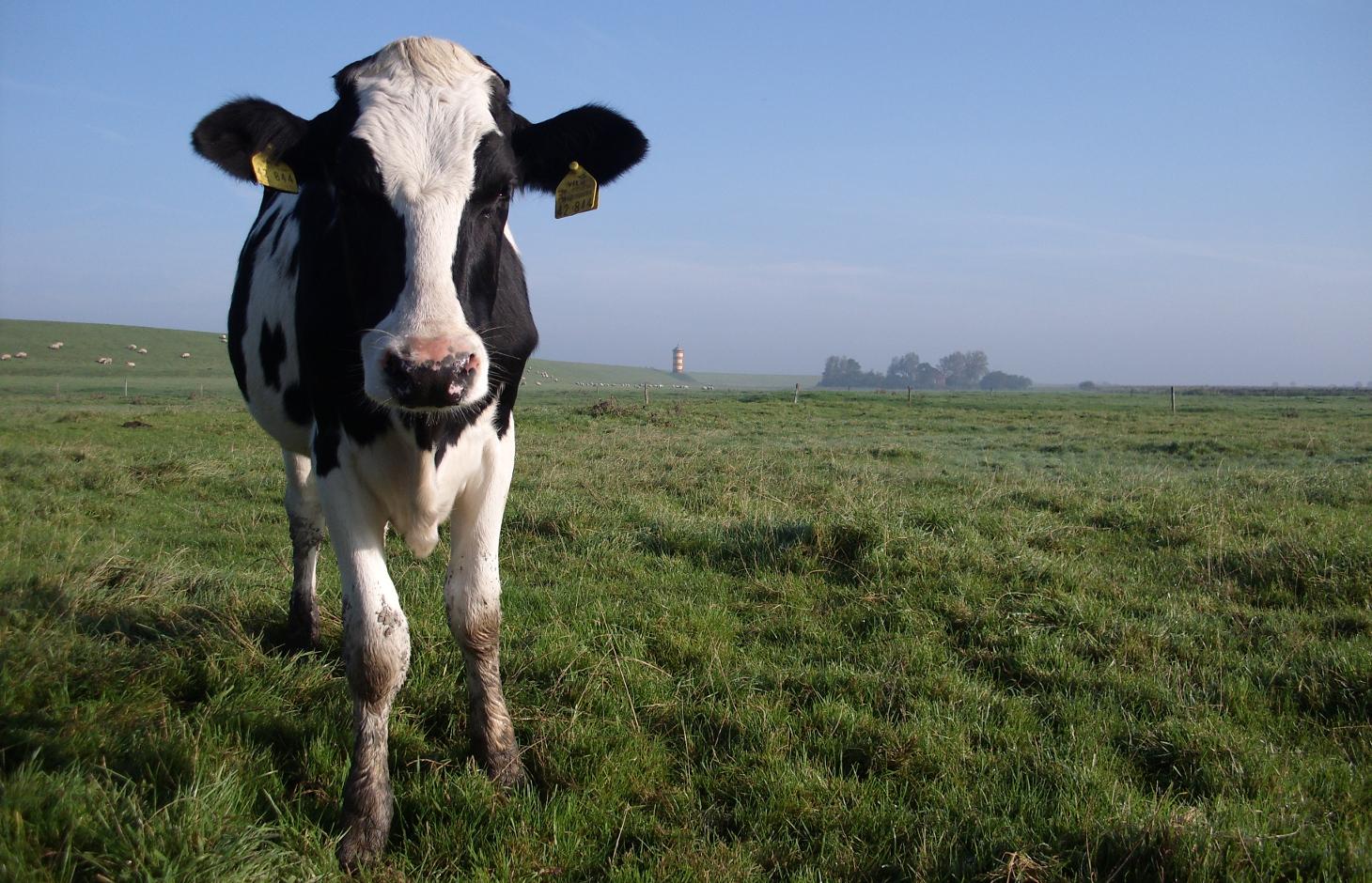
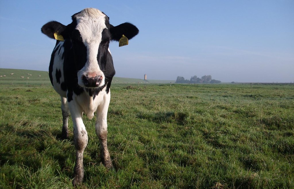
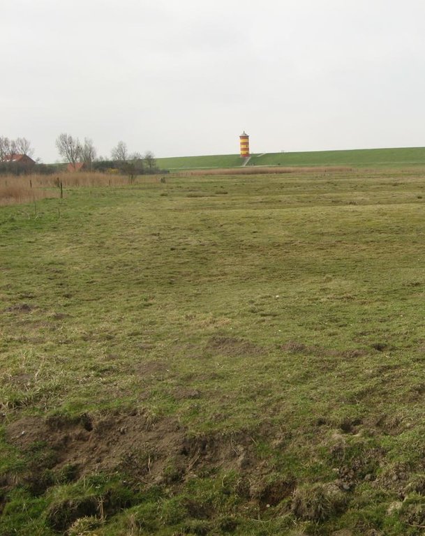
In some coastal locations of north-western Germany, during the 19th and 20th century, land was reclaimed from the sea: at present, the land lies below sea level. It is protected from the sea by a wall called ‘dyke’. The reason for reclamation by drainage and walls was to make use of the fertile soil for intensive cropland or pastures. In the Landkreis Aurich region, agriculture is the most important form of land use: it is the main source of income, supplemented by tourism.
Purpose of the Technology: However, in anticipation of the expected increase in winter precipitation due to climate change, extra freshwater discharge will need to be dealt with. Furthermore, the periods when natural discharge of freshwater into the sea can occur is likely to become shorter, due to the sea level rising – again as a result of climate change. Consequently, in autumn and winter, more freshwater will have to be pumped into the sea rather than being discharged naturally during low tides.
Establishment / maintenance activities and inputs: A dense drainage network enables intensive agriculture on the landward side of the primary sea wall. In total, one third of the Krummhörn community’s land is used for crops and one third as pasture. Drainage water from land which lies below sea level is pumped into the main drainage channels - which are at higher elevations and discharge naturally into the sea during low tides.
Natural / human environment: During storm tides when the sea level is high, large amounts of excess drainage water need to be pumped into the sea instead of naturally discharging. However, with climate change the present drainage network will no longer be capable of discharging all of the excess freshwater as a result of increased precipitation and sea level rise. This will require considerable investments in higher pumping capacities and an adapted drainage system with increased dimensions of ditches, as well as additional ditches in areas with a high flooding risk.
2.3 ຮູບພາບຂອງເຕັກໂນໂລຢີ
2.5 ປະເທດ / ເຂດ / ສະຖານທີ່ບ່ອນທີ່ ເຕັກໂນໂລຢີ ໄດ້ຮັບການນໍາໃຊ້ ແລະ ທີ່ຖືກປົກຄຸມດ້ວຍການປະເມີນຜົນ
ປະເທດ:
ເຢຍລະມັນ
ພາກພື້ນ / ລັດ / ແຂວງ:
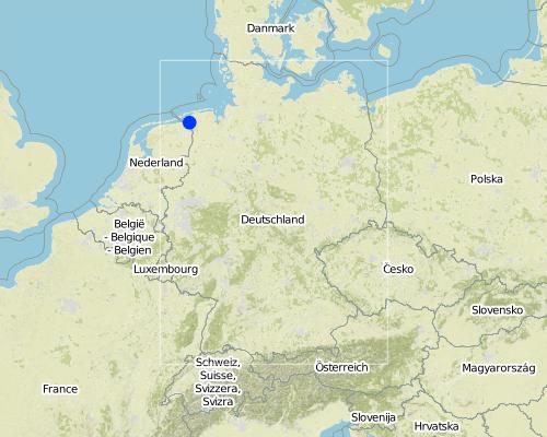
Germany, Lower Saxony
ຂໍ້ມູນເພີ່ມເຕີມຂອງສະຖານທີ່:
Landkreis Aurich
Map
×2.6 ວັນທີໃນການຈັດຕັ້ງປະຕິບັດ
ຖ້າຫາກວ່າ ບໍ່ຮູ້ຈັກ ປີທີ່ຊັດເຈນ ແມ່ນໃຫ້ປະມານ ວັນທີເອົາ:
- ຫຼາຍກ່ອນ 50 ປີຜ່ານມາ (ແບບພື້ນບ້ານ)
2.7 ການນໍາສະເໜີ ເຕັກໂນໂລຢີ
ໃຫ້ລະບຸ ເຕັກໂນໂລຢີ ໄດ້ຖືກຈັດຕັ້ງປະຕິບັດຄືແນວໃດ?
- ເປັນສ່ວນໜື່ງຂອງລະບົບພື້ນເມືອງ (>50 ປີ)
ຄວາມຄິດເຫັນ (ປະເພດ ໂຄງການ ແລະ ອື່ນໆ):
Traditional land use with dense drainage network to enable intensive agricultural land use in low elevated coastal landscapes.
3. ການໃຈ້ແຍກ ເຕັກໂນໂລຢີ ໃນການຄຸ້ມຄອງ ດິນແບບຍືນຍົງ
3.2 ປະເພດການນໍາໃຊ້ທີ່ດິນ ໃນປະຈຸບັນ() ທີ່ເຕັກໂນໂລຢີ ໄດ້ຖືກນໍາໃຊ້

ປະສົມປະສານ (ການປູກພືດ / ທົ່ງຫຍ້າລ້ຽງສັດ / ຕົ້ນໄມ້), ລວມທັງ ປ່າໄມ້ ແບບປະສົມປະສານ
- ກະສິກຳ-ທົ່ງຫຍ້າ
ຜະລິດຕະພັນຫຼັກ / ບໍລິການ:
Major cash crop annual cropping: Corn
Major food crop annual cropping: Wheat, barley
Main species intensive grazing land cut-and-carry/ zero grazing: cows for milk
Main species intensive grazing land improved pasture: cattle for milk and meat
ຄວາມຄິດເຫັນ:
Major land use problems (compiler’s opinion): Flood events and droughts may substantially disrupt the current land use system in the future and lead to higher drainage costs and higher economic risks for agricultural production. This will reduce the ecological and economic viability of the current intensive and highly productive land use under a changing climate.
Major land use problems (land users’ perception): There is no awareness of risks due to climate change.
ຖ້າຫາກວ່າ ການນໍາໃຊ້ທີ່ດິນ ມີການປ່ຽນແປງ ໃນເວລາ ຈັດຕັ້ງປະຕິບັດ ເຕັກໂນໂລຢີ, ແມ່ນໃຫ້ລະບຸວ່າ ດິນພື້ນທີ່ດັ່ງກ່າວ ເຄີຍເປັນດິນປະເພດໃດ ກ່ອນການຈັດຕັ້ງປະຕິບັດ ເຕັກໂນໂລຢີ:
Mixed: Mp: Agro-pastoralism
3.3 ຂໍ້ມູນເພີ່ມເຕີມກ່ຽວກັບການນໍາໃຊ້ທີ່ດິນ
ຄວາມຄິດເຫັນ:
Water supply: rainfed, mixed rainfed - irrigated
ຈໍານວນ ລະດູການ ປູກໃນປີໜຶ່ງ:
- 1
ລະບຸ ຊະນິດ:
Longest growing period in days: 240 Longest growing period from month to month: March to October
ຄວາມໜາແໜ້ນ ຂອງສັດລ້ຽງ (ຖ້າຫາກວ່າກ່ຽວຂ້ອງ):
> 100 LU /km2
3.4 ການນໍາໃຊ້ເຕັກໂນໂລຢີ ທີ່ຢູ່ໃນກຸ່ມການຄຸ້ມຄອງ ທີ່ດິນແບບຍືນຍົງ
- ຄວາມຫຼາກຫຼາຍຂອງນໍ້າ ແລະ ການລະບາຍ
- ການຄຸ້ມຄອງນໍ້າໜ້າດິນ (ນ້ຳຈາກພຸ, ແມ່ນໍ້າ, ທະເລສາບ, ທະເລ)
3.5 ການຂະຫຍາຍເຕັກໂນໂລຢີ
ຄວາມຄິດເຫັນ:
Total area covered by the SLM Technology is 33.7 m2.
3.6 ມາດຕະການ ການຄຸ້ມຄອງ ທີ່ດິນແບບຍືນຍົງ ປະກອບດ້ວຍ ເຕັກໂນໂລຢີ

ມາດຕະການໂຄງສ້າງ
- S3: ຮ່ອງ, ຄອງນໍ້າ, ທາງໄຫຼນໍ້າ
ຄວາມຄິດເຫັນ:
Main measures: structural measures
3.7 ປະເພດດິນເຊື່ອມໂຊມ ຫຼັກທີ່ໄດ້ນໍາໃຊ້ ເຕັກໂນໂລຢີ

ການເຊື່ອມໂຊມ ຂອງນໍ້າ
- Hg: ການປ່ຽນແປງ ລະດັບນ້ຳໃຕ້ດິນ ຫຼື ນ້ຳບາດານ
ຄວາມຄິດເຫັນ:
Main type of degradation addressed: Hg: change in groundwater / aquifer level
Main causes of degradation: change of seasonal rainfall (Climate change, higher rainfall in winter, lower in summer), Heavy / extreme rainfall (intensity/amounts) (Heavy rainfall in winter due to climate change expected), floods (Flooding due to heavy rainfall in winter)
Secondary causes of degradation: droughts (Droughts due to less rainfall in summer (climate change))
4. ຂໍ້ກໍາໜົດ, ກິດຈະກໍາການປະຕິບັດ, ວັດຖຸດິບ, ແລະຄ່າໃຊ້ຈ່າຍ
4.1 ເຕັກນິກ ໃນການແຕ້ມແຜນວາດ ເຕັກໂນໂລຢີ
4.2 ການແຕ້ມແຜນວາດອະທິບາຍເຕັກນິກ
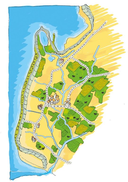
The figure shows the study region, located on the North Sea coast. The whole area is protected by a sea wall (grey). Crop fields (yellow), grasslands (green) and the drainage system (light blue) characterize the region. The traditional dense drainage network sometimes lacks the capacity to drain the lower land. This leads to flooding and limits agricultural productivity. It is expected that this flooding will increase with climate change. Agricultural production is faced with increased risks of crop failure in the future, unless the drainage system is strengthened.
Location: Krummhörn. County of Aurich, Lower Saxony
Technical knowledge required for land users: moderate
Main technical functions: decrease groundwater level by artificial drainage
Construction material (earth): digged in soil, no specific material needed
4.3 ຂໍ້ມູນທົ່ວໄປກ່ຽວກັບການຄິດໄລ່ປັດໃຈຂາເຂົ້າໃນການຜະລິດ ແລະ ມູນຄ່າອື່ນໆ
ສະກຸນເງິນອື່ນໆ / ປະເທດອື່ນໆ (ລະບຸ):
EURO
ລະບຸ ອັດຕາແລກປ່ຽນ ຈາກໂດລາ ເປັນເງິນຕາທ້ອງຖີ່ນ (ຖ້າກ່ຽວຂ້ອງ): 1 ໂດລາ =:
0.94
ລະບຸ ຄ່າຈ້າງ ຄ່າແຮງງານສະເລ່ຍ ຕໍ່ ວັນ:
100.00
4.5 ຕົ້ນທຶນ ແລະ ປັດໄຈຂາເຂົ້າທີ່ຈໍາເປັນໃນຈັດຕັ້ງປະຕິບັດ
ຄວາມຄິດເຫັນ:
Duration of establishment phase: 3 month(s)
4.6 ບໍາລຸງຮັກສາ / ແຜນຈັດຕັ້ງປະຕິບັດ ກິດຈະກໍາ
| ກິດຈະກໍາ | ປະເພດ ມາດຕະການ | ໄລຍະເວລາ / ຄວາມຖີ່ | |
|---|---|---|---|
| 1. | Maintenance of drainage system (ditches) | ໂຄງສ້າງ | once per year |
4.7 ຄ່າໃຊ້ຈ່າຍ ແລະ ປັດໄຈນໍາເຂົ້າທີ່ຈໍາເປັນສໍາລັບການບໍາລຸງຮັກສາກິດຈະກໍາ / ແຜນປະຕິບັດ (ຕໍ່ປີ)
| ລະບຸ ປັດໃຈ ນໍາເຂົ້າ ໃນການຜະລີດ | ຫົວໜ່ວຍ | ປະລິມານ | ຕົ້ນທຶນ ຕໍ່ຫົວໜ່ວຍ | ຕົ້ນທຶນທັງໝົດ ຂອງປັດໃຈຂາເຂົ້າ ໃນການຜະລິດ | % ຂອງຕົ້ນທຶນທັງໝົດ ທີ່ຜູ້ນໍາໃຊ້ທີ່ດິນ ໃຊ້ຈ່າຍເອງ | |
|---|---|---|---|---|---|---|
| ອື່ນໆ | Maintenance cost pre km ditch | km ditch | 2270.7 |
4.8 ປັດໄຈ ທີ່ສໍາຄັນ ທີ່ສົ່ງຜົນກະທົບ ຕໍ່ຄ່າໃຊ້ຈ່າຍ
ໃຫ້ອະທິບາຍ ປັດໃຈ ທີ່ສົ່ງຜົນກະທົບ ຕໍ່ຕົ້ນທຶນ ໃນການຈັດຕັ້ງປະຕິບັດ:
Cost are affected by soil types and cost of labour. The calculation is based on the mean costs over many years. This gives a mean annual cost of Euro 2,270 per km ditch per year. With 1,145 km of ditches this totals Euro 2,600,000 per year for the whole area (approx. 49,000 ha).
5. ສະພາບແວດລ້ອມທໍາມະຊາດ ແລະ ມະນຸດ
5.1 ອາກາດ
ປະລິມານນໍ້າຝົນປະຈໍາປີ
- < 250 ມີລິແມັດ
- 251-500 ມີລິແມັດ
- 501-750 ມີລິແມັດ
- 751-1,000 ມີລິແມັດ
- 1,001-1,500 ມີລິແມັດ
- 1,501-2,000 ມີລິແມັດ
- 2,001-3,000 ມີລິແມັດ
- 3,001-4,000 ມີລິແມັດ
- > 4,000 ມີລິແມັດ
ເຂດສະພາບອາກາດກະສິກໍາ
- ຄວາມຊຸ່ມ
Thermal climate class: temperate
5.2 ພູມິປະເທດ
ຄ່າສະເລ່ຍ ຄວາມຄ້ອຍຊັນ:
- ພື້ນທີ່ຮາບພຽງ (0-2%)
- ອ່ອນ (3-5 %)
- ປານກາງ (6-10 %)
- ມ້ວນ (11-15 %)
- ເນີນ(16-30%)
- ໍຊັນ (31-60%)
- ຊັນຫຼາຍ (>60%)
ຮູບແບບຂອງດິນ:
- ພູພຽງ / ທົ່ງພຽງ
- ສັນພູ
- ເປີ້ນພູ
- ເນີນພູ
- ຕີນພູ
- ຮ່ອມພູ
ເຂດລະດັບສູງ:
- 0-100 ແມັດ a.s.l.
- 101-500 ແມັດ a.s.l.
- 501-1,000 ແມັດ a.s.l.
- 1,001-1,500 ແມັດ a.s.l.
- 1,501-2,000 ແມັດ a.s.l.
- 2,001-2,500 ແມັດ a.s.l.
- 2,501-3,000 ແມັດ a.s.l.
- 3,001-4,000 ແມັດ a.s.l.
- > 4,000 ແມັດ a.s.l.
5.3 ດິນ
ຄວາມເລິກ ຂອງດິນສະເລ່ຍ:
- ຕື້ນຫຼາຍ (0-20 ຊັງຕີແມັດ)
- ຕື້ນ (21-50 ຊຕມ)
- ເລີກປານກາງ (51-80 ຊຕມ)
- ເລິກ (81-120 ຊມ)
- ເລິກຫຼາຍ (> 120 cm)
ເນື້ອດິນ (ໜ້າດິນ):
- ບາງລະອຽດ / ໜັກ (ໜຽວ)
ຊັ້ນອິນຊີວັດຖຸ ເທິງໜ້າດິນ:
- ສູງ (> 3 %)
ຖ້າເປັນໄປໄດ້ ແມ່ນໃຫ້ຕິດຄັດ ການພັນລະນາດິນ ຫຼື ຂໍ້ມູນສະເພາະຂອງດິນ, ຕົວຢ່າງ, ຄຸນລັກສະນະ ປະເພດຂອງດິນ, ຄ່າຄວາມເປັນກົດ / ເປັນດ່າງຂອງດິນ, ສານອາຫານ, ດິນເຄັມ ແລະ ອື່ນໆ.
Soil fertility is high
Soil drainage/infiltration is medium
Soil water storage capacity is high
5.4 ມີນໍ້າ ແລະ ຄຸນນະພາບ
ລະດັບ ນໍ້າໃຕ້ດິນ:
< 5 ແມັດ
ການມີນໍ້າ ເທິງໜ້າດິນ:
ດີ
ຄຸນນະພາບນໍ້າ (ບໍ່ມີການບໍາບັດ):
ນຳໃຊ້ເຂົ້າໃນການຜະລິດກະສິກໍາພຽງຢ່າງດຽງ (ຊົນລະປະທານ)
5.5 ຊີວະນາໆພັນ
ຄວາມຫຼາກຫຼາຍ ທາງສາຍພັນ:
- ຕໍ່າ
5.6 ຄຸນລັກສະນະ ຂອງຜູ້ນໍາໃຊ້ທີ່ດິນ ທີ່ໄດ້ນໍາໃຊ້ເຕັກໂນໂລຢີ
ລະບົບ ການຕະຫຼາດ ແລະ ຜົນຜະລິດ:
- ການຄ້າ / ຕະຫຼາດ
ລາຍຮັບ ທີ່ບໍ່ໄດ້ມາຈາກ ການຜະລິດ ກະສິກໍາ:
- 10-50 % ຂອງລາຍຮັບທັງໝົດ
ລະດັບຄວາມຮັ່ງມີ:
- ສະເລ່ຍ
ບຸກຄົນ ຫຼື ກຸ່ມ:
- ການຈ້າງງານ (ບໍລິສັດ, ອົງການ ລັດຖະບານ)
ລະດັບ ການຫັນເປັນກົນຈັກ:
- ເຄື່ອງກົນຈັກ
ເພດ:
- ຜູ້ຍິງ
- ຜູ້ຊາຍ
ໃຫ້ລະບຸ ຄຸນລັກສະນະ ຂອງຜູ້ນໍາໃຊ້ທີ່ດິນ:
Land users applying the Technology are mainly common / average land users
Population density: 50-100 persons/km2
Annual population growth: < 0.5%
1% of the land users are very rich and own 1% of the land.
49% of the land users are rich and own 24% of the land.
50% of the land users are average wealthy and own 50% of the land.
and own 15% of the land.
Off-farm income specification: Many farmers do additional work in companies
5.7 ພື້ນທີ່ສະເລ່ຍຂອງທີ່ດິນ ຫຼື ເຊົ່າໂດຍຜູ້ໃຊ້ທີ່ດິນການນໍາໃຊ້ ເຕັກໂນໂລຢີ
- <0.5 ເຮັກຕາ
- 0.5-1 ເຮັກຕາ
- 1-2 ເຮັກຕາ
- 2-5 ເຮັກຕາ
- 5-15 ເຮັກຕາ
- 15-50 ເຮັກຕາ
- 50-100 ເຮັກຕາ
- 100-500 ເຮັກຕາ
- 500-1,000 ເຮັກຕາ
- 1,000-10,000 ເຮັກຕາ
- > 10,000 ເຮັກຕາ
ຖືໄດ້ວ່າ ເປັນຂະໜາດນ້ອຍ, ກາງ ຫຼື ໃຫຍ່ (ອີງຕາມເງື່ອນໄຂ ສະພາບຄວາມເປັນຈິງ ຂອງທ້ອງຖີ່ນ)? :
- ຂະໜາດໃຫຍ່
ຄວາມຄິດເຫັນ:
Average area of land owned or leased by land users applying the Technology: 5-15 ha, 15-50 ha, 50-100 ha, 100-500 ha
5.8 ເຈົ້າຂອງທີ່ດິນ, ສິດໃຊ້ທີ່ດິນ, ແລະ ສິດທິການນໍາໃຊ້ນໍ້າ
ເຈົ້າຂອງດິນ:
- ບຸກຄົນ, ບໍ່ມີຕໍາແໜ່ງ
ສິດທິ ໃນການນໍາໃຊ້ທີ່ດິນ:
- ບຸກຄົນ
5.9 ການເຂົ້າເຖິງການບໍລິການ ແລະ ພື້ນຖານໂຄງລ່າງ
ສຸຂະພາບ:
- ທຸກຍາກ
- ປານກາງ
- ດີ
ການສຶກສາ:
- ທຸກຍາກ
- ປານກາງ
- ດີ
ການຊ່ວຍເຫຼືອ ດ້ານວິຊາການ:
- ທຸກຍາກ
- ປານກາງ
- ດີ
ການຈ້າງງານ (ຕົວຢ່າງ, ການເຮັດກິດຈະກໍາອື່ນ ທີ່ບໍ່ແມ່ນ ການຜະລິດກະສິກໍາ):
- ທຸກຍາກ
- ປານກາງ
- ດີ
ຕະຫຼາດ:
- ທຸກຍາກ
- ປານກາງ
- ດີ
ພະລັງງານ:
- ທຸກຍາກ
- ປານກາງ
- ດີ
ຖະໜົນຫົນທາງ ແລະ ການຂົນສົ່ງ:
- ທຸກຍາກ
- ປານກາງ
- ດີ
ການດື່ມນໍ້າ ແລະ ສຸຂາພິບານ:
- ທຸກຍາກ
- ປານກາງ
- ດີ
ການບໍລິການ ທາງດ້ານການເງິນ:
- ທຸກຍາກ
- ປານກາງ
- ດີ
6. ຜົນກະທົບ ແລະ ລາຍງານສະຫຼຸບ
6.1 ການສະແດງຜົນກະທົບ ພາຍໃນພື້ນທີ່ ທີ່ໄດ້ຈັດຕັ້ງປະຕິບັດ ເຕັກໂນໂລຢີ
ຜົນກະທົບທາງເສດຖະກິດສັງຄົມ
ການຜະລິດ
ການຜະລິດພືດ
ການຜະລິດອາຫານສັດ
ຄຸນນະພາບຂອງອາຫານສັດ
ຄວາມສ່ຽງ ຕໍ່ຜົນຜະລິດ
ເນື້ອທີ່ການຜະລິດ
ມີນໍ້າ ແລະ ຄຸນນະພາບ
ມີນໍ້າດື່ມ
ມີນໍ້າຊົນລະປະທານ
ລາຍໄດ້ ແລະ ຄ່າໃຊ້ຈ່າຍ
ລາຍຮັບ ຈາກການຜະລີດ
ຜົນກະທົບດ້ານວັດທະນາທໍາສັງຄົມ
ໂອກາດ ໃນການພັກຜ່ອນຢ່ອນໃຈ
ຜົນກະທົບຕໍ່ລະບົບນິເວດ
ວົງຈອນນໍ້າ / ນໍ້າ
ປະລິມານນໍ້າ
ຄຸນນະພາບນໍ້າ
ການໄຫຼ ຂອງນໍ້າໜ້າດິນ
ຊັ້ນນໍ້າໄຕ້ດິນ / ນໍ້າ
ດິນ
ດິນເຄັມ
ອິນຊີວັດຖຸໃນດິນ / ຢູ່ລຸ່ມຊັ້ນດິນ C
ຊີວະນານາພັນ: ສັດ, ພືດ
ຄວາມຫຼາກຫຼາຍຂອງພືດ
ຄວາມຄິດເຫັນ / ລະບຸແຈ້ງ:
Reduced crop diversity
ຄວາມຫຼາກຫຼາຍ ທາງດ້ານທີ່ຢູ່ອາໃສ ຂອງສິ່ງທີ່ມີຊີວິດ
ຄວາມຄິດເຫັນ / ລະບຸແຈ້ງ:
Increased habitat fragmentation
6.2 ຜົນກະທົບທາງອ້ອມ ຈາກການນໍາໃຊ້ເຕັກໂນໂລຢີ
ນໍ້າຖ້ວມຢູ່ເຂດລຸ່ມນໍ້າ
ພື້ນທີ່ທໍາການຜະລິດ ຂອງເພື່ອນບ້ານທີ່ຢູ່ໃກ້ຄຽງ ໄດ້ຮັບຜົນກະທົບ
ຄວາມເສຍຫາຍ ກ່ຽວກັບພື້ນຖານໂຄງລ່າງ ສາທາລະນະ / ເອກກະຊົນ
Excess water
Hazard towards adverse events
6.3 ການປ້ອງກັນ ແລະ ຄວາມບອບບາງ ຂອງເຕັກໂນໂລຢິ ໃນການປ່ຽນແປງສະພາບດິນຟ້າອາກາດ ແລະ ກ່ຽວຂ້ອງກັບອາກາດທີ່ມີການປ່ຽນແປງທີ່ຮຸນແຮງ / ໄພພິບັດທາງທໍາມະຊາດ (ຮັບຮູ້ໄດ້ໂດຍຜູ້ນໍາໃຊ້ທີ່ດິນ)
ການປ່ຽນແປງດິນຟ້າອາກາດ ເທື່ອລະກ້າວ
ການປ່ຽນແປງດິນຟ້າອາກາດ ເທື່ອລະກ້າວ
| ລະດູການ | ຮູບແບບ ການປ່ຽນແປງດິນຟ້າອາກາດ / ທີ່ຮ້າຍແຮງ | ການນໍາໃຊ້ ເຕັກໂນໂລຢີ ສາມາດ ຮັບມື ໄດ້ຄືແນວໃດ? | |
|---|---|---|---|
| ອຸນຫະພູມປະຈໍາປີ | ເພີ່ມຂື້ນ | ດີ |
ອາກາດ ທີ່ກ່ຽວພັນກັບຄວາມຮຸນແຮງ (ໄພພິບັດທາງທໍາມະຊາດ)
ໄພພິບັດທາງອຸຕຸນິຍົມ
| ການນໍາໃຊ້ ເຕັກໂນໂລຢີ ສາມາດ ຮັບມື ໄດ້ຄືແນວໃດ? | |
|---|---|
| ພະຍຸຝົນ | ບໍ່ດີ |
| ພາຍຸລົມທ້ອງຖິ່ນ | ບໍ່ດີ |
ໄພພິບັດທາງພູມອາກາດ
| ການນໍາໃຊ້ ເຕັກໂນໂລຢີ ສາມາດ ຮັບມື ໄດ້ຄືແນວໃດ? | |
|---|---|
| ແຫ້ງແລ້ງ | ດີ |
ໄພພິບັດທາງອຸທົກກະສາກ
| ການນໍາໃຊ້ ເຕັກໂນໂລຢີ ສາມາດ ຮັບມື ໄດ້ຄືແນວໃດ? | |
|---|---|
| ໂດຍທົ່ວໄປ (ແມ່ນໍ້າ) ນໍ້າຖ້ວມ | ບໍ່ດີ |
ຜົນສະທ້ອນສະພາບອາກາດອື່ນໆທີ່ກ່ຽວຂ້ອງ
ຜົນສະທ້ອນສະພາບອາກາດອື່ນໆທີ່ກ່ຽວຂ້ອງ
| ການນໍາໃຊ້ ເຕັກໂນໂລຢີ ສາມາດ ຮັບມື ໄດ້ຄືແນວໃດ? | |
|---|---|
| ໄລຍະເວລາການຂະຫຍາຍຕົວຫຼຸດລົງ | ບໍ່ຮູ້ |
| climate change | ບໍ່ດີ |
6.4 ການວິເຄາະຕົ້ນທຶນ ແລະ ຜົນປະໂຫຍດ
ຈະເຮັດປະໂຫຍດເພື່ອປຽບທຽບກັບຄ່າໃຊ້ຈ່າຍກັບສິ່ງກໍ່ສ້າງ (ຈາກທັດສະນະຂອງຜູ້ນຳໃຊ້ທີ່ດິນ) ໄດ້ແນວໃດ?
ຜົນຕອບແທນ ໃນໄລຍະສັ້ນ:
ຜົນກະທົບທາງລົບຫຼາຍ
ຜົນຕອບແທນ ໃນໄລຍະຍາວ:
ຜົນກະທົບທາງບວກ
ຈະໄດ້ຮັບຜົນປະໂຫຍດເມື່ອປຽບທຽບກັບ / ຄ່າໃຊ້ຈ່າຍໃນການບຳລຸງຮັກສາທີເ່ກີດຂື້ນອິກ (ຈາກທັດສະນະຄະຕິຂອງຜູ້ນຳໃຊ້ທີ່ດິນ) ໄດ້ແນວໃດ?
ຜົນຕອບແທນ ໃນໄລຍະສັ້ນ:
ຜົນກະທົບທາງບວກ
ຜົນຕອບແທນ ໃນໄລຍະຍາວ:
ຜົນກະທົບທາງບວກຫຼາຍ
ຄວາມຄິດເຫັນ:
Development of dense drainage network is very cost intensive but last for very long time. Maintainance cost are quite low compared to the benefits of intensive land use.
6.5 ການປັບຕົວຮັບເອົາເຕັກໂນໂລຢີ
ທັງໝົດນັ້ນ ແມ່ນໃຜ ທີ່ເປັນຜູ້ປັບຕົວ ໃນການນໍາໃຊ້ ເຕັກໂນໂລຢີ, ມີຈັກຄົນ ທີ່ສາມາດເຮັດເອງໄດ້, ຕົວຢ່າງ, ປາດສະຈາກ ການຊ່ວຍເຫຼືອ ທາງດ້ານອຸປະກອນ / ການຈ່າຍເປັນເງິນ?
- 90-100%
ຄວາມຄິດເຫັນ:
100% of land user families have adopted the Technology without any external material support
Comments on spontaneous adoption: Well established technology in the whole region.
6.7 ຈຸດແຂງ / ຂໍ້ດີ / ໂອກາດ ໃນການນໍາໃຊ້ ເຕັກໂນໂລຢີ
| ຈຸດແຂງ / ຂໍ້ດີ / ໂອກາດໃນການນໍາໃຊ້ທີ່ດິນ |
|---|
|
Optimal for agricultural production How can they be sustained / enhanced? Invest in infrastructure to maintain the system |
| ຈຸດແຂງ / ຈຸດດີ / ໂອກາດ ຈາກທັດສະນະຂອງຜູ້ປ້ອນຂໍ້ມູນ ຫຼື ບຸກຄົນສຳຄັນ |
|---|
|
High agricultural production How can they be sustained / enhanced? Strengthen the drainage system to adapt to climate change |
6.8 ຈຸດອ່ອນ / ຂໍ້ເສຍ / ຄວາມສ່ຽງ ໃນການນໍາໃຊ້ ເຕັກໂນໂລຢີ ແລະ ວິທີການແກ້ໄຂບັນຫາ
| ຈຸດອ່ອນ/ຂໍ້ບົກຜ່ອງ/ຄວາມສ່ຽງ ຈາກທັດສະນະຂອງຜູ້ປ້ອນຂໍ້ມູນ ຫຼື ບຸກຄົນສຳຄັນ | ມີວິທີການແກ້ໄຂຄືແນວໃດ? |
|---|---|
| High drainage costs | Development of water retention areas ( see A_GER001_en, A_GER002_en and A_GER003_en) |
| Landscape vulnerable to climate change | Development of water retention areas (see A_GER001_en, A_GER002_en and A_GER003_en) |
7. ເອກະສານອ້າງອີງ ແລະ ການເຊື່ອມຕໍ່
7.2 ເອກກະສານອ້າງອີງທີ່ເປັນບົດລາຍງານ
ຫົວຂໍ້, ຜູ້ຂຽນ, ປີ, ISBN:
http://www.comtess.uni-oldenburg.de/
7.3 ສາມາດເຊື່ອມໂຍງ ຂໍ້ມູນຂ່າວສານ ໄດ້ໂດຍຜ່ານການອອນລາຍ
ຫົວຂໍ້ / ພັນລະນາ:
http://www.comtess.uni-oldenburg.de/
ຂໍ້ມູນການເຊື່ອມຕໍ່ ແລະ ເນື້ອໃນ
ຂະຫຍາຍທັງໝົດ ຍຸບທັງໝົດການເຊື່ອມຕໍ່
ບໍ່ມີຂໍ້ມູນການເຊື່ອມຕໍ່
ເນື້ອໃນ
ບໍ່ມີເນື້ອໃນ


