Ex-post and ex-ante soil sealing maps [ໂປແລນ]
- ການສ້າງ:
- ປັບປູງ:
- ຜູ້ສັງລວມຂໍ້ມູນ: Tomasz Miturski
- ບັນນາທິການ: –
- ຜູ້ທົບທວນຄືນ: Fabian Ottiger, Alexandra Gavilano
Mapy procesu zasklepiania gleb (Polish)
technologies_1716 - ໂປແລນ
ເບິ່ງພາກສ່ວນ
ຂະຫຍາຍທັງໝົດ ຍຸບທັງໝົດ1. ຂໍ້ມູນທົ່ວໄປ
1.2 ຂໍ້ມູນ ການຕິດຕໍ່ພົວພັນ ຂອງບຸກຄົນທີ່ສໍາຄັນ ແລະ ສະຖາບັນ ທີ່ມີສ່ວນຮ່ວມ ໃນການປະເມີນເອກກະສານ ເຕັກໂນໂລຢີ
ຊື່ໂຄງການ ທີ່ອໍານວຍຄວາມສະດວກ ໃນການສ້າງເອກກະສານ/ປະເມີນ ເຕັກໂນໂລຢີ (ຖ້າກ່ຽວຂ້ອງ)
Preventing and Remediating degradation of soils in Europe through Land Care (EU-RECARE )ຊື່ສະຖາບັນ (ຫຼາຍສະຖາບັນ) ທີ່ອໍານວຍຄວາມສະດວກ ໃນການສ້າງເອກກະສານ / ປະເມີນ ເຕັກໂນໂລຢີ (ຖ້າກ່ຽວຂ້ອງ)
Institute of Soil Science and Plant Cultivation (Institute of Soil Science and Plant Cultivation) - ໂປແລນ1.3 ເງື່ອນໄຂ ກ່ຽວກັບ ການນໍາໃຊ້ຂໍ້ມູນເອກະສານ ທີ່ສ້າງຂື້ນ ໂດຍຜ່ານ ອົງການພາບລວມຂອງໂລກ ທາງດ້ານແນວທາງ ແລະ ເຕັກໂນໂລຢີ ຂອງການອານຸລັກ ທໍາມະຊາດ (WOCAT)
ຜູ້ປ້ອນຂໍ້ມູນ ແລະ ບຸກຄົນສຳຄັນ ທີ່ໃຫ້ຂໍ້ມູນ (ຫຼາຍ) ຍິນຍອມ ຕາມເງື່ອນໄຂ ໃນການນຳໃຊ້ຂໍ້ມູນ ເພື່ອສ້າງເປັນເອກກະສານຂອງ WOCAT:
ແມ່ນ
1.4 ແຈ້ງການວ່າ ດ້ວຍຄວາມຍືນຍົງຂອງ ເຕັກໂນໂລຢີ
ການນໍາໃຊ້ ເຕັກໂນໂລຢີ ດັ່ງກ່າວໄດ້ອະທິບາຍ ເຖິງບັນຫາ ກ່ຽວກັບ ການເຊື່ອມໂຊມຂອງດິນບໍ? ຖ້າບໍ່ດັ່ງນັ້ນ ມັນບໍ່ສາມາດ ຢັ້ງຢືນໄດ້ວ່າ ເປັນເຕັກໂນໂລຊີ ໃນການຄຸ້ມຄອງ ທີ່ດິນແບບຍືນຍົງ? :
ບໍ່ແມ່ນ
1.5 ແບບສອບຖາມທີ່ອ້າງອີງເຖີງແນວທາງ ການຄຸ້ມຄອງທີ່ດິນແບບຍືນຍົງ (ໄດ້ເຮັດເປັນເອກະສານທີ່ໃຊ້ WOCAT)

The prevention of soil sealing [ໂປແລນ]
The prevention of soil sealing is an approach in which stakeholders are making spatial planning decisions based on the new map of soil sealing, in case of protecting the most valuable soils.
- ຜູ້ສັງລວມຂໍ້ມູນ: Tomasz Miturski
2. ການອະທິບາຍ ເຕັກໂນໂລຢີ ຂອງການຄຸ້ມຄອງ ທີ່ດິນແບບຍືນຍົງ
2.1 ຄໍາອະທິບາຍສັ້ນຂອງ ເຕັກໂນໂລຢີ
ການກຳໜົດຄວາມໝາຍ ຂອງເຕັກໂນໂລຢີ:
Ex-post and ex-ante soil sealing maps
2.2 ການອະທິບາຍ ລາຍລະອຽດ ຂອງເຕັກໂນໂລຢີ
ການພັນລະນາ:
The technology utilizes soil agricultural maps and provides information on quality of sealed soils.
It involves cellular automata software to build the model of land use change and produce the forecasts for various soil protection scenarios.
Spatial development of the functional areas. These are mostly areas of soil protection for food production purposes. The delineation is based on land productivity information (present on soil-agricultural maps), distribution of high nature value areas, need for establishment of “green rings” around the bigger cities.
The maps will be sent to the municipal authorities, with a scientific comment on the problem. The technology enables determining the scale of the soil sealing threat in the province, also what is the soil quality class of the area of interest. In the municipalities with the greatest soil sealing problem and with perspective to expand in the future, there is a need for new legal regulations to force soil protection in local spatial plans. The regional spatial planning office should become a coordinator for the local spatial planning offices, to raise the knowledge about how to use soil digital maps in spatial planning, especially in the case of protecting the soil against soil sealing process. For the municipalities, large scale maps are produced, which contain results of soil sealing forecasting model.
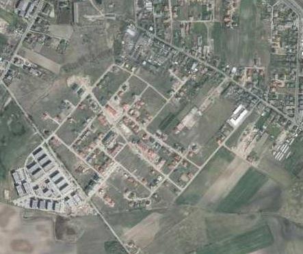
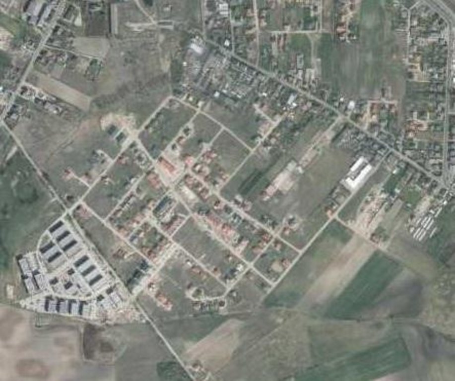
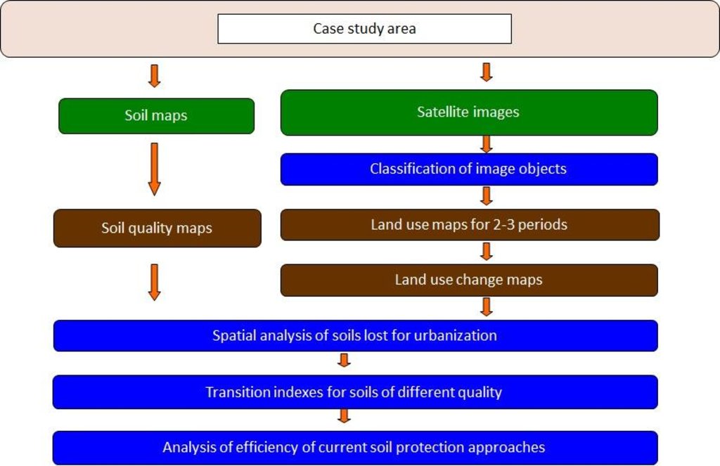
Land use maps of at least 10-meter resolution are produced for two historical periods through classification of the satellite images and using available local land use information. The information on land use change is superimposed on maps characterizing soil quality in order to detect to what extend the urbanization took place on valuable soils. The new sealed area, reflecting the built up sprawl of at least last 15 years, consists with expansion of the following land use classes: continuous residential area, commercial/industrial area and transport facilities. The soils under these new land use types fully lost their environmental functions.
In the soil sealing forecasts the Cellular Automata-based Metronamica model is used. The software was developed and provided by the Research Institute from Knowledge Systems (RIKS) from Maastricht, The Netherlands. The software utilizes cellular automata model to spatially distribute areas of particular land use classes with assumption that the neighborhood of a cell (surrounding cells) influences the transition of this cell into other land use class in the next time step. The method utilizes land use maps and soil quality maps.
2.3 ຮູບພາບຂອງເຕັກໂນໂລຢີ
2.5 ປະເທດ / ເຂດ / ສະຖານທີ່ບ່ອນທີ່ ເຕັກໂນໂລຢີ ໄດ້ຮັບການນໍາໃຊ້ ແລະ ທີ່ຖືກປົກຄຸມດ້ວຍການປະເມີນຜົນ
ປະເທດ:
ໂປແລນ
ພາກພື້ນ / ລັດ / ແຂວງ:
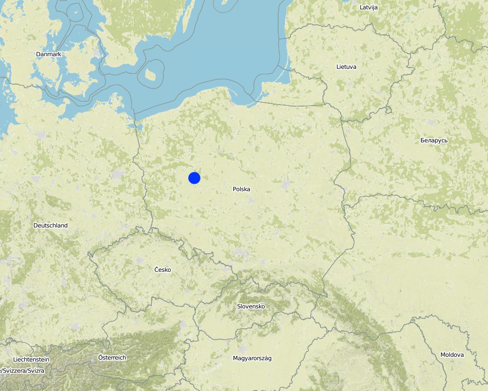
Poland/Great Poland province
ຂໍ້ມູນເພີ່ມເຕີມຂອງສະຖານທີ່:
Poznań
ໃຫ້ລະບຸ ການແຜ່ຂະຫຍາຍ ເຕັກໂນໂລຢີ:
- ແຜ່ຂະຫຍາຍຢ່າງໄວວາໃນພື້ນທີ່
ຖ້າຫາກວ່າເຕັກໂນໂລຢີ ໄດ້ກະຈາຍໄປທົ່ວພື້ນທີ່, ໃຫ້ລະບຸເນື້ອທີ່ ທີ່ຖືກປົກຄຸມ (ເປັນ ກິໂລຕາແມັດ):
199.0
ຖ້າຫາກບໍ່ຮູ້ເນື້ອທີ່ທີ່ແນ່ນອນ, ໃຫ້ລະບຸ ເນື້ອທີ່ໂດຍປະມານ ທີ່ໃກ້ຄຽງ:
- 100-1,000 ກມ 2
ຄວາມຄິດເຫັນ:
Total area covered by the SLM Technology is 199 km2.
Map
×2.6 ວັນທີໃນການຈັດຕັ້ງປະຕິບັດ
ຖ້າຫາກວ່າ ບໍ່ຮູ້ຈັກ ປີທີ່ຊັດເຈນ ແມ່ນໃຫ້ປະມານ ວັນທີເອົາ:
- ຕໍ່າກວ່າ 10 ປີ ຜ່ານມາ (ມາເຖິງປະຈຸບັນ)
2.7 ການນໍາສະເໜີ ເຕັກໂນໂລຢີ
ໃຫ້ລະບຸ ເຕັກໂນໂລຢີ ໄດ້ຖືກຈັດຕັ້ງປະຕິບັດຄືແນວໃດ?
- ໃນໄລຍະການທົດລອງ / ການຄົ້ນຄວ້າ
- ໂດຍຜ່ານໂຄງການ / ການຊ່ວຍເຫຼືອຈາກພາຍນອກ
3. ການໃຈ້ແຍກ ເຕັກໂນໂລຢີ ໃນການຄຸ້ມຄອງ ດິນແບບຍືນຍົງ
3.1 ຈຸດປະສົງຫຼັກ (ຫຼາຍ) ຂອງເຕັກໂນໂລຢີ
- ສ້າງຜົນກະທົບ ທາງເສດຖະກິດ ທີ່ເປັນປະໂຫຍດ
- ສ້າງຜົນກະທົບ ທີ່ເປັນທາງບວກ ໃຫ້ແກ່ສັງຄົມ
- Create and spread knowledge
3.2 ປະເພດການນໍາໃຊ້ທີ່ດິນ ໃນປະຈຸບັນ() ທີ່ເຕັກໂນໂລຢີ ໄດ້ຖືກນໍາໃຊ້

ດິນທີ່ປູກພືດ
- ການປູກພືດປະຈໍາປີ
ຈໍານວນ ລະດູການ ປູກໃນປີໜຶ່ງ:
- 1
ລະບຸ ຊະນິດ:
Longest growing period in days: 215, Longest growing period from month to month: April - October

ທົ່ງຫຍ້າລ້ຽງສັດ
ຄວາມຄິດເຫັນ:
Major land use problems (compiler’s opinion): Preferential sealing of most productive soils.
3.5 ການນໍາໃຊ້ເຕັກໂນໂລຢີ ທີ່ຢູ່ໃນກຸ່ມການຄຸ້ມຄອງ ທີ່ດິນແບບຍືນຍົງ
- ຫຼຸດຜ່ອນຄວາມສ່ຽງ ທາງໄພພິບັດ ບົນພື້ນຖານລະບົບນິເວດ
- Creating and sharing knowledge
3.6 ມາດຕະການ ການຄຸ້ມຄອງ ທີ່ດິນແບບຍືນຍົງ ປະກອບດ້ວຍ ເຕັກໂນໂລຢີ

ມາດຕະການ ທາງດ້ານການຄຸ້ມຄອງ
- M2: ການປ່ຽນແປງ ການຈັດການຄຸ້ມຄອງ / ລະດັບຄວາມໜາແໜ້ນ
3.7 ປະເພດດິນເຊື່ອມໂຊມ ຫຼັກທີ່ໄດ້ນໍາໃຊ້ ເຕັກໂນໂລຢີ

ການເຊື່ອມໂຊມ ຂອງດິນ ທາງກາຍະພາບ
- Pu: ການສູນເສຍ ການທໍາງານ ຂອງຊີວະພາບຜົນຜະລິດ ເນື່ອງຈາກການກິດຈະກໍາອື່ນໆ
ຄວາມຄິດເຫັນ:
Main causes of degradation: urbanisation and infrastructure development, population pressure, governance / institutional
Secondary causes of degradation: inputs and infrastructure: (roads, markets, distribution of water points, other, …)
3.8 ການປ້ອງກັນ, ການຫຼຸດຜ່ອນ, ຫຼືການຟື້ນຟູຂອງການເຊື່ອມໂຊມຂອງດິນ
ໃຫ້ລະບຸ ເປົ້າໝາຍ ເຕັກໂນໂລຢີ ທີ່ພົວພັນ ກັບຄວາມເຊື່ອມໂຊມຂອງດິນ:
- ປ້ອງກັນການເຊື່ອມໂຊມຂອງດິນ
- ຫຼຸດຜ່ອນການເຊື່ອມໂຊມຂອງດິນ
4. ຂໍ້ກໍາໜົດ, ກິດຈະກໍາການປະຕິບັດ, ວັດຖຸດິບ, ແລະຄ່າໃຊ້ຈ່າຍ
4.1 ເຕັກນິກ ໃນການແຕ້ມແຜນວາດ ເຕັກໂນໂລຢີ
ຄຸນລັກສະນະ ຂອງເຕັກນິກ (ທີ່ກ່ຽວຂ້ອງ ກັບການແຕ້ມແຜນວາດ ທາງດ້ານເຕັກນີກ):
This is a schema for soil sealing maps developement.
Technical knowledge required for land users: moderate (Developers)
Technical knowledge required for Administration: high
Technical knowledge required for Researchers: high
Main technical functions: improvement of surface structure (crusting, sealing), increase of infiltration, spatial arrangement and diversification of land use
Secondary technical functions: improvement of water quality, buffering / filtering water
Change of land use type: Limited conversion of agricultural land into urban purposes.
Change of land use practices / intensity level: Steering new constructions to soils with less functions. Limited sealing of high quality soils.
5. ສະພາບແວດລ້ອມທໍາມະຊາດ ແລະ ມະນຸດ
5.1 ອາກາດ
ປະລິມານນໍ້າຝົນປະຈໍາປີ
- < 250 ມີລິແມັດ
- 251-500 ມີລິແມັດ
- 501-750 ມີລິແມັດ
- 751-1,000 ມີລິແມັດ
- 1,001-1,500 ມີລິແມັດ
- 1,501-2,000 ມີລິແມັດ
- 2,001-3,000 ມີລິແມັດ
- 3,001-4,000 ມີລິແມັດ
- > 4,000 ມີລິແມັດ
ເຂດສະພາບອາກາດກະສິກໍາ
- ເຄີ່ງຄວາມຊຸ່ມ
Thermal climate class: temperate
5.2 ພູມິປະເທດ
ຄ່າສະເລ່ຍ ຄວາມຄ້ອຍຊັນ:
- ພື້ນທີ່ຮາບພຽງ (0-2%)
- ອ່ອນ (3-5 %)
- ປານກາງ (6-10 %)
- ມ້ວນ (11-15 %)
- ເນີນ(16-30%)
- ໍຊັນ (31-60%)
- ຊັນຫຼາຍ (>60%)
ຮູບແບບຂອງດິນ:
- ພູພຽງ / ທົ່ງພຽງ
- ສັນພູ
- ເປີ້ນພູ
- ເນີນພູ
- ຕີນພູ
- ຮ່ອມພູ
ເຂດລະດັບສູງ:
- 0-100 ແມັດ a.s.l.
- 101-500 ແມັດ a.s.l.
- 501-1,000 ແມັດ a.s.l.
- 1,001-1,500 ແມັດ a.s.l.
- 1,501-2,000 ແມັດ a.s.l.
- 2,001-2,500 ແມັດ a.s.l.
- 2,501-3,000 ແມັດ a.s.l.
- 3,001-4,000 ແມັດ a.s.l.
- > 4,000 ແມັດ a.s.l.
ໃຫ້ລະບຸ ເຕັກໂນໂລຢີ ທີ່ໄດ້ຖືກນຳໃຊ້:
- ບໍ່ກ່ຽວຂ້ອງ
5.3 ດິນ
ຄວາມເລິກ ຂອງດິນສະເລ່ຍ:
- ຕື້ນຫຼາຍ (0-20 ຊັງຕີແມັດ)
- ຕື້ນ (21-50 ຊຕມ)
- ເລີກປານກາງ (51-80 ຊຕມ)
- ເລິກ (81-120 ຊມ)
- ເລິກຫຼາຍ (> 120 cm)
ເນື້ອດິນ (ໜ້າດິນ):
- ປານກາງ (ດິນໜຽວ, ດິນໂຄນ)
ຊັ້ນອິນຊີວັດຖຸ ເທິງໜ້າດິນ:
- ປານກາງ (1-3 %)
ຖ້າເປັນໄປໄດ້ ແມ່ນໃຫ້ຕິດຄັດ ການພັນລະນາດິນ ຫຼື ຂໍ້ມູນສະເພາະຂອງດິນ, ຕົວຢ່າງ, ຄຸນລັກສະນະ ປະເພດຂອງດິນ, ຄ່າຄວາມເປັນກົດ / ເປັນດ່າງຂອງດິນ, ສານອາຫານ, ດິນເຄັມ ແລະ ອື່ນໆ.
Soil fertility: High
Soil drainage/infiltration: Medium (ranked 1) and poor (ranked 2)
Soil water storage capacity: Medium
5.4 ມີນໍ້າ ແລະ ຄຸນນະພາບ
ລະດັບ ນໍ້າໃຕ້ດິນ:
< 5 ແມັດ
ການມີນໍ້າ ເທິງໜ້າດິນ:
ດີ
5.6 ຄຸນລັກສະນະ ຂອງຜູ້ນໍາໃຊ້ທີ່ດິນ ທີ່ໄດ້ນໍາໃຊ້ເຕັກໂນໂລຢີ
ລະບົບ ການຕະຫຼາດ ແລະ ຜົນຜະລິດ:
- ປະສົມປົນເປ( ກຸ້ມຕົນເອງ/ເປັນສິນຄ້າ)
ບຸກຄົນ ຫຼື ກຸ່ມ:
- ການຈ້າງງານ (ບໍລິສັດ, ອົງການ ລັດຖະບານ)
ໃຫ້ລະບຸ ຄຸນລັກສະນະ ຂອງຜູ້ນໍາໃຊ້ທີ່ດິນ:
Population density: > 500 persons/km2
5.7 ເນື້ອທີ່ສະເລ່ຍຂອງດິນ ທີ່ຜູ້ນຳໃຊ້ທີ່ດິນ ໃຊ້ເຮັດເຕັກໂນໂລຢີ
- <0.5 ເຮັກຕາ
- 0.5-1 ເຮັກຕາ
- 1-2 ເຮັກຕາ
- 2-5 ເຮັກຕາ
- 5-15 ເຮັກຕາ
- 15-50 ເຮັກຕາ
- 50-100 ເຮັກຕາ
- 100-500 ເຮັກຕາ
- 500-1,000 ເຮັກຕາ
- 1,000-10,000 ເຮັກຕາ
- > 10,000 ເຮັກຕາ
ຖືໄດ້ວ່າ ເປັນຂະໜາດນ້ອຍ, ກາງ ຫຼື ໃຫຍ່ (ອີງຕາມເງື່ອນໄຂ ສະພາບຄວາມເປັນຈິງ ຂອງທ້ອງຖີ່ນ)? :
- ຂະໜາດໃຫຍ່
5.8 ເຈົ້າຂອງທີ່ດິນ, ສິດໃຊ້ທີ່ດິນ, ແລະ ສິດທິການນໍາໃຊ້ນໍ້າ
ເຈົ້າຂອງດິນ:
- ບຸກຄົນ, ທີ່ມີຕໍາແໜ່ງ
ສິດທິ ໃນການນໍາໃຊ້ທີ່ດິນ:
- ບຸກຄົນ
5.9 ການເຂົ້າເຖິງການບໍລິການ ແລະ ພື້ນຖານໂຄງລ່າງ
ສຸຂະພາບ:
- ທຸກຍາກ
- ປານກາງ
- ດີ
ການສຶກສາ:
- ທຸກຍາກ
- ປານກາງ
- ດີ
ການຊ່ວຍເຫຼືອ ດ້ານວິຊາການ:
- ທຸກຍາກ
- ປານກາງ
- ດີ
ການຈ້າງງານ (ຕົວຢ່າງ, ການເຮັດກິດຈະກໍາອື່ນ ທີ່ບໍ່ແມ່ນ ການຜະລິດກະສິກໍາ):
- ທຸກຍາກ
- ປານກາງ
- ດີ
ຕະຫຼາດ:
- ທຸກຍາກ
- ປານກາງ
- ດີ
ພະລັງງານ:
- ທຸກຍາກ
- ປານກາງ
- ດີ
ຖະໜົນຫົນທາງ ແລະ ການຂົນສົ່ງ:
- ທຸກຍາກ
- ປານກາງ
- ດີ
ການດື່ມນໍ້າ ແລະ ສຸຂາພິບານ:
- ທຸກຍາກ
- ປານກາງ
- ດີ
ການບໍລິການ ທາງດ້ານການເງິນ:
- ທຸກຍາກ
- ປານກາງ
- ດີ
6. ຜົນກະທົບ ແລະ ລາຍງານສະຫຼຸບ
6.1 ການສະແດງຜົນກະທົບ ພາຍໃນພື້ນທີ່ ທີ່ໄດ້ຈັດຕັ້ງປະຕິບັດ ເຕັກໂນໂລຢີ
ຜົນກະທົບທາງເສດຖະກິດສັງຄົມ
ການຜະລິດ
ການຜະລິດອາຫານສັດ
ຄວາມຄິດເຫັນ / ລະບຸແຈ້ງ:
comparing to baseline scenario
ເນື້ອທີ່ການຜະລິດ
ຄວາມຄິດເຫັນ / ລະບຸແຈ້ງ:
comparing to baseline scenario
ມີນໍ້າ ແລະ ຄຸນນະພາບ
ມີນໍ້າຊົນລະປະທານ
ຄວາມຄິດເຫັນ / ລະບຸແຈ້ງ:
comparing to baseline scenario
ຄຸນນະພາບ ຂອງນໍ້າຊົນລະປະທານ
ຄວາມຄິດເຫັນ / ລະບຸແຈ້ງ:
comparing to baseline scenario
ຜົນກະທົບດ້ານວັດທະນາທໍາສັງຄົມ
ການຄໍ້າປະກັນ ສະບຽງອາຫານ / ກຸ້ມຢູ່ກຸ້ມກິນ
ຄວາມຄິດເຫັນ / ລະບຸແຈ້ງ:
comparing to baseline scenario
ໂອກາດ ໃນການພັກຜ່ອນຢ່ອນໃຈ
ຄວາມຄິດເຫັນ / ລະບຸແຈ້ງ:
comparing to baseline scenario
ຄວາມຮູ້ກ່ຽວກັບ ການຄຸ້ມຄອງ ທີ່ດິນແບບຍືນຍົງ / ການເຊື່ອມໂຊມຂອງດິນ
ຜົນກະທົບຕໍ່ລະບົບນິເວດ
ວົງຈອນນໍ້າ / ນໍ້າ
ການໄຫຼ ຂອງນໍ້າໜ້າດິນ
ດິນ
ການສູນເສຍດິນ
ດິນເປັນຜົງ / ການຈັບໂຕຂອງດິນ ທີ່ມີຂະໜາດນ້ອຍຫຼາຍ ທີ່ມີການຈັບໂຕກັນເປັນກ້ອນ
ການອັດແໜ້ນຂອງດິນ
ຊີວະນານາພັນ: ສັດ, ພືດ
ຄວາມຫຼາກຫຼາຍ ທາງດ້ານທີ່ຢູ່ອາໃສ ຂອງສິ່ງທີ່ມີຊີວິດ
6.2 ຜົນກະທົບທາງອ້ອມ ຈາກການນໍາໃຊ້ເຕັກໂນໂລຢີ
ສາມາດເຂົ້າເຖິງແຫຼ່ງນໍ້າ
ນໍ້າຖ້ວມຢູ່ເຂດລຸ່ມນໍ້າ
6.5 ການປັບຕົວຮັບເອົາເຕັກໂນໂລຢີ
ຄວາມຄິດເຫັນ:
There are examples of land use and soil maps for spatial planing in cities of Central Europe, e.g. Stuttgart. it is impossible to assess the percentage of users.
6.7 ຈຸດແຂງ / ຂໍ້ດີ / ໂອກາດ ໃນການນໍາໃຊ້ ເຕັກໂນໂລຢີ
| ຈຸດແຂງ / ຈຸດດີ / ໂອກາດ ຈາກທັດສະນະຂອງຜູ້ປ້ອນຂໍ້ມູນ ຫຼື ບຸກຄົນສຳຄັນ |
|---|
| Analysis of various scenarios possible |
| Decisions in spatial planning based on empirical data in spatial format |
6.8 ຈຸດອ່ອນ / ຂໍ້ເສຍ / ຄວາມສ່ຽງ ໃນການນໍາໃຊ້ ເຕັກໂນໂລຢີ ແລະ ວິທີການແກ້ໄຂບັນຫາ
| ຈຸດອ່ອນ/ຂໍ້ບົກຜ່ອງ/ຄວາມສ່ຽງ ຈາກທັດສະນະຂອງຜູ້ປ້ອນຂໍ້ມູນ ຫຼື ບຸກຄົນສຳຄັນ | ມີວິທີການແກ້ໄຂຄືແນວໃດ? |
|---|---|
| Lack of regulations forcing use of the technology | Pressenting examples of implementation in order to encourage to apply at local level strategies |
| Potential errors in forecasts | Improving the data quality and model effectiveness. |
7. ເອກະສານອ້າງອີງ ແລະ ການເຊື່ອມຕໍ່
7.1 ວິທີການ / ແຫຼ່ງຂໍ້ມູນ
- ການໄປຢ້ຽມຢາມພາກສະໜາມ, ການສໍາຫຼວດພາກສະໜາມ
- ການສໍາພາດ ຜູ້ນໍາໃຊ້ທີ່ດິນ
ເມື່ອໃດທີ່ໄດ້ສັງລວມຂໍ້ມູນ (ຢູ່ພາກສະໜາມ)?
28/02/2015
ຂໍ້ມູນການເຊື່ອມຕໍ່ ແລະ ເນື້ອໃນ
ຂະຫຍາຍທັງໝົດ ຍຸບທັງໝົດການເຊື່ອມຕໍ່

The prevention of soil sealing [ໂປແລນ]
The prevention of soil sealing is an approach in which stakeholders are making spatial planning decisions based on the new map of soil sealing, in case of protecting the most valuable soils.
- ຜູ້ສັງລວມຂໍ້ມູນ: Tomasz Miturski
ເນື້ອໃນ
ບໍ່ມີເນື້ອໃນ


