Double Basin Masonry Check Dam [ອີທິໂອເປຍ]
- ການສ້າງ:
- ປັບປູງ:
- ຜູ້ສັງລວມຂໍ້ມູນ: GERBA LETA
- ບັນນາທິການ: Torben Helbig, Noel Templer, Tabitha Nekesa, Ahmadou Gaye, Siagbé Golli
- ຜູ້ທົບທວນຄືນ: William Critchley, Rima Mekdaschi Studer, Sally Bunning
NA
technologies_6716 - ອີທິໂອເປຍ
ເບິ່ງພາກສ່ວນ
ຂະຫຍາຍທັງໝົດ ຍຸບທັງໝົດ1. ຂໍ້ມູນທົ່ວໄປ
1.2 ຂໍ້ມູນ ການຕິດຕໍ່ພົວພັນ ຂອງບຸກຄົນທີ່ສໍາຄັນ ແລະ ສະຖາບັນ ທີ່ມີສ່ວນຮ່ວມ ໃນການປະເມີນເອກກະສານ ເຕັກໂນໂລຢີ
ບັນດາຜູ້ຕອບແບບສອບຖາມທີ່ສໍາຄັນ ()
ຜຸ້ຊ່ຽວຊານ ດ້ານການຄຸ້ມຄອງ ທີ່ດິນແບບຍືນຍົງ:
Abdi Amir
Dry valley Rehabilitation and Productive Use (DVRPU) project of the GIZ
ອີທິໂອເປຍ
ຊື່ໂຄງການ ທີ່ອໍານວຍຄວາມສະດວກ ໃນການສ້າງເອກກະສານ/ປະເມີນ ເຕັກໂນໂລຢີ (ຖ້າກ່ຽວຂ້ອງ)
Soil protection and rehabilitation for food security (ProSo(i)l)ຊື່ສະຖາບັນ (ຫຼາຍສະຖາບັນ) ທີ່ອໍານວຍຄວາມສະດວກ ໃນການສ້າງເອກກະສານ / ປະເມີນ ເຕັກໂນໂລຢີ (ຖ້າກ່ຽວຂ້ອງ)
Alliance Bioversity and International Center for Tropical Agriculture (Alliance Bioversity-CIAT) - ເຄັນຢາ1.3 ເງື່ອນໄຂ ກ່ຽວກັບ ການນໍາໃຊ້ຂໍ້ມູນເອກະສານ ທີ່ສ້າງຂື້ນ ໂດຍຜ່ານ ອົງການພາບລວມຂອງໂລກ ທາງດ້ານແນວທາງ ແລະ ເຕັກໂນໂລຢີ ຂອງການອານຸລັກ ທໍາມະຊາດ (WOCAT)
ຜູ້ປ້ອນຂໍ້ມູນ ແລະ ບຸກຄົນສຳຄັນ ທີ່ໃຫ້ຂໍ້ມູນ (ຫຼາຍ) ຍິນຍອມ ຕາມເງື່ອນໄຂ ໃນການນຳໃຊ້ຂໍ້ມູນ ເພື່ອສ້າງເປັນເອກກະສານຂອງ WOCAT:
ແມ່ນ
1.4 ແຈ້ງການວ່າ ດ້ວຍຄວາມຍືນຍົງຂອງ ເຕັກໂນໂລຢີ
ການນໍາໃຊ້ ເຕັກໂນໂລຢີ ດັ່ງກ່າວໄດ້ອະທິບາຍ ເຖິງບັນຫາ ກ່ຽວກັບ ການເຊື່ອມໂຊມຂອງດິນບໍ? ຖ້າບໍ່ດັ່ງນັ້ນ ມັນບໍ່ສາມາດ ຢັ້ງຢືນໄດ້ວ່າ ເປັນເຕັກໂນໂລຊີ ໃນການຄຸ້ມຄອງ ທີ່ດິນແບບຍືນຍົງ? :
ບໍ່ແມ່ນ
ຄວາມຄິດເຫັນ:
The Check Dam helps to arrest the runoff of flood and rehabilitate the gully development.
1.5 ແບບສອບຖາມທີ່ອ້າງອີງເຖີງແນວທາງ ການຄຸ້ມຄອງທີ່ດິນແບບຍືນຍົງ (ໄດ້ເຮັດເປັນເອກະສານທີ່ໃຊ້ WOCAT)
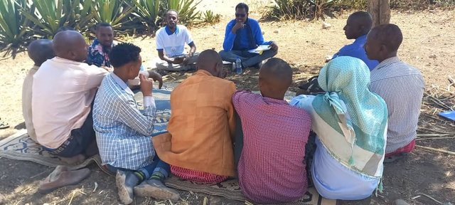
Participatory Rehabilitation of Dry Valleys [ອີທິໂອເປຍ]
Participatory rehabilitation and productive use of dry valleys is an approach employed to rehabilitate degraded and degradable land. It is operationalised through the Lowland Soil Rehabilitation Project with local development partners from kebele, district, regional agricultural bureaus, and other relevant stakeholders.
- ຜູ້ສັງລວມຂໍ້ມູນ: GERBA LETA
2. ການອະທິບາຍ ເຕັກໂນໂລຢີ ຂອງການຄຸ້ມຄອງ ທີ່ດິນແບບຍືນຍົງ
2.1 ຄໍາອະທິບາຍສັ້ນຂອງ ເຕັກໂນໂລຢີ
ການກຳໜົດຄວາມໝາຍ ຂອງເຕັກໂນໂລຢີ:
A double basin masonry check dam is a physical structure that helps to stop gully formation or further development of gullies in dry valleys. It rehabilitates small to a medium-sized deep gullies that are eating into the heart of adjacent land.
2.2 ການອະທິບາຍ ລາຍລະອຽດ ຂອງເຕັກໂນໂລຢີ
ການພັນລະນາ:
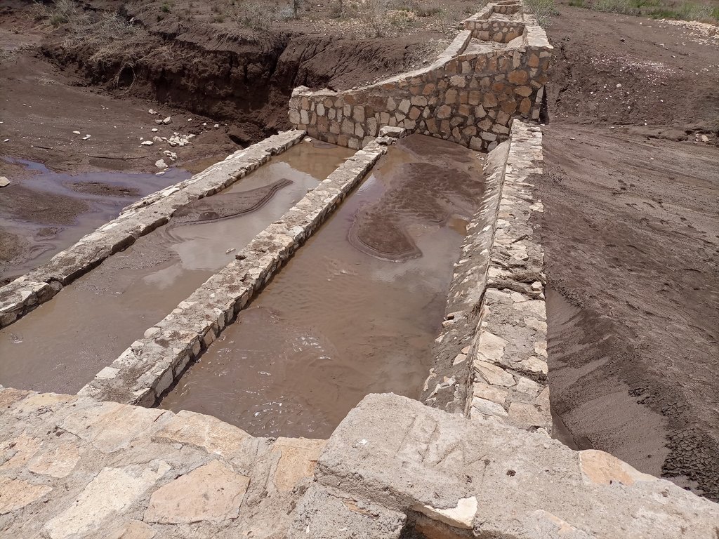
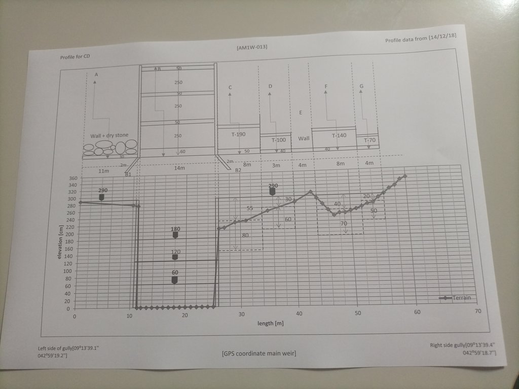
A “double basin masonry check dam” is a structure built in a narrow gully or depression to stop further gully formation. It is made of stone, concrete, gabions and wooden bars and serves as a permanent barrier. In this particular site stone is used as the structure is masonry. The technology is applied in areas where there are concentrated flows of water or runoff. The double basin masonry check dam is sited across a slope or a deep gully to slow water flow and capture sediment from upstream in the basins and behind the structure, thereby preventing expansion of the gully. The width of a check dam is variable. This particular structure is 14 meter wide, three meters deep and about 52 meters long. By helping to fill up the gully with sediment, it leads to rehabilitation and makes productive use of the area for growing trees, forage, and other plants. Apart from reducing the speed of surface runoff, the structure also promotes water infiltration, and recharges the groundwater reserves in the aquifer.
The main inputs necessary to build the check dams are financial resources, technical skills, skilled and unskilled labour, and construction materials including sand, stone, cement, water and other materials. Furthermore, construction tools such as a theodolite, line level, string, hammers, spades, hoes, and other tools are essential for design & construction. Technical skills for designing and profiling, and further capacity-building training are essential also. Application of the technology is also supported by satellite image and ground truthing to ensure the precision of siting.
The agropastoralists in the dry basin areas are pleased to see a huge movement of the soil arrested by the structure. The reduced expansion of the gully into the heart of the farm and grazing lands raises hopes of their land become productive and remaining so for generations to come. This hope and expectation have motivated them to welcome the intervention and develop an understanding of the actual benefits accrued from it. This leads to their support for the construction efforts. The disadvantages are that the technology is labour and resource-intensive which can be unaffordable for resource-poor agropastoralist communities living in food-insecure areas where rainfall is unreliable. This may make the adoption of the technology difficult to establish and nurture on their own without outside support.
2.3 ຮູບພາບຂອງເຕັກໂນໂລຢີ
ຂໍ້ສັງເກດທົ່ວໄປທີ່ກ່ຽວກັບຮູບພາບ:
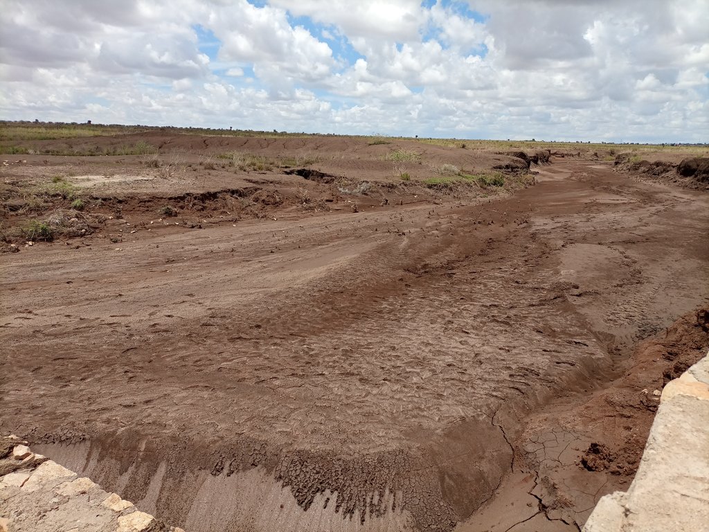
The photos display a large amount of sediment captured by a few days' shower post recurrent droughts experienced in the area over the last two to three years.
2.4 ວິດີໂອ ເຕັກໂນໂລຢີ
ຄວາມຄິດເຫັນ, ຄໍາອະທິບາຍຫຍໍ້:
Video of the technology was not taken by this particular documentation exercise.
2.5 ປະເທດ / ເຂດ / ສະຖານທີ່ບ່ອນທີ່ ເຕັກໂນໂລຢີ ໄດ້ຮັບການນໍາໃຊ້ ແລະ ທີ່ຖືກປົກຄຸມດ້ວຍການປະເມີນຜົນ
ປະເທດ:
ອີທິໂອເປຍ
ພາກພື້ນ / ລັດ / ແຂວງ:
Somali
ຂໍ້ມູນເພີ່ມເຕີມຂອງສະຖານທີ່:
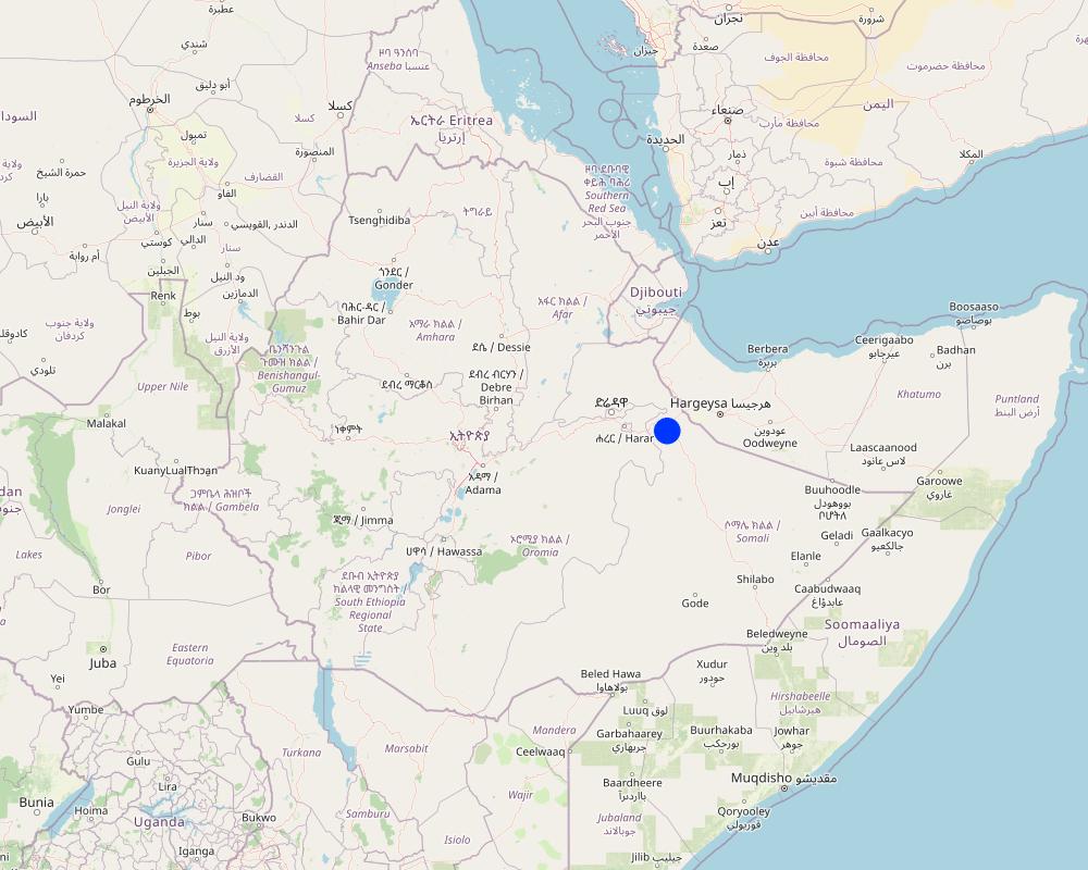
Hadow kebele of south Jigjiga district
ໃຫ້ລະບຸ ການແຜ່ຂະຫຍາຍ ເຕັກໂນໂລຢີ:
- ນໍາໃຊ້ໃນຈຸດສະເພາະ / ແນໃສ່ນໍາໃຊ້ໃນພື້ນທີ່ຂະໜາດນ້ອຍ
ສ່ວນຫຼາຍສະຖານທີ່ຕັ້ງຂອງເຕັກໂນໂລຢີ ແມ່ນ ຢູ່ໃນເຂດພື້ນທີ່ສະຫງວນບໍ?
ບໍ່ແມ່ນ
ຄວາມຄິດເຫັນ:
Locating the check dam closer to each other may help to stop the damage of heavy and concentrated flood moving in the drainage basin.
Map
×2.6 ວັນທີໃນການຈັດຕັ້ງປະຕິບັດ
ໃຫ້ລະບຸປີ ໃນການຈັດຕັ້ງປະຕິບັດ:
2021
2.7 ການນໍາສະເໜີ ເຕັກໂນໂລຢີ
ໃຫ້ລະບຸ ເຕັກໂນໂລຢີ ໄດ້ຖືກຈັດຕັ້ງປະຕິບັດຄືແນວໃດ?
- ໂດຍຜ່ານໂຄງການ / ການຊ່ວຍເຫຼືອຈາກພາຍນອກ
ຄວາມຄິດເຫັນ (ປະເພດ ໂຄງການ ແລະ ອື່ນໆ):
Capacity Development and Strengthening Drought Resilience (CDSDR) project of the GIZ in Somali Region.
3. ການໃຈ້ແຍກ ເຕັກໂນໂລຢີ ໃນການຄຸ້ມຄອງ ດິນແບບຍືນຍົງ
3.1 ຈຸດປະສົງຫຼັກ (ຫຼາຍ) ຂອງເຕັກໂນໂລຢີ
- ຫຼຸດຜ່ອນ, ປ້ອງກັນ, ຟື້ນຟູ ການເຊື່ອມໂຊມຂອງດິນ
- ການອະນຸລັກ ລະບົບນິເວດ
- ປົກປັກຮັກສານໍ້າ / ນໍ້າພື້ນທີ່ - ປະສົມປະສານກັບ ເຕັກໂນໂລຢີອື່ນໆ
- ປົກປັກຮັກສາ / ການປັບປຸງຊີວະນາໆພັນ
- ຫຼຸດຜ່ອນຄວາມສ່ຽງ ທາງໄພພິບັດທໍາມະຊາດ
3.2 ປະເພດການນໍາໃຊ້ທີ່ດິນ ໃນປະຈຸບັນ() ທີ່ເຕັກໂນໂລຢີ ໄດ້ຖືກນໍາໃຊ້
ການນຳໃຊ້ທີ່ດິນ ປະສົມພາຍໃນພື້ນທີ່ດຽວກັນ:
ບໍ່ແມ່ນ
3.3 ການນຳໃຊ້ທີ່ດິນ ມີການປ່ຽນແປງຍ້ອນການຈັດຕັ້ງທົດລອງເຕັກໂນໂລຢີ ແມ່ນບໍ່?
ການນຳໃຊ້ທີ່ດິນ ມີການປ່ຽນແປງຍ້ອນການຈັດຕັ້ງທົດລອງເຕັກໂນໂລຢີ ແມ່ນບໍ່?
- ບໍ່ (ຕໍ່ເໜືອງກັບ ຄຳຖາມ 3.4)
3.4 ການສະໜອງນ້ຳ
ການສະໜອງນໍ້າ ໃນພື້ນທີ່ ທີ່ໄດ້ນໍາໃຊ້ ເຕັກໂນໂລຢີ:
- ນໍ້າຝົນ
ຄວາມຄິດເຫັນ:
Rainfed is the type of water supply that often experiences erratic distribution characterized by the reception of lower amounts. Mostly characterized by erratic and erosive feature.
3.5 ການນໍາໃຊ້ເຕັກໂນໂລຢີ ທີ່ຢູ່ໃນກຸ່ມການຄຸ້ມຄອງ ທີ່ດິນແບບຍືນຍົງ
- ການຄຸ້ມຄອງສັດລ້ຽງ ແລະ ທົ່ງຫຍ້າລ້ຽງສັດ
- ມາດຕະການ ຕັດຂວາງ ກັບຄວາມຄ້ອຍຊັນ
- ການເກັບກັກນໍ້າ
3.6 ມາດຕະການ ການຄຸ້ມຄອງ ທີ່ດິນແບບຍືນຍົງ ປະກອບດ້ວຍ ເຕັກໂນໂລຢີ

ມາດຕະການໂຄງສ້າງ
- S6: ແລວກັນເຈື່ອນ, ຮົ້ວ
3.7 ປະເພດດິນເຊື່ອມໂຊມ ຫຼັກທີ່ໄດ້ນໍາໃຊ້ ເຕັກໂນໂລຢີ

ດິນເຊາະເຈື່ອນ ໂດຍນໍ້າ
- Wt: ການສູນເສຍຊັ້ນໜ້າດິນ / ການເຊາະເຈື່ອນຜິວໜ້າດິນ
- Wg: ການເຊາະເຈື່ອນຮ່ອງນ້ຳ / ຫ້ວຍ
- Wm: ການເຄື່ອນຍ້າຍອິນຊີວັດຖຸ / ດິນເຈື່ອນ
3.8 ການປ້ອງກັນ, ການຫຼຸດຜ່ອນ, ຫຼືການຟື້ນຟູຂອງການເຊື່ອມໂຊມຂອງດິນ
ໃຫ້ລະບຸ ເປົ້າໝາຍ ເຕັກໂນໂລຢີ ທີ່ພົວພັນ ກັບຄວາມເຊື່ອມໂຊມຂອງດິນ:
- ຫຼຸດຜ່ອນການເຊື່ອມໂຊມຂອງດິນ
- ການຟື້ນຟູ / ຟື້ນຟູດິນທີ່ຊຸດໂຊມ
ຄວາມຄິດເຫັນ:
The technology stops the mass movement of soil and water. As a result, it reduces land degradation, rehabilitates the degraded dry valley, and makes the land available for productive uses.
4. ຂໍ້ກໍາໜົດ, ກິດຈະກໍາການປະຕິບັດ, ວັດຖຸດິບ, ແລະຄ່າໃຊ້ຈ່າຍ
4.1 ເຕັກນິກ ໃນການແຕ້ມແຜນວາດ ເຕັກໂນໂລຢີ
ຄຸນລັກສະນະ ຂອງເຕັກນິກ (ທີ່ກ່ຽວຂ້ອງ ກັບການແຕ້ມແຜນວາດ ທາງດ້ານເຕັກນີກ):
The design (layout - top view) and profile (lower view) of the technology is presented with universal units to clearly read and understand by the SLM experts or engineers. In addition, there are section drawings of the main weir and Bill of Quantity (BOQ).
ຜູ້ຂຽນ:
Amir Abdi
ວັນທີ:
14/12/2018
4.2 ຂໍ້ມູນທົ່ວໄປກ່ຽວກັບການຄິດໄລ່ປັດໃຈຂາເຂົ້າໃນການຜະລິດ ແລະ ມູນຄ່າອື່ນໆ
ລະບຸ ວິທີການ ຄຳໃຊ້ຈ່າຍ ແລະ ປັດໄຈນໍາເຂົ້າ ທີ່ໄດ້ຄິດໄລ່:
- ຕໍ່ຫົວໜ່ວຍ ທີ່ໄດ້ຈັດຕັ້ງປະຕິບັດ ເຕັກໂນໂລຢີ
ໃຫ້ລະບຸຫົວໜ່ວຍ:
check dam
ກໍານົດຂະຫນາດຂອງຫົວນ໋ວຍ (ຖ້າກ່ຽວຂ້ອງ):
14m*3m*52m =2184m3
ລະບຸ ສະກຸນເງິນທີ່ໃຊ້ສໍາລັບ ການຄິດໄລ່ຄ່າໃຊ້ຈ່າຍ:
- USA
ລະບຸ ຄ່າຈ້າງ ຄ່າແຮງງານສະເລ່ຍ ຕໍ່ ວັນ:
8.5 - 16 USD based on their skills
4.3 ການສ້າງຕັ້ງກິດຈະກໍາ
| ກິດຈະກໍາ | Timing (season) | |
|---|---|---|
| 1. | Conduct rapid assessment and Surveillance of intervention site | During the off-season |
| 2. | Finalize site selection | ditto |
| 3. | Layout, Design and profiling works | |
| 4. | Identify and train masonry workers | During off-season |
| 5. | Material supply | |
| 6. | Start actual layout and excavation work | |
| 7. | Supervision... |
ຄວາມຄິດເຫັນ:
Once intended to put the technology or the structure in place, a series of activities are conducted involving experts and contract workers until the activities are effectively finalized.
4.4 ຕົ້ນທຶນ ແລະ ປັດໄຈຂາເຂົ້າທີ່ຈໍາເປັນໃນຈັດຕັ້ງປະຕິບັດ
ຖ້າທ່ານບໍ່ສາມາດ ໄຈ້ແຍກຄ່າໃຊ້ຈ່າຍໃນຕາຕະລາງຂ້າງເທິງ, ໃຫ້ຄາດຄະເນຂອງຄ່າໃຊ້ຈ່າຍທັງຫມົດ ຂອງການສ້າງເຕັກໂນໂລຢີ:
9200.0
ຖ້າຫາກຜູ້ນຳໃຊ້ທີ່ດິນ ນຳໃຊ້ມູນຄ່າຕ່ຳກວ່າ 100% ໃຫ້ລະບຸ ແມ່ນໃຜເປັນຜູ້ຊ່ວຍ ໃນລາຍຈ່າຍທີ່ເຫຼືອ:
The project is responsible to cover the cost.
ຄວາມຄິດເຫັນ:
The cost for an unskilled casual laborer a day is 8.5 USD whereas the daily cost of a skilled Masonry worker is 16 USD per day.
4.5 ບໍາລຸງຮັກສາ / ແຜນຈັດຕັ້ງປະຕິບັດ ກິດຈະກໍາ
| ກິດຈະກໍາ | ໄລຍະເວລາ / ຄວາມຖີ່ | |
|---|---|---|
| 1. | Oversee and identify damage | During and after rainy season |
| 2. | Measure the degrees of damage | ditto |
| 3. | Quantify cost and materials needed | |
| 4. | Schedule the maintenance work | Right before the off-season |
| 5. | Employ the workers and reconstruct the damaged parts or upgrade it. | During off-season |
ຄວາມຄິດເຫັນ:
As some of the technology implementation sites are inaccessible during the rainy season, implementing the activities during the off-season is commendable.
4.6 ຄ່າໃຊ້ຈ່າຍ ແລະ ປັດໄຈນໍາເຂົ້າທີ່ຈໍາເປັນສໍາລັບການບໍາລຸງຮັກສາກິດຈະກໍາ / ແຜນປະຕິບັດ (ຕໍ່ປີ)
ຖ້າທ່ານບໍ່ສາມາດ ໄຈ້ແຍກຄ່າໃຊ້ຈ່າຍໃນຕາຕະລາງຂ້າງເທິງ, ໃຫ້ຄາດຄະເນຂອງຄ່າໃຊ້ຈ່າຍທັງຫມົດ ຂອງການບຳລຸງຮັກສາ ເຕັກໂນໂລຢີ:
3244.0
ຖ້າຫາກຜູ້ນຳໃຊ້ທີ່ດິນ ນຳໃຊ້ມູນຄ່າຕ່ຳກວ່າ 100% ໃຫ້ລະບຸ ແມ່ນໃຜເປັນຜູ້ຊ່ວຍ ໃນລາຍຈ່າຍທີ່ເຫຼືອ:
The project is expected to cover the entire maintenance cost. However, maintenance cost is attributed to various factors including the degree of damage, material costs at the time, etc. The figure merely represents an estimation of the cost, on average.
ຄວາມຄິດເຫັນ:
As the dry land receive erratic and erosive rain, damage to the structure is not uncommon. Combining fast-growing trees and deep-rooted perennial fodder grass stabilizes the sediment and reduces the speed of run-off on top of the structure. Therefore, associating the structure with biological barriers right after the first season of rain is a mandatory action that assists to reduce the damage and maintenance cost that is not affordable by resource-poor communities.
4.7 ປັດໄຈ ທີ່ສໍາຄັນ ທີ່ສົ່ງຜົນກະທົບ ຕໍ່ຄ່າໃຊ້ຈ່າຍ
ໃຫ້ອະທິບາຍ ປັດໃຈ ທີ່ສົ່ງຜົນກະທົບ ຕໍ່ຕົ້ນທຶນ ໃນການຈັດຕັ້ງປະຕິບັດ:
Inflation and increasingly changing material prices, labor and transportation costs.
5. ສະພາບແວດລ້ອມທໍາມະຊາດ ແລະ ມະນຸດ
5.1 ອາກາດ
ປະລິມານນໍ້າຝົນປະຈໍາປີ
- < 250 ມີລິແມັດ
- 251-500 ມີລິແມັດ
- 501-750 ມີລິແມັດ
- 751-1,000 ມີລິແມັດ
- 1,001-1,500 ມີລິແມັດ
- 1,501-2,000 ມີລິແມັດ
- 2,001-3,000 ມີລິແມັດ
- 3,001-4,000 ມີລິແມັດ
- > 4,000 ມີລິແມັດ
ຂໍ້ມູນສະເພາະ / ຄວາມເຫັນກ່ຽວກັບ ປະລິມານນໍ້າຝົນ:
Rainfall distribution is erratic and erosive.
ໃຫ້ລະບຸ ຊື່ສະຖານີ ອຸຕຸນິຍົມ ເພື່ອເປັນຂໍ້ມູນອ້າງອີງ:
Jijiga Meteorology station
ເຂດສະພາບອາກາດກະສິກໍາ
- ເຄິ່ງແຫ້ງແລ້ງ
There are bimodal rainfall patterns but the distribution in each respective season is not uniform. Particularly, the past consecutive seasons have been characterized by drought.
5.2 ພູມິປະເທດ
ຄ່າສະເລ່ຍ ຄວາມຄ້ອຍຊັນ:
- ພື້ນທີ່ຮາບພຽງ (0-2%)
- ອ່ອນ (3-5 %)
- ປານກາງ (6-10 %)
- ມ້ວນ (11-15 %)
- ເນີນ(16-30%)
- ໍຊັນ (31-60%)
- ຊັນຫຼາຍ (>60%)
ຮູບແບບຂອງດິນ:
- ພູພຽງ / ທົ່ງພຽງ
- ສັນພູ
- ເປີ້ນພູ
- ເນີນພູ
- ຕີນພູ
- ຮ່ອມພູ
ເຂດລະດັບສູງ:
- 0-100 ແມັດ a.s.l.
- 101-500 ແມັດ a.s.l.
- 501-1,000 ແມັດ a.s.l.
- 1,001-1,500 ແມັດ a.s.l.
- 1,501-2,000 ແມັດ a.s.l.
- 2,001-2,500 ແມັດ a.s.l.
- 2,501-3,000 ແມັດ a.s.l.
- 3,001-4,000 ແມັດ a.s.l.
- > 4,000 ແມັດ a.s.l.
ໃຫ້ລະບຸ ເຕັກໂນໂລຢີ ທີ່ໄດ້ຖືກນຳໃຊ້:
- ລັກສະນະກີ່ວ
ຄຳເຫັນ ແລະ ຂໍ້ມູນສະເພາະ ເພີ່ມເຕີມ ກ່ຽວກັບ ພູມີປະເທດ:
The technology is implemented in the gully or depression to reduce the speed of runoff and hold back the sediment and running water itself.
5.3 ດິນ
ຄວາມເລິກ ຂອງດິນສະເລ່ຍ:
- ຕື້ນຫຼາຍ (0-20 ຊັງຕີແມັດ)
- ຕື້ນ (21-50 ຊຕມ)
- ເລີກປານກາງ (51-80 ຊຕມ)
- ເລິກ (81-120 ຊມ)
- ເລິກຫຼາຍ (> 120 cm)
ເນື້ອດິນ (ໜ້າດິນ):
- ປານກາງ (ດິນໜຽວ, ດິນໂຄນ)
ເນື້ອດິນ (ເລິກຈາກໜ້າດິນ ລົງໄປຫຼາຍກວ່າ 20 ຊັງຕິແມັດ):
- ປານກາງ (ດິນໜຽວ, ດິນໂຄນ)
ຊັ້ນອິນຊີວັດຖຸ ເທິງໜ້າດິນ:
- ປານກາງ (1-3 %)
5.4 ມີນໍ້າ ແລະ ຄຸນນະພາບ
ລະດັບ ນໍ້າໃຕ້ດິນ:
> 50 ແມັດ
ການມີນໍ້າ ເທິງໜ້າດິນ:
ທຸກຍາກ / ບໍ່ມີ
ຄຸນນະພາບນໍ້າ (ບໍ່ມີການບໍາບັດ):
ມີນໍ້າດື່ມ
ຄຸນນະພາບນ້ຳ ໝາຍເຖີງ:
ນ້ຳໃຕ້ດິນ
ມີບັນຫາ ກ່ຽວກັບນໍ້າເຄັມບໍ່?
ແມ່ນ
ລະບຸ ຊະນິດ:
Land users communicated the presence of a medium level of water salinity.
ເກີດມີນໍ້າຖ້ວມ ໃນພື້ນທີ່ບໍ່?
ແມ່ນ
ເປັນປົກກະຕິ:
ຕອນ
ຄວາມຄິດເຫັນ ແລະ ຂໍ້ກໍານົດ ເພີ່ມເຕີມ ກ່ຽວກັບ ຄຸນນະພາບ ແລະ ປະລິມານ ຂອງນ້ຳ:
The water quality is a relative description as it is not supported by facts. Both livestock and human beings are using ponds and still water for drinking after rainfall.
5.5 ຊີວະນາໆພັນ
ຄວາມຫຼາກຫຼາຍ ທາງສາຍພັນ:
- ຕໍ່າ
ຄວາມຫຼາກຫຼາຍ ທາງດ້ານ ທີ່ຢູ່ອາໃສ ຂອງສິ່ງທີ່ມີຊີວິດ:
- ຕໍ່າ
ຄວາມຄິດເຫັນ ແລະ ລັກສະນະສະເພາະ ເພີ່ມເຕີມກ່ຽວກັບ ຊີວະນາໆພັນ:
A few tree and shrub species are common in the area. Acacia, opentia (Euphorbia species), and some invasive weed species are common.
5.6 ຄຸນລັກສະນະ ຂອງຜູ້ນໍາໃຊ້ທີ່ດິນ ທີ່ໄດ້ນໍາໃຊ້ເຕັກໂນໂລຢີ
ຢູ່ປະຈຳ ຫຼື ເຄື່ອນຍ້າຍຕະຫຼອດ:
- ແບບເຄີ່ງຂັງ-ເຄີ່ງປ່ອຍ
ອື່ນໆ (ລະບຸແຈ້ງ):
Agro-pastoralist
ລາຍຮັບ ທີ່ບໍ່ໄດ້ມາຈາກ ການຜະລິດ ກະສິກໍາ:
- ໜ້ອຍກ່ວາ 10 % ຂອງລາຍຮັບທັງໝົດ
ລະດັບຄວາມຮັ່ງມີ:
- ທຸກຍາກ
ບຸກຄົນ ຫຼື ກຸ່ມ:
- ກຸ່ມ / ຊຸມຊົນ
ລະດັບ ການຫັນເປັນກົນຈັກ:
- ການໃຊ້ແຮງງານຄົນ
- ສັດລາກແກ່
ເພດ:
- ຜູ້ຍິງ
- ຜູ້ຊາຍ
ໃຫ້ລະບຸ ຄຸນລັກສະນະ ຂອງຜູ້ນໍາໃຊ້ທີ່ດິນ:
The agro-pastoralist settlement pattern is stable except their mobility with their livestock looking for water and feed. Land users of various age groups are benefiting from the technology.
5.7 ເນື້ອທີ່ສະເລ່ຍຂອງດິນ ທີ່ຜູ້ນຳໃຊ້ທີ່ດິນ ໃຊ້ເຮັດເຕັກໂນໂລຢີ
- <0.5 ເຮັກຕາ
- 0.5-1 ເຮັກຕາ
- 1-2 ເຮັກຕາ
- 2-5 ເຮັກຕາ
- 5-15 ເຮັກຕາ
- 15-50 ເຮັກຕາ
- 50-100 ເຮັກຕາ
- 100-500 ເຮັກຕາ
- 500-1,000 ເຮັກຕາ
- 1,000-10,000 ເຮັກຕາ
- > 10,000 ເຮັກຕາ
ຖືໄດ້ວ່າ ເປັນຂະໜາດນ້ອຍ, ກາງ ຫຼື ໃຫຍ່ (ອີງຕາມເງື່ອນໄຂ ສະພາບຄວາມເປັນຈິງ ຂອງທ້ອງຖີ່ນ)? :
- ຂະໜາດນ້ອຍ
5.8 ເຈົ້າຂອງທີ່ດິນ, ສິດໃຊ້ທີ່ດິນ, ແລະ ສິດທິການນໍາໃຊ້ນໍ້າ
ເຈົ້າຂອງດິນ:
- ຊຸມຊົນ / ບ້ານ
- ບຸກຄົນ, ບໍ່ມີຕໍາແໜ່ງ
ສິດທິ ໃນການນໍາໃຊ້ທີ່ດິນ:
- ຊຸມຊົນ (ທີ່ມີການຈັດຕັ້ງ)
- ບຸກຄົນ
ສິດທິ ໃນການນໍາໃຊ້ນໍ້າ:
- ຊຸມຊົນ (ທີ່ມີການຈັດຕັ້ງ)
- ບຸກຄົນ
ສິດນຳໃຊ້ທີ່ດິນ ແມ່ນ ອີງໃສ່ລະບົບກົດໝາຍແບບດັ້ງເດີມບໍ?
ແມ່ນ
ລະບຸ ຊະນິດ:
Land use is largely communal and individual inherit it from their lineage.
5.9 ການເຂົ້າເຖິງການບໍລິການ ແລະ ພື້ນຖານໂຄງລ່າງ
ສຸຂະພາບ:
- ທຸກຍາກ
- ປານກາງ
- ດີ
ການສຶກສາ:
- ທຸກຍາກ
- ປານກາງ
- ດີ
ການຊ່ວຍເຫຼືອ ດ້ານວິຊາການ:
- ທຸກຍາກ
- ປານກາງ
- ດີ
ການຈ້າງງານ (ຕົວຢ່າງ, ການເຮັດກິດຈະກໍາອື່ນ ທີ່ບໍ່ແມ່ນ ການຜະລິດກະສິກໍາ):
- ທຸກຍາກ
- ປານກາງ
- ດີ
ຕະຫຼາດ:
- ທຸກຍາກ
- ປານກາງ
- ດີ
ພະລັງງານ:
- ທຸກຍາກ
- ປານກາງ
- ດີ
ຖະໜົນຫົນທາງ ແລະ ການຂົນສົ່ງ:
- ທຸກຍາກ
- ປານກາງ
- ດີ
ການດື່ມນໍ້າ ແລະ ສຸຂາພິບານ:
- ທຸກຍາກ
- ປານກາງ
- ດີ
ການບໍລິການ ທາງດ້ານການເງິນ:
- ທຸກຍາກ
- ປານກາງ
- ດີ
ຄວາມຄິດເຫັນ:
Not much service is available in the pastoralist area except that the road paths through the area also create access to the market and other service centers.
6. ຜົນກະທົບ ແລະ ລາຍງານສະຫຼຸບ
6.1 ການສະແດງຜົນກະທົບ ພາຍໃນພື້ນທີ່ ທີ່ໄດ້ຈັດຕັ້ງປະຕິບັດ ເຕັກໂນໂລຢີ
ຜົນກະທົບທາງເສດຖະກິດສັງຄົມ
ການຜະລິດ
ການຜະລິດອາຫານສັດ
ຄວາມຄິດເຫັນ / ລະບຸແຈ້ງ:
With the development of the sediments trapped by the structure by fodder crops of multipurpose tree species, it is possible to boost production and ensure the sustainability of the structure.
ຄຸນນະພາບຂອງອາຫານສັດ
ຄວາມຄິດເຫັນ / ລະບຸແຈ້ງ:
As the sediment brings in fertile topsoil from the upstream catchments, the likelihood of producing quality fodder in the rehabilitated area is so high.
ຜົນຜະລິດໄມ້
ຄວາມຄິດເຫັນ / ລະບຸແຈ້ງ:
The multipurpose tree species assumed to be planted in the rehabilitated area are expected to increase wood production.
ມີນໍ້າ ແລະ ຄຸນນະພາບ
ມີນໍ້າດື່ມ
ຄວາມຄິດເຫັນ / ລະບຸແຈ້ງ:
As the rehabilitated valley reduces runoff and increases the groundwater reserves, it caters to the opportunity to access drinking water.
ນໍ້າດື່ມ ມີຄຸນນະພາບ
ຄວາມຄິດເຫັນ / ລະບຸແຈ້ງ:
Succeeding vegetation covers enables to filter of the water and improves the quality of surface and subsurface water.
ມີນໍ້າ ໃຫ້ສັດລ້ຽງ
ຄວາມຄິດເຫັນ / ລະບຸແຈ້ງ:
Slightly increases as the structure and rehabilitated areas improves water infiltration and formation of still water or micro ponds behind the structure.
ຄຸນນະພາບ ຂອງນໍ້າ ສໍາລັບລ້ຽງສັດ
ຄວາມຄິດເຫັນ / ລະບຸແຈ້ງ:
Simultaneously increases with the availability of surface and subsurface water.
ຜົນກະທົບດ້ານວັດທະນາທໍາສັງຄົມ
ການຄໍ້າປະກັນ ສະບຽງອາຫານ / ກຸ້ມຢູ່ກຸ້ມກິນ
ຄວາມຄິດເຫັນ / ລະບຸແຈ້ງ:
Reduction of gully formations that consume the rangeland allows accessing relatively more rangeland areas for the livestock to graze over. This inevitably improves the food security of the pastoralist community.
ຄວາມຮູ້ກ່ຽວກັບ ການຄຸ້ມຄອງ ທີ່ດິນແບບຍືນຍົງ / ການເຊື່ອມໂຊມຂອງດິນ
ຄວາມຄິດເຫັນ / ລະບຸແຈ້ງ:
The technology and its function along the mainstreaming work with local development actors certainly improve the understanding and evidence-based knowledge of the land users.
ຜົນກະທົບຕໍ່ລະບົບນິເວດ
ວົງຈອນນໍ້າ / ນໍ້າ
ປະລິມານນໍ້າ
ຄວາມຄິດເຫັນ / ລະບຸແຈ້ງ:
The technology is believed to increase both surface and groundwater quantity in the intervention valley.
ຄຸນນະພາບນໍ້າ
ການໄຫຼ ຂອງນໍ້າໜ້າດິນ
ຄວາມຄິດເຫັນ / ລະບຸແຈ້ງ:
Surface runoff speed and volume are gradually decreased with the rehabilitation of the gully and the development of the area behind the structure.
ການລະບາຍນໍ້າ
ຊັ້ນນໍ້າໄຕ້ດິນ / ນໍ້າ
ດິນ
ຄວາມຊຸ່ມຂອງດິນ
ຄວາມຄິດເຫັນ / ລະບຸແຈ້ງ:
Soil moisture in the rehabilitated area positively increased.
ການປົກຄຸມຂອງດິນ
ການສູນເສຍດິນ
ຄວາມຄິດເຫັນ / ລະບຸແຈ້ງ:
As the structure on the upstream side reduces the speed of runoff, soil, and water loss decrease, and soil accumulation is increasing over time.
ການທັບຖົມຂອງດິນ
ດິນເປັນຜົງ / ການຈັບໂຕຂອງດິນ ທີ່ມີຂະໜາດນ້ອຍຫຼາຍ ທີ່ມີການຈັບໂຕກັນເປັນກ້ອນ
ຊີວະນານາພັນ: ສັດ, ພືດ
ການປົກຫຸ້ມຂອງພືດ
ຄວາມຄິດເຫັນ / ລະບຸແຈ້ງ:
It increases with the deposition of sediments. Seeds of different trees and vegetation can emerge as succession species.
ຄວາມຫຼາກຫຼາຍຂອງພືດ
ຄວາມຄິດເຫັນ / ລະບຸແຈ້ງ:
Increases!
ການຫຼຸດຜ່ອນ ຄວາມສ່ຽງ ຈາກໄພພິບັດ ແລະ ອາກາດປ່ຽນແປງ
ຜົນກະທົບ ຂອງນໍ້າຖ້ວມ
ຄວາມຄິດເຫັນ / ລະບຸແຈ້ງ:
The structure and rehabilitated areas reduces the speed and impacts of the flood.
ການເຊາະເຈື່ອນຂອງດິນ / ຊາກສະລະຫະພັງ
ຜົນກະທົບ ຂອງໄພແຫ້ງແລ້ງ
ການລະເຫີຍອາຍກາກບອນ ແລະ ອາຍຜິດເຮືອນແກ້ວ
ຄວາມຄິດເຫັນ / ລະບຸແຈ້ງ:
Overtime, tree cover reduces emission of carbon and green gases.
ລະບຸ ການປະເມີນຜົນກະທົບ ຕໍ່ສະຖານທີ່ (ການວັດແທກ):
Assessment of on-site impacts desires long-term follow-up, data collection, and analysis.
6.2 ຜົນກະທົບທາງອ້ອມ ຈາກການນໍາໃຊ້ເຕັກໂນໂລຢີ
ສາມາດເຂົ້າເຖິງແຫຼ່ງນໍ້າ
ຄວາມຄິດເຫັນ / ລະບຸແຈ້ງ:
As the technology put in place in recent times, off-site impacts need assessment based on facts.
ນໍ້າຖ້ວມຢູ່ເຂດລຸ່ມນໍ້າ
ຄວາມຄິດເຫັນ / ລະບຸແຈ້ງ:
The structure and rehabilitated areas inevitably reduces downstream flooding and siltation in the future.
ການທັບຖົມ ຂອງດິນຕະກອນ ຢູ່ເຂດລຸ່ມນໍ້າ
ຄວາມຄິດເຫັນ / ລະບຸແຈ້ງ:
There is visible siltation held back by the structure. However, quantifying demands empirical analysis.
ມົນລະພິດ ທາງນໍ້າ / ນໍ້າໄຕ້ດິນ
ການປ້ອງກັນ / ຄວາມອາດສາມາດ ການກັ່ນຕອງ
ພື້ນທີ່ທໍາການຜະລິດ ຂອງເພື່ອນບ້ານທີ່ຢູ່ໃກ້ຄຽງ ໄດ້ຮັບຜົນກະທົບ
ຄວາມເສຍຫາຍ ກ່ຽວກັບພື້ນຖານໂຄງລ່າງ ສາທາລະນະ / ເອກກະຊົນ
ຜົນກະທົບ ຂອງອາຍຜິດເຮືອນແກ້ວ
ກໍານົດ ການປະເມີນ ຜົນກະທົບທາງນອກ (ການວັດແທກ):
The facts regarding the off-site impacts will certainly be assessed as a long-term impact.
6.3 ການປ້ອງກັນ ແລະ ຄວາມບອບບາງ ຂອງເຕັກໂນໂລຢິ ໃນການປ່ຽນແປງສະພາບດິນຟ້າອາກາດ ແລະ ກ່ຽວຂ້ອງກັບອາກາດທີ່ມີການປ່ຽນແປງທີ່ຮຸນແຮງ / ໄພພິບັດທາງທໍາມະຊາດ (ຮັບຮູ້ໄດ້ໂດຍຜູ້ນໍາໃຊ້ທີ່ດິນ)
ການປ່ຽນແປງດິນຟ້າອາກາດ ເທື່ອລະກ້າວ
ການປ່ຽນແປງດິນຟ້າອາກາດ ເທື່ອລະກ້າວ
| ລະດູການ | ເພີ່ມຂື້ນ ຫຼື ຫຼຸດລົງ | ການນໍາໃຊ້ ເຕັກໂນໂລຢີ ສາມາດ ຮັບມື ໄດ້ຄືແນວໃດ? | |
|---|---|---|---|
| ອຸນຫະພູມປະຈໍາປີ | ເພີ່ມຂື້ນ | ປານກາງ | |
| ປະລິມານນໍ້າຝົນປະຈໍາປີ | ຫຼຸດລົງ | ປານກາງ |
ອາກາດ ທີ່ກ່ຽວພັນກັບຄວາມຮຸນແຮງ (ໄພພິບັດທາງທໍາມະຊາດ)
ໄພພິບັດທາງອຸທົກກະສາກ
| ການນໍາໃຊ້ ເຕັກໂນໂລຢີ ສາມາດ ຮັບມື ໄດ້ຄືແນວໃດ? | |
|---|---|
| ໂດຍທົ່ວໄປ (ແມ່ນໍ້າ) ນໍ້າຖ້ວມ | ບໍ່ຮູ້ |
| ນໍ້າຖ້ວມຮູນແຮງ | ດີຫຼາຍ |
| ດິນເຈື່ອນ | ດີ |
ຄວາມຄິດເຫັນ:
Similar to on-site impacts, the off-site impact assessment needs, facts, and long-term follow-up.
6.4 ການວິເຄາະຕົ້ນທຶນ ແລະ ຜົນປະໂຫຍດ
ຈະເຮັດປະໂຫຍດເພື່ອປຽບທຽບກັບຄ່າໃຊ້ຈ່າຍກັບສິ່ງກໍ່ສ້າງ (ຈາກທັດສະນະຂອງຜູ້ນຳໃຊ້ທີ່ດິນ) ໄດ້ແນວໃດ?
ຜົນຕອບແທນ ໃນໄລຍະສັ້ນ:
ຜົນກະທົບທາງບວກ
ຜົນຕອບແທນ ໃນໄລຍະຍາວ:
ຜົນກະທົບທາງບວກຫຼາຍ
ຈະໄດ້ຮັບຜົນປະໂຫຍດເມື່ອປຽບທຽບກັບ / ຄ່າໃຊ້ຈ່າຍໃນການບຳລຸງຮັກສາທີເ່ກີດຂື້ນອິກ (ຈາກທັດສະນະຄະຕິຂອງຜູ້ນຳໃຊ້ທີ່ດິນ) ໄດ້ແນວໃດ?
ຜົນຕອບແທນ ໃນໄລຍະສັ້ນ:
ຜົນກະທົບທາງບວກ
ຜົນຕອບແທນ ໃນໄລຍະຍາວ:
ຜົນກະທົບທາງບວກຫຼາຍ
6.5 ການປັບຕົວຮັບເອົາເຕັກໂນໂລຢີ
- ກໍລະນີດຽວ / ການທົດລອງ
ຖ້າຫາກວ່າມີ, ປະລິມານ (ຈໍານວນຂອງຄົວເຮືອນ / ເນື້ອທີ່ການຄຸ້ມຄອງ):
Adoption rate is yet to be evaluated. The technology put in communal land.
ຄວາມຄິດເຫັນ:
No community so far adopted and implemented the technology on its own.
6.6 ການປັບຕົວ
ໄດ້ມີການດັດປັບ ເຕັກໂນໂລຢີ ເພື່ອໃຫ້ແທດເໝາະກັບເງື່ອນໄຂ ການປ່ຽນແປງບໍ?
ບໍ່ແມ່ນ
6.7 ຈຸດແຂງ / ຂໍ້ດີ / ໂອກາດ ໃນການນໍາໃຊ້ ເຕັກໂນໂລຢີ
| ຈຸດແຂງ / ຂໍ້ດີ / ໂອກາດໃນການນໍາໃຊ້ທີ່ດິນ |
|---|
| Rehabilitate the gully, and stop and reverse the gully formation. |
| It creates the opportunity for productive use of the degraded environment. |
| Recharge the groundwater aquifer and supply still water for temporary use by local people and livestock. |
| ຈຸດແຂງ / ຈຸດດີ / ໂອກາດ ຈາກທັດສະນະຂອງຜູ້ປ້ອນຂໍ້ມູນ ຫຼື ບຸກຄົນສຳຄັນ |
|---|
| Promote regeneration of the lost species through resilience building. |
| Improve the landscape feature. |
| Improve the ecosystem and its overall services. |
6.8 ຈຸດອ່ອນ / ຂໍ້ເສຍ / ຄວາມສ່ຽງ ໃນການນໍາໃຊ້ ເຕັກໂນໂລຢີ ແລະ ວິທີການແກ້ໄຂບັນຫາ
| ຈຸດອ່ອນ / ຂໍ້ເສຍ / ຄວາມສ່ຽງໃນມຸມມອງຂອງຜູ້ນໍາໃຊ້ທີ່ດິນ | ມີວິທີການແກ້ໄຂຄືແນວໃດ? |
|---|---|
| High investment cost to implement the technology. | Promote government awareness and emphasis on the benefit and investment in developing the technology. |
| Lack of implementation skills. | Develop the skills and motivation of the community and other stakeholders. |
| Conflict of interest on the use of the rehabilitated land in the intersection of neighboring kebeles. | Awareness creation and promote behavioral change on the joint benefit of the technology. |
| ຈຸດອ່ອນ/ຂໍ້ບົກຜ່ອງ/ຄວາມສ່ຽງ ຈາກທັດສະນະຂອງຜູ້ປ້ອນຂໍ້ມູນ ຫຼື ບຸກຄົນສຳຄັນ | ມີວິທີການແກ້ໄຂຄືແນວໃດ? |
|---|---|
| Inability to put micro check dams along the drainage line before it cuts deep into the soil. | Improve surveillance and promote early intervention. |
| Lower level of participation from the land users. | Develop the capacity, awareness and motivation of the land users. |
| Stakeholders and land users lower level of environmental education, improper land management and the consequent climate change and other associated adversities. | Promote environmental education, emerging climate change and climate variability in adult and vocational education. |
7. ເອກະສານອ້າງອີງ ແລະ ການເຊື່ອມຕໍ່
7.1 ວິທີການ / ແຫຼ່ງຂໍ້ມູນ
- ການໄປຢ້ຽມຢາມພາກສະໜາມ, ການສໍາຫຼວດພາກສະໜາມ
Four individuals
- ສໍາພາດ ຊ່ຽວຊານ ການຄຸ້ມຄອງ ດິນແບບຍືນຍົງ
Two individuals.
ເມື່ອໃດທີ່ໄດ້ສັງລວມຂໍ້ມູນ (ຢູ່ພາກສະໜາມ)?
23/03/2023
ຄວາມຄິດເຫັນ:
The flash flood post three years of drought is so damaging. The fragile soil that has been exposed to the sun is easily detached and moved away by the flood. Substantial tons of soil stopped by the check dam signals the positive effects of the structure in changing the trends.
7.2 ເອກກະສານອ້າງອີງທີ່ເປັນບົດລາຍງານ
ຫົວຂໍ້, ຜູ້ຂຽນ, ປີ, ISBN:
Criteria for optimizing check dam location and maintenance requirements. Hassanli, A. M. & Beecham. 2013; ISBN: 971-1-60876-146-3
ມີຢູ່ໃສ?ມູນຄ່າເທົ່າໃດ?
https://www.researchgate.net/publication/287636490_Criteria_for_optimizing_check_dam_location_and_maintenance_requirements
7.3 ເຊື່ອມຕໍ່ກັບຂໍ້ມູນທີ່ກ່ຽວຂ້ອງໂດຍກົງ
ຫົວຂໍ້ / ພັນລະນາ:
Different Types of Check Dams & Design Procedures
URL:
https://forestrybloq.com/different-types-of-check-dams/
7.4 ຄຳຄິດຄຳເຫັນທົ່ວໄປ
The questionnaire is comprehensive. However, to answer every question, there must be a tradition of long-term data collection and documentation exercises by either the project or the partners government organizations. In that way, it is possible to fully address the multifaceted demands included in the questionnaires such as " the before and after SLM intervention" which is dire to address them for those projects at their early stages of implementation.
ຂໍ້ມູນການເຊື່ອມຕໍ່ ແລະ ເນື້ອໃນ
ຂະຫຍາຍທັງໝົດ ຍຸບທັງໝົດການເຊື່ອມຕໍ່

Participatory Rehabilitation of Dry Valleys [ອີທິໂອເປຍ]
Participatory rehabilitation and productive use of dry valleys is an approach employed to rehabilitate degraded and degradable land. It is operationalised through the Lowland Soil Rehabilitation Project with local development partners from kebele, district, regional agricultural bureaus, and other relevant stakeholders.
- ຜູ້ສັງລວມຂໍ້ມູນ: GERBA LETA
ເນື້ອໃນ
ບໍ່ມີເນື້ອໃນ


