Improved Forest management [ເຢຍລະມັນ]
- ການສ້າງ:
- ປັບປູງ:
- ຜູ້ສັງລວມຂໍ້ມູນ: Anke Benndorf
- ບັນນາທິການ: –
- ຜູ້ທົບທວນຄືນ: Rima Mekdaschi Studer, William Critchley
Waldbewirtschaftung
technologies_7129 - ເຢຍລະມັນ
ເບິ່ງພາກສ່ວນ
ຂະຫຍາຍທັງໝົດ ຍຸບທັງໝົດ1. ຂໍ້ມູນທົ່ວໄປ
1.2 ຂໍ້ມູນ ການຕິດຕໍ່ພົວພັນ ຂອງບຸກຄົນທີ່ສໍາຄັນ ແລະ ສະຖາບັນ ທີ່ມີສ່ວນຮ່ວມ ໃນການປະເມີນເອກກະສານ ເຕັກໂນໂລຢີ
ຜຸ້ຊ່ຽວຊານ ດ້ານການຄຸ້ມຄອງ ທີ່ດິນແບບຍືນຍົງ:
Böttcher Hannes
Öko-Institut e.V.
ເຢຍລະມັນ
ຊື່ໂຄງການ ທີ່ອໍານວຍຄວາມສະດວກ ໃນການສ້າງເອກກະສານ/ປະເມີນ ເຕັກໂນໂລຢີ (ຖ້າກ່ຽວຂ້ອງ)
Land Use Based Mitigation for Resilient Climate Pathways (LANDMARC)ຊື່ສະຖາບັນ (ຫຼາຍສະຖາບັນ) ທີ່ອໍານວຍຄວາມສະດວກ ໃນການສ້າງເອກກະສານ / ປະເມີນ ເຕັກໂນໂລຢີ (ຖ້າກ່ຽວຂ້ອງ)
Öko-Institut (Öko-Institut) - ເຢຍລະມັນ1.3 ເງື່ອນໄຂ ກ່ຽວກັບ ການນໍາໃຊ້ຂໍ້ມູນເອກະສານ ທີ່ສ້າງຂື້ນ ໂດຍຜ່ານ ອົງການພາບລວມຂອງໂລກ ທາງດ້ານແນວທາງ ແລະ ເຕັກໂນໂລຢີ ຂອງການອານຸລັກ ທໍາມະຊາດ (WOCAT)
ຜູ້ປ້ອນຂໍ້ມູນ ແລະ ບຸກຄົນສຳຄັນ ທີ່ໃຫ້ຂໍ້ມູນ (ຫຼາຍ) ຍິນຍອມ ຕາມເງື່ອນໄຂ ໃນການນຳໃຊ້ຂໍ້ມູນ ເພື່ອສ້າງເປັນເອກກະສານຂອງ WOCAT:
ແມ່ນ
1.4 ແຈ້ງການວ່າ ດ້ວຍຄວາມຍືນຍົງຂອງ ເຕັກໂນໂລຢີ
ການນໍາໃຊ້ ເຕັກໂນໂລຢີ ດັ່ງກ່າວໄດ້ອະທິບາຍ ເຖິງບັນຫາ ກ່ຽວກັບ ການເຊື່ອມໂຊມຂອງດິນບໍ? ຖ້າບໍ່ດັ່ງນັ້ນ ມັນບໍ່ສາມາດ ຢັ້ງຢືນໄດ້ວ່າ ເປັນເຕັກໂນໂລຊີ ໃນການຄຸ້ມຄອງ ທີ່ດິນແບບຍືນຍົງ? :
ບໍ່ແມ່ນ
2. ການອະທິບາຍ ເຕັກໂນໂລຢີ ຂອງການຄຸ້ມຄອງ ທີ່ດິນແບບຍືນຍົງ
2.1 ຄໍາອະທິບາຍສັ້ນຂອງ ເຕັກໂນໂລຢີ
ການກຳໜົດຄວາມໝາຍ ຂອງເຕັກໂນໂລຢີ:
There are opportunities for robust forest management strategies in Germany to enhance land-based climate change mitigation. Through targeted measures, forest management can contribute to the continuous uptake of CO2 from the atmosphere by trees, and to the increase of carbon stocks in living and dead biomass, as well as in the soil.
2.2 ການອະທິບາຍ ລາຍລະອຽດ ຂອງເຕັກໂນໂລຢີ
ການພັນລະນາ:
Through targeted measures, forest management (FM) to enhance land-based climate change mitigation can be applied to all forested land within Germany. The aim is to increase carbon (C) uptake and storage in forests. FM options generally include forest protection (e.g. by taking forest area out of wood use), increasing forest carbon stocks (e.g. by extending the harvest cycle, and reducing the number of harvested trees), forest adaptation (e.g. increasing resilience of forest stands through the introduction of adapted species and varieties), and increasing the carbon stock in harvested wood products (e.g. by increasing the share of long-lived products).
This case study covers the whole 11.4 million hectares under forest in Germany. Coniferous trees make up 54% and deciduous trees cover 46% of the forest area. Half of the forests are privately owned, with an average property size of 3 ha. About 50% of private forest properties are under 20 ha and only 13% of private forest owners manage forests of more than 1,000 ha.
Incentive systems for rewarding ecosystem and environmental protection services in land use in general, and climate protection services in forest management in particular, should be established, so that forest owners have a source of income besides cutting and selling timber. Such a system should reward the efforts and ambitions to develop forests’ contribution towards a more climate resilient ecosystem that further provides society with clean air, water retention capacities, healthy soils, biodiversity and contributes crucially to the goal of C removal.
The measures to promote carbon sinks in the forest can be implemented on the existing forest area, which means that, in contrast to other land-based climate protection measures, there is no direct competition for land.
Synergies with the protection of biodiversity can result if native deciduous tree species are promoted and, above all, a higher proportion of older deciduous trees is left in the forest. In addition, a higher proportion of deadwood and a greater diversity of deadwood structures (lying, standing; different dimensions) also contribute. Promoting more deciduous trees in the forest can lead to higher groundwater percolation rates compared to coniferous stands.
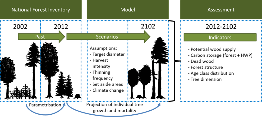
Oeko-Institut has been developing the Forestry and Agriculture Biomass Model (FABio) since 2015. FABio-Forest describes the growth of individual trees as a distance-independent individual tree growth model. Parameters for tree growth and mortality are derived from National Forest Inventory (NFI) data. Assumptions on forest management as well as for climate change drive the future development of tree stands.
In addition, FABio includes modules for estimating carbon stored of wood products, forest litter and soil. The model is based on the following components:
•a model for the characterisation of tree growth based on diameter, height, site productivity and forest stand density;
•an ingrowth model for the characterisation of new trees based on stand density and tree species;
•a mortality model for the characterisation of dieback processes depending on tree species, site productivity, age and stand density;
•a deadwood model factoring in decomposition of dead trees;
•a soil carbon model simulating the decomposition of biomass in litter and soil over time depending on climate factors; and
•a model for the sorting and classification of wood products, i.e., to sort harvested trees into use categories and quantify carbon retention times of wood products.
FABio supports scenario analyses for various silvicultural practices and management scenarios and their effects on wood supply, carbon sequestration and aspects of nature conservation.
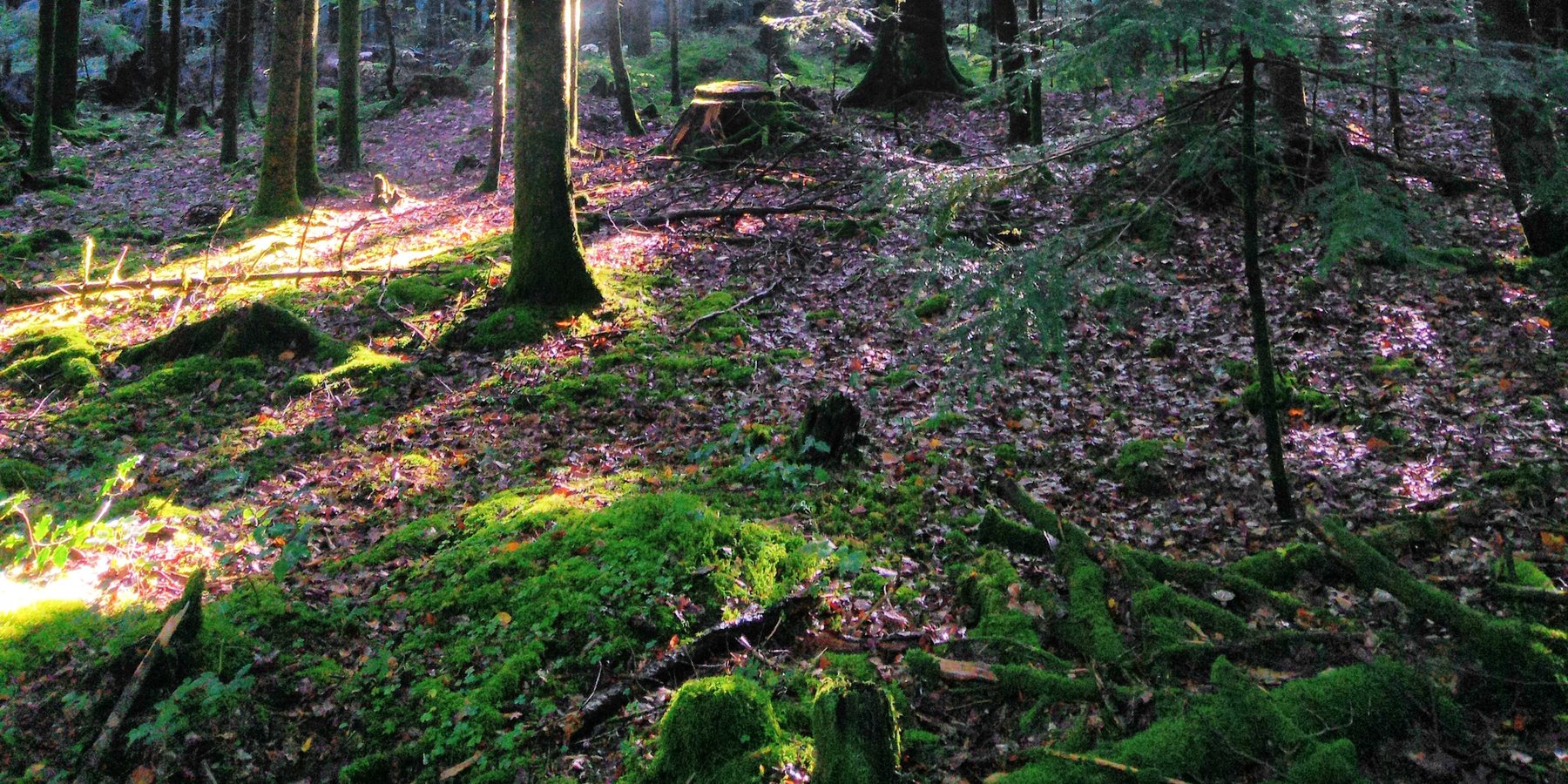
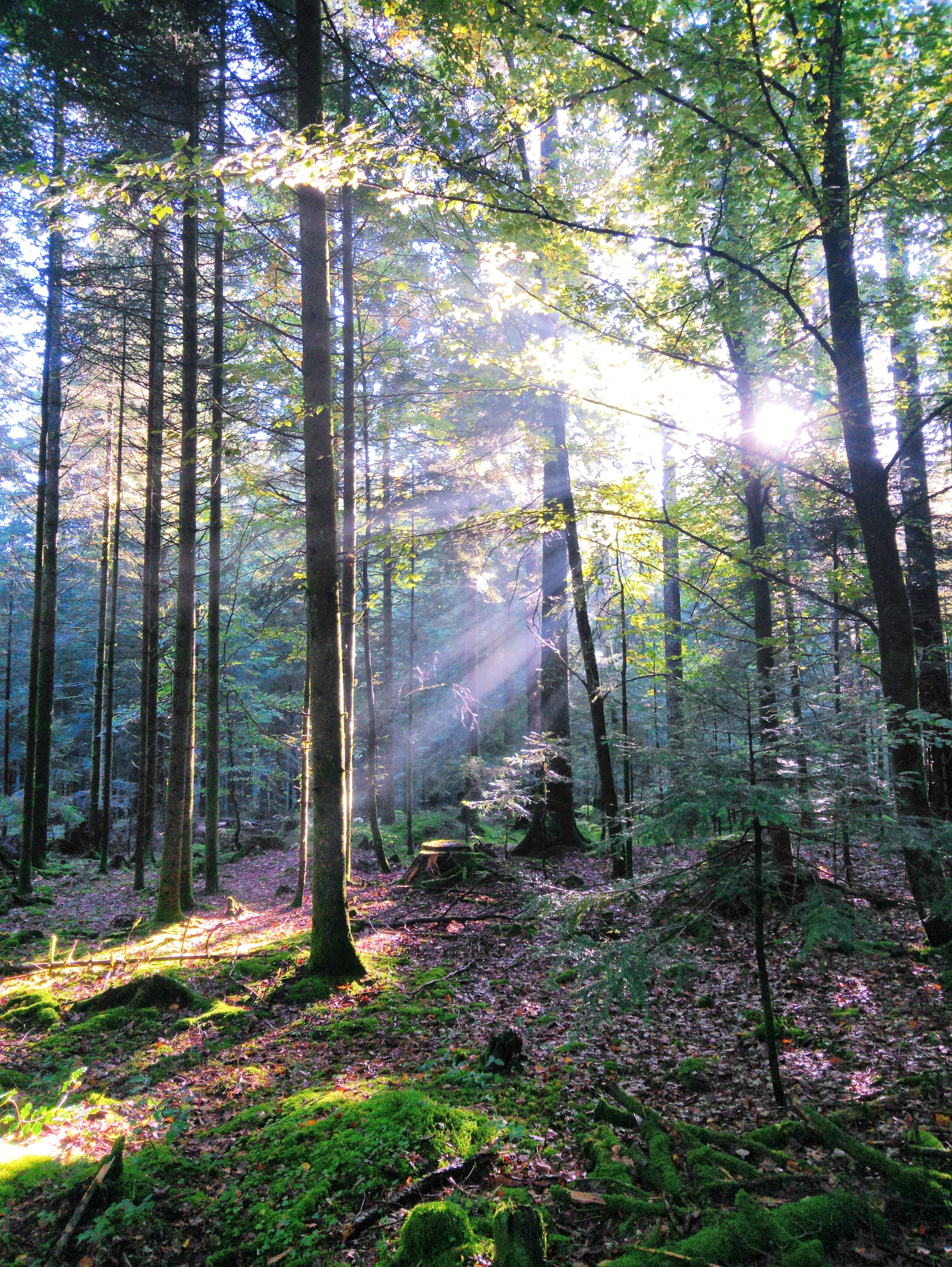
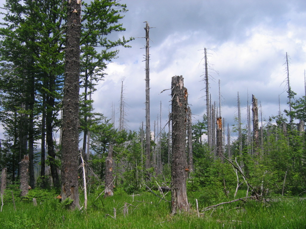
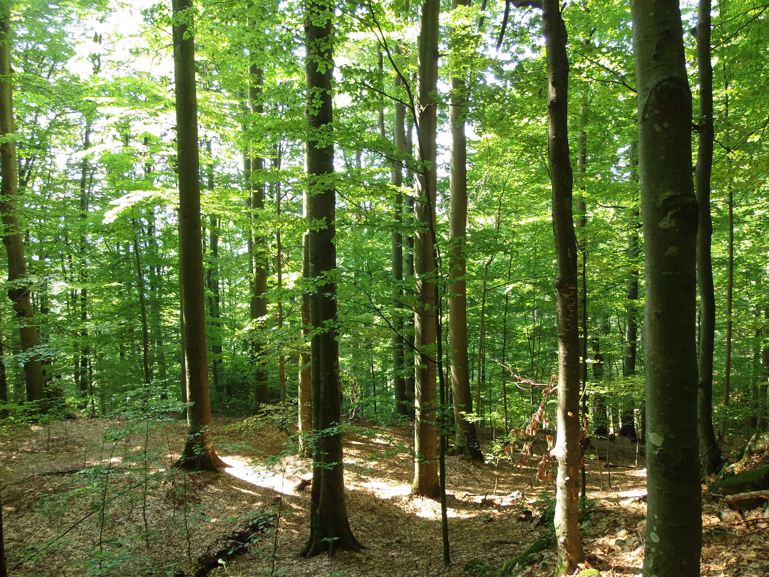
2.3 ຮູບພາບຂອງເຕັກໂນໂລຢີ
ສື່ຮູບພາບ
2.5 ປະເທດ / ເຂດ / ສະຖານທີ່ບ່ອນທີ່ ເຕັກໂນໂລຢີ ໄດ້ຮັບການນໍາໃຊ້ ແລະ ທີ່ຖືກປົກຄຸມດ້ວຍການປະເມີນຜົນ
ປະເທດ:
ເຢຍລະມັນ
ພາກພື້ນ / ລັດ / ແຂວງ:
Germany
ຂໍ້ມູນເພີ່ມເຕີມຂອງສະຖານທີ່:
Nationwide
ໃຫ້ລະບຸ ການແຜ່ຂະຫຍາຍ ເຕັກໂນໂລຢີ:
- ແຜ່ຂະຫຍາຍຢ່າງໄວວາໃນພື້ນທີ່
ຖ້າຫາກບໍ່ຮູ້ເນື້ອທີ່ທີ່ແນ່ນອນ, ໃຫ້ລະບຸ ເນື້ອທີ່ໂດຍປະມານ ທີ່ໃກ້ຄຽງ:
- > 10,000 ກມ 2
ສ່ວນຫຼາຍສະຖານທີ່ຕັ້ງຂອງເຕັກໂນໂລຢີ ແມ່ນ ຢູ່ໃນເຂດພື້ນທີ່ສະຫງວນບໍ?
ບໍ່ແມ່ນ
ຄວາມຄິດເຫັນ:
Total area potentially covered by the improved forest management technology is 11.4 Mha: the technology is modeled for - and applicable to - all the forest area in Germany.
2.6 ວັນທີໃນການຈັດຕັ້ງປະຕິບັດ
ຖ້າຫາກວ່າ ບໍ່ຮູ້ຈັກ ປີທີ່ຊັດເຈນ ແມ່ນໃຫ້ປະມານ ວັນທີເອົາ:
- ຕໍ່າກວ່າ 10 ປີ ຜ່ານມາ (ມາເຖິງປະຈຸບັນ)
2.7 ການນໍາສະເໜີ ເຕັກໂນໂລຢີ
ໃຫ້ລະບຸ ເຕັກໂນໂລຢີ ໄດ້ຖືກຈັດຕັ້ງປະຕິບັດຄືແນວໃດ?
- ເປັນສ່ວນໜື່ງຂອງລະບົບພື້ນເມືອງ (>50 ປີ)
3. ການໃຈ້ແຍກ ເຕັກໂນໂລຢີ ໃນການຄຸ້ມຄອງ ດິນແບບຍືນຍົງ
3.1 ຈຸດປະສົງຫຼັກ (ຫຼາຍ) ຂອງເຕັກໂນໂລຢີ
- ການອະນຸລັກ ລະບົບນິເວດ
- ປົກປັກຮັກສາ / ການປັບປຸງຊີວະນາໆພັນ
- ປັບຕົວຕໍ່ກັບການປ່ຽນແປງດິນຟ້າອາກາດ / ທີ່ຮ້າຍແຮງ ແລະ ຜົນກະທົບ
- ຫຼຸດຜ່ອນຜົນກະທົບ ຈາກການປ່ຽນແປງດິນຟ້າອາກາດ
- ສ້າງຜົນກະທົບ ທີ່ເປັນທາງບວກ ໃຫ້ແກ່ສັງຄົມ
3.2 ປະເພດການນໍາໃຊ້ທີ່ດິນ ໃນປະຈຸບັນ() ທີ່ເຕັກໂນໂລຢີ ໄດ້ຖືກນໍາໃຊ້
ການນຳໃຊ້ທີ່ດິນ ປະສົມພາຍໃນພື້ນທີ່ດຽວກັນ:
ບໍ່ແມ່ນ

ປ່າໄມ້ / ປ່າ
- (ເຄິ່ງ) ປ່າໄມ້ທໍາມະຊາດ / ປ່າປູກໄມ້
(ເຄີ່ງ) ປ່າທໍາມະຊາດ / ປ່າປູກ: ລະບຸປະເພດການຄຸ້ມຄອງ:
- ການຄັດເລືອກຕັດ
- ການເຄື່ອນຍ້າຍໄມ້ທີ່ຕັດ / ໄມ້ທີ່ຕາຍແລ້ວອອກໄປ
- ການນຳໃຊ້ເຄື່ອງປ່າຂອງດົງ
ປະເພດ ( ເຄີ່ງ ) ປ່າທຳມະຊາດ:
- ພືດຜັກທຳມະຊາດ ປ່າໄມ້ເຂດໜາວ
- ລະບົບພືດຜັກທຳມະຊາດ ພູຜ່າເຂດໜາວ
ປະເພດຂອງຕົ້ນໄມ້:
- Abies species (fir)
- Picea species (spruce)
- ສາຍພັນໝາກກໍ່
- Quercus robur, Quercus petraea, Fagus sylvatica
ຕົ້ນໄມ້ທີ່ຖືກລະບຸຢູ່ຂ້າງເທິງ ເປັນປ່າຜັດປ່ຽນໃບ ຫລື ປ່າດົງດິບ?
- ປະສົມປ່າປ່ຽນໃບ / ປ່າດົງດິບ
ຜົນຜະລິດ ແລະ ການບໍລິການ:
- ເຄື່ອງປ່າຂອງດົງ
- ໄມ້ຟືນ
- ຜະລິດຕະພັນ ປ່າໄມ້ອື່ນໆ
- ການອະນຸລັກທໍາມະຊາດ / ການປ້ອງກັນ
- ນັນທະນາການ / ການທ່ອງທ່ຽວ
3.3 ການນຳໃຊ້ທີ່ດິນ ມີການປ່ຽນແປງຍ້ອນການຈັດຕັ້ງທົດລອງເຕັກໂນໂລຢີ ແມ່ນບໍ່?
ການນຳໃຊ້ທີ່ດິນ ມີການປ່ຽນແປງຍ້ອນການຈັດຕັ້ງທົດລອງເຕັກໂນໂລຢີ ແມ່ນບໍ່?
- ບໍ່ (ຕໍ່ເໜືອງກັບ ຄຳຖາມ 3.4)
ການນຳໃຊ້ທີ່ດິນ ປະສົມພາຍໃນພື້ນທີ່ດຽວກັນ:
ບໍ່ແມ່ນ
3.4 ການສະໜອງນ້ຳ
ການສະໜອງນໍ້າ ໃນພື້ນທີ່ ທີ່ໄດ້ນໍາໃຊ້ ເຕັກໂນໂລຢີ:
- ນໍ້າຝົນ
3.5 ການນໍາໃຊ້ເຕັກໂນໂລຢີ ທີ່ຢູ່ໃນກຸ່ມການຄຸ້ມຄອງ ທີ່ດິນແບບຍືນຍົງ
- ການຄຸ້ມຄອງ ຊັບພະຍາກອນ ປ່າໄມ້ ທຳມະຊາດ ແລະ ເຄີ່ງທຳມະຊາດ
3.6 ມາດຕະການ ການຄຸ້ມຄອງ ທີ່ດິນແບບຍືນຍົງ ປະກອບດ້ວຍ ເຕັກໂນໂລຢີ

ມາດຕະການ ທາງດ້ານການຄຸ້ມຄອງ
- M2: ການປ່ຽນແປງ ການຈັດການຄຸ້ມຄອງ / ລະດັບຄວາມໜາແໜ້ນ
- M5: ການຄວບຄຸມ / ການປ່ຽນແປງຂອງອົງປະກອບຂອງຊະນິດ
3.7 ປະເພດດິນເຊື່ອມໂຊມ ຫຼັກທີ່ໄດ້ນໍາໃຊ້ ເຕັກໂນໂລຢີ

ການເຊື່ອມໂຊມ ທາງຊີວະພາບ
- Bc: ການຫຼຸດຜ່ອນການປົກຫຸ້ມຂອງພືດ
- Bh: ການສູນເສຍ ທີ່ຢູ່ອາໃສ ຂອງສິ່ງທີ່ມີຊິວິດ
- Bq: ປະລິມານ / ອິນຊີວັດຖຸຫຼຸດລົງ
- Bs: ຄຸນນະພາບ / ການອັດແໜ້ນ ຂອງສາຍພັນຫຼຸດລົງ
- Bp: ສັດຕູພືດ ແລະ ພະຍາດເພີ່ມຂື້ນ, ສູນເສຍນັກລ່າ ແມງໄມ້ທີ່ໃຊ້ປາບສັດຕູພືດ ແລະ ພະຍາດຂອງພືດ
3.8 ການປ້ອງກັນ, ການຫຼຸດຜ່ອນ, ຫຼືການຟື້ນຟູຂອງການເຊື່ອມໂຊມຂອງດິນ
ໃຫ້ລະບຸ ເປົ້າໝາຍ ເຕັກໂນໂລຢີ ທີ່ພົວພັນ ກັບຄວາມເຊື່ອມໂຊມຂອງດິນ:
- ປ້ອງກັນການເຊື່ອມໂຊມຂອງດິນ
4. ຂໍ້ກໍາໜົດ, ກິດຈະກໍາການປະຕິບັດ, ວັດຖຸດິບ, ແລະຄ່າໃຊ້ຈ່າຍ
4.1 ເຕັກນິກ ໃນການແຕ້ມແຜນວາດ ເຕັກໂນໂລຢີ
ຄຸນລັກສະນະ ຂອງເຕັກນິກ (ທີ່ກ່ຽວຂ້ອງ ກັບການແຕ້ມແຜນວາດ ທາງດ້ານເຕັກນີກ):
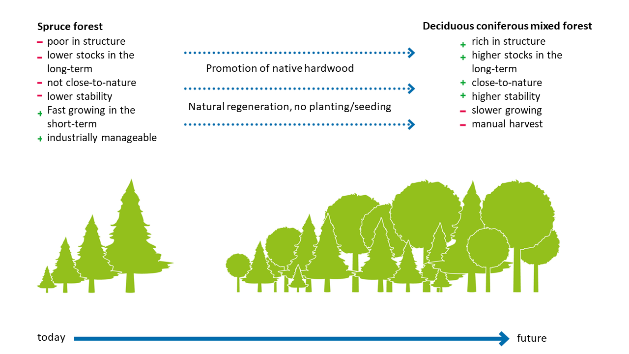
Spruce is the dominant tree species regarding coniferous trees growing outside their optimal habitat. So, a change from coniferous to deciduous coniferous mixed forest, mostly only affects spruce and not any other conifer tree species within Germany.
The drawing shows disadvantages (marked with a minus) and benefits (marked with a plus) of the forest types . The arrows indicate the measures to be taken to facilitate the transformation from a pure spruce forest to a mixed forest stand.
ຜູ້ຂຽນ:
Hannes Böttcher
ວັນທີ:
15/03/2018
ຄຸນລັກສະນະ ຂອງເຕັກນິກ (ທີ່ກ່ຽວຂ້ອງ ກັບການແຕ້ມແຜນວາດ ທາງດ້ານເຕັກນີກ):
Work and information flow of the FABio forest model used for the SLM forest management.
FABio-Forest describes the growth of individual trees as a distance-independent individual tree growth model. Parameters for tree growth and mortality are derived from National Forest Inventory (NFI) data. Assumptions on forest management as well as for climate change drive the future development of tree stands
ຜູ້ຂຽນ:
Klaus Hennenberg
ວັນທີ:
15/03/2018
4.2 ຂໍ້ມູນທົ່ວໄປກ່ຽວກັບການຄິດໄລ່ປັດໃຈຂາເຂົ້າໃນການຜະລິດ ແລະ ມູນຄ່າອື່ນໆ
ລະບຸ ວິທີການ ຄຳໃຊ້ຈ່າຍ ແລະ ປັດໄຈນໍາເຂົ້າ ທີ່ໄດ້ຄິດໄລ່:
- ຕໍ່ພື້ນທີ່ ທີ່ໄດ້ຈັດຕັ້ງປະຕິບັດ ເຕັກໂນໂລຢີ
ໃຫ້ລະບຸຫົວໜ່ວຍ ຂະໜາດ ແລະ ເນື້ອທີ່:
1 ha
ສະກຸນເງິນອື່ນໆ / ປະເທດອື່ນໆ (ລະບຸ):
€
ຖ້າກ່ຽວຂ້ອງ, ໃຫ້ລະບຸອັດຕາແລກປ່ຽນຈາກ USD ເປັນສະກຸນເງິນທ້ອງຖິ່ນ (ເຊັ່ນ: 1 USD = 79.9 Brazilian Real): 1 USD =:
0.93
ລະບຸ ຄ່າຈ້າງ ຄ່າແຮງງານສະເລ່ຍ ຕໍ່ ວັນ:
39,50
4.3 ການສ້າງຕັ້ງກິດຈະກໍາ
| ກິດຈະກໍາ | Timing (season) | |
|---|---|---|
| 1. | fencing to allow undisturbed regeneration without game pressure | all year |
| 2. | planting new trees | spring, no frequency |
| 3. | game control to allow natural regeneration/planted trees to grow | hunting season |
4.4 ຕົ້ນທຶນ ແລະ ປັດໄຈຂາເຂົ້າທີ່ຈໍາເປັນໃນຈັດຕັ້ງປະຕິບັດ
ຖ້າທ່ານບໍ່ສາມາດ ໄຈ້ແຍກຄ່າໃຊ້ຈ່າຍໃນຕາຕະລາງຂ້າງເທິງ, ໃຫ້ຄາດຄະເນຂອງຄ່າໃຊ້ຈ່າຍທັງຫມົດ ຂອງການສ້າງເຕັກໂນໂລຢີ:
10000.0
ຄວາມຄິດເຫັນ:
The range is between 5.000 - 15.000 €/ha per hectare, the cost vary, e.g. depending on what tree species are chosen, how many saplings are planted or how much natural regeneration is allowed. Total area is 11,4 mio hectares.
4.5 ບໍາລຸງຮັກສາ / ແຜນຈັດຕັ້ງປະຕິບັດ ກິດຈະກໍາ
| ກິດຈະກໍາ | ໄລຍະເວລາ / ຄວາມຖີ່ | |
|---|---|---|
| 1. | tending, thinning of young trees for managing tree species composition | every few years |
| 2. | monitoring of areas taken out of use | througout the year |
| 3. | wildlife management | hunting season, 1-2 per year |
4.6 ຄ່າໃຊ້ຈ່າຍ ແລະ ປັດໄຈນໍາເຂົ້າທີ່ຈໍາເປັນສໍາລັບການບໍາລຸງຮັກສາກິດຈະກໍາ / ແຜນປະຕິບັດ (ຕໍ່ປີ)
ຖ້າທ່ານບໍ່ສາມາດ ໄຈ້ແຍກຄ່າໃຊ້ຈ່າຍໃນຕາຕະລາງຂ້າງເທິງ, ໃຫ້ຄາດຄະເນຂອງຄ່າໃຊ້ຈ່າຍທັງຫມົດ ຂອງການບຳລຸງຮັກສາ ເຕັກໂນໂລຢີ:
2000.0
ຄວາມຄິດເຫັນ:
The range is between 500 - 4000 € /ha depending, among others, on the age and structure of the forest stands. If areas are taken out of wood production or leaving dead wood on the site after calamities then opportunity costs occur in the range between 200 €/ha and 1000 €/ha. Souce: https://www.bmuv.de/download/foerderrichtlinie-klimaangepasstes-waldmanagement-plus. Total area is 11,4 mio hectares.
4.7 ປັດໄຈ ທີ່ສໍາຄັນ ທີ່ສົ່ງຜົນກະທົບ ຕໍ່ຄ່າໃຊ້ຈ່າຍ
ໃຫ້ອະທິບາຍ ປັດໃຈ ທີ່ສົ່ງຜົນກະທົບ ຕໍ່ຕົ້ນທຶນ ໃນການຈັດຕັ້ງປະຕິບັດ:
Availability of labor, availability of seedlings, density of deer population, costs for fencing.
5. ສະພາບແວດລ້ອມທໍາມະຊາດ ແລະ ມະນຸດ
5.1 ອາກາດ
ປະລິມານນໍ້າຝົນປະຈໍາປີ
- < 250 ມີລິແມັດ
- 251-500 ມີລິແມັດ
- 501-750 ມີລິແມັດ
- 751-1,000 ມີລິແມັດ
- 1,001-1,500 ມີລິແມັດ
- 1,501-2,000 ມີລິແມັດ
- 2,001-3,000 ມີລິແມັດ
- 3,001-4,000 ມີລິແມັດ
- > 4,000 ມີລິແມັດ
ໃຫ້ລະບຸສະເລ່ຍ ປະລິມານນໍ້າຝົນຕົກປະຈໍາປີ ເປັນມິນລິແມັດ (ຖ້າຫາກຮູ້ຈັກ):
740.00
ໃຫ້ລະບຸ ຊື່ສະຖານີ ອຸຕຸນິຍົມ ເພື່ອເປັນຂໍ້ມູນອ້າງອີງ:
Evaluation from the Federal Environment Agency of Germany based on data provided by the German Weather Service (DWD)
ເຂດສະພາບອາກາດກະສິກໍາ
- ເຄີ່ງຄວາມຊຸ່ມ
The length of the growing period in Germany is around 200 days. Germany is part of the temperate, rainy climate zone of the mid-latitudes. The annual mean temperature from 1961 to 1990 was 8.2°C.
5.2 ພູມິປະເທດ
ໃຫ້ລະບຸ ເຕັກໂນໂລຢີ ທີ່ໄດ້ຖືກນຳໃຊ້:
- ບໍ່ກ່ຽວຂ້ອງ
ຄຳເຫັນ ແລະ ຂໍ້ມູນສະເພາະ ເພີ່ມເຕີມ ກ່ຽວກັບ ພູມີປະເທດ:
Forests in Germany are found in all different types of landscapes. In the north everything is rather flat, the center of Germany consists of mountains around the elevation of up to 1000 m a.s.l and the very south has high mountain ranges of an altitude of almost 3000 m a.s.l.
5.3 ດິນ
ຖ້າເປັນໄປໄດ້ ແມ່ນໃຫ້ຕິດຄັດ ການພັນລະນາດິນ ຫຼື ຂໍ້ມູນສະເພາະຂອງດິນ, ຕົວຢ່າງ, ຄຸນລັກສະນະ ປະເພດຂອງດິນ, ຄ່າຄວາມເປັນກົດ / ເປັນດ່າງຂອງດິນ, ສານອາຫານ, ດິນເຄັມ ແລະ ອື່ນໆ.
Same as above as the SLM covers the entire area of the country all different soils with the above mentioned parameters are represented that occur in the respective climatic zone.
5.4 ມີນໍ້າ ແລະ ຄຸນນະພາບ
ລະດັບ ນໍ້າໃຕ້ດິນ:
5-50 ແມັດ
ຄຸນນະພາບນໍ້າ (ບໍ່ມີການບໍາບັດ):
ມີນໍ້າດື່ມ
ຄຸນນະພາບນ້ຳ ໝາຍເຖີງ:
ນ້ຳໃຕ້ດິນ
ມີບັນຫາ ກ່ຽວກັບນໍ້າເຄັມບໍ່?
ບໍ່ແມ່ນ
ເກີດມີນໍ້າຖ້ວມ ໃນພື້ນທີ່ບໍ່?
ແມ່ນ
ເປັນປົກກະຕິ:
ຕອນ
ຄວາມຄິດເຫັນ ແລະ ຂໍ້ກໍານົດ ເພີ່ມເຕີມ ກ່ຽວກັບ ຄຸນນະພາບ ແລະ ປະລິມານ ຂອງນ້ຳ:
Flooding occurs only after very heavy rainfall, when certain weather conditions apply. The latest major floods were in 2003, 2013 and 2024.
5.5 ຊີວະນາໆພັນ
ຄວາມຄິດເຫັນ ແລະ ລັກສະນະສະເພາະ ເພີ່ມເຕີມກ່ຽວກັບ ຊີວະນາໆພັນ:
It differs very much from region to region, depending on what type of forest is there, regarding mountainous or flat area, species composition and age structure.
5.6 ຄຸນລັກສະນະ ຂອງຜູ້ນໍາໃຊ້ທີ່ດິນ ທີ່ໄດ້ນໍາໃຊ້ເຕັກໂນໂລຢີ
ຢູ່ປະຈຳ ຫຼື ເຄື່ອນຍ້າຍຕະຫຼອດ:
- ບໍ່ເຄື່ອນໄຫວ
ລະບົບ ການຕະຫຼາດ ແລະ ຜົນຜະລິດ:
- ການຄ້າ / ຕະຫຼາດ
ບຸກຄົນ ຫຼື ກຸ່ມ:
- ບຸກຄົນ / ຄົວເຮືອນ
- ກຸ່ມ / ຊຸມຊົນ
ລະດັບ ການຫັນເປັນກົນຈັກ:
- ເຄື່ອງກົນຈັກ
ເພດ:
- ຜູ້ຍິງ
- ຜູ້ຊາຍ
ອາຍຸ ຂອງຜູ້ນໍາໃຊ້ທີ່ດິນ:
- ໄວກາງຄົນ
- ຜູ້ສູງອາຍຸ
5.7 ເນື້ອທີ່ສະເລ່ຍຂອງດິນ ທີ່ຜູ້ນຳໃຊ້ທີ່ດິນ ໃຊ້ເຮັດເຕັກໂນໂລຢີ
- <0.5 ເຮັກຕາ
- 0.5-1 ເຮັກຕາ
- 1-2 ເຮັກຕາ
- 2-5 ເຮັກຕາ
- 5-15 ເຮັກຕາ
- 15-50 ເຮັກຕາ
- 50-100 ເຮັກຕາ
- 100-500 ເຮັກຕາ
- 500-1,000 ເຮັກຕາ
- 1,000-10,000 ເຮັກຕາ
- > 10,000 ເຮັກຕາ
ຖືໄດ້ວ່າ ເປັນຂະໜາດນ້ອຍ, ກາງ ຫຼື ໃຫຍ່ (ອີງຕາມເງື່ອນໄຂ ສະພາບຄວາມເປັນຈິງ ຂອງທ້ອງຖີ່ນ)? :
- ຂະໜາດໃຫຍ່
ຄວາມຄິດເຫັນ:
This applies to all to different forest owners with different forest land sizes. The average size of privately owned forest area is 2,4 ha. Publicly owned forest is typically larger.
5.8 ເຈົ້າຂອງທີ່ດິນ, ສິດໃຊ້ທີ່ດິນ, ແລະ ສິດທິການນໍາໃຊ້ນໍ້າ
- all of the above
- all of the above
- no information
ສິດນຳໃຊ້ທີ່ດິນ ແມ່ນ ອີງໃສ່ລະບົບກົດໝາຍແບບດັ້ງເດີມບໍ?
ບໍ່ແມ່ນ
5.9 ການເຂົ້າເຖິງການບໍລິການ ແລະ ພື້ນຖານໂຄງລ່າງ
ສຸຂະພາບ:
- ທຸກຍາກ
- ປານກາງ
- ດີ
ການສຶກສາ:
- ທຸກຍາກ
- ປານກາງ
- ດີ
ການຊ່ວຍເຫຼືອ ດ້ານວິຊາການ:
- ທຸກຍາກ
- ປານກາງ
- ດີ
ການຈ້າງງານ (ຕົວຢ່າງ, ການເຮັດກິດຈະກໍາອື່ນ ທີ່ບໍ່ແມ່ນ ການຜະລິດກະສິກໍາ):
- ທຸກຍາກ
- ປານກາງ
- ດີ
ຕະຫຼາດ:
- ທຸກຍາກ
- ປານກາງ
- ດີ
ພະລັງງານ:
- ທຸກຍາກ
- ປານກາງ
- ດີ
ຖະໜົນຫົນທາງ ແລະ ການຂົນສົ່ງ:
- ທຸກຍາກ
- ປານກາງ
- ດີ
ການດື່ມນໍ້າ ແລະ ສຸຂາພິບານ:
- ທຸກຍາກ
- ປານກາງ
- ດີ
ການບໍລິການ ທາງດ້ານການເງິນ:
- ທຸກຍາກ
- ປານກາງ
- ດີ
6. ຜົນກະທົບ ແລະ ລາຍງານສະຫຼຸບ
6.1 ການສະແດງຜົນກະທົບ ພາຍໃນພື້ນທີ່ ທີ່ໄດ້ຈັດຕັ້ງປະຕິບັດ ເຕັກໂນໂລຢີ
ຜົນກະທົບທາງເສດຖະກິດສັງຄົມ
ການຜະລິດ
ຜົນຜະລິດໄມ້
ຜົນກະທົບຕໍ່ລະບົບນິເວດ
ວົງຈອນນໍ້າ / ນໍ້າ
ປະລິມານນໍ້າ
ຄຸນນະພາບນໍ້າ
ການໄຫຼ ຂອງນໍ້າໜ້າດິນ
ຊັ້ນນໍ້າໄຕ້ດິນ / ນໍ້າ
ການລະເຫີຍອາຍ
ດິນ
ຄວາມຊຸ່ມຂອງດິນ
ວົງຈອນ ຂອງສານອາຫານໃນດິນ
ຊີວະນານາພັນ: ສັດ, ພືດ
ການປົກຫຸ້ມຂອງພືດ
ມວນຊີວະພາບ / ຢູ່ເທິງຊັ້ນດິນ C
ຄວາມຫຼາກຫຼາຍຂອງພືດ
ຄວາມຫຼາກຫຼາຍຂອງສັດ
ຄວາມຫຼາກຫຼາຍ ທາງດ້ານທີ່ຢູ່ອາໃສ ຂອງສິ່ງທີ່ມີຊີວິດ
ການຫຼຸດຜ່ອນ ຄວາມສ່ຽງ ຈາກໄພພິບັດ ແລະ ອາກາດປ່ຽນແປງ
ການລະເຫີຍອາຍກາກບອນ ແລະ ອາຍຜິດເຮືອນແກ້ວ
ລະບຸ ການປະເມີນຜົນກະທົບ ຕໍ່ສະຖານທີ່ (ການວັດແທກ):
The model provides information that if timber extraction is reduced that it will impact positively the C sequestration rate and C storage of the forest. There are no other impacts modeled explicitly but impacts can be expected also on the water cycle, soil quality, and biodiversity.
6.2 ຜົນກະທົບທາງອ້ອມ ຈາກການນໍາໃຊ້ເຕັກໂນໂລຢີ
ກໍານົດ ການປະເມີນ ຜົນກະທົບທາງນອກ (ການວັດແທກ):
not assessed
6.3 ການປ້ອງກັນ ແລະ ຄວາມບອບບາງ ຂອງເຕັກໂນໂລຢິ ໃນການປ່ຽນແປງສະພາບດິນຟ້າອາກາດ ແລະ ກ່ຽວຂ້ອງກັບອາກາດທີ່ມີການປ່ຽນແປງທີ່ຮຸນແຮງ / ໄພພິບັດທາງທໍາມະຊາດ (ຮັບຮູ້ໄດ້ໂດຍຜູ້ນໍາໃຊ້ທີ່ດິນ)
ການປ່ຽນແປງດິນຟ້າອາກາດ ເທື່ອລະກ້າວ
ການປ່ຽນແປງດິນຟ້າອາກາດ ເທື່ອລະກ້າວ
| ລະດູການ | ເພີ່ມຂື້ນ ຫຼື ຫຼຸດລົງ | ການນໍາໃຊ້ ເຕັກໂນໂລຢີ ສາມາດ ຮັບມື ໄດ້ຄືແນວໃດ? | |
|---|---|---|---|
| ອຸນຫະພູມປະຈໍາປີ | ເພີ່ມຂື້ນ | ປານກາງ | |
| ອຸນຫະພູມລະດູການ | ລະດູຮ້ອນ | ເພີ່ມຂື້ນ | ປານກາງ |
| ປະລິມານນໍ້າຝົນປະຈໍາປີ | ຫຼຸດລົງ | ປານກາງ | |
| ປະລິມານນໍ້າຝົນຕາມລະດູການ | ລະດູຮ້ອນ | ຫຼຸດລົງ | ປານກາງ |
ອາກາດ ທີ່ກ່ຽວພັນກັບຄວາມຮຸນແຮງ (ໄພພິບັດທາງທໍາມະຊາດ)
ໄພພິບັດທາງພູມອາກາດ
| ການນໍາໃຊ້ ເຕັກໂນໂລຢີ ສາມາດ ຮັບມື ໄດ້ຄືແນວໃດ? | |
|---|---|
| ແຫ້ງແລ້ງ | ບໍ່ຮູ້ |
ໄພພິບັດທາງຊີວະພາບ
| ການນໍາໃຊ້ ເຕັກໂນໂລຢີ ສາມາດ ຮັບມື ໄດ້ຄືແນວໃດ? | |
|---|---|
| ແມງໄມ້ / ການລະບາດຂອງພະຍາດ | ບໍ່ຮູ້ |
6.4 ການວິເຄາະຕົ້ນທຶນ ແລະ ຜົນປະໂຫຍດ
ຈະເຮັດປະໂຫຍດເພື່ອປຽບທຽບກັບຄ່າໃຊ້ຈ່າຍກັບສິ່ງກໍ່ສ້າງ (ຈາກທັດສະນະຂອງຜູ້ນຳໃຊ້ທີ່ດິນ) ໄດ້ແນວໃດ?
ຜົນຕອບແທນ ໃນໄລຍະຍາວ:
ຜົນກະທົບທາງບວກ
ຈະໄດ້ຮັບຜົນປະໂຫຍດເມື່ອປຽບທຽບກັບ / ຄ່າໃຊ້ຈ່າຍໃນການບຳລຸງຮັກສາທີເ່ກີດຂື້ນອິກ (ຈາກທັດສະນະຄະຕິຂອງຜູ້ນຳໃຊ້ທີ່ດິນ) ໄດ້ແນວໃດ?
ຜົນຕອບແທນ ໃນໄລຍະຍາວ:
ຜົນກະທົບທາງບວກ
ຄວາມຄິດເຫັນ:
Regarding forests, long-term refers to a time span of a minimum of 60 years.
6.5 ການປັບຕົວຮັບເອົາເຕັກໂນໂລຢີ
ຖ້າຫາກວ່າມີ, ປະລິມານ (ຈໍານວນຂອງຄົວເຮືອນ / ເນື້ອທີ່ການຄຸ້ມຄອງ):
unknown
6.7 ຈຸດແຂງ / ຂໍ້ດີ / ໂອກາດ ໃນການນໍາໃຊ້ ເຕັກໂນໂລຢີ
| ຈຸດແຂງ / ຂໍ້ດີ / ໂອກາດໃນການນໍາໃຊ້ທີ່ດິນ |
|---|
| The payment for ecosystem services creates a new field of income and thus diversifies its' revenues. |
| The establishment of a more resilient forest provides benefits to the forest owner as he can longer profit from the resources the forest produces/provides. |
| ຈຸດແຂງ / ຈຸດດີ / ໂອກາດ ຈາກທັດສະນະຂອງຜູ້ປ້ອນຂໍ້ມູນ ຫຼື ບຸກຄົນສຳຄັນ |
|---|
| It is expected that there will be an increase of biodiversity as a higher diversity in tree species attracts other fauna and new habitats are created. Areas taken out of use might contribute to that aspect as well. |
| Natural development of forest sites taken out of use provides the opportunity to have old-growth trees in the forest again and diversify the age structure in forested areas. Old trees also provide great habitats to a variety of different species. |
| The increase of wood stock as less trees are harvested will increase CO2 sequestration. |
6.8 ຈຸດອ່ອນ / ຂໍ້ເສຍ / ຄວາມສ່ຽງ ໃນການນໍາໃຊ້ ເຕັກໂນໂລຢີ ແລະ ວິທີການແກ້ໄຂບັນຫາ
| ຈຸດອ່ອນ / ຂໍ້ເສຍ / ຄວາມສ່ຽງໃນມຸມມອງຂອງຜູ້ນໍາໃຊ້ທີ່ດິນ | ມີວິທີການແກ້ໄຂຄືແນວໃດ? |
|---|---|
| reduction of timber supply | import, reduce demand |
| ຈຸດອ່ອນ/ຂໍ້ບົກຜ່ອງ/ຄວາມສ່ຽງ ຈາກທັດສະນະຂອງຜູ້ປ້ອນຂໍ້ມູນ ຫຼື ບຸກຄົນສຳຄັນ | ມີວິທີການແກ້ໄຂຄືແນວໃດ? |
|---|---|
| management of multi species forests requires silvicultural knowledge | training |
7. ເອກະສານອ້າງອີງ ແລະ ການເຊື່ອມຕໍ່
7.1 ວິທີການ / ແຫຼ່ງຂໍ້ມູນ
- ສໍາພາດ ຊ່ຽວຊານ ການຄຸ້ມຄອງ ດິນແບບຍືນຍົງ
in-house specialists: 4
- ການລວບລວມ ບົດລາຍງານ ແລະ ເອກະສານ ອື່ນໆ ທີ່ມີຢູ່ແລ້ວ
4 (s. references below)
ຄວາມຄິດເຫັນ:
Data collection for a national forest inventory takes about 2 years ahead of the official release. It is similar regarding the C inventory, data collection was done in the year ahead.
7.2 ເອກກະສານອ້າງອີງທີ່ເປັນບົດລາຍງານ
ຫົວຂໍ້, ຜູ້ຂຽນ, ປີ, ISBN:
Forest Vision Germany - Description of methodology, assumptions and results , Böttcher et al., 2018
ມີຢູ່ໃສ?ມູນຄ່າເທົ່າໃດ?
https://www.oeko.de/fileadmin/oekodoc/Forest-Vision-Methods-and-Results.pdf
ຫົວຂໍ້, ຜູ້ຂຽນ, ປີ, ISBN:
Referenzszenario der Holzverwendung und der Waldentwicklung im UBA-Projekt BioSINK, Pfeiffer et al., 2023
ມີຢູ່ໃສ?ມູນຄ່າເທົ່າໃດ?
file:///C:/Users/a.benndorf/Downloads/WP-Referenzszenario-BioSINK.pdf
ຫົວຂໍ້, ຜູ້ຂຽນ, ປີ, ISBN:
Zukunftsaufgabe Waldanpassung, ANDREAS BOLTE, MARKUS HÖHL, PETRA HENNIG, TOBIAS SCHAD, FRANZ KROIHER, BJÖRN SEINTSCH, HERMANN ENGLERT, LYDIA ROSENKRANZ, 2018
ມີຢູ່ໃສ?ມູນຄ່າເທົ່າໃດ?
Zukunftsaufgabe Waldanpassung
7.3 ເຊື່ອມຕໍ່ກັບຂໍ້ມູນທີ່ກ່ຽວຂ້ອງໂດຍກົງ
ຫົວຂໍ້ / ພັນລະນາ:
Portal on Forest Inventories
URL:
https://bwi.info/start.aspx
ຫົວຂໍ້ / ພັນລະນາ:
Förderrichtlinie Klimaangepasstes Waldmanagement PLUS
URL:
https://www.bmuv.de/download/foerderrichtlinie-klimaangepasstes-waldmanagement-plus
ຂໍ້ມູນການເຊື່ອມຕໍ່ ແລະ ເນື້ອໃນ
ຂະຫຍາຍທັງໝົດ ຍຸບທັງໝົດການເຊື່ອມຕໍ່
ບໍ່ມີຂໍ້ມູນການເຊື່ອມຕໍ່
ເນື້ອໃນ
ບໍ່ມີເນື້ອໃນ