Trenches combined with living hedges or grass lines [Руанда]
- Шинийг нээх:
- Шинэчлэх:
- Эмхэтгэгч: Desire Kagabo
- Хянан тохиолдуулагч: –
- Хянагч: David Streiff
Imiringoti
technologies_1550 - Руанда
Бүлгүүдийг үзэх
Бүгдийг дэлгэх Бүгдийг хаах1. Ерөнхий мэдээлэл
1.2 Технологийг үнэлэх, баримтжуулах ажилд хамаарах мэдээлэл өгсөн хүмүүс, байгууллагуудын холбоо барих мэдээлэл
ГТМ мэргэжилтэн:
ГТМ мэргэжилтэн:
Технологи баримтжуулах/үнэлэх ажилд дэмжлэг үзүүлсэн төслийн нэр (шаардлагатай бол)
The Transboundary Agro-ecosystem Management Project for the Kagera River Basin (GEF-FAO / Kagera TAMP )Технологи баримтжуулах/үнэлэх ажилд дэмжлэг үзүүлсэн байгууллага(ууд)-ын нэр (шаардлагатай бол)
Food and Agriculture Organization of the United Nations (FAO) - ИталиТехнологи баримтжуулах/үнэлэх ажилд дэмжлэг үзүүлсэн байгууллага(ууд)-ын нэр (шаардлагатай бол)
Rwanda Agriculture Board (Rwanda Agriculture Board) - Руанда1.3 ВОКАТ-аар баримтжуулсан өгөгдлийг ашиглахтай холбоотой нөхцөл
Эмхэтгэгч болон гол мэдээлэгч хүн(хүмүүс) WOCAT аргачлалаар баримтжуулсан мэдээллийг ашиглахтай холбоотой нөхцлийг хүлээн зөвшөөрсөн:
Тийм
2. ГТМ Технологийн тодорхойлолт
2.1 Технологийн товч тодорхойлолт
Технологийн тодорхойлолт:
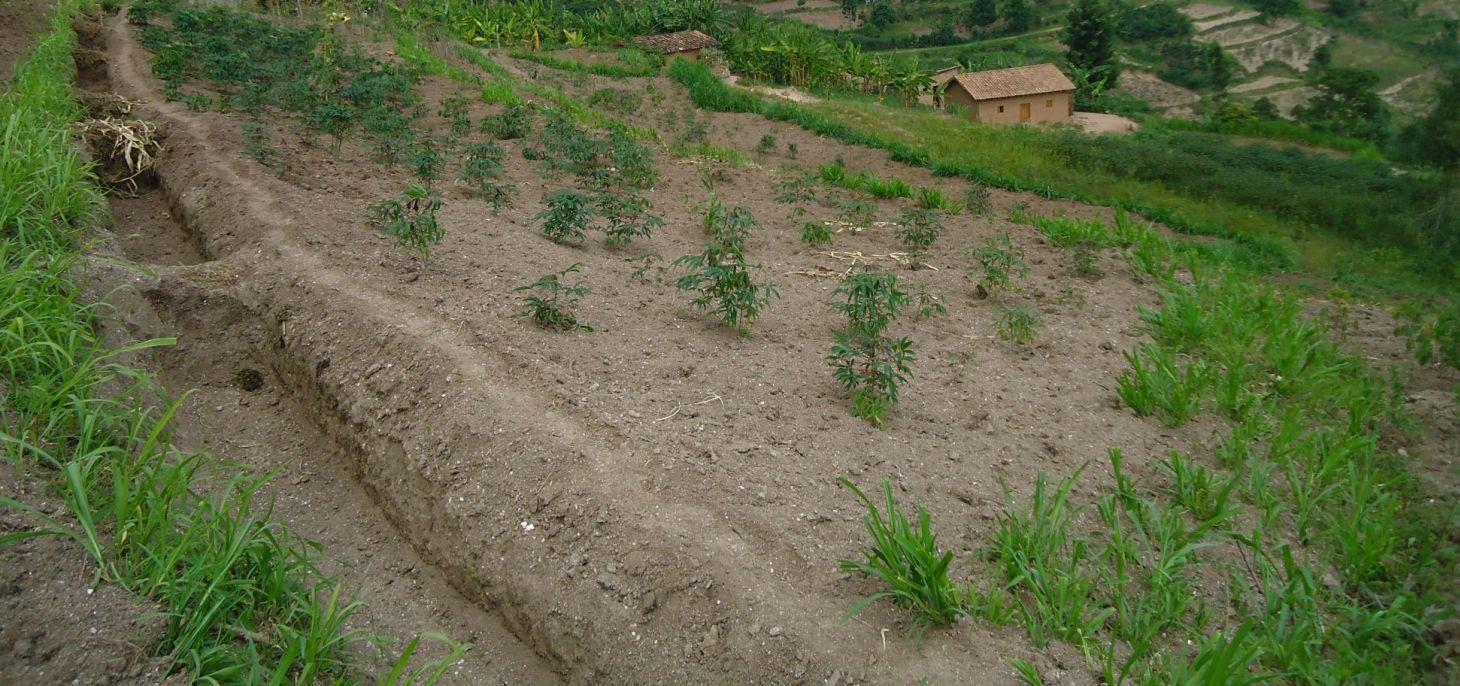
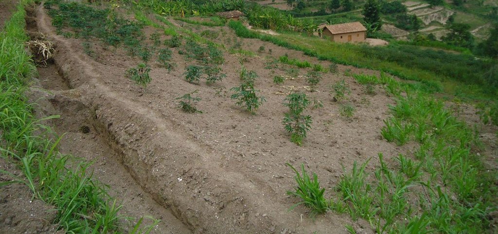
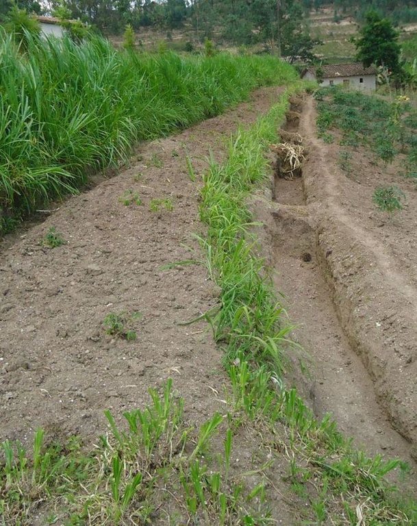
Trenches combined with living hedges or grass lines are slow-forming terraces to control soil erosion by changing the length of the slope and progressively reducing the slope gradient; he slope steepness decreases progressively by hydric and tillage erosion.
2.2 Технологийн дэлгэрэнгүй тодорхойлолт
Тодорхойлолт:
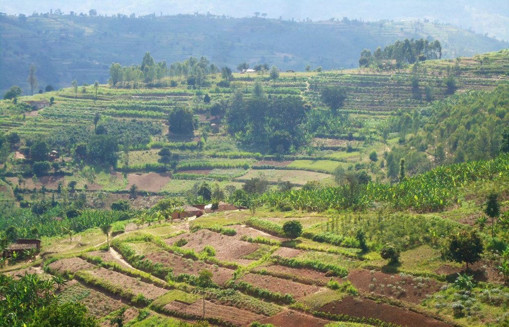
Trenches combined with living hedges or grassed lines are less labour-intensive method that is practiced in the highlands of Rwanda. The method involves digging trenches which have grass-stabilized banks, or simply planting grass strips and vegetative barriers across the slope to reduce runoff. This method, locally referred to as ‘progressive terracing’, is more adaptable by individual farmers across the country. In the study conducted by Kagabo et al. (2013) in the highlands of Buberuka Region of Rwanda, it was noted that net increment in yields and returns on investment increased with the age of terraces, since the capital costs of terracing were easily recovered. These terraces also showed more resilience, some being over 30 years old and still effective. Along the contour band, soil from the upper parts of the slope is removed and deposited above by creating a series of discontinuous trenches in order to extend the flat terrain. Over 5-10 years, the terraces become enlarged and form a terrace along the contour, such that the slopes are transformed over time into level bench terraces (but never %).
Purpose of the Technology: The main purpose of this technology is to reduce runoff and soil erosion on the slope and to improve soil quality and soil moisture retention. Grass strips or living hedgerows are intended to both trap sediments and facilitate the slow formation of terraces.
Establishment / maintenance activities and inputs: The establishment of trenches combined with living hedges or grassed lines is less labor intensive and requires less skilled labor. Regular maintenance banks on which living hedges are planted, to seasonally stream living hedges to minimize the competition of nutrients and water with plants. To efficiently use these terraces it is advisable to introduce intensive and rentable cropping systems or agroforestry with fruits and forage trees.
Natural / human environment: This technology was reported to be very resilient as trenches combined with living hedges or grassed lines of 20+ year old are still effective in controlling soil erosion. However, the soil quality on these formed terraces between alleys does not homogenize 100% over the course of time. Large soil fertility gradients with marked spatial difference in both soil quality and crop yield from their upper parts downwards of the terraces is observed. The soil in the lower parts of the terraces showed as much as 57% more organic carbon content and 31% more available phosphorous than the soil in the upper parts of the terraces (Kagabo et al. 2013).
2.3 Технологийн гэрэл зураг
2.5 Энэ үнэлгээнд хамрагдсан технологийг хэрэгжүүлсэн улс орон/ бүс нутаг/ байршил
Улс:
Руанда
Улс/аймаг/сум:
Rwanda
Байршлын дэлгэрэнгүй тодорхойлолт:
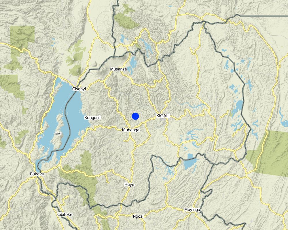
Kamonyi District (Southern Province)
Map
×2.6 Хэрэгжсэн хугацаа
Байгуулсан тодорхой оныг мэдэхгүй бол баримжаа хугацааг тодорхойл:
- 10-50 жилийн өмнө
2.7 Технологийн танилцуулга
- Government
3. ГТМ технологийн ангилал
3.1 Технологийн үндсэн зорилго (ууд)
- газрын доройтлыг бууруулах, сэргийлэх, нөхөн сэргээх
3.2 Технологи нэвтрүүлсэн газрын одоогийн газар ашиглалтын хэлбэр(үүд)

Тариалангийн талбай
- Нэг наст үр тариа
- Мод, сөөг тарих
Гол нэрийн үр тариа (арилжааны болон хүнсний таримал):
major cash crop: Coffee and cassava
major food crop: Banana and beans
other: Maize
Тайлбар:
Major land use problems (compiler’s opinion): Soil erosion, water contamination due to sediment loads, decrease of soil fertility and soil depth, loss of vegetation cover
Major land use problems (land users’ perception): Soil erosion, contamination of water (the turbidity of water is high) therefore the domestic use of water is a problem.
Future (final) land use (after implementation of SLM Technology): Cropland: Ca: Annual cropping
Хэрэв технологи нэвтрүүлснээр газар ашиглалтад өөрчлөлт гарсан бол технологи нэвтрүүлэхээс өмнө байсан газар ашиглалтын хэлбэрийг тодорхойлно уу:
Grazing land: Ge: Extensive grazing land
3.3 Газар ашиглалтын тухай нэмэлт мэдээлэл
Технологи хэрэгжүүлсэн газрын усан хангамж:
- Байгалийн усалгаатай
Тодорхойлно уу:
Longest growing period in days: 150; Longest growing period from month to month: September – February; Second longest growing period in days: 120; Second longest growing period from month to month: March – July
Малын нягт (шаардлагатай бол):
10-25 LU /km2
3.4 Технологи ГТМ-ийн аль бүлэгт хамаарах вэ
- хөрс/ ургамлын бүрхэвч сайжруулах
- Налуугийн арга хэмжээ
3.5 Технологийн хамрах талбай
Технологи өргөн дэлгэрсэн эсхийг тодорхойл:
- газар дээр жигд тархсан
Технологи газар нутгийн хэмжээнд жигд тархсан бол түүний эзлэх талбайг дундажаар тооцож тэмдэглэ:
- 10-100 км2
Тайлбар:
The area covered by this technology has been estimated
3.6 Технологийг бүрдүүлэх ГТМ арга хэмжээ

Ургамлын арга хэмжээ
- V1: Мод ба бут, сөөг
- V2: Өвс ба олон наст өвслөг ургамал

Барилга байгууламжийн арга хэмжээ
- S3: Шаталсан суваг, шуудуу, голдирол
Тайлбар:
Type of vegetative measures: aligned: -contour, aligned: -along boundary
3.7 Технологид харгалзах газрын доройтлын төрөл

хөрс усаар эвдрэх
- Wt: Хөрсний гадаргын угаагдал
- Wg: Гуу жалгын элэгдэл
- Wo: Усны элэгдлийн дам нөлөө
Тайлбар:
Secondary types of degradation addressed: Wg: gully erosion / gullying, Wo: offsite degradation effects
Main causes of degradation: deforestation / removal of natural vegetation (incl. forest fires) (Used as energy (fire wood)), other natural causes (avalanches, volcanic eruptions, mud flows, highly susceptible natural resources, extreme topography, etc.) specify (Steep slopes in many cases are over 60%), population pressure (High density (in rural area over 400 inhabitant per ha))
Secondary causes of degradation: soil management (Less use of organic manure), crop management (annual, perennial, tree/shrub) (No proper crop rotation and all crop residues are exported), over-exploitation of vegetation for domestic use (Fodder), poverty / wealth (Farmers have low income and have less access to off farm income or remittances), education, access to knowledge and support services (High rate of irriteracy)
3.8 Газрын доройтлоос урьдчилан сэргийлэх, сааруулах ба нөхөн сэргээх
Газрын доройтолтой холбоотойгоор Технологи ямар зорилго тавьсан болохыг тодорхойл:
- газрын доройтлоос урьдчилан сэргийлэх
- Газрын доройтлыг бууруулах
Тайлбар:
Secondary goals: prevention of land degradation
4. Техникийн нөхцөл, хэрэгжүүлсэн үйл ажиллагаа, материал ба зардал
4.1 Технологийн техник зураг
Зохиогч:
Kagabo Desire and Guy Ngenzi, RAB, 5016 Kigali
4.2 Техникийн үзүүлэлт/ техникийн зургийн тайлбар
Trenches are dug in trapezoidal shape with 40 cm of height, 30 cm of base length and 50 cm of top lengths. An empty space of 40 cm is left between two consecutive trenches along a contour line.
Location: Kamonyi/Giko. Southern province
Date: 2012
Technical knowledge required for field staff / advisors: high (Special training should be provided to field staff to be able to make an adequate design and teach land users)
Technical knowledge required for land users: low (Land users are required to only implement the technology under the supervision of field staff)
Technical knowledge required for Farmer representive: high (These farmers need to be trained so that the can easily supervise the work)
Main technical functions: control of concentrated runoff: retain / trap, reduction of slope length, improvement of topsoil structure (compaction), increase of infiltration, sediment retention / trapping, sediment harvesting
Secondary technical functions: control of concentrated runoff: impede / retard, reduction of slope angle
Aligned: -contour
Vegetative material: G : grass
Number of plants per (ha): 11114
Vertical interval between rows / strips / blocks (m): 1
Spacing between rows / strips / blocks (m): 6
Vertical interval within rows / strips / blocks (m): 0.3
Width within rows / strips / blocks (m): 0.2
Aligned: -along boundary
Vegetative material: T : trees / shrubs, F : fruit trees / shrubs, G : grass
Number of plants per (ha): 84
Vertical interval between rows / strips / blocks (m): NA
Spacing between rows / strips / blocks (m): NA
Vertical interval within rows / strips / blocks (m): 20
Width within rows / strips / blocks (m): NA
Trees/ shrubs species: Grevelea/planted
Fruit trees / shrubs species: Avocado/Planted
Grass species: Napier grass/planted
Slope (which determines the spacing indicated above): 20%
If the original slope has changed as a result of the Technology, the slope today is (see figure below): 45%
Gradient along the rows / strips: 0%
Bund/ bank: level
Vertical interval between structures (m): 1.2
Spacing between structures (m): 6
Depth of ditches/pits/dams (m): 0.4
Width of ditches/pits/dams (m): 0.5
Length of ditches/pits/dams (m): 5
Height of bunds/banks/others (m): 0.4
Width of bunds/banks/others (m): 0.4
Length of bunds/banks/others (m): 5
Bund/ bank: graded
Vertical interval between structures (m): 1.2
Spacing between structures (m): 6
Depth of ditches/pits/dams (m): 0.4
Width of ditches/pits/dams (m): 0.5
Length of ditches/pits/dams (m): 5
Height of bunds/banks/others (m): 0.4
Width of bunds/banks/others (m): 0.4
Length of bunds/banks/others (m): 5
Construction material (earth): Soil excavation in farmers land along the contour
Slope (which determines the spacing indicated above): 30%
If the original slope has changed as a result of the Technology, the slope today is: 10%
Lateral gradient along the structure: 0%
Vegetation is used for stabilisation of structures.
4.3 Материал болон зардалд хамаарах ерөнхий мэдээлэл
бусад/үндэсний мөнгөн нэгж (тодорхойл):
Rwandan Francs
Ам.доллар ба үндэсний мөнгөн нэгж хоорондын хөрвөх үнийг тодорхойл (шаардлагатай бол): 1 USD =:
640.0
Хөлсний ажилчны нэг өдрийн цалингийн хэмжээг тодорхойлно уу:
1000
4.4 Бий болгох үйл ажиллагаа
| Үйл ажиллагаа | Арга хэмжээний төрөл | Хугацаа | |
|---|---|---|---|
| 1. | Cuttings | Ургамлын | Rainy season |
| 2. | Transport | Ургамлын | Rainy season |
| 3. | Planting | Ургамлын | Rainy season |
| 4. | Identification of contour lines, digging of trenches and grass planting on risers | Барилга байгууламжийн | dry season |
4.5 Бий болгоход шаардагдсан зардал, хөрөнгийн өртөг
| Зардлын нэр, төрөл | Хэмжих нэгж | Тоо хэмжээ | Нэгжийн үнэ | Зардал бүрийн нийт өртөг | Нийт дүнгээс газар ашиглагчийн төлсөн % | |
|---|---|---|---|---|---|---|
| Хөдөлмөр эрхлэлт | Planting | persons/day/ha | 20.0 | 1000.0 | 20000.0 | 100.0 |
| Хөдөлмөр эрхлэлт | Identification of contour lines, digging and planting | persons/day/ha | 100.0 | 1000.0 | 100000.0 | 100.0 |
| Тоног төхөөрөмж | Transport | ha | 10.0 | 1000.0 | 10000.0 | 100.0 |
| Тоног төхөөрөмж | Tools | pieces/ha | 100.0 | 1200.0 | 120000.0 | 100.0 |
| таримал материал | Cuttings | ha | 2.0 | 1000.0 | 2000.0 | 100.0 |
| Технологи бий болгох нийт үнэ өртөг | 252000.0 | |||||
Тайлбар:
Duration of establishment phase: 1 month(s)
4.6 Арчилгаа/ урсгал үйл ажиллагаа
| Үйл ажиллагаа | Арга хэмжээний төрөл | Хугацаа/ давтамж | |
|---|---|---|---|
| 1. | Weeding | Ургамлын | Before crop planting/each cropping season |
| 2. | Manure application and transportation | Ургамлын | Before crop planting/annually |
| 3. | Grass streaming | Ургамлын | Throughout the year |
| 4. | Clearing the ditches by removing piled up sediments. | Барилга байгууламжийн | Rainy season |
4.7 Арчилгаа/урсгал ажилд шаардагдсан зардал, хөрөнгийн өртөг (нэг жилд)
| Зардлын нэр, төрөл | Хэмжих нэгж | Тоо хэмжээ | Нэгжийн үнэ | Зардал бүрийн нийт өртөг | Нийт дүнгээс газар ашиглагчийн төлсөн % | |
|---|---|---|---|---|---|---|
| Хөдөлмөр эрхлэлт | Weeding | persons/day/ha | 5.0 | 1000.0 | 5000.0 | 100.0 |
| Хөдөлмөр эрхлэлт | Manure application and transportation | persons/day/ha | 10.0 | 1000.0 | 10000.0 | 100.0 |
| Хөдөлмөр эрхлэлт | Grass streaming | persons/day/ha | 2.0 | 1000.0 | 2000.0 | 100.0 |
| Хөдөлмөр эрхлэлт | Clearing the ditches | persons/day/ha | 30.0 | 1000.0 | 30000.0 | 100.0 |
| Тоног төхөөрөмж | Tools | pieces/ha | 30.0 | 800.0 | 24000.0 | 100.0 |
| Технологийн арчилгаа/урсгал үйл ажиллагаанд шаардагдах нийт үнэ өртөг | 71000.0 | |||||
Тайлбар:
Machinery/ tools: Not applicable
The cost of labor is estimated based on land steepness, soil structure (deep, gravel or shallow soils). Land steepness defines the spacing between anti-erosion ditches hence affecting the cost of labor. Similarly, the soil structure (deep, gravel or shallow soils) defines the size of labor to be used per hectare.
4.8 Зардалд нөлөөлж байгаа хамгийн чухал хүчин зүйл
Өртөг, зардалд нөлөөлөх гол хүчин зүйл:
The most determining factor affecting the cost is labor (the cost of labor increases with the nature of the soil structure as well as with the land steepness.
5. Байгаль ба нийгмийн нөхцөл
5.1 Уур амьсгал
Жилийн нийлбэр хур тундас
- < 250 мм
- 251-500 мм
- 501-750 мм
- 751-1,000 мм
- 1,001-1,500 мм
- 1,501-2,000 мм
- 2,001-3,000 мм
- 3,001-4,000 мм
- > 4,000 мм
Агро-уур амьсгалын бүс
- чийглэг
Thermal climate class: tropics
5.2 Гадаргын хэлбэр
Дундаж налуу:
- хавтгай (0-2 %)
- бага зэрэг налуу (3-5 %)
- дунд зэрэг налуу (6-10 % )
- хэвгий (11-15 %)
- налуу (16-30 %)
- их налуу (31-60 % )
- эгц налуу (>60 %)
Гадаргын хэлбэр:
- тэгш өндөрлөг / тал
- нуруу
- уулын энгэр
- дов толгод
- бэл
- хөндий
Өндрийн бүслүүр:
- 0-100 д.т.д. м.
- 101-500 д.т.д. м.
- 501-1,000 д.т.д м.
- 1,001-1,500 д.т.д м.
- 1,501-2,000 д.т.д м.
- 2,001-2,500 д.т.д. м.
- 2,501-3,000 д.т.д. м.
- 3,001-4,000 д.т.д м.
- > 4,000 д.т.д. м.
5.3 Хөрс
Хөрсний дундаж зузаан:
- маш нимгэн (0-20 см)
- нимгэн (21-50 см)
- дунд зэрэг зузаан (51-80 см)
- зузаан (81-120 cм)
- маш зузаан (>120 cм)
Хөрсний бүтэц (өнгөн хөрс):
- дундаж (элсэнцэр, шавранцар)
- нарийн /хүнд (шаварлаг)
Өнгөн хөрсөнд агуулагдах ялзмаг:
- дунд (1-3 % )
- бага (<1 % )
Боломжтой бол хөрсний бүрэн тодорхойлолт, боломжит мэдээллийг өгнө үү, жишээ нь хөрсний төрөл, хөрсний урвалын орчин/хүчиллэг байдал, катион солилцох чадавхи, азотын хэмжээ, давсжилт г.м.
Soil fertility is medium
Soil drainage / infiltration is good
Soil water storage capacity is medium
5.4 Усны хүртээмж ба чанар
Гүний усны түвшин:
5-50 м
Гадаргын усны хүртээмж:
хангалтгүй/ байхгүй
Усны чанар (цэвэршүүлээгүй):
муу чанарын ундны ус (цэвэршүүлэх шаардлагатай)
5.5 Биологийн олон янз байдал
Зүйлийн олон янз байдал:
- дунд зэрэг
5.6 Технологи нэвтрүүлсэн газар ашиглагчдын тухай мэдээлэл
Үйлдвэрлэлийн системийн зах зээлийн чиг баримжаа:
- амь зуух арга хэлбэрийн (өөрийгөө хангах)
Бусад эх үүсвэрээс олох орлого:
- Нийт орлогын 10 %-иас доош
Чинээлэг байдлын түвшин:
- нэн ядуу
- ядуу
Хувь хүн эсвэл бүлэг:
- Хувь хүн / өрх
Механикжилтын түвшин:
- гар ажил
Хүйс:
- эмэгтэй
- эрэгтэй
Газар ашиглагчдын бусад шинж чанарыг тодорхойл:
Land users applying the Technology are mainly common / average land users
Population density: 50-100 persons/km2
Annual population growth: 2% - 3%; 3%
75% of the land users are poor and own 75% of the land.
30% of the land users are poor and own 25% of the land.
5.7 Технологи нэвтрүүлсэн газар ашиглагчийн өмчилж буй, эзэмшиж буй, түрээсэлж буй эсвэл ашиглаж буй (ашиглах эрх) газрын талбай
- < 0.5 га
- 0.5-1 га
- 1-2 га
- 2-5 га
- 5-15 га
- 15-50 га
- 50-100 га
- 100-500 га
- 500-1,000 га
- 1,000-10,000 га
- > 10,000 га
Энэ талбай том, жижиг, дунд алинд хамаарах вэ (орон нутгийн нөхцөлд харгалзуулна уу)?
- бага-хэмжээний
5.8 Газар эзэмшил, газар ашиглах эрх, ус ашиглах эрх
Газар өмчлөл:
- хувь хүн, өмчийн гэрчилгээтэй
Газар ашиглах эрх:
- хувь хүн
Ус ашиглах эрх:
- нээлттэй хүртэх (зохион байгуулалтгүй)
5.9 Дэд бүтэц, үйлчилгээний хүртээмж
эрүүл мэнд:
- ядуу
- дунд зэргийн
- сайн
боловсрол:
- ядуу
- дунд зэргийн
- сайн
техник зөвлөгөө:
- ядуу
- дунд зэргийн
- сайн
хөдөлмөр эрхлэлт (жишээ нь, ХАА-аас өөр):
- ядуу
- дунд зэргийн
- сайн
зах зээл:
- ядуу
- дунд зэргийн
- сайн
эрчим хүчний хангамж:
- ядуу
- дунд зэргийн
- сайн
зам тээвэр:
- ядуу
- дунд зэргийн
- сайн
усан хангамж ба ариутгал:
- ядуу
- дунд зэргийн
- сайн
санхүүгийн үйлчилгээ:
- ядуу
- дунд зэргийн
- сайн
6. Үр нөлөө ба дүгнэлт
6.1 Технологийн талбайд үзүүлсэн нөлөө
Нийгэм-эдийн засгийн үр нөлөө
Үйлдвэрлэл
газар тариалангийн үйлдвэрлэл
ГТМ хэрэгжихээс өмнөх тоо хэмжээ:
3472
ГТМ хэрэгжиснээс хойшхи тоо хэмжээ:
10416
Тайлбар/ тодорхой дурьдах:
Yield of beans increased
тэжээл үйлдвэрлэл
ГТМ хэрэгжихээс өмнөх тоо хэмжээ:
40
ГТМ хэрэгжиснээс хойшхи тоо хэмжээ:
160
Тайлбар/ тодорхой дурьдах:
Grasses availability increases because grasses are growing along the contours
үйлдвэрлэлийн газар
Орлого, зарлага
ажлын хэмжээ
Нийгэм-соёлын үр нөлөө
ГТМ/ газрын доройтлын мэдлэг
ГТМ хэрэгжихээс өмнөх тоо хэмжээ:
1
ГТМ хэрэгжиснээс хойшхи тоо хэмжээ:
30
Тайлбар/ тодорхой дурьдах:
The technology improved awareness regarding soil erosion control
маргааныг шийдвэрлэх
ГТМ хэрэгжихээс өмнөх тоо хэмжээ:
20
ГТМ хэрэгжиснээс хойшхи тоо хэмжээ:
80
Тайлбар/ тодорхой дурьдах:
Production per unit area increased considerably thus theft between farmers have been reduced
livelihood and human well-being
Тайлбар/ тодорхой дурьдах:
Increase in agricultural production has contributed to income generation and provide needed school fees
Экологийн үр нөлөө
Усны эргэлт/ илүүдэл
ус хураах / цуглуулах
гадаргын урсац
Хөрс
хөрсний чийг
хөрсөн бүрхэвч
хөрс алдагдах
Экологийн бусад үр нөлөө
hazard towards adverse events
6.2 Технологийн талбайн гадна үзүүлсэн үр нөлөө
голын адагт лаг шавар хуримтлагдах
хөрш зэргэлдээ газарт учирах хохирол
Тайлбар/ тодорхой дурьдах:
Each farmer use his land without causing damage in the down neighbor's land
6.3 Технологийн уур амьсгалын өөрчлөлт, цаг агаарын гамшигт үзэгдэлд өртөх байдал ба эмзэг байдал (газар ашиглагчийн бодлоор)
Уур амьсгалын аажим өөрчлөлт
Уур амьсгалын аажим өөрчлөлт
| Улирал | Уур амьсгалын өөрчлөлт/экстрим үзэгдлийн төрөл | Технологи түүний нөлөөг хэрхэн бууруулж байна? | |
|---|---|---|---|
| жилийн дундаж температур | Өсөлт | сайн |
Уур амьсгалаас хамаарах аюул (гамшиг)
Цаг уурын гамшигт үзэгдэл
| Технологи түүний нөлөөг хэрхэн бууруулж байна? | |
|---|---|
| орон нутгийн аадар бороо | муу |
| орон нутгийн салхин шуурга | сайн |
Уур амьсгалын гамшиг
| Технологи түүний нөлөөг хэрхэн бууруулж байна? | |
|---|---|
| ган гачиг | сайн |
Усзүйн гамшиг
| Технологи түүний нөлөөг хэрхэн бууруулж байна? | |
|---|---|
| усны үер (гол) | муу |
Уур амьсгалд хамаарах бусад үр дагавар
Уур амьсгалд хамаарах бусад үр дагавар
| Технологи түүний нөлөөг хэрхэн бууруулж байна? | |
|---|---|
| цргалтын хугацаа багасах | сайн |
6.4 Өртөг ба ашгийн шинжилгээ
Бий болгох зардалтай харьцуулахад ямар ашиг өгсөн бэ (газар ашиглагчийн бодлоор)?
Богино хугацаанд эргэн төлөгдөх байдал:
нөлөө үл мэдэг
Урт хугацаанд эргэн төлөгдөх байдал:
маш эерэг
Арчилгаа/урсгал зардалтай харьцуулахад ямар ашиг өгсөн бэ (газар ашиглагчийн бодлоор)?
Богино хугацаанд эргэн төлөгдөх байдал:
бага зэрэг сөрөг
Урт хугацаанд эргэн төлөгдөх байдал:
маш эерэг
6.5 Технологи нэвтрүүлэлт
- 50 -иас их %
Боломжтой бол, тоогоор илэрхийл (өрхийн тоо эсвэл бүрхэх талбай):
207 households covering 100 percent of the stated area
Технологи нэвтрүүлсэн хүмүүсээс хэд нь өөрийн хүчээр технологийг хэрэгжүүлсэн бэ, өөрөөр хэлбэл гадны тусламж дэмжлэг авалгүйгээр?
- 90-100 %
Тайлбар:
207 land user families have adopted the Technology without any external material support
There is a strong trend towards spontaneous adoption of the Technology
Comments on adoption trend: 100% of farmers has adopted the technology
6.7 Технологийн давуу тал/боломжууд
| Газар ашиглагчдын тодорхойлсон давуу тал/боломжууд |
|---|
|
To prevent soil erosion How can they be sustained / enhanced? Maintenance of contour lines |
|
Grasses provide mulching How can they be sustained / enhanced? Proper maintenance of grasses on contour lines |
| Эмхэтгэгч, бусад мэдээлэл өгсөн хүмүүсийн өнцгөөс тодорхойлсон давуу тал/боломжууд |
|---|
|
Mitigation of land degradation due to soil erosion How can they be sustained / enhanced? Continuous sensitization and enforcement by government to land users to stabilize the technology. |
|
Increased crop productivity How can they be sustained / enhanced? Continuous training from government and give all basic necessary support services to land users |
|
Increased fodder production How can they be sustained / enhanced? Proper maintenance of the technology by land users |
6.8 Технологийн дутагдалтай/сул тал/аюул болон тэдгээрийг хэрхэн даван туулах арга зам
| Газар ашиглагч нарын тодорхойлсон сул тал/ дутагдал/ эрсдэл | Тэдгээрийг хэрхэн даван туулах вэ? |
|---|---|
| It is hard to implement mainly by older and poor land users | It is required to offer communal support or financial support from development partners |
| Эмхэтгэгч, бусад мэдээлэл өгсөн хүмүүсийн өнцгөөс тодорхойлсон сул тал/ дутагдал/ эрсдэл | Тэдгээрийг хэрхэн даван туулах вэ? |
|---|---|
| It requires a lot of physical energy, elderly people can't afford | Help each other through communal work (umuganda) |
| Labor costs | Land users with less financial means should join their efforts by working together |
7. Ном зүй ба холбоосууд
7.2 Ном, хэвлэлийн ишлэл
Гарчиг, зохиогч, он, ISBN:
Kagera TAMP project website
Хаанаас авч болох вэ? Зардал?
http://www.fao.org/nr/kagera/en/
Гарчиг, зохиогч, он, ISBN:
Participatory Integrated Watershed Managementin the north-western highlands of RwandaMbarushimana Désiré2013
Хаанаас авч болох вэ? Зардал?
http://www.wageningenur.nl/nl/show/Desire-Kagabo-Participatory-Integrated-Watershed-Management-in-the-northwestern-highlands-of-Rwanda.htm
Холбоос ба модулууд
Бүгдийг дэлгэх Бүгдийг хаахХолбоосууд
Холбоос байхгүй байна
Модулууд
Модуль байхгүй байна


