Double Basin Masonry Check Dam [Этиоп]
- Шинийг нээх:
- Шинэчлэх:
- Эмхэтгэгч: GERBA LETA
- Хянан тохиолдуулагчид: Torben Helbig, Noel Templer, Tabitha Nekesa, Ahmadou Gaye, Siagbé Golli
- Хянагчид: William Critchley, Rima Mekdaschi Studer, Sally Bunning
NA
technologies_6716 - Этиоп
Бүлгүүдийг үзэх
Бүгдийг дэлгэх Бүгдийг хаах1. Ерөнхий мэдээлэл
1.2 Технологийг үнэлэх, баримтжуулах ажилд хамаарах мэдээлэл өгсөн хүмүүс, байгууллагуудын холбоо барих мэдээлэл
Мэдээлэл өгсөн хүн (с)
ГТМ мэргэжилтэн:
Abdi Amir
Dry valley Rehabilitation and Productive Use (DVRPU) project of the GIZ
Этиоп
Технологи баримтжуулах/үнэлэх ажилд дэмжлэг үзүүлсэн төслийн нэр (шаардлагатай бол)
Soil protection and rehabilitation for food security (ProSo(i)l)Технологи баримтжуулах/үнэлэх ажилд дэмжлэг үзүүлсэн байгууллага(ууд)-ын нэр (шаардлагатай бол)
Alliance Bioversity and International Center for Tropical Agriculture (Alliance Bioversity-CIAT) - Кени1.3 ВОКАТ-аар баримтжуулсан өгөгдлийг ашиглахтай холбоотой нөхцөл
Эмхэтгэгч болон гол мэдээлэгч хүн(хүмүүс) WOCAT аргачлалаар баримтжуулсан мэдээллийг ашиглахтай холбоотой нөхцлийг хүлээн зөвшөөрсөн:
Тийм
1.4 Технологи тогтвортой гэдгийг баталгаажуулах
Энэ технологийг газрын доройтлыг бууруулж, газрын тогтвортой менежментийг хангахад тохиромжтой гэж үзэж болох уу?
Үгүй
Тайлбар:
The Check Dam helps to arrest the runoff of flood and rehabilitate the gully development.
1.5 ГТМ Арга барилын Асуулга (ууд) руу хандах (ВОКАТ ашиглан баримтжуулсан)
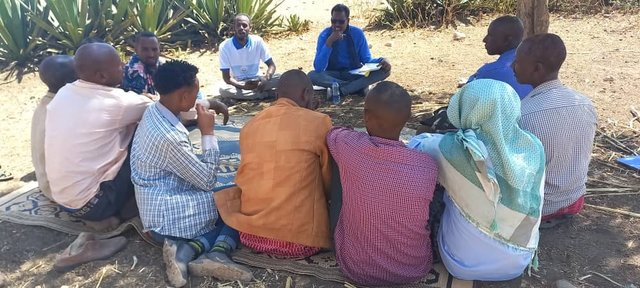
Participatory Rehabilitation of Dry Valleys [Этиоп]
Participatory rehabilitation and productive use of dry valleys is an approach employed to rehabilitate degraded and degradable land. It is operationalised through the Lowland Soil Rehabilitation Project with local development partners from kebele, district, regional agricultural bureaus, and other relevant stakeholders.
- Эмхэтгэгч: GERBA LETA
2. ГТМ Технологийн тодорхойлолт
2.1 Технологийн товч тодорхойлолт
Технологийн тодорхойлолт:
A double basin masonry check dam is a physical structure that helps to stop gully formation or further development of gullies in dry valleys. It rehabilitates small to a medium-sized deep gullies that are eating into the heart of adjacent land.
2.2 Технологийн дэлгэрэнгүй тодорхойлолт
Тодорхойлолт:
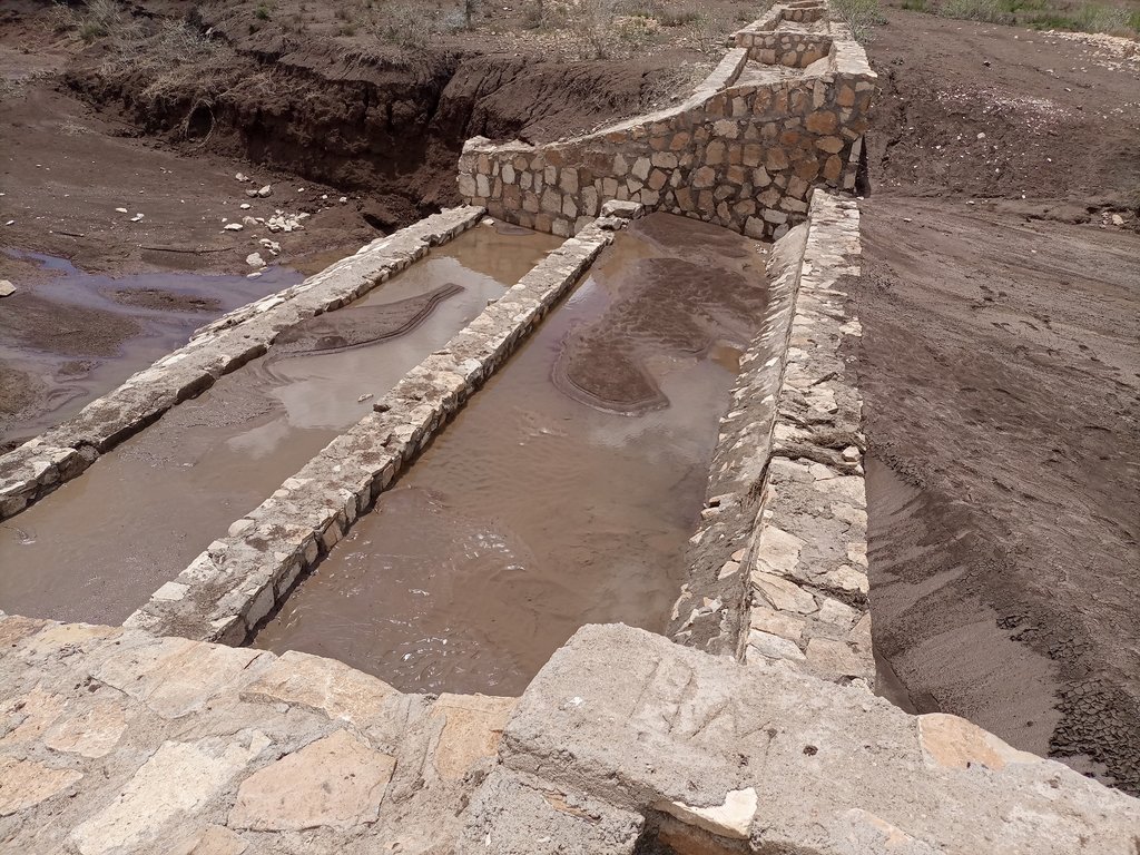
A “double basin masonry check dam” is a structure built in a narrow gully or depression to stop further gully formation. It is made of stone, concrete, gabions and wooden bars and serves as a permanent barrier. In this particular site stone is used as the structure is masonry. The technology is applied in areas where there are concentrated flows of water or runoff. The double basin masonry check dam is sited across a slope or a deep gully to slow water flow and capture sediment from upstream in the basins and behind the structure, thereby preventing expansion of the gully. The width of a check dam is variable. This particular structure is 14 meter wide, three meters deep and about 52 meters long. By helping to fill up the gully with sediment, it leads to rehabilitation and makes productive use of the area for growing trees, forage, and other plants. Apart from reducing the speed of surface runoff, the structure also promotes water infiltration, and recharges the groundwater reserves in the aquifer.
The main inputs necessary to build the check dams are financial resources, technical skills, skilled and unskilled labour, and construction materials including sand, stone, cement, water and other materials. Furthermore, construction tools such as a theodolite, line level, string, hammers, spades, hoes, and other tools are essential for design & construction. Technical skills for designing and profiling, and further capacity-building training are essential also. Application of the technology is also supported by satellite image and ground truthing to ensure the precision of siting.
The agropastoralists in the dry basin areas are pleased to see a huge movement of the soil arrested by the structure. The reduced expansion of the gully into the heart of the farm and grazing lands raises hopes of their land become productive and remaining so for generations to come. This hope and expectation have motivated them to welcome the intervention and develop an understanding of the actual benefits accrued from it. This leads to their support for the construction efforts. The disadvantages are that the technology is labour and resource-intensive which can be unaffordable for resource-poor agropastoralist communities living in food-insecure areas where rainfall is unreliable. This may make the adoption of the technology difficult to establish and nurture on their own without outside support.
2.3 Технологийн гэрэл зураг
Гэрэл зурагтай холбоотой ерөнхий тэмдэглэл:
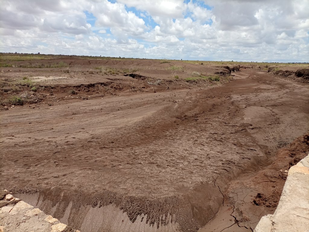
The photos display a large amount of sediment captured by a few days' shower post recurrent droughts experienced in the area over the last two to three years.
2.4 Технологийн дүрс бичлэг
Тайлбар, товч тодорхойлолт:
Video of the technology was not taken by this particular documentation exercise.
2.5 Энэ үнэлгээнд хамрагдсан технологийг хэрэгжүүлсэн улс орон/ бүс нутаг/ байршил
Улс:
Этиоп
Улс/аймаг/сум:
Somali
Байршлын дэлгэрэнгүй тодорхойлолт:
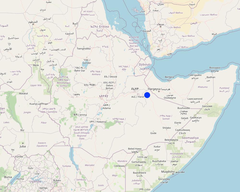
Hadow kebele of south Jigjiga district
Технологи өргөн дэлгэрсэн эсхийг тодорхойл:
- тодорхой газар хэрэгжсэн/ жижиг талбайд төвлөрсөн
Технологи(иуд) нэвтрүүлсэн талбай тусгай хамгаалалттай газар нутагт байрладаг уу?
Үгүй
Тайлбар:
Locating the check dam closer to each other may help to stop the damage of heavy and concentrated flood moving in the drainage basin.
Map
×2.6 Хэрэгжсэн хугацаа
Хэрэгжүүлсэн он:
2021
2.7 Технологийн танилцуулга
Технологийг хэрхэн нэвтрүүлснийг тодорхойл:
- Гадны төсөл/хөтөлбөрийн дэмжлэгтэйгээр
Тайлбар (төслийн төрөл г.м.):
Capacity Development and Strengthening Drought Resilience (CDSDR) project of the GIZ in Somali Region.
3. ГТМ технологийн ангилал
3.1 Технологийн үндсэн зорилго (ууд)
- газрын доройтлыг бууруулах, сэргийлэх, нөхөн сэргээх
- экосистемийг хамгаалах
- сав газрыг хамгаалах (усны эх/ голын адаг) - бусад технологитой хослуулах
- биологийн төрөл зүйлийг хамгаалах / сайжруулах
- гамшгийн эрсдлийг бууруулах
3.2 Технологи нэвтрүүлсэн газрын одоогийн газар ашиглалтын хэлбэр(үүд)
Нэг газр нутгийн хэмжээнд хэрэгжих холимог газар ашиглалт:
Үгүй
3.3 Технологи хэрэгжүүлснээр газар ашиглалтад өөрчлөлт гарсан уу?
Технологи хэрэгжүүлснээр газар ашиглалтад өөрчлөлт гарсан уу?
- Үгүй (3.4 руу шилжинэ үү)
3.4 Усан хангамж
Технологи хэрэгжүүлсэн газрын усан хангамж:
- Байгалийн усалгаатай
Тайлбар:
Rainfed is the type of water supply that often experiences erratic distribution characterized by the reception of lower amounts. Mostly characterized by erratic and erosive feature.
3.5 Технологи ГТМ-ийн аль бүлэгт хамаарах вэ
- Бэлчээрийн мал аж ахуй ба бэлчээрийн газрын менежмент
- Налуугийн арга хэмжээ
- Ус хуримтлуулах
3.6 Технологийг бүрдүүлэх ГТМ арга хэмжээ

Барилга байгууламжийн арга хэмжээ
- S6: Хашаа, саад, явган хашлага, хашаа
3.7 Технологид харгалзах газрын доройтлын төрөл

хөрс усаар эвдрэх
- Wt: Хөрсний гадаргын угаагдал
- Wg: Гуу жалгын элэгдэл
- Wm: Хөрсний нуралт, шилжилт
3.8 Газрын доройтлоос урьдчилан сэргийлэх, сааруулах ба нөхөн сэргээх
Газрын доройтолтой холбоотойгоор Технологи ямар зорилго тавьсан болохыг тодорхойл:
- Газрын доройтлыг бууруулах
- Хүчтэй доройтсон газрыг нөхөн сэргээх/ сайжруулах
Тайлбар:
The technology stops the mass movement of soil and water. As a result, it reduces land degradation, rehabilitates the degraded dry valley, and makes the land available for productive uses.
4. Техникийн нөхцөл, хэрэгжүүлсэн үйл ажиллагаа, материал ба зардал
4.1 Технологийн техник зураг
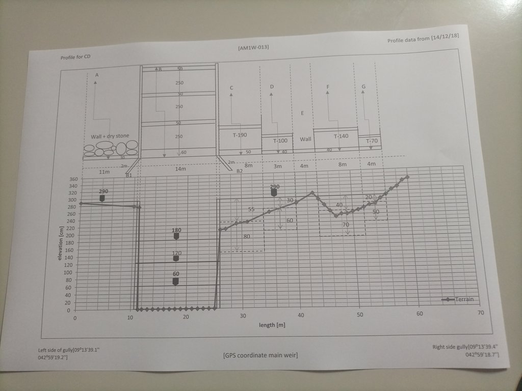
Техник тодорхойлолт (техник зургийн тайлбар):
The design (layout - top view) and profile (lower view) of the technology is presented with universal units to clearly read and understand by the SLM experts or engineers. In addition, there are section drawings of the main weir and Bill of Quantity (BOQ).
Зохиогч:
Amir Abdi
Он, сар, өдөр:
14/12/2018
4.2 Материал болон зардалд хамаарах ерөнхий мэдээлэл
Үнэ өртөг, оруулсан хувь нэмрийг хэрхэн тооцсоныг тодорхойл:
- Технологийн нэгж тус бүр
Нэгжийг тодорхойл:
check dam
Нэгжийн хэмжих нэгж (тохирох бол):
14m*3m*52m =2184m3
Үнэ өртөгийг тооцоход ашигласан мөнгөн нэгж:
- Ам.доллар
Хөлсний ажилчны нэг өдрийн цалингийн хэмжээг тодорхойлно уу:
8.5 - 16 USD based on their skills
4.3 Бий болгох үйл ажиллагаа
| Үйл ажиллагаа | Хугацаа (улирал) | |
|---|---|---|
| 1. | Conduct rapid assessment and Surveillance of intervention site | During the off-season |
| 2. | Finalize site selection | ditto |
| 3. | Layout, Design and profiling works | |
| 4. | Identify and train masonry workers | During off-season |
| 5. | Material supply | |
| 6. | Start actual layout and excavation work | |
| 7. | Supervision... |
Тайлбар:
Once intended to put the technology or the structure in place, a series of activities are conducted involving experts and contract workers until the activities are effectively finalized.
4.4 Бий болгоход шаардагдсан зардал, хөрөнгийн өртөг
Хэрэв зардлыг нэр төрлөөр тодорхойлох боломжгүй бол технологийг бий болгоход зарцуулсан хөрөнгийг тоймлон оруулна уу:
9200.0
Хэрэв газар ашиглагч нийт зардлын 100% -иас бага хэсгийг төлсөн бол хэн голлох зардлыг гаргасан бэ:
The project is responsible to cover the cost.
Тайлбар:
The cost for an unskilled casual laborer a day is 8.5 USD whereas the daily cost of a skilled Masonry worker is 16 USD per day.
4.5 Арчилгаа/ урсгал үйл ажиллагаа
| Үйл ажиллагаа | Хугацаа/ давтамж | |
|---|---|---|
| 1. | Oversee and identify damage | During and after rainy season |
| 2. | Measure the degrees of damage | ditto |
| 3. | Quantify cost and materials needed | |
| 4. | Schedule the maintenance work | Right before the off-season |
| 5. | Employ the workers and reconstruct the damaged parts or upgrade it. | During off-season |
Тайлбар:
As some of the technology implementation sites are inaccessible during the rainy season, implementing the activities during the off-season is commendable.
4.6 Арчилгаа/урсгал ажилд шаардагдсан зардал, хөрөнгийн өртөг (нэг жилд)
Хэрэв зардлыг нэр төрлөөр тодорхойлох боломжгүй бол Технологийг бий болгоход зарцуулсан хөрөнгийг тоймлон оруулна уу:
3244.0
Хэрэв газар ашиглагч нийт зардлын 100% -иас бага хэсгийг төлсөн бол хэн голлох зардлыг гаргасан бэ:
The project is expected to cover the entire maintenance cost. However, maintenance cost is attributed to various factors including the degree of damage, material costs at the time, etc. The figure merely represents an estimation of the cost, on average.
Тайлбар:
As the dry land receive erratic and erosive rain, damage to the structure is not uncommon. Combining fast-growing trees and deep-rooted perennial fodder grass stabilizes the sediment and reduces the speed of run-off on top of the structure. Therefore, associating the structure with biological barriers right after the first season of rain is a mandatory action that assists to reduce the damage and maintenance cost that is not affordable by resource-poor communities.
4.7 Зардалд нөлөөлж байгаа хамгийн чухал хүчин зүйл
Өртөг, зардалд нөлөөлөх гол хүчин зүйл:
Inflation and increasingly changing material prices, labor and transportation costs.
5. Байгаль ба нийгмийн нөхцөл
5.1 Уур амьсгал
Жилийн нийлбэр хур тундас
- < 250 мм
- 251-500 мм
- 501-750 мм
- 751-1,000 мм
- 1,001-1,500 мм
- 1,501-2,000 мм
- 2,001-3,000 мм
- 3,001-4,000 мм
- > 4,000 мм
Хур тунадасны талаархи тодорхойлолт/ тайлбар:
Rainfall distribution is erratic and erosive.
Холбогдох цаг уурын станцын нэр:
Jijiga Meteorology station
Агро-уур амьсгалын бүс
- хагас хуурай
There are bimodal rainfall patterns but the distribution in each respective season is not uniform. Particularly, the past consecutive seasons have been characterized by drought.
5.2 Гадаргын хэлбэр
Дундаж налуу:
- хавтгай (0-2 %)
- бага зэрэг налуу (3-5 %)
- дунд зэрэг налуу (6-10 % )
- хэвгий (11-15 %)
- налуу (16-30 %)
- их налуу (31-60 % )
- эгц налуу (>60 %)
Гадаргын хэлбэр:
- тэгш өндөрлөг / тал
- нуруу
- уулын энгэр
- дов толгод
- бэл
- хөндий
Өндрийн бүслүүр:
- 0-100 д.т.д. м.
- 101-500 д.т.д. м.
- 501-1,000 д.т.д м.
- 1,001-1,500 д.т.д м.
- 1,501-2,000 д.т.д м.
- 2,001-2,500 д.т.д. м.
- 2,501-3,000 д.т.д. м.
- 3,001-4,000 д.т.д м.
- > 4,000 д.т.д. м.
Технологи дараах асуудалд хандсан эсэхийг тодорхойл:
- хотгор нөхцөл
Гадаргын талаархи тодорхойлолт ба бусад тайлбар:
The technology is implemented in the gully or depression to reduce the speed of runoff and hold back the sediment and running water itself.
5.3 Хөрс
Хөрсний дундаж зузаан:
- маш нимгэн (0-20 см)
- нимгэн (21-50 см)
- дунд зэрэг зузаан (51-80 см)
- зузаан (81-120 cм)
- маш зузаан (>120 cм)
Хөрсний бүтэц (өнгөн хөрс):
- дундаж (элсэнцэр, шавранцар)
Хөрсний бүтэц (>20 см-ээс доош):
- дундаж (элсэнцэр, шавранцар)
Өнгөн хөрсөнд агуулагдах ялзмаг:
- дунд (1-3 % )
5.4 Усны хүртээмж ба чанар
Гүний усны түвшин:
> 50 м
Гадаргын усны хүртээмж:
хангалтгүй/ байхгүй
Усны чанар (цэвэршүүлээгүй):
сайн чанарын ундны ус
Усны чанар гэж:
газрын доорхи ус
Усны давсжилтын асуудал бий юу?
Тийм
Тодорхойлно уу:
Land users communicated the presence of a medium level of water salinity.
Энэ газар үерт автдаг уу?
Тийм
Тогтмол байдал:
тохиолдлын
Усны чанар, нөөцийн талаархи тайлбар ба бусад тодорхойлолт:
The water quality is a relative description as it is not supported by facts. Both livestock and human beings are using ponds and still water for drinking after rainfall.
5.5 Биологийн олон янз байдал
Зүйлийн олон янз байдал:
- Бага
Амьдрах орчны олон янз байдал:
- Бага
Биологийн олон янз байдлын талаархи тайлбар ба бусад тодорхойлолт:
A few tree and shrub species are common in the area. Acacia, opentia (Euphorbia species), and some invasive weed species are common.
5.6 Технологи нэвтрүүлсэн газар ашиглагчдын тухай мэдээлэл
Суурьшмал эсвэл нүүдлийн:
- Хагас-нүүдэлийн
Бусад (тодорхойлно уу):
Agro-pastoralist
Бусад эх үүсвэрээс олох орлого:
- Нийт орлогын 10 %-иас доош
Чинээлэг байдлын түвшин:
- ядуу
Хувь хүн эсвэл бүлэг:
- бүлэг / олон нийтийн
Механикжилтын түвшин:
- гар ажил
- ердийн хөсөг
Хүйс:
- эмэгтэй
- эрэгтэй
Газар ашиглагчдын бусад шинж чанарыг тодорхойл:
The agro-pastoralist settlement pattern is stable except their mobility with their livestock looking for water and feed. Land users of various age groups are benefiting from the technology.
5.7 Газар ашиглагчийн технологи нэвтрүүлсэн газрын дундаж талбайн хэмжээ
- < 0.5 га
- 0.5-1 га
- 1-2 га
- 2-5 га
- 5-15 га
- 15-50 га
- 50-100 га
- 100-500 га
- 500-1,000 га
- 1,000-10,000 га
- > 10,000 га
Энэ талбай том, жижиг, дунд алинд хамаарах вэ (орон нутгийн нөхцөлд харгалзуулна уу)?
- бага-хэмжээний
5.8 Газар эзэмшил, газар ашиглах эрх, ус ашиглах эрх
Газар өмчлөл:
- нэгдлийн/ тосгон
- хувь хүн, өмчийн гэрчилгээгүй
Газар ашиглах эрх:
- нэгдлийн хэлбэрээр (зохион байгуулалттай)
- хувь хүн
Ус ашиглах эрх:
- нэгдлийн хэлбэрээр (зохион байгуулалттай)
- хувь хүн
Газар ашиглах эрх нь уламжлалт эрхзүйн тогтолцоонд суурилсан уу?
Тийм
Тодорхойлно уу:
Land use is largely communal and individual inherit it from their lineage.
5.9 Дэд бүтэц, үйлчилгээний хүртээмж
эрүүл мэнд:
- ядуу
- дунд зэргийн
- сайн
боловсрол:
- ядуу
- дунд зэргийн
- сайн
техник зөвлөгөө:
- ядуу
- дунд зэргийн
- сайн
хөдөлмөр эрхлэлт (жишээ нь, ХАА-аас өөр):
- ядуу
- дунд зэргийн
- сайн
зах зээл:
- ядуу
- дунд зэргийн
- сайн
эрчим хүчний хангамж:
- ядуу
- дунд зэргийн
- сайн
зам тээвэр:
- ядуу
- дунд зэргийн
- сайн
усан хангамж ба ариутгал:
- ядуу
- дунд зэргийн
- сайн
санхүүгийн үйлчилгээ:
- ядуу
- дунд зэргийн
- сайн
Тайлбар:
Not much service is available in the pastoralist area except that the road paths through the area also create access to the market and other service centers.
6. Үр нөлөө ба дүгнэлт
6.1 Технологийн талбайд үзүүлсэн нөлөө
Нийгэм-эдийн засгийн үр нөлөө
Үйлдвэрлэл
тэжээл үйлдвэрлэл
Тайлбар/ тодорхой дурьдах:
With the development of the sediments trapped by the structure by fodder crops of multipurpose tree species, it is possible to boost production and ensure the sustainability of the structure.
тэжээлийн чанар
Тайлбар/ тодорхой дурьдах:
As the sediment brings in fertile topsoil from the upstream catchments, the likelihood of producing quality fodder in the rehabilitated area is so high.
модлогийн бүтээмж
Тайлбар/ тодорхой дурьдах:
The multipurpose tree species assumed to be planted in the rehabilitated area are expected to increase wood production.
Усны хүртээмж ба чанар
ундны усны хүрэлцээ
Тайлбар/ тодорхой дурьдах:
As the rehabilitated valley reduces runoff and increases the groundwater reserves, it caters to the opportunity to access drinking water.
ундны усны чанар
Тайлбар/ тодорхой дурьдах:
Succeeding vegetation covers enables to filter of the water and improves the quality of surface and subsurface water.
мал услах усны хүрэлцээ
Тайлбар/ тодорхой дурьдах:
Slightly increases as the structure and rehabilitated areas improves water infiltration and formation of still water or micro ponds behind the structure.
мал услах усны чанар
Тайлбар/ тодорхой дурьдах:
Simultaneously increases with the availability of surface and subsurface water.
Нийгэм-соёлын үр нөлөө
хүнсний аюулгүй байдал/ өөрийн хэрэгцээг хангах
Тайлбар/ тодорхой дурьдах:
Reduction of gully formations that consume the rangeland allows accessing relatively more rangeland areas for the livestock to graze over. This inevitably improves the food security of the pastoralist community.
ГТМ/ газрын доройтлын мэдлэг
Тайлбар/ тодорхой дурьдах:
The technology and its function along the mainstreaming work with local development actors certainly improve the understanding and evidence-based knowledge of the land users.
Экологийн үр нөлөө
Усны эргэлт/ илүүдэл
усны хэмжээ
Тайлбар/ тодорхой дурьдах:
The technology is believed to increase both surface and groundwater quantity in the intervention valley.
усны чанар
гадаргын урсац
Тайлбар/ тодорхой дурьдах:
Surface runoff speed and volume are gradually decreased with the rehabilitation of the gully and the development of the area behind the structure.
усны урсац
гүний усны түвшин / уст давхарга
Хөрс
хөрсний чийг
Тайлбар/ тодорхой дурьдах:
Soil moisture in the rehabilitated area positively increased.
хөрсөн бүрхэвч
хөрс алдагдах
Тайлбар/ тодорхой дурьдах:
As the structure on the upstream side reduces the speed of runoff, soil, and water loss decrease, and soil accumulation is increasing over time.
хөрс хуримтлагдах
хөрс хагарах/ хагсах
Биологийн олон янз байдал: ургамал, амьтан
Ургамалын бүрхэвч
Тайлбар/ тодорхой дурьдах:
It increases with the deposition of sediments. Seeds of different trees and vegetation can emerge as succession species.
ургамлын төрөл, зүйл
Тайлбар/ тодорхой дурьдах:
Increases!
Уур амьсгал болон гамшгийн эрсдлийг бууруулах
үер усны нөлөө
Тайлбар/ тодорхой дурьдах:
The structure and rehabilitated areas reduces the speed and impacts of the flood.
хөрсний гулсалт/ чулуун нуранги
гангийн нөлөө
нүүрстөрөгч ба хүлэмжийн хийн ялгаруулалт
Тайлбар/ тодорхой дурьдах:
Overtime, tree cover reduces emission of carbon and green gases.
Талбайд илэрсэн үр нөлөөг үнэлнэ үү (хэмжилт):
Assessment of on-site impacts desires long-term follow-up, data collection, and analysis.
6.2 Технологийн талбайн гадна үзүүлсэн үр нөлөө
Усны хүртээмж
Тайлбар/ тодорхой дурьдах:
As the technology put in place in recent times, off-site impacts need assessment based on facts.
голын адагт үерлэх
Тайлбар/ тодорхой дурьдах:
The structure and rehabilitated areas inevitably reduces downstream flooding and siltation in the future.
голын адагт лаг шавар хуримтлагдах
Тайлбар/ тодорхой дурьдах:
There is visible siltation held back by the structure. However, quantifying demands empirical analysis.
газар доорхи ус/голын усны бохирдол
буферлэх / шүүлтүүрийн багтаамж
хөрш зэргэлдээ газарт учирах хохирол
нийтийн/хувийн хэвшлийн дэд бүтцэд учрах хохирол
хүлэмжийн хийн нөлөө
Талбайн гадна илрэх үр нөлөөллийн үнэлгээг тайлбарлана уу (хэмжилтүүд):
The facts regarding the off-site impacts will certainly be assessed as a long-term impact.
6.3 Технологийн уур амьсгалын өөрчлөлт, цаг агаарын гамшигт үзэгдэлд өртөх байдал ба эмзэг байдал (газар ашиглагчийн бодлоор)
Уур амьсгалын аажим өөрчлөлт
Уур амьсгалын аажим өөрчлөлт
| Улирал | Өсөх эсвэл буурах | Технологи түүний нөлөөг хэрхэн бууруулж байна? | |
|---|---|---|---|
| жилийн дундаж температур | Өсөлт | дунд зэрэг | |
| жилийн дундаж хур тундас | Бууралт | дунд зэрэг |
Уур амьсгалаас хамаарах аюул (гамшиг)
Усзүйн гамшиг
| Технологи түүний нөлөөг хэрхэн бууруулж байна? | |
|---|---|
| усны үер (гол) | мэдэхгүй |
| шар усны үер | маш сайн |
| хөрсний гулсалт | сайн |
Тайлбар:
Similar to on-site impacts, the off-site impact assessment needs, facts, and long-term follow-up.
6.4 Өртөг ба ашгийн шинжилгээ
Бий болгох зардалтай харьцуулахад ямар ашиг өгсөн бэ (газар ашиглагчийн бодлоор)?
Богино хугацаанд эргэн төлөгдөх байдал:
эерэг
Урт хугацаанд эргэн төлөгдөх байдал:
маш эерэг
Арчилгаа/урсгал зардалтай харьцуулахад ямар ашиг өгсөн бэ (газар ашиглагчийн бодлоор)?
Богино хугацаанд эргэн төлөгдөх байдал:
эерэг
Урт хугацаанд эргэн төлөгдөх байдал:
маш эерэг
6.5 Технологи нэвтрүүлэлт
- жишээ/ туршилт
Боломжтой бол, тоогоор илэрхийл (өрхийн тоо эсвэл бүрхэх талбай):
Adoption rate is yet to be evaluated. The technology put in communal land.
Тайлбар:
No community so far adopted and implemented the technology on its own.
6.6 Дасан зохицох
Бий болсон өөрчлөлтөд зохицуулан технологийг өөрчилсөн үү?
Үгүй
6.7 Технологийн давуу тал/боломжууд
| Газар ашиглагчдын тодорхойлсон давуу тал/боломжууд |
|---|
| Rehabilitate the gully, and stop and reverse the gully formation. |
| It creates the opportunity for productive use of the degraded environment. |
| Recharge the groundwater aquifer and supply still water for temporary use by local people and livestock. |
| Эмхэтгэгч, бусад мэдээлэл өгсөн хүмүүсийн өнцгөөс тодорхойлсон давуу тал/боломжууд |
|---|
| Promote regeneration of the lost species through resilience building. |
| Improve the landscape feature. |
| Improve the ecosystem and its overall services. |
6.8 Технологийн дутагдалтай/сул тал/аюул болон тэдгээрийг хэрхэн даван туулах арга зам
| Газар ашиглагч нарын тодорхойлсон сул тал/ дутагдал/ эрсдэл | Тэдгээрийг хэрхэн даван туулах вэ? |
|---|---|
| High investment cost to implement the technology. | Promote government awareness and emphasis on the benefit and investment in developing the technology. |
| Lack of implementation skills. | Develop the skills and motivation of the community and other stakeholders. |
| Conflict of interest on the use of the rehabilitated land in the intersection of neighboring kebeles. | Awareness creation and promote behavioral change on the joint benefit of the technology. |
| Эмхэтгэгч, бусад мэдээлэл өгсөн хүмүүсийн өнцгөөс тодорхойлсон сул тал/ дутагдал/ эрсдэл | Тэдгээрийг хэрхэн даван туулах вэ? |
|---|---|
| Inability to put micro check dams along the drainage line before it cuts deep into the soil. | Improve surveillance and promote early intervention. |
| Lower level of participation from the land users. | Develop the capacity, awareness and motivation of the land users. |
| Stakeholders and land users lower level of environmental education, improper land management and the consequent climate change and other associated adversities. | Promote environmental education, emerging climate change and climate variability in adult and vocational education. |
7. Ном зүй ба холбоосууд
7.1 Мэдээлэл цуглуулсан арга/эх үүсвэр
- Хээрийн уулзалт, судалгаа
Four individuals
- ГТМ-ийн мэргэжилтэн/шинжээчтэй хийсэн ярилцлага
Two individuals.
Мэдээллийг хэзээ (газар дээр нь) цуглуулсан бэ?
23/03/2023
Тайлбар:
The flash flood post three years of drought is so damaging. The fragile soil that has been exposed to the sun is easily detached and moved away by the flood. Substantial tons of soil stopped by the check dam signals the positive effects of the structure in changing the trends.
7.2 Ном, хэвлэлийн ишлэл
Гарчиг, зохиогч, он, ISBN:
Criteria for optimizing check dam location and maintenance requirements. Hassanli, A. M. & Beecham. 2013; ISBN: 971-1-60876-146-3
Хаанаас авч болох вэ? Зардал?
https://www.researchgate.net/publication/287636490_Criteria_for_optimizing_check_dam_location_and_maintenance_requirements
7.3 Холбогдох мэдээллийн интернет холбоос
Гарчиг/ тодорхойлолт:
Different Types of Check Dams & Design Procedures
URL:
https://forestrybloq.com/different-types-of-check-dams/
7.4 Ерөнхий мэдээлэл
The questionnaire is comprehensive. However, to answer every question, there must be a tradition of long-term data collection and documentation exercises by either the project or the partners government organizations. In that way, it is possible to fully address the multifaceted demands included in the questionnaires such as " the before and after SLM intervention" which is dire to address them for those projects at their early stages of implementation.
Холбоос ба модулууд
Бүгдийг дэлгэх Бүгдийг хаахХолбоосууд

Participatory Rehabilitation of Dry Valleys [Этиоп]
Participatory rehabilitation and productive use of dry valleys is an approach employed to rehabilitate degraded and degradable land. It is operationalised through the Lowland Soil Rehabilitation Project with local development partners from kebele, district, regional agricultural bureaus, and other relevant stakeholders.
- Эмхэтгэгч: GERBA LETA
Модулууд
Модуль байхгүй байна


