Spate Irrigation [Eritreia]
- Criação:
- Atualização:
- Compilador/a: Unknown User
- Editor: –
- Revisores: Fabian Ottiger, Deborah Niggli, Alexandra Gavilano
technologies_1333 - Eritreia
Veja as seções
Expandir tudo Recolher tudo1. Informação geral
1.2 Detalhes do contato das pessoas capacitadas e instituições envolvidas na avaliação e documentação da tecnologia
Pessoa(s) capacitada(s)
Especialista em GST:
Abraham Mehari Haile
UNESCO-IHE Institute for Water Education, Delft, The Netherlands
Países Baixos
Nome do projeto que facilitou a documentação/avaliação da Tecnologia (se relevante)
Book project: SLM in Practice - Guidelines and Best Practices for Sub-Saharan Africa (SLM in Practice)Nome do projeto que facilitou a documentação/avaliação da Tecnologia (se relevante)
Book project: Water Harvesting – Guidelines to Good Practice (Water Harvesting)Nome da(s) instituição(ões) que facilitou(ram) a documentação/ avaliação da Tecnologia (se relevante)
UNESCO - IHE (UNESCO - IHE) - Países Baixos1.3 Condições em relação ao uso da informação documentada através de WOCAT
O/a compilador/a e a(s) pessoa(s) capacitada(s) aceitam as condições relativas ao uso de dados documentados através da WOCAT:
Sim
2. Descrição da tecnologia de GST
2.1 Descrição curta da tecnologia
Definição da tecnologia:
Spate irrigation is a traditional water diversion and spreading technology.
2.2 Descrição detalhada da tecnologia
Descrição:
Spate irrigation has a long history in Eritrea and still forms the livelihood base for rural communities in arid lowlands of the country.
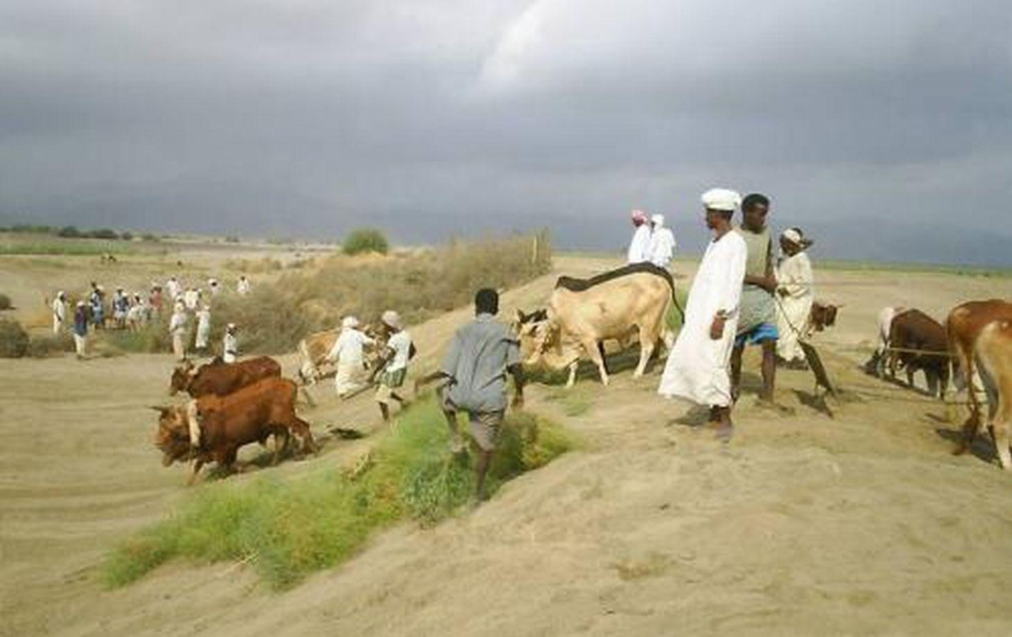
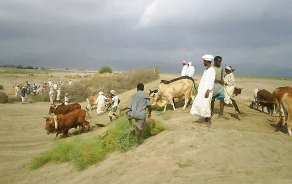
Purpose of the Technology: It is a traditional water diversion and spreading technique under which seasonal floods of short duration – springing from the rainfall-rich highlands – are diverted from ephemeral rivers (wadis) to irrigate cascades of leveled and bunded fields in the coastal plains.
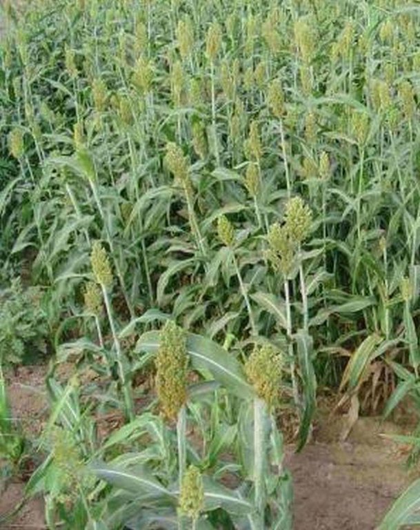
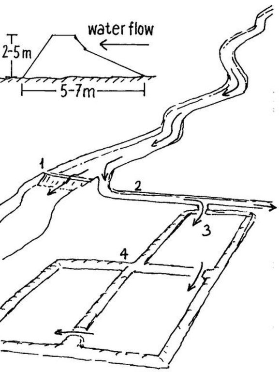
Establishment / maintenance activities and inputs: The diversion structures include the following elements: (1) the ‘agim’, a temporary 3-4 m high river diversion structure on the low-flow side of the wadi, made from brushwood, tree trunks, earth, stones and/or boulders, erected to divert a large part of the flow during a spate flow to adjacent agricultural fields; (2) a primary, and several secondary, distribution canals; unlined, bordered by earthen embankments; convey and spread the floodwater to the irrigable fields; (3) the fields, rectangular shaped, of about 1–2 ha, separated by earthen bunds. Floodwater is distributed from field to field: when a field is completely flooded (to a depth of about 0.5 m), water is conveyed to the immediate downstream field by breaching one of the bunds. This process continues until all the water is used up. Arable fields need to be flooded several times. The water soaks deep into the soil profile (up to 2.4 m) and provides moisture sufficient for two or even three harvests: crop growth is entirely dependent on the residual soil moisture. The main crop grown is sorghum; maize is the next most important. Sedimentation is as important as water management: With each flood, soil is built up by depositing rich sediment on the fields. Due to the force of the floods, the diversion structures are frequently damaged and/or washed away. Reconstruction and maintenance are labour-intensive and require collective community action.
Natural / human environment: Elaborate local regulations, organization and cooperation at the community level are prerequisites for successful management of spate irrigation systems.
2.3 Fotos da tecnologia
2.5 País/região/locais onde a tecnologia foi aplicada e que estão cobertos nesta avaliação
País:
Eritreia
Região/Estado/Província:
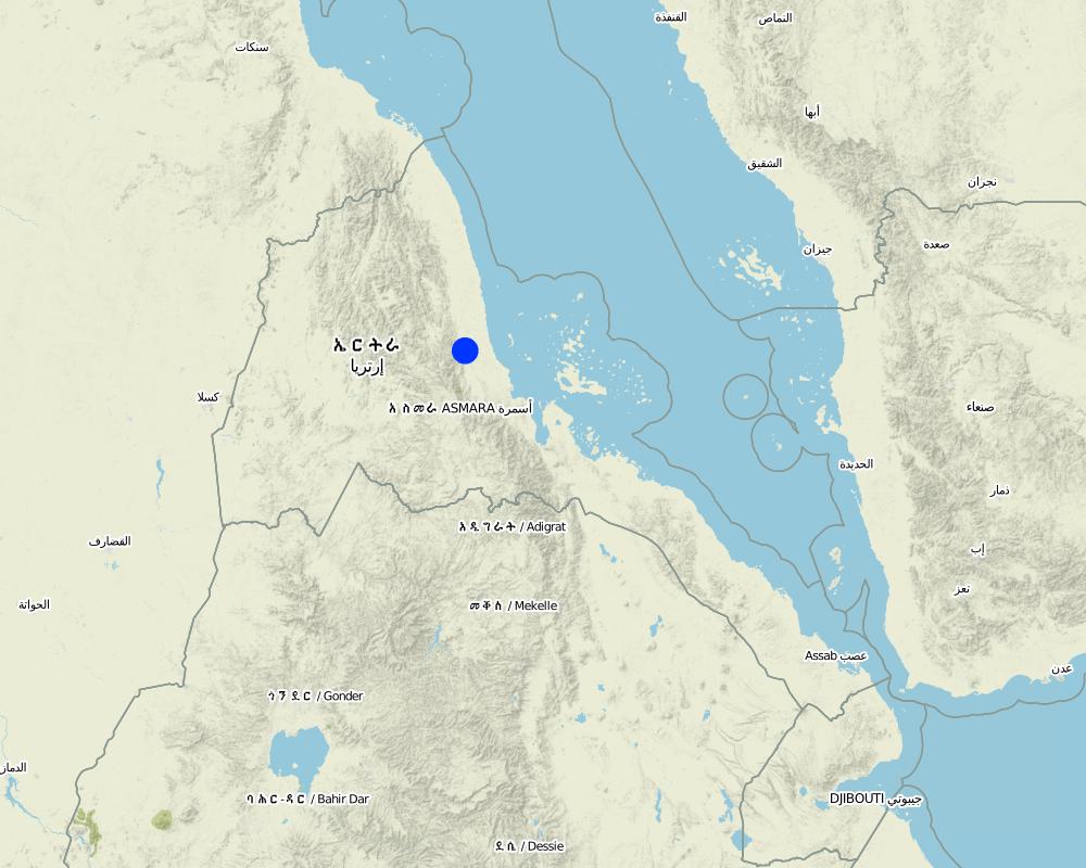
Sheeb area, Eastern lowlands
Especificação adicional de localização:
Wadi Laba
Especifique a difusão da tecnologia:
- Uniformemente difundida numa área
Se a Tecnologia estiver uniformemente distribuída por uma área, especifique a área coberta (em km2):
160,0
Comentários:
Total area covered by the SLM Technology is 160 km2.
Current spate irrigation area in Eritrea is 16’000 hectares. Potential area is estimated at 60’000–90’000 hectares.
Map
×2.6 Data da implementação
Caso o ano exato seja desconhecido, indique a data aproximada:
- mais de 50 anos atrás (tradicional)
2.7 Introdução da tecnologia
Especifique como a tecnologia foi introduzida:
- Como parte do sistema tradicional (>50 anos)
Comentários (tipos de projeto, etc.):
Spate irrigation is an indigenous technology, originally introduced from Yemen
3. Classificação da tecnologia de GST
3.1 Principal/principais finalidade(s) da tecnologia
- Melhora a produção
- Reduz, previne, recupera a degradação do solo
3.2 Tipo(s) atualizado(s) de uso da terra onde a tecnologia foi aplicada

Terra de cultivo
- Cultura anual
Cultivo anual - Especificar culturas:
- cereais - milho
- cereais - sorgo
Comentários:
Livestock is grazing on crop residues
3.4 Abastecimento de água
Comentários:
Water supply: post-flooding
3.5 Grupo de GST ao qual pertence a tecnologia
- Gestão de irrigação (inclusive abastecimento de água, drenagem)
- Gestão de água de superfície (nascente, rio, lagos, mar)
3.6 Medidas de GST contendo a tecnologia

Medidas estruturais
- S3: Valas graduadas, canais, vias navegáveis
Comentários:
Main measures: structural measures
4. Especificações técnicas, implementação de atividades, entradas e custos
4.1 Desenho técnico da tecnologia
Especificações técnicas (relacionada ao desenho técnico):
Cross section of an agim (top left); Components of a traditional spate irrigation system: (1) agim; (2) main distribution canal; (3) irrigated fields; (4) earthen embankments. Arrows indicate the water flow
Technical knowledge required for field staff / advisors: high
Technical knowledge required for land users: high
Main technical functions: control of concentrated runoff: drain / divert, increase of infiltration, water harvesting / increase water supply, water spreading
Diversion ditch/ drainage
Depth of ditches/pits/dams (m): 4.00
Construction material (earth): earth
Construction material (stone): stones
Construction material (wood): brushwood, tree trunks
Autor:
Mats Gurtner, Center for Development and Environment, University of Bern
4.3 Atividades de implantação
| Atividade | Periodicidade (estação do ano) | |
|---|---|---|
| 1. | Construction of diversion structure (agim) | before rainy season |
| 2. | Construction of main distribution canal | before rainy season |
| 3. | Construction of secondary distribution canals | before rainy season |
| 4. | Leveling of fields | before rainy season |
| 5. | Establish embankments around fields and within fields | before rainy season |
4.4 Custos e entradas necessárias para a implantação
| Especifique a entrada | Unidade | Quantidade | Custos por unidade | Custos totais por entrada | % dos custos arcados pelos usuários da terra | |
|---|---|---|---|---|---|---|
| Mão-de-obra | Labour | ha | 1,0 | 24,0 | 24,0 | |
| Equipamento | Animal traction | ha | 1,0 | 36,0 | 36,0 | |
| Custos totais para a implantação da tecnologia | 60,0 | |||||
| Custos totais para o estabelecimento da Tecnologia em USD | 60,0 | |||||
4.5 Atividades recorrentes/manutenção
| Atividade | Periodicidade/frequência | |
|---|---|---|
| 1. | Reconstruction / repair of diversion structures (2-4 times / year; collective community action) | 2-4 times / year |
| 2. | Desilting / repair of distribution canals | annual |
| 3. | Raising of bund heights due to silting up of fields | annual |
| 4. | Flood fields (community action, during highland rainy season: July-September). Most likely a field receives 3 irrigation turns, on a bi-weekly interval between any 2 turns | rainy season (july-september) |
| 5. | Soil tillage (15 cm deep; using oxen-drawn plough) to break capillary uplift of soil water and to create evaporation barrier | end of flooding season |
4.6 Custos e entradas necessárias pata a manutenção/atividades recorrentes (por ano)
| Especifique a entrada | Unidade | Quantidade | Custos por unidade | Custos totais por entrada | % dos custos arcados pelos usuários da terra | |
|---|---|---|---|---|---|---|
| Mão-de-obra | Labour | ha | 1,0 | 24,0 | 24,0 | |
| Equipamento | Animal traction | ha | 1,0 | 36,0 | 36,0 | |
| Custos totais para a manutenção da tecnologia | 60,0 | |||||
| Custos totais de manutenção da Tecnologia em USD | 60,0 | |||||
Comentários:
Machinery/ tools: scouring and tillage implements, shovels
The costs were calculated per unit = 10 m long agim (1 m high, 3 m wide), constructed with mixed material (stones, earth, brushwood)
4.7 Fatores mais importantes que afetam os custos
Descreva os fatores mais determinantes que afetam os custos:
Data on labour inputs for construction/maintenance of canals and field bunds are not included, therefore not included in the tables above. Costs for agim reconstruction are 40% of establishment. Total maintenance costs depend on the number of reconstructions during normal spate season (2-4 times). The yearly cost (establishment and maintenance) reaches US$ 60-156.
5. Ambiente natural e humano
5.1 Clima
Precipitação pluviométrica anual
- <250 mm
- 251-500 mm
- 501-750 mm
- 751-1.000 mm
- 1.001-1.500 mm
- 1.501-2.000 mm
- 2.001-3.000 mm
- 3.001-4.000 mm
- > 4.000 mm
Zona agroclimática
- Árido
Thermal climate class: tropics
5.2 Topografia
Declividade média:
- Plano (0-2%)
- Suave ondulado (3-5%)
- Ondulado (6-10%)
- Moderadamente ondulado (11-15%)
- Forte ondulado (16-30%)
- Montanhoso (31-60%)
- Escarpado (>60%)
Formas de relevo:
- Planalto/planície
- Cumes
- Encosta de serra
- Encosta de morro
- Sopés
- Fundos de vale
Zona de altitude:
- 0-100 m s.n.m.
- 101-500 m s.n.m.
- 501-1.000 m s.n.m.
- 1.001-1.500 m s.n.m.
- 1.501-2.000 m s.n.m.
- 2.001-2.500 m s.n.m.
- 2.501-3.000 m s.n.m.
- 3.001-4.000 m s.n.m.
- > 4.000 m s.n.m.
Comentários e outras especificações sobre a topografia:
Altitudinal zone: 101-500 m a.s.l. (200 m.a.s.l.)
5.3 Solos
Profundidade do solo em média:
- Muito raso (0-20 cm)
- Raso (21-50 cm)
- Moderadamente profundo (51-80 cm)
- Profundo (81-120 cm)
- Muito profundo (>120 cm)
Textura do solo (solo superficial):
- Médio (limoso, siltoso)
Caso disponível anexe a descrição completa do solo ou especifique as informações disponíveis, p. ex. tipo de solo, PH/acidez do solo, nitrogênio, capacidade de troca catiônica, salinidade, etc.
Soil texture is medium (loam to silt loams)
Soil fertility is very high (alluvial silts formed by annual sedimentation)
Soil drainage/infiltration is good
5.4 Disponibilidade e qualidade de água
Disponibilidade de água de superfície:
Excesso
5.6 Características dos usuários da terra que utilizam a tecnologia
Orientação de mercado do sistema de produção:
- Subsistência (autoabastecimento)
Nível relativo de riqueza:
- Muito pobre
- Pobre
Indivíduos ou grupos:
- Grupos/comunidade
Nível de mecanização:
- Trabalho manual
- Tração animal
Indique outras características relevantes dos usuários da terra:
Land users applying the Technology are mainly disadvantaged land users
Difference in the involvement of women and men: water management carried out communally, crop management individually
5.7 Área média de terrenos utilizados pelos usuários de terrenos que aplicam a Tecnologia
- < 0,5 ha
- 0,5-1 ha
- 1-2 ha
- 2-5 ha
- 5-15 ha
- 15-50 ha
- 50-100 ha
- 100-500 ha
- 500-1.000 ha
- 1.000-10.000 ha
- > 10.000 ha
É considerado pequena, média ou grande escala (referente ao contexto local)?
- Pequena escala
5.8 Propriedade de terra, direitos de uso da terra e de uso da água
Propriedade da terra:
- Estado
Direitos do uso da terra:
- Indivíduo
6. Impactos e declarações finais
6.1 Impactos no local mostrados pela tecnologia
Impactos socioeconômicos
Produção
Produção agrícola
Produção de forragens
Comentários/especificar:
Residues are fed to livestock
Área de produção
Comentários/especificar:
Without irrigation, agricultural production is not possible
Renda e custos
Rendimento agrícola
Impactos socioculturais
Segurança alimentar/auto-suficiência
Instituições comunitárias
Impactos ecológicos
Ciclo hídrico/escoamento
Colheita/recolhimento de água
Solo
Umidade do solo
Ciclo e recarga de nutrientes
6.3 Exposição e sensibilidade da tecnologia às mudanças climáticas graduais e extremos/desastres relacionados ao clima (conforme o ponto de vista dos usuários da terra)
Mudança climática gradual
Mudança climática gradual
| Estação do ano | aumento ou diminuição | Como a tecnologia lida com isso? | |
|---|---|---|---|
| Temperatura anual | aumento | bem |
Extremos (desastres) relacionados ao clima
Desastres meteorológicos
| Como a tecnologia lida com isso? | |
|---|---|
| Temporal local | bem |
| Tempestade de vento local | bem |
Desastres climatológicos
| Como a tecnologia lida com isso? | |
|---|---|
| Seca | bem |
Desastres hidrológicos
| Como a tecnologia lida com isso? | |
|---|---|
| Inundação geral (rio) | bem |
Comentários:
The technology is tolerant to climatic extremes (adapted to unpredictable heavy floods)
6.4 Análise do custo-benefício
Comentários:
no data
6.5 Adoção da tecnologia
Comentários:
There is a strong trend towards spontaneous adoption of the Technology
Comments on adoption trend: Spontaneous spread takes place throughout the lowlands. Current spate irrigation area in Eritrea is 16’000 hectares. Potential area is estimated at 60’000–90’000 hectares.
6.7 Pontos fortes/vantagens/oportunidades da tecnologia
| Pontos fortes/vantagens/oportunidades na visão do/a compilador/a ou de outra pessoa capacitada |
|---|
| Spate irrigation forms the livelihood base for rural communities in arid lowlands of the country |
6.8 Pontos fracos, desvantagens/riscos da tecnologia e formas de superá-los
| Pontos fracos/desvantagens/riscos na visão do usuário da terra | Como eles podem ser superados? |
|---|---|
| Highly labour-intensive and time consuming maintenance; water diversion structures are frequently breached / washed away by heavy floods; canals are obstructed through deposition of boulders, gravel and coarse sediments. | To overcome all 3 problems, recommendations focus on building permanent flood diversion and distribution structures which: |
| Great demand for wood: huge numbers of trees are annually needed for (re-)constructing diversion structures | (1) withstand the force of heavy floods and divert the water effectively; |
| Irrigation efficiency is only about 20% because of the difficulty of controlling large amounts of water in a short period of time (and often at night) and because water is lost by percolation, seepage and evaporation | (2) eliminate the need to cut trees |
| (3) reduce human and animal labour inputs | |
| (4) increase productivity; Lining the main canals with cements would reduce water loss by percolation and seepage. Proper leveling of basin fields helps to distribute the floodwater uniformly |
7. Referências e links
7.2 Referências às publicações disponíveis
Título, autor, ano, ISBN:
Abraham Mehari H, Van Steenbergen F, Verheijen O, Van Aarst S:Spate Irrigation, Livelihood Improvement and Adaptation to Climate Variability and Change
Título, autor, ano, ISBN:
Mehretab Tesfai Stroosnijder L:The Eritrean spate irrigation system
Título, autor, ano, ISBN:
Berhane Haile G, Van Steenbergen F: Agricultural Water Management in Ephemeral Rivers: Community Management in Spate Irrigation in Eritrea; in African Water Journal
7.3 Links para informações on-line relevantes
Título/ descrição:
Abraham Mehari, Depeweg, H, Schultz B (2005): Hydraulic Performance Evaluation of The Wadi Laba Spate Irrigation Systemin Eritrea, in Irrigation and Drainage. 54: 389–406
URL:
www.interscience.wiley.com
Título/ descrição:
Berhane Haile G: Community Spate Irrigation in Bada, Eritrea n Mehretab Tesfai, Stroosnijder L (2000): The Eritrean spate irrigation system
URL:
linkinghub.elsevier.com/retrieve/pii/S0378377400001153
Links e módulos
Expandir tudo Recolher tudoLinks
Não há links
Módulos
Não há módulos


