Integrated Land and Water Management [República da Moldávia]
- Criação:
- Atualização:
- Compilador/a: Valentin Ciubotaru
- Editores: Valentin Ciubotaru, UNCCD PRAIS
- Revisores: Farrukh Nazarmavloev, William Critchley, Rima Mekdaschi Studer
Managementul integrat al solului și al apei
technologies_1817 - República da Moldávia
Veja as seções
Expandir tudo Recolher tudo1. Informação geral
1.2 Detalhes do contato das pessoas capacitadas e instituições envolvidas na avaliação e documentação da tecnologia
Pessoa(s) capacitada(s)
Especialista em GST:
Ciubotaru Valentin
+37322723372 / +37369134294
valentin.ciubotaru@yahoo.com / valentin.chiubotaru@gmail.com
NGO BIOS
11/1 Gheorghe Asachi str., ap. nr. 87
República da Moldávia
Nome da(s) instituição(ões) que facilitou(ram) a documentação/ avaliação da Tecnologia (se relevante)
NGO BIOS (.) - República da Moldávia1.3 Condições em relação ao uso da informação documentada através de WOCAT
Quando os dados foram compilados (no campo)?
01/07/2010
O/a compilador/a e a(s) pessoa(s) capacitada(s) aceitam as condições relativas ao uso de dados documentados através da WOCAT:
Sim
1.4 Declaração de sustentabilidade da tecnologia descrita
A tecnologia descrita aqui é problemática em relação a degradação da terra de forma que não pode ser declarada uma tecnologia de gestão sustentável de terra?
Não
2. Descrição da tecnologia de GST
2.1 Descrição curta da tecnologia
Definição da tecnologia:
Integrated land and water management was promoted in order to improve agricultural production while reducing soil loss and nutrient discharge into water bodies. Technical assistance and financial support was provided for sustainable agricultural practices, including: nutrient management, conservation agriculture, integrated cropping management, agroforestry and wetland management.
2.2 Descrição detalhada da tecnologia
Descrição:
Integrated land and water management was promoted in order to improve agricultural production while reducing soil loss and nutrient discharge into water bodies. Technical assistance and financial support was provided for sustainable agricultural practices, including:
1. Manure Management Practices:
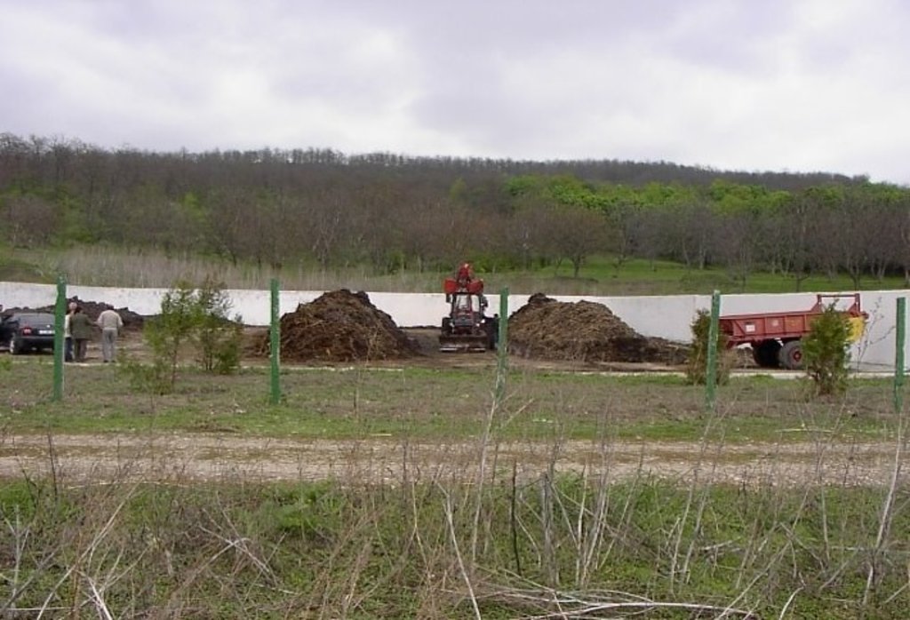
Organic manure was substituted for inorganic fertilizer, and eight commune/village stores were constructed together with 1200 household stores and equipment provided for manure handling and field application. A monitoring database was made available.
2. Promotion of Environment-Friendly Agricultural Practices:
A well-documented pilot was completed and evaluated for replication, and 300 farmers then trained in the application of environment-friendly agricultural practices. The capacity of extension staff significantly improved. A monitoring system to determine the impact of practices on soil quality was installed and data collected.
3. Shrub and Tree Planting:
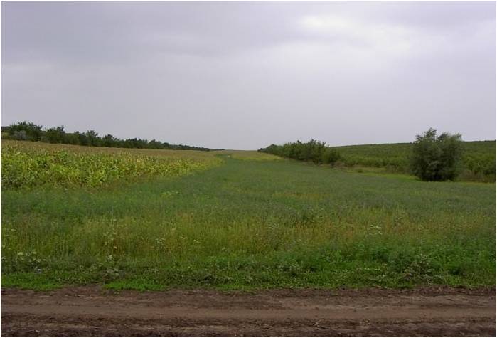
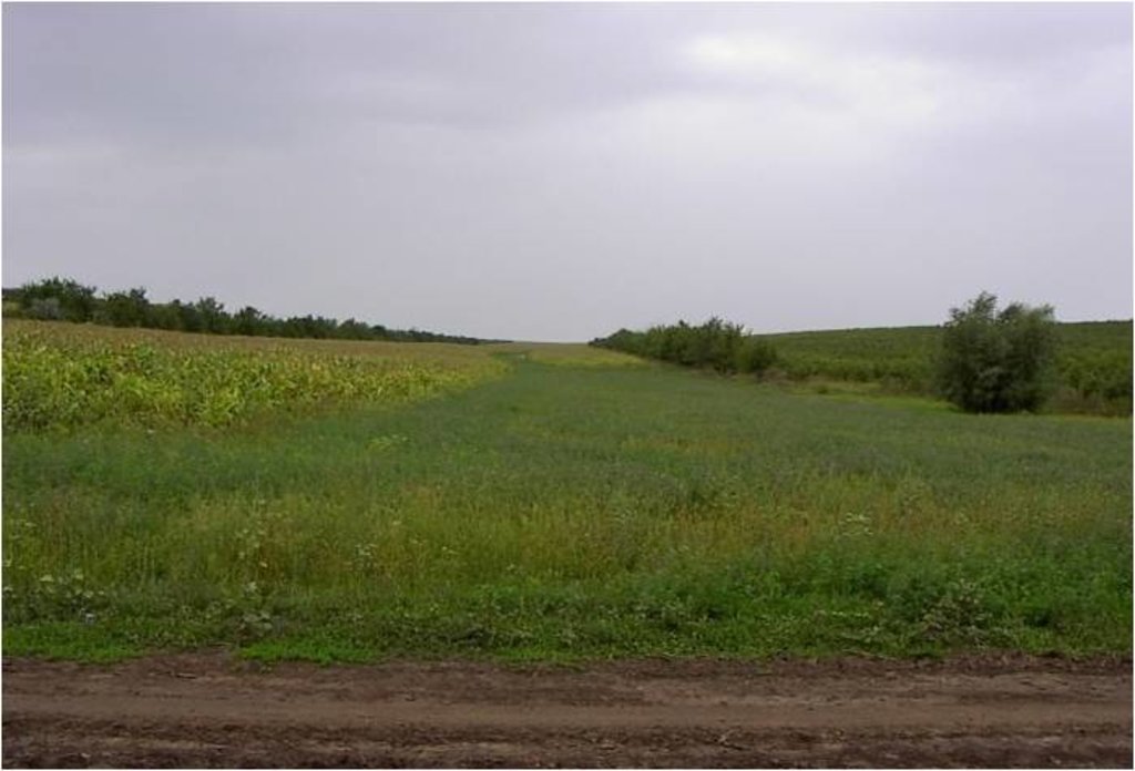
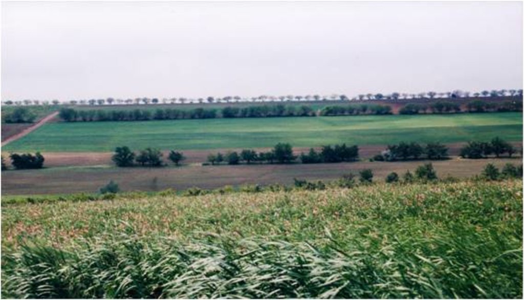
• 132 hectares of shelterbelts for water protection established; 112 hectares of improved anti-erosion forest belts set up; 50 hectares of improved pasture established; 484 hectares of the existing forests rehabilitated and properly managed; forest monitoring was incorporated into the general monitoring scheme.
4.Wetland Restoration and Promotion of Sustainable Management Practices:
The existing ecosystems were rehabilitated and ecologically well balanced. In this context two dams were built with a sluice gate system for the stabilization of water levels; three concrete bridges with adequate culvert capacity were installed for accessibility to different portions of the wetland; and 10 small wood bridges with culverts were built for access.
5 .Monitoring Soil and Water Quality and Environmental Impacts
Availability of water for downstream users and fisheries was increased, drinking water supplies was improved, there was increased quality and availability of groundwater for human and animal consumption, and simultaneously better productive lands with increased organic matter and carbon sequestration, as well as increased biodiversity.
Key Elements of the Manure Management System:
a. Segregation of inert and recyclable materials from livestock waste through the provision of a separate household waste container.
b. Improved manure stores for storage of waste at a single impermeable store at the household with enough storage for up to one month's production.
c. Transfer of waste from the farm store to a central site, using transport units then unloading it at the commune platform, to aerate the waste, promoting continued bacterial activity.
d. At the commune/village store level, the segregated inert materials deposited in designated bunkers.
e. At the commune/village store level, management of the household manure at the main bunker involving stacking in shaped windrow heaps three metres high.
f. Store the waste deep so that the areas getting wet from rainfall is minimised. Provide impermeable walls and floor to eliminate leaching.
g. Provide storage capacity for over the winter so that matured manure will be available for use on the land.
Key Elements of facilities at the Village Platform are:
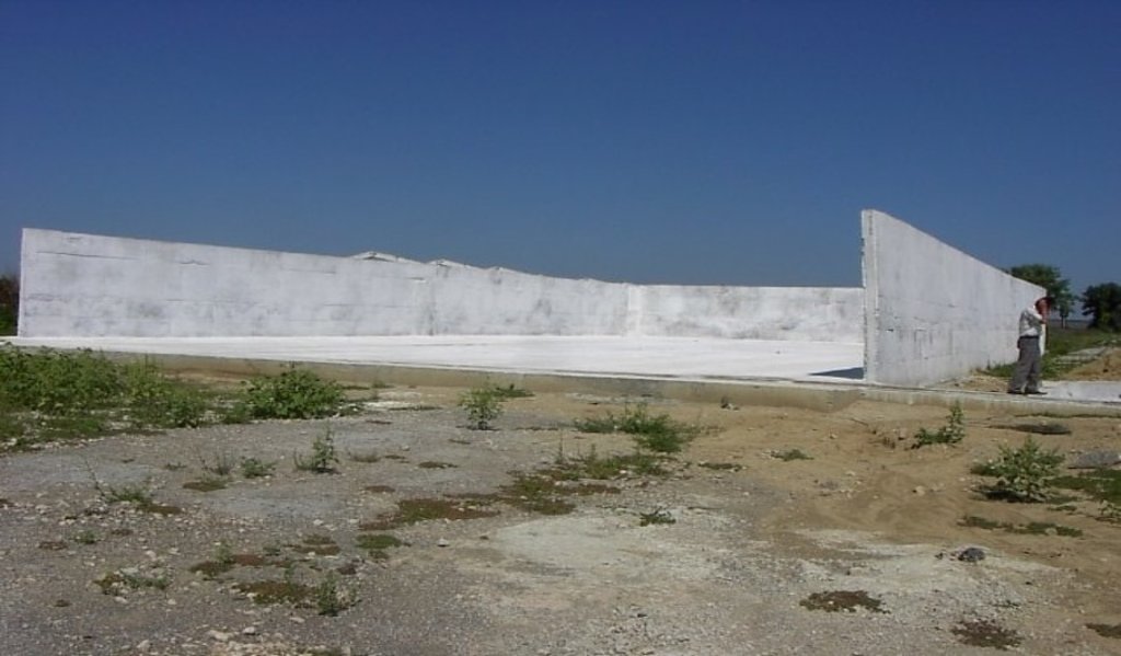
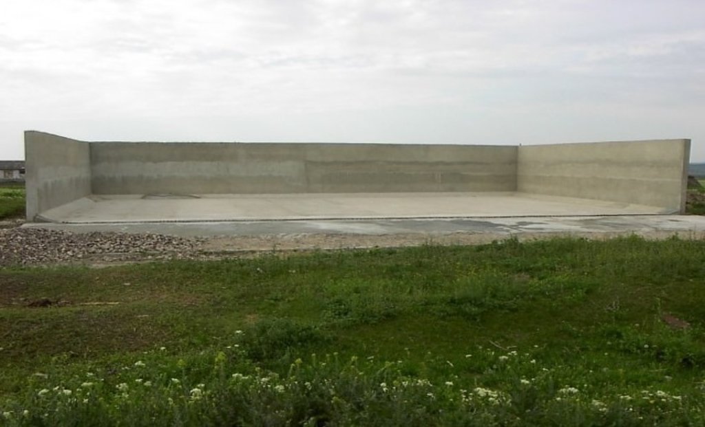
a. Concrete area for the management of the manure.
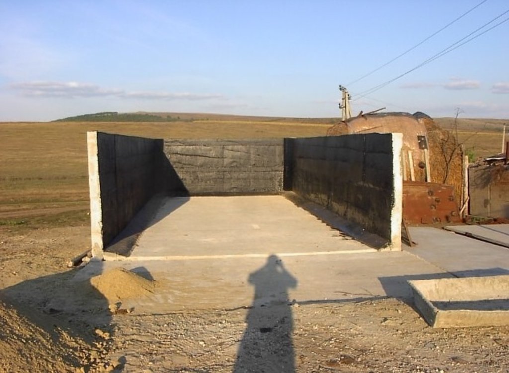
b. Bunkers for the segregated household manure.
c. Collecting channel for runoff from the platform.
d. Storage pits and tanks with impermeable base and walls.
e. Security fencing.
f. Office / Staff facilities and Landscaping. Monitoring wells to check for leakages.
Overall results show that 8,250 farmers from both the project pilot area and other regions of Moldova had adopted at least one environmentally-friendly agricultural practice promoted by the project, and had implemented these on 14,028 ha of land.
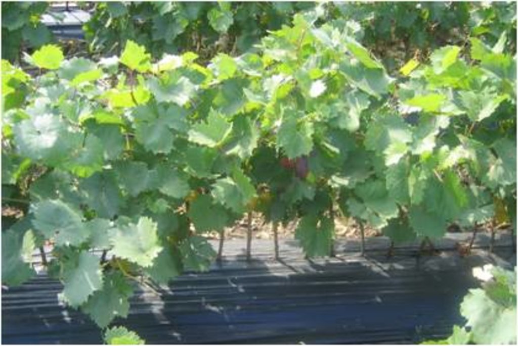
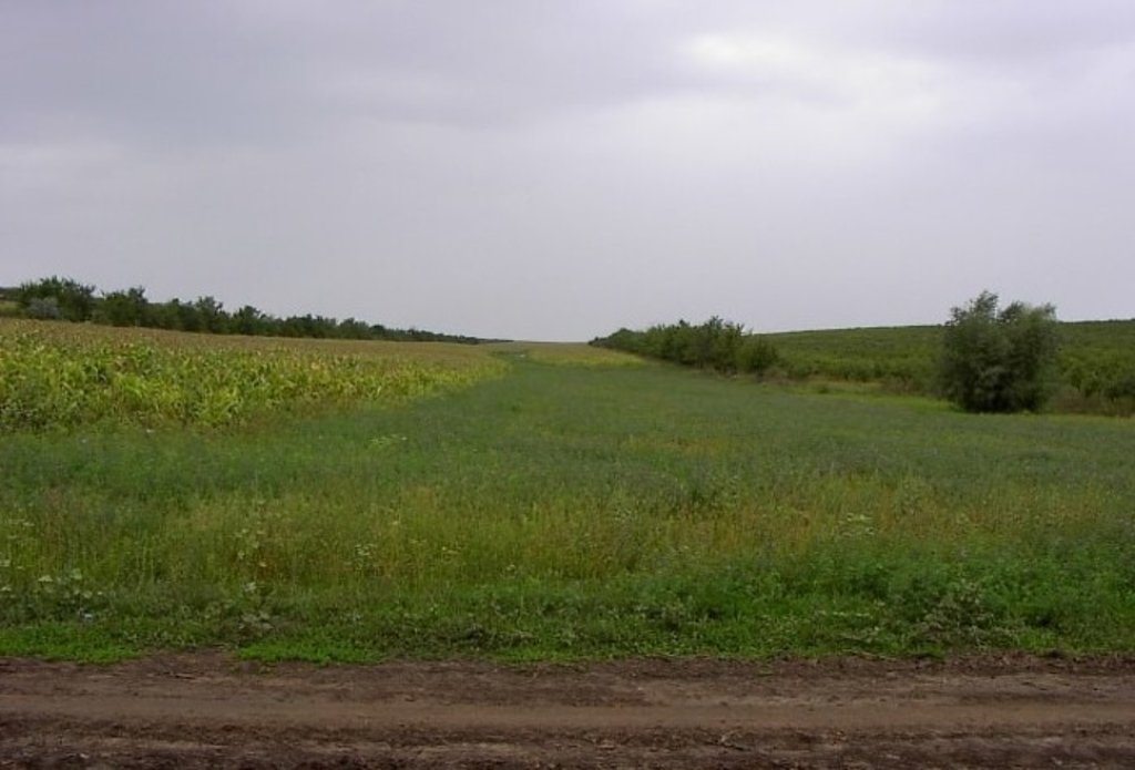
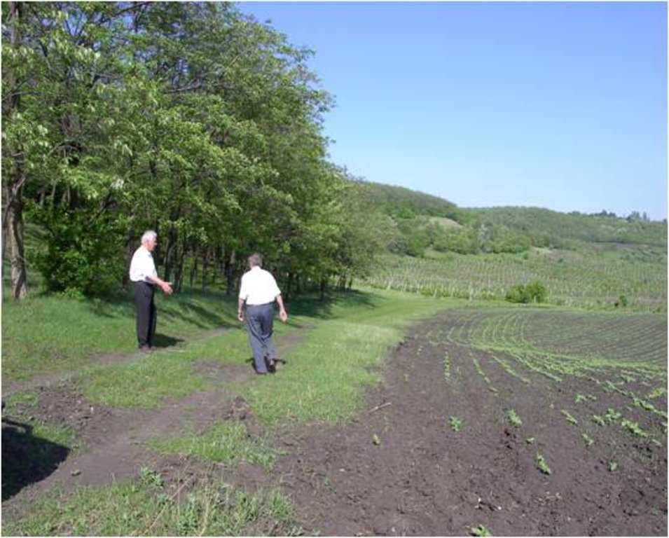
2.3 Fotos da tecnologia
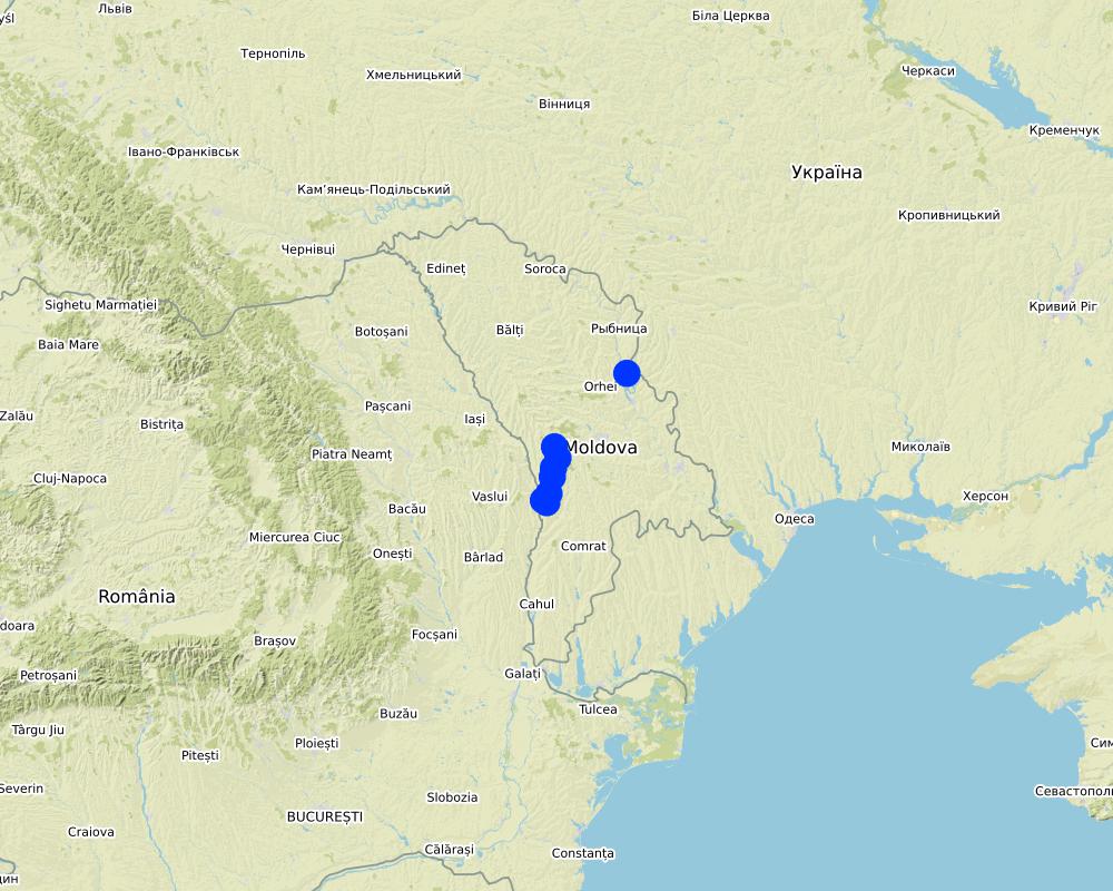
2.5 País/região/locais onde a tecnologia foi aplicada e que estão cobertos nesta avaliação
País:
República da Moldávia
Região/Estado/Província:
Hincesti and Orhei districts
Especificação adicional de localização:
Negrea, Lapusna, Carpineni, Minjir communes, Hincesti district; Sarata Razesti commune, Leova district, and Jora de Mijloc, Orhei district
Map
×3. Classificação da tecnologia de GST
3.1 Principal/principais finalidade(s) da tecnologia
- Melhora a produção
- Reduz, previne, recupera a degradação do solo
- Preserva ecossistema
- Protege uma bacia/zonas a jusante – em combinação com outra tecnologia
- Preservar/melhorar a biodiversidade
- Reduzir riscos de desastre
- Criar impacto econômico benéfico
3.2 Tipo(s) atualizado(s) de uso da terra onde a tecnologia foi aplicada

Terra de cultivo
- Cultura anual
- Cultura perene (não lenhosa)
- Cultura de árvores e arbustos
Principais plantações (colheitas para venda e consumo próprio):
Wheat, corn, sunflower, alfalfa (lucerne), vineyards, orchards, vegetables

Vias navegáveis, corpo d'água, zonas úmidas
- Linhas de drenagem, vias navegáveis
- Pântanos, zonas úmidas
Principais produtos/serviços:
The existing ecosystems rehabilitated and ecologically well balanced; dams with a sluice gate system for the stabilization of water levels; concrete bridges with adequate culvert capacity for access to different portions of the wetland; and wooden bridges with culvert capacity for access through the zone constructed
3.3 Mais informações sobre o uso da terra
Abastecimento de água para a terra na qual a tecnologia é aplicada:
- Misto de precipitação natural-irrigado
Número de estações de cultivo por ano:
- 1
Especifique:
1 growing season per year for rainfed and 2 growing seasons per year for irrigated areas
3.4 Grupo de GST ao qual pertence a tecnologia
- Gestão de plantação florestal
- sistema rotativo (rotação de culturas, pousios, cultivo itinerante)
- Gestão integrada plantação-criação de animais
3.5 Difusão da tecnologia
Especifique a difusão da tecnologia:
- Uniformemente difundida numa área
Caso a tecnologia seja uniformemente difundida numa área, indique a área coberta aproximada:
- > 10.000 km2
Comentários:
8,250 farmers from both project pilot area and other regions of Moldova that adopted at least one environmentally friendly agricultural practice promoted by the project implemented on as much as 14,028 ha of land in total.
3.6 Medidas de GST contendo a tecnologia

Medidas agronômicas
- A1: cobertura vegetal/do solo
- A2: Matéria orgânica/fertilidade do solo

Medidas vegetativas
- V1: cobertura de árvores/arbustos
- V2: gramíneas e plantas herbáceas perenes
- V4: Substituição ou retirada de espécies exóticas/invasivas

Medidas de gestão
- M2: Mudança de gestão/nível de intensidade
- M3: Disposição de acordo com o ambiente natural e humano
- M5: Controle/mudança de composição de espécies
- M6: Gestão de resíduos (reciclagem, reuso ou redução)
3.7 Principais tipos de degradação da terra abordados pela tecnologia

Erosão do solo pela água
- Wt: Perda do solo superficial/erosão de superfície
- Wg: Erosão por ravinas/ravinamento
- Wm: movimento de massas/deslizamentos
- Wr: erosão das margens
- Wo: efeitos de degradação externa

Deteriorização química do solo
- Cn: declínio de fertilidade e teor reduzido de matéria orgânica (não causado pela erosão)
- Cp: poluição do solo
- Cs: salinização/alcalinização

Deteriorização física do solo
- Pc: Compactação
- Pk: quebra e ressecamento
- Ps: Subsidência de solos orgânico, sedimentação do solo

Degradação biológica
- Bc: redução da cobertura vegetal
- Bh: perda dos habitats
- Bq: quantidade/ declínio da biomassa
- Bs: Qualidade e composição de espécies/declínio de diversidade
- Bl: perda da vida do solo

Degradação da água
- Ha: aridificação
- Hp: declínio da qualidade de água de superfície
- Hq: declínio da qualidade do lençol freático
- Hw: redução da capacidade de tamponamento de zonas úmidas
3.8 Redução, prevenção ou recuperação da degradação do solo
Especifique o objetivo da tecnologia em relação a degradação da terra:
- Prevenir degradação do solo
- Recuperar/reabilitar solo severamente degradado
4. Especificações técnicas, implementação de atividades, entradas e custos
4.1 Desenho técnico da tecnologia
4.2 Especificações técnicas/ explicações do desenho técnico
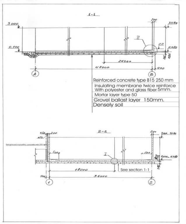
Schematic structure of village platform: Length - 48 m, Width - 36 m, Height - 3 m, Capacity - 3400 tons, Storage period - 5 months
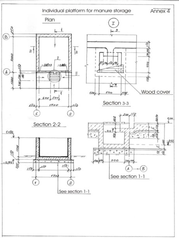
Schematic structure of household platform: Length - 2.2 m, Height - 1.2 m, Capacity - 4.8 c.m., Storage period - 1 month.
At village level, the project supported the construction of waste storage platforms of 3400 tonnes capacity and a storage period of 5 months. The platform has 48 m length and 36 m width. It is surrounded by a concrete 3 m high wall and bedded by a concrete floor with an impermeable insolating membrane. The platform is equipped with a bunker for inert material and a basin for collection of liquid fraction. The platform is built on the commune land (administrated by the Mayoralty) in full compliance with the environmental protection requirements.
At the household-level 150 platforms were built. The platforms have 2.55 m3 and a storage period of one month. The platform capacity was calculated based on estimated quantity of manure for an average household with at least two cattle, two-three pigs and a certain number of poultry. The designed platform consists of a simple open fronted store with a concrete floor and 1.5 m height walls. In front of the platform, a concrete below ground tank (125 dcm3 volume) covered by a wood lid with a plastic basket inside of 50 liters capacity for collection of liquid fraction would be equipped. A separate small capacity container (about 90 liters) for the collection of recyclable and non-recyclable household wastes was also provided.
4.4 Atividades de implantação
| Atividade | Tipo de medida | Periodicidade | |
|---|---|---|---|
| 1. | Packages developed for manure management at village and household level and evaluated for replication | ||
| 2. | Public awareness & education | ||
| 3. | Use of good agricultural practices by farmer associations, family farms and individual farmers on cropland. | ||
| 4. | Monitoring & evaluation. |
4.7 Custos e entradas necessárias pata a manutenção/atividades recorrentes (por ano)
Se o usuário da terra arca com menos que 100% dos custos, indique quem cobre os custos remanescentes:
The Project
5. Ambiente natural e humano
5.1 Clima
Precipitação pluviométrica anual
- <250 mm
- 251-500 mm
- 501-750 mm
- 751-1.000 mm
- 1.001-1.500 mm
- 1.501-2.000 mm
- 2.001-3.000 mm
- 3.001-4.000 mm
- > 4.000 mm
Especifique a média pluviométrica anual em mm (se conhecida):
500,00
Indique o nome da estação meteorológica de referência considerada:
Hincesti
Zona agroclimática
- Subúmido
Climate is moderately continental: the summers are warm and long, with temperatures averaging about 20°C, and the winters are relatively mild and dry, with January temperatures averaging -4°C. Annual rainfall, which ranges from around 500 millimeters; long dry spells are not unusual. The heaviest rainfall occurs in summer; heavy showers and thunderstorms are common.
5.2 Topografia
Declividade média:
- Plano (0-2%)
- Suave ondulado (3-5%)
- Ondulado (6-10%)
- Moderadamente ondulado (11-15%)
- Forte ondulado (16-30%)
- Montanhoso (31-60%)
- Escarpado (>60%)
Formas de relevo:
- Planalto/planície
- Cumes
- Encosta de serra
- Encosta de morro
- Sopés
- Fundos de vale
Zona de altitude:
- 0-100 m s.n.m.
- 101-500 m s.n.m.
- 501-1.000 m s.n.m.
- 1.001-1.500 m s.n.m.
- 1.501-2.000 m s.n.m.
- 2.001-2.500 m s.n.m.
- 2.501-3.000 m s.n.m.
- 3.001-4.000 m s.n.m.
- > 4.000 m s.n.m.
Indique se a tecnologia é aplicada especificamente em:
- Não relevante
Comentários e outras especificações sobre a topografia:
The territory belongs to the Central Moldova Height and the Plain of Upper Prut. The landscape is hilly, very fragmented with a dense network of valleys, hollows and plains. Almost 75% of the land is situated on slopes. Water erosion processes are widespread and quite intense. The predominant length of the hillsides in Negrea pilot area is 800-900 m.
5.3 Solos
Profundidade do solo em média:
- Muito raso (0-20 cm)
- Raso (21-50 cm)
- Moderadamente profundo (51-80 cm)
- Profundo (81-120 cm)
- Muito profundo (>120 cm)
Textura do solo (solo superficial):
- Médio (limoso, siltoso)
Textura do solo (>20 cm abaixo da superfície):
- Médio (limoso, siltoso)
Matéria orgânica do solo superficial:
- Médio (1-3%)
Caso disponível anexe a descrição completa do solo ou especifique as informações disponíveis, p. ex. tipo de solo, PH/acidez do solo, nitrogênio, capacidade de troca catiônica, salinidade, etc.
Chernozems (black soils) prevail in the soil composition (65% of the area) divided into argilo-illuvial and carbonate subtypes. These soils are perfectly suited for agriculture. They are friable, permeable, have good water and air saturation and are easy to till. Chernozems are rich in organic matter (3-4% humus content), however they are degraded. Alluvial soils are spread in the floodplain of the Lapusna river and its tributaries. alluvial soils are often subject to salinization and water logging.
5.4 Disponibilidade e qualidade de água
Lençol freático:
5-50 m
Disponibilidade de água de superfície:
Médio
Qualidade da água (não tratada):
Água potável precária (tratamento necessário)
A salinidade da água é um problema?
Sim
Especifique:
high water mineralisation
Ocorre inundação da área?
Sim
Regularidade:
Esporadicamente
5.5 Biodiversidade
Diversidade de espécies:
- Baixo
Diversidade de habitat:
- Baixo
5.6 Características dos usuários da terra que utilizam a tecnologia
Sedentário ou nômade:
- Sedentário
Orientação de mercado do sistema de produção:
- Misto (subsistência/comercial)
Rendimento não agrícola:
- 10-50% de toda renda
Nível relativo de riqueza:
- Pobre
- Média
Indivíduos ou grupos:
- Indivíduo/unidade familiar
- Grupos/comunidade
Nível de mecanização:
- Tração animal
- Mecanizado/motorizado
Gênero:
- Mulheres
- Homens
Idade dos usuários da terra:
- idosos
Indique outras características relevantes dos usuários da terra:
The principal activity in the commune is agriculture. The farmers cultivate arable crops, grapes and fruits. From vegetables, pea and bean plantations, cabbage, cucumber, tomatoes, beats and carrots are most usual. Potatoes are predominantly cultivated on the households’ plots. There are two small economic units dealing with wood processing and meat production activating under the umbrella of the local farmer’s association, “SRL Negrea-Pomvit”. |
The income of the people depends much on the harvest and climatic conditions, but also on imbalances of the market, import policies, governmental purchases, etc. The estimated average income per capita in the community over the last 3 years was 45 US dollars per month.
5.7 Média da área de terra própria ou arrendada por usuários da terra que utilizam a tecnologia
- < 0,5 ha
- 0,5-1 ha
- 1-2 ha
- 2-5 ha
- 5-15 ha
- 15-50 ha
- 50-100 ha
- 100-500 ha
- 500-1.000 ha
- 1.000-10.000 ha
- > 10.000 ha
É considerado pequena, média ou grande escala (referente ao contexto local)?
- Média escala
- Grande escala
Comentários:
The total number of land shares in the commune is 772. Each land share has on average 1.20 ha, including 0.70 ha of arable land, 0.15 ha of orchards and 0.35 ha of vineyards. The number of individual farms is 190. The principal landowner in the region is the association of shareholders “SRL Negrea-Pomvit”. The association manages collectively 664 ha. |
5.8 Propriedade de terra, direitos de uso da terra e de uso da água
Propriedade da terra:
- Comunitário/rural
- Indivíduo, intitulado
Direitos do uso da terra:
- Comunitário (organizado)
- Arrendado
Direitos do uso da água:
- Acesso livre (não organizado)
- Indivíduo
5.9 Acesso a serviços e infraestrutura
Saúde:
- Pobre
- Moderado
- Bom
Educação:
- Pobre
- Moderado
- Bom
Assistência técnica:
- Pobre
- Moderado
- Bom
Emprego (p. ex. não agrícola):
- Pobre
- Moderado
- Bom
Mercados:
- Pobre
- Moderado
- Bom
Energia:
- Pobre
- Moderado
- Bom
Vias e transporte:
- Pobre
- Moderado
- Bom
Água potável e saneamento:
- Pobre
- Moderado
- Bom
Serviços financeiros:
- Pobre
- Moderado
- Bom
6. Impactos e declarações finais
6.1 Impactos no local mostrados pela tecnologia
Impactos socioeconômicos
Produção
Produção agrícola
Comentários/especificar:
According to elevator (NGO BIOS), •The SROI (Social Return on Investment) ratio for the period of 2004-2009 was 3,34, or, every $US1 invested by the Project $US 3,34 worth of value (economic, social and/or environmental) was delivered to society.
Produção animal
Produção de madeira
Produção florestal não madeireira
Risco de falha de produção
Gestão de terra
Disponibilidade e qualidade de água
Qualidade da água potável
Qualidade da água para criação de animais
Qualidade da água para irrigação
Impactos ecológicos
Ciclo hídrico/escoamento
Escoamento superficial
Solo
Perda de solo
Compactação do solo
Ciclo e recarga de nutrientes
Matéria orgânica do solo/carbono abaixo do solo
Biodiversidade: vegetação, animais
Cobertura vegetal
Diversidade vegetal
Espécies exóticas invasoras
Diversidade de habitat
6.2 Impactos externos mostrados pela tecnologia
Sedimentação a jusante
Poluição de água subterrânea/rio
Capacidade de tamponamento/filtragem
Danos em áreas vizinhas
Danos na infraestrutura pública/privada
Comentários relativos à avaliação de impacto:
he Social Survey indicated an improved environmental situation in LPA in comparison to other rural localities. Some problems in LPA are not so acute as there were in 2002, especially soil erosion, aquatic reservoirs pollution and quality of potable water, which demonstrates the efficiency of APCP P|
The fact that over 50 % of the respondents from Lapusnita Pilot Area consider APCP implementation has a positive impact on life, health and environment, shows that APCP contributed substantially to the improving the economic, social and ecological conditions, especially in LPA. The acknowledged impa|
It is expected that the project will be scaled up at the national level and facilities for waste management will be improved in all communities; the value of manure will be appreciated and used as fertiliser, wetlands will be restored; environment-friendly practices, including reintroducing trees wi|
The level of applied good agricultural practices in LPA is higher than in other communities of the country and has increased as compared to 2003. Farmers apply more organic fertilizers (by 13%), forest belts (10%), strip cropping (9%) and less mineral fertilizers (17%).
ACSA organized 90 seminars. People from all districts attended the training seminars. Survey data show that 90 % of the participants in seminars intended to apply GAP.
Over 3,000 farmers adopted at least 1 of GAP in Lapusnita Pilot Area and over 12,000 outside LPA. The total area, where environmentally-friendly practices were applied was 28,275 ha.
6.3 Exposição e sensibilidade da tecnologia às mudanças climáticas graduais e extremos/desastres relacionados ao clima (conforme o ponto de vista dos usuários da terra)
Comentários:
Healthy organisms are adapted easily to various conditions. In this way agro-ecosystems having soils and water with improved properties (due to application of good agricultural practices) with adequate management practices will have also positively impact on climate change adaptation.
Due to the fact that Good Agricultural practices improve soil and water qualities, they create very good conditions for the development of soil biodiversity and wild biodiversity in farming landscapes. Due to the reduction of pollution landscapes become more healthy and also is very beneficial for the agricultural biodiversity.
Permanent vegetated strips established at field and stream riparian boundaries and in water courses will create conditions for the development of biodiversity.|
Conventional agriculture is the major contributor to increasing of methane and nitrous oxide concentrations in earth's atmosphere. Aforestation and soil conservation technologies are one of the main sink of carbon dioxide. In this way good agricultural practices have a positively impact on climate change mitigation.
6.4 Análise do custo-benefício
Como os benefícios se comparam aos custos de implantação (do ponto de vista dos usuários da terra)?
Retornos a curto prazo:
levemente positivo
Retornos a longo prazo:
positivo
Como os benefícios se comparam aos custos recorrentes/de manutenção(do ponto de vista dos usuários da terra)?
Retornos a curto prazo:
neutro/balanceado
Retornos a longo prazo:
positivo
6.5 Adoção da tecnologia
- 10-50%
Se disponível, determine a quantidade (número de unidades familiares e/ou área abordada):
8,250 farmers from both project pilot area and other regions of Moldova
Entre todos aqueles que adotaram a tecnologia, quantos adotaram espontaneamente, ou seja, sem receber nenhum incentivo material/pagamentos?
- 10-50%
6.6 Adaptação
A tecnologia foi recentemente modificada para adaptar-se as condições variáveis?
Não
6.8 Pontos fracos, desvantagens/riscos da tecnologia e formas de superá-los
| Pontos fracos/desvantagens/riscos na visão do usuário da terra | Como eles podem ser superados? |
|---|---|
| Farmers did not calculate properly expenses and benefits. | They should be provided simple instruments to calculate their inputs and to plan for future activity. |
| Agricultural literature is too difficult for rural people to understand. | Knowledge should be provided in an accessible manner. Small guides should exist for separate crops with drawings and schemes. |
7. Referências e links
7.1 Métodos/fontes de informação
- entrevistas com usuários de terras
300
7.2 Referências às publicações disponíveis
Título, autor, ano, ISBN:
Guidelines for Good Agricultural Practices (Practici agricole prietenoase mediului). Îndrumar: /Ungureanu V., Cerbari V., Magdîl A., Gherman E.- Chişinău: Tipografia Centrală, 2006. – 96 p.
Disponível de onde? Custos?
http://www.acsa.md/album.php?l=ro&idc=152&t=/GALERIE-FOTO/Practici-agricole-prietenoase-mediului
7.3 Links para informação relevante que está disponível online
Título/ descrição:
Moldova - Agricultural Pollution Control Project (English)
URL:
http://documents.worldbank.org/curated/en/117701468287732017/Moldova-Agricultural-Pollution-Control-Project
Links e módulos
Expandir tudo Recolher tudoLinks
Não há links
Módulos
Não há módulos


