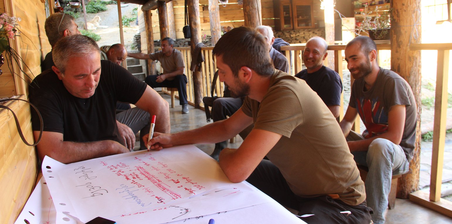
Pasture management workshop in Tusheti with local stakeholders (Hanns Kirchmeir)
Project area and purpose
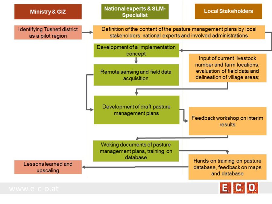
The project area comprises the Tusheti Protected Areas (PAs) on the northern slopes of the Greater Caucasus Mountains in Georgia. This group of protected areas consists of a strict nature reserve, a national park and a protected landscape with about 40 villages and settlements. Together they form a total protected area of approx. 114,000 ha. In Tusheti, overgrazing has led, especially in the eastern part with a higher number of villages and roads, to soil erosion and biodiversity loss. Especially the intensive use of summer pastures during the Soviet period resulted in a severe deterioration of the mountain slopes. So far, there are no standards or guidelines for the elaboration of sustainable pasture management plans in Georgia. Pasture passports, as a first step towards sustainable pasture management, document the actual grazing capacity for each pasture unit and serve as a guiding document for shepherds and local stakeholders and as a basis to prepare lease contracts.
Data gathering
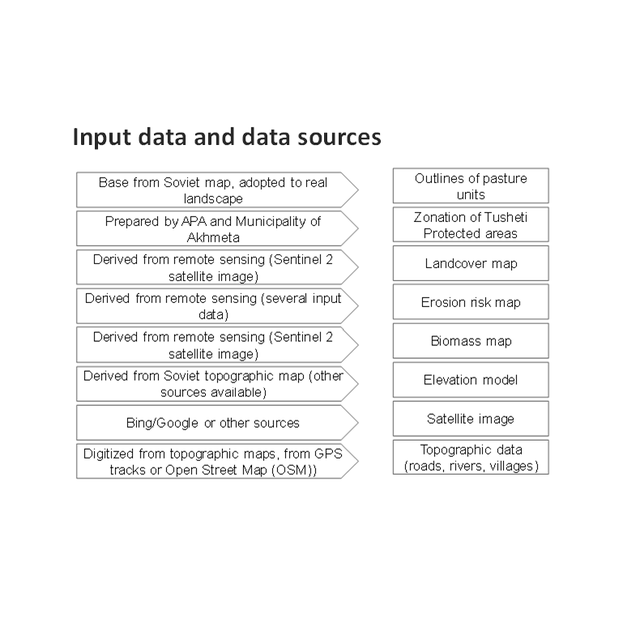
As a prerequisite for the development of pasture passports and the calculation of grazing capacity, the type of land cover, the erosion risk and the biomass of the pastureland had to be assessed for each pasture unit. This was done using remote sensing tools in combination with data collected in the field for calibration.
The details on the methodology of the Land Cover & Biomass as well as the Erosion Risk Assessment can be found in the WOCAT technology on "Remote Sensing as a Tool for Land Degradation Neutrality Monitoring" (see link).
Evaluation and Ground Truthing
All interim results have been checked and evaluated by local stakeholders, national experts and experts from local administrations. It was important not only to conduct workshops in seminar rooms but to meet the local stakeholders in the field and to discuss the problems and challenges of pasture management on place in the field. At this workshops all levels of decision makers were included (Ministries, Donor organisations, international and national experts, local administrations and land users). This was important to create a common understanding of the current situation from different perspectives (nature conservation, administration, shepherds ...). The combination of remote sensing with calibration data from the field can be summarised as a very effective method to assess the erosion state in large areas. Neither of the two instruments would be able to provide results in this spatial dimension and quality alone.
Pasture Passports
As part of the spatial planning of Akhmeta municipality, pastureland that can be leased to shepherds was separated from land used as hay meadows, farmland or pastures belonging to the villagers. The resulting map shows land available to the village and land available for lease. To understand the current use of pastureland, farms, livestock numbers and pasture units were assessed. In workshops with the local stakeholders and potential users of the results (shepherds, Tusheti Protected Landscape Administration, Tusheti NP Administration, APA), the design of the pasture passports was developed. Each pasture unit is described on four pages in the pasture passport.
Each pasture unit is described on four pages in the pasture passport: Header: the number (code), total area; content: map of the land cover types, the area of each land cover type, map of available biomass and carrying capacity, name of farmers/shepherds and their livestock numbers using the pasture unit
Spatial Planning Department and Construction Policy (within the Ministry of Regional Development and Infrastructure MRDI), and the Agency of Protected Areas APA (within the Ministry of Environmental Protection and Agriculture MEPA), are key stakeholders to use the pasture passports and to further develop and upscale this approach to other protected areas in Georgia. Beside APA, the Tusheti Protected Landscape Administration (TPLA), located within the Akhmeta municipality administration, is the second important user of pasture passports.
The pasture passports are showing not only the boundaries of each pasture unit, but also those areas that must not be grazed because this lands are part of strict protected areas or areas of high erosion risk. This helps shepherds to guide their flocks to the right places and the park rangers to check, if the regulations are respected correctly.
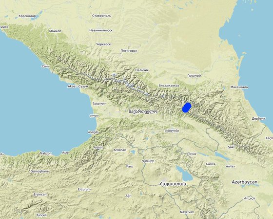
Местоположение: Entire territory of Tusheti Protected Areas (1100 km²), Tusheti, Грузия
Дата ввода в действие: 2016
Дата завершения: н/п
Тип Подхода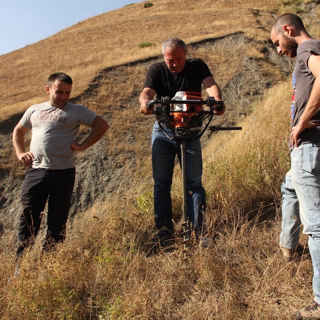
| Какие заинтересованные стороны/ организации-исполнители участвовали в реализации Подхода? | Перечислите заинтересованные стороны | Опишите роли заинтересованных сторон |
| местные землепользователи/ местные сообщества | Shephards, local communities | Participation at the workshop/meeting and making contributions through comments, suggestions and sharing their analytical point of view. |
| эксперты по УЗП/ сельскому хозяйству | GIS-LAB (Georgian scientific GIS service provider) | National experts on remote sensing and modelling of erosion risk. |
| ученые-исследователи | National ecologists from universities | |
| общественные организации | Centre for Biodiversity Research & Conservation (NACRES); staff and experts from FATPA (Friends Association of Tusheti Protected Areas); local NGO's | Interviews with local stakeholders, field experts |
| местные власти | Municipality of Akhmeta and Tusheti Protected Landscape Management | Participation at the workshop where they have given input and made contributions to the topic of technical aspects of the approach. |
| государственные власти (отвечающие за планирование или принятие решений) | National Park management and APA (Agency for Protected Areas) | Long term aplication and upscaling on national level. |
| международные организации | Deutsche Gesellschaft fuer Zusammenarbeit (GIZ) | Funding and supervision of the implementation process. |
The process of generating pasture passports consists of several phases. The needs and expected content of the pasture management plans was defined in the early stage of the project by the local stakeholders, national experts and involved administrations. The preparation of the pasture management plans was an iterative process between the remotsensing and field sampling results and feedback and input from local stakeholders.
•
Решения принимались
Принятие решений было основано на
Evaluation of model results, preliminary result maps of erosion risk in the field, technical implementation of the sensitivity model in Georgia.
National and international ecologists did research on vegetation details and biomass as well as on the remote sensing technology.
The Agency of Protected Areas (APA) thinks about upscaling the pasture passport method on a national level and establish the approach also in other protected areas of Georgia.
Through the field visits and workshops, it has involved both experts and authorities, where they have assessed, analysed and given input.
By the assessment of biomass, the carrying capacity of each pasture unit was calculated.
The perception of the key stakeholders and management towards the importance of biodiversity and ecosystem services has become more positive.
The implementation capacity of line ministries, their subordinate bodies and of training institutions regarding the management of biodiversity and ecosystem services is improved at the national level.
A cooperation between the local Administration of the Protected Landscape (managed by municipality) and the Administration of National Park (managed by national Agency of Protected Areas) was strengthened.
The remote sensing technology is not available to the land users, but the results (pasture passports) can be used by shepherds and local authorities to adjust the grazing intensity to the maximum carrying capacity of each pasture unit.


