Pasture inclination used for developing grazing plan [ทาจิกิสถาน]
- ผู้สร้างสรรค์:
- การอัพเดท:
- ผู้รวบรวม: Askarsho Zevarshoev
- ผู้เรียบเรียง: –
- ผู้ตรวจสอบ: Maximilian Knoll, Yacime Khadraoui
Накшаи чарондани чорво дар чарогох аз руи мавкеи чойгиршави (офтобруя ва сояру)
approaches_3474 - ทาจิกิสถาน
ดูส่วนย่อย
ขยายทั้งหมด ย่อทั้งหมด1. ข้อมูลทั่วไป
1.2 รายละเอียดที่ติดต่อได้ของผู้รวบรวมและองค์กรที่เกี่ยวข้องในการประเมินและการจัดเตรียมทำเอกสารของแนวทาง
ผู้เชี่ยวชาญ SLM:
ชื่อของโครงการซึ่งอำนวยความสะดวกในการทำเอกสารหรือการประเมินแนวทาง (ถ้าเกี่ยวข้อง)
Environmental Land Management and Rural Livelihood Projectชื่อของโครงการซึ่งอำนวยความสะดวกในการทำเอกสารหรือการประเมินแนวทาง (ถ้าเกี่ยวข้อง)
Aga Khan Foundation (Aga Khan Foundation) - สวิตเซอร์แลนด์1.3 เงื่อนไขที่เกี่ยวข้องกับการใช้ข้อมูลที่ได้บันทึกไว้ผ่านทาง WOCAT
วันที่เก็บรวบรวมข้อมูล (ภาคสนาม):
20/07/2016
ผู้รวบรวมและวิทยากรหลักยอมรับเงื่อนไขเกี่ยวกับการใช้ข้อมูลที่ถูกบันทึกผ่านทาง WOCAT:
ใช่
1.4 การอ้างอิงถึงแบบสอบถามเรื่องเทคโนโลยี SLM

Технология управлениия пастбищами в условиях Западного Памира [ทาจิกิสถาน]
Управление пастбищных угодий путем внедрения новой техники пастбищеоборота с учетом емкости пастбища
- ผู้รวบรวม: Aslam Qadamov
2. คำอธิบายของแนวทาง SLM
2.1 การอธิบายแบบสั้น ๆ ของแนวทาง
In this approach the inclination of pasture land and its effect on the spread of sun and shadow is used to identify different periods for grazing. This simple approach will raise awareness and provides biological aspects in pasture management. In this approach the vegetation cover of the pasture is linked to the position of the sun. This is specific to mountain areas, where in one location vegetation periods can differ in two spots although they are in the same location.
2.2 การอธิบายอย่างละเอียดของแนวทาง
การอธิบายอย่างละเอียดของแนวทาง:
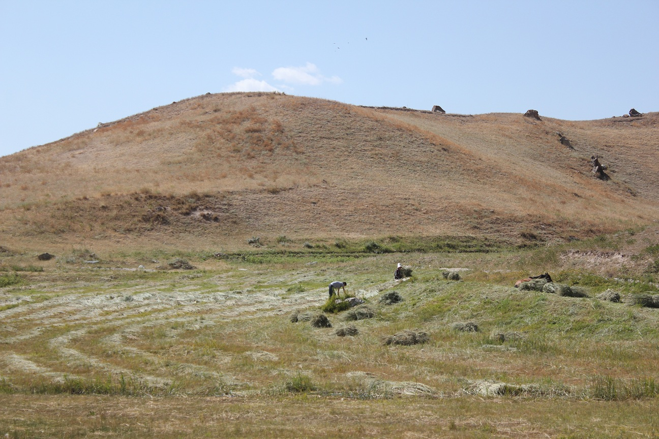
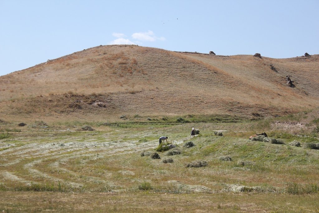
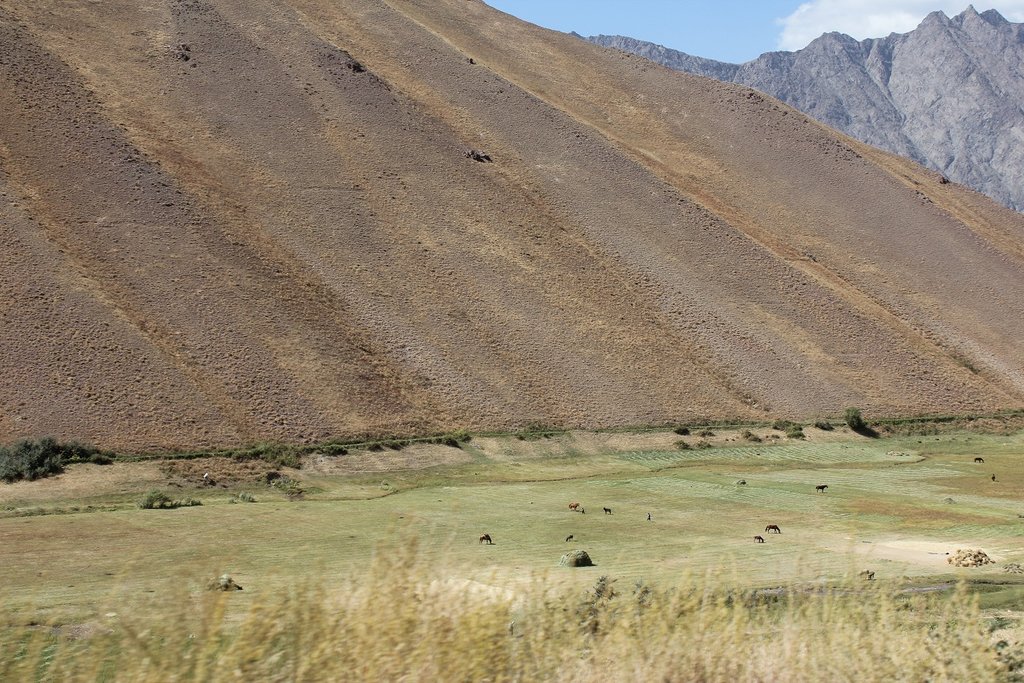
Considering pasture's geographical location and its inclination to the sun is identified as an important element of devoloping rotational grazing plans. Because of the mountainous geography of the area, within certain pasture areas one part can be sun inclined and the other is shadowed. This is effecting the vegetation growing process, since on the sun inclined part the vegetation is growing faster compared to the other where sun is reaching later. Communities in the past did not take this into consideration and grazed in both areas at the same time. This leads to degradation in the areas where vegetation did not grow properly. On the other side if the areas inclined to the sun are not grazed in time they dry up.
The main objective of this approach is to apply an ecosystem based adaptation approach in pasture use, with vegetative periods for different areas and locations. By applying this approach communities will be enabled to organize grazing plans correctly and to prevent pasture degradation.
The implementation period will start from the planing phase up to the implementation of the pasture plan. Mainly livestock owners and the PUU management is involved in the implementation of this approach. Pasture users will be mobilized according to the grazing plan, in which part of the pasture when to graze with taking into consideration the position to the sun. Beside land users, the local government is also involved to ensure sustainable use of this approach as one of the techniques in prevention of pasture degradation.
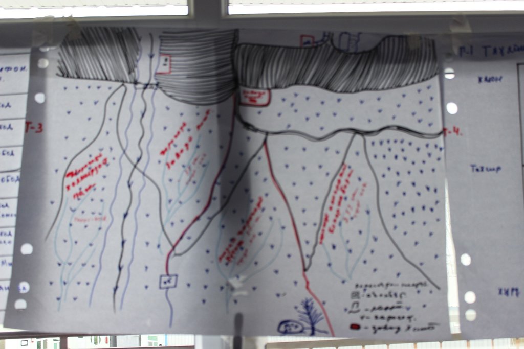
Based on the existing traditional community knowledge and experiences the communities identify the geographical location. Based on this knowledge while developing the grazing plan for the year in a meeting in a participatory manner they do community resource mapping, where the location of resources is provided. After preparing the community resource maps, especially with focus on pasture resources they mark the plots according to assigned attributes. Based on these attributes, where the important features is pasture exposition, a timeframe for grazing for each plot is set up.
Livestock owners are very much in favor to implement this approach as a simple method to prevent degradation and raising awareness on importance of periodic and systematic use of pasture lands. It was not well perceived well by some individual livestock owners, who abused the absence of grazing plans and benefited from early use of grazing without considering the degradation of the pastures.
2.3 รูปภาพของแนวทาง
ข้อสังเกตทั่วไปเกี่ยวกับรูปภาพ:
Community resource mapping with using land use system approach and distribution of the pasture lands into different plots according to different attributes.
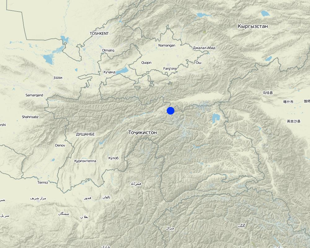
2.5 ประเทศ ภูมิภาค หรือสถานที่ตั้งที่ได้นำแนวทางไปใช้
ประเทศ:
ทาจิกิสถาน
ภูมิภาค/รัฐ/จังหวัด: :
Central Asia/Tajikistan/Rasht Valley
Map
×2.6 วันที่เริ่มต้นและสิ้นสุดของแนวทาง
ถ้าไม่รู้ปีที่แน่นอนให้ประมาณวันที่ที่ริเริ่มใช้แนวทางนี้ :
10-50 ปี
ความคิดเห็น:
Traditionally community used this approach based on the knowledge on pasture management coming to them from their ancestors.
2.7 ประเภทของแนวทาง
- แบบดั้งเดิม/ แบบพื้นเมิอง
2.8 เป้าหมายหรือวัตถุประสงค์หลักของแนวทาง
The main aim of this approach is to set up clear timeframes for grazing in different plots of the pasture. When the pasture plot is sun inclined this will define the grazing time earlier, because the vegetation grows faster and bigger. On the other hand the pasture plot which is in the shadowed part is grazed later after winter, because the grass should reach a certain height before grazing.
2.9 เงื่อนไขที่เอื้ออำนวยหรือเป็นอุปสรรคต่อการนำเทคโนโลยีภายใต้แนวทางนี้ไปปฏิบัติใช้
บรรทัดฐานและค่านิยมทางสังคม วัฒนธรรม ศาสนา
- เอื้ออำนวย
Since the beginning traditional institute based on traditional knowledge used to apply this approach.
การมีไว้ให้หรือการเข้าถึงแหล่งการเงินและบริการ
- เอื้ออำนวย
No financial resource is required to apply this approach. It is purely based on the management techniques and depend on the organizational capacity of the communities.
การจัดตั้งระดับองค์กร
- เอื้ออำนวย
Traditionally community based organizations exist, which were responsible for management of community resource, including pasture lands. Nowadays, based on this knowledge community in their newly established Pasture User Unions apply this approach.
กรอบแนวทางในการดำเนินการด้านกฎหมาย (การถือครองที่ดิน สิทธิในการใช้ที่ดินและน้ำ)
- เอื้ออำนวย
No legal framework is required for this approach.
ความรู้เกี่ยวกับ SLM การเข้าถึงการสนับสนุนด้านเทคนิค
- เอื้ออำนวย
Community members usually inherit this kind of traditional practices from their ancestors.
3. การมีส่วนร่วมและบทบาทของผู้มีส่วนได้ส่วนเสียที่เกี่ยวข้อง
3.1 ผู้มีส่วนได้ส่วนเสียที่เกี่ยวข้องในแนวทางนี้และบทบาท
- ผู้ใช้ที่ดินระดับท้องถิ่นหรือชุมชนระดับท้องถิ่น
livestock owners
People traditionally use this approach as a limiting factor to plan for grazing and this approach is also incorporated into the community pasture plan.
- องค์กรที่ขึ้นอยู่กับชุมชน
village organizations
In those communities, where official legal structure is not established, community based organization still use this approach as traditional practices inherited from previous generation.
3.2 การเกี่ยวข้องของผู้ใช้ที่ดินระดับท้องถิ่นหรือชุมชนระดับท้องถิ่นในช่วงต่างๆของแนวทาง
| ความเกี่ยวข้องของผู้ใช้ที่ดินระดับท้องถิ่นหรือชุมชนระดับท้องถิ่น | ระบุผู้ที่มีส่วนเกี่ยวข้องและอธิบายกิจกรรม | |
|---|---|---|
| การริเริ่มหรือการจูงใจ | ระดมกำลังด้วยตนเอง | Land users and their community structure is traditionally aware of this approach and consider it in their planning process. |
| การวางแผน | ระดมกำลังด้วยตนเอง | Once a community initiates its pasture plan they take this approach into consideration. |
| การดำเนินการ | ระดมกำลังด้วยตนเอง | The plan is developed in a participatory way with involvement of all stakeholders and agreed on. The grazing location within different timeframe is implemented by the responsible person according to the plan. |
| การติดตามตรวจสอบหรือการประเมินผล | ระดมกำลังด้วยตนเอง | Community leaders or PUUs management assign responsible people to follow up on the approved grazing plan and follow up on the progress by reporting to them. |
3.4 การตัดสินใจเลือกใช้เทคโนโลยี SLM
ระบุผู้ที่ทำการตัดสินใจเลือกเทคโนโลยีมากกว่าหนึ่งวิธีไปปฏิบัติใช้:
- ผู้ใช้ที่ดินเพียงผู้เดียว ( ริเริ่มด้วยตัวเอง)
การอธิบาย:
This is a specific grographycally bound approach, where land users themselves take initiative.
ระบุว่าการตัดสินใจตั้งอยู่บนพื้นฐานของ:
- ประสบการณ์และความคิดเห็นส่วนตัว (ไม่ได้ลงบันทึกไว้)
4. การสนับสนุนด้านเทคนิค การสร้างขีดความสามารถ และการจัดการด้านความรู้
4.1 การสร้างขีดความสามารถ / การอบรม
ได้มีการจัดอบรมให้แก่ผู้ใช้ที่ดินหรือผู้มีส่วนได้ส่วนเสียคนอื่น ๆ หรือไม่:
ไม่ใช่
4.2 การบริการให้คำแนะนำ
ผู้ใช้ที่ดินมีการเข้าถึงการรับบริการให้คำปรึกษาหรือไม่:
ไม่ใช่
4.3 การเสริมความแข็งแกร่งให้กับสถาบัน (การพัฒนาองค์กร)
สถาบันได้รับการจัดตั้งขึ้นมาหรือเสริมความแข็งแกร่งโดยแนวทางนี้หรือไม่:
- ไม่
4.4 การติดตามตรวจสอบและประเมินผล
การติดตามตรวจสอบและประเมินผลเป็นส่วนหนึ่งของแนวทางหรือไม่:
ไม่ใช่
ความคิดเห็น:
Communities themselves follow up according to their plan.
4.5 การวิจัย
การวิจัยเป็นส่วนหนึ่งของแนวทางหรือไม่:
ไม่ใช่
5. การสนับสนุนด้านการเงินและวัสดุอุปกรณ์
5.1 ระบุงบประมาณประจำปีสำหรับแนวทาง SLM นี้
แสดงความคิดเห็น (แหล่งของการระดมทุน ผู้บริจาคคนสำคัญ):
no special budget is required to implement this approach
5.2 การสนับสนุนด้านการเงิน / วัสดุอุปกรณ์ให้แก่ผู้ใช้ที่ดิน
ผู้ใช้ที่ดินได้รับการสนับสนุนด้านการเงิน / วัสดุอุปกรณ์ไปปฏิบัติใช้เทคโนโลยีหรือไม่:
ไม่ใช่
5.3 เงินสนับสนุนสำหรับปัจจัยนำเข้า (รวมถึงแรงงาน)
- ไม่มี
ถ้าแรงงานโดยผู้ใช้ที่ดินเป็นปัจจัยนำเข้าที่มีอยู่มากมาย ระบุด้วยว่าเนื่องจาก:
- สมัครใจ
5.4 เครดิต
มีการจัดหาเครดิตมาให้ภายใต้แนวทาง SLM หรือไม่:
ไม่ใช่
5.5 แรงจูงใจหรือเครื่องมืออื่น ๆ
แรงจูงใจหรือเครื่องมืออื่น ๆ ได้ถูกนำไปใช้ส่งเสริมการใช้เทคโนโลยี SLM หรือไม่:
ใช่
ถ้าใช่ ระบุ:
Some people usually try to graze in those plots which are exposed to sun and the vegetation is growing earlier. Especially farmers who are limited in fodder crops start grazing earlier. They are provided with some incentives to balance fodder and livestock number and are not permitted for earlier grazing.
6. การวิเคราะห์ผลกระทบและการสรุป
6.1 ผลกระทบของแนวทาง
ทำให้ผู้ใช้ที่ดินระดับท้องถิ่นมีอำนาจขึ้น ปรับปรุงการเข้าร่วมของผู้มีส่วนได้ส่วนเสียให้ดีขึ้นหรือไม่:
- ไม่ใช่
- ใช่ เล็กน้อย
- ใช่ ปานกลาง
- ใช่ อย่างมาก
Because the design of a grazing plan takes place in a participatory meeting, it brings together all stakeholders to agree on the decision. In addition all stakeholders are involved in preparing community resource map and plan accordingly.
ช่วยให้ผู้ใช้ที่ดินนำเอาเทคโนโลยี SLMไปใช้และบำรุงรักษาสภาพไว้ได้หรือไม่:
- ไม่ใช่
- ใช่ เล็กน้อย
- ใช่ ปานกลาง
- ใช่ อย่างมาก
The approach is considered as one of the important steps to prevent pasture degradation. Once this approach is applied correctly it leads to implementation of other SLM technologies for improving pasture conditions.
ปรับปรุงประเด็นของการถือครองที่ดินหรือสิทธิในการใช้ ซึ่งขัดขวางการนำเทคโนโลยีไปใช้ให้ดีขึ้น:
- ไม่ใช่
- ใช่ เล็กน้อย
- ใช่ ปานกลาง
- ใช่ อย่างมาก
When the whole pasture area is used sustainably, it improves land users rights.
นำไปสู่การใช้ที่ดินอย่างยั่งยืนหรือแหล่งพลังงานหรือไม่:
- ไม่ใช่
- ใช่ เล็กน้อย
- ใช่ ปานกลาง
- ใช่ อย่างมาก
If the approach is applied, it will minimize the risk of pasture degradation, where people also collect wood for energy.
ปรับปรุงความสามารถของผู้ใช้ที่ดินในการปรับตัวให้เข้ากับการเปลี่ยนแปลงของสภาพภูมิอากาศหรือสภาพที่รุนแรงและภัยพิบัติหรือไม่:
- ไม่ใช่
- ใช่ เล็กน้อย
- ใช่ ปานกลาง
- ใช่ อย่างมาก
Because of the effect of climate change in the mountain areas unplanned grazing leads to degradation immediately.
6.2 แรงจูงใจหลักของผู้ใช้ที่ดินเพื่อที่จะนำ SLM ไปปฏิบัติใช้
- การเสื่อมของที่ดินลดลง
When the approach is followed, it prevents early grazing in the areas which are not exposed to sun and lets the vegetation grow properly.
- ความเสี่ยงของภัยพิบัติลดลง
The approach will lead to prevention of pasture degradation which is the main cause of land slides during rainfall.
- กฎและระเบียบ (ค่าปรับ) หรือการบังคับใช้
The approach is considered a part of the grazing plan development and requires enforcement of certain rules in order to achieve the goal.
6.3 ความยั่งยืนของกิจกรรมของแนวทาง
ผู้ใช้ที่ดินสามารถทำให้สิ่งต่างๆ ที่ได้ปฏิบัติใช้โดยแนวทางนี้ยั่งยืนได้หรือไม่ (โดยไม่มีการสนับสนุนจากภายนอก):
- ใช่
ถ้าตอบว่าใช่ ให้อธิบายว่าอย่างไร :
The approach does not require technical knowledge in implementing SLM technology. It therefore is simple and mobilized communities can sustain it for a long time once practiced successfully.
6.4 จุดแข็งและข้อได้เปรียบของแนวทาง
| จุดแข็ง / ข้อได้เปรียบของแนวทางในทัศนคติของผู้ใช้ที่ดิน |
|---|
| cost effective, simple to apply and produces good effects |
| simple techniques, easy understandable, based on traditional knowledge |
| can be applied in big areas |
| จุดแข็ง / ข้อได้เปรียบของแนวทางในทัศนคติของผู้รวบรวมหรือวิทยากรหลัก |
|---|
| traditionally practiced and adapted to local conditions |
| cost effective and easy to document and provides evidence based results in a short period of time |
| could be replicated in all other mountain areas |
6.5 จุดอ่อน / ข้อเสียเปรียบของแนวทางและวิธีในการแก้ไข
| จุดอ่อน / ข้อเสียเปรียบในทัศนคติของผู้ใช้ที่ดิน | สามารถแก้ไขปัญหาได้อย่างไร |
|---|---|
| not considered within other factors, like meteorological | Research could be applied to study it on scientific evidence. |
| จุดอ่อน / ข้อเสียเปรียบในทัศนคติของผู้รวบรวมหรือวิทยากรหลัก | สามารถแก้ไขปัญหาได้อย่างไร |
|---|---|
| If overall pasture management is not planned properly and managed chaotically, the uncontrolled use of this approach can easily contribute to pasture degradation. | It should be well documented as it is a simple and effective approach in degradation prevention. |
7. การอ้างอิงและการเชื่อมต่อ
7.1 วิธีการหรือแหล่งข้อมูล
- ไปเยี่ยมชมภาคสนาม การสำรวจพื้นที่ภาคสนาม
6
- การสัมภาษณ์กับผู้ใช้ที่ดิน
4
7.2 การอ้างอิงถึงสิ่งตีพิมพ์
ชื่อเรื่อง ผู้เขียน ปี ISBN:
Pasture and Livestock Management Plan of PUU Soyru, 2015
ช่องทางในการสืบค้น และราคา:
from community, free of cost
ลิงก์และโมดูล
ขยายทั้งหมด ย่อทั้งหมดลิงก์

Технология управлениия пастбищами в условиях Западного Памира [ทาจิกิสถาน]
Управление пастбищных угодий путем внедрения новой техники пастбищеоборота с учетом емкости пастбища
- ผู้รวบรวม: Aslam Qadamov
โมดูล
ไม่มีโมดูล


