Rockwall Terracing [ฟิลิปปินส์]
- ผู้สร้างสรรค์:
- การอัพเดท:
- ผู้รวบรวม: Philippine Overview of Conservation Approaches and Technologies
- ผู้เรียบเรียง: –
- ผู้ตรวจสอบ: Fabian Ottiger
technologies_1700 - ฟิลิปปินส์
ดูส่วนย่อย
ขยายทั้งหมด ย่อทั้งหมด1. ข้อมูลทั่วไป
1.2 รายละเอียดที่ติดต่อได้ของผู้รวบรวมและองค์กรที่เกี่ยวข้องในการประเมินและการจัดเตรียมทำเอกสารของเทคโนโลยี
วิทยากรหลัก
ผู้เชี่ยวชาญ SLM:
Luistro Aida
273-2474
Department of Agriculture-STIARC, RFO IVA
RMIC Bldg., BPI Compound Visayas Ave Quezon City
ฟิลิปปินส์
ผู้เชี่ยวชาญ SLM:
Gregorio Elizabeth
Department of Agriculture-STIARC, RFO IVA
RMIC Bldg., BPI Compound Visayas Ave Quezon City
ฟิลิปปินส์
ผู้เชี่ยวชาญ SLM:
Dinamling Djolly Ma.
Bureau of Soils and Water Management
Visayas Avenue, Vasra, Quezon City, Philippines
ฟิลิปปินส์
ผู้เชี่ยวชาญ SLM:
Guttierez Albert
alfergu@yahoo.com
LGU of La Libertad
Negros Oriental
ฟิลิปปินส์
ชื่อขององค์กรซึ่งอำนวยความสะดวกในการทำเอกสารหรือการประเมินเทคโนโลยี (ถ้าเกี่ยวข้อง)
Bureau of Soils and Water Management (Bureau of Soils and Water Management) - ฟิลิปปินส์ชื่อขององค์กรซึ่งอำนวยความสะดวกในการทำเอกสารหรือการประเมินเทคโนโลยี (ถ้าเกี่ยวข้อง)
Southern Tagalog Integrated Agricultural Research Center (STIARC) - ฟิลิปปินส์ชื่อขององค์กรซึ่งอำนวยความสะดวกในการทำเอกสารหรือการประเมินเทคโนโลยี (ถ้าเกี่ยวข้อง)
LGU of La Libertad - ฟิลิปปินส์1.3 เงื่อนไขการใช้ข้อมูลที่ได้บันทึกผ่านทาง WOCAT
วันที่เก็บรวบรวมข้อมูล(ภาคสนาม) :
28/05/2015
ผู้รวบรวมและวิทยากรหลักยอมรับเงื่อนไขเกี่ยวกับการใช้ข้อมูลที่ถูกบันทึกผ่านทาง WOCAT:
ใช่
2. การอธิบายลักษณะของเทคโนโลยี SLM
2.1 การอธิบายแบบสั้น ๆ ของเทคโนโลยี
คำจำกัดความของเทคโนโลยี:
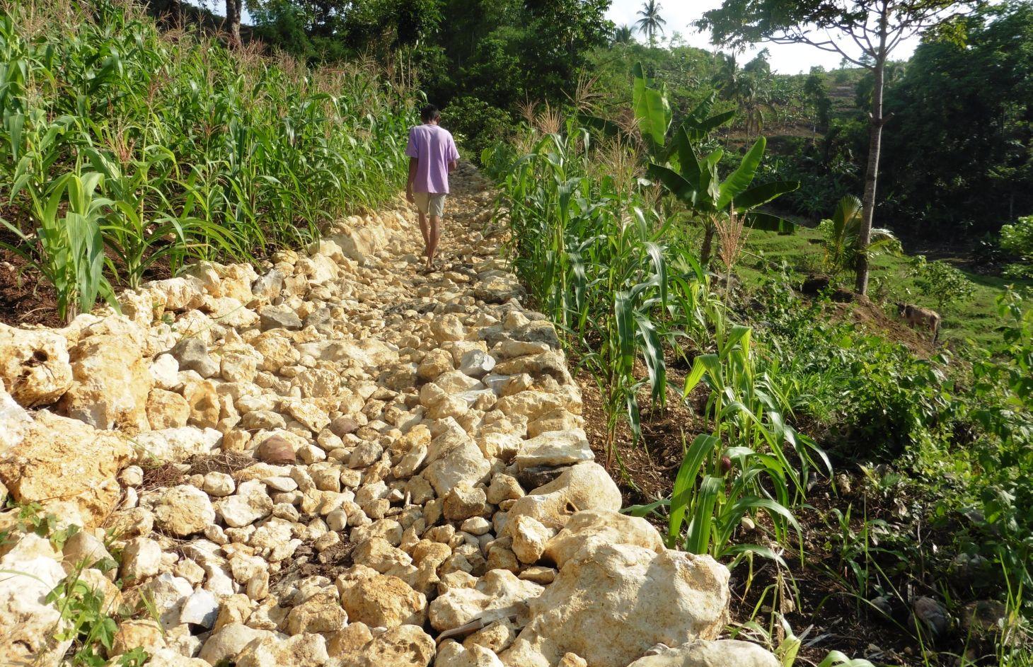
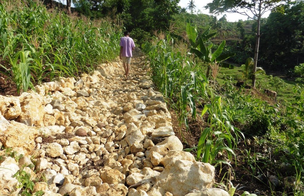
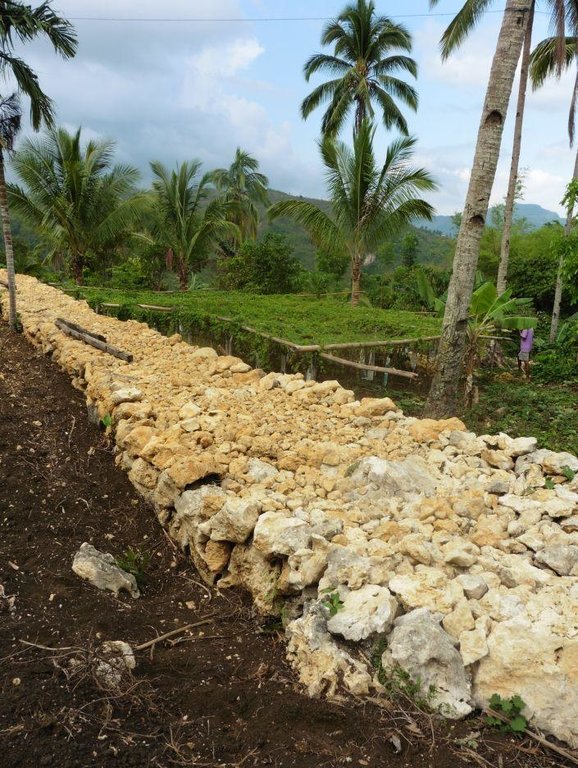
Rockwall terracing refers to the piling of stones or rocks along contour lines to reduce soil erosion in hilly areas.
2.2 การอธิบายแบบละเอียดของเทคโนโลยี
คำอธิบาย:
Rockwall terracing technology is widely practiced by farmers in hilly area of Barangay Nasunggan, La Libertad, Negros Oriental. Rocks piled along contours are indigenous to the area. The terrace bed is cultivated and planted with corn, watermelon, and vegetables. In some areas, livestock like cattle and native pigs are being raised. The technology is a traditional practice in the Philippines and one of the conservation techniques under the Conservation Farming Village (CFV) approach.
Purpose of the Technology: Rockwall terraces are built to reduce soil erosion and provide ease in land preparation through the removal of naturally present rocks in the cultivated area.It also contributes to the partial arrangement and diversification of land use. Before the implementation of the technology, the physical condition of the area is not recommended for farming practices due to the presence of rocks scattered all over the area.Dispersed and concentrated runoff are controlled in this technology. Raindrop splash is also restrained. Moreover, water storage is maintained in the soil.
Establishment / maintenance activities and inputs: With the aid of an A-Frame, contours are determined. Rocks and/or stones are gathered from the area and piled along contours to form walls 1.10 m wide and 1.50 m high. It requires 14 person-day for a month to construct a 50-meter rockwall with a cost of 800 USD. Maintenance of the structure is done three times a year by repiling of dislodged rocks.
Natural / human environment: The area is classified under a humid agro-climate condition where an average annual rainfall of 1000-1500 mm per year are observed. The average cropland size of land user ranges from 0.5-1 hectare with a slope of 18-25%. Majority of their income are derived from on-farm activities. Crops planted in the terraced bed are sold in the town market and is also utilized for consumption.
2.3 รูปภาพของเทคโนโลยี
2.5 ประเทศภูมิภาค หรือสถานที่ตั้งที่เทคโนโลยีได้นำไปใช้และได้รับการครอบคลุมโดยการประเมินนี้
ประเทศ:
ฟิลิปปินส์
ภูมิภาค/รัฐ/จังหวัด:
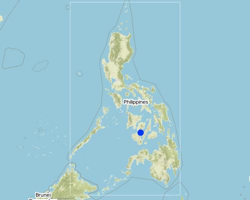
La Libertad
ข้อมูลจำเพาะเพิ่มเติมของสถานที่ตั้ง :
Negros Oriental
Map
×2.6 วันที่การดำเนินการ
ถ้าไม่รู้ปีที่แน่นอน ให้ระบุวันที่โดยประมาณ:
- น้อยกว่า 10 ปี (ไม่นานนี้)
2.7 คำแนะนำของเทคโนโลยี
ให้ระบุว่าเทคโนโลยีถูกแนะนำเข้ามาอย่างไร:
- ด้วยการริเริ่มของผู้ใช้ที่ดินเอง
3. การจัดประเภทของเทคโนโลยี SLM
3.2 ประเภทของการใช้ที่ดินในปัจจุบันที่ได้นำเทคโนโลยีไปใช้

พื้นที่ปลูกพืช
- การปลูกพืชล้มลุกอายุปีเดียว
พืชหลัก (พืชเศรษฐกิจและพืชอาหาร):
Major cash crop: Vegetable, banana, cacao, coffee
Major food crop: Corn, forage legumes

การใช้ที่ดินแบบผสมผสาน (รวมถึงวนเกษตร)
- การปลูกพืชร่วมกับปศุสัตว์ (Agro-pastoralism)
ผลิตภัณฑ์หลักหรือบริการ:
Main livestock species: swine, cattle, chicken
แสดงความคิดเห็น:
Major land use problems (compiler’s opinion): The area is prone to soil erosion and land degradation due to absence of vegetation.
Major land use problems (land users’ perception): Not suitable for crop production because of the rocks or stones scattered in the area.
Mixed: (eg agro-pastoralism, silvo-pastoralism): swine, cattle, chicken
Future (final) land use (after implementation of SLM Technology): Mixed: Mo: Other
ถ้าการใช้ที่ดินมีการเปลี่ยนแปลงเนื่องมาจากการนำเทคโนโลยีไปปฏิบัติใช้ ให้ระบุการใช้ที่ดินก่อนนำเทคโนโลยีไปปฏิบัติใช้:
Cropland: Ca: Annual cropping
3.3 ข้อมูลเพิ่มเติมเกี่ยวกับการใช้ที่ดิน
การใช้น้ำของที่ดินที่มีการใช้เทคโนโลยีอยู่:
- จากน้ำฝน
แสดงความคิดเห็น:
Water supply: rainfed, mixed rainfed - irrigated
Water supply: rainfed, post-flooding
ความหนาแน่นของปศุสัตว์ (ถ้าเกี่ยวข้อง):
10-25 LU /km2
3.4 กลุ่ม SLM ที่ตรงกับเทคโนโลยีนี้
- มาตรการปลูกพืชขวางความลาดชัน (cross-slope measure)
3.5 กระจายตัวของเทคโนโลยี
แสดงความคิดเห็น:
Total area covered by the SLM Technology is 0.278 m2.
At present, rockwalls are not constructed in contiguous manner. Construction were done prioritizing those highly eroded areas but the plan is to build and expand in the barangay, smallest administrative division in the Philippines.
3.6 มาตรการ SLM ที่ประกอบกันเป็นเทคโนโลยี

มาตรการอนุรักษ์ด้วยโครงสร้าง
- S6: กำแพง สิ่งกีดขวาง รั้วไม้ รั้วต่างๆ
แสดงความคิดเห็น:
Main measures: structural measures
3.7 รูปแบบหลักของการเสื่อมโทรมของที่ดินที่ได้รับการแก้ไขโดยเทคโนโลยี

การกัดกร่อนของดินโดยน้ำ
- Wt (Loss of topsoil): การสูญเสียดินชั้นบนหรือการกัดกร่อนที่ผิวดิน

การเสื่อมโทรมของดินทางด้านเคมี
- Cn (Fertility decline): ความอุดมสมบูรณ์และปริมาณอินทรียวัตถุในดินถูกทำให้ลดลงไป (ไม่ได้เกิดจากสาเหตุการกัดกร่อน)

การเสื่อมโทรมของดินทางด้านชีวภาพ
- Bc (Reduction of vegetation cover): การลดลงของจำนวนพืชที่ปกคลุมดิน
แสดงความคิดเห็น:
Main type of degradation addressed: Wt: loss of topsoil / surface erosion
Secondary types of degradation addressed: Cn: fertility decline and reduced organic matter content, Bc: reduction of vegetation cover
Main causes of degradation: soil management (intensive soil cultivation/tillage)
Secondary causes of degradation: crop management (annual, perennial, tree/shrub) (inappropriate cropping system), deforestation / removal of natural vegetation (incl. forest fires) (logging), education, access to knowledge and support services (limited access to learning facilities)
3.8 การป้องกัน การลดลง หรือการฟื้นฟูความเสื่อมโทรมของที่ดิน
ระบุเป้าหมายของเทคโนโลยีกับความเสื่อมโทรมของที่ดิน:
- ฟื้นฟูบำบัดที่ดินที่เสื่อมโทรมลงอย่างมาก
แสดงความคิดเห็น:
Main goals: rehabilitation / reclamation of denuded land
4. ข้อมูลจำเพาะด้านเทคนิค กิจกรรมการนำไปปฏิบัติใช้ ปัจจัยนำเข้า และค่าใช้จ่าย
4.1 แบบแปลนทางเทคนิคของเทคโนโลยี
ผู้เขียน:
Patricio A. Yambot, Bureau of Soils and Water Management
4.2 ข้อมูลจำเพาะด้านเทคนิคและการอธิบายแบบแปลนทางเทคนิค
Rockwall terrace built to utilize the rocks in the area.
Location: Brgy. Nasunngan. La Libertad, Negros Oriental
Date: May 25,2015
Technical knowledge required for field staff / advisors: moderate
Technical knowledge required for land users: moderate
Main technical functions: control of dispersed runoff: retain / trap, control of concentrated runoff: retain / trap, control soil erosion
Secondary technical functions: control of raindrop splash, reduction of slope angle, reduction of slope length, increase / maintain water stored in soil, promotion of vegetation species and varieties (quality, eg palatable fodder), spatial arrangement and diversification of land use, serve as access road
Wall/ barrier
Spacing between structures (m): 3-5m
Height of bunds/banks/others (m): 1.5
Width of bunds/banks/others (m): 1.1
Length of bunds/banks/others (m): 50 m
Construction material (stone): limestones
Slope (which determines the spacing indicated above): 18%
4.3 ข้อมูลทั่วไปเกี่ยวกับการคำนวณปัจจัยนำเข้าและค่าใช้จ่าย
อื่นๆ หรือสกุลเงินประจำชาติ (ระบุ):
Pesos
ระบุอัตราแลกเปลี่ยนจากดอลลาร์สหรัฐเป็นสกุลเงินท้องถิ่น (ถ้าเกี่ยวข้อง) คือ 1 เหรียญสหรัฐ =:
45.0
ระบุค่าเฉลี่ยของค่าจ้างในการจ้างแรงงานต่อวัน:
2.22
4.4 กิจกรรมเพื่อการจัดตั้ง
| กิจกรรม | ประเภทของมาตรการ | ช่วงเวลาดำเนินการ | |
|---|---|---|---|
| 1. | Contouring | ด้วยโครงสร้าง | 1 day |
| 2. | Digging along contour, Gathering and piling of stones along contours | ด้วยโครงสร้าง | 3 months |
4.5 ค่าใช้จ่ายของปัจจัยนำเข้าที่จำเป็นสำหรับการจัดตั้ง
| ปัจจัยนำเข้า | หน่วย | ปริมาณ | ค่าใช้จ่ายต่อหน่วย | ค่าใช้จ่ายทั้งหมดต่อปัจจัยนำเข้า | %ของค่าใช้จ่ายที่ก่อให้เกิดขึ้นโดยผู้ใช้ที่ดิน | |
|---|---|---|---|---|---|---|
| แรงงาน | labour | dam | 1.0 | 804.44 | 804.44 | 100.0 |
| อุปกรณ์ | Tools | dam | 1.0 | 22.22 | 22.22 | 100.0 |
| ค่าใช้จ่ายทั้งหมดของการจัดตั้งเทคโนโลยี | 826.66 | |||||
แสดงความคิดเห็น:
Duration of establishment phase: 5 month(s)
4.6 การบำรุงรักษาสภาพหรือกิจกรรมที่เกิดขึ้นเป็นประจำ
| กิจกรรม | ประเภทของมาตรการ | ช่วงระยะเวลา/ความถี่ | |
|---|---|---|---|
| 1. | Repiling of stones and rocks that were dislodged | ด้วยโครงสร้าง | 3 times a year |
4.7 ค่าใช้จ่ายของปัจจัยนำเข้าและกิจกรรมที่เกิดขึ้นเป็นประจำที่ต้องการการบำรุงรักษา (ต่อปี)
| ปัจจัยนำเข้า | หน่วย | ปริมาณ | ค่าใช้จ่ายต่อหน่วย | ค่าใช้จ่ายทั้งหมดต่อปัจจัยนำเข้า | %ของค่าใช้จ่ายที่ก่อให้เกิดขึ้นโดยผู้ใช้ที่ดิน | |
|---|---|---|---|---|---|---|
| แรงงาน | Labour | 50m | 1.0 | 13.33 | 13.33 | 100.0 |
| ค่าใช้จ่ายทั้งหมดของการบำรุงรักษาสภาพเทคโนโลยี | 13.33 | |||||
แสดงความคิดเห็น:
Machinery/ tools: A-Frame, Mattock, Shovel
5. สิ่งแวดล้อมทางธรรมชาติและของมนุษย์
5.1 ภูมิอากาศ
ฝนประจำปี
- < 250 ม.ม.
- 251-500 ม.ม.
- 501-750 ม.ม.
- 751-1,000 ม.ม.
- 1,001-1,500 ม.ม.
- 1,501-2,000 ม.ม.
- 2,001-3,000 ม.ม.
- 3,001-4,000 ม.ม.
- > 4,000 ม.ม.
เขตภูมิอากาศเกษตร
- ชื้น
Thermal climate class: tropics
5.2 สภาพภูมิประเทศ
ค่าเฉลี่ยความลาดชัน:
- ราบเรียบ (0-2%)
- ลาดที่ไม่ชัน (3-5%)
- ปานกลาง (6-10%)
- เป็นลูกคลื่น (11-15%)
- เป็นเนิน (16-30%)
- ชัน (31-60%)
- ชันมาก (>60%)
ธรณีสัณฐาน:
- ที่ราบสูง/ที่ราบ
- สันเขา
- ไหล่เขา
- ไหล่เนินเขา
- ตีนเนิน
- หุบเขา
ระดับความสูง:
- 0-100 เมตร
- 101-500 เมตร
- 501-1,000 เมตร
- 1,001-1,500 เมตร
- 1,501-2,000 เมตร
- 2,001-2,500 เมตร
- 2,501-3,000 เมตร
- 3,001-4,000 เมตร
- > 4,000 เมตร
ความคิดเห็นและข้อมูลจำเพาะเพิ่มเติมเรื่องสภาพภูมิประเทศ:
Altiudinal zones: 501-100 m a.s.l. (600m)
5.3 ดิน
ค่าเฉลี่ยความลึกของดิน:
- ตื้นมาก (0-20 ซ.ม.)
- ตื้น (21-50 ซ.ม.)
- ลึกปานกลาง (51-80 ซ.ม.)
- ลึก (81-120 ซ.ม.)
- ลึกมาก (>120 ซ.ม.)
เนื้อดิน (ดินชั้นบน):
- ปานกลาง (ดินร่วน ทรายแป้ง)
อินทรียวัตถุในดิน:
- ปานกลาง (1-3%)
5.4 ความเป็นประโยชน์และคุณภาพของน้ำ
ระดับน้ำใต้ดิน:
> 50 เมตร
น้ำไหลบ่าที่ผิวดิน:
ไม่ดีหรือไม่มีเลย
คุณภาพน้ำ (ที่ยังไม่ได้บำบัด):
เป็นน้ำเพื่อการดื่มที่ดี
ความคิดเห็นและข้อมูลจำเพาะเพิ่มเติมเรื่องคุณภาพและปริมาณน้ำ:
Seasonality of water quality and source of pollution (good drinking water, year round, spring water )
5.5 ความหลากหลายทางชีวภาพ
ความหลากหลายทางชนิดพันธุ์:
- ต่ำ
5.6 ลักษณะของผู้ใช้ที่ดินที่นำเทคโนโลยีไปปฏิบัติใช้
แนวทางการตลาดของระบบการผลิต:
- เพื่อการยังชีพ (หาเลี้ยงตนเอง)
- ผสม (การเลี้ยงชีพ/ทำการค้า)
รายได้ที่มาจากนอกฟาร์ม:
- < 10% ของรายได้ทั้งหมด
ระดับของความมั่งคั่งโดยเปรียบเทียบ:
- จน
- พอมีพอกิน
เป็นรายบุคคล/ครัวเรือน:
- เป็นรายบุคคล/ครัวเรือน
ระดับของการใช้เครื่องจักรกล:
- งานที่ใช้แรงกาย
- การใช้กำลังจากสัตว์
เพศ:
- หญิง
- ชาย
ระบุลักษณะอื่นๆที่เกี่ยวข้องของผู้ใช้ที่ดิน:
Land users applying the Technology are mainly disadvantaged land users
Population density: 10-50 persons/km2
Level of mechanization: Manual work, animal traction
Market orientation: subsistence (self-supply)
Market orientation: Mixed (subsistence/commercial)
Annual population growth: 1% - 2%; 2%
30% of the land users are average wealthy and own 30% of the land.
70% of the land users are poor and own 70% of the land.
5.7 พื้นที่เฉลี่ยของที่ดินที่เป็นเจ้าของหรือเช่าโดยผู้ใช้ที่ดินที่นำเทคโนโลยีไปปฏิบัติใช้
- < 0.5 เฮกตาร์
- 0.5-1 เฮกตาร์
- 1-2 เฮกตาร์
- 2-5 เฮกตาร์
- 5-15 เฮกตาร์
- 15-50 เฮกตาร์
- 50-100 เฮกตาร์
- 100-500 เฮกตาร์
- 500-1,000 เฮกตาร์
- 1,000-10,000 เฮกตาร์
- >10,000 เฮกตาร์
พิจารณาว่าเป็นขนาดเล็ก กลาง หรือขนาดใหญ่ (ซึ่งอ้างอิงถึงบริบทระดับท้องถิ่น):
- ขนาดเล็ก
แสดงความคิดเห็น:
1-2ha of cropland and <0.5ha grazing land per household
5.8 กรรมสิทธิ์ในที่ดิน สิทธิในการใช้ที่ดินและสิทธิในการใช้น้ำ
กรรมสิทธิ์ในที่ดิน:
- รายบุคคล ไม่ได้รับสิทธิครอบครอง
สิทธิในการใช้ที่ดิน:
- รายบุคคล
สิทธิในการใช้น้ำ:
- รายบุคคล
แสดงความคิดเห็น:
Sharing of water from spring during summer
5.9 การเข้าถึงบริการและโครงสร้างพื้นฐาน
สุขภาพ:
- จน
- ปานกลาง
- ดี
การศึกษา:
- จน
- ปานกลาง
- ดี
ความช่วยเหลือทางด้านเทคนิค:
- จน
- ปานกลาง
- ดี
การจ้างงาน (เช่น ภายนอกฟาร์ม):
- จน
- ปานกลาง
- ดี
ตลาด:
- จน
- ปานกลาง
- ดี
พลังงาน:
- จน
- ปานกลาง
- ดี
ถนนและการขนส่ง:
- จน
- ปานกลาง
- ดี
น้ำดื่มและการสุขาภิบาล:
- จน
- ปานกลาง
- ดี
บริการด้านการเงิน:
- จน
- ปานกลาง
- ดี
6. ผลกระทบและสรุปคำบอกกล่าว
6.1 ผลกระทบในพื้นที่ดำเนินการ (On-site) จากการใช้เทคโนโลยี
ผลกระทบทางด้านเศรษฐกิจและสังคม
การผลิต
การผลิตพืชผล
จำนวนก่อน SLM:
5000 ears for corn/ha
หลังจาก SLM:
10000 ears for corn/ha
การผลิตพืชที่ใช้เลี้ยงปศุสัตว์
คุณภาพพืชที่ใช้เลี้ยงปศุสัตว์
ความหลากหลายของผลิตภัณฑ์
พื้นที่สำหรับการผลิต
รายได้และค่าใช้จ่าย
ค่าใช่จ่ายของปัจจัยการผลิตทางการเกษตร
รายได้จากฟาร์ม
ความหลากหลายของแหล่งผลิตรายได้
ผลกระทบทางด้านเศรษฐกิจและสังคมอื่น ๆ
crop production area
แสดงความคิดเห็น/ระบุ:
Reduced crop production area: medium (20-50%)
ผลกระทบด้านสังคมวัฒนธรรมอื่น ๆ
ความมั่นคงด้านอาหาร / พึ่งตนเองได้
โอกาสทางวัฒนธรรม
สถาบันของชุมชน
สถาบันแห่งชาติ
การบรรเทาความขัดแย้ง
สถานการณ์ของกลุ่มด้อยโอกาส ทางด้านสังคมและเศรษฐกิจ
Improved livelihoods and human well-being
แสดงความคิดเห็น/ระบุ:
yes, greatly
ผลกระทบด้านนิเวศวิทยา
ดิน
การสูญเสียดิน
6.2 ผลกระทบนอกพื้นที่ดำเนินการ (Off-site) จากการใช้เทคโนโลยี
การทับถมของดินตะกอนพื้นที่ท้ายน้ำ
ความสามารถต้านทานการเปลี่ยนแปลง / ความสามารถในการคัดกรอง
ความเสียหายต่อพื้นที่เพาะปลูกของเพื่อนบ้าน
6.3 การเผชิญและความตอบสนองของเทคโนโลยีต่อการเปลี่ยนแปลงสภาพภูมิอากาศที่ค่อยเป็นค่อยไป และสภาพรุนแรงของภูมิอากาศ / ภัยพิบัติ (ที่รับรู้ได้โดยผู้ใช้ที่ดิน)
การเปลี่ยนแปลงสภาพภูมิอากาศที่ค่อยเป็นค่อยไป
การเปลี่ยนแปลงสภาพภูมิอากาศที่ค่อยเป็นค่อยไป
| ฤดู | ประเภทของการเปลี่ยนแปลงสภาพภูมิอากาศที่ค่อยเป็นค่อยไป และสภาพรุนแรงของภูมิอากาศ | เทคโนโลยีมีวิธีการรับมืออย่างไร | |
|---|---|---|---|
| อุณหภูมิประจำปี | เพิ่มขึ้น | ดี |
สภาพรุนแรงของภูมิอากาศ (ภัยพิบัติ)
ภัยพิบัติทางอุตุนิยมวิทยา
| เทคโนโลยีมีวิธีการรับมืออย่างไร | |
|---|---|
| พายุฝนประจำท้องถิ่น | ไม่ค่อยดี |
6.4 การวิเคราะห์ค่าใช้จ่ายและผลประโยชน์ที่ได้รับ
ผลประโยชน์ที่ได้รับเปรียบเทียบกับค่าใช้จ่ายในการจัดตั้งเป็นอย่างไร (จากมุมมองของผู้ใช้ที่ดิน)
ผลตอบแทนระยะสั้น:
ด้านบวก
ผลตอบแทนระยะยาว:
ด้านบวก
ผลประโยชน์ที่ได้รับเปรียบเทียบกับค่าใช้จ่ายในการบำรุงรักษาหรือต้นทุนที่เกิดขึ้นซ้ำอีก เป็นอย่างไร (จากมุมมองของผู้ใช้ที่ดิน)
ผลตอบแทนระยะสั้น:
ด้านบวก
ผลตอบแทนระยะยาว:
ด้านบวก
6.5 การปรับตัวของเทคโนโลยี
ถ้ามีข้อมูลให้บอกปริมาณด้วย (จำนวนของครัวเรือนหรือครอบคลุมพื้นที่):
10 land user families/households
จากทั้งหมดที่ได้รับเทคโนโลยีเข้ามามีจำนวนเท่าใดที่ทำแบบทันที โดยไม่ได้รับการจูงใจด้านวัสดุหรือการเงินใด ๆ:
- 50-90%
แสดงความคิดเห็น:
63% of land user families have adopted the Technology with external material support
10 land user families have adopted the Technology with external material support
37% of land user families have adopted the Technology without any external material support
6 land user families have adopted the Technology without any external material support
There is a moderate trend towards spontaneous adoption of the Technology
Comments on adoption trend: Even without LGU assistance, rockwall technology will continue since most of the landusers in the area were trained on how to construct with the use of A-frame.
6.7 จุดแข็ง / ข้อได้เปรียบ / โอกาสของเทคโนโลยี
| จุดแข็ง / ข้อได้เปรียบ / โอกาสในทัศนคติของผู้ใช้ที่ดิน |
|---|
| Rockwall terraces prevent downstream siltation thus preserving the topsoil in the upper part of the area. |
| Ease of land preparation since rocks are not scattered in the field.It improves the soil condition for crop establishment. |
| จุดแข็ง / ข้อได้เปรียบ / โอกาสในทัศนคติของผู้รวบรวมหรือวิทยากรหลัก |
|---|
|
The technology involves indigenous material such as rocks and stones from the area. How can they be sustained / enhanced? Improvement of piling rocks/stones |
6.8 จุดอ่อน / ข้อเสียเปรียบ / ความเสี่ยงของเทคโนโลยีและวิธีการแก้ไข
| จุดอ่อน / ข้อเสียเปรียบ / ความเสี่ยงในทัศนคติของผู้ใช้ที่ดิน | มีวิธีการแก้ไขได้อย่างไร |
|---|---|
| Production area is reduced due to the rock wall structure. |
| จุดอ่อน / ข้อเสียเปรียบ / ความเสี่ยงในทัศนคติของผู้รวบรวมหรือวิทยากรหลัก | มีวิธีการแก้ไขได้อย่างไร |
|---|---|
| Durability of the structure. | This could be improved by cementing the gaps between rocks (riprapping) to enhance durability, thus reducing maintenance cost. |
ลิงก์และโมดูล
ขยายทั้งหมด ย่อทั้งหมดลิงก์
ไม่มีลิงก์
โมดูล
ไม่มีโมดูล


