Gradual development of bench terraces from contour ditches [ทาจิกิสถาน]
- ผู้สร้างสรรค์:
- การอัพเดท:
- ผู้รวบรวม: Manuchehr Rakhmatdzhonov
- ผู้เรียบเรียง: –
- ผู้ตรวจสอบ: Alexandra Gavilano, Laura Ebneter
Ташакули тадричии терассахо тавассути чуйборхои контури
technologies_1043 - ทาจิกิสถาน
- บทสรุปทั้งหมดในรูปแบบของ PDF
- บทสรุปทั้งหมดในรูปแบบของ PDF เพื่อพิมพ์
- บทสรุปทั้งหมดในรูปหน้าเว็บ
- บทสรุปทั้งหมด (ไม่มีการจัดเรียง)
- Gradual development of bench terraces from contour ditches: 20 สิงหาคม 2019 (inactive)
- Gradual development of bench terraces from contour ditches: 2 พฤศจิกายน 2021 (public)
- Gradual development of bench terraces from contour ditches: 22 กรกฎาคม 2017 (inactive)
- Gradual development of bench terraces from contour ditches: 2 มิถุนายน 2017 (inactive)
- Gradual development of bench terraces from contour ditches: 31 พฤษภาคม 2017 (inactive)
- Gradual development of bench terraces from contour ditches: 27 ธันวาคม 2016 (inactive)
ดูส่วนย่อย
ขยายทั้งหมด ย่อทั้งหมด1. ข้อมูลทั่วไป
1.2 รายละเอียดที่ติดต่อได้ของผู้รวบรวมและองค์กรที่เกี่ยวข้องในการประเมินและการจัดเตรียมทำเอกสารของเทคโนโลยี
hafizova tahmina
Deutsche Welthungerhilfe, Tajikistan
ทาจิกิสถาน
ชื่อขององค์กรซึ่งอำนวยความสะดวกในการทำเอกสารหรือการประเมินเทคโนโลยี (ถ้าเกี่ยวข้อง)
Deutsche Welthungerhilfe e. V. (Welthungerhilfe) - ทาจิกิสถาน1.3 เงื่อนไขการใช้ข้อมูลที่ได้บันทึกผ่านทาง WOCAT
วันที่เก็บรวบรวมข้อมูล(ภาคสนาม) :
02/05/2011
ผู้รวบรวมและวิทยากรหลักยอมรับเงื่อนไขเกี่ยวกับการใช้ข้อมูลที่ถูกบันทึกผ่านทาง WOCAT:
ใช่
2. การอธิบายลักษณะของเทคโนโลยี SLM
2.1 การอธิบายแบบสั้น ๆ ของเทคโนโลยี
คำจำกัดความของเทคโนโลยี:
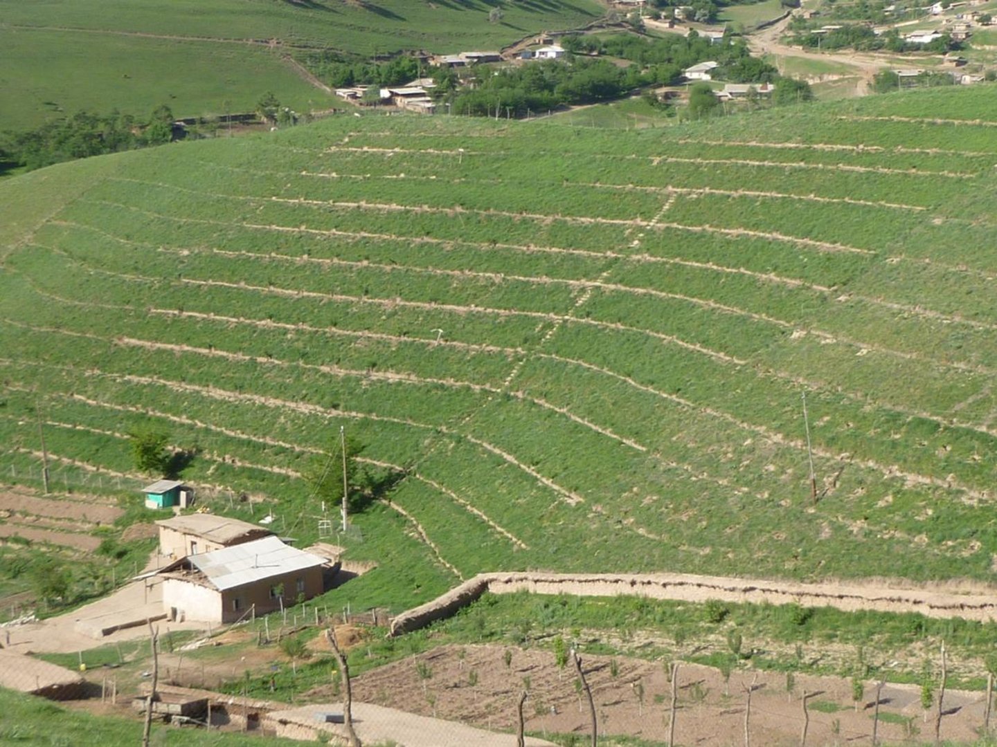
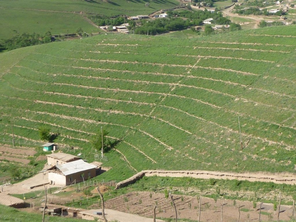
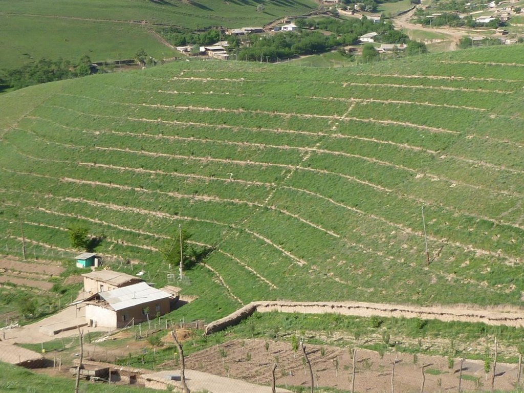
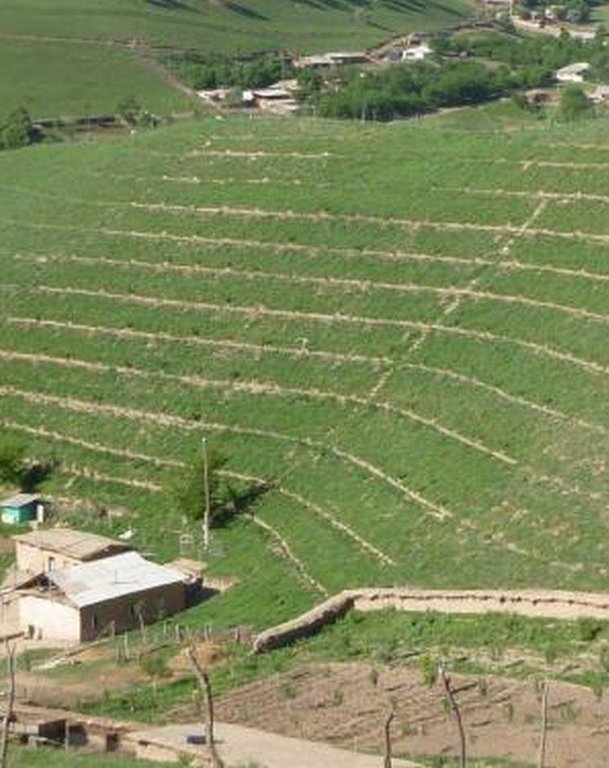
Use of the SLM technology facilitates the development of bench terraces from contour channels by gradually removing soil material up the slope for an estimated 5 years until the terraces on the slope reach a desired width of 1.2 m.
2.2 การอธิบายแบบละเอียดของเทคโนโลยี
คำอธิบาย:
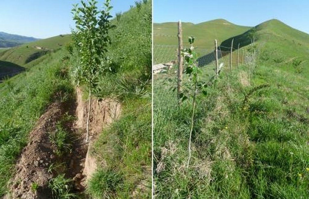
The SLM technology is thought to stop water run-off resulting in the prevention of damage to the top soil on steep slopes. This enables better distribution and infiltration of water into the soil. A complementing live fence, along with a metal net along the perimeter aim to stop livestock grazing. Contour ditches are planted in intervals with fruit trees, and the live fence is made of a combination of fire wood, trees and bushes. This combination makes possible the establishment of an agro forestry system on a slope in an area with limited irrigation using making use of the natural rainfall.
Details: 1. Ditches are dug out along the contour lines drawn by an "A" frame on the slope. 2. Seedlings are planted in 5 metre intervals, positioned right in the middle of the ditch. 3. The back wall behind each tree (upslope) has a half moon cutting to enable an even water/moisture supply. 4. The ditches are barriered with "septas" between two trees to trap water in the individual sections. 5. Horizontally across the ditches, the tree species vary, but vertically are homogeneous. 6. The strips between ditches are left free to enable natural grass to grow. 7. The residual soil material is mounted in front of the ditches in piles the width of a shovel. 8. The complementing perimeter live fence and metal net (1.5m height) is supported by wooden poles made of Acacia trees. (Assumed life span of poles is 25 years). 9. Improvised drip irrigation with 5 litre plastic bottles is used together with mulch coverage beneath the trees. 10. Species composition: apple, cherry, apricot, grape, walnut, pomegranate. In the garden; species of Acacia, Ailantus, dogroses and willow act as a live fence.
Purpose of the Technology: The aim of this system is to significantly reduce the water run-off that removes the top soil, and to subsequently prevent water erosion, and the formation/development of gullies. This can be achieved through the following methods; conserving the available resources and using them more efficiently, prevention overgrazing and improving the natural soil cover, as well as changing the type of land management towards a more sustainable and profitable one.
Establishment / maintenance activities and inputs: The plot was established on one side of a micro watershed. In mid February the contour lines were identified using an “A” frame. Digging of contour ditches then took until late February. The material was accumulated down the slope in deposits the width of a shovel to build a riser. At the beginning of March all the fruit tree seedlings were planted in the middle of the ditches. Perimeter fencing was constructed and live fence plants were planted up until late March. In May, the grass around the trees was cut and used for mulching beneath the trees. During June and July in the first year the plants needed watering 3 times a week which was done using a drip irrigation system with 5 litre plastic bottles. To help prevent the water heating and evaporating, the bottles were left under the mulch cover. Mulching and irrigation are repeated every dry and hot season. Every spring, the soil material is removed alongside the inner wall of the ditch just taking an amount that equals the width of a shovel, and accumulated down the slope to extend the riser. Materials required include: (1) Ditches: hand tools, stakes, rope, “A” frame, (2) Live fence: seedlings of Acacia, Ailantus, willow and dog rose, (3) Fencing: metal net, wooden poles, metal wire, (4) Cow dung, lime suspension, straw, mulch, plastic bottles.
Natural / human environment: The watershed can be characterised as follows: Hydrology - surface water is available only at times of rain and snow melt, this can be used for irrigation only. No sources of potable water exist. Soils are of loess type, as generally characteristic to the whole area. Flora - natural grasses prevail in the micro watershed, 9 species could be identified. Natural bushes and trees were completely removed due to high demand for fuelwood. Cultivation of rare tree varieties and household gardening was practiced in advance of the project. Fauna - Wild animals are often still seen such as turtles, lizards and snakes. Farm animals - mixed breeds of cattle, sheep and goats are very important. The households in this micro watershed area own almost 350 animals. The majority of these are kept for the summer season in adjacent pastures. The micro watershed was first inhabited in early 2000. Five households were established with a total of around 40 inhabitants. Family heads tend to be in their early 40s. Families have 7 to 9 members, including 5 to 7 children. All are of Tajik ethnicity, and Muslim, open to secular values. Of these 5 households, only 4 households have adopted the SLM technology. The fifth household only decided to join the project after witnessing their neighbour’s positive experiences. Both spouses tended to be involved in the activities. Both men and women took part in the training sessions and orientation meeting. However, it is likely that most decisions were made by the men, after the women had shared their ideas. Work load: providing the external inputs, construction and the heavy manual labour were done by the men. Maintenance work: watering, mulching and grass cutting was shared between men and women. Digging and fencing were performed in "hashars" - community labour groups. As women spend more time at home working within their households, they tend to perform more maintenance work on the plot compared to men. Other activities away from the farms are important to the family budget providing a means of extra income. This often includes men’s long term migration to Russia to find work.
2.3 รูปภาพของเทคโนโลยี
2.5 ประเทศภูมิภาค หรือสถานที่ตั้งที่เทคโนโลยีได้นำไปใช้และได้รับการครอบคลุมโดยการประเมินนี้
ประเทศ:
ทาจิกิสถาน
ภูมิภาค/รัฐ/จังหวัด:
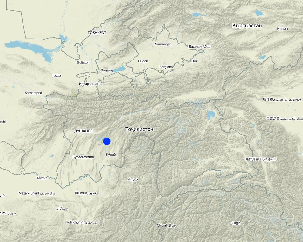
Tajikistan, Khatlon
ข้อมูลจำเพาะเพิ่มเติมของสถานที่ตั้ง :
Baljuvon, Khirob
แสดงความคิดเห็น:
Boundary points of the Technology area: North - 38.284233°N 69.639420°E
South - 38.278485°N 69.639555°E
East - 38.281854°N 69.641276°E
South - 38.281250°N 69.638009°E
Map
×2.6 วันที่การดำเนินการ
ถ้าไม่รู้ปีที่แน่นอน ให้ระบุวันที่โดยประมาณ:
- น้อยกว่า 10 ปี (ไม่นานนี้)
2.7 คำแนะนำของเทคโนโลยี
ให้ระบุว่าเทคโนโลยีถูกแนะนำเข้ามาอย่างไร:
- ทางโครงการหรือจากภายนอก
3. การจัดประเภทของเทคโนโลยี SLM
3.2 ประเภทของการใช้ที่ดินในปัจจุบันที่ได้นำเทคโนโลยีไปใช้

พื้นที่ปลูกพืช
- การปลูกพืชล้มลุกอายุปีเดียว
- การปลูกพืชยืนต้นที่ไม่มีเนื้อไม้

ทุ่งหญ้าเลี้ยงสัตว์
ทุ่งหญ้าเลี้ยงสัตว์ที่ใช้พื้นที่กว้าง:
- การเลี้ยงสัตว์แบบเร่ร่อนไปตามที่ต่าง ๆ (Nomadism)
- กึ่งเร่ร่อน / อาจมีการทำทุ่งหญ้าเลี้ยงสัตว์ร่วมด้วย (Semi-nomadism/ pastoralism)
ทุ่งหญ้าเลี้ยงสัตว์ที่มีการจัดการแบบเข้มข้นหรือการผลิตอาหารสัตว์:
- ตัดแล้วขนไป / ไม่มีการปล่อยแทะเล็มเอง (Cut-and-carry / zero grazing)
แสดงความคิดเห็น:
Major land use problems (compiler’s opinion): Implementation of land tenure rights at a local level was also a major barrier.
Major land use problems (land users’ perception): There is a soil and water conservation project in place to manage water runoff, soil erosion and gully formation. Low land productivity only allows for wheat production with long fallow periods. Improper pasture management has led to overall overgrazing.
Nomadism: animals taken to summer pastures
Semi-nomadism / pastoralism: animal graze around villages
Ranching: no practice
Cut-and-carry/ zero grazing: almost extinct
Improved pasture: no practice at all
Clear felling of (semi-)natural forests: No selection in times of electricity cuts in winter season.
Forest products and services: timber, fuelwood, fruits and nuts, grazing / browsing, other forest products / uses (honey, medical, etc.), nature conservation / protection
Future (final) land use (after implementation of SLM Technology): Mixed: Mf: Agroforestry
Constraints of infrastructure network (roads, railways, pipe lines, power lines): no irrigation network, heavy transports costs
ถ้าการใช้ที่ดินมีการเปลี่ยนแปลงเนื่องมาจากการนำเทคโนโลยีไปปฏิบัติใช้ ให้ระบุการใช้ที่ดินก่อนนำเทคโนโลยีไปปฏิบัติใช้:
Grazing land: Ge: Extensive grazing land
3.3 ข้อมูลเพิ่มเติมเกี่ยวกับการใช้ที่ดิน
แสดงความคิดเห็น:
Water supply: rainfed, mixed rainfed - irrigated, rainfed
Water supply: post-flooding
post-flooding
จำนวนของฤดูเพาะปลูกต่อปี:
- 1
ระบุ:
Longest growing period in days: 180Longest growing period from month to month: March - August
ความหนาแน่นของปศุสัตว์ (ถ้าเกี่ยวข้อง):
50-100 LU /km2
3.5 กระจายตัวของเทคโนโลยี
แสดงความคิดเห็น:
Total area covered by the SLM Technology is 0.112 m2.
The application of the SLM technology is planned for the whole micro watershed which has a total area of 0.112 km2. Currently it has been impemented in 0.07km2 of this watershed.
3.6 มาตรการ SLM ที่ประกอบกันเป็นเทคโนโลยี

มาตรการจัดการพืช
- A1: พืช/สิ่งปกคลุมดิน

มาตรการอนุรักษ์ด้วยวิธีพืช
- V1: ต้นไม้และพุ่มไม้คลุมดิน

มาตรการอนุรักษ์ด้วยโครงสร้าง
- S1: คันดิน

มาตรการอนุรักษ์ด้วยการจัดการ
- M1: การเปลี่ยนรูปแบบของการใช้ประโยชน์ที่ดิน
แสดงความคิดเห็น:
Main measures: agronomic measures, vegetative measures, structural measures, management measures
Type of agronomic measures: mixed cropping / intercropping, contour planting / strip cropping, mulching, legume inter-planting, manure / compost / residues, zero tillage / no-till, pits
Type of vegetative measures: aligned: -contour, aligned: -graded strips *<sup>3</sup>, aligned: -along boundary
3.7 รูปแบบหลักของการเสื่อมโทรมของที่ดินที่ได้รับการแก้ไขโดยเทคโนโลยี

การกัดกร่อนของดินโดยน้ำ
- Wt (Loss of topsoil): การสูญเสียดินชั้นบนหรือการกัดกร่อนที่ผิวดิน
- Wg (Gully erosion): การกัดกร่อนแบบร่องธารหรือการทำให้เกิดร่องน้ำเซาะ

การเสื่อมโทรมของดินทางด้านชีวภาพ
- Bc (Reduction of vegetation cover): การลดลงของจำนวนพืชที่ปกคลุมดิน
แสดงความคิดเห็น:
Main causes of degradation: soil management (Tillage on steep slope >35%.), deforestation / removal of natural vegetation (incl. forest fires) (Natural tree and shrubs removed completely.), over-exploitation of vegetation for domestic use, overgrazing (Stocking rates do exceed the standards in multiple times), disturbance of water cycle (infiltration / runoff) (Run-off is induced by maximum removal of vegetation cover.), land tenure (Unclear land right situation induces irresponsible attitudes.), inputs and infrastructure: (roads, markets, distribution of water points, other, …) (Very limited infrastructure development, vital infrastructure points are a long distance away.)
Secondary causes of degradation: Heavy / extreme rainfall (intensity/amounts) (Induces gully formation and mass movement.), droughts (If vegetation is dry then less soil cover is provided.), other natural causes (avalanches, volcanic eruptions, mud flows, highly susceptible natural resources, extreme topography, etc.) specify (The gradient is over 30%.), population pressure (Large family sizes, and high growth rates causes increased need for food and living space in the area.), poverty / wealth (Very limited financial power to develop the land.), labour availability (Though cheap labour is available, it takes much effort to organise communities to work together for SLM activities.), education, access to knowledge and support services (Basic schooling of children, no state provided extension or training after school age.), war and conflicts (The after-effects of recent civil war still have some influence.), governance / institutional (Communist attitudes still persist, very slow institutional development.)
3.8 การป้องกัน การลดลง หรือการฟื้นฟูความเสื่อมโทรมของที่ดิน
แสดงความคิดเห็น:
Main goals: prevention of land degradation
Secondary goals: mitigation / reduction of land degradation, rehabilitation / reclamation of denuded land
4. ข้อมูลจำเพาะด้านเทคนิค กิจกรรมการนำไปปฏิบัติใช้ ปัจจัยนำเข้า และค่าใช้จ่าย
4.1 แบบแปลนทางเทคนิคของเทคโนโลยี
4.2 ข้อมูลจำเพาะด้านเทคนิคและการอธิบายแบบแปลนทางเทคนิค
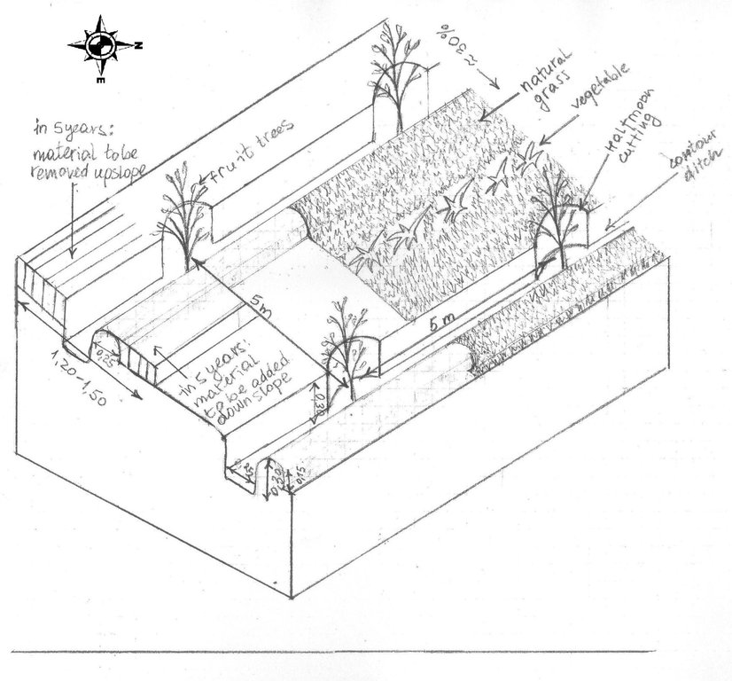
The drawing shows the contour ditches on a slope with a 25 - 30 % steepness. The gradient is 3-5%.
Vertically, the contour ditches are spaced at 5 m intervals. The upper left part of the drawing shows how the material on the slope will be removed in portions during the five years to create a levelled terrace. The ditches are planted with fruit trees, and strips of natural grass cover the space between the ditches. In the middle line of the strips in the bottom part of the plot the farmer has grown vegetables.
Location: Khirob village. Baljuvon/ Khatlon/ Tajikistan
Date: 06.05.2011
Technical knowledge required for field staff / advisors: high (Specific knowledge needed in the issues of integrated watershed management and technology.)
Technical knowledge required for land users: moderate (Training needed in terms of technology, planning and implementation of activities.)
Main technical functions: control of dispersed runoff: retain / trap, reduction of slope angle, increase of infiltration, promotion of vegetation species and varieties (quality, eg palatable fodder)
Secondary technical functions: control of dispersed runoff: impede / retard, improvement of ground cover, increase of surface roughness, improvement of topsoil structure (compaction), stabilisation of soil (eg by tree roots against land slides), increase / maintain water stored in soil, water harvesting / increase water supply, water spreading, increase of biomass (quantity), spatial arrangement and diversification of land use
Mixed cropping / intercropping
Material/ species: Growing a few tomatoes and paprica on the bottom strips.
Quantity/ density: 4plants m2
Remarks: Down slope alongside the ditches.
Contour planting / strip cropping
Material/ species: Wild vegetation is left to grow.
Quantity/ density: very dense
Remarks: Over 9 species counted on the plot all palatable, cut for hay and mulch.
Mulching
Material/ species: Mulching from natural grass, over 9 species.
Remarks: Ditches and trees covered beneath.
Legume inter-planting
Quantity/ density: 2 raisers.
Remarks: As a test to cover raiser surface.
Manure / compost / residues
Material/ species: Cattle dung suspended in water.
Quantity/ density: Once.
Remarks: Applied while planting the trees.
Zero tillage / no-till
Material/ species: No tillage for intercropping completed.
Pits
Material/ species: Pits were dug to plant seedlings.
Aligned: -contour
Vegetative material: T : trees / shrubs
Number of plants per (ha): 400
Vertical interval between rows / strips / blocks (m): 5
Spacing between rows / strips / blocks (m): 5
Vertical interval within rows / strips / blocks (m): 5
Width within rows / strips / blocks (m): 5
Aligned: -graded strips
Vegetative material: G : grass
Number of plants per (ha): na
Vertical interval between rows / strips / blocks (m): 1
Spacing between rows / strips / blocks (m): 3
Aligned: -along boundary
Vegetative material: T : trees / shrubs
Number of plants per (ha): 400
Spacing between rows / strips / blocks (m): 1
Trees/ shrubs species: Ailantus, Acacia, dog rose, willow, poplar
Fruit trees / shrubs species: Apple, grape, pear, apricot, cherry, pomegranate, mulberry, walnut
Perennial crops species: little alfalfa and espercet
Grass species: 9 naturally growing species
Slope (which determines the spacing indicated above): 30.00%
Gradient along the rows / strips: 25.00%
Retention/infiltration ditch/pit, sediment/sand trap
Vertical interval between structures (m): 5
Spacing between structures (m): 5
Depth of ditches/pits/dams (m): 0.3
Width of ditches/pits/dams (m): 0.25
Height of bunds/banks/others (m): 0.15
Width of bunds/banks/others (m): 0.25
Terrace: bench level
Vertical interval between structures (m): 3.50-3.80
Height of bunds/banks/others (m): 0.25
Width of bunds/banks/others (m): 1.20-1.50
Construction material (earth): the earth is removed upslope and added downslope to the front bank (raiser)
Slope (which determines the spacing indicated above): 25-30%
Lateral gradient along the structure: 3-5%
Vegetation is used for stabilisation of structures.
Change of land use type: Communal pasture land was turned into an agroforestry system
Change of land use practices / intensity level: Self subsistance, market orientated agroforestry system
Layout change according to natural and human environment: Along the contour lines of the slope
Major change in timing of activities: Major seasonal activities in three seasons: spring agronomic and vegetative measures, summer and autumn yield harvesting, clearing the branches
4.3 ข้อมูลทั่วไปเกี่ยวกับการคำนวณปัจจัยนำเข้าและค่าใช้จ่าย
อื่นๆ หรือสกุลเงินประจำชาติ (ระบุ):
Somoni
ระบุอัตราแลกเปลี่ยนจากดอลลาร์สหรัฐเป็นสกุลเงินท้องถิ่น (ถ้าเกี่ยวข้อง) คือ 1 เหรียญสหรัฐ =:
4.5
ระบุค่าเฉลี่ยของค่าจ้างในการจ้างแรงงานต่อวัน:
5.00
4.4 กิจกรรมเพื่อการจัดตั้ง
| กิจกรรม | ประเภทของมาตรการ | ช่วงเวลาดำเนินการ | |
|---|---|---|---|
| 1. | Planting seedlings in contour ditches | ด้วยวิธีพืช | February-March |
| 2. | Planting seedlings and bushes along the perimeter | ด้วยวิธีพืช | March |
| 3. | Cost of seedlings: frutiouse and firewood trees | ด้วยวิธีพืช | February -March |
| 4. | Gradual terracing by Broadening the ditch onslope and extending the raiser downslope | ด้วยโครงสร้าง | every spring during 5 years |
| 5. | Membership fees | ด้วยการจัดการ | |
| 6. | Attending the training | ด้วยการจัดการ | |
| 7. | Management of staff | ด้วยการจัดการ | |
| 8. | Taxes | ด้วยการจัดการ | |
| 9. | Taxes | ด้วยการจัดการ | |
| 10. | Membership fees | ด้วยการจัดการ |
4.5 ค่าใช้จ่ายของปัจจัยนำเข้าที่จำเป็นสำหรับการจัดตั้ง
| ปัจจัยนำเข้า | หน่วย | ปริมาณ | ค่าใช้จ่ายต่อหน่วย | ค่าใช้จ่ายทั้งหมดต่อปัจจัยนำเข้า | %ของค่าใช้จ่ายที่ก่อให้เกิดขึ้นโดยผู้ใช้ที่ดิน | |
|---|---|---|---|---|---|---|
| แรงงาน | labour | 1.0 | 589.0 | 589.0 | 50.0 | |
| อุปกรณ์ | tools | 1.0 | 69.0 | 69.0 | 50.0 | |
| วัสดุด้านพืช | mulching | 1.0 | 4.5 | 4.5 | 100.0 | |
| วัสดุด้านพืช | seedlings | 1.0 | 333.0 | 333.0 | 50.0 | |
| ค่าใช้จ่ายทั้งหมดของการจัดตั้งเทคโนโลยี | 995.5 | |||||
4.6 การบำรุงรักษาสภาพหรือกิจกรรมที่เกิดขึ้นเป็นประจำ
| กิจกรรม | ประเภทของมาตรการ | ช่วงระยะเวลา/ความถี่ | |
|---|---|---|---|
| 1. | Drip irrigation with plastic bottles | จัดการพืช | first 3 years |
| 2. | Mulching | จัดการพืช | once a year |
| 3. | Shaping the trees, cutting branches | ด้วยวิธีพืช | Autumn |
| 4. | Shaping the trees, cutting branches | ด้วยวิธีพืช | Autumn |
| 5. | Grafting | ด้วยวิธีพืช | March |
| 6. | Grafting | ด้วยวิธีพืช | March |
| 7. | Manuring | ด้วยวิธีพืช | March |
4.7 ค่าใช้จ่ายของปัจจัยนำเข้าและกิจกรรมที่เกิดขึ้นเป็นประจำที่ต้องการการบำรุงรักษา (ต่อปี)
| ปัจจัยนำเข้า | หน่วย | ปริมาณ | ค่าใช้จ่ายต่อหน่วย | ค่าใช้จ่ายทั้งหมดต่อปัจจัยนำเข้า | %ของค่าใช้จ่ายที่ก่อให้เกิดขึ้นโดยผู้ใช้ที่ดิน | |
|---|---|---|---|---|---|---|
| แรงงาน | labour | 1.0 | 123.6 | 123.6 | 100.0 | |
| วัสดุด้านพืช | mulching | 1.0 | 22.0 | 22.0 | 100.0 | |
| ค่าใช้จ่ายทั้งหมดของการบำรุงรักษาสภาพเทคโนโลยี | 145.6 | |||||
แสดงความคิดเห็น:
Labour costs apply to the cultivation of the whole 7ha plot.
4.8 ปัจจัยสำคัญที่สุดที่มีผลกระทบต่อค่าใช้จ่าย
ปัจจัยสำคัญที่สุดที่มีผลกระทบต่อค่าใช้จ่ายต่างๆ:
The most affecting factors were the high cost inputs for construction material which usually has to be imported into the area: Fuel, metal nets for fencing, cement, etc.
5. สิ่งแวดล้อมทางธรรมชาติและของมนุษย์
5.1 ภูมิอากาศ
ฝนประจำปี
- < 250 ม.ม.
- 251-500 ม.ม.
- 501-750 ม.ม.
- 751-1,000 ม.ม.
- 1,001-1,500 ม.ม.
- 1,501-2,000 ม.ม.
- 2,001-3,000 ม.ม.
- 3,001-4,000 ม.ม.
- > 4,000 ม.ม.
ข้อมูลจำเพาะ/ความคิดเห็นเรื่องปริมาณน้ำฝน:
Summer, >120 dry days
250-500 mm
Late summer, late autumn, rain prevails until the late autumn
500-750 mm
Late autumn mid spring, rain, snow.
750-1000 mm
avarage annual, usually up to 800mm
1000-1500 mm
not often, 1000mm heppen in single years
เขตภูมิอากาศเกษตร
- กึ่งแห้งแล้ง
Thermal climate class: temperate. winters with possible extreme cold, warm summers, with hot spells in July August
5.2 สภาพภูมิประเทศ
ค่าเฉลี่ยความลาดชัน:
- ราบเรียบ (0-2%)
- ลาดที่ไม่ชัน (3-5%)
- ปานกลาง (6-10%)
- เป็นลูกคลื่น (11-15%)
- เป็นเนิน (16-30%)
- ชัน (31-60%)
- ชันมาก (>60%)
ธรณีสัณฐาน:
- ที่ราบสูง/ที่ราบ
- สันเขา
- ไหล่เขา
- ไหล่เนินเขา
- ตีนเนิน
- หุบเขา
ระดับความสูง:
- 0-100 เมตร
- 101-500 เมตร
- 501-1,000 เมตร
- 1,001-1,500 เมตร
- 1,501-2,000 เมตร
- 2,001-2,500 เมตร
- 2,501-3,000 เมตร
- 3,001-4,000 เมตร
- > 4,000 เมตร
ให้ระบุถ้าเทคโนโลยีได้ถูกนำไปใช้:
- ไม่เกี่ยวข้อง
ความคิดเห็นและข้อมูลจำเพาะเพิ่มเติมเรื่องสภาพภูมิประเทศ:
hilly area, located on the foot of Vakhsh mountain range; micro watersheds feeding the bigger watershed of the Kyzylsu river
5.3 ดิน
ค่าเฉลี่ยความลึกของดิน:
- ตื้นมาก (0-20 ซ.ม.)
- ตื้น (21-50 ซ.ม.)
- ลึกปานกลาง (51-80 ซ.ม.)
- ลึก (81-120 ซ.ม.)
- ลึกมาก (>120 ซ.ม.)
เนื้อดิน (ดินชั้นบน):
- ปานกลาง (ดินร่วน ทรายแป้ง)
อินทรียวัตถุในดิน:
- ปานกลาง (1-3%)
- ต่ำ (<1%)
5.4 ความเป็นประโยชน์และคุณภาพของน้ำ
ระดับน้ำใต้ดิน:
5-50 เมตร
น้ำไหลบ่าที่ผิวดิน:
ปานกลาง
คุณภาพน้ำ (ที่ยังไม่ได้บำบัด):
เป็นน้ำใช้เพื่อการเกษตรเท่านั้น (การชลประทาน)
5.5 ความหลากหลายทางชีวภาพ
ความหลากหลายทางชนิดพันธุ์:
- ปานกลาง
5.6 ลักษณะของผู้ใช้ที่ดินที่นำเทคโนโลยีไปปฏิบัติใช้
รายได้ที่มาจากนอกฟาร์ม:
- 10-50% ของรายได้ทั้งหมด
ระดับของความมั่งคั่งโดยเปรียบเทียบ:
- ยากจนมาก
- จน
เป็นรายบุคคล/ครัวเรือน:
- เป็นรายบุคคล/ครัวเรือน
เพศ:
- ชาย
ระบุลักษณะอื่นๆที่เกี่ยวข้องของผู้ใช้ที่ดิน:
Land users applying the Technology are mainly common / average land users
Difference in the involvement of women and men: Very few women are trusted to run a farm or make decisions about land use. Usually women have taken leading roles only if the men leave the family for long term migration, or have died. Only 8 women in the whole district are farm owners out of the total of 350 existing farms.
Women's involvement and level of freedom given to them are influenced by existing patriarchal values, and in many areas women often remain unaware of their rights.
Population density: 10-50 persons/km2
Annual population growth: 1% - 2%
3% of the land users are very rich and own 20% of the land.
5% of the land users are rich and own 10% of the land.
10% of the land users are average wealthy and own 40% of the land.
60% of the land users are poor and own 20% of the land.
22% of the land users are poor and own 10% of the land.
Off-farm income specification: Complemented by salary from state job, NGO activity, transport service and construction work in capital town and other regions, labour migration to Russia.
Market orientation of production system: subsistence (self-supply), subsistence (self-supply), subsistence (self-supply), mixed (subsistence/ commercial, mixed (subsistence/ commercial, commercial/ market
5.7 พื้นที่เฉลี่ยของที่ดินที่เป็นเจ้าของหรือเช่าโดยผู้ใช้ที่ดินที่นำเทคโนโลยีไปปฏิบัติใช้
- < 0.5 เฮกตาร์
- 0.5-1 เฮกตาร์
- 1-2 เฮกตาร์
- 2-5 เฮกตาร์
- 5-15 เฮกตาร์
- 15-50 เฮกตาร์
- 50-100 เฮกตาร์
- 100-500 เฮกตาร์
- 500-1,000 เฮกตาร์
- 1,000-10,000 เฮกตาร์
- >10,000 เฮกตาร์
พิจารณาว่าเป็นขนาดเล็ก กลาง หรือขนาดใหญ่ (ซึ่งอ้างอิงถึงบริบทระดับท้องถิ่น):
- ขนาดเล็ก
แสดงความคิดเห็น:
Average area of land owned or leased by land users applying the Technology: < 0.5 ha, 0.5-1 ha, 1-2 ha, 2-5 ha, 5-15 ha, 5-15 ha, 15-50 ha
5.8 กรรมสิทธิ์ในที่ดิน สิทธิในการใช้ที่ดินและสิทธิในการใช้น้ำ
กรรมสิทธิ์ในที่ดิน:
- รัฐ
5.9 การเข้าถึงบริการและโครงสร้างพื้นฐาน
สุขภาพ:
- จน
- ปานกลาง
- ดี
การศึกษา:
- จน
- ปานกลาง
- ดี
ความช่วยเหลือทางด้านเทคนิค:
- จน
- ปานกลาง
- ดี
การจ้างงาน (เช่น ภายนอกฟาร์ม):
- จน
- ปานกลาง
- ดี
ตลาด:
- จน
- ปานกลาง
- ดี
พลังงาน:
- จน
- ปานกลาง
- ดี
ถนนและการขนส่ง:
- จน
- ปานกลาง
- ดี
น้ำดื่มและการสุขาภิบาล:
- จน
- ปานกลาง
- ดี
บริการด้านการเงิน:
- จน
- ปานกลาง
- ดี
6. ผลกระทบและสรุปคำบอกกล่าว
6.1 ผลกระทบในพื้นที่ดำเนินการ (On-site) จากการใช้เทคโนโลยี
ผลกระทบทางด้านเศรษฐกิจและสังคม
การผลิต
การผลิตพืชที่ใช้เลี้ยงปศุสัตว์
จำนวนก่อน SLM:
very little fodder could be collected
หลังจาก SLM:
cut and carry fodder production
คุณภาพพืชที่ใช้เลี้ยงปศุสัตว์
การผลิตสัตว์
การผลิตไม้
จำนวนก่อน SLM:
not possible
หลังจาก SLM:
may cover 40 -50 percent of HH need only in 5 year
การเสี่ยงต่อความล้มเหลวในการผลิต
จำนวนก่อน SLM:
no
หลังจาก SLM:
yes
ความหลากหลายของผลิตภัณฑ์
หลังจาก SLM:
yes
พื้นที่สำหรับการผลิต
จำนวนก่อน SLM:
no
หลังจาก SLM:
yes
การจัดการที่ดิน
หลังจาก SLM:
yes
การผลิตพลังงาน
รายได้และค่าใช้จ่าย
รายได้จากฟาร์ม
จำนวนก่อน SLM:
no
หลังจาก SLM:
yes
ความหลากหลายของแหล่งผลิตรายได้
จำนวนก่อน SLM:
no
หลังจาก SLM:
yes
ภาระงาน
ผลกระทบด้านสังคมวัฒนธรรมอื่น ๆ
ความมั่นคงด้านอาหาร / พึ่งตนเองได้
สถานการณ์ด้านสุขภาพ
โอกาสทางด้านสันทนาการ
สถาบันของชุมชน
สถาบันแห่งชาติ
SLM หรือความรู้เรื่องความเสื่อมโทรมของที่ดิน
ผลกระทบด้านนิเวศวิทยา
วัฐจักรน้ำหรือน้ำบ่า
น้ำไหลบ่าที่ผิวดิน
การระเหย
ดิน
ความชื้นในดิน
สิ่งปกคลุมดิน
การสูญเสียดิน
การอัดแน่นของดิน
ความหลากหลายทางชีวภาพของพืชและสัตว์
มวลชีวภาพ/เหนือดินชั้น C
ความหลากหลายทางชีวภาพของพืช
การจัดการศัตรูพืชและโรคพืช
ลดความเสี่ยงของภัยพิบัติ
การปล่อยคาร์บอนและก๊าซเรือนกระจก
ความเสี่ยงจากไฟ
ความเร็วของลม
6.2 ผลกระทบนอกพื้นที่ดำเนินการ (Off-site) จากการใช้เทคโนโลยี
น้ำท่วมพื้นที่ท้ายน้ำ
ความสามารถต้านทานการเปลี่ยนแปลง / ความสามารถในการคัดกรอง
ตะกอนที่ถูกพัดพามาโดยลม
ความเสียหายต่อพื้นที่เพาะปลูกของเพื่อนบ้าน
6.3 การเผชิญและความตอบสนองของเทคโนโลยีต่อการเปลี่ยนแปลงสภาพภูมิอากาศที่ค่อยเป็นค่อยไป และสภาพรุนแรงของภูมิอากาศ / ภัยพิบัติ (ที่รับรู้ได้โดยผู้ใช้ที่ดิน)
การเปลี่ยนแปลงสภาพภูมิอากาศที่ค่อยเป็นค่อยไป
การเปลี่ยนแปลงสภาพภูมิอากาศที่ค่อยเป็นค่อยไป
| ฤดู | ประเภทของการเปลี่ยนแปลงสภาพภูมิอากาศที่ค่อยเป็นค่อยไป และสภาพรุนแรงของภูมิอากาศ | เทคโนโลยีมีวิธีการรับมืออย่างไร | |
|---|---|---|---|
| อุณหภูมิประจำปี | เพิ่มขึ้น | ไม่ค่อยดี |
สภาพรุนแรงของภูมิอากาศ (ภัยพิบัติ)
ภัยพิบัติทางอุตุนิยมวิทยา
| เทคโนโลยีมีวิธีการรับมืออย่างไร | |
|---|---|
| พายุฝนประจำท้องถิ่น | ไม่ค่อยดี |
| พายุลมประจำท้องถิ่น | ดี |
ภัยพิบัติจากสภาพภูมิอากาศ
| เทคโนโลยีมีวิธีการรับมืออย่างไร | |
|---|---|
| ภัยจากฝนแล้ง | ไม่ค่อยดี |
ภัยพิบัติจากน้ำ
| เทคโนโลยีมีวิธีการรับมืออย่างไร | |
|---|---|
| น้ำท่วมตามปกติ (แม่น้ำ) | ดี |
ผลลัพธ์ตามมาที่เกี่ยวข้องกับภูมิอากาศอื่น ๆ
ผลลัพธ์ตามมาที่เกี่ยวข้องกับภูมิอากาศอื่น ๆ
| เทคโนโลยีมีวิธีการรับมืออย่างไร | |
|---|---|
| ช่วงการปลูกพืชที่ลดลงมา | ดี |
6.4 การวิเคราะห์ค่าใช้จ่ายและผลประโยชน์ที่ได้รับ
ผลประโยชน์ที่ได้รับเปรียบเทียบกับค่าใช้จ่ายในการจัดตั้งเป็นอย่างไร (จากมุมมองของผู้ใช้ที่ดิน)
ผลตอบแทนระยะสั้น:
ด้านลบเล็กน้อย
ผลตอบแทนระยะยาว:
ด้านบวก
ผลประโยชน์ที่ได้รับเปรียบเทียบกับค่าใช้จ่ายในการบำรุงรักษาหรือต้นทุนที่เกิดขึ้นซ้ำอีก เป็นอย่างไร (จากมุมมองของผู้ใช้ที่ดิน)
ผลตอบแทนระยะสั้น:
ด้านลบเล็กน้อย
ผลตอบแทนระยะยาว:
ด้านบวก
6.5 การปรับตัวของเทคโนโลยี
แสดงความคิดเห็น:
100% of land user families have adopted the Technology with external material support
4 land user families have adopted the Technology with external material support
Comments on acceptance with external material support: Project subsidised only 50% of material inputs.
Comments on adoption trend: Metal for the net was costly- farmers had to convince the project to subsidise prior to adoption, otherwise would reject adopting (area has high risk of crop damage- high livestock density, grazing not controlled).
Year following implementation: 3 farmers in neighbourhood have adopted on own funds; much more are willing to adopt, but need external support
6.7 จุดแข็ง / ข้อได้เปรียบ / โอกาสของเทคโนโลยี
| จุดแข็ง / ข้อได้เปรียบ / โอกาสในทัศนคติของผู้ใช้ที่ดิน |
|---|
| It helped to acquire more land user rights. |
| Land users feel they have an increased status in local society. |
|
It has good potential for replication in other areas. How can they be sustained / enhanced? It would be better if the more expensive parts of the input were subsidised. |
| Good long term perspectives for improvement of livelihoods. |
| It allows a positive long term change in household provision regarding food, employment and energy sources, allowing more spare time for cultural events and education. |
| จุดแข็ง / ข้อได้เปรียบ / โอกาสในทัศนคติของผู้รวบรวมหรือวิทยากรหลัก |
|---|
| It made possible the change to more sustainable land management techniques. |
| The technology is well suited to the sloping landscape and is easy to adopt. |
| The technology allows the use of locally available materials, and has low maintenance costs. |
|
It fits well to the local needs for land reclamation and conservation, and sits within the legislative frameworks. How can they be sustained / enhanced? There has been a recent state decree to encourage promotion of orchard development. |
|
It has a positive effect on the areas downstream. How can they be sustained / enhanced? Prior to implementation of the technology, areas downstream were often were damaged by floods. |
6.8 จุดอ่อน / ข้อเสียเปรียบ / ความเสี่ยงของเทคโนโลยีและวิธีการแก้ไข
| จุดอ่อน / ข้อเสียเปรียบ / ความเสี่ยงในทัศนคติของผู้ใช้ที่ดิน | มีวิธีการแก้ไขได้อย่างไร |
|---|---|
| It needed some immediate on-site adjustments when structuring the half moon cuttings in the contour ditches. | The farmer's opinion should be considered during the adoption of the technology, and to assist with any changes made. |
| It caused some disagreements between the farmers and the consultant over what part of the material input should be subsidised. | The consultant should try to ensure they understand the social and economic factors affecting the locals. |
| จุดอ่อน / ข้อเสียเปรียบ / ความเสี่ยงในทัศนคติของผู้รวบรวมหรือวิทยากรหลัก | มีวิธีการแก้ไขได้อย่างไร |
|---|---|
| Needs more until the final structure is finished | This depends on the length and intensity of any precipitation/drought/dry spells etc. |
| It is a new technology in this area so will need some time to be proven effective. | |
| External knowledge is needed for the establishment and maintainance of the technology. | |
| Extra workers are needed for the complementary drip irrigation - child labour is often used for this. |
7. การอ้างอิงและการเชื่อมต่อ
7.2 การอ้างอิงถึงสิ่งตีพิมพ์
หัวข้อ, ผู้เขียน, ปี, หมายเลข ISBN:
Scetch map of Khirob Microwatershed
ชื่อเรื่อง ผู้เขียน ปี ISBN:
DWHH Baljuvon Office
หัวข้อ, ผู้เขียน, ปี, หมายเลข ISBN:
Interim Narrative Report 01.05.2009-30.04.2010 Project TAJ 1068
ชื่อเรื่อง ผู้เขียน ปี ISBN:
DWHH Baljuvon Office
หัวข้อ, ผู้เขียน, ปี, หมายเลข ISBN:
Grant Application Form to EU Commision: "Individual incomes & Improving Living Standards in Khatlon and Sughd Regions", Tajikistan
ชื่อเรื่อง ผู้เขียน ปี ISBN:
DWHH Regional Office, Dushanbe mail to:
ลิงก์และโมดูล
ขยายทั้งหมด ย่อทั้งหมดลิงก์
ไม่มีลิงก์
โมดูล
ไม่มีโมดูล


