Growing of fodder crops on steep slopes in arid highlands [ทาจิกิสถาน]
- ผู้สร้างสรรค์:
- การอัพเดท:
- ผู้รวบรวม: Gulniso Nekushoeva
- ผู้เรียบเรียง: –
- ผู้ตรวจสอบ: David Streiff, Alexandra Gavilano
Парвариши алафхои бисьерсола (юнучка) дар нишебихои ростфуромадагии минтакахои баландкухои хушк
technologies_1028 - ทาจิกิสถาน
- บทสรุปทั้งหมดในรูปแบบของ PDF
- บทสรุปทั้งหมดในรูปแบบของ PDF เพื่อพิมพ์
- บทสรุปทั้งหมดในรูปหน้าเว็บ
- บทสรุปทั้งหมด (ไม่มีการจัดเรียง)
- Growing of fodder crops on steep slopes in arid highlands: 2 พฤศจิกายน 2021 (public)
- Growing of fodder crops on steep slopes in arid highlands: 14 สิงหาคม 2019 (inactive)
- Growing of fodder crops on steep slopes in arid highlands: 19 กรกฎาคม 2017 (inactive)
- Growing of fodder crops on steep slopes in arid highlands: 19 กรกฎาคม 2017 (inactive)
- Growing of fodder crops on steep slopes in arid highlands: 14 มีนาคม 2017 (inactive)
ดูส่วนย่อย
ขยายทั้งหมด ย่อทั้งหมด1. ข้อมูลทั่วไป
1.2 รายละเอียดที่ติดต่อได้ของผู้รวบรวมและองค์กรที่เกี่ยวข้องในการประเมินและการจัดเตรียมทำเอกสารของเทคโนโลยี
ผู้เชี่ยวชาญ SLM:
ผู้ใช้ที่ดิน:
Gulomshoev Burkhvalisho
ทาจิกิสถาน
ชื่อขององค์กรซึ่งอำนวยความสะดวกในการทำเอกสารหรือการประเมินเทคโนโลยี (ถ้าเกี่ยวข้อง)
Tajik Academy of Agricultural Sciences (Tajik Academy of Agricultural Sciences) - ทาจิกิสถานชื่อขององค์กรซึ่งอำนวยความสะดวกในการทำเอกสารหรือการประเมินเทคโนโลยี (ถ้าเกี่ยวข้อง)
Global Environment Facility Tajikistan (GEF) - ทาจิกิสถานชื่อขององค์กรซึ่งอำนวยความสะดวกในการทำเอกสารหรือการประเมินเทคโนโลยี (ถ้าเกี่ยวข้อง)
Tajik Soil Insitute (Tajik Soil Institute) - ทาจิกิสถานชื่อขององค์กรซึ่งอำนวยความสะดวกในการทำเอกสารหรือการประเมินเทคโนโลยี (ถ้าเกี่ยวข้อง)
UNEP (UNEP) - เคนยาชื่อขององค์กรซึ่งอำนวยความสะดวกในการทำเอกสารหรือการประเมินเทคโนโลยี (ถ้าเกี่ยวข้อง)
Institute for Environment and Human Security, United Nations University (Institute for Environment and Human Security, United Nations University) - เยอรมนี1.3 เงื่อนไขการใช้ข้อมูลที่ได้บันทึกผ่านทาง WOCAT
วันที่เก็บรวบรวมข้อมูล(ภาคสนาม) :
26/06/2010
ผู้รวบรวมและวิทยากรหลักยอมรับเงื่อนไขเกี่ยวกับการใช้ข้อมูลที่ถูกบันทึกผ่านทาง WOCAT:
ใช่
2. การอธิบายลักษณะของเทคโนโลยี SLM
2.1 การอธิบายแบบสั้น ๆ ของเทคโนโลยี
คำจำกัดความของเทคโนโลยี:
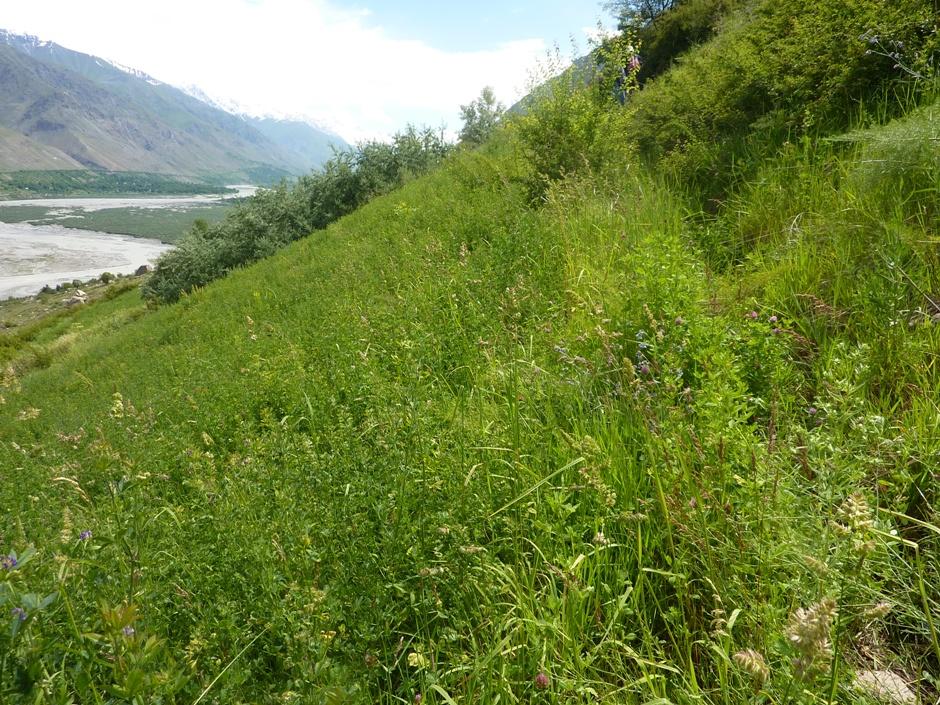
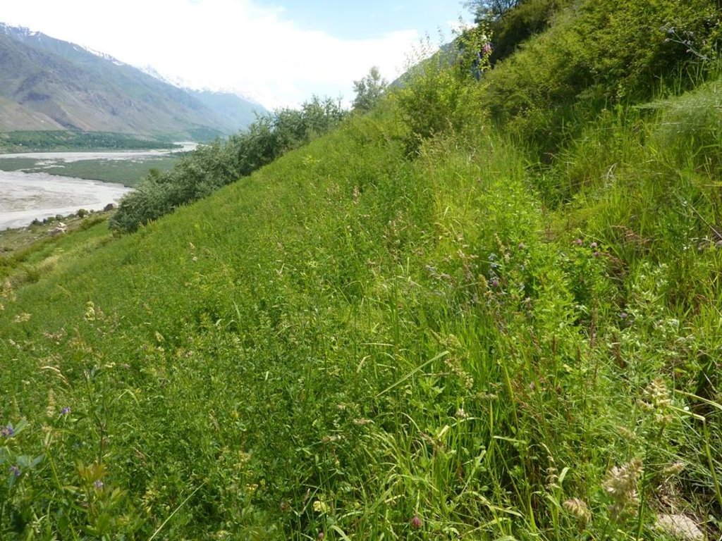
Cultivation of fodder crops (alfa-аlfa) on irrigated slopes of 60% steepness in the arid mountainous area of the Western Pamirs (Vanj valley).
2.2 การอธิบายแบบละเอียดของเทคโนโลยี
คำอธิบาย:
In 1993, in the Vanj district all land suitable for tilling was already occupied, only steep slopes were uncultivated. However, one innovative land user began to set up on a slope with 60% steepness, a 3 ha plot for intensive grass / fodder production through his own initiative. By the application of irrigation, within 3-5 years the very low productive grazing land was converted into a highly productive and sustainable cut-and-carry system. The technology is very effective in these ecological conditions for rapid rehabilitation of degraded lands. Over the 18 years of on-going fodder production on the plot, the pure alfa-alfa culture transformed into a grass-bean mixture, which provides even better soil cover and soil conservation.
Purpose of the Technology: The main purpose is secured fodder production for keeping livestock in the winter time. Despite the steep slope of 60%, and low-productive soils, by applying irrigation, the farmer gets three harvests of hay per season, amounting to about 8-12 ton of high quality fodder. Thus, over all these years, the farmer has had no problems producing sufficient fodder for his livestock.
Establishment / maintenance activities and inputs: The establishment of such a plot is very labour-intensive. However, within 3-4 years the productivity of the land improves several times over. High yields of high quality hay can be obtained within the short term, and the labour intensive activities are mostly needed just within the first year of establishment. Thus, many farmers have been attracted to apply this technology.
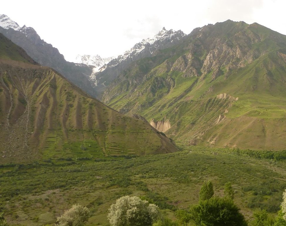
Natural / human environment: The plot described is situated in the village of Ravgada, Jamoat Teharv in Vanj district. Vanj is one of the two districts of GBAO with favourable agro-climatic conditions. But even here the natural fertility of the stony soils is low, especially on pasture lands with sparse vegetation. Due to the high aridity, farming is not possible without irrigation. The main income of the population is from livestock and the sale of nuts and fruits. All families that have recently become independent farmers, had mostly lands on steep slopes allocated to them. These families have therefore been applying the described technology with minor variations depending on the topography of their land.
2.3 รูปภาพของเทคโนโลยี
2.5 ประเทศภูมิภาค หรือสถานที่ตั้งที่เทคโนโลยีได้นำไปใช้และได้รับการครอบคลุมโดยการประเมินนี้
ประเทศ:
ทาจิกิสถาน
ภูมิภาค/รัฐ/จังหวัด:
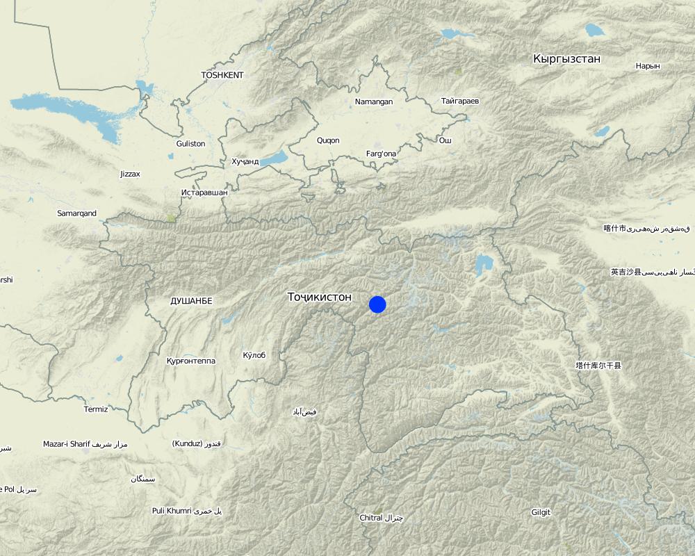
Tajikistan / GBAO
ข้อมูลจำเพาะเพิ่มเติมของสถานที่ตั้ง :
Vanch / Ravgada
Map
×2.6 วันที่การดำเนินการ
ถ้าไม่รู้ปีที่แน่นอน ให้ระบุวันที่โดยประมาณ:
- 10-50 ปี
2.7 คำแนะนำของเทคโนโลยี
ให้ระบุว่าเทคโนโลยีถูกแนะนำเข้ามาอย่างไร:
- ด้วยการริเริ่มของผู้ใช้ที่ดินเอง
ความคิดเห็น (ประเภทของโครงการ เป็นต้น) :
The technology was established in 1992.
3. การจัดประเภทของเทคโนโลยี SLM
3.1 วัตถุประสงค์หลักของเทคโนโลยี
- ปรับปรุงการผลิตให้ดีขึ้น
3.2 ประเภทของการใช้ที่ดินในปัจจุบันที่ได้นำเทคโนโลยีไปใช้

พื้นที่ปลูกพืช
- การปลูกพืชยืนต้นที่ไม่มีเนื้อไม้
พืชหลัก (พืชเศรษฐกิจและพืชอาหาร):
Main food crops: alfa-alfa

ทุ่งหญ้าเลี้ยงสัตว์
ทุ่งหญ้าเลี้ยงสัตว์ที่มีการจัดการแบบเข้มข้นหรือการผลิตอาหารสัตว์:
- ตัดแล้วขนไป / ไม่มีการปล่อยแทะเล็มเอง (Cut-and-carry / zero grazing)
แสดงความคิดเห็น:
Major land use problems (compiler’s opinion): Low natural fertility of soils, very stony land, farming is not possible without irrigation.
Major land use problems (land users’ perception): Lack of water. A lot of money and work is required to supply water to areas on steep slopes.
Future (final) land use (after implementation of SLM Technology): Grazing land: Gi: Intensive grazing/ fodder production
ถ้าการใช้ที่ดินมีการเปลี่ยนแปลงเนื่องมาจากการนำเทคโนโลยีไปปฏิบัติใช้ ให้ระบุการใช้ที่ดินก่อนนำเทคโนโลยีไปปฏิบัติใช้:
Grazing land: Ge: Extensive grazing land
3.3 ข้อมูลเพิ่มเติมเกี่ยวกับการใช้ที่ดิน
การใช้น้ำของที่ดินที่มีการใช้เทคโนโลยีอยู่:
- การชลประทานแบบเต็มรูปแบบ
จำนวนของฤดูเพาะปลูกต่อปี:
- 1
ระบุ:
Longest growing period in days: 180Longest growing period from month to month: April-September
3.4 กลุ่ม SLM ที่ตรงกับเทคโนโลยีนี้
- การปรับปรุงดิน / พืชคลุมดิน
- การปรับปรุงพันธุ์พืชหรือพันธุ์สัตว์ต่าง ๆ
3.5 กระจายตัวของเทคโนโลยี
ระบุการกระจายตัวของเทคโนโลยี:
- กระจายไปอย่างสม่ำเสมอในพื้นที่
ถ้าหากว่าเทคโนโลยีได้มีการกระจายออกไปอย่างสม่ำเสมอในพื้นที่ ให้ระบุปริมาณพื้นที่ที่ได้รับการครอบคลุมถึง:
- < 0.1 ตร.กม.(10 เฮกตาร์)
แสดงความคิดเห็น:
Total area covered by the SLM Technology is 0.03 m2.
3.6 มาตรการ SLM ที่ประกอบกันเป็นเทคโนโลยี

มาตรการจัดการพืช
- A1: พืช/สิ่งปกคลุมดิน

มาตรการอนุรักษ์ด้วยวิธีพืช
- V2: หญ้าและไม้ยืนต้น

มาตรการอนุรักษ์ด้วยโครงสร้าง
- S3: Graded ditches, channels, waterways

มาตรการอนุรักษ์ด้วยการจัดการ
- M1: การเปลี่ยนรูปแบบของการใช้ประโยชน์ที่ดิน
แสดงความคิดเห็น:
Main measures: vegetative measures
Secondary measures: structural measures
Type of vegetative measures: in blocks
3.7 รูปแบบหลักของการเสื่อมโทรมของที่ดินที่ได้รับการแก้ไขโดยเทคโนโลยี

การกัดกร่อนของดินโดยน้ำ
- Wt (Loss of topsoil): การสูญเสียดินชั้นบนหรือการกัดกร่อนที่ผิวดิน
- Wg (Gully erosion): การกัดกร่อนแบบร่องธารหรือการทำให้เกิดร่องน้ำเซาะ

การเสื่อมโทรมของดินทางด้านเคมี
- Cn (Fertility decline): ความอุดมสมบูรณ์และปริมาณอินทรียวัตถุในดินถูกทำให้ลดลงไป (ไม่ได้เกิดจากสาเหตุการกัดกร่อน)

การเสื่อมโทรมของดินทางด้านชีวภาพ
- Bc (Reduction of vegetation cover): การลดลงของจำนวนพืชที่ปกคลุมดิน

การเสื่อมโทรมของน้ำ
- Ha (Aridification): การเกิดความแห้งแล้ง
แสดงความคิดเห็น:
Main type of degradation addressed: Wt: loss of topsoil / surface erosion, Cn: fertility decline and reduced organic matter content, Bc: reduction of vegetation cover
Secondary types of degradation addressed: Wg: gully erosion / gullying, Ha: aridification
Main causes of degradation: overgrazing (grazing without rotation), droughts (High aridity, low precipitation), other natural causes (avalanches, volcanic eruptions, mud flows, highly susceptible natural resources, extreme topography, etc.) specify (very steep slopes (all other land was already occupied)), population pressure (lack of land), poverty / wealth (not enough resources)
Secondary causes of degradation: crop management (annual, perennial, tree/shrub) (fields with perennial crops are not wide spread), deforestation / removal of natural vegetation (incl. forest fires) (tree cutting for fuel), labour availability (migration to Russia), inputs and infrastructure: (roads, markets, distribution of water points, other, …) (no direct access to markets), education, access to knowledge and support services (no institutional support), war and conflicts (main cause for food unsecurity)
3.8 การป้องกัน การลดลง หรือการฟื้นฟูความเสื่อมโทรมของที่ดิน
ระบุเป้าหมายของเทคโนโลยีกับความเสื่อมโทรมของที่ดิน:
- ลดความเสื่อมโทรมของดิน
- ฟื้นฟูบำบัดที่ดินที่เสื่อมโทรมลงอย่างมาก
แสดงความคิดเห็น:
Main goals: mitigation / reduction of land degradation
Secondary goals: prevention of land degradation, rehabilitation / reclamation of denuded land
4. ข้อมูลจำเพาะด้านเทคนิค กิจกรรมการนำไปปฏิบัติใช้ ปัจจัยนำเข้า และค่าใช้จ่าย
4.2 ข้อมูลจำเพาะด้านเทคนิคและการอธิบายแบบแปลนทางเทคนิค
Technical knowledge required for land users: moderate (creating an irrigation system on such a steep slope requires knowledge)
Main technical functions: reduction of slope length, improvement of ground cover, increase in organic matter, increase in nutrient availability (supply, recycling,…), increase of biomass (quantity)
Secondary technical functions: control of dispersed runoff: retain / trap, control of dispersed runoff: impede / retard, control of concentrated runoff: retain / trap, improvement of surface structure (crusting, sealing), stabilisation of soil (eg by tree roots against land slides), increase / maintain water stored in soil, water harvesting / increase water supply, promotion of vegetation species and varieties (quality, eg palatable fodder)
Aligned: -graded strips
Vegetative material: C : perennial crops
In blocks
Vegetative material: C : perennial crops
Number of plants per (ha): 16kg/ha
Trees/ shrubs species: naturally grown along irrigation canals: Dog rose, sea buckthorn
Perennial crops species: alfa-alfa
Grass species: natural grasses
Slope (which determines the spacing indicated above): 60.00%
Gradient along the rows / strips: 60.00%
Structural measure: digging irrigation canal
Depth of ditches/pits/dams (m): 50
Width of ditches/pits/dams (m): 50
Length of ditches/pits/dams (m): 3000
Construction material (earth): first irrigation canals were dug into the earth
Construction material (stone): collected from the field stones were lined along the irrigation canals
4.3 ข้อมูลทั่วไปเกี่ยวกับการคำนวณปัจจัยนำเข้าและค่าใช้จ่าย
อื่นๆ หรือสกุลเงินประจำชาติ (ระบุ):
somoni
ระบุอัตราแลกเปลี่ยนจากดอลลาร์สหรัฐเป็นสกุลเงินท้องถิ่น (ถ้าเกี่ยวข้อง) คือ 1 เหรียญสหรัฐ =:
4.53
ระบุค่าเฉลี่ยของค่าจ้างในการจ้างแรงงานต่อวัน:
6.60
4.4 กิจกรรมเพื่อการจัดตั้ง
| กิจกรรม | ประเภทของมาตรการ | ช่วงเวลาดำเนินการ | |
|---|---|---|---|
| 1. | Clearing the site of stones | ด้วยวิธีพืช | before plowing |
| 2. | Clearing the site of stones | ด้วยวิธีพืช | before plowing |
| 3. | plowing the land using ox | ด้วยวิธีพืช | Spring / 1 time in 19 years |
| 4. | plowing the land using ox | ด้วยวิธีพืช | Spring / 1 time in 19 years |
| 5. | Purchasing fertilisers(50 kg=150s) | ด้วยวิธีพืช | |
| 6. | Purchasing fertilisers(50 kg=150s) | ด้วยวิธีพืช | |
| 7. | Applying fertilisers | ด้วยวิธีพืช | before sowing |
| 8. | Applying fertilisers | ด้วยวิธีพืช | before sowing |
| 9. | alfa-alfa seeds | ด้วยวิธีพืช | |
| 10. | alfa-alfa seeds | ด้วยวิธีพืช | |
| 11. | planting (sowing) alfalfa | ด้วยวิธีพืช | |
| 12. | planting (sowing) alfalfa | ด้วยวิธีพืช | |
| 13. | watering the field | ด้วยวิธีพืช | |
| 14. | watering the field | ด้วยวิธีพืช | |
| 15. | Construction of main irrigation canal(pipes water from a spring) | ด้วยโครงสร้าง | |
| 16. | Construction of main irrigation canal(pipes water from a spring) | ด้วยโครงสร้าง | |
| 17. | Purchasing of pipes20 Ø= 50cm x 6m1=100$ | ด้วยโครงสร้าง | |
| 18. | Purchasing of pipes20 Ø= 50cm x 6m1=100$ | ด้วยโครงสร้าง | |
| 19. | installation of pipesover a length of 120m | ด้วยโครงสร้าง | |
| 20. | installation of pipesover a length of 120m | ด้วยโครงสร้าง | |
| 21. | Construction ofirrigation network on site | ด้วยโครงสร้าง | before sowing |
| 22. | Construction ofirrigation network on site | ด้วยโครงสร้าง | before sowing |
| 23. | stabilisation of irrigation canals with stones collected from the fields | ด้วยโครงสร้าง | after plowing |
| 24. | stabilisation of irrigation canals with stones collected from the fields | ด้วยโครงสร้าง | after plowing |
4.5 ค่าใช้จ่ายของปัจจัยนำเข้าที่จำเป็นสำหรับการจัดตั้ง
| ปัจจัยนำเข้า | หน่วย | ปริมาณ | ค่าใช้จ่ายต่อหน่วย | ค่าใช้จ่ายทั้งหมดต่อปัจจัยนำเข้า | %ของค่าใช้จ่ายที่ก่อให้เกิดขึ้นโดยผู้ใช้ที่ดิน | |
|---|---|---|---|---|---|---|
| แรงงาน | Clearing the site of stones | Persons/day | 10.0 | 30.0 | 300.0 | 100.0 |
| แรงงาน | Plowing the land with ox | Persons/day | 9.0 | 180.0 | 1620.0 | 100.0 |
| แรงงาน | Applying Fertilizer/planting alfalfa/watering | Persons/day | 13.0 | 30.0 | 390.0 | 100.0 |
| แรงงาน | Construction of irrigation pipes | Persons/day | 304.0 | 30.0 | 9120.0 | 100.0 |
| อุปกรณ์ | Purchasing of pipes 20 Ø= 50cm x 6m 1=100$ | pipes | 20.0 | 453.0 | 9060.0 | 100.0 |
| อุปกรณ์ | Labour: Constructing and stabilizing irrigation network (3km) | Persons/day | 450.0 | 30.0 | 13500.0 | 100.0 |
| วัสดุด้านพืช | Alfa-alfa seeds | kg | 48.0 | 20.0 | 960.0 | 100.0 |
| ปุ๋ยและสารฆ่า/ยับยั้งการเจริญเติบโตของสิ่งมีชีวิต (ไบโอไซด์) | Fertilizer | kg | 500.0 | 3.0 | 1500.0 | 100.0 |
| ค่าใช้จ่ายทั้งหมดของการจัดตั้งเทคโนโลยี | 36450.0 | |||||
แสดงความคิดเห็น:
Duration of establishment phase: 1 month(s)
4.6 การบำรุงรักษาสภาพหรือกิจกรรมที่เกิดขึ้นเป็นประจำ
| กิจกรรม | ประเภทของมาตรการ | ช่วงระยะเวลา/ความถี่ | |
|---|---|---|---|
| 1. | watering the field10 times per vegetation period (5 month).Once, every 9 days for 3 ha. | ด้วยวิธีพืช | during vegetation period |
| 2. | cutting of alfa-alfa and natural grass | ด้วยวิธีพืช | 3 times per year |
| 3. | Repairing and cleaning of the main irrigation canal from sediments and debris | ด้วยโครงสร้าง | Before the irrigation season in spring |
| 4. | repairing and cleaning of the irrigation network from sediment and branches on an overall area of 3 ha | ด้วยโครงสร้าง | Before the irrigation season in spring |
4.7 ค่าใช้จ่ายของปัจจัยนำเข้าและกิจกรรมที่เกิดขึ้นเป็นประจำที่ต้องการการบำรุงรักษา (ต่อปี)
| ปัจจัยนำเข้า | หน่วย | ปริมาณ | ค่าใช้จ่ายต่อหน่วย | ค่าใช้จ่ายทั้งหมดต่อปัจจัยนำเข้า | %ของค่าใช้จ่ายที่ก่อให้เกิดขึ้นโดยผู้ใช้ที่ดิน | |
|---|---|---|---|---|---|---|
| แรงงาน | watering the field 10 times per vegetation period | Persons/day | 90.0 | 30.0 | 2700.0 | 100.0 |
| แรงงาน | cutting of alfa-alfa and natural grass | Persons/day | 45.0 | 30.0 | 1350.0 | 100.0 |
| แรงงาน | Cleaning irrigation network and canal | Persons/day | 12.0 | 30.0 | 360.0 | 100.0 |
| ค่าใช้จ่ายทั้งหมดของการบำรุงรักษาสภาพเทคโนโลยี | 4410.0 | |||||
แสดงความคิดเห็น:
Machinery/ tools: manual labour using sickle/shovel., shovels
The slope of the plot described is 55-60%.
4.8 ปัจจัยสำคัญที่สุดที่มีผลกระทบต่อค่าใช้จ่าย
ปัจจัยสำคัญที่สุดที่มีผลกระทบต่อค่าใช้จ่ายต่างๆ:
The steepness of the slope.
5. สิ่งแวดล้อมทางธรรมชาติและของมนุษย์
5.1 ภูมิอากาศ
ฝนประจำปี
- < 250 ม.ม.
- 251-500 ม.ม.
- 501-750 ม.ม.
- 751-1,000 ม.ม.
- 1,001-1,500 ม.ม.
- 1,501-2,000 ม.ม.
- 2,001-3,000 ม.ม.
- 3,001-4,000 ม.ม.
- > 4,000 ม.ม.
เขตภูมิอากาศเกษตร
- แห้งแล้ง
Thermal climate class: subtropics
5.2 สภาพภูมิประเทศ
ค่าเฉลี่ยความลาดชัน:
- ราบเรียบ (0-2%)
- ลาดที่ไม่ชัน (3-5%)
- ปานกลาง (6-10%)
- เป็นลูกคลื่น (11-15%)
- เป็นเนิน (16-30%)
- ชัน (31-60%)
- ชันมาก (>60%)
ธรณีสัณฐาน:
- ที่ราบสูง/ที่ราบ
- สันเขา
- ไหล่เขา
- ไหล่เนินเขา
- ตีนเนิน
- หุบเขา
ระดับความสูง:
- 0-100 เมตร
- 101-500 เมตร
- 501-1,000 เมตร
- 1,001-1,500 เมตร
- 1,501-2,000 เมตร
- 2,001-2,500 เมตร
- 2,501-3,000 เมตร
- 3,001-4,000 เมตร
- > 4,000 เมตร
ความคิดเห็นและข้อมูลจำเพาะเพิ่มเติมเรื่องสภาพภูมิประเทศ:
Altitudinal zone: More exactly 2150-2200m
Lanforms: Straight steep slope in high mountain area
Slopes on average: 60% steepness on the upper part of the plot, and 50-55% on the lower part.
5.3 ดิน
ค่าเฉลี่ยความลึกของดิน:
- ตื้นมาก (0-20 ซ.ม.)
- ตื้น (21-50 ซ.ม.)
- ลึกปานกลาง (51-80 ซ.ม.)
- ลึก (81-120 ซ.ม.)
- ลึกมาก (>120 ซ.ม.)
เนื้อดิน (ดินชั้นบน):
- ปานกลาง (ดินร่วน ทรายแป้ง)
อินทรียวัตถุในดิน:
- ปานกลาง (1-3%)
(ถ้ามี) ให้แนบคำอธิบายเรื่องดินแบบเต็มหรือระบุข้อมูลที่มีอยู่ เช่น ชนิดของดิน ค่า pH ของดินหรือความเป็นกรดของดิน ความสามารถในการแลกเปลี่ยนประจุบวก ไนโตรเจน ความเค็ม เป็นต้น:
Soil fertility is low
Soil drainage / infiltration is good
Soil water storage capacity is medium
5.4 ความเป็นประโยชน์และคุณภาพของน้ำ
ระดับน้ำใต้ดิน:
> 50 เมตร
คุณภาพน้ำ (ที่ยังไม่ได้บำบัด):
เป็นน้ำเพื่อการดื่มที่ดี
ความคิดเห็นและข้อมูลจำเพาะเพิ่มเติมเรื่องคุณภาพและปริมาณน้ำ:
Ground water table: It is a steep mountain slope
Water quality (untreated): Water comes from a spring, it is good drinking water
5.5 ความหลากหลายทางชีวภาพ
ความหลากหลายทางชนิดพันธุ์:
- สูง
ความคิดเห็นและข้อมูลจำเพาะเพิ่มเติมของความหลากหลายทางชีวภาพ:
Much evidence of insects and birds, and also traces of soil fauna.
5.6 ลักษณะของผู้ใช้ที่ดินที่นำเทคโนโลยีไปปฏิบัติใช้
แนวทางการตลาดของระบบการผลิต:
- เพื่อการยังชีพ (หาเลี้ยงตนเอง)
รายได้ที่มาจากนอกฟาร์ม:
- 10-50% ของรายได้ทั้งหมด
ระดับของความมั่งคั่งโดยเปรียบเทียบ:
- รวย
เป็นรายบุคคล/ครัวเรือน:
- เป็นรายบุคคล/ครัวเรือน
ระดับของการใช้เครื่องจักรกล:
- การใช้กำลังจากสัตว์
เพศ:
- หญิง
- ชาย
ระบุลักษณะอื่นๆที่เกี่ยวข้องของผู้ใช้ที่ดิน:
Land users applying the Technology are mainly common / average land users
Population density: 50-100 persons/km2
Annual population growth: 1% - 2%
20% of the land users are rich (Farmer became richer after 1993).
Off-farm income specification: In addition to the fodder plot, he also has a big forest plot rented from the Forest committee, a big apple and nut orchard, and he also keeps chickens and turkeys.
Market orientation of production system: This fodder is sufficient for his own livestock
Level of mechanization animal traction: Land cultivation once in 18 years
5.7 พื้นที่เฉลี่ยของที่ดินที่เป็นเจ้าของหรือเช่าโดยผู้ใช้ที่ดินที่นำเทคโนโลยีไปปฏิบัติใช้
- < 0.5 เฮกตาร์
- 0.5-1 เฮกตาร์
- 1-2 เฮกตาร์
- 2-5 เฮกตาร์
- 5-15 เฮกตาร์
- 15-50 เฮกตาร์
- 50-100 เฮกตาร์
- 100-500 เฮกตาร์
- 500-1,000 เฮกตาร์
- 1,000-10,000 เฮกตาร์
- >10,000 เฮกตาร์
พิจารณาว่าเป็นขนาดเล็ก กลาง หรือขนาดใหญ่ (ซึ่งอ้างอิงถึงบริบทระดับท้องถิ่น):
- ขนาดกลาง
แสดงความคิดเห็น:
Average area of land owned or leased by land users applying the Technology: Also 0.5-1 ha but used for forest
1-2 ha: on the flat areas and they are low productive grazing lands
2-5 ha: mostly on steep slopes
5.8 กรรมสิทธิ์ในที่ดิน สิทธิในการใช้ที่ดินและสิทธิในการใช้น้ำ
กรรมสิทธิ์ในที่ดิน:
- รัฐ
สิทธิในการใช้ที่ดิน:
- เช่า
สิทธิในการใช้น้ำ:
- เข้าถึงได้แบบเปิด (ไม่ได้จัดระเบียบ)
5.9 การเข้าถึงบริการและโครงสร้างพื้นฐาน
สุขภาพ:
- จน
- ปานกลาง
- ดี
การศึกษา:
- จน
- ปานกลาง
- ดี
ความช่วยเหลือทางด้านเทคนิค:
- จน
- ปานกลาง
- ดี
การจ้างงาน (เช่น ภายนอกฟาร์ม):
- จน
- ปานกลาง
- ดี
ตลาด:
- จน
- ปานกลาง
- ดี
พลังงาน:
- จน
- ปานกลาง
- ดี
ถนนและการขนส่ง:
- จน
- ปานกลาง
- ดี
น้ำดื่มและการสุขาภิบาล:
- จน
- ปานกลาง
- ดี
บริการด้านการเงิน:
- จน
- ปานกลาง
- ดี
6. ผลกระทบและสรุปคำบอกกล่าว
6.1 ผลกระทบในพื้นที่ดำเนินการ (On-site) จากการใช้เทคโนโลยี
ผลกระทบทางด้านเศรษฐกิจและสังคม
การผลิต
การผลิตพืชที่ใช้เลี้ยงปศุสัตว์
หลังจาก SLM:
8-12 t / ha
คุณภาพพืชที่ใช้เลี้ยงปศุสัตว์
การผลิตสัตว์
รายได้และค่าใช้จ่าย
รายได้จากฟาร์ม
ความหลากหลายของแหล่งผลิตรายได้
ผลกระทบด้านสังคมวัฒนธรรมอื่น ๆ
ความมั่นคงด้านอาหาร / พึ่งตนเองได้
SLM หรือความรู้เรื่องความเสื่อมโทรมของที่ดิน
การบรรเทาความขัดแย้ง
ผลกระทบด้านนิเวศวิทยา
ดิน
ความชื้นในดิน
สิ่งปกคลุมดิน
การสูญเสียดิน
การหมุนเวียนและการเติมของธาตุอาหาร
อินทรียวัตถุในดิน/ต่ำกว่าดินชั้น C
ความหลากหลายทางชีวภาพของพืชและสัตว์
มวลชีวภาพ/เหนือดินชั้น C
ความหลากหลายทางชีวภาพของพืช
ความหลากหลายทางชีวภาพของสัตว์
ชนิดพันธุ์ที่ให้ประโยชน์
ความหลากหลายของสัตว์
ลดความเสี่ยงของภัยพิบัติ
การปล่อยคาร์บอนและก๊าซเรือนกระจก
6.2 ผลกระทบนอกพื้นที่ดำเนินการ (Off-site) จากการใช้เทคโนโลยี
น้ำท่วมพื้นที่ท้ายน้ำ
ความเสียหายต่อพื้นที่เพาะปลูกของเพื่อนบ้าน
6.3 การเผชิญและความตอบสนองของเทคโนโลยีต่อการเปลี่ยนแปลงสภาพภูมิอากาศที่ค่อยเป็นค่อยไป และสภาพรุนแรงของภูมิอากาศ / ภัยพิบัติ (ที่รับรู้ได้โดยผู้ใช้ที่ดิน)
การเปลี่ยนแปลงสภาพภูมิอากาศที่ค่อยเป็นค่อยไป
การเปลี่ยนแปลงสภาพภูมิอากาศที่ค่อยเป็นค่อยไป
| ฤดู | ประเภทของการเปลี่ยนแปลงสภาพภูมิอากาศที่ค่อยเป็นค่อยไป และสภาพรุนแรงของภูมิอากาศ | เทคโนโลยีมีวิธีการรับมืออย่างไร | |
|---|---|---|---|
| อุณหภูมิประจำปี | เพิ่มขึ้น | ไม่ค่อยดี |
สภาพรุนแรงของภูมิอากาศ (ภัยพิบัติ)
ภัยพิบัติทางอุตุนิยมวิทยา
| เทคโนโลยีมีวิธีการรับมืออย่างไร | |
|---|---|
| พายุฝนประจำท้องถิ่น | ดี |
| พายุลมประจำท้องถิ่น | ดี |
ภัยพิบัติจากสภาพภูมิอากาศ
| เทคโนโลยีมีวิธีการรับมืออย่างไร | |
|---|---|
| ภัยจากฝนแล้ง | ไม่ค่อยดี |
ภัยพิบัติจากน้ำ
| เทคโนโลยีมีวิธีการรับมืออย่างไร | |
|---|---|
| น้ำท่วมตามปกติ (แม่น้ำ) | ดี |
ผลลัพธ์ตามมาที่เกี่ยวข้องกับภูมิอากาศอื่น ๆ
ผลลัพธ์ตามมาที่เกี่ยวข้องกับภูมิอากาศอื่น ๆ
| เทคโนโลยีมีวิธีการรับมืออย่างไร | |
|---|---|
| ช่วงการปลูกพืชที่ลดลงมา | ดี |
แสดงความคิดเห็น:
The use of irrigation has made the technology sustainable and more tolerant to temperature increases and drought. However, if climate change leads to decreasing snow fall, this may affect the quantity and the duration of irrigation water available. Reduced irrigation water may lead to a reduced number of yields.
6.4 การวิเคราะห์ค่าใช้จ่ายและผลประโยชน์ที่ได้รับ
ผลประโยชน์ที่ได้รับเปรียบเทียบกับค่าใช้จ่ายในการจัดตั้งเป็นอย่างไร (จากมุมมองของผู้ใช้ที่ดิน)
ผลตอบแทนระยะสั้น:
เป็นกลางหรือสมดุล
ผลตอบแทนระยะยาว:
ด้านบวกอย่างมาก
ผลประโยชน์ที่ได้รับเปรียบเทียบกับค่าใช้จ่ายในการบำรุงรักษาหรือต้นทุนที่เกิดขึ้นซ้ำอีก เป็นอย่างไร (จากมุมมองของผู้ใช้ที่ดิน)
ผลตอบแทนระยะสั้น:
ด้านลบเล็กน้อย
ผลตอบแทนระยะยาว:
ด้านบวก
แสดงความคิดเห็น:
The largest amount of money was spent on the purchase of water pipes to bring irrigation water to the site. But the farmer says that over the long-term (18 years), he has already covered this cost.
6.5 การปรับตัวของเทคโนโลยี
- ครั้งเดียวหรือเป็นการทดลอง
ถ้ามีข้อมูลให้บอกปริมาณด้วย (จำนวนของครัวเรือนหรือครอบคลุมพื้นที่):
266 houshold in an area
จากทั้งหมดที่ได้รับเทคโนโลยีเข้ามามีจำนวนเท่าใดที่ทำแบบทันที โดยไม่ได้รับการจูงใจด้านวัสดุหรือการเงินใด ๆ:
- 90-100%
แสดงความคิดเห็น:
Comments on spontaneous adoption: All families that have recently come to live as individual farmers and had lands allocated to them, have mostly obtained land on steep slopes.
There is a moderate trend towards spontaneous adoption of the Technology
Comments on adoption trend: The rapidly seen benefits of the technology have attracted many farmers to apply this technology.
6.7 จุดแข็ง / ข้อได้เปรียบ / โอกาสของเทคโนโลยี
| จุดแข็ง / ข้อได้เปรียบ / โอกาสในทัศนคติของผู้ใช้ที่ดิน |
|---|
| For many years the farmer had no problems with fodder for his 10 cows. |
| จุดแข็ง / ข้อได้เปรียบ / โอกาสในทัศนคติของผู้รวบรวมหรือวิทยากรหลัก |
|---|
| this technology is very effective in these ecological conditions for the rapid rehabilitation of, and reduction of land degradation in these low-productivity soils. |
| Alfalfa has been grown for the last 18 years, giving a stable hay yield. |
| Over many years, the pure alfa-alfa fields became mixed with grass-bean herbs, which provide much better soild cover than alfalfa alone. |
| Despite the 60% steep slope and low-productive soils, thanks to irrigation, the farmer can harvest three yields of hay per season, which is about 8-10 ton of high quality fodder. |
6.8 จุดอ่อน / ข้อเสียเปรียบ / ความเสี่ยงของเทคโนโลยีและวิธีการแก้ไข
| จุดอ่อน / ข้อเสียเปรียบ / ความเสี่ยงในทัศนคติของผู้ใช้ที่ดิน | มีวิธีการแก้ไขได้อย่างไร |
|---|---|
| Next year the farmer wants to plow the field and re-plant the alfalfa. He is already an old man and on such a steep slope it will be difficult |
| จุดอ่อน / ข้อเสียเปรียบ / ความเสี่ยงในทัศนคติของผู้รวบรวมหรือวิทยากรหลัก | มีวิธีการแก้ไขได้อย่างไร |
|---|---|
| The farmer did not engage in beekeeping. Possibly because he does not have enough knowledge. | the farmer should start beekeeping which can have several benefits, including ecologically clean honey and good pollination of alfalfa, which will lead to greater seed yields and greater income. |
ลิงก์และโมดูล
ขยายทั้งหมด ย่อทั้งหมดลิงก์
ไม่มีลิงก์
โมดูล
ไม่มีโมดูล


