Water harvesting from concentrated runoff for irrigation purposes [สเปน]
- ผู้สร้างสรรค์:
- การอัพเดท:
- ผู้รวบรวม: Joris De Vente
- ผู้เรียบเรียง: –
- ผู้ตรวจสอบ: Fabian Ottiger, Alexandra Gavilano
Boqueras (Spanish)
technologies_1517 - สเปน
- บทสรุปทั้งหมดในรูปแบบของ PDF
- บทสรุปทั้งหมดในรูปแบบของ PDF เพื่อพิมพ์
- บทสรุปทั้งหมดในรูปหน้าเว็บ
- บทสรุปทั้งหมด (ไม่มีการจัดเรียง)
- Water harvesting from concentrated runoff for irrigation purposes: 23 กรกฎาคม 2019 (public)
- Water harvesting from concentrated runoff for irrigation purposes: 4 เมษายน 2018 (inactive)
- Water harvesting from concentrated runoff for irrigation purposes: 4 เมษายน 2018 (inactive)
- Water harvesting from concentrated runoff for irrigation purposes: 5 สิงหาคม 2017 (inactive)
- Water harvesting from concentrated runoff for irrigation purposes: 14 มีนาคม 2017 (inactive)
ดูส่วนย่อย
ขยายทั้งหมด ย่อทั้งหมด1. ข้อมูลทั่วไป
1.2 รายละเอียดที่ติดต่อได้ของผู้รวบรวมและองค์กรที่เกี่ยวข้องในการประเมินและการจัดเตรียมทำเอกสารของเทคโนโลยี
ผู้เชี่ยวชาญ SLM:
ผู้เชี่ยวชาญ SLM:
López Carratala Jorge
+34.950.281045
carratala@cebas.csic.es
Consejo Superior de Investigaciones Científicas, Estación Experimental de Zonas Áridas (EEZA-CSIC)
General Segura 1, 04001; Almeria; Spain
สเปน
ผู้เชี่ยวชาญ SLM:
Ibáñez Torres Ascensión
+34.968 36 66 87 / +34 699 65 36 16
ascension.ibanez@carm.es
Consejería de Agricultura y Agua Murcia (CARM)
30008 Murcia, Spain
สเปน
ผู้ใช้ที่ดิน:
Escamez Antonio
608 862 629 / 968 43 82 50
Alhagüeces. Zarzilla de Totana
สเปน
ผู้เชี่ยวชาญ SLM:
bas.vanwesemael@uclouvain.be
Researcher Université Catholique de Lovain (UCL)
Researcher Université Catolique de Lovain (UCL). Belgium
เบลเยียม
ชื่อขององค์กรซึ่งอำนวยความสะดวกในการทำเอกสารหรือการประเมินเทคโนโลยี (ถ้าเกี่ยวข้อง)
EEZA-CSIC (EEZA-CSIC) - สเปนชื่อขององค์กรซึ่งอำนวยความสะดวกในการทำเอกสารหรือการประเมินเทคโนโลยี (ถ้าเกี่ยวข้อง)
Consejería de Agricultura y Agua Murcia (CARM) - สเปน1.3 เงื่อนไขการใช้ข้อมูลที่ได้บันทึกผ่านทาง WOCAT
วันที่เก็บรวบรวมข้อมูล(ภาคสนาม) :
12/06/2008
ผู้รวบรวมและวิทยากรหลักยอมรับเงื่อนไขเกี่ยวกับการใช้ข้อมูลที่ถูกบันทึกผ่านทาง WOCAT:
ใช่
2. การอธิบายลักษณะของเทคโนโลยี SLM
2.1 การอธิบายแบบสั้น ๆ ของเทคโนโลยี
คำจำกัดความของเทคโนโลยี:
Water harvesting from intermittent streams towards nearby fields and terraces during runoff events.
2.2 การอธิบายแบบละเอียดของเทคโนโลยี
คำอธิบาย:
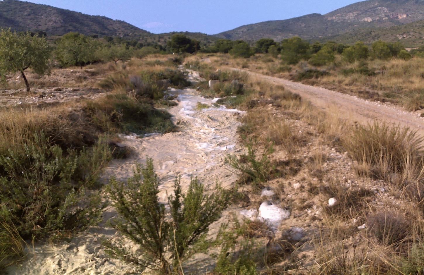
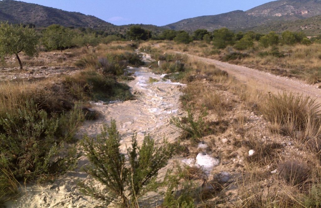
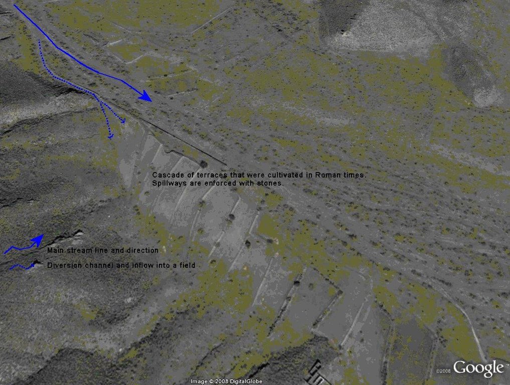
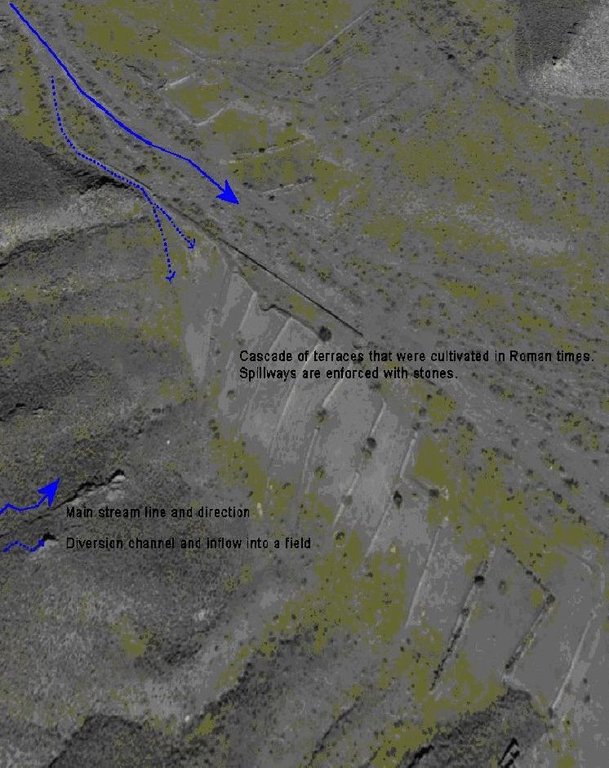
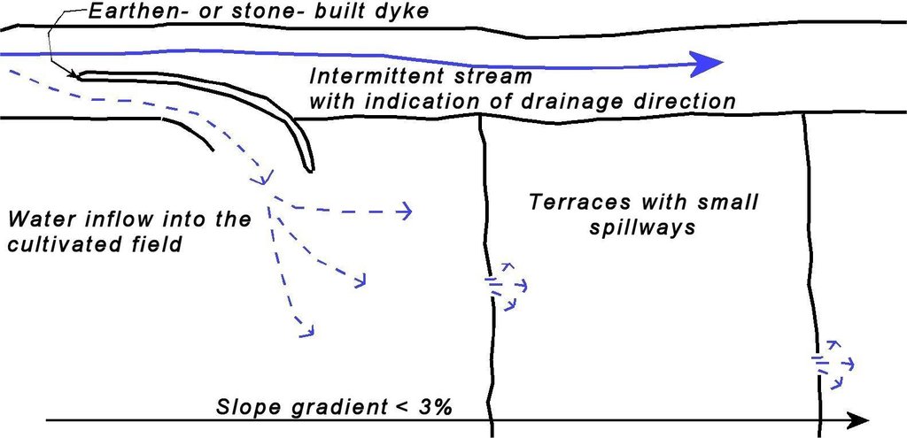
Water shortage is one of the most limiting factors for sustainable agriculture in large parts of SE-Spain. Part of the solution of this problem may come from the restoration of traditional water harvesting structures. Many of these structures were widely used in SE-Spain already during Arab and Roman times, and are also widespread in N-Africa and the Middle East. However, nowadays in Spain many of them are abandoned and forgotten. Here, we describe the technology of a small earthen- or stone- built bund that diverts flood water from intermittent streams towards cultivated fields with almond orchards and/or cereals. The diverted water will temporarily flood the fields and provide the crops with water. Depending on the slope gradient and the amount of water to be harvested, the fields are organised as single terraces, or as a staircase of terraces. On fields with gradients above ~3%, terraces are necessary to reduce the gradient and to retain the floodwater as long as possible. Water is diverted from one terrace to the next through small spillways in the terrace. The spillways can best be fortified with stones to prevent bank gully formation. The extra input of surface water can double the almond yield. The use of these water harvesting structures is only possible under certain environmental and topographic conditions. The cultivated fields should be at a relatively short distance from an intermittent stream (<~50m), and the stream should have a sufficiently large upstream contributing area to provide significant amounts of runoff water during rainfall events. With these systems, water can be harvested up to 8 times per year, mostly in spring and autumn during high intensity rainfall events. A well designed Boquera system may provide up to 550 mm of additional water, in areas with an average annual rainfall of 300 m.
Purpose of the Technology: The goal of this technology is to increase crop yield. In addition, these structures help to reduce the intensity of floods and reduce the damage caused by them by reducing runoff volume in intermittent streams.
Establishment / maintenance activities and inputs: Water harvesting requires the identification of a suitable location for the construction of a diversion structure. This requires assessment of expected water inflow, which can usually be based on simple field observation during rainfall events and based on local knowledge of land users. It is, however, important to consider whether there are activities upstream that possibly affect the water quality (e.g. farm animals) and to assess the implications the water harvesting might have downstream. Permission is required from the water authorities to construct any type of water harvesting structure. Such structures are built by creating a small bund (<1m height) in the centre or to the side of a stream. Depending on the size, the bund can be built with a shovel or a tractor. The water harvesting structure will require control and some maintenance after each important runoff event. When strengthened with concrete, maintenance will be reduced to approximately once every 5 years.
Natural / human environment: Soils are mostly of shallow to medium depth (20-60 cm), and slopes are gentle to moderate (5-15%). The climate is semi-arid with a mean annual rainfall around 300 mm. Droughts, centred in summer commonly last for more than 4-5 months. Annual potential evapotranspiration rates larger than 1000 mm are common.
2.3 รูปภาพของเทคโนโลยี
2.5 ประเทศภูมิภาค หรือสถานที่ตั้งที่เทคโนโลยีได้นำไปใช้และได้รับการครอบคลุมโดยการประเมินนี้
ประเทศ:
สเปน
ภูมิภาค/รัฐ/จังหวัด:
Murcia
ข้อมูลจำเพาะเพิ่มเติมของสถานที่ตั้ง :
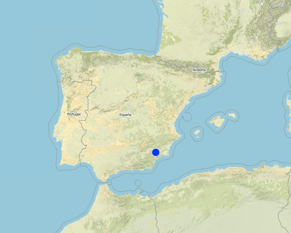
Guadalentin catchment
Map
×2.6 วันที่การดำเนินการ
ถ้าไม่รู้ปีที่แน่นอน ให้ระบุวันที่โดยประมาณ:
- มากกว่า 50 ปี (แบบดั้งเดิม)
2.7 คำแนะนำของเทคโนโลยี
ให้ระบุว่าเทคโนโลยีถูกแนะนำเข้ามาอย่างไร:
- เป็นส่วนหนึ่งของระบบแบบดั้งเดิมที่ทำก้นอยู่ (> 50 ปี)
ความคิดเห็น (ประเภทของโครงการ เป็นต้น) :
Most of the water harvesting structures are already much older than 50 years and originate even from Roman or Arab times.
3. การจัดประเภทของเทคโนโลยี SLM
3.2 ประเภทของการใช้ที่ดินในปัจจุบันที่ได้นำเทคโนโลยีไปใช้

พื้นที่ปลูกพืช
- การปลูกไม้ยืนต้น ไม้พุ่ม
พืชหลัก (พืชเศรษฐกิจและพืชอาหาร):
Major cash crop tree/shrub cropping: Almonds
major cash crop annual cropping: Cereals

การใช้ที่ดินแบบผสมผสาน (รวมถึงวนเกษตร)
- วนเกษตร (Agroforestry)
แสดงความคิดเห็น:
Major land use problems (compiler’s opinion): There is a lack of water for irrigation of crops limiting the crop types that can be planted as well as the crop yield of dryland farming. A lack of water availability seriously limits the production potential of the soil and results in a low vegetation/crop cover. The relatively high soil erosion rates cause various off-site related problems (i.e. flooding, reservoir siltation) and on-site problems (i.e. gully formation and loss of soil depth).
Major land use problems (land users’ perception): Lack of water for irrigation of crops limiting the crop types that can be planted as well as the crop yield of dryland farming.
Livestock is grazing on crop residues
3.3 ข้อมูลเพิ่มเติมเกี่ยวกับการใช้ที่ดิน
การใช้น้ำของที่ดินที่มีการใช้เทคโนโลยีอยู่:
- จากน้ำฝน
จำนวนของฤดูเพาะปลูกต่อปี:
- 1
ระบุ:
Longest growing period in days: 220Longest growing period from month to month: november until June
3.4 กลุ่ม SLM ที่ตรงกับเทคโนโลยีนี้
- การเก็บเกี่ยวน้ำ
3.5 กระจายตัวของเทคโนโลยี
ระบุการกระจายตัวของเทคโนโลยี:
- กระจายไปอย่างสม่ำเสมอในพื้นที่
ถ้าหากว่าเทคโนโลยีได้มีการกระจายออกไปอย่างสม่ำเสมอในพื้นที่ ให้ระบุปริมาณพื้นที่ที่ได้รับการครอบคลุมถึง:
- < 0.1 ตร.กม.(10 เฮกตาร์)
แสดงความคิดเห็น:
The exact area is not known. Traditionally the technology was common throughout the province of Murcia and the district of the upper Guadalentin, now most are abandoned and destroyed.
3.6 มาตรการ SLM ที่ประกอบกันเป็นเทคโนโลยี

มาตรการอนุรักษ์ด้วยโครงสร้าง
- S1: คันดิน
- S11: อื่น ๆ
แสดงความคิดเห็น:
Main measures: structural measures
3.7 รูปแบบหลักของการเสื่อมโทรมของที่ดินที่ได้รับการแก้ไขโดยเทคโนโลยี

การกัดกร่อนของดินโดยน้ำ
- Wo (Offsite degradation): ผลกระทบนอกพื้นที่

การเสื่อมโทรมของน้ำ
- Ha (Aridification): การเกิดความแห้งแล้ง
แสดงความคิดเห็น:
Main type of degradation addressed: Ha: aridification
Secondary types of degradation addressed: Wo: offsite degradation effects
Main causes of degradation: droughts (Dry periods and dry years require higher water availability)
Secondary causes of degradation: crop management (annual, perennial, tree/shrub) (Large areas without a protective vegetation cover cause increased runoff and erosion rates and facilitat flash floods), over abstraction / excessive withdrawal of water (for irrigation, industry, etc.) (Over-abstraction leads to a lowering of the water table. Therefore additional aquifer abstraction is not allowed by water authority.), Heavy / extreme rainfall (intensity/amounts) (Extreme rainfall causes flash floods with high water losses and low effectiveness for crop production.)
3.8 การป้องกัน การลดลง หรือการฟื้นฟูความเสื่อมโทรมของที่ดิน
ระบุเป้าหมายของเทคโนโลยีกับความเสื่อมโทรมของที่ดิน:
- ป้องกันความเสื่อมโทรมของที่ดิน
- ลดความเสื่อมโทรมของดิน
แสดงความคิดเห็น:
Main goals: prevention of land degradation, mitigation / reduction of land degradation
4. ข้อมูลจำเพาะด้านเทคนิค กิจกรรมการนำไปปฏิบัติใช้ ปัจจัยนำเข้า และค่าใช้จ่าย
4.1 แบบแปลนทางเทคนิคของเทคโนโลยี
4.2 ข้อมูลจำเพาะด้านเทคนิคและการอธิบายแบบแปลนทางเทคนิค
Sketch of a water harvesting structure consisting of an earthen- or stone- built dyke that diverts water into cultivated fields. Several terraces are present in the fields in order to reduce slope gradient and retain water longer within the fields to allow maximum infiltration. Depending on the expected inflow of water several spillways can be made per terrace to prevent excessive concentration of flow in each spillway.
Technical knowledge required for field staff / advisors: moderate (Selection of the proper location and assessment of up- and downstream linkages.)
Technical knowledge required for land users: low (Practical implementation of the water harvesting structure does not require a high level of knowledge)
Main technical functions: control of concentrated runoff: retain / trap, control of concentrated runoff: impede / retard, control of concentrated runoff: drain / divert, increase of infiltration, water harvesting / increase water supply
Secondary technical functions: increase of groundwater level / recharge of groundwater, water spreading
Spillway
Spacing between structures (m): 50
Depth of ditches/pits/dams (m): 0.5
Width of ditches/pits/dams (m): 1-3
Structural measure: water harvest dyke
Depth of ditches/pits/dams (m): <1
Width of ditches/pits/dams (m): <2
Length of ditches/pits/dams (m): <50
Construction material (earth): Soil from the stream banks is used to built the dyke and provide an opening into the cultivated fiel
Construction material (stone): Stones are used to fortify the dyke and spillways against the impact of flow.
Construction material (concrete): Potentially concrete is used to fortify the dyke and spillways against the impact of flow.
Specification of dams/ pans/ ponds: Capacity 5m3
Catchment area: >0.5km2m2
Beneficial area: 1-2 ham2
Slope of dam wall inside: 100%;
Slope of dam wall outside: 100%
Dimensions of spillways: 1-3m wide and <50 cm deep
4.3 ข้อมูลทั่วไปเกี่ยวกับการคำนวณปัจจัยนำเข้าและค่าใช้จ่าย
อื่นๆ หรือสกุลเงินประจำชาติ (ระบุ):
EURO
ระบุอัตราแลกเปลี่ยนจากดอลลาร์สหรัฐเป็นสกุลเงินท้องถิ่น (ถ้าเกี่ยวข้อง) คือ 1 เหรียญสหรัฐ =:
0.63
ระบุค่าเฉลี่ยของค่าจ้างในการจ้างแรงงานต่อวัน:
79.00
4.4 กิจกรรมเพื่อการจัดตั้ง
| กิจกรรม | ประเภทของมาตรการ | ช่วงเวลาดำเนินการ | |
|---|---|---|---|
| 1. | Construction of a dyke (dam) | ด้วยโครงสร้าง | summer or winter |
4.5 ค่าใช้จ่ายของปัจจัยนำเข้าที่จำเป็นสำหรับการจัดตั้ง
| ปัจจัยนำเข้า | หน่วย | ปริมาณ | ค่าใช้จ่ายต่อหน่วย | ค่าใช้จ่ายทั้งหมดต่อปัจจัยนำเข้า | %ของค่าใช้จ่ายที่ก่อให้เกิดขึ้นโดยผู้ใช้ที่ดิน | |
|---|---|---|---|---|---|---|
| แรงงาน | Labour | 5 meter dyke | 1.0 | 150.0 | 150.0 | 100.0 |
| อุปกรณ์ | Machine use | 5 meter dyke | 1.0 | 350.0 | 350.0 | 100.0 |
| วัสดุสำหรับก่อสร้าง | Concrete | 5 meter dyke | 1.0 | 400.0 | 400.0 | 100.0 |
| ค่าใช้จ่ายทั้งหมดของการจัดตั้งเทคโนโลยี | 900.0 | |||||
แสดงความคิดเห็น:
Duration of establishment phase: 1 month(s)
4.6 การบำรุงรักษาสภาพหรือกิจกรรมที่เกิดขึ้นเป็นประจำ
| กิจกรรม | ประเภทของมาตรการ | ช่วงระยะเวลา/ความถี่ | |
|---|---|---|---|
| 1. | restoration of the dyke | ด้วยโครงสร้าง | once in 5 yr (after important events) |
4.7 ค่าใช้จ่ายของปัจจัยนำเข้าและกิจกรรมที่เกิดขึ้นเป็นประจำที่ต้องการการบำรุงรักษา (ต่อปี)
| ปัจจัยนำเข้า | หน่วย | ปริมาณ | ค่าใช้จ่ายต่อหน่วย | ค่าใช้จ่ายทั้งหมดต่อปัจจัยนำเข้า | %ของค่าใช้จ่ายที่ก่อให้เกิดขึ้นโดยผู้ใช้ที่ดิน | |
|---|---|---|---|---|---|---|
| แรงงาน | Labour | 5 meter dyke | 1.0 | 4.0 | 4.0 | 100.0 |
| อุปกรณ์ | Machine use | 5 meter dyke | 1.0 | 12.0 | 12.0 | 100.0 |
| วัสดุสำหรับก่อสร้าง | Concrete | 5 meter dyke | 1.0 | 25.0 | 25.0 | 100.0 |
| ค่าใช้จ่ายทั้งหมดของการบำรุงรักษาสภาพเทคโนโลยี | 41.0 | |||||
แสดงความคิดเห็น:
Machinery/ tools: For construction and maintenance of the dyke tractor or small bulldozer is required.
The costs were indicated assuming a length of the bund dimensions of 5*1*1 metres. Maintenance is required once every 5 years, so yearly costs are the total costs divided by 5 (Prices are for spring 2008).
4.8 ปัจจัยสำคัญที่สุดที่มีผลกระทบต่อค่าใช้จ่าย
ปัจจัยสำคัญที่สุดที่มีผลกระทบต่อค่าใช้จ่ายต่างๆ:
Labour costs and price of concrete are the most determinate factors affecting the costs.
5. สิ่งแวดล้อมทางธรรมชาติและของมนุษย์
5.1 ภูมิอากาศ
ฝนประจำปี
- < 250 ม.ม.
- 251-500 ม.ม.
- 501-750 ม.ม.
- 751-1,000 ม.ม.
- 1,001-1,500 ม.ม.
- 1,501-2,000 ม.ม.
- 2,001-3,000 ม.ม.
- 3,001-4,000 ม.ม.
- > 4,000 ม.ม.
ระบุปริมาณน้ำฝนเฉลี่ยรายปี (ถ้ารู้) :หน่วย ม.ม.
300.00
เขตภูมิอากาศเกษตร
- กึ่งแห้งแล้ง
Thermal climate class: subtropics
Thermal climate class: temperate. The higher parts are generally somewhat colder
5.2 สภาพภูมิประเทศ
ค่าเฉลี่ยความลาดชัน:
- ราบเรียบ (0-2%)
- ลาดที่ไม่ชัน (3-5%)
- ปานกลาง (6-10%)
- เป็นลูกคลื่น (11-15%)
- เป็นเนิน (16-30%)
- ชัน (31-60%)
- ชันมาก (>60%)
ธรณีสัณฐาน:
- ที่ราบสูง/ที่ราบ
- สันเขา
- ไหล่เขา
- ไหล่เนินเขา
- ตีนเนิน
- หุบเขา
ระดับความสูง:
- 0-100 เมตร
- 101-500 เมตร
- 501-1,000 เมตร
- 1,001-1,500 เมตร
- 1,501-2,000 เมตร
- 2,001-2,500 เมตร
- 2,501-3,000 เมตร
- 3,001-4,000 เมตร
- > 4,000 เมตร
ให้ระบุถ้าเทคโนโลยีได้ถูกนำไปใช้:
- บริเวณแอ่งบนที่ราบ (concave situations)
ความคิดเห็นและข้อมูลจำเพาะเพิ่มเติมเรื่องสภาพภูมิประเทศ:
Landforms: Valley floors (mostly concave slope section)
5.3 ดิน
ค่าเฉลี่ยความลึกของดิน:
- ตื้นมาก (0-20 ซ.ม.)
- ตื้น (21-50 ซ.ม.)
- ลึกปานกลาง (51-80 ซ.ม.)
- ลึก (81-120 ซ.ม.)
- ลึกมาก (>120 ซ.ม.)
เนื้อดิน (ดินชั้นบน):
- ปานกลาง (ดินร่วน ทรายแป้ง)
- ละเอียด/หนัก (ดินเหนียว)
อินทรียวัตถุในดิน:
- ปานกลาง (1-3%)
- ต่ำ (<1%)
5.4 ความเป็นประโยชน์และคุณภาพของน้ำ
ระดับน้ำใต้ดิน:
5-50 เมตร
น้ำไหลบ่าที่ผิวดิน:
ไม่ดีหรือไม่มีเลย
คุณภาพน้ำ (ที่ยังไม่ได้บำบัด):
เป็นน้ำใช้เพื่อการเกษตรเท่านั้น (การชลประทาน)
ความคิดเห็นและข้อมูลจำเพาะเพิ่มเติมเรื่องคุณภาพและปริมาณน้ำ:
Ground water table: >50m (There is a lowering of groundwater table due to overexploitation for irrigation purposes)
Availability of surface water: Poor/none. Sporadically excess when there are flash floods during extreme rainfall events
Water quality (untreated) For agricultural use only (irrigation)(groundwater)
5.5 ความหลากหลายทางชีวภาพ
ความหลากหลายทางชนิดพันธุ์:
- ต่ำ
5.6 ลักษณะของผู้ใช้ที่ดินที่นำเทคโนโลยีไปปฏิบัติใช้
แนวทางการตลาดของระบบการผลิต:
- ผสม (การเลี้ยงชีพ/ทำการค้า)
- ทำการค้า/การตลาด
รายได้ที่มาจากนอกฟาร์ม:
- > 50% ของรายได้ทั้งหมด
ระดับของความมั่งคั่งโดยเปรียบเทียบ:
- พอมีพอกิน
เป็นรายบุคคล/ครัวเรือน:
- เป็นรายบุคคล/ครัวเรือน
ระดับของการใช้เครื่องจักรกล:
- การใช้เครื่องจักรหรือเครื่องยนต์
เพศ:
- ชาย
ระบุลักษณะอื่นๆที่เกี่ยวข้องของผู้ใช้ที่ดิน:
Land users applying the Technology are mainly common / average land users
Difference in the involvement of women and men: Traditionally most agriculture is done by men in this region.
Population density: 10-50 persons/km2
Annual population growth: < 0.5%
15% of the land users are rich and own 20% of the land.
80% of the land users are average wealthy and own 75% of the land.
5% of the land users are poor and own 5% of the land.
Off-farm income specification: There is no difference in the ones who apply the technology and those who don’t. Most farmers do have an off-farm income for example from hunting, work in a factory, or office.
Market orientation: Commercial/market or mixed (subsistence and commercial)(some farmers are weekend or hobby farmers and not market oriented)
5.7 พื้นที่เฉลี่ยของที่ดินที่เป็นเจ้าของหรือเช่าโดยผู้ใช้ที่ดินที่นำเทคโนโลยีไปปฏิบัติใช้
- < 0.5 เฮกตาร์
- 0.5-1 เฮกตาร์
- 1-2 เฮกตาร์
- 2-5 เฮกตาร์
- 5-15 เฮกตาร์
- 15-50 เฮกตาร์
- 50-100 เฮกตาร์
- 100-500 เฮกตาร์
- 500-1,000 เฮกตาร์
- 1,000-10,000 เฮกตาร์
- >10,000 เฮกตาร์
พิจารณาว่าเป็นขนาดเล็ก กลาง หรือขนาดใหญ่ (ซึ่งอ้างอิงถึงบริบทระดับท้องถิ่น):
- ขนาดเล็ก
แสดงความคิดเห็น:
Average area of land owned or leased by land users applying the Technology: 2-5 ha, 5-15 ha, 15-50 ha, 100-500 ha (There are few farmers with large properties within the study area)(
5.8 กรรมสิทธิ์ในที่ดิน สิทธิในการใช้ที่ดินและสิทธิในการใช้น้ำ
กรรมสิทธิ์ในที่ดิน:
- รัฐ
- รายบุคคล ได้รับสิทธิครอบครอง
สิทธิในการใช้ที่ดิน:
- เกี่ยวกับชุมชน (ถูกจัดระเบียบ)
- รายบุคคล
สิทธิในการใช้น้ำ:
- เกี่ยวกับชุมชน (ถูกจัดระเบียบ)
- รายบุคคล
แสดงความคิดเห็น:
Most land is privately owned. The streams are not privately owned. Therefore permits are required to construct a water harvesting structure. Some shrubland or forest is state property. Water rights are provided and controlled by the Water authority of the Segura river basin (CHS).
5.9 การเข้าถึงบริการและโครงสร้างพื้นฐาน
สุขภาพ:
- จน
- ปานกลาง
- ดี
การศึกษา:
- จน
- ปานกลาง
- ดี
ความช่วยเหลือทางด้านเทคนิค:
- จน
- ปานกลาง
- ดี
การจ้างงาน (เช่น ภายนอกฟาร์ม):
- จน
- ปานกลาง
- ดี
ตลาด:
- จน
- ปานกลาง
- ดี
พลังงาน:
- จน
- ปานกลาง
- ดี
ถนนและการขนส่ง:
- จน
- ปานกลาง
- ดี
น้ำดื่มและการสุขาภิบาล:
- จน
- ปานกลาง
- ดี
บริการด้านการเงิน:
- จน
- ปานกลาง
- ดี
6. ผลกระทบและสรุปคำบอกกล่าว
6.1 ผลกระทบในพื้นที่ดำเนินการ (On-site) จากการใช้เทคโนโลยี
ผลกระทบทางด้านเศรษฐกิจและสังคม
การผลิต
การผลิตพืชผล
แสดงความคิดเห็น/ระบุ:
Depending on the amount of water harvested yield may be the same or increase slightly
การเสี่ยงต่อความล้มเหลวในการผลิต
ความเป็นประโยชน์และคุณภาพของน้ำ
การมีน้ำไว้ให้สำหรับการชลประทาน
คุณภาพน้ำสำหรับการชลประทาน
รายได้และค่าใช้จ่าย
ค่าใช่จ่ายของปัจจัยการผลิตทางการเกษตร
แสดงความคิดเห็น/ระบุ:
Implementation of dykes is considered relatively expensive
รายได้จากฟาร์ม
ผลกระทบด้านสังคมวัฒนธรรมอื่น ๆ
การบรรเทาความขัดแย้ง
แสดงความคิดเห็น/ระบุ:
Water extraction by a water harvesting may cause less water at downstream locations, whihc may cause conflicts
Improved livelihoods and human well-being
แสดงความคิดเห็น/ระบุ:
during Roman and Arab times when most structures were operative they increased significantly the production. Nowadays, most of them are abandoned. However, those that are operational do cause increased crop yields.
ผลกระทบด้านนิเวศวิทยา
วัฐจักรน้ำหรือน้ำบ่า
ปริมาณน้ำ
การเก็บเกี่ยวหรือการกักเก็บน้ำ
น้ำไหลบ่าที่ผิวดิน
การระบายน้ำส่วนเกิน
แสดงความคิดเห็น/ระบุ:
For small flood events only
น้ำบาดาลหรือระดับน้ำในแอ่งน้ำบาดาล
แสดงความคิดเห็น/ระบุ:
Possibly a small effect
ดิน
ความชื้นในดิน
6.2 ผลกระทบนอกพื้นที่ดำเนินการ (Off-site) จากการใช้เทคโนโลยี
การไหลของน้ำคงที่และสม่ำเสมอในช่วงฤดูแล้ง
น้ำท่วมพื้นที่ท้ายน้ำ
แสดงความคิดเห็น/ระบุ:
If various structures are present in a stream and only for relatively low intensity events
ความเสียหายต่อโครงสร้างพื้นฐานของรัฐหรือของเอกชน
6.3 การเผชิญและความตอบสนองของเทคโนโลยีต่อการเปลี่ยนแปลงสภาพภูมิอากาศที่ค่อยเป็นค่อยไป และสภาพรุนแรงของภูมิอากาศ / ภัยพิบัติ (ที่รับรู้ได้โดยผู้ใช้ที่ดิน)
การเปลี่ยนแปลงสภาพภูมิอากาศที่ค่อยเป็นค่อยไป
การเปลี่ยนแปลงสภาพภูมิอากาศที่ค่อยเป็นค่อยไป
| ฤดู | ประเภทของการเปลี่ยนแปลงสภาพภูมิอากาศที่ค่อยเป็นค่อยไป และสภาพรุนแรงของภูมิอากาศ | เทคโนโลยีมีวิธีการรับมืออย่างไร | |
|---|---|---|---|
| อุณหภูมิประจำปี | เพิ่มขึ้น | ดี |
สภาพรุนแรงของภูมิอากาศ (ภัยพิบัติ)
ภัยพิบัติทางอุตุนิยมวิทยา
| เทคโนโลยีมีวิธีการรับมืออย่างไร | |
|---|---|
| พายุฝนประจำท้องถิ่น | ไม่ค่อยดี |
| พายุลมประจำท้องถิ่น | ดี |
ภัยพิบัติจากสภาพภูมิอากาศ
| เทคโนโลยีมีวิธีการรับมืออย่างไร | |
|---|---|
| ภัยจากฝนแล้ง | ดี |
ภัยพิบัติจากน้ำ
| เทคโนโลยีมีวิธีการรับมืออย่างไร | |
|---|---|
| น้ำท่วมตามปกติ (แม่น้ำ) | ไม่ค่อยดี |
ผลลัพธ์ตามมาที่เกี่ยวข้องกับภูมิอากาศอื่น ๆ
ผลลัพธ์ตามมาที่เกี่ยวข้องกับภูมิอากาศอื่น ๆ
| เทคโนโลยีมีวิธีการรับมืออย่างไร | |
|---|---|
| ช่วงการปลูกพืชที่ลดลงมา | ดี |
แสดงความคิดเห็น:
The crop type is sensitive to changes in water availability under the semi arid conditions.
6.4 การวิเคราะห์ค่าใช้จ่ายและผลประโยชน์ที่ได้รับ
ผลประโยชน์ที่ได้รับเปรียบเทียบกับค่าใช้จ่ายในการจัดตั้งเป็นอย่างไร (จากมุมมองของผู้ใช้ที่ดิน)
ผลตอบแทนระยะสั้น:
ด้านลบ
ผลตอบแทนระยะยาว:
ด้านบวก
ผลประโยชน์ที่ได้รับเปรียบเทียบกับค่าใช้จ่ายในการบำรุงรักษาหรือต้นทุนที่เกิดขึ้นซ้ำอีก เป็นอย่างไร (จากมุมมองของผู้ใช้ที่ดิน)
ผลตอบแทนระยะสั้น:
ด้านบวก
ผลตอบแทนระยะยาว:
ด้านบวก
แสดงความคิดเห็น:
Implementation of the technology is relatively expensive. Once installed, maintenance is not expensive and pays off because of higher productivity.
6.5 การปรับตัวของเทคโนโลยี
จากทั้งหมดที่ได้รับเทคโนโลยีเข้ามามีจำนวนเท่าใดที่ทำแบบทันที โดยไม่ได้รับการจูงใจด้านวัสดุหรือการเงินใด ๆ:
- 90-100%
แสดงความคิดเห็น:
100% of land user families have adopted the Technology without any external material support
There is no trend towards spontaneous adoption of the Technology
Comments on adoption trend: Much of this knowledge is forgotten and not applied or maintained anymore.
6.7 จุดแข็ง / ข้อได้เปรียบ / โอกาสของเทคโนโลยี
| จุดแข็ง / ข้อได้เปรียบ / โอกาสในทัศนคติของผู้ใช้ที่ดิน |
|---|
| The extra input of free water allows higher crop productivity. |
| จุดแข็ง / ข้อได้เปรียบ / โอกาสในทัศนคติของผู้รวบรวมหรือวิทยากรหลัก |
|---|
|
This technology is very effective at increasing water available for crop production and so increasing crop yield and farm income How can they be sustained / enhanced? Temporarily store the harvested water in a cistern to be used for irrigation using drip irrigation when most needed. |
|
The technology takes advantage of floodwater that is otherwise lost because of the erratic character and short duration of flow How can they be sustained / enhanced? Finding the optimal location for the water harvesting structures using a modelling approach |
6.8 จุดอ่อน / ข้อเสียเปรียบ / ความเสี่ยงของเทคโนโลยีและวิธีการแก้ไข
| จุดอ่อน / ข้อเสียเปรียบ / ความเสี่ยงในทัศนคติของผู้ใช้ที่ดิน | มีวิธีการแก้ไขได้อย่างไร |
|---|---|
| Farmers consider it relatively expensive to implement and there is no guarantee for water as this depends on the rainfall events. | Subsidies might help to install these structures where feasible. Therefore, good assessments of expected water inflow volumes are required before construction |
| จุดอ่อน / ข้อเสียเปรียบ / ความเสี่ยงในทัศนคติของผู้รวบรวมหรือวิทยากรหลัก | มีวิธีการแก้ไขได้อย่างไร |
|---|---|
| The implementation costs are relatively high when the bunds are made of concrete | Use of cheap materials that are freely available (stones from the fields). However, it is important to make the structure as resistant as possible against flood events. |
| The water provided by these techniques is mostly interesting for small- and medium- scale rainfed farming. Intensively irrigated farming requires more water and a guarantee for water independently of flood events | Intensively irrigated farming might use this technology as an additional source of water and may store the harvested water in a cistern for use when needed. |
7. การอ้างอิงและการเชื่อมต่อ
7.2 การอ้างอิงถึงสิ่งตีพิมพ์
หัวข้อ, ผู้เขียน, ปี, หมายเลข ISBN:
rot, E., van Wesemael, B., Benet, A.S. and House, M.A., 2008. Water harvesting potential in function of hillslope characteristics: A case study from the Sierra de Gador Journal of Arid Environments 72(7):1213-1231
ชื่อเรื่อง ผู้เขียน ปี ISBN:
Internet
หัวข้อ, ผู้เขียน, ปี, หมายเลข ISBN:
Giráldez, J.V., Ayuso, J.L., Garcia, A., López, J.G. and Roldán, J., 1988. Water harvesting strategies in the semiarid climate of southeastern Spain. Agricultural Water Management, 14(1-4): 253-263.
ชื่อเรื่อง ผู้เขียน ปี ISBN:
Internet
หัวข้อ, ผู้เขียน, ปี, หมายเลข ISBN:
Hooke, J.M. and Mant, J.M., 2002. Floodwater use and management strategies in valleys of southeast Spain. Land Degradation & Development, 13(2): 165-175.
ชื่อเรื่อง ผู้เขียน ปี ISBN:
Internet
หัวข้อ, ผู้เขียน, ปี, หมายเลข ISBN:
López-Gálvez, J. and Losada, A., 1998. EVOLUCIÓN DE TÉCNICAS DE RIEGO EN EL SUDESTE DE ESPAÑA. Ingeniería del Agua, 5(3): 41-50.
ชื่อเรื่อง ผู้เขียน ปี ISBN:
Internet
หัวข้อ, ผู้เขียน, ปี, หมายเลข ISBN:
Nasri, S., Albergel, J., Cudennec, C. and Berndtsson, R., 2004. Hydrological processes in macrocatchment water harvestingin the arid region of Tunisia: the traditional system of tabias. Hydrological Sciences-Journal, 49(2): 261-272.
ชื่อเรื่อง ผู้เขียน ปี ISBN:
Internet
หัวข้อ, ผู้เขียน, ปี, หมายเลข ISBN:
van Wesemael, B., et al., 1998. Collection and storage of runoff from hillslopes in a semi-arid environment: geomorphic and hydrologic aspects of the aljibe system in Almeria (Spain). Journal of Arid Environments 40(1):1-14
ชื่อเรื่อง ผู้เขียน ปี ISBN:
Internet
หัวข้อ, ผู้เขียน, ปี, หมายเลข ISBN:
Greenpeace, 2007. El negocio del agua en la cuenca del Segura, Greenpeace.
ชื่อเรื่อง ผู้เขียน ปี ISBN:
www.greenpeace.es
ลิงก์และโมดูล
ขยายทั้งหมด ย่อทั้งหมดลิงก์
ไม่มีลิงก์
โมดูล
ไม่มีโมดูล


