Sand dams [เคนยา]
- ผู้สร้างสรรค์:
- การอัพเดท:
- ผู้รวบรวม: Ian Neal
- ผู้เรียบเรียง: –
- ผู้ตรวจสอบ: David Streiff, Deborah Niggli
Sand storage dams, Groundwater dams
technologies_1537 - เคนยา
ดูส่วนย่อย
ขยายทั้งหมด ย่อทั้งหมด1. ข้อมูลทั่วไป
1.2 รายละเอียดที่ติดต่อได้ของผู้รวบรวมและองค์กรที่เกี่ยวข้องในการประเมินและการจัดเตรียมทำเอกสารของเทคโนโลยี
ผู้เชี่ยวชาญ SLM:
ผู้เชี่ยวชาญ SLM:
Musila Andrew
musila.asdf@gmail.com
Africa Sand Dam Foundation
P.O Box 125 - 90128, Mtito Andei, Kenya,
เคนยา
ชื่อของโครงการซึ่งอำนวยความสะดวกในการทำเอกสารหรือการประเมินเทคโนโลยี (ถ้าเกี่ยวข้อง)
Book project: Water Harvesting – Guidelines to Good Practice (Water Harvesting)ชื่อขององค์กรซึ่งอำนวยความสะดวกในการทำเอกสารหรือการประเมินเทคโนโลยี (ถ้าเกี่ยวข้อง)
Africa Sand Dam Foundation (ASDF) - เคนยาชื่อขององค์กรซึ่งอำนวยความสะดวกในการทำเอกสารหรือการประเมินเทคโนโลยี (ถ้าเกี่ยวข้อง)
Excellent Development Ltd. (Excellent Development Ltd.) - สหราชอาณาจักร1.3 เงื่อนไขการใช้ข้อมูลที่ได้บันทึกผ่านทาง WOCAT
วันที่เก็บรวบรวมข้อมูล(ภาคสนาม) :
27/03/2012
ผู้รวบรวมและวิทยากรหลักยอมรับเงื่อนไขเกี่ยวกับการใช้ข้อมูลที่ถูกบันทึกผ่านทาง WOCAT:
ใช่
2. การอธิบายลักษณะของเทคโนโลยี SLM
2.1 การอธิบายแบบสั้น ๆ ของเทคโนโลยี
คำจำกัดความของเทคโนโลยี:
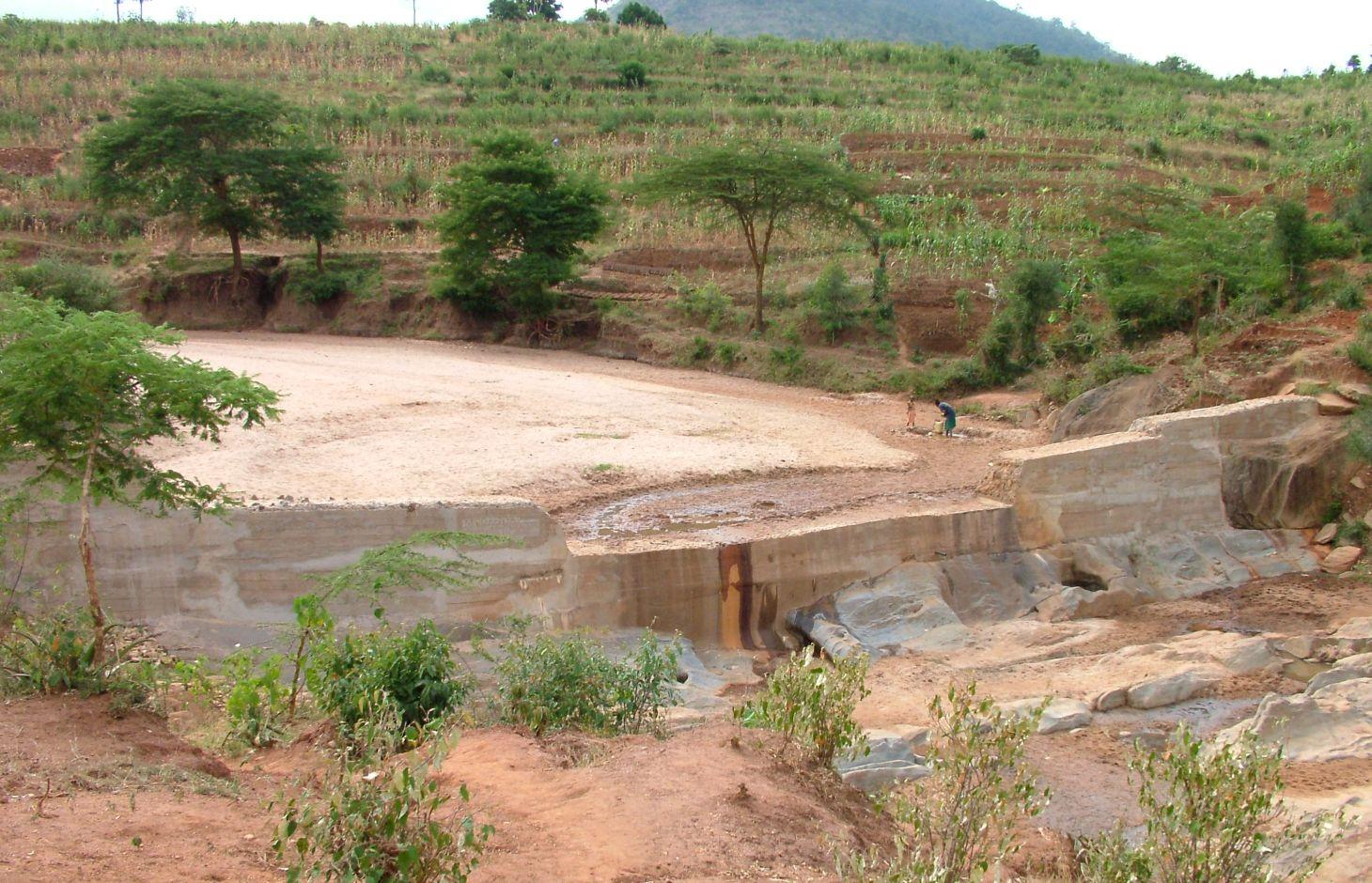
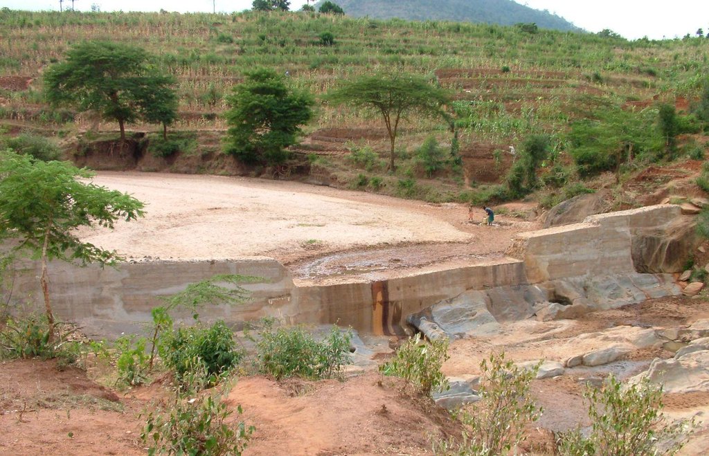
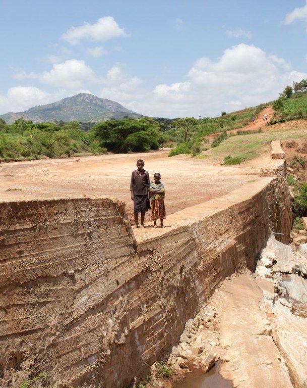
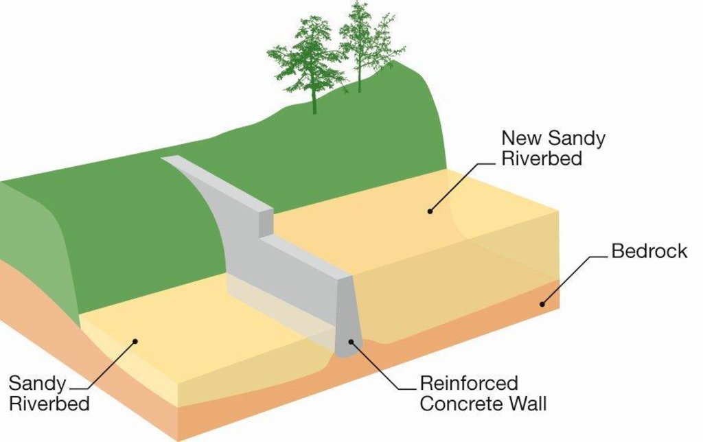
A sand dam is a stone masonry barrier across a seasonal sandy riverbed that traps rainwater and sand flowing down the catchment.
2.2 การอธิบายแบบละเอียดของเทคโนโลยี
คำอธิบาย:
A sand dam is typically 1 - 5 metres high and 10-50 metres across. When it rains the dam captures soil laden water behind it – the sand in the water sinks to the bottom, whilst the silt remains suspended in the water. Eventually the dams fill with sand - sometimes after only one rainfall or over 1 – 3 seasons. 25 to 40% of the volume of the sand held is actually water. A mature sand dam can store millions of litres of water – refilling after each rainfall providing a year round supply to over 1,000 people.
Purpose of the Technology: Sand dams are a simple, low cost and low maintenance, replicable rainwater harvesting technology. They provide a clean, local water supply for domestic and farming use and are suited to arid and semi-arid areas of the world. It is a solution that is scaleable and has a broader application for use as a rural and game park road crossing to replace less effective culvert bridges.
Establishment / maintenance activities and inputs: Sand dams are the lowest cost form of rainwater harvesting and its robust nature and very low operational and maintenance costs make it particularly suited to remote and poorly served regions. A typical dam using 500 bags of cement would approx be 40 metres in length with a spillway 2 metres above the bedrock. The dam is constructed using stone masonry placed in timber formwork. Such a dam costs approximately USD 11,800 (in 2012 prices). This consists of materials (cement, steel reinforcement, timber, transport) and dam permit USD 8,800 (75%), project management including technical support from skilled local artisans and dam designers USD 2150 (18%) and finance and administration costs of implementing organisation USD 850 (7%). Local people freely contribute their labour to collect rock, sand and water, terrace and protect the immediate catchment and construct the dam. If this contribution was costed and included the cost of the dam would almost double. The maintenance and repair costs of the dam provided it has been well designed and constructed is negligible. Local users are responsible for the management and repair of the dam and its abstraction system. Where a hand pump is fitted, local users fund the repair and replacement of the pump as required. The purchase and repair of petrol powered water pumps which some groups use to irrigate adjacent land is the responsibility of the members of the local group.
Natural / human environment: Because the water is stored within the sand, evaporation losses are very low, the sand filters the water and water-vector diseases such as malaria are controlled. Sand dams provide significant environmental benefits such as aquifer recharge, increased downstream flows in the dry-season, rejuvenation of river ecologies and moderation of floods. As such, it contributes to ecosystem services and climate change adaption.
2.3 รูปภาพของเทคโนโลยี
2.5 ประเทศภูมิภาค หรือสถานที่ตั้งที่เทคโนโลยีได้นำไปใช้และได้รับการครอบคลุมโดยการประเมินนี้
ประเทศ:
เคนยา
ภูมิภาค/รัฐ/จังหวัด:
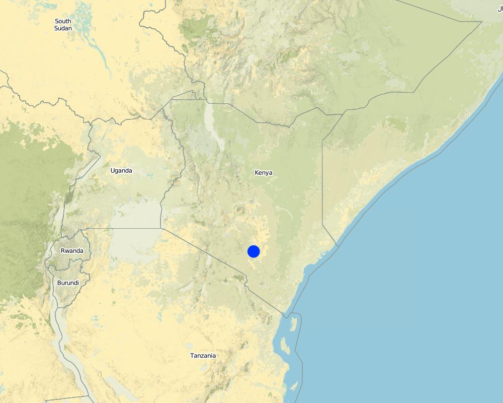
Machakos, Kitui and Makueni Counties
ข้อมูลจำเพาะเพิ่มเติมของสถานที่ตั้ง :
Eastern Province, Kenya
แสดงความคิดเห็น:
Boundary points of the Technology area: An approx. triangular area bordered by Machakos, Kitui and Mitio Andei.
Map
×2.6 วันที่การดำเนินการ
ถ้าไม่รู้ปีที่แน่นอน ให้ระบุวันที่โดยประมาณ:
- 10-50 ปี
2.7 คำแนะนำของเทคโนโลยี
ให้ระบุว่าเทคโนโลยีถูกแนะนำเข้ามาอย่างไร:
- ทางโครงการหรือจากภายนอก
ความคิดเห็น (ประเภทของโครงการ เป็นต้น) :
Sand dams are an ancient technology. Examples are found across the world's drylands although the greatest concentration is found in Kenya. They were introduced to Kenya in the 1950s from India. Dams were pioneered in Machakos and Makueni counties of Kenya by Joshua Mukusya, a visionary farmer and development worker, in 1978. He worked with a range of agencies to develop and implement the technology. In 1990, staff trained by Joshua set up SASOL to pioneer sand dams in the neighbouring county of Kitui. In 2002, Joshua teamed up with Simon Maddrell, Excellent Development's director, to establish Excellent Development Kenya, now Utooni Development Organisation (UDO) to scale up the work. Sadly, in 2011, Joshua passed away. In 2010, Excellent Development formed a strategic partnership with the Kenyan NGO, Africa Sand Dam Foundation (ASDF), to support the wider uptake beyond Kenya. Today, ASDF, SASOL and UDO are the three NGOs with the most experience of building successful sand dams, approx. 130 dams / year, although many other NGOs have adopted the technology.
3. การจัดประเภทของเทคโนโลยี SLM
3.1 วัตถุประสงค์หลักของเทคโนโลยี
- access to water
3.2 ประเภทของการใช้ที่ดินในปัจจุบันที่ได้นำเทคโนโลยีไปใช้

ทางน้ำ แหล่งน้ำ พื้นที่ชุ่มน้ำ
- ทางระบายน้ำ ทางน้ำ
- บ่อน้ำ เขื่อน
แสดงความคิดเห็น:
Major land use problems (compiler’s opinion): Drylands are characterised by intense and variable rainfall and a lack of vegetative cover. As a result, drylands are prone to droughts, flooding and soil erosion which result in endemic water and food scarcity.
Major land use problems (land users’ perception): “We used to fetch water from Londokwe; we could spend a night to collect water. One way was 3 to 10 km and up to 12 hours or more to go and come back [because of the time taken to queue]. If we could not make it to the river, we would send our children to fetch water. When they went fetching water that would mean they did not go to school. At times people would fight over fetching water from other people’s scoop holes. Scoop holes would be guarded in turns. The gourds [water containers] would be damaged and the water poured down. Children would not go to school [as they needed to] take care of the young ones as the parents went to fetch water. Children would fail to go to school because they were hungry – just because there was no water to cook."
Yikiuuku SHG
3.4 กลุ่ม SLM ที่ตรงกับเทคโนโลยีนี้
- การเก็บเกี่ยวน้ำ
3.5 กระจายตัวของเทคโนโลยี
ระบุการกระจายตัวของเทคโนโลยี:
- กระจายไปอย่างสม่ำเสมอในพื้นที่
ถ้าหากว่าเทคโนโลยีได้มีการกระจายออกไปอย่างสม่ำเสมอในพื้นที่ ให้ระบุปริมาณพื้นที่ที่ได้รับการครอบคลุมถึง:
- 1,000-10,000 ตร.กม.
แสดงความคิดเห็น:
Over 1000 dams have been built to date in these counties, predominantly by 3 organisations: Utooni Development organisation, SASOL and Africa Sand Dam Foundation in an approx. triangular area bordered by Machakos, Kitui and Mitio Andei.
3.6 มาตรการ SLM ที่ประกอบกันเป็นเทคโนโลยี

มาตรการอนุรักษ์ด้วยโครงสร้าง
- S3: Graded ditches, channels, waterways
- S5: เขื่อน ชั้นดินที่แน่นแข็งบ่อน้ำ
แสดงความคิดเห็น:
Main measures: structural measures
3.7 รูปแบบหลักของการเสื่อมโทรมของที่ดินที่ได้รับการแก้ไขโดยเทคโนโลยี

การเสื่อมโทรมของดินทางด้านชีวภาพ
- Bq (Quantity/biomass decline): การลดลงของปริมาณหรือมวลชีวภาพ
- Bs (Quality and species composition): องค์ประกอบหรือความหลากหลายทางคุณภาพและชนิดพันธุ์ลดลง

การเสื่อมโทรมของน้ำ
- Ha (Aridification): การเกิดความแห้งแล้ง
- Hs (Change in quantity of surface water): การเปลี่ยนแปลงปริมาณของน้ำที่ผิวดิน
- Hg (Change in groundwater): การเปลี่ยนแปลงของน้ำบาดาลหรือระดับน้ำในแอ่งน้ำบาดาล
แสดงความคิดเห็น:
Main type of degradation addressed: Hs: change in quantity of surface water
Secondary types of degradation addressed: Bq: quantity / biomass decline, Bs: quality and species composition /diversity decline, Ha: aridification, Hg: change in groundwater / aquifer level
Main causes of degradation: Heavy / extreme rainfall (intensity/amounts), droughts
3.8 การป้องกัน การลดลง หรือการฟื้นฟูความเสื่อมโทรมของที่ดิน
ระบุเป้าหมายของเทคโนโลยีกับความเสื่อมโทรมของที่ดิน:
- ป้องกันความเสื่อมโทรมของที่ดิน
- ลดความเสื่อมโทรมของดิน
4. ข้อมูลจำเพาะด้านเทคนิค กิจกรรมการนำไปปฏิบัติใช้ ปัจจัยนำเข้า และค่าใช้จ่าย
4.1 แบบแปลนทางเทคนิคของเทคโนโลยี
4.2 ข้อมูลจำเพาะด้านเทคนิคและการอธิบายแบบแปลนทางเทคนิค
Cross-section of sand dam
Technical knowledge required for field staff / advisors: moderate (The technical skills required to site, design and supervise construction. These skills have and can be developed locally.)
Technical knowledge required for land users: low (Knowledge of local rivers and their flood levels essential. Basic knowledge of stone masonry useful)
Main technical functions: control of concentrated runoff: retain / trap, water harvesting / increase water supply, improvement of water quality, buffering / filtering water
Secondary technical functions: increase of groundwater level / recharge of groundwater, sediment retention / trapping, sediment harvesting, increase of biomass (quantity), promotion of vegetation species and varieties (quality, eg palatable fodder)
Dam/ pan/ pond
Depth of ditches/pits/dams (m): 1-5
Width of ditches/pits/dams (m): 1-2
Length of ditches/pits/dams (m): 5-50
Specification of dams/ pans/ ponds: Capacity 5,000m3
Catchment area: 300 km2m2
4.3 ข้อมูลทั่วไปเกี่ยวกับการคำนวณปัจจัยนำเข้าและค่าใช้จ่าย
อื่นๆ หรือสกุลเงินประจำชาติ (ระบุ):
Kenyan Shilling
ระบุอัตราแลกเปลี่ยนจากดอลลาร์สหรัฐเป็นสกุลเงินท้องถิ่น (ถ้าเกี่ยวข้อง) คือ 1 เหรียญสหรัฐ =:
83.0
ระบุค่าเฉลี่ยของค่าจ้างในการจ้างแรงงานต่อวัน:
2.50
4.4 กิจกรรมเพื่อการจัดตั้ง
| กิจกรรม | ประเภทของมาตรการ | ช่วงเวลาดำเนินการ | |
|---|---|---|---|
| 1. | Collection of rock, sand and water | ด้วยโครงสร้าง | 1-3 months before construction |
| 2. | Construct dam | ด้วยโครงสร้าง | During dry season |
| 3. | Cure dam | ด้วยโครงสร้าง | For 4 weeks after construction |
| 4. | Terracing and protection of immediate catchment | ด้วยโครงสร้าง | 1-3 months before construction |
4.5 ค่าใช้จ่ายของปัจจัยนำเข้าที่จำเป็นสำหรับการจัดตั้ง
| ปัจจัยนำเข้า | หน่วย | ปริมาณ | ค่าใช้จ่ายต่อหน่วย | ค่าใช้จ่ายทั้งหมดต่อปัจจัยนำเข้า | %ของค่าใช้จ่ายที่ก่อให้เกิดขึ้นโดยผู้ใช้ที่ดิน | |
|---|---|---|---|---|---|---|
| แรงงาน | Collection of rock, sand and water | Persons/day | 220.0 | 2.5 | 550.0 | 100.0 |
| แรงงาน | Terracing and protection of immediate catchment | Persons/day | 100.0 | 2.5 | 250.0 | 100.0 |
| แรงงาน | Construct dam | Persons/day | 500.0 | 2.5 | 1250.0 | 90.0 |
| แรงงาน | Cure dam | Persons/day | 50.0 | 2.5 | 125.0 | 100.0 |
| อุปกรณ์ | Tools | per dam | 1.0 | 300.0 | 300.0 | |
| วัสดุสำหรับก่อสร้าง | Cement (bag = 50kg) | bags | 500.0 | 9.15 | 4575.0 | |
| วัสดุสำหรับก่อสร้าง | Steel (12m x Y20 steel bar) | pieces | 7.0 | 45.7 | 319.9 | |
| วัสดุสำหรับก่อสร้าง | Steel | per dam | 1.0 | 1000.0 | 1000.0 | |
| อื่น ๆ | Skilled labour | per dam | 1.0 | 3000.0 | 3000.0 | |
| ค่าใช้จ่ายทั้งหมดของการจัดตั้งเทคโนโลยี | 11369.9 | |||||
แสดงความคิดเห็น:
Duration of establishment phase: 6 month(s)
4.6 การบำรุงรักษาสภาพหรือกิจกรรมที่เกิดขึ้นเป็นประจำ
| กิจกรรม | ประเภทของมาตรการ | ช่วงระยะเวลา/ความถี่ | |
|---|---|---|---|
| 1. | Inspect and if necessary extend spillway or repair erosion around dam | ด้วยโครงสร้าง | As required / annually |
| 2. | Maintain hand pump if fitted | ด้วยโครงสร้าง | As required / annually |
4.7 ค่าใช้จ่ายของปัจจัยนำเข้าและกิจกรรมที่เกิดขึ้นเป็นประจำที่ต้องการการบำรุงรักษา (ต่อปี)
แสดงความคิดเห็น:
In 2012, in Machakos County, Kenya, the cost of materials and technical support for a dam using 250 bags of cement is USD 7,000 and USD 11,700 for a 500 bag dam. The costs in 2.6.1 are based on a 500 bag dam. The volume of a 500 bag dam is approx 140m3 of stone masonry of which 40% is mortar (sand and cement) and 60% is rock. Such a dam will typically be appropriate on rivers 30m wide and with a spillway 3 metres above the bedrock in the river bed level. Costs rise by up to 50% in more remote regions or countries. Sand dams require a lot of hard work. Community members collect the required stones, sand and water, support construction and terrace the land around the dam. If this in-kind contribution is included the costs would rise by 100%. In Kenya, with a long tradition of building sand dams, it takes from 6 to 12 weeks to plan and prepare for construction and 2 days to 2 weeks to build the dam. In other areas, with less experience and/or less community commitment, building a dam may take 6 months or more.
4.8 ปัจจัยสำคัญที่สุดที่มีผลกระทบต่อค่าใช้จ่าย
ปัจจัยสำคัญที่สุดที่มีผลกระทบต่อค่าใช้จ่ายต่างๆ:
Each dam is individually designed. The size, design and cost of a dam varies considerably with the size of the river and to a lesser extent, location and transport costs. Sand dams are the world’s lowest cost method of capturing rainwater in dry rural areas by a factor of 3 to 30 times compared to rain water harvesting tanks, earth dams, haffirs and rock catchments.
5. สิ่งแวดล้อมทางธรรมชาติและของมนุษย์
5.1 ภูมิอากาศ
ฝนประจำปี
- < 250 ม.ม.
- 251-500 ม.ม.
- 501-750 ม.ม.
- 751-1,000 ม.ม.
- 1,001-1,500 ม.ม.
- 1,501-2,000 ม.ม.
- 2,001-3,000 ม.ม.
- 3,001-4,000 ม.ม.
- > 4,000 ม.ม.
ข้อมูลจำเพาะ/ความคิดเห็นเรื่องปริมาณน้ำฝน:
Sand dams suit dryland climate: dry sub-humid, semi-arid and arid climates
เขตภูมิอากาศเกษตร
- กึ่งแห้งแล้ง
Thermal climate class: subtropics
5.2 สภาพภูมิประเทศ
ค่าเฉลี่ยความลาดชัน:
- ราบเรียบ (0-2%)
- ลาดที่ไม่ชัน (3-5%)
- ปานกลาง (6-10%)
- เป็นลูกคลื่น (11-15%)
- เป็นเนิน (16-30%)
- ชัน (31-60%)
- ชันมาก (>60%)
ธรณีสัณฐาน:
- ที่ราบสูง/ที่ราบ
- สันเขา
- ไหล่เขา
- ไหล่เนินเขา
- ตีนเนิน
- หุบเขา
ระดับความสูง:
- 0-100 เมตร
- 101-500 เมตร
- 501-1,000 เมตร
- 1,001-1,500 เมตร
- 1,501-2,000 เมตร
- 2,001-2,500 เมตร
- 2,501-3,000 เมตร
- 3,001-4,000 เมตร
- > 4,000 เมตร
ความคิดเห็นและข้อมูลจำเพาะเพิ่มเติมเรื่องสภาพภูมิประเทศ:
Land forms: Sand dams only suit seasonal rivers with sufficient sandy sediment and an accessible bedrock
Altitudinal zone: Also 1,001-1,500 m a.s.l.
Slopes on average: Also moderate
5.3 ดิน
(ถ้ามี) ให้แนบคำอธิบายเรื่องดินแบบเต็มหรือระบุข้อมูลที่มีอยู่ เช่น ชนิดของดิน ค่า pH ของดินหรือความเป็นกรดของดิน ความสามารถในการแลกเปลี่ยนประจุบวก ไนโตรเจน ความเค็ม เป็นต้น:
Soil water storage capacity: The aquifer behind the dam must consist of sandy sediments with a high porosity and drainable porosity
5.4 ความเป็นประโยชน์และคุณภาพของน้ำ
ระดับน้ำใต้ดิน:
5-50 เมตร
น้ำไหลบ่าที่ผิวดิน:
เกินพอ
คุณภาพน้ำ (ที่ยังไม่ได้บำบัด):
เป็นน้ำเพื่อการดื่มที่ดี
ความคิดเห็นและข้อมูลจำเพาะเพิ่มเติมเรื่องคุณภาพและปริมาณน้ำ:
Availability of surface water: Sand dams only suit seasonal rivers
Water quality (untreated): Good drinking water because the sand filters the water. Water abstracted through an infiltration gallery has a high bacterialogical quality but water is often used for small scale irrigation and livestock watering.
5.5 ความหลากหลายทางชีวภาพ
ความหลากหลายทางชนิดพันธุ์:
- สูง
ความคิดเห็นและข้อมูลจำเพาะเพิ่มเติมของความหลากหลายทางชีวภาพ:
Sand dams rejuvenate riverine ecologies and increase local biodiversity
5.6 ลักษณะของผู้ใช้ที่ดินที่นำเทคโนโลยีไปปฏิบัติใช้
รายได้ที่มาจากนอกฟาร์ม:
- < 10% ของรายได้ทั้งหมด
ระดับของความมั่งคั่งโดยเปรียบเทียบ:
- จน
- พอมีพอกิน
เป็นรายบุคคล/ครัวเรือน:
- กลุ่ม/ชุมชน
เพศ:
- หญิง
ระบุลักษณะอื่นๆที่เกี่ยวข้องของผู้ใช้ที่ดิน:
Land users applying the Technology are mainly common / average land users
Difference in the involvement of women and men: The dams are built by members of registered self-help groups, typically 50 members / group and two-thirds women. The primary concerns of these groups tend to be food and water. Sand dams provide for people, livestock and crops. Water collection and farming are primarily undertaken by women in Kikamba culture and hence women have the greatest vested interest to imrpove food and water availability. Many men migrate away from the area in search of work.
Population density: 50-100 persons/km2
Annual population growth: 2% - 3%
Off-farm income specification: This varies considerably, but most self-help group members are subsistence farmers
5.7 พื้นที่เฉลี่ยของที่ดินที่เป็นเจ้าของหรือเช่าโดยผู้ใช้ที่ดินที่นำเทคโนโลยีไปปฏิบัติใช้
- < 0.5 เฮกตาร์
- 0.5-1 เฮกตาร์
- 1-2 เฮกตาร์
- 2-5 เฮกตาร์
- 5-15 เฮกตาร์
- 15-50 เฮกตาร์
- 50-100 เฮกตาร์
- 100-500 เฮกตาร์
- 500-1,000 เฮกตาร์
- 1,000-10,000 เฮกตาร์
- >10,000 เฮกตาร์
พิจารณาว่าเป็นขนาดเล็ก กลาง หรือขนาดใหญ่ (ซึ่งอ้างอิงถึงบริบทระดับท้องถิ่น):
- ขนาดเล็ก
5.8 กรรมสิทธิ์ในที่ดิน สิทธิในการใช้ที่ดินและสิทธิในการใช้น้ำ
กรรมสิทธิ์ในที่ดิน:
- รัฐ
สิทธิในการใช้ที่ดิน:
- เกี่ยวกับชุมชน (ถูกจัดระเบียบ)
สิทธิในการใช้น้ำ:
- เกี่ยวกับชุมชน (ถูกจัดระเบียบ)
แสดงความคิดเห็น:
Legal agreements for construction and access between the self-help group and the owners of land adjacent to the dam and registering the dam and its associated water rights by the self-help group with the Kenyan Water Resources Management Authority (WRMA) is vital to safeguarding water rights, controlling water and sand abstraction, formalising the authority of the self-help group to levy water tarriffs if appropriate and ensuring there is open access to all to water from scoop holes.
5.9 การเข้าถึงบริการและโครงสร้างพื้นฐาน
สุขภาพ:
- จน
- ปานกลาง
- ดี
การศึกษา:
- จน
- ปานกลาง
- ดี
ความช่วยเหลือทางด้านเทคนิค:
- จน
- ปานกลาง
- ดี
การจ้างงาน (เช่น ภายนอกฟาร์ม):
- จน
- ปานกลาง
- ดี
ตลาด:
- จน
- ปานกลาง
- ดี
พลังงาน:
- จน
- ปานกลาง
- ดี
ถนนและการขนส่ง:
- จน
- ปานกลาง
- ดี
น้ำดื่มและการสุขาภิบาล:
- จน
- ปานกลาง
- ดี
บริการด้านการเงิน:
- จน
- ปานกลาง
- ดี
6. ผลกระทบและสรุปคำบอกกล่าว
6.1 ผลกระทบในพื้นที่ดำเนินการ (On-site) จากการใช้เทคโนโลยี
ผลกระทบทางด้านเศรษฐกิจและสังคม
การผลิต
การผลิตพืชผล
การผลิตพืชที่ใช้เลี้ยงปศุสัตว์
คุณภาพพืชที่ใช้เลี้ยงปศุสัตว์
การผลิตสัตว์
การผลิตไม้
การเสี่ยงต่อความล้มเหลวในการผลิต
ความหลากหลายของผลิตภัณฑ์
การผลิตพลังงาน
แสดงความคิดเห็น/ระบุ:
Tree planting enabled by dams increases fuel wood availability
ความเป็นประโยชน์และคุณภาพของน้ำ
การมีน้ำดื่มไว้ให้ใช้
การมีน้ำไว้ให้ปศุสัตว์
คุณภาพน้ำสำหรับปศุสัตว์
การมีน้ำไว้ให้สำหรับการชลประทาน
คุณภาพน้ำสำหรับการชลประทาน
รายได้และค่าใช้จ่าย
รายได้จากฟาร์ม
ความหลากหลายของแหล่งผลิตรายได้
ภาระงาน
แสดงความคิดเห็น/ระบุ:
Construction of sand dams is labour intensive. This is more than offset by the time savings created by reducing the time required to collect water.
ผลกระทบทางด้านเศรษฐกิจและสังคมอื่น ๆ
School attendance
ผลกระทบด้านสังคมวัฒนธรรมอื่น ๆ
ความมั่นคงด้านอาหาร / พึ่งตนเองได้
แสดงความคิดเห็น/ระบุ:
Sand dams are integrated within a wider programme that promotes food security and self sufficiency
สถานการณ์ด้านสุขภาพ
แสดงความคิดเห็น/ระบุ:
Reduced water borne disease. Increased access to higher quality water and improved food security improves health.
โอกาสทางวัฒนธรรม
แสดงความคิดเห็น/ระบุ:
Working through and strengthening self help groups builds on the local tradition of self-help called mwethya
สถาบันของชุมชน
แสดงความคิดเห็น/ระบุ:
Increases the capacity of self-help groups
SLM หรือความรู้เรื่องความเสื่อมโทรมของที่ดิน
แสดงความคิดเห็น/ระบุ:
Learning exchanges between self-help groups and demonstration plots builds knowledge and adoption of conservation farming
การบรรเทาความขัดแย้ง
แสดงความคิดเห็น/ระบุ:
If ownership and management of dam is not clear and legally protected this can result in conflict
Fuel security
แสดงความคิดเห็น/ระบุ:
Tree nursersies and agro-forestry enabled by sand dams improves access to fuel food
Livelihood and human well-being
แสดงความคิดเห็น/ระบุ:
Sand dams save farmers hours every day that they can invest in improving their farms to grow more food and create the potential for farmers to irrigate trees and crops, water livestock and generate an income. It is strongly advised that sand ams are integrated within a wider land management and livelihoods programme in order to realise these opportunities to the maximum. Community ownership and management is critical to achieving this
Livestock health
แสดงความคิดเห็น/ระบุ:
Sand dams provide secure water source for livestock
Income
แสดงความคิดเห็น/ระบุ:
Irrigated horticulture and tree nurseries improves farmer incomes
ผลกระทบด้านนิเวศวิทยา
วัฐจักรน้ำหรือน้ำบ่า
ปริมาณน้ำ
จำนวนก่อน SLM:
<1000m3
หลังจาก SLM:
2-10,000m3
คุณภาพน้ำ
แสดงความคิดเห็น/ระบุ:
Sand filters the water
การเก็บเกี่ยวหรือการกักเก็บน้ำ
แสดงความคิดเห็น/ระบุ:
Sand dams capture excess flood flows
น้ำไหลบ่าที่ผิวดิน
แสดงความคิดเห็น/ระบุ:
Terracing the immediate dam catchment reduces surface runoff
น้ำบาดาลหรือระดับน้ำในแอ่งน้ำบาดาล
แสดงความคิดเห็น/ระบุ:
Studies of Kitui dams found watertable increased by several metres
การระเหย
แสดงความคิดเห็น/ระบุ:
Once the water level in the dam aquifer is below 60cm, evaporation losses from the sand are negligible
ดิน
ความชื้นในดิน
แสดงความคิดเห็น/ระบุ:
Sand dams recharge the aquifer and raises the watertable above and below the dam
ความเค็ม
แสดงความคิดเห็น/ระบุ:
Salinity of sand dam water is often less than surrounding groundwater
ความหลากหลายทางชีวภาพของพืชและสัตว์
ความหลากหลายทางชีวภาพของพืช
แสดงความคิดเห็น/ระบุ:
Rejuvenation of riverine ecologies and planting indigenous trees increases diversity
ความหลากหลายของสัตว์
แสดงความคิดเห็น/ระบุ:
Riverine ecologies rejuvenated
ลดความเสี่ยงของภัยพิบัติ
ผลกระทบจากน้ำท่วม
แสดงความคิดเห็น/ระบุ:
By creating a buffer, flooding downstream of a dam or series of dams is reduced
การปล่อยคาร์บอนและก๊าซเรือนกระจก
แสดงความคิดเห็น/ระบุ:
Tree nursersies enabled by sand dams capture store carbon and reduce deforestation
6.2 ผลกระทบนอกพื้นที่ดำเนินการ (Off-site) จากการใช้เทคโนโลยี
น้ำที่ใช้ประโยชน์ได้
น้ำท่วมพื้นที่ท้ายน้ำ
ความสามารถต้านทานการเปลี่ยนแปลง / ความสามารถในการคัดกรอง
ความเสียหายต่อพื้นที่เพาะปลูกของเพื่อนบ้าน
ความเสียหายต่อโครงสร้างพื้นฐานของรัฐหรือของเอกชน
6.3 การเผชิญและความตอบสนองของเทคโนโลยีต่อการเปลี่ยนแปลงสภาพภูมิอากาศที่ค่อยเป็นค่อยไป และสภาพรุนแรงของภูมิอากาศ / ภัยพิบัติ (ที่รับรู้ได้โดยผู้ใช้ที่ดิน)
การเปลี่ยนแปลงสภาพภูมิอากาศที่ค่อยเป็นค่อยไป
การเปลี่ยนแปลงสภาพภูมิอากาศที่ค่อยเป็นค่อยไป
| ฤดู | ประเภทของการเปลี่ยนแปลงสภาพภูมิอากาศที่ค่อยเป็นค่อยไป และสภาพรุนแรงของภูมิอากาศ | เทคโนโลยีมีวิธีการรับมืออย่างไร | |
|---|---|---|---|
| อุณหภูมิประจำปี | เพิ่มขึ้น | ดี |
สภาพรุนแรงของภูมิอากาศ (ภัยพิบัติ)
ภัยพิบัติทางอุตุนิยมวิทยา
| เทคโนโลยีมีวิธีการรับมืออย่างไร | |
|---|---|
| พายุฝนประจำท้องถิ่น | ดี |
| พายุลมประจำท้องถิ่น | ดี |
ภัยพิบัติจากสภาพภูมิอากาศ
| เทคโนโลยีมีวิธีการรับมืออย่างไร | |
|---|---|
| ภัยจากฝนแล้ง | ดี |
ภัยพิบัติจากน้ำ
| เทคโนโลยีมีวิธีการรับมืออย่างไร | |
|---|---|
| น้ำท่วมตามปกติ (แม่น้ำ) | ดี |
ผลลัพธ์ตามมาที่เกี่ยวข้องกับภูมิอากาศอื่น ๆ
ผลลัพธ์ตามมาที่เกี่ยวข้องกับภูมิอากาศอื่น ๆ
| เทคโนโลยีมีวิธีการรับมืออย่างไร | |
|---|---|
| ช่วงการปลูกพืชที่ลดลงมา | ดี |
แสดงความคิดเห็น:
The capacity of the spillway would be increased to control peak flood events
6.4 การวิเคราะห์ค่าใช้จ่ายและผลประโยชน์ที่ได้รับ
ผลประโยชน์ที่ได้รับเปรียบเทียบกับค่าใช้จ่ายในการจัดตั้งเป็นอย่างไร (จากมุมมองของผู้ใช้ที่ดิน)
ผลตอบแทนระยะสั้น:
ด้านบวก
ผลตอบแทนระยะยาว:
ด้านบวกอย่างมาก
ผลประโยชน์ที่ได้รับเปรียบเทียบกับค่าใช้จ่ายในการบำรุงรักษาหรือต้นทุนที่เกิดขึ้นซ้ำอีก เป็นอย่างไร (จากมุมมองของผู้ใช้ที่ดิน)
ผลตอบแทนระยะสั้น:
ด้านบวกอย่างมาก
ผลตอบแทนระยะยาว:
ด้านบวกอย่างมาก
แสดงความคิดเห็น:
The very low cost of operating and maintaining sand dams means they are well suited to remote, poorly served regions. Because it is a low cost technology that requires a major community contribution and the knowledge and skills of locally trained artisans, it’s a solution particularly suited to community ownership and self-supply. This contributes to effective implementation.
6.5 การปรับตัวของเทคโนโลยี
จากทั้งหมดที่ได้รับเทคโนโลยีเข้ามามีจำนวนเท่าใดที่ทำแบบทันที โดยไม่ได้รับการจูงใจด้านวัสดุหรือการเงินใด ๆ:
- 0-10%
แสดงความคิดเห็น:
100% of land user families have adopted the Technology with external material support
Comments on acceptance with external material support: Sand dams require external material support including technical advice to correctly site, design and construct
There is a little trend towards spontaneous adoption of the Technology
Comments on adoption trend: There is some evidence of spontaneous adoption amongst development agencies working in regions suited to sand dams.
6.7 จุดแข็ง / ข้อได้เปรียบ / โอกาสของเทคโนโลยี
| จุดแข็ง / ข้อได้เปรียบ / โอกาสในทัศนคติของผู้ใช้ที่ดิน |
|---|
| “I will be able to rent a plot of land near to the sand dam and grow vegetables (tomatoes, peppers, and French beans). My animals will also be healthy because they will always be able to drink here, even during the droughts.” Mauwa Maingi, self-help group member, aged 87, 2010 |
|
Mbatha Mbuli, 83. "My family collects water from a near-by well, about ½ Km away, but the water is very salty. It takes one hour to collect water, and needs 6 trips to fetch enough to last the day. There is a pipeline nearby but we must pay 2 shillings per 20 litres. I planted 9 different crops last year, but only 2 survived. I wanted to work with Excellent on this project because I had heard that the projects you support help communities like us to build sand dams, grow trees and create seed banks. I would like to grow trees like Neem in the future and a sand dam here will really help with that. Excellent shares in the interests of the community and they listen to the community and take direction from us" |
| Stephen Hussey, Dabane Trust, 2011 “Dabane has made its name by getting water out of sand rivers – Our next step is to ensure we don’t over abstract – the answer to that, especially upstream, is sand dams. Without a doubt.” |
| Milka Mutunga, Kilili Catchment SHG, Kenya 2009-10 "The distance that I used to travel in order to fetch water has been reduced..now I am able to plant more vegetables close to my home. I have learnt how to dig terraces which have helped in increasing the yields that I harvest from my farm..If this is not development then I do not know what development means" |
| Kimanthi Ngovi, Yikiuuku SHG “The sand dams have done an incredible work for us – water availability at a shorter distance has helped me in saving time for other activities. When water was a long way away I had to get time to collect water in one day and dig terraces on the other day. Today I can fetch water and dig terraces on the same day.” |
| จุดแข็ง / ข้อได้เปรียบ / โอกาสในทัศนคติของผู้รวบรวมหรือวิทยากรหลัก |
|---|
|
Sand dams provide a safe, reliable, year round, local supply of water for people, crops and livestock in water scarce environments How can they be sustained / enhanced? The very low cost of operating and maintaining sand dams means they are well suited to remote, poorly served regions. Community ownership is critical to their effective management. |
|
Sand dams save farmers hours every day that they can invest in improving their farms to grow more food and create the potential for farmers to irrigate trees and crops, water livestock and generate an income How can they be sustained / enhanced? Don’t build a sand dam in isolation. An independent evaluation in 2010 of 2 sand dam programmes found the long term impacts on poverty, food security and incomes were greatest when sand dams were integrated within a wider community development programme aimed at improving food production, livestock management and land management practice. |
|
Because it is a low cost technology that requires a major community contribution and the knowledge and skills of locally trained artisans, it’s a solution particularly suited to community ownership and self-supply. This contributes to effective implementation. How can they be sustained / enhanced? Don’t short cut community ownership. Communities better understand and are able to implement solutions to their problems if they are central to the planning of the solution. Genuine community commitment and ownership from initial planning to on-going management is vital to realise the intended benefits and full potential created by a dam. Legal registration and agreements to safeguard community access and water rights help this. |
|
Sand dams provide significant environmental benefits such as aquifer recharge, increased downstream flows in the dry-season, rejuvenation of river ecologies and moderation of floods. As such, it contributes to eco-system services and climate change adaption. How can they be sustained / enhanced? Support terracing, tree planting and conservation farming in the wider catchment. This conserves soil and water on farms, increases aquifer recharge and base flows into the dam and reduces the amount of silt in the sand dam aquiver. Research and disseminate evidence of these benefits and the value of these eco-system services |
|
The technology is scaleable and has a broader application for use as a rural and game park road crossing to replace less effective culvert bridges. How can they be sustained / enhanced? In order to upscale this solution, there is a need for greater awareness and advocacy of the technology and its benefits amongst these groups. Nothing generates interest in sand dams more than exposure to successful examples |
6.8 จุดอ่อน / ข้อเสียเปรียบ / ความเสี่ยงของเทคโนโลยีและวิธีการแก้ไข
| จุดอ่อน / ข้อเสียเปรียบ / ความเสี่ยงในทัศนคติของผู้รวบรวมหรือวิทยากรหลัก | มีวิธีการแก้ไขได้อย่างไร |
|---|---|
| Although sand dams are technically replicable, their application in new contexts requires careful understanding and consideration. | Excellent Development has developed a framework tool to help agencies identify the political, economic, social, technical, legal and environmental factors that should be taken account of when introducing sand dams to a new context. |
| Sand dams require the technical knowledge and skills of local artisans in order to correctly site, design and construct them | The technical barriers to adoption are low: The technical skills required have and can be developed locally. Learning exchanges between implementing organisations and developing technical manuals and resources aids this learning |
| This is a drylands solution. Sand dams can only be built on seasonal rivers with sufficient sandy sediment and where the bedrock or impermeable layer is accessible in the river bed. | Increase awareness of the criteria that determine the technical suitability of a site. Use simple field tests, such as sediment seiving and probing, to assess potential sites and to map the potenial application of sand dams. |
7. การอ้างอิงและการเชื่อมต่อ
7.2 การอ้างอิงถึงสิ่งตีพิมพ์
หัวข้อ, ผู้เขียน, ปี, หมายเลข ISBN:
Be buffered website including Managing the Water Buffer for Development and Climate Change Adaptation. Groundwater recharge, retention, reuse and rainwater storage. Steenbergen F. van and A. Tuinhof. (2009) which includes sand dams
ชื่อเรื่อง ผู้เขียน ปี ISBN:
www.bebuffered.com/3rbook
ลิงก์และโมดูล
ขยายทั้งหมด ย่อทั้งหมดลิงก์
ไม่มีลิงก์
โมดูล
ไม่มีโมดูล


