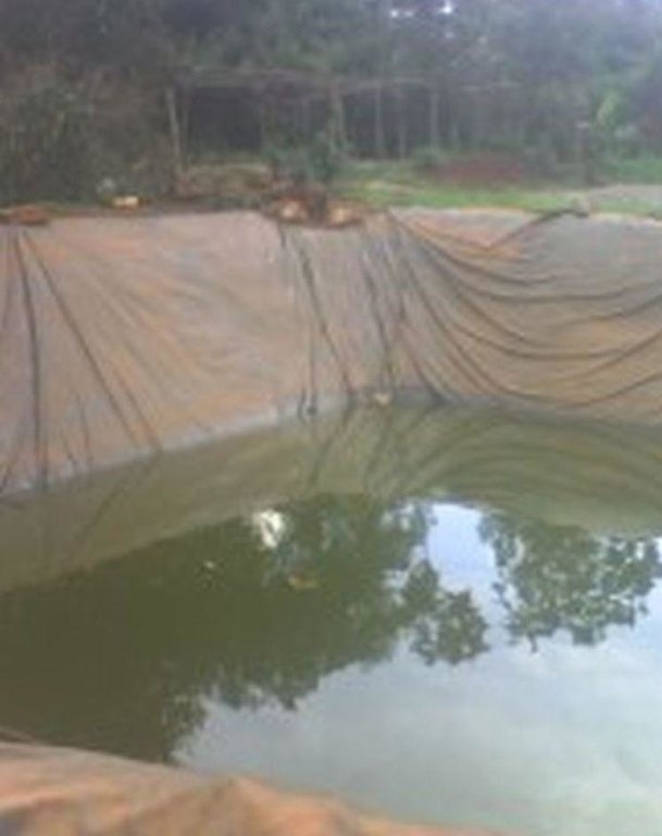
Lining geomembrane plastics for water harvesting and storage [รวันดา]
- ผู้สร้างสรรค์:
- การอัพเดท:
- ผู้รวบรวม: Iwona Piechowiak
- ผู้เรียบเรียง: –
- ผู้ตรวจสอบ: David Streiff, Alexandra Gavilano
Ibidamu
technologies_1551 - รวันดา
ดูส่วนย่อย
ขยายทั้งหมด ย่อทั้งหมด1. ข้อมูลทั่วไป
1.2 รายละเอียดที่ติดต่อได้ของผู้รวบรวมและองค์กรที่เกี่ยวข้องในการประเมินและการจัดเตรียมทำเอกสารของเทคโนโลยี
ผู้เชี่ยวชาญ SLM:
ผู้เชี่ยวชาญ SLM:
ผู้เชี่ยวชาญ SLM:
Muligirwa Emmanuel
FAO
รวันดา
ชื่อของโครงการซึ่งอำนวยความสะดวกในการทำเอกสารหรือการประเมินเทคโนโลยี (ถ้าเกี่ยวข้อง)
The Transboundary Agro-ecosystem Management Project for the Kagera River Basin (GEF-FAO / Kagera TAMP )ชื่อขององค์กรซึ่งอำนวยความสะดวกในการทำเอกสารหรือการประเมินเทคโนโลยี (ถ้าเกี่ยวข้อง)
Food and Agriculture Organization of the United Nations (FAO) - อิตาลีชื่อขององค์กรซึ่งอำนวยความสะดวกในการทำเอกสารหรือการประเมินเทคโนโลยี (ถ้าเกี่ยวข้อง)
Rwanda Agriculture Board (Rwanda Agriculture Board) - รวันดา1.3 เงื่อนไขการใช้ข้อมูลที่ได้บันทึกผ่านทาง WOCAT
ผู้รวบรวมและวิทยากรหลักยอมรับเงื่อนไขเกี่ยวกับการใช้ข้อมูลที่ถูกบันทึกผ่านทาง WOCAT:
ใช่
1.5 Reference to Questionnaire(s) on SLM Approaches (documented using WOCAT)
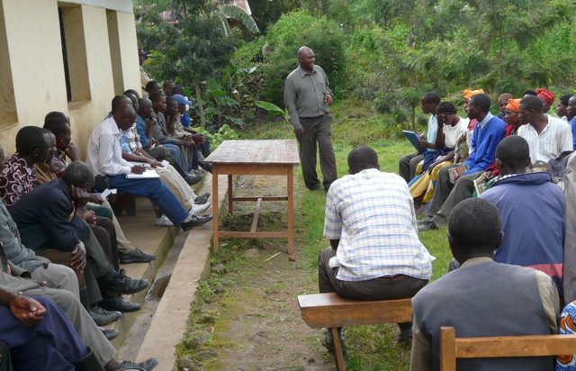
Participatory approach [รวันดา]
This approach is a contribution of different stakeholders and land users in the identification and resolution of a particular crop land problems, which implicate at the end different stage of intervention by all stakeholders to resolve the problem.
- ผู้รวบรวม: Desire Kagabo
2. การอธิบายลักษณะของเทคโนโลยี SLM
2.1 การอธิบายแบบสั้น ๆ ของเทคโนโลยี
คำจำกัดความของเทคโนโลยี:
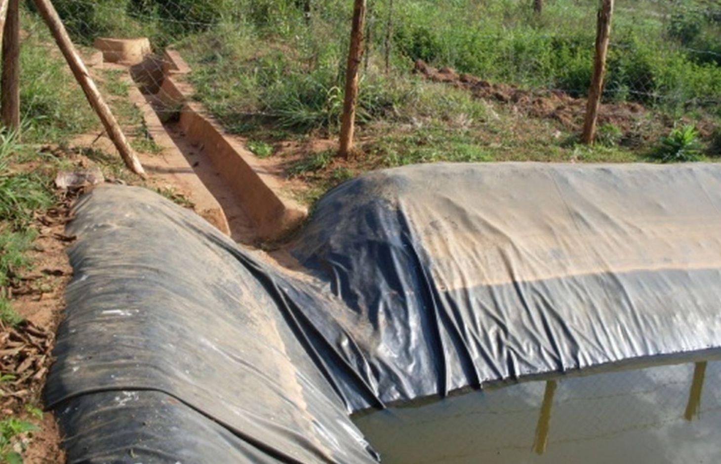
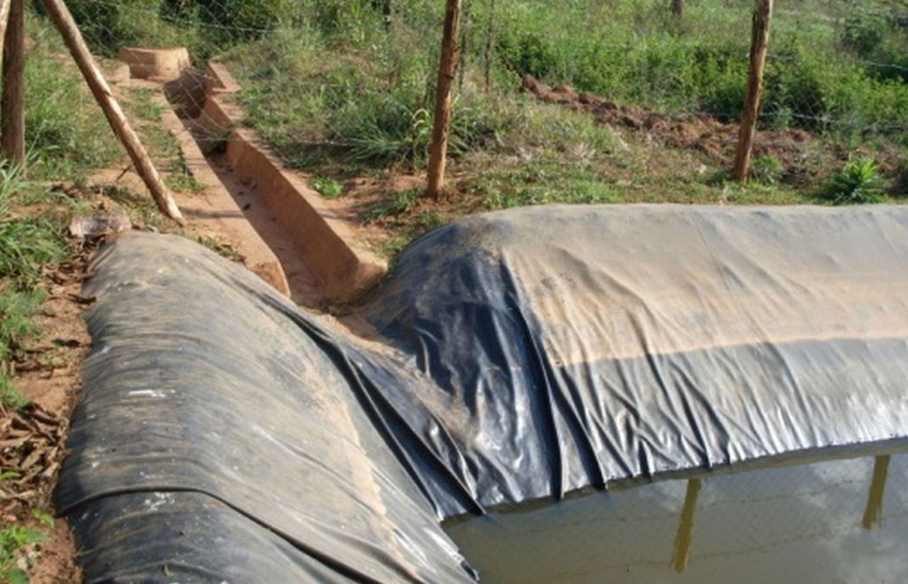
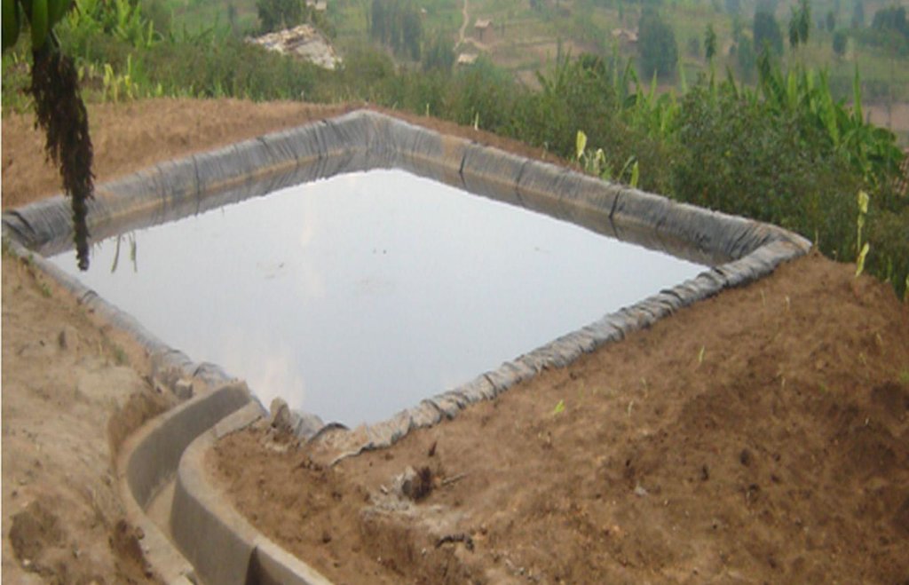
Lining geomembrane plastic for water harvesting and storage is a rainwater harvesting technique used by land users to collect rain water or runoff from a concave watershed to a common well-structured plastic-lined pond for agricultural, domestic and other use.
2.2 การอธิบายแบบละเอียดของเทคโนโลยี
คำอธิบาย:
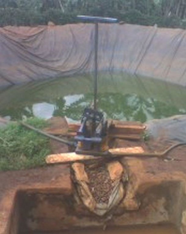
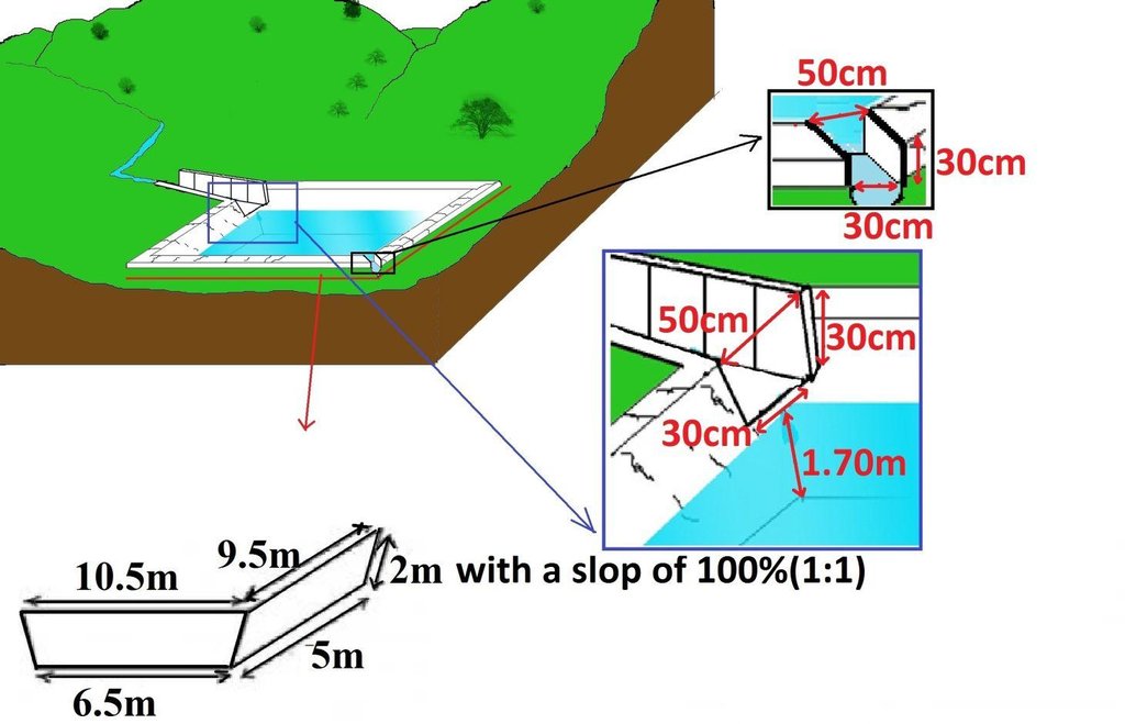
Rainwater harvesting initiatives were introduced in Rwanda in 2007, through a government-supported project on a pilot basis in three districts (Ruhango, Bugesera and Kirehe). By 2011, the technology had expanded at exponential rates such that the demand has exceeded the supply. Now the supply policy has shifted from government to private still there is a shortage of plastic lining. The typical design of each pond is trapezoidal in shape, measuring 10.5 by 9 meters top-width, 6.5 by 5 meters bottom width and 2 meters depth and a total storage volume about 120 m3. The plastic lining is factory–manufactured with standard shape and size to fit these dimensions. The ponds are made with this standard design to enable bulk purchase and supply of geo-membranes, to make use of economies of scale. The cost of the geo-membranes was subsidized by up to 100% by the government until 2010 but now only 20% are provided by the government. When this project was initiated, activities related to soil excavation was done by the government. However, with time the government pulled out and farmers are now covering the total cost of excavation and the government intervenes only for the technical compliance. The government provides technicians to train farmers on the safety and management of ponds. The volume of water harvested and stored in the ponds is on average 90 m3. However, water retention within the ponds over time differs with from farm to farm as affected by usage, evaporation and seepage losses. Treadle pumps are sometimes used to lift water by some of the farmers. Among most households, the water from the pond is used for domestic, livestock and supplemental irrigation, especially of horticultural crops. About 20% of the water is used for seedling and fruit production, 75% for livestock watering and 5% for domestic use. When the excavation of the pond is complete, the beds as well as sides of the pond have to be leveled and prepared for laying the lining plastic. Any rocks, large stones or other projections, which might damage the lining plastic, should be removed from the beds and sides of the excavated ponds.
Purpose of the Technology: Lining geomembrane plastic for water storage is designed to reduce seepage losses in ponds. This water is used by smallholder farmers to cope with the beginning of dry season and enhance crops to reach the maturity stage safely.
Establishment / maintenance activities and inputs: A periodical inspection is required for better life of the pond, thus timely maintenance hold the key of success for longer time. The maintenance includes inspection, repairing damages. Regular investigations are required on the pond sides, bottom, the inlet and the emergency outlet. In addition, the pond should be protected from intrusion of animals by constructing a fence around the pond. It is also important to remove aquatic vegetation, silt and sediment periodically that accumulate on the bottom of the pond.
2.3 รูปภาพของเทคโนโลยี
2.5 ประเทศภูมิภาค หรือสถานที่ตั้งที่เทคโนโลยีได้นำไปใช้และได้รับการครอบคลุมโดยการประเมินนี้
ประเทศ:
รวันดา
ภูมิภาค/รัฐ/จังหวัด:
Rwanda
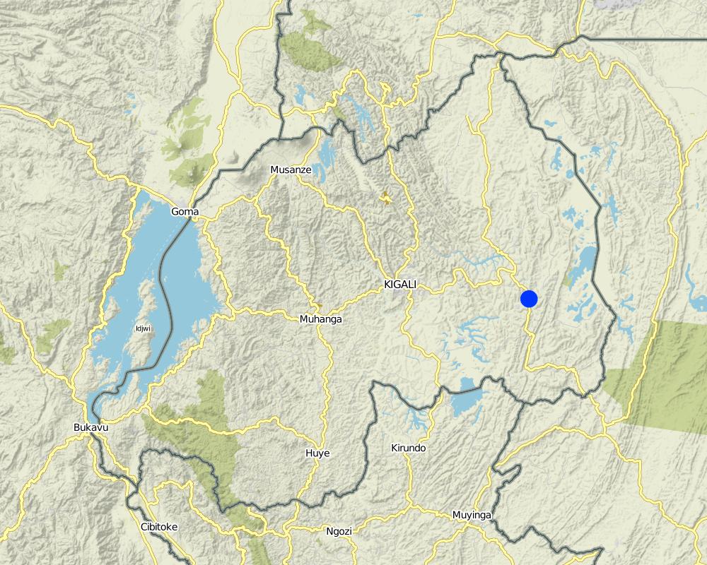
ข้อมูลจำเพาะเพิ่มเติมของสถานที่ตั้ง :
Kayonza District (East provice)
ระบุการกระจายตัวของเทคโนโลยี:
- กระจายไปอย่างสม่ำเสมอในพื้นที่
If precise area is not known, indicate approximate area covered:
- < 0.1 ตร.กม.(10 เฮกตาร์)
แสดงความคิดเห็น:
The area was estimated.
Map
×2.6 วันที่การดำเนินการ
ถ้าไม่รู้ปีที่แน่นอน ให้ระบุวันที่โดยประมาณ:
- น้อยกว่า 10 ปี (ไม่นานนี้)
2.7 คำแนะนำของเทคโนโลยี
- Government
ความคิดเห็น (ประเภทของโครงการ เป็นต้น) :
the technology was initiated in 2008
3. การจัดประเภทของเทคโนโลยี SLM
3.1 วัตถุประสงค์หลักของเทคโนโลยี
- access to water
3.2 ประเภทของการใช้ที่ดินในปัจจุบันที่ได้นำเทคโนโลยีไปใช้

พื้นที่ปลูกพืช
- การปลูกพืชล้มลุกอายุปีเดียว
Annual cropping - Specify crops:
- cereals - maize
- legumes and pulses - beans
- vegetables - other
ระบุ:
Longest growing period in days: 150; Longest growing period from month to month: September – February; Second longest growing period in days: 120; Second longest growing period from month to month: March – July
แสดงความคิดเห็น:
major cash crop: Vegetables
major food crop: Beans
other: Maize
Major land use problems (compiler’s opinion): There were poor yields of crops caused by elongation of dry season and increase of runoff soil erosion (intensive rain during rainy seasons) at the previous season.
Major land use problems (land users’ perception): Low crop production, soil erosion
Livestock is grazing on crop residues
3.4 การใช้น้ำ
การใช้น้ำของที่ดินที่มีการใช้เทคโนโลยีอยู่:
- น้ำฝนร่วมกับการชลประทาน
3.5 กลุ่ม SLM ที่ตรงกับเทคโนโลยีนี้
- การเก็บเกี่ยวน้ำ
3.6 มาตรการ SLM ที่ประกอบกันเป็นเทคโนโลยี

มาตรการอนุรักษ์ด้วยโครงสร้าง
- S5: เขื่อน ชั้นดินที่แน่นแข็งบ่อน้ำ
3.7 รูปแบบหลักของการเสื่อมโทรมของที่ดินที่ได้รับการแก้ไขโดยเทคโนโลยี

การกัดกร่อนของดินโดยน้ำ
- Wg (Gully erosion): การกัดกร่อนแบบร่องธารหรือการทำให้เกิดร่องน้ำเซาะ
- Wo (Offsite degradation): ผลกระทบนอกพื้นที่

การเสื่อมโทรมของน้ำ
- Ha (Aridification): การเกิดความแห้งแล้ง
แสดงความคิดเห็น:
Secondary types of degradation addressed: Ha: aridification
Main causes of degradation: deforestation / removal of natural vegetation (incl. forest fires), other natural causes (avalanches, volcanic eruptions, mud flows, highly susceptible natural resources, extreme topography, etc.) specify (Steep slopes in many cases over 60%), population pressure (Rwanda’s natural resource is subject to a high density of population with an average of 400 people per ha)
Secondary causes of degradation: overgrazing, urbanisation and infrastructure development, poverty / wealth (Farmers have low income and have less access to off farm income or remittances), education, access to knowledge and support services (High rate of irriteracy)
3.8 การป้องกัน การลดลง หรือการฟื้นฟูความเสื่อมโทรมของที่ดิน
ระบุเป้าหมายของเทคโนโลยีกับความเสื่อมโทรมของที่ดิน:
- ลดความเสื่อมโทรมของดิน
4. ข้อมูลจำเพาะด้านเทคนิค กิจกรรมการนำไปปฏิบัติใช้ ปัจจัยนำเข้า และค่าใช้จ่าย
4.1 แบบแปลนทางเทคนิคของเทคโนโลยี
ข้อมูลจำเพาะด้านเทคนิค (แบบแปลนทางเทคนิคของเทคโนโลยี):
Surface runoff water storage pond have got a reservoir of 10.5m x 9.5m at top and 6.5m x 5m at bottom and a depth of 2m with side slope of 1:1.5. The capacity of one pond is estimated about 120m3.
Location: Kabarondo. Kayonza/West/Rwanda
Date: 2013
Technical knowledge required for field staff / advisors: high (The technology need skilled engineers)
Technical knowledge required for land users: moderate (It need moderately skilled labor to construct the technology under supervision of engineers.)
Main technical functions: control of concentrated runoff: retain / trap, water harvesting / increase water supply
Secondary technical functions: water spreading
Dam/ pan/ pond
Vertical interval between structures (m): 2
Spacing between structures (m): 20
Depth of ditches/pits/dams (m): 2
Width of ditches/pits/dams (m): 9.5
Length of ditches/pits/dams (m): 10.5
Construction material (earth): the original land is digging
Construction material (stone): stones are used to concrete the pond inlet and outlet
Construction material (concrete): Cements, sand
Construction material (other): fencing wire and waterproof steering(plastic sheet)
Lateral gradient along the structure: 0%
Specification of dams/ pans/ ponds: Capacity 120m3
Catchment area: 6ham2
Beneficial area: valleym2
Slope of dam wall inside: 50%;
Slope of dam wall outside: 50%
Dimensions of spillways: 0.8m x0.6mm
For water harvesting: the ratio between the area where the harvested water is applied and the total area from which water is collected is: 1:0.25
ผู้เขียน:
Kagabo Desire and Ngenzi Guy, RAB, 5016 Kigali
4.2 ข้อมูลทั่วไปเกี่ยวกับการคำนวณปัจจัยนำเข้าและค่าใช้จ่าย
อื่นๆ หรือสกุลเงินประจำชาติ (ระบุ):
Rwandan francs
If relevant, indicate exchange rate from USD to local currency (e.g. 1 USD = 79.9 Brazilian Real): 1 USD =:
640.0
ระบุค่าเฉลี่ยของค่าจ้างในการจ้างแรงงานต่อวัน:
1000
4.3 กิจกรรมเพื่อการจัดตั้ง
| กิจกรรม | Timing (season) | |
|---|---|---|
| 1. | Surveying | any time |
| 2. | Buying materials | Any time after surveying |
| 3. | Construction of pond | Dry season |
4.4 ค่าใช้จ่ายของปัจจัยนำเข้าที่จำเป็นสำหรับการจัดตั้ง
| ปัจจัยนำเข้า | หน่วย | ปริมาณ | ค่าใช้จ่ายต่อหน่วย | ค่าใช้จ่ายทั้งหมดต่อปัจจัยนำเข้า | %ของค่าใช้จ่ายที่ก่อให้เกิดขึ้นโดยผู้ใช้ที่ดิน | |
|---|---|---|---|---|---|---|
| แรงงาน | Surveying | persons/day/ha | 4.0 | 45000.0 | 180000.0 | |
| แรงงาน | Construction of pond | persons/day/ha | 180.0 | 1000.0 | 180000.0 | 80.0 |
| อุปกรณ์ | Tools | pieces/ha | 100.0 | 3000.0 | 300000.0 | 20.0 |
| วัสดุสำหรับก่อสร้าง | Cements | kg | 300.0 | 200.0 | 60000.0 | |
| วัสดุสำหรับก่อสร้าง | Plastic sheet | m2 | 24.0 | 2500.0 | 60000.0 | |
| วัสดุสำหรับก่อสร้าง | Stone | m3 | 8.0 | 562.5 | 4500.0 | |
| วัสดุสำหรับก่อสร้าง | Sand | m3 | 8.0 | 390.625 | 3125.0 | |
| วัสดุสำหรับก่อสร้าง | Fencing wire | m2 | 24.0 | 625.0 | 15000.0 | |
| ค่าใช้จ่ายทั้งหมดของการจัดตั้งเทคโนโลยี | 802625.0 | |||||
| Total costs for establishment of the Technology in USD | 1254.1 | |||||
แสดงความคิดเห็น:
Duration of establishment phase: 2 month(s)
4.5 การบำรุงรักษาสภาพหรือกิจกรรมที่เกิดขึ้นเป็นประจำ
| กิจกรรม | ช่วงระยะเวลา/ความถี่ | |
|---|---|---|
| 1. | regular maintenance of Channels and all around the pond. | Rainy season |
4.6 ค่าใช้จ่ายของปัจจัยนำเข้าและกิจกรรมที่เกิดขึ้นเป็นประจำที่ต้องการการบำรุงรักษา (ต่อปี)
| ปัจจัยนำเข้า | หน่วย | ปริมาณ | ค่าใช้จ่ายต่อหน่วย | ค่าใช้จ่ายทั้งหมดต่อปัจจัยนำเข้า | %ของค่าใช้จ่ายที่ก่อให้เกิดขึ้นโดยผู้ใช้ที่ดิน | |
|---|---|---|---|---|---|---|
| แรงงาน | Regular maintenance | persons/day/ha | 10.0 | 1000.0 | 10000.0 | 100.0 |
| ค่าใช้จ่ายทั้งหมดของการบำรุงรักษาสภาพเทคโนโลยี | 10000.0 | |||||
| Total costs for maintenance of the Technology in USD | 15.63 | |||||
แสดงความคิดเห็น:
Machinery/ tools: hoes, meter, clinomrter, ect....
4.7 ปัจจัยสำคัญที่สุดที่มีผลกระทบต่อค่าใช้จ่าย
ปัจจัยสำคัญที่สุดที่มีผลกระทบต่อค่าใช้จ่ายต่างๆ:
The most factors that affects the cost is the construction materials and labor.
5. สิ่งแวดล้อมทางธรรมชาติและของมนุษย์
5.1 ภูมิอากาศ
ฝนประจำปี
- < 250 ม.ม.
- 251-500 ม.ม.
- 501-750 ม.ม.
- 751-1,000 ม.ม.
- 1,001-1,500 ม.ม.
- 1,501-2,000 ม.ม.
- 2,001-3,000 ม.ม.
- 3,001-4,000 ม.ม.
- > 4,000 ม.ม.
เขตภูมิอากาศเกษตร
- กึ่งชุ่มชื้น
Thermal climate class: tropics
5.2 สภาพภูมิประเทศ
ค่าเฉลี่ยความลาดชัน:
- ราบเรียบ (0-2%)
- ลาดที่ไม่ชัน (3-5%)
- ปานกลาง (6-10%)
- เป็นลูกคลื่น (11-15%)
- เป็นเนิน (16-30%)
- ชัน (31-60%)
- ชันมาก (>60%)
ธรณีสัณฐาน:
- ที่ราบสูง/ที่ราบ
- สันเขา
- ไหล่เขา
- ไหล่เนินเขา
- ตีนเนิน
- หุบเขา
ระดับความสูง:
- 0-100 เมตร
- 101-500 เมตร
- 501-1,000 เมตร
- 1,001-1,500 เมตร
- 1,501-2,000 เมตร
- 2,001-2,500 เมตร
- 2,501-3,000 เมตร
- 3,001-4,000 เมตร
- > 4,000 เมตร
5.3 ดิน
ค่าเฉลี่ยความลึกของดิน:
- ตื้นมาก (0-20 ซ.ม.)
- ตื้น (21-50 ซ.ม.)
- ลึกปานกลาง (51-80 ซ.ม.)
- ลึก (81-120 ซ.ม.)
- ลึกมาก (>120 ซ.ม.)
เนื้อดิน (ดินชั้นบน):
- ปานกลาง (ดินร่วน ทรายแป้ง)
- ละเอียด/หนัก (ดินเหนียว)
อินทรียวัตถุในดิน:
- สูง (>3%)
- ปานกลาง (1-3%)
(ถ้ามี) ให้แนบคำอธิบายเรื่องดินแบบเต็มหรือระบุข้อมูลที่มีอยู่ เช่น ชนิดของดิน ค่า pH ของดินหรือความเป็นกรดของดิน ความสามารถในการแลกเปลี่ยนประจุบวก ไนโตรเจน ความเค็ม เป็นต้น:
Soil fertility is medium - high
Soil drainage / infiltration is medium
Soil water storage capacity is very high - high
5.4 ความเป็นประโยชน์และคุณภาพของน้ำ
ระดับน้ำใต้ดิน:
5-50 เมตร
น้ำไหลบ่าที่ผิวดิน:
ดี
คุณภาพน้ำ (ที่ยังไม่ได้บำบัด):
เป็นน้ำใช้เพื่อการเกษตรเท่านั้น (การชลประทาน)
5.5 ความหลากหลายทางชีวภาพ
ความหลากหลายทางชนิดพันธุ์:
- ปานกลาง
5.6 ลักษณะของผู้ใช้ที่ดินที่นำเทคโนโลยีไปปฏิบัติใช้
แนวทางการตลาดของระบบการผลิต:
- ทำการค้า/การตลาด
รายได้ที่มาจากนอกฟาร์ม:
- < 10% ของรายได้ทั้งหมด
ระดับของความมั่งคั่งโดยเปรียบเทียบ:
- จน
- พอมีพอกิน
เป็นรายบุคคล/ครัวเรือน:
- เป็นรายบุคคล/ครัวเรือน
ระดับของการใช้เครื่องจักรกล:
- งานที่ใช้แรงกาย
เพศ:
- หญิง
- ชาย
ระบุลักษณะอื่นๆที่เกี่ยวข้องของผู้ใช้ที่ดิน:
Population density: 200-500 persons/km2
Annual population growth: 3% - 4%
55% of the land users are average wealthy and own 60% of the land.
45% of the land users are poor and own 40% of the land.
Market orientation of production system: (Begetables)
5.7 Average area of land used by land users applying the Technology
- < 0.5 เฮกตาร์
- 0.5-1 เฮกตาร์
- 1-2 เฮกตาร์
- 2-5 เฮกตาร์
- 5-15 เฮกตาร์
- 15-50 เฮกตาร์
- 50-100 เฮกตาร์
- 100-500 เฮกตาร์
- 500-1,000 เฮกตาร์
- 1,000-10,000 เฮกตาร์
- >10,000 เฮกตาร์
พิจารณาว่าเป็นขนาดเล็ก กลาง หรือขนาดใหญ่ (ซึ่งอ้างอิงถึงบริบทระดับท้องถิ่น):
- ขนาดเล็ก
5.8 กรรมสิทธิ์ในที่ดิน สิทธิในการใช้ที่ดินและสิทธิในการใช้น้ำ
กรรมสิทธิ์ในที่ดิน:
- รายบุคคล ได้รับสิทธิครอบครอง
สิทธิในการใช้ที่ดิน:
- รายบุคคล
สิทธิในการใช้น้ำ:
- เข้าถึงได้แบบเปิด (ไม่ได้จัดระเบียบ)
- เกี่ยวกับชุมชน (ถูกจัดระเบียบ)
5.9 การเข้าถึงบริการและโครงสร้างพื้นฐาน
สุขภาพ:
- จน
- ปานกลาง
- ดี
การศึกษา:
- จน
- ปานกลาง
- ดี
ความช่วยเหลือทางด้านเทคนิค:
- จน
- ปานกลาง
- ดี
การจ้างงาน (เช่น ภายนอกฟาร์ม):
- จน
- ปานกลาง
- ดี
ตลาด:
- จน
- ปานกลาง
- ดี
พลังงาน:
- จน
- ปานกลาง
- ดี
ถนนและการขนส่ง:
- จน
- ปานกลาง
- ดี
น้ำดื่มและการสุขาภิบาล:
- จน
- ปานกลาง
- ดี
บริการด้านการเงิน:
- จน
- ปานกลาง
- ดี
6. ผลกระทบและสรุปคำบอกกล่าว
6.1 ผลกระทบในพื้นที่ดำเนินการ (On-site) จากการใช้เทคโนโลยี
ผลกระทบทางด้านเศรษฐกิจและสังคม
การผลิต
การผลิตพืชผล
จำนวนก่อน SLM:
200 kg
หลังจาก SLM:
800 kg
การเสี่ยงต่อความล้มเหลวในการผลิต
จำนวนก่อน SLM:
50%
หลังจาก SLM:
10%
รายได้และค่าใช้จ่าย
รายได้จากฟาร์ม
จำนวนก่อน SLM:
40%
หลังจาก SLM:
80%
แสดงความคิดเห็น/ระบุ:
40% of income increases due to increase of agriculture
ผลกระทบด้านสังคมวัฒนธรรมอื่น ๆ
ความมั่นคงด้านอาหาร / พึ่งตนเองได้
สถานการณ์ด้านสุขภาพ
แสดงความคิดเห็น/ระบุ:
The technology improved the productivity so that farmers had means to take health insurance
SLM หรือความรู้เรื่องความเสื่อมโทรมของที่ดิน
แสดงความคิดเห็น/ระบุ:
Increases up to 15%
livelihood and human well-being
แสดงความคิดเห็น/ระบุ:
It has increased income of household hence enhance life.
ผลกระทบด้านนิเวศวิทยา
วัฐจักรน้ำหรือน้ำบ่า
การเก็บเกี่ยวหรือการกักเก็บน้ำ
แสดงความคิดเห็น/ระบุ:
60% improved
ดิน
การสูญเสียดิน
ความหลากหลายทางชีวภาพของพืชและสัตว์
การจัดการศัตรูพืชและโรคพืช
จำนวนก่อน SLM:
20%
หลังจาก SLM:
50%
แสดงความคิดเห็น/ระบุ:
It increases the predominance of mosquito
6.2 ผลกระทบนอกพื้นที่ดำเนินการ (Off-site) จากการใช้เทคโนโลยี
การทับถมของดินตะกอนพื้นที่ท้ายน้ำ
6.3 การเผชิญและความตอบสนองของเทคโนโลยีต่อการเปลี่ยนแปลงสภาพภูมิอากาศที่ค่อยเป็นค่อยไป และสภาพรุนแรงของภูมิอากาศ / ภัยพิบัติ (ที่รับรู้ได้โดยผู้ใช้ที่ดิน)
การเปลี่ยนแปลงสภาพภูมิอากาศที่ค่อยเป็นค่อยไป
การเปลี่ยนแปลงสภาพภูมิอากาศที่ค่อยเป็นค่อยไป
| ฤดู | increase or decrease | เทคโนโลยีมีวิธีการรับมืออย่างไร | |
|---|---|---|---|
| อุณหภูมิประจำปี | เพิ่มขึ้น | ดี |
สภาพรุนแรงของภูมิอากาศ (ภัยพิบัติ)
ภัยพิบัติทางอุตุนิยมวิทยา
| เทคโนโลยีมีวิธีการรับมืออย่างไร | |
|---|---|
| พายุฝนประจำท้องถิ่น | ไม่ค่อยดี |
| พายุลมประจำท้องถิ่น | ไม่ทราบ |
ภัยพิบัติจากสภาพภูมิอากาศ
| เทคโนโลยีมีวิธีการรับมืออย่างไร | |
|---|---|
| ภัยจากฝนแล้ง | ดี |
ภัยพิบัติจากน้ำ
| เทคโนโลยีมีวิธีการรับมืออย่างไร | |
|---|---|
| น้ำท่วมตามปกติ (แม่น้ำ) | ไม่ค่อยดี |
6.4 การวิเคราะห์ค่าใช้จ่ายและผลประโยชน์ที่ได้รับ
ผลประโยชน์ที่ได้รับเปรียบเทียบกับค่าใช้จ่ายในการจัดตั้งเป็นอย่างไร (จากมุมมองของผู้ใช้ที่ดิน)
ผลตอบแทนระยะสั้น:
เป็นกลางหรือสมดุล
ผลตอบแทนระยะยาว:
ด้านบวกอย่างมาก
ผลประโยชน์ที่ได้รับเปรียบเทียบกับค่าใช้จ่ายในการบำรุงรักษาหรือต้นทุนที่เกิดขึ้นซ้ำอีก เป็นอย่างไร (จากมุมมองของผู้ใช้ที่ดิน)
ผลตอบแทนระยะสั้น:
ด้านบวกเล็กน้อย
ผลตอบแทนระยะยาว:
ด้านบวกอย่างมาก
แสดงความคิดเห็น:
It require light labor during the maintenance activities
6.5 การปรับตัวของเทคโนโลยี
- > 50%
ถ้ามีข้อมูลให้บอกปริมาณด้วย (จำนวนของครัวเรือนหรือครอบคลุมพื้นที่):
260 household covering 90 percent of stated area
Of all those who have adopted the Technology, how many did so spontaneously, i.e. without receiving any material incentives/ payments?
- 0-10%
แสดงความคิดเห็น:
250 land user families have adopted the Technology with external material support
10 land user families have adopted the Technology without any external material support
There is a little trend towards spontaneous adoption of the Technology
6.7 จุดแข็ง / ข้อได้เปรียบ / โอกาสของเทคโนโลยี
| จุดแข็ง / ข้อได้เปรียบ / โอกาสในทัศนคติของผู้รวบรวมหรือวิทยากรหลัก |
|---|
|
Income generation How can they be sustained / enhanced? More financial support and trainings |
|
Improvement of production How can they be sustained / enhanced? To make a regular maintenance of ponds |
|
Soil erosion control How can they be sustained / enhanced? Divert more runoff to mitigate the soil erosion downstream and always clean the conveying channel. |
|
Impermeable material How can they be sustained / enhanced? Acquisition of high quality plastics that can last many years |
6.8 จุดอ่อน / ข้อเสียเปรียบ / ความเสี่ยงของเทคโนโลยีและวิธีการแก้ไข
| จุดอ่อน / ข้อเสียเปรียบ / ความเสี่ยงในทัศนคติของผู้รวบรวมหรือวิทยากรหลัก | มีวิธีการแก้ไขได้อย่างไร |
|---|---|
| Occasional accidents | To maintain fences around the pond and increase awareness about accidents around a pond, especially for parents (high risk for small kids) |
| Pond attract various insects and diseases (habitat for Mosquitoes) | Mosquito nets are needed |
7. การอ้างอิงและการเชื่อมต่อ
7.1 วิธีการและแหล่งข้อมูล
7.2 การอ้างอิงถึงสิ่งตีพิมพ์
หัวข้อ, ผู้เขียน, ปี, หมายเลข ISBN:
Kagera TAMP project website
ชื่อเรื่อง ผู้เขียน ปี ISBN:
http://www.fao.org/nr/kagera/en/
ลิงก์และโมดูล
ขยายทั้งหมด ย่อทั้งหมดลิงก์

Participatory approach [รวันดา]
This approach is a contribution of different stakeholders and land users in the identification and resolution of a particular crop land problems, which implicate at the end different stage of intervention by all stakeholders to resolve the problem.
- ผู้รวบรวม: Desire Kagabo
โมดูล
ไม่มีโมดูล


