Agroforestry in arid alpine zone above 3300 m asl [ทาจิกิสถาน]
- ผู้สร้างสรรค์:
- การอัพเดท:
- ผู้รวบรวม: Gulniso Nekushoeva
- ผู้เรียบเรียง: –
- ผู้ตรวจสอบ: David Streiff, Alexandra Gavilano
technologies_1056 - ทาจิกิสถาน
ดูส่วนย่อย
ขยายทั้งหมด ย่อทั้งหมด1. ข้อมูลทั่วไป
1.2 รายละเอียดที่ติดต่อได้ของผู้รวบรวมและองค์กรที่เกี่ยวข้องในการประเมินและการจัดเตรียมทำเอกสารของเทคโนโลยี
ผู้เชี่ยวชาญ SLM:
ชื่อขององค์กรซึ่งอำนวยความสะดวกในการทำเอกสารหรือการประเมินเทคโนโลยี (ถ้าเกี่ยวข้อง)
Tajik Soil Insitute (Tajik Soil Institute) - ทาจิกิสถานชื่อขององค์กรซึ่งอำนวยความสะดวกในการทำเอกสารหรือการประเมินเทคโนโลยี (ถ้าเกี่ยวข้อง)
Tajik Academy of Agricultural Sciences (Tajik Academy of Agricultural Sciences) - ทาจิกิสถาน1.3 เงื่อนไขการใช้ข้อมูลที่ได้บันทึกผ่านทาง WOCAT
ผู้รวบรวมและวิทยากรหลักยอมรับเงื่อนไขเกี่ยวกับการใช้ข้อมูลที่ถูกบันทึกผ่านทาง WOCAT:
ใช่
2. การอธิบายลักษณะของเทคโนโลยี SLM
2.1 การอธิบายแบบสั้น ๆ ของเทคโนโลยี
คำจำกัดความของเทคโนโลยี:
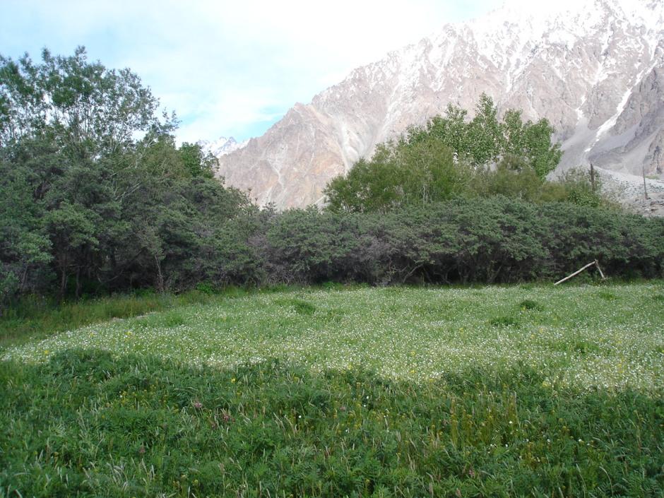
Cultivation of grain, potatoes and forage crops (esparzet) under the protection of windbreak live fence in the zone of risky agriculture (in the arid highlands traditional livestock zone of the Pamirs) above 3300m a.s.l
2.2 การอธิบายแบบละเอียดของเทคโนโลยี
คำอธิบาย:
Purpose of the Technology: Increase the possibility of subsistence grain, potatoes and fodder. Reduce the dependence of yield of sharp daily fluctuations of temperature, cold winds and frost
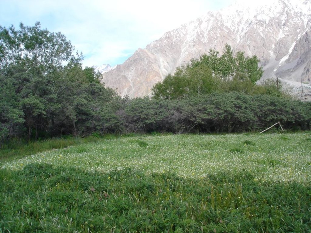
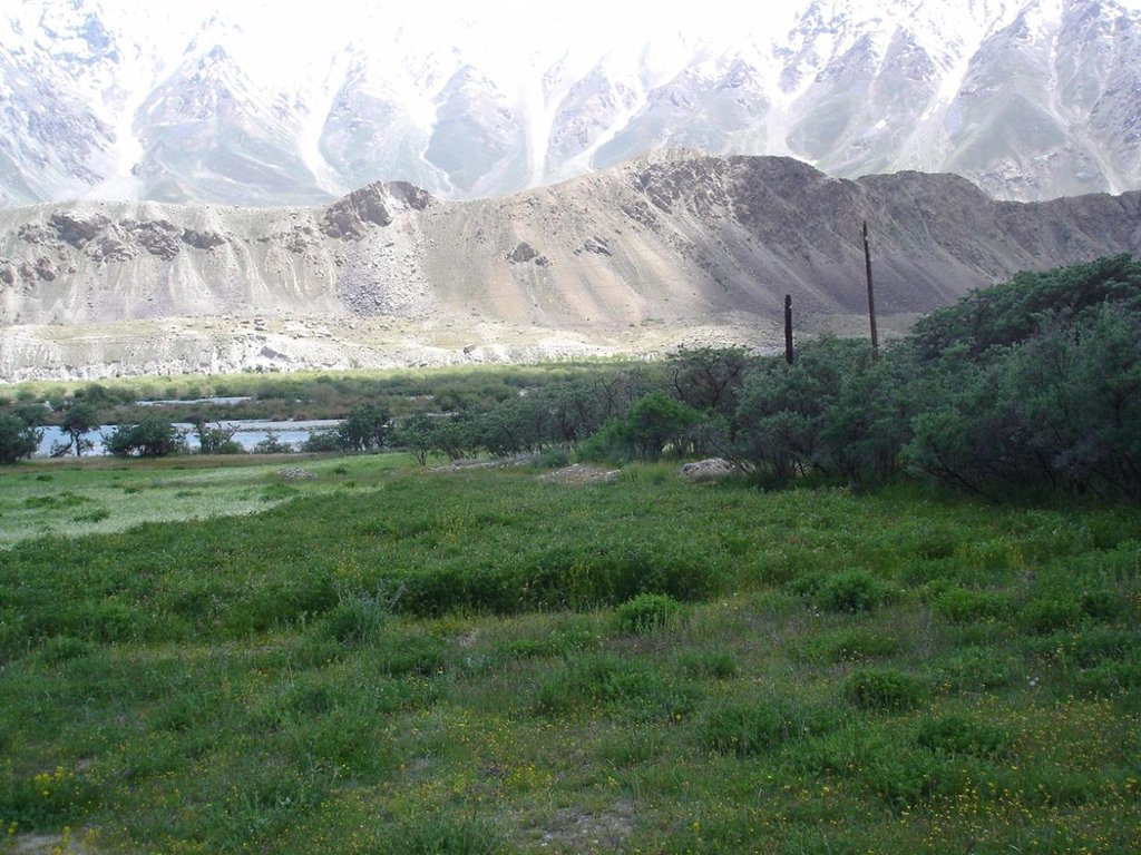
2.3 รูปภาพของเทคโนโลยี
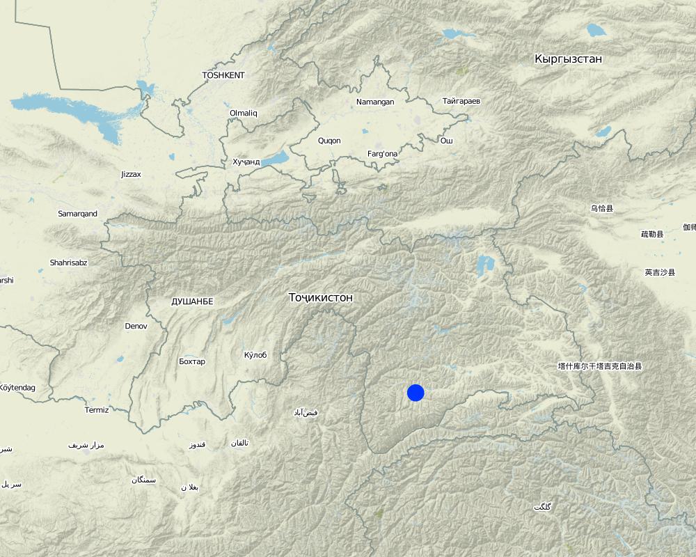
2.5 ประเทศภูมิภาค หรือสถานที่ตั้งที่เทคโนโลยีได้นำไปใช้และได้รับการครอบคลุมโดยการประเมินนี้
ประเทศ:
ทาจิกิสถาน
ภูมิภาค/รัฐ/จังหวัด:
Tajikistan/ GBAO
ข้อมูลจำเพาะเพิ่มเติมของสถานที่ตั้ง :
Shugnan/ Vankala, v.Bachor
ระบุการกระจายตัวของเทคโนโลยี:
- กระจายไปอย่างสม่ำเสมอในพื้นที่
If precise area is not known, indicate approximate area covered:
- < 0.1 ตร.กม.(10 เฮกตาร์)
แสดงความคิดเห็น:
Total area covered by the SLM Technology is 0.015 km2.
farmer's land is composed of several disparate fields, rather than one large area
Map
×2.6 วันที่การดำเนินการ
ถ้าไม่รู้ปีที่แน่นอน ให้ระบุวันที่โดยประมาณ:
- น้อยกว่า 10 ปี (ไม่นานนี้)
2.7 คำแนะนำของเทคโนโลยี
ให้ระบุว่าเทคโนโลยีถูกแนะนำเข้ามาอย่างไร:
- ด้วยการริเริ่มของผู้ใช้ที่ดินเอง
ความคิดเห็น (ประเภทของโครงการ เป็นต้น) :
sowing of cereals and potatoes in a frame of trees had started 18 years ago, and sowing esparzet on third part of their land began in 2008, seeing in the center of Jamoat Vankala esparzet that have been produced through MSDSP, swapped seeds and planted
3. การจัดประเภทของเทคโนโลยี SLM
3.1 วัตถุประสงค์หลักของเทคโนโลยี
- ปรับปรุงการผลิตให้ดีขึ้น
3.2 ประเภทของการใช้ที่ดินในปัจจุบันที่ได้นำเทคโนโลยีไปใช้
Land use mixed within the same land unit:
ใช่
Specify mixed land use (crops/ grazing/ trees):
- วนเกษตร (Agroforestry)

พื้นที่ปลูกพืช
- การปลูกพืชล้มลุกอายุปีเดียว
- การปลูกพืชยืนต้นที่ไม่มีเนื้อไม้
- การปลูกไม้ยืนต้น ไม้พุ่ม
- sea buckthorn
จำนวนของฤดูเพาะปลูกต่อปี:
- 1
ระบุ:
Longest growing period in days: 90Longest growing period from month to month: June-August
แสดงความคิดเห็น:
Major land use problems (compiler’s opinion): low natural fertility of the stony shallow soils, short growing season, the zone of risky agriculture, farming is not possible without irrigation, despite the low temperatures
Major land use problems (land users’ perception): low temperatures at night in growing period , often leading to freezing of potato and grain maturation ..
Future (final) land use (after implementation of SLM Technology): Mixed: Mf: Agroforestry
3.3 Has land use changed due to the implementation of the Technology?

ทุ่งหญ้าเลี้ยงสัตว์
แสดงความคิดเห็น:
Grazing land: Ge: Extensive grazing land
3.4 การใช้น้ำ
การใช้น้ำของที่ดินที่มีการใช้เทคโนโลยีอยู่:
- การชลประทานแบบเต็มรูปแบบ
3.5 กลุ่ม SLM ที่ตรงกับเทคโนโลยีนี้
- การปลูกป่าร่วมกับพืช
- แนวกันลมหรือแนวต้านลม
3.6 มาตรการ SLM ที่ประกอบกันเป็นเทคโนโลยี

มาตรการจัดการพืช
- A1: พืช/สิ่งปกคลุมดิน

มาตรการอนุรักษ์ด้วยวิธีพืช
- V1: ต้นไม้และพุ่มไม้คลุมดิน

มาตรการอนุรักษ์ด้วยโครงสร้าง
- S3: Graded ditches, channels, waterways

มาตรการอนุรักษ์ด้วยการจัดการ
- M1: การเปลี่ยนรูปแบบของการใช้ประโยชน์ที่ดิน
แสดงความคิดเห็น:
Main measures: agronomic measures, vegetative measures, structural measures, management measures
Type of agronomic measures: better crop cover, cover cropping, manure / compost / residues, furrows (drainage, irrigation)
Type of vegetative measures: aligned: -against wind, aligned: -along boundary
3.7 รูปแบบหลักของการเสื่อมโทรมของที่ดินที่ได้รับการแก้ไขโดยเทคโนโลยี

การเสื่อมโทรมของดินทางด้านเคมี
- Cn (Fertility decline): ความอุดมสมบูรณ์และปริมาณอินทรียวัตถุในดินถูกทำให้ลดลงไป (ไม่ได้เกิดจากสาเหตุการกัดกร่อน)

การเสื่อมโทรมของดินทางด้านชีวภาพ
- Bc (Reduction of vegetation cover): การลดลงของจำนวนพืชที่ปกคลุมดิน
- Bq (Quantity/biomass decline): การลดลงของปริมาณหรือมวลชีวภาพ

การเสื่อมโทรมของน้ำ
- Ha (Aridification): การเกิดความแห้งแล้ง
แสดงความคิดเห็น:
Main type of degradation addressed: Bc: reduction of vegetation cover, Bq: quantity / biomass decline
Secondary types of degradation addressed: Cn: fertility decline and reduced organic matter content, Ha: aridification
Main causes of degradation: deforestation / removal of natural vegetation (incl. forest fires) (lack of electricity and a long winter forced people to cut most of trees), over-exploitation of vegetation for domestic use (food unsecurity), overgrazing (because of the inability to sent livestock to remote pastures in Murgab), change in temperature (frequent frosts in the vegetation season lead to the eradication (t° variability)), population pressure (Because of need for subsistence there is intense pressure on arable land), poverty / wealth (Basically, all people are poor)
Secondary causes of degradation: soil management (The need for subsistence from 92th forced people to do farming), droughts (High aridity, minimum precipitation. forced to irrigate), labour availability (work is only in 1-9 classes school and on little ambulatory.), inputs and infrastructure: (roads, markets, distribution of water points, other, …) (complete isolation in winter, bad roads, no access to the market), education, access to knowledge and support services (There is a school until 9 class), war and conflicts (after the crisis of the 90s and the civil war forced to subsistence)
3.8 การป้องกัน การลดลง หรือการฟื้นฟูความเสื่อมโทรมของที่ดิน
ระบุเป้าหมายของเทคโนโลยีกับความเสื่อมโทรมของที่ดิน:
- ลดความเสื่อมโทรมของดิน
แสดงความคิดเห็น:
Secondary goals: prevention of land degradation, rehabilitation / reclamation of denuded land
4. ข้อมูลจำเพาะด้านเทคนิค กิจกรรมการนำไปปฏิบัติใช้ ปัจจัยนำเข้า และค่าใช้จ่าย
4.1 แบบแปลนทางเทคนิคของเทคโนโลยี
ข้อมูลจำเพาะด้านเทคนิค (แบบแปลนทางเทคนิคของเทคโนโลยี):
echnical knowledge required for land users: moderate
Main technical functions: improvement of ground cover, improvement of surface structure (crusting, sealing), increase in organic matter, increase in nutrient availability (supply, recycling,…), reduction in wind speed, increase of biomass (quantity)
Secondary technical functions: increase of surface roughness, improvement of topsoil structure (compaction), stabilisation of soil (eg by tree roots against land slides), increase / maintain water stored in soil, water harvesting / increase water supply, promotion of vegetation species and varieties (quality, eg palatable fodder), spatial arrangement and diversification of land use
Better crop cover
Material/ species: barley
Quantity/ density: 200kg/ha
Manure / compost / residues
Material/ species: manure
Quantity/ density: 4t/ha
Furrows (drainage, irrigation)
Material/ species: irrigation canals net
Quantity/ density: 200/ha
Aligned: -against wind
Vegetative material: T : trees / shrubs
Spacing between rows / strips / blocks (m): 1
Vertical interval within rows / strips / blocks (m): 1
Aligned: -along boundary
Vegetative material: T : trees / shrubs
Waterway
Material: Earth
Trees/ shrubs species: T- sea buckthorn, in the begining - planted
Perennial crops species: C-esparzet on 1\3 of the field
Slope (which determines the spacing indicated above): 5-8%
ผู้เขียน:
Gulniso Nekushoeva, Dushanbe, Tajikistan
4.2 ข้อมูลทั่วไปเกี่ยวกับการคำนวณปัจจัยนำเข้าและค่าใช้จ่าย
อื่นๆ หรือสกุลเงินประจำชาติ (ระบุ):
Somoni
If relevant, indicate exchange rate from USD to local currency (e.g. 1 USD = 79.9 Brazilian Real): 1 USD =:
4.52
ระบุค่าเฉลี่ยของค่าจ้างในการจ้างแรงงานต่อวัน:
30
4.3 กิจกรรมเพื่อการจัดตั้ง
| กิจกรรม | Timing (season) | |
|---|---|---|
| 1. | Clean up the plot of the stones and shrubs | |
| 2. | plowing | |
| 3. | manuring | |
| 4. | Sowing of barley, rye | |
| 5. | Planting potatoes | |
| 6. | preparing sea-buckthorn seedlings | spring |
| 7. | bringing and putting manure in the holes | end of spring |
| 8. | manure | |
| 9. | planting seedlings along the irrigation canal | planting seedlings along the irrigation canal |
| 10. | irrigation of the seedlings |
4.4 ค่าใช้จ่ายของปัจจัยนำเข้าที่จำเป็นสำหรับการจัดตั้ง
| ปัจจัยนำเข้า | หน่วย | ปริมาณ | ค่าใช้จ่ายต่อหน่วย | ค่าใช้จ่ายทั้งหมดต่อปัจจัยนำเข้า | %ของค่าใช้จ่ายที่ก่อให้เกิดขึ้นโดยผู้ใช้ที่ดิน | |
|---|---|---|---|---|---|---|
| แรงงาน | Cleaning up the plot | Persons/day | 4.0 | 30.0 | 120.0 | 100.0 |
| แรงงาน | Plowing | Persons/day | 6.0 | 30.0 | 180.0 | 100.0 |
| แรงงาน | Manuring | Persons/day | 7.0 | 30.0 | 210.0 | 100.0 |
| แรงงาน | Preparing sea-buckthorn | Persons/day | 3.0 | 35.0 | 105.0 | 100.0 |
| วัสดุด้านพืช | Barley rye seeds | ha | 1.0 | 430.0 | 430.0 | 100.0 |
| วัสดุด้านพืช | Potatoe seeds | ha | 1.0 | 110.0 | 110.0 | 100.0 |
| ปุ๋ยและสารฆ่า/ยับยั้งการเจริญเติบโตของสิ่งมีชีวิต (ไบโอไซด์) | Manure | kg | 400.0 | 0.0625 | 25.0 | |
| อื่น ๆ | Labour: Bringing and putting manure in the holes | Persons/day | 2.0 | 35.0 | 70.0 | 100.0 |
| อื่น ๆ | Labour: Planting seedlings along the irrigation cana | Persons/day | 4.0 | 35.0 | 140.0 | 100.0 |
| อื่น ๆ | Labour: Irrigation of the seedlings | Persons/day | 1.0 | 35.0 | 35.0 | 100.0 |
| ค่าใช้จ่ายทั้งหมดของการจัดตั้งเทคโนโลยี | 1425.0 | |||||
| Total costs for establishment of the Technology in USD | 315.27 | |||||
4.5 การบำรุงรักษาสภาพหรือกิจกรรมที่เกิดขึ้นเป็นประจำ
| กิจกรรม | ช่วงระยะเวลา/ความถี่ | |
|---|---|---|
| 1. | irrigation of the crop fields | during growing/ |
| 2. | irrigation of potatoes field | during growing/ |
| 3. | weeding of potatoes field | during growing/2-3time |
| 4. | harvesting potatoes | september/every year |
| 5. | harvesting crops | september/every year |
| 6. | irrigation of bushes | |
| 7. | pruning and cutting the brunches | |
| 8. | mowing the natural grass |
4.6 ค่าใช้จ่ายของปัจจัยนำเข้าและกิจกรรมที่เกิดขึ้นเป็นประจำที่ต้องการการบำรุงรักษา (ต่อปี)
| ปัจจัยนำเข้า | หน่วย | ปริมาณ | ค่าใช้จ่ายต่อหน่วย | ค่าใช้จ่ายทั้งหมดต่อปัจจัยนำเข้า | %ของค่าใช้จ่ายที่ก่อให้เกิดขึ้นโดยผู้ใช้ที่ดิน | |
|---|---|---|---|---|---|---|
| แรงงาน | Weeding / harvesting of potatoes field | Persons/day | 4.0 | 30.0 | 120.0 | 100.0 |
| แรงงาน | Harvesting crops | Persons/day | 6.0 | 30.0 | 180.0 | 100.0 |
| ค่าใช้จ่ายทั้งหมดของการบำรุงรักษาสภาพเทคโนโลยี | 300.0 | |||||
| Total costs for maintenance of the Technology in USD | 66.37 | |||||
แสดงความคิดเห็น:
Machinery/ tools: shovel, shears,axe
5. สิ่งแวดล้อมทางธรรมชาติและของมนุษย์
5.2 สภาพภูมิประเทศ
ค่าเฉลี่ยความลาดชัน:
- ราบเรียบ (0-2%)
- ลาดที่ไม่ชัน (3-5%)
- ปานกลาง (6-10%)
- เป็นลูกคลื่น (11-15%)
- เป็นเนิน (16-30%)
- ชัน (31-60%)
- ชันมาก (>60%)
ธรณีสัณฐาน:
- ที่ราบสูง/ที่ราบ
- สันเขา
- ไหล่เขา
- ไหล่เนินเขา
- ตีนเนิน
- หุบเขา
ระดับความสูง:
- 0-100 เมตร
- 101-500 เมตร
- 501-1,000 เมตร
- 1,001-1,500 เมตร
- 1,501-2,000 เมตร
- 2,001-2,500 เมตร
- 2,501-3,000 เมตร
- 3,001-4,000 เมตร
- > 4,000 เมตร
ความคิดเห็นและข้อมูลจำเพาะเพิ่มเติมเรื่องสภาพภูมิประเทศ:
Altitudinal zone: 3300m
5.3 ดิน
ค่าเฉลี่ยความลึกของดิน:
- ตื้นมาก (0-20 ซ.ม.)
- ตื้น (21-50 ซ.ม.)
- ลึกปานกลาง (51-80 ซ.ม.)
- ลึก (81-120 ซ.ม.)
- ลึกมาก (>120 ซ.ม.)
(ถ้ามี) ให้แนบคำอธิบายเรื่องดินแบบเต็มหรือระบุข้อมูลที่มีอยู่ เช่น ชนิดของดิน ค่า pH ของดินหรือความเป็นกรดของดิน ความสามารถในการแลกเปลี่ยนประจุบวก ไนโตรเจน ความเค็ม เป็นต้น:
Soil drainage / infiltration is good
5.4 ความเป็นประโยชน์และคุณภาพของน้ำ
คุณภาพน้ำ (ที่ยังไม่ได้บำบัด):
เป็นน้ำเพื่อการดื่มที่ดี
5.5 ความหลากหลายทางชีวภาพ
ความหลากหลายทางชนิดพันธุ์:
- ปานกลาง
5.6 ลักษณะของผู้ใช้ที่ดินที่นำเทคโนโลยีไปปฏิบัติใช้
แนวทางการตลาดของระบบการผลิต:
- เพื่อการยังชีพ (หาเลี้ยงตนเอง)
ระดับของความมั่งคั่งโดยเปรียบเทียบ:
- จน
- พอมีพอกิน
เป็นรายบุคคล/ครัวเรือน:
- เป็นรายบุคคล/ครัวเรือน
ระดับของการใช้เครื่องจักรกล:
- งานที่ใช้แรงกาย
- การใช้กำลังจากสัตว์
เพศ:
- หญิง
- ชาย
ระบุลักษณะอื่นๆที่เกี่ยวข้องของผู้ใช้ที่ดิน:
Land users applying the Technology are mainly common / average land users
Population density: < 10 persons/km2
5.7 Average area of land used by land users applying the Technology
- < 0.5 เฮกตาร์
- 0.5-1 เฮกตาร์
- 1-2 เฮกตาร์
- 2-5 เฮกตาร์
- 5-15 เฮกตาร์
- 15-50 เฮกตาร์
- 50-100 เฮกตาร์
- 100-500 เฮกตาร์
- 500-1,000 เฮกตาร์
- 1,000-10,000 เฮกตาร์
- >10,000 เฮกตาร์
พิจารณาว่าเป็นขนาดเล็ก กลาง หรือขนาดใหญ่ (ซึ่งอ้างอิงถึงบริบทระดับท้องถิ่น):
- ขนาดเล็ก
5.8 กรรมสิทธิ์ในที่ดิน สิทธิในการใช้ที่ดินและสิทธิในการใช้น้ำ
กรรมสิทธิ์ในที่ดิน:
- รัฐ
สิทธิในการใช้ที่ดิน:
- เช่า
สิทธิในการใช้น้ำ:
- เข้าถึงได้แบบเปิด (ไม่ได้จัดระเบียบ)
5.9 การเข้าถึงบริการและโครงสร้างพื้นฐาน
สุขภาพ:
- จน
- ปานกลาง
- ดี
การศึกษา:
- จน
- ปานกลาง
- ดี
ความช่วยเหลือทางด้านเทคนิค:
- จน
- ปานกลาง
- ดี
การจ้างงาน (เช่น ภายนอกฟาร์ม):
- จน
- ปานกลาง
- ดี
ตลาด:
- จน
- ปานกลาง
- ดี
พลังงาน:
- จน
- ปานกลาง
- ดี
ถนนและการขนส่ง:
- จน
- ปานกลาง
- ดี
น้ำดื่มและการสุขาภิบาล:
- จน
- ปานกลาง
- ดี
บริการด้านการเงิน:
- จน
- ปานกลาง
- ดี
6. ผลกระทบและสรุปคำบอกกล่าว
6.1 ผลกระทบในพื้นที่ดำเนินการ (On-site) จากการใช้เทคโนโลยี
ผลกระทบทางด้านเศรษฐกิจและสังคม
การผลิต
การผลิตพืชผล
การผลิตพืชที่ใช้เลี้ยงปศุสัตว์
คุณภาพพืชที่ใช้เลี้ยงปศุสัตว์
การผลิตไม้
การเสี่ยงต่อความล้มเหลวในการผลิต
ความหลากหลายของผลิตภัณฑ์
พื้นที่สำหรับการผลิต
การผลิตพลังงาน
รายได้และค่าใช้จ่าย
รายได้จากฟาร์ม
ความหลากหลายของแหล่งผลิตรายได้
ผลกระทบด้านสังคมวัฒนธรรมอื่น ๆ
ความมั่นคงด้านอาหาร / พึ่งตนเองได้
สถานการณ์ด้านสุขภาพ
SLM หรือความรู้เรื่องความเสื่อมโทรมของที่ดิน
Livelihood and human well-being
ผลกระทบด้านนิเวศวิทยา
วัฐจักรน้ำหรือน้ำบ่า
การระเหย
ดิน
ความชื้นในดิน
สิ่งปกคลุมดิน
การสูญเสียดิน
การอัดแน่นของดิน
การหมุนเวียนและการเติมของธาตุอาหาร
อินทรียวัตถุในดิน/ต่ำกว่าดินชั้น C
ความหลากหลายทางชีวภาพของพืชและสัตว์
มวลชีวภาพ/เหนือดินชั้น C
ความหลากหลายทางชีวภาพของพืช
ชนิดพันธุ์ที่ให้ประโยชน์
ลดความเสี่ยงของภัยพิบัติ
การปล่อยคาร์บอนและก๊าซเรือนกระจก
ความเร็วของลม
6.3 การเผชิญและความตอบสนองของเทคโนโลยีต่อการเปลี่ยนแปลงสภาพภูมิอากาศที่ค่อยเป็นค่อยไป และสภาพรุนแรงของภูมิอากาศ / ภัยพิบัติ (ที่รับรู้ได้โดยผู้ใช้ที่ดิน)
การเปลี่ยนแปลงสภาพภูมิอากาศที่ค่อยเป็นค่อยไป
การเปลี่ยนแปลงสภาพภูมิอากาศที่ค่อยเป็นค่อยไป
| ฤดู | increase or decrease | เทคโนโลยีมีวิธีการรับมืออย่างไร | |
|---|---|---|---|
| อุณหภูมิประจำปี | เพิ่มขึ้น | ดี |
สภาพรุนแรงของภูมิอากาศ (ภัยพิบัติ)
ภัยพิบัติทางอุตุนิยมวิทยา
| เทคโนโลยีมีวิธีการรับมืออย่างไร | |
|---|---|
| พายุลมประจำท้องถิ่น | ดี |
ผลลัพธ์ตามมาที่เกี่ยวข้องกับภูมิอากาศอื่น ๆ
ผลลัพธ์ตามมาที่เกี่ยวข้องกับภูมิอากาศอื่น ๆ
| เทคโนโลยีมีวิธีการรับมืออย่างไร | |
|---|---|
| ช่วงการปลูกพืชที่ลดลงมา | ไม่ค่อยดี |
6.4 การวิเคราะห์ค่าใช้จ่ายและผลประโยชน์ที่ได้รับ
ผลประโยชน์ที่ได้รับเปรียบเทียบกับค่าใช้จ่ายในการจัดตั้งเป็นอย่างไร (จากมุมมองของผู้ใช้ที่ดิน)
ผลตอบแทนระยะสั้น:
ด้านบวกเล็กน้อย
ผลตอบแทนระยะยาว:
ด้านบวกอย่างมาก
ผลประโยชน์ที่ได้รับเปรียบเทียบกับค่าใช้จ่ายในการบำรุงรักษาหรือต้นทุนที่เกิดขึ้นซ้ำอีก เป็นอย่างไร (จากมุมมองของผู้ใช้ที่ดิน)
ผลตอบแทนระยะสั้น:
ด้านบวกเล็กน้อย
ผลตอบแทนระยะยาว:
ด้านบวกอย่างมาก
6.5 การปรับตัวของเทคโนโลยี
- > 50%
ถ้ามีข้อมูลให้บอกปริมาณด้วย (จำนวนของครัวเรือนหรือครอบคลุมพื้นที่):
1 housefold in an area of 1.5 ha
Of all those who have adopted the Technology, how many did so spontaneously, i.e. without receiving any material incentives/ payments?
- 91-100%
7. การอ้างอิงและการเชื่อมต่อ
7.1 วิธีการและแหล่งข้อมูล
ลิงก์และโมดูล
ขยายทั้งหมด ย่อทั้งหมดลิงก์
ไม่มีลิงก์
โมดูล
ไม่มีโมดูล


