Retention ditches for soil and water conservation [เคนยา]
- ผู้สร้างสรรค์:
- การอัพเดท:
- ผู้รวบรวม: William Akwanyi
- ผู้เรียบเรียง: Innocent Faith, JARED AYIENA, Noel Templer, George Onyango, Tabitha Nekesa, Ahmadou Gaye, Siagbé Golli
- ผู้ตรวจสอบ: William Critchley, Rima Mekdaschi Studer, Joana Eichenberger, Sally Bunning
Mitaro ya kuhifadhi maji (Kiswahili)
technologies_6675 - เคนยา
ดูส่วนย่อย
ขยายทั้งหมด ย่อทั้งหมด1. ข้อมูลทั่วไป
1.2 รายละเอียดที่ติดต่อได้ของผู้รวบรวมและองค์กรที่เกี่ยวข้องในการประเมินและการจัดเตรียมทำเอกสารของเทคโนโลยี
วิทยากรหลัก
ผู้ใช้ที่ดิน:
Odongo Rosemary Ogola
Welthungerhilfe
เคนยา
ผู้เชี่ยวชาญ SLM:
ผู้เชี่ยวชาญ SLM:
ผู้เชี่ยวชาญ SLM:
ชื่อของโครงการซึ่งอำนวยความสะดวกในการทำเอกสารหรือการประเมินเทคโนโลยี (ถ้าเกี่ยวข้อง)
Soil protection and rehabilitation for food security (ProSo(i)l)ชื่อขององค์กรซึ่งอำนวยความสะดวกในการทำเอกสารหรือการประเมินเทคโนโลยี (ถ้าเกี่ยวข้อง)
Deutsche Gesellschaft für Internationale Zusammenarbeit (GIZ)ชื่อขององค์กรซึ่งอำนวยความสะดวกในการทำเอกสารหรือการประเมินเทคโนโลยี (ถ้าเกี่ยวข้อง)
Alliance Bioversity and International Center for Tropical Agriculture (Alliance Bioversity-CIAT) - เคนยา1.3 เงื่อนไขการใช้ข้อมูลที่ได้บันทึกผ่านทาง WOCAT
ผู้รวบรวมและวิทยากรหลักยอมรับเงื่อนไขเกี่ยวกับการใช้ข้อมูลที่ถูกบันทึกผ่านทาง WOCAT:
ใช่
1.4 การเปิดเผยเรื่องความยั่งยืนของเทคโนโลยีที่ได้อธิบายไว้
เทคโนโลยีที่ได้อธิบายไว้นี้เป็นปัญหาของความเสื่อมโทรมโทรมของที่ดินหรือไม่ จึงไม่ได้รับการยอมรับว่าเป็นเทคโนโลยีเพื่อการจัดการที่ดินอย่างยั่งยืน:
ไม่ใช่
แสดงความคิดเห็น:
Farmers who have implemented the technology have been able to control surface runoff at their farms.
1.5 Reference to Questionnaire(s) on SLM Approaches (documented using WOCAT)
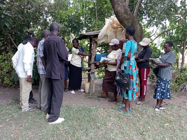
Community Resource Persons (CRP) in agricultural extension [เคนยา]
Community Resource Persons (CRP) form a farmer-to-farmer learning approach that bridges the gap in agricultural extension, increases farmers' access to agricultural information (SLM knowledge), and increases the adoption of SLM practices.
- ผู้รวบรวม: William Akwanyi
2. การอธิบายลักษณะของเทคโนโลยี SLM
2.1 การอธิบายแบบสั้น ๆ ของเทคโนโลยี
คำจำกัดความของเทคโนโลยี:
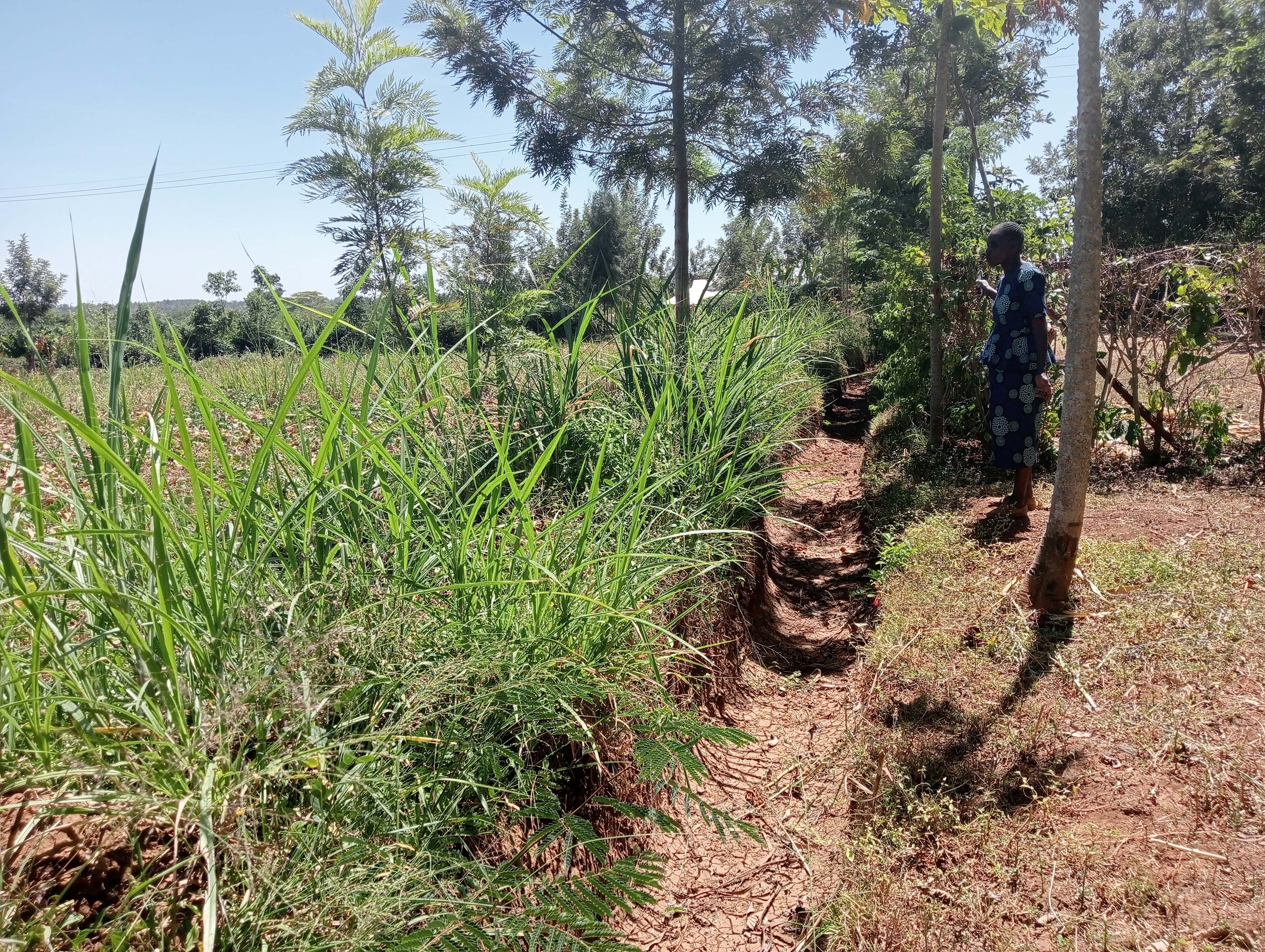
Retention ditches are channels aligned along the contour which are designed for surface runoff management. They improve water infiltration into the ground and prevent soil erosion.
2.2 การอธิบายแบบละเอียดของเทคโนโลยี
คำอธิบาย:
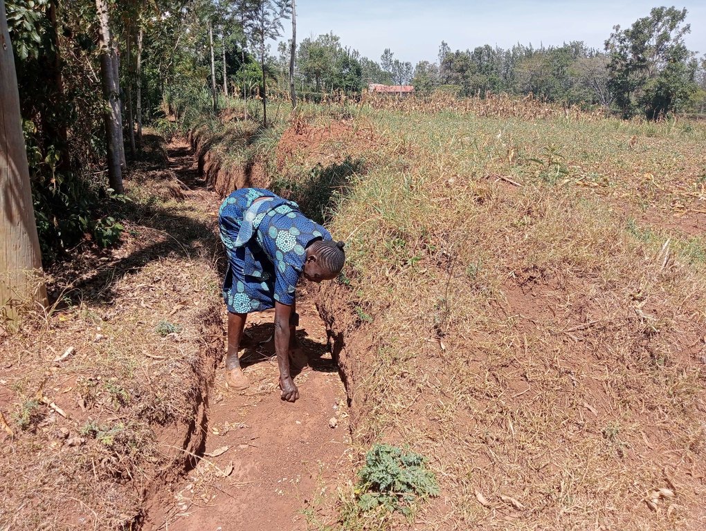
Retention ditches are soil and water conservation practices. They are channels dug along contours (i.e., across the slope), especially at the uppermost part of the farm to retain stormwater/ surface runoff. They typically comprise two components: (a) vegetational-biological and (b) mechanical-structural components which are integrated to collect surface runoff, allowing for sediment carried by runoff to settle as water infiltrates into the ground. The mechanical-structural component consists of channels dug in such a way that they follow the contour and run perpendicular to the flow of water in areas where runoff naturally flows or collects. The soil excavated from the ditch forms a bund below the ditch. Retention ditches prevent surface runoff from outside the farm from flowing into or through the farm. The vegetational-biological component consists of plants grown on the bunds. The plant roots bind the soil thus increasing the slope stability, especially of the bunds; thus, preventing soil from collapsing and falling back into the channel. Retention ditches thus harvest and retain water (especially in low rainfall areas) preventing fertile soil from being washed away by surface runoff and increasing water availability for plants. In high-rainfall areas, they play the role of discharging excessive runoff into waterways.
Retention ditches are dug to about 60 cm deep and about 50 cm wide. To ensure stability, especially in areas with unstable soils, the top width is made wider than the bottom width allowing for slanting walls that are more stable than vertical walls. An understanding of the slope angle is an important factor in the designing and construction of retention ditches. A line-level (a spirit level attached to a string suspended between two poles) can be used to determine the measure slope. The slope angle determines the size of the ditch (depth and width) and the spacing between successive ditches on the same piece of land. In low-rainfall areas (such as Siaya), retention ditches are spaced at about 50 – 70 m while in high-rainfall areas the space between the ditches are closer (about 20 m). Similarly, the size of the retention ditches increases with increasing slope.
Some crops, especially bananas, arrowroot, etc. that demand a lot of water can be established in the ditches. Maintenance of retention ditches involves regular desilting, whenever the ditch is about 1/3 filled with silt. Hoes, shovels/ spades, and a panga (machete) are some of the tools used in digging and maintaining retention ditches. Farmers like retention ditches because they help in controlling soil erosion.
2.3 รูปภาพของเทคโนโลยี
2.5 ประเทศภูมิภาค หรือสถานที่ตั้งที่เทคโนโลยีได้นำไปใช้และได้รับการครอบคลุมโดยการประเมินนี้
ประเทศ:
เคนยา
ภูมิภาค/รัฐ/จังหวัด:
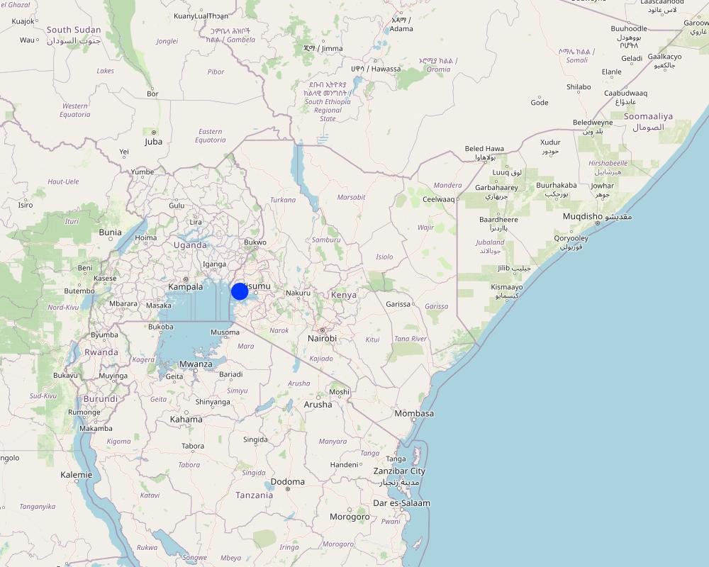
Siaya County, Nyanza Region
ข้อมูลจำเพาะเพิ่มเติมของสถานที่ตั้ง :
Uloma Village, Bondo Municipality, Bondo Sub-county
ระบุการกระจายตัวของเทคโนโลยี:
- กระจายไปอย่างสม่ำเสมอในพื้นที่
If precise area is not known, indicate approximate area covered:
- < 0.1 ตร.กม.(10 เฮกตาร์)
Is/are the technology site(s) located in a permanently protected area?
ไม่ใช่
แสดงความคิดเห็น:
The farm where the technology is implemented is not in a protected area.
Map
×2.6 วันที่การดำเนินการ
ระบุปีที่ใช้:
2018
2.7 คำแนะนำของเทคโนโลยี
ให้ระบุว่าเทคโนโลยีถูกแนะนำเข้ามาอย่างไร:
- ทางโครงการหรือจากภายนอก
ความคิดเห็น (ประเภทของโครงการ เป็นต้น) :
Soil Protection and Rehabilitation of Degraded Soil for Food Security (ProSoil) project
3. การจัดประเภทของเทคโนโลยี SLM
3.1 วัตถุประสงค์หลักของเทคโนโลยี
- ปรับปรุงการผลิตให้ดีขึ้น
- ลด ป้องกัน ฟื้นฟู การเสื่อมโทรมของที่ดิน
- ป้องกันพื้นที่ลุ่มน้ำ/บริเวณท้ายน้ำ โดยร่วมกับเทคโนโลยีอื่นๆ
- รักษาสภาพหรือปรับปรุงความหลากหลายทางชีวภาพ
- ปรับตัวเข้ากับการเปลี่ยนแปลงภูมิอากาศของโลก สภาพภูมิอากาศที่รุนแรงและผลกระทบ
3.2 ประเภทของการใช้ที่ดินในปัจจุบันที่ได้นำเทคโนโลยีไปใช้
Land use mixed within the same land unit:
ใช่
Specify mixed land use (crops/ grazing/ trees):
- การปลูกพืชร่วมกับปศุสัตว์และการทำป่าไม้ (Agro-silvopastoralism)

พื้นที่ปลูกพืช
- การปลูกพืชล้มลุกอายุปีเดียว
- การปลูกพืชยืนต้นที่ไม่มีเนื้อไม้
- การปลูกไม้ยืนต้น ไม้พุ่ม
Annual cropping - Specify crops:
- fodder crops - other
- fodder crops - grasses
- cereals - maize
- vegetables - other
- legumes and pulses - other
- legumes and pulses - beans
Annual cropping system:
Fallow - maize/sorghum/millet intercropped with legume
Perennial (non-woody) cropping - Specify crops:
- banana/plantain/abaca
- fodder crops - grasses
- fodder crops - legumes, clover
Tree and shrub cropping - Specify crops:
- fodder trees (Calliandra, Leucaena leucocephala, Prosopis, etc.)
- avocado
- fruits, other
- mango, mangosteen, guava
- papaya
จำนวนของฤดูเพาะปลูกต่อปี:
- 2
ระบุ:
Long and short rain seasons
Is intercropping practiced?
ใช่
If yes, specify which crops are intercropped:
Maize and legumes e.g., beans
Is crop rotation practiced?
ใช่
ถ้าใช่ ระบุ:
Some sections of the farm are left fallow during the short rains to allow for soil regeneration.

ทุ่งหญ้าเลี้ยงสัตว์
ทุ่งหญ้าเลี้ยงสัตว์ที่มีการจัดการแบบเข้มข้นหรือการผลิตอาหารสัตว์:
- ตัดแล้วขนไป / ไม่มีการปล่อยแทะเล็มเอง (Cut-and-carry / zero grazing)
- ทุ่งหญ้าเลี้ยงสัตว์ที่ได้มีการปรับปรุง (Improved pastures)
Animal type:
- cattle - dairy and beef (e.g. zebu)
- poultry
Is integrated crop-livestock management practiced?
ใช่
ถ้าใช่ ระบุ:
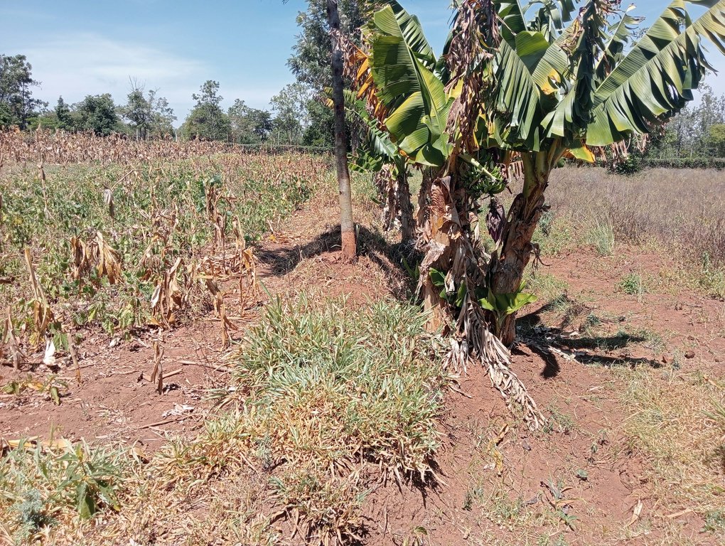
Fodder (nappier grass) planted on the berms is fed to the cattle. The manure from the cattle and droppings from the chicken is used as manure for the crops.
ผลิตภัณฑ์และบริการ:
- milk
- eggs
- meat
Species:
cattle - dairy and beef (e.g. zebu)
Count:
3
Species:
poultry
Count:
100
แสดงความคิดเห็น:
There are assorted trees on the farm, including fruit trees. Some of the trees are planted on the berm of the retention ditches.
3.3 Has land use changed due to the implementation of the Technology?
Has land use changed due to the implementation of the Technology?
- No (Continue with question 3.4)
3.4 การใช้น้ำ
การใช้น้ำของที่ดินที่มีการใช้เทคโนโลยีอยู่:
- จากน้ำฝน
แสดงความคิดเห็น:
Crops are planted only during the rainy seasons since there is no irrigation.
3.5 กลุ่ม SLM ที่ตรงกับเทคโนโลยีนี้
- มาตรการปลูกพืชขวางความลาดชัน (cross-slope measure)
- การผันน้ำและการระบายน้ำ
3.6 มาตรการ SLM ที่ประกอบกันเป็นเทคโนโลยี

มาตรการอนุรักษ์ด้วยวิธีพืช
- V1: ต้นไม้และพุ่มไม้คลุมดิน
- V2: หญ้าและไม้ยืนต้น

มาตรการอนุรักษ์ด้วยโครงสร้าง
- S4: คูน้ำแนวระดับ หลุม
แสดงความคิดเห็น:
Trees and grasses are planted on the berms of the retention ditches.
3.7 รูปแบบหลักของการเสื่อมโทรมของที่ดินที่ได้รับการแก้ไขโดยเทคโนโลยี

การกัดกร่อนของดินโดยน้ำ
- Wt (Loss of topsoil): การสูญเสียดินชั้นบนหรือการกัดกร่อนที่ผิวดิน
- Wg (Gully erosion): การกัดกร่อนแบบร่องธารหรือการทำให้เกิดร่องน้ำเซาะ
แสดงความคิดเห็น:
The retention ditches, especially when applied at the top of a plot and the design is to heap the soil below the channel ('fanya chini') has helped control gully erosion. Gullies were common in the farm before the digging of the retention ditches.
3.8 การป้องกัน การลดลง หรือการฟื้นฟูความเสื่อมโทรมของที่ดิน
ระบุเป้าหมายของเทคโนโลยีกับความเสื่อมโทรมของที่ดิน:
- ลดความเสื่อมโทรมของดิน
- ฟื้นฟูบำบัดที่ดินที่เสื่อมโทรมลงอย่างมาก
แสดงความคิดเห็น:
The retention ditches saved the land from gullies, and are still controlling soil erosion.
4. ข้อมูลจำเพาะด้านเทคนิค กิจกรรมการนำไปปฏิบัติใช้ ปัจจัยนำเข้า และค่าใช้จ่าย
4.1 แบบแปลนทางเทคนิคของเทคโนโลยี
ข้อมูลจำเพาะด้านเทคนิค (แบบแปลนทางเทคนิคของเทคโนโลยี):
Ditch dimensions: length = 70m, width = 50cm, depth = 60cm
Slope of the field = 4%
Plants on the berm: nappier grass
ผู้เขียน:
William Akwanyi
วันที่:
01/07/2023
4.2 ข้อมูลทั่วไปเกี่ยวกับการคำนวณปัจจัยนำเข้าและค่าใช้จ่าย
ให้ระบุว่าค่าใช้จ่ายและปัจจัยนำเข้าได้รับการคำนวณอย่างไร:
- ต่อพื้นที่ที่ใช้เทคโนโลยี
ระบุขนาดและหน่วยพื้นที่:
0.4 ha
อื่นๆ หรือสกุลเงินประจำชาติ (ระบุ):
KES
If relevant, indicate exchange rate from USD to local currency (e.g. 1 USD = 79.9 Brazilian Real): 1 USD =:
122.95
ระบุค่าเฉลี่ยของค่าจ้างในการจ้างแรงงานต่อวัน:
300
4.3 กิจกรรมเพื่อการจัดตั้ง
| กิจกรรม | Timing (season) | |
|---|---|---|
| 1. | Slope measurement and determination of position for the retention ditch | During the dry season |
| 2. | Digging the ditches | Before onset of rains |
แสดงความคิดเห็น:
The ditches should be constructed during the dry season or before the rains start when the soil is light and easy to remove from the ditches.
4.4 ค่าใช้จ่ายของปัจจัยนำเข้าที่จำเป็นสำหรับการจัดตั้ง
| ปัจจัยนำเข้า | หน่วย | ปริมาณ | ค่าใช้จ่ายต่อหน่วย | ค่าใช้จ่ายทั้งหมดต่อปัจจัยนำเข้า | %ของค่าใช้จ่ายที่ก่อให้เกิดขึ้นโดยผู้ใช้ที่ดิน | |
|---|---|---|---|---|---|---|
| แรงงาน | Digging the ditches | Man days | 10.0 | 300.0 | 3000.0 | 100.0 |
| อุปกรณ์ | Hoe | No. | 1.0 | 80.0 | 80.0 | 100.0 |
| อุปกรณ์ | Panga (broad blade) | No. | 1.0 | 60.0 | 60.0 | 100.0 |
| อุปกรณ์ | Wheelbarrow | No. | 1.0 | 800.0 | 800.0 | 100.0 |
| อุปกรณ์ | Spade | No. | 1.0 | 90.0 | 90.0 | 100.0 |
| อุปกรณ์ | Planting rope | No. | 1.0 | 60.0 | 60.0 | 100.0 |
| อุปกรณ์ | Spirit level | No. | 1.0 | 600.0 | 600.0 | |
| อื่น ๆ | Slope measurement and determination of position for the retention ditch (professional service) | Professional service | 1.0 | 2000.0 | 2000.0 | |
| ค่าใช้จ่ายทั้งหมดของการจัดตั้งเทคโนโลยี | 6690.0 | |||||
| Total costs for establishment of the Technology in USD | 54.41 | |||||
ถ้าผู้ใช้ที่ดินรับภาระน้อยกว่า 100% ของค่าใช้จ่าย ให้ระบุว่าใครเป็นผู้รับผิดชอบส่วนที่เหลือ:
ProSoil project
แสดงความคิดเห็น:
The costs of the implements are KES 400/- for a hoe, KES 4,000/- for a wheelbarrow, KES 300/- for a planting rope and broad blade, KES 3,000/- for a spirit level, and KES 450/- for a spade. It is assumed that the farmer will be able to use the hoe, planting rope, broad blade, and spade over a period of 5 years, and a wheelbarrow over a period of 10 years before these implements will have depreciated to a point where they will not be useable. The cost is thus spread over the years when the farmer will be able to use the implement.
4.5 การบำรุงรักษาสภาพหรือกิจกรรมที่เกิดขึ้นเป็นประจำ
| กิจกรรม | ช่วงระยะเวลา/ความถี่ | |
|---|---|---|
| 1. | Desilting | Whenever the ditch is about 1/3 filled with silt |
แสดงความคิดเห็น:
Maintenance activities do not happen at regular intervals but depend on volume of runoff and amount of silt carried by surface runoff for desilting the ditch, rate of growth of weeds for weeding, and factors that lead to lead of plants for plant re-establishment.
4.6 ค่าใช้จ่ายของปัจจัยนำเข้าและกิจกรรมที่เกิดขึ้นเป็นประจำที่ต้องการการบำรุงรักษา (ต่อปี)
If you are unable to break down the costs in the table above, give an estimation of the total costs of maintaining the Technology:
2000.0
แสดงความคิดเห็น:
the above cost is based on the farmer's estimate.
4.7 ปัจจัยสำคัญที่สุดที่มีผลกระทบต่อค่าใช้จ่าย
ปัจจัยสำคัญที่สุดที่มีผลกระทบต่อค่าใช้จ่ายต่างๆ:
Rate of man-days vary from one place to another and also depend on the kind of work.
Exchange rate for January 2023, source: European Commission/ InfoEuro online at https://commission.europa.eu/funding-tenders/procedures-guidelines-tenders/information-contractors-and-beneficiaries/exchange-rate-inforeuro_en
5. สิ่งแวดล้อมทางธรรมชาติและของมนุษย์
5.1 ภูมิอากาศ
ฝนประจำปี
- < 250 ม.ม.
- 251-500 ม.ม.
- 501-750 ม.ม.
- 751-1,000 ม.ม.
- 1,001-1,500 ม.ม.
- 1,501-2,000 ม.ม.
- 2,001-3,000 ม.ม.
- 3,001-4,000 ม.ม.
- > 4,000 ม.ม.
ข้อมูลจำเพาะ/ความคิดเห็นเรื่องปริมาณน้ำฝน:
Rainfall pattern is bimodal. Monthly rainfall variability is high with some months such as January recording less than 5 mm of total rainfall.
ระบุชื่อของสถานีตรวดวัดอากาศที่ใช้อ้างอิงคือ:
Bondo Meteorological Station
เขตภูมิอากาศเกษตร
- กึ่งแห้งแล้ง
The area is found near Lake Victoria which influences the climate.
5.2 สภาพภูมิประเทศ
ค่าเฉลี่ยความลาดชัน:
- ราบเรียบ (0-2%)
- ลาดที่ไม่ชัน (3-5%)
- ปานกลาง (6-10%)
- เป็นลูกคลื่น (11-15%)
- เป็นเนิน (16-30%)
- ชัน (31-60%)
- ชันมาก (>60%)
ธรณีสัณฐาน:
- ที่ราบสูง/ที่ราบ
- สันเขา
- ไหล่เขา
- ไหล่เนินเขา
- ตีนเนิน
- หุบเขา
ระดับความสูง:
- 0-100 เมตร
- 101-500 เมตร
- 501-1,000 เมตร
- 1,001-1,500 เมตร
- 1,501-2,000 เมตร
- 2,001-2,500 เมตร
- 2,501-3,000 เมตร
- 3,001-4,000 เมตร
- > 4,000 เมตร
ให้ระบุถ้าเทคโนโลยีได้ถูกนำไปใช้:
- บริเวณสันเขา (convex situations)
ความคิดเห็นและข้อมูลจำเพาะเพิ่มเติมเรื่องสภาพภูมิประเทศ:
Retention ditches divert the flow of surface runoff. The slope of the farmer's field is 4%.
5.3 ดิน
ค่าเฉลี่ยความลึกของดิน:
- ตื้นมาก (0-20 ซ.ม.)
- ตื้น (21-50 ซ.ม.)
- ลึกปานกลาง (51-80 ซ.ม.)
- ลึก (81-120 ซ.ม.)
- ลึกมาก (>120 ซ.ม.)
เนื้อดิน (ดินชั้นบน):
- ปานกลาง (ดินร่วน ทรายแป้ง)
เนื้อดินล่าง (> 20 ซ.ม.ต่ำจากผิวดิน):
- ปานกลาง (ดินร่วน ทรายแป้ง)
อินทรียวัตถุในดิน:
- ปานกลาง (1-3%)
(ถ้ามี) ให้แนบคำอธิบายเรื่องดินแบบเต็มหรือระบุข้อมูลที่มีอยู่ เช่น ชนิดของดิน ค่า pH ของดินหรือความเป็นกรดของดิน ความสามารถในการแลกเปลี่ยนประจุบวก ไนโตรเจน ความเค็ม เป็นต้น:
N/A
5.4 ความเป็นประโยชน์และคุณภาพของน้ำ
ระดับน้ำใต้ดิน:
5-50 เมตร
น้ำไหลบ่าที่ผิวดิน:
ดี
คุณภาพน้ำ (ที่ยังไม่ได้บำบัด):
เป็นน้ำเพื่อการดื่มที่ไม่ดี (จำเป็นต้องได้รับการบำบัด)
Water quality refers to:
both ground and surface water
ความเค็มของน้ำเป็นปัญหาหรือไม่:
ไม่ใช่
กำลังเกิดน้ำท่วมในพื้นที่หรือไม่:
ไม่ใช่
ความคิดเห็นและข้อมูลจำเพาะเพิ่มเติมเรื่องคุณภาพและปริมาณน้ำ:
There are several boreholes in the area and according to interviews with some borehole owners, the depts are not more than 50 metres. Lake Victoria is a permanent surface water body in the area.
5.5 ความหลากหลายทางชีวภาพ
ความหลากหลายทางชนิดพันธุ์:
- ปานกลาง
ความหลากหลายของแหล่งที่อยู่:
- ปานกลาง
ความคิดเห็นและข้อมูลจำเพาะเพิ่มเติมของความหลากหลายทางชีวภาพ:
The area has high agrobiodiversity as most farms are under crops and trees.
5.6 ลักษณะของผู้ใช้ที่ดินที่นำเทคโนโลยีไปปฏิบัติใช้
อยู่กับที่หรือเร่ร่อน:
- กึ่งเร่ร่อน
แนวทางการตลาดของระบบการผลิต:
- mixed (subsistence/ commercial)
รายได้ที่มาจากนอกฟาร์ม:
- 10-50% ของรายได้ทั้งหมด
ระดับของความมั่งคั่งโดยเปรียบเทียบ:
- พอมีพอกิน
เป็นรายบุคคล/ครัวเรือน:
- เป็นรายบุคคล/ครัวเรือน
ระดับของการใช้เครื่องจักรกล:
- งานที่ใช้แรงกาย
เพศ:
- หญิง
- ชาย
อายุของผู้ใช้ที่ดิน:
- วัยกลางคน
- ผู้สูงอายุ
ระบุลักษณะอื่นๆที่เกี่ยวข้องของผู้ใช้ที่ดิน:
The farmer uses the land together with his other family members.
5.7 Average area of land used by land users applying the Technology
- < 0.5 เฮกตาร์
- 0.5-1 เฮกตาร์
- 1-2 เฮกตาร์
- 2-5 เฮกตาร์
- 5-15 เฮกตาร์
- 15-50 เฮกตาร์
- 50-100 เฮกตาร์
- 100-500 เฮกตาร์
- 500-1,000 เฮกตาร์
- 1,000-10,000 เฮกตาร์
- >10,000 เฮกตาร์
พิจารณาว่าเป็นขนาดเล็ก กลาง หรือขนาดใหญ่ (ซึ่งอ้างอิงถึงบริบทระดับท้องถิ่น):
- ขนาดกลาง
แสดงความคิดเห็น:
Farmers with more than 2 ha in the area are considered to have large pieces of land since there is high level of land fragmentation in the area.
5.8 กรรมสิทธิ์ในที่ดิน สิทธิในการใช้ที่ดินและสิทธิในการใช้น้ำ
กรรมสิทธิ์ในที่ดิน:
- รายบุคคล ได้รับสิทธิครอบครอง
สิทธิในการใช้ที่ดิน:
- รายบุคคล
สิทธิในการใช้น้ำ:
- เกี่ยวกับชุมชน (ถูกจัดระเบียบ)
Are land use rights based on a traditional legal system?
ไม่ใช่
ระบุ:
Each landowner has full control of the way he/ she wants to use his/ her land.
แสดงความคิดเห็น:
The farmer has a title for his piece of land.
5.9 การเข้าถึงบริการและโครงสร้างพื้นฐาน
สุขภาพ:
- จน
- ปานกลาง
- ดี
การศึกษา:
- จน
- ปานกลาง
- ดี
ความช่วยเหลือทางด้านเทคนิค:
- จน
- ปานกลาง
- ดี
การจ้างงาน (เช่น ภายนอกฟาร์ม):
- จน
- ปานกลาง
- ดี
ตลาด:
- จน
- ปานกลาง
- ดี
พลังงาน:
- จน
- ปานกลาง
- ดี
ถนนและการขนส่ง:
- จน
- ปานกลาง
- ดี
น้ำดื่มและการสุขาภิบาล:
- จน
- ปานกลาง
- ดี
บริการด้านการเงิน:
- จน
- ปานกลาง
- ดี
แสดงความคิดเห็น:
The above rating varies from one village to the other.
6. ผลกระทบและสรุปคำบอกกล่าว
6.1 ผลกระทบในพื้นที่ดำเนินการ (On-site) จากการใช้เทคโนโลยี
ผลกระทบทางด้านเศรษฐกิจและสังคม
การผลิต
การผลิตพืชผล
จำนวนก่อน SLM:
2
หลังจาก SLM:
4
แสดงความคิดเห็น/ระบุ:
Quantity refers to the number of 90 Kg bags of maize produced per acre. Based on estimation by the farmer.
คุณภาพพืชผล
แสดงความคิดเห็น/ระบุ:
Not easy to quantify but according to the farmer, the crops are doing better compared to how they were before the retention ditches were dug.
การผลิตพืชที่ใช้เลี้ยงปศุสัตว์
จำนวนก่อน SLM:
1
หลังจาก SLM:
3
แสดงความคิดเห็น/ระบุ:
Quantity refers to harvesting cycles for nappier grass from the same farm. Based on estimation by the farmer.
คุณภาพพืชที่ใช้เลี้ยงปศุสัตว์
แสดงความคิดเห็น/ระบุ:
Not easy to quantify but according to the farmer, fodder is doing better compared to how it was before the retention ditches were dug.
การผลิตสัตว์
จำนวนก่อน SLM:
1
หลังจาก SLM:
3
แสดงความคิดเห็น/ระบุ:
Quantity refers to the amount of milk in litres from one cow. Milk production is often at the peak during early lactation months. Based on estimation by the farmer.
การเสี่ยงต่อความล้มเหลวในการผลิต
จำนวนก่อน SLM:
80
หลังจาก SLM:
40
แสดงความคิดเห็น/ระบุ:
Quantity refers to the percentage probability of the crop failing to do well. Based on estimation by the farmer.
รายได้และค่าใช้จ่าย
ภาระงาน
แสดงความคิดเห็น/ระบุ:
Refers to the number of hours that the farmer can be free in any working day. During the rainy season, the farmer spends some time desilting the ditches. Based on estimation by the farmer.
ผลกระทบด้านสังคมวัฒนธรรมอื่น ๆ
ความมั่นคงด้านอาหาร / พึ่งตนเองได้
จำนวนก่อน SLM:
5
หลังจาก SLM:
2
แสดงความคิดเห็น/ระบุ:
Quantity refers to the number of months in a year when there is total lack of food in the house, and the farmer has to buy all the food required in the house. Based on estimation by the farmer.
SLM หรือความรู้เรื่องความเสื่อมโทรมของที่ดิน
จำนวนก่อน SLM:
10%
หลังจาก SLM:
80%
แสดงความคิดเห็น/ระบุ:
Quantity refers to the estimated percentage of knowledge in SLM/ land management. This is a farmer's estimate.
ผลกระทบด้านนิเวศวิทยา
วัฐจักรน้ำหรือน้ำบ่า
การเก็บเกี่ยวหรือการกักเก็บน้ำ
แสดงความคิดเห็น/ระบุ:
Not easy to quantify. Based on estimation by the farmer.
น้ำไหลบ่าที่ผิวดิน
แสดงความคิดเห็น/ระบุ:
Refers to the amount of water that flows through the farm. Not easy to quantify. Based on estimation by the farmer.
ดิน
การสูญเสียดิน
แสดงความคิดเห็น/ระบุ:
Not easy to quantify.
ความหลากหลายทางชีวภาพของพืชและสัตว์
การปกคลุมด้วยพืช
แสดงความคิดเห็น/ระบุ:
Refers to the farmer's estimated percentage vegetation cover at the farm. Based on estimation by the farmer.
Specify assessment of on-site impacts (measurements):
No recorded data is available for reference. All are estimates based on the farmer's explanation or as given by her.
6.2 ผลกระทบนอกพื้นที่ดำเนินการ (Off-site) จากการใช้เทคโนโลยี
น้ำท่วมพื้นที่ท้ายน้ำ
แสดงความคิดเห็น/ระบุ:
Not easy to quantify. Retention ditches have reduced the amount of water that flows to the farms in the lower areas. This has reduced soil erosion in these farms.
การทับถมของดินตะกอนพื้นที่ท้ายน้ำ
แสดงความคิดเห็น/ระบุ:
Not easy to quantify. All silt is deposited in the retention ditches and scooped by the farmer for replenishing parts of the farm with low soil levels.
ความเสียหายต่อพื้นที่เพาะปลูกของเพื่อนบ้าน
แสดงความคิดเห็น/ระบุ:
Not easy to quantify. Retention ditches have reduced the amount of water that flows to the farms in the lower areas. This has reduced soil erosion in these farms.
Specify assessment of off-site impacts (measurements):
It was not possible for the farmer to quantify the above.
6.3 การเผชิญและความตอบสนองของเทคโนโลยีต่อการเปลี่ยนแปลงสภาพภูมิอากาศที่ค่อยเป็นค่อยไป และสภาพรุนแรงของภูมิอากาศ / ภัยพิบัติ (ที่รับรู้ได้โดยผู้ใช้ที่ดิน)
การเปลี่ยนแปลงสภาพภูมิอากาศที่ค่อยเป็นค่อยไป
การเปลี่ยนแปลงสภาพภูมิอากาศที่ค่อยเป็นค่อยไป
| ฤดู | increase or decrease | เทคโนโลยีมีวิธีการรับมืออย่างไร | |
|---|---|---|---|
| อุณหภูมิประจำปี | เพิ่มขึ้น | ดี | |
| อุณหภูมิตามฤดูกาล | ฤดูแล้ง | เพิ่มขึ้น | ปานกลาง |
6.4 การวิเคราะห์ค่าใช้จ่ายและผลประโยชน์ที่ได้รับ
ผลประโยชน์ที่ได้รับเปรียบเทียบกับค่าใช้จ่ายในการจัดตั้งเป็นอย่างไร (จากมุมมองของผู้ใช้ที่ดิน)
ผลตอบแทนระยะสั้น:
ด้านบวก
ผลตอบแทนระยะยาว:
ด้านบวกอย่างมาก
ผลประโยชน์ที่ได้รับเปรียบเทียบกับค่าใช้จ่ายในการบำรุงรักษาหรือต้นทุนที่เกิดขึ้นซ้ำอีก เป็นอย่างไร (จากมุมมองของผู้ใช้ที่ดิน)
ผลตอบแทนระยะสั้น:
ด้านบวกอย่างมาก
ผลตอบแทนระยะยาว:
ด้านบวกอย่างมาก
แสดงความคิดเห็น:
The retention ditches have generally improved crop production.
6.5 การปรับตัวของเทคโนโลยี
- 11-50%
Of all those who have adopted the Technology, how many did so spontaneously, i.e. without receiving any material incentives/ payments?
- 11-50%
6.6 การปรับตัว
เทคโนโลยีได้รับการปรับเปลี่ยนเมื่อเร็วๆนี้ เพื่อให้ปรับตัวเข้ากับสภาพที่กำลังเปลี่ยนแปลงหรือไม่:
ไม่ใช่
6.7 จุดแข็ง / ข้อได้เปรียบ / โอกาสของเทคโนโลยี
| จุดแข็ง / ข้อได้เปรียบ / โอกาสในทัศนคติของผู้ใช้ที่ดิน |
|---|
| Controls soil erosion. Silt collected in the ditches is used to replenish other sections of the farm with poor soils. |
| Improved crop yields. |
| จุดแข็ง / ข้อได้เปรียบ / โอกาสในทัศนคติของผู้รวบรวมหรือวิทยากรหลัก |
|---|
| Controls road damage due to runoff as most of the water is collected by the ditches before it destroys the road. |
6.8 จุดอ่อน / ข้อเสียเปรียบ / ความเสี่ยงของเทคโนโลยีและวิธีการแก้ไข
| จุดอ่อน / ข้อเสียเปรียบ / ความเสี่ยงในทัศนคติของผู้ใช้ที่ดิน | มีวิธีการแก้ไขได้อย่างไร |
|---|---|
| Establishment investment is capital and labour intensive. | The farmer has to be committed. |
| Maintenance is labour intensive. | The farmer has to be committed. Proper planning of farm work. |
| จุดอ่อน / ข้อเสียเปรียบ / ความเสี่ยงในทัศนคติของผู้รวบรวมหรือวิทยากรหลัก | มีวิธีการแก้ไขได้อย่างไร |
|---|---|
| If not managed properly by regular removal of silt, the ditch can easily fill up. | The farmer must be committed to remove silt regularly. |
| May overflow and collapse during high rainfall leading to high levels of soil erosion. | Proper designing in consideration of runoff volumes and slope angle. Regular maintenance. |
7. การอ้างอิงและการเชื่อมต่อ
7.1 วิธีการและแหล่งข้อมูล
- ไปเยี่ยมชมภาคสนาม การสำรวจพื้นที่ภาคสนาม
One visit at one farm
- การสัมภาษณ์กับผู้ใช้ที่ดิน
One farmer interviewed at his farm. Follow-up questions on phone.
- การสัมภาษณ์ผู้เชี่ยวชาญด้าน SLM หรือผู้ชำนาญ
ProSoil team and project implementers from Welthungerhilfe consulted.
- การเก็บรวบรวมมาจากรายงานและเอกสารที่มีอยู่
Siaya County Integrated Development Plan, 2018-2022 and online sources reviewed.
วันที่เก็บรวบรวมข้อมูล(ภาคสนาม) :
27/01/2023
แสดงความคิดเห็น:
One field visit and several follow-up consultations.
7.2 การอ้างอิงถึงสิ่งตีพิมพ์
หัวข้อ, ผู้เขียน, ปี, หมายเลข ISBN:
Climate Smart Extension Manual by KCEP - CRAL, 2021
ชื่อเรื่อง ผู้เขียน ปี ISBN:
Download free at https://www.kalro.org/files/kcep/CSA-extension-manual-18-06-21.pdf
7.3 Links to relevant online information
ชื่อเรื่องหรือคำอธิบาย:
Siaya County Integrated Development Plan, 2018-2022
URL:
https://repository.kippra.or.ke/bitstream/handle/123456789/1218/2018-2022%20%20Siaya%20County%20CIDP.pdf?sequence=1&isAllowed=y
7.4 General comments
1. Provide a function to be able to link the documented SLM to similar work that has been documented in other databases e.g., LandPortal, UNCCD, etc.
2. Some of the impacts (section 6) cannot be quantified.
ลิงก์และโมดูล
ขยายทั้งหมด ย่อทั้งหมดลิงก์

Community Resource Persons (CRP) in agricultural extension [เคนยา]
Community Resource Persons (CRP) form a farmer-to-farmer learning approach that bridges the gap in agricultural extension, increases farmers' access to agricultural information (SLM knowledge), and increases the adoption of SLM practices.
- ผู้รวบรวม: William Akwanyi
โมดูล
ไม่มีโมดูล


