Sunken gully pits [อินเดีย]
- ผู้สร้างสรรค์:
- การอัพเดท:
- ผู้รวบรวม: SATYANARAYANA SAHU
- ผู้เรียบเรียง: –
- ผู้ตรวจสอบ: Fabian Ottiger, Alexandra Gavilano
khancha, Dhuda
technologies_1479 - อินเดีย
ดูส่วนย่อย
ขยายทั้งหมด ย่อทั้งหมด1. ข้อมูลทั่วไป
1.2 รายละเอียดที่ติดต่อได้ของผู้รวบรวมและองค์กรที่เกี่ยวข้องในการประเมินและการจัดเตรียมทำเอกสารของเทคโนโลยี
ผู้เชี่ยวชาญ SLM:
ผู้เชี่ยวชาญ SLM:
Nayak Pradeep Kumar
อินเดีย
1.3 เงื่อนไขการใช้ข้อมูลที่ได้บันทึกผ่านทาง WOCAT
ผู้รวบรวมและวิทยากรหลักยอมรับเงื่อนไขเกี่ยวกับการใช้ข้อมูลที่ถูกบันทึกผ่านทาง WOCAT:
ใช่
1.5 Reference to Questionnaire(s) on SLM Approaches (documented using WOCAT)
Participatory Watershed Development Approach [อินเดีย]
Livelihood asset base development through participatory watershed developemnt keeping people at the center stage of development and promoting village level institutions.
- ผู้รวบรวม: Narendra Kumar Panigrahi
2. การอธิบายลักษณะของเทคโนโลยี SLM
2.1 การอธิบายแบบสั้น ๆ ของเทคโนโลยี
คำจำกัดความของเทคโนโลยี:
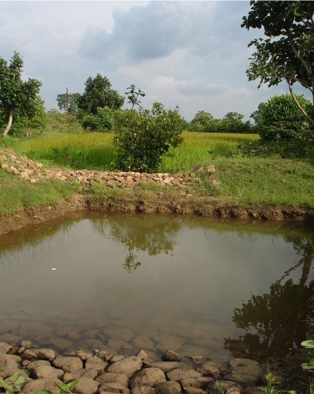
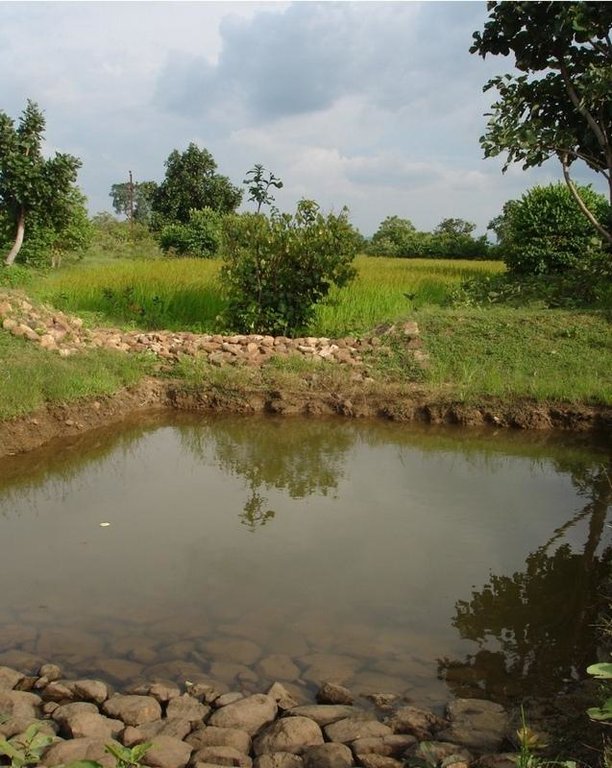
Runoff management pit in the gully with provision of waterway for excess runoff water.
2.2 การอธิบายแบบละเอียดของเทคโนโลยี
คำอธิบาย:
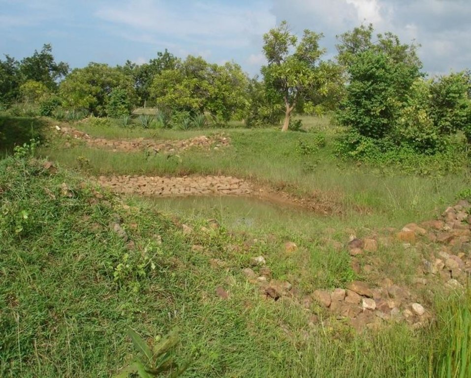
Adopted in 4-8% sloped gully at an interval varying from 20 M to 30 M . Pits are dug on the upsteam of the bund with graded slope or the upsteam of the pits. Also having provision of safe water disposal. Purpose: 1. Reduction in flow velocity 2. Withheld and impound the flow water 3. Ground water recharge 4. Increase in soil moisture regime 5. For supplemental irrigation by the middle and lower reach structure. Establishment/maintenance: Turfing, Placing in position of displaced boulder. Excavation of deposited earth from the pit. Environment: User friendly, Low maintenance, Promotes vegetation,Eco-friendly
2.3 รูปภาพของเทคโนโลยี
2.5 ประเทศภูมิภาค หรือสถานที่ตั้งที่เทคโนโลยีได้นำไปใช้และได้รับการครอบคลุมโดยการประเมินนี้
ประเทศ:
อินเดีย
ภูมิภาค/รัฐ/จังหวัด:
ORISSA
ข้อมูลจำเพาะเพิ่มเติมของสถานที่ตั้ง :
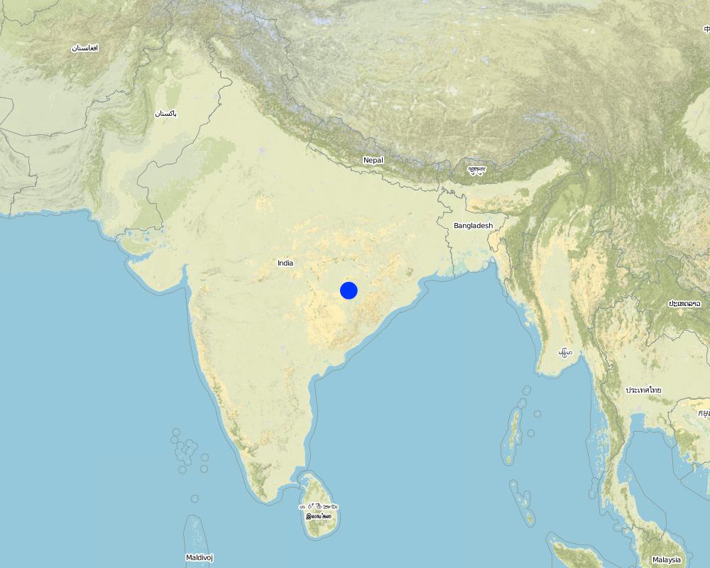
ORISSA/NUAPADA/MAHANADI/CHAKAPADA
ระบุการกระจายตัวของเทคโนโลยี:
- กระจายไปอย่างสม่ำเสมอในพื้นที่
If the Technology is evenly spread over an area, specify area covered (in km2):
0.4
If precise area is not known, indicate approximate area covered:
- 0.1-1 ตร.กม.
แสดงความคิดเห็น:
Total area covered by the SLM Technology is 0.4 km2.
Technology adopted following T.Hanumanth Rao's four- Water concept.
Map
×2.6 วันที่การดำเนินการ
ถ้าไม่รู้ปีที่แน่นอน ให้ระบุวันที่โดยประมาณ:
- มากกว่า 50 ปี (แบบดั้งเดิม)
2.7 คำแนะนำของเทคโนโลยี
ให้ระบุว่าเทคโนโลยีถูกแนะนำเข้ามาอย่างไร:
- ทางโครงการหรือจากภายนอก
ความคิดเห็น (ประเภทของโครงการ เป็นต้น) :
ANDHRA PRADESH By Hanumant Rao based upon Four- Water concept.
3. การจัดประเภทของเทคโนโลยี SLM
3.1 วัตถุประสงค์หลักของเทคโนโลยี
- ลด ป้องกัน ฟื้นฟู การเสื่อมโทรมของที่ดิน
- ปรับตัวเข้ากับการเปลี่ยนแปลงภูมิอากาศของโลก สภาพภูมิอากาศที่รุนแรงและผลกระทบ
3.2 ประเภทของการใช้ที่ดินในปัจจุบันที่ได้นำเทคโนโลยีไปใช้
Land use mixed within the same land unit:
ใช่
Specify mixed land use (crops/ grazing/ trees):
- ปศุสัตว์ร่วมกับการทำป่าไม้ (Silvo-pastoralism)

ทุ่งหญ้าเลี้ยงสัตว์

ป่า/พื้นที่ทำไม้
- ป่ากึ่งธรรมชาติ / พื้นที่ทำไม้
- ป่า/พื้นที่ทำไม้
ผลิตภัณฑ์และบริการ:
- ไม้ที่นำมาทำเป็นเชื้อเพลิง
- ผลไม้และถั่ว
- ผลิตภัณฑ์อื่น ๆ จากป่า
- การแทะเล็มหญ้า / การเก็บกินหญ้า
- การอนุรักษ์ / ป้องกันธรรมชาติ
- นันทนาการ / การท่องเที่ยว
แสดงความคิดเห็น:
Major land use problems (compiler’s opinion): Formation and development of gully in course of time.
Major land use problems (land users’ perception): Problem of sand casting in crop land and graduallly coverted into unproductive lands.
Semi-nomadism / pastoralism: Animals reside in the Watershed area
Grazingland comments: Trend increasing towards livestock production. Trend to have stall feeding. Trend to produce better and improved quality fodder.
Plantation forestry: Yes
Other type of forest: Natural forest
Problems / comments regarding forest use: Management and protection of existing forest and species are increasing by providing watch and ward by the Watershed members through Vana Surakhya Samiti(Forest Protection Committee)
Number of growing seasons per year: 2
Longest growing period in days: 150 Longest growing period from month to month: Jun - Oct Second longest growing period in days: 75 Second longest growing period from month to month: Nov - Jan
3.4 การใช้น้ำ
การใช้น้ำของที่ดินที่มีการใช้เทคโนโลยีอยู่:
- จากน้ำฝน
3.5 กลุ่ม SLM ที่ตรงกับเทคโนโลยีนี้
- การเก็บเกี่ยวน้ำ
- การจัดการด้านชลประทาน (รวมถึงการลำเลียงส่งน้ำ การระบายน้ำ)
- การจัดการน้ำบาดาล
3.6 มาตรการ SLM ที่ประกอบกันเป็นเทคโนโลยี

มาตรการอนุรักษ์ด้วยโครงสร้าง
แสดงความคิดเห็น:
Main measures: structural measures
3.7 รูปแบบหลักของการเสื่อมโทรมของที่ดินที่ได้รับการแก้ไขโดยเทคโนโลยี

การกัดกร่อนของดินโดยน้ำ
- Wt (Loss of topsoil): การสูญเสียดินชั้นบนหรือการกัดกร่อนที่ผิวดิน
- Wg (Gully erosion): การกัดกร่อนแบบร่องธารหรือการทำให้เกิดร่องน้ำเซาะ
- Wo (Offsite degradation): ผลกระทบนอกพื้นที่
แสดงความคิดเห็น:
Main type of degradation addressed: Wg: gully erosion / gullying
Secondary types of degradation addressed: Wt: loss of topsoil / surface erosion, Wo: offsite degradation effects
3.8 การป้องกัน การลดลง หรือการฟื้นฟูความเสื่อมโทรมของที่ดิน
ระบุเป้าหมายของเทคโนโลยีกับความเสื่อมโทรมของที่ดิน:
- ป้องกันความเสื่อมโทรมของที่ดิน
- ลดความเสื่อมโทรมของดิน
แสดงความคิดเห็น:
Main goals: prevention of land degradation
Secondary goals: mitigation / reduction of land degradation
4. ข้อมูลจำเพาะด้านเทคนิค กิจกรรมการนำไปปฏิบัติใช้ ปัจจัยนำเข้า และค่าใช้จ่าย
4.1 แบบแปลนทางเทคนิคของเทคโนโลยี
ข้อมูลจำเพาะด้านเทคนิค (แบบแปลนทางเทคนิคของเทคโนโลยี):
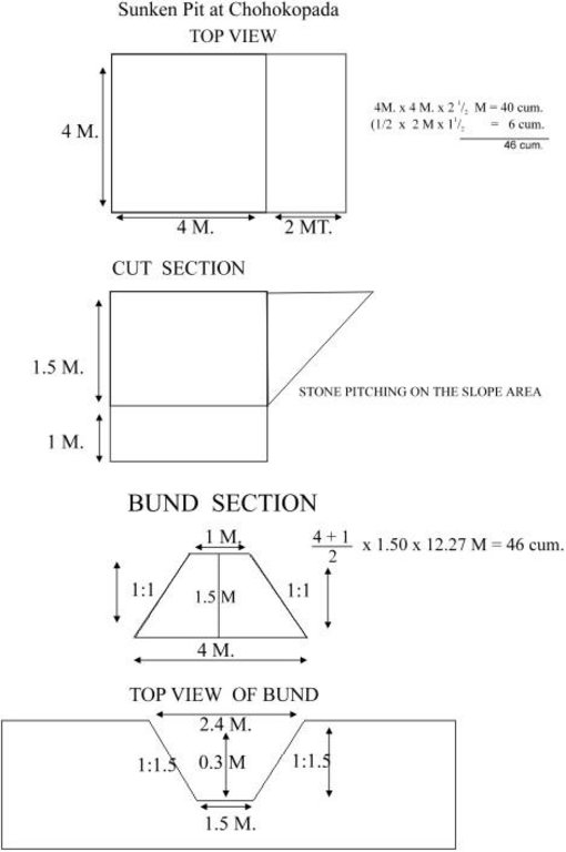
Sunken pit technical drawing
Technical knowledge required for field staff / advisors: moderate
Technical knowledge required for land users: low
Main technical functions: control of dispersed runoff: retain / trap, control of concentrated runoff: impede / retard, increase of infiltration, increase / maintain water stored in soil
Secondary technical functions: control of concentrated runoff: retain / trap, control of concentrated runoff: drain / divert, reduction of slope angle, reduction of slope length, sediment retention / trapping, sediment harvesting, increase in soil fertility
Vegetative measure: Turf on bund
Vegetative material: G : grass
Vegetative measure: Vegetative material: G : grass
Vegetative measure: Vegetative material: G : grass
Vegetative measure: Vegetative material: G : grass
Grass species: Local grass
Slope (which determines the spacing indicated above): 3.00%
If the original slope has changed as a result of the Technology, the slope today is (see figure below): 2.00%
Gradient along the rows / strips: 0.00%
Structural measure: Sunken gully pit
Vertical interval between structures (m): 1
Spacing between structures (m): 20
Depth of ditches/pits/dams (m): 1
Width of ditches/pits/dams (m): 2
Length of ditches/pits/dams (m): 3
Height of bunds/banks/others (m): 1
Width of bunds/banks/others (m): 2.5
Length of bunds/banks/others (m): 3
Construction material (earth): Excavated earth over 4.5 cum is utilised for construction of down stream bund
Construction material (stone): 1.08 cum of stone is used in upstream pit slope
Slope (which determines the spacing indicated above): 3%
If the original slope has changed as a result of the Technology, the slope today is: 2%
Lateral gradient along the structure: 0%
Vegetation is used for stabilisation of structures.
4.2 ข้อมูลทั่วไปเกี่ยวกับการคำนวณปัจจัยนำเข้าและค่าใช้จ่าย
อื่นๆ หรือสกุลเงินประจำชาติ (ระบุ):
Rupees
If relevant, indicate exchange rate from USD to local currency (e.g. 1 USD = 79.9 Brazilian Real): 1 USD =:
50.0
ระบุค่าเฉลี่ยของค่าจ้างในการจ้างแรงงานต่อวัน:
1.00
4.3 กิจกรรมเพื่อการจัดตั้ง
| กิจกรรม | Timing (season) | |
|---|---|---|
| 1. | Local grass collection | Onset of monsoon(Jun-july) |
| 2. | Putting the turf on the bund | Onset of monsoon(Jun-july) |
| 3. | Establishment of grass | During monsoon |
| 4. | Survey and layout | before onset of rain. |
| 5. | digging of pit & construction of earthen bund | pre-monsoon |
| 6. | stone pitching on upstream slope of pit | pre-monsoon |
| 7. | grass turffing | monsoon |
4.4 ค่าใช้จ่ายของปัจจัยนำเข้าที่จำเป็นสำหรับการจัดตั้ง
| ปัจจัยนำเข้า | หน่วย | ปริมาณ | ค่าใช้จ่ายต่อหน่วย | ค่าใช้จ่ายทั้งหมดต่อปัจจัยนำเข้า | %ของค่าใช้จ่ายที่ก่อให้เกิดขึ้นโดยผู้ใช้ที่ดิน | |
|---|---|---|---|---|---|---|
| แรงงาน | Labour | ha | 1.0 | 37.0 | 37.0 | |
| วัสดุสำหรับก่อสร้าง | Stone | ha | 1.0 | 3.0 | 3.0 | |
| ค่าใช้จ่ายทั้งหมดของการจัดตั้งเทคโนโลยี | 40.0 | |||||
| Total costs for establishment of the Technology in USD | 0.8 | |||||
แสดงความคิดเห็น:
Duration of establishment phase: 12 month(s)
4.5 การบำรุงรักษาสภาพหรือกิจกรรมที่เกิดขึ้นเป็นประจำ
| กิจกรรม | ช่วงระยะเวลา/ความถี่ | |
|---|---|---|
| 1. | Replanting of grass in the dried out patches | During rainy season(July-Sept) /When required. |
| 2. | stabilisatioin of bund with grass | during rain/annual |
| 3. | de-silting of pit | Before onset of monsoon/annual |
| 4. | Maintaing upstream & down stream bund slope | Before onset of rain/annual |
| 5. | Re-arrangement of displaced stones | before onset of rain/annual |
4.6 ค่าใช้จ่ายของปัจจัยนำเข้าและกิจกรรมที่เกิดขึ้นเป็นประจำที่ต้องการการบำรุงรักษา (ต่อปี)
แสดงความคิดเห็น:
Length of structure , deapth of gully , stone availability
4.7 ปัจจัยสำคัญที่สุดที่มีผลกระทบต่อค่าใช้จ่าย
ปัจจัยสำคัญที่สุดที่มีผลกระทบต่อค่าใช้จ่ายต่างๆ:
Labour availability, stone transportation.
5. สิ่งแวดล้อมทางธรรมชาติและของมนุษย์
5.1 ภูมิอากาศ
ฝนประจำปี
- < 250 ม.ม.
- 251-500 ม.ม.
- 501-750 ม.ม.
- 751-1,000 ม.ม.
- 1,001-1,500 ม.ม.
- 1,501-2,000 ม.ม.
- 2,001-3,000 ม.ม.
- 3,001-4,000 ม.ม.
- > 4,000 ม.ม.
ระบุปริมาณน้ำฝนเฉลี่ยรายปี (ถ้ารู้) :หน่วย ม.ม.
1250.00
เขตภูมิอากาศเกษตร
- กึ่งแห้งแล้ง
5.2 สภาพภูมิประเทศ
ค่าเฉลี่ยความลาดชัน:
- ราบเรียบ (0-2%)
- ลาดที่ไม่ชัน (3-5%)
- ปานกลาง (6-10%)
- เป็นลูกคลื่น (11-15%)
- เป็นเนิน (16-30%)
- ชัน (31-60%)
- ชันมาก (>60%)
ธรณีสัณฐาน:
- ที่ราบสูง/ที่ราบ
- สันเขา
- ไหล่เขา
- ไหล่เนินเขา
- ตีนเนิน
- หุบเขา
ระดับความสูง:
- 0-100 เมตร
- 101-500 เมตร
- 501-1,000 เมตร
- 1,001-1,500 เมตร
- 1,501-2,000 เมตร
- 2,001-2,500 เมตร
- 2,501-3,000 เมตร
- 3,001-4,000 เมตร
- > 4,000 เมตร
5.3 ดิน
ค่าเฉลี่ยความลึกของดิน:
- ตื้นมาก (0-20 ซ.ม.)
- ตื้น (21-50 ซ.ม.)
- ลึกปานกลาง (51-80 ซ.ม.)
- ลึก (81-120 ซ.ม.)
- ลึกมาก (>120 ซ.ม.)
เนื้อดิน (ดินชั้นบน):
- ปานกลาง (ดินร่วน ทรายแป้ง)
อินทรียวัตถุในดิน:
- ปานกลาง (1-3%)
(ถ้ามี) ให้แนบคำอธิบายเรื่องดินแบบเต็มหรือระบุข้อมูลที่มีอยู่ เช่น ชนิดของดิน ค่า pH ของดินหรือความเป็นกรดของดิน ความสามารถในการแลกเปลี่ยนประจุบวก ไนโตรเจน ความเค็ม เป็นต้น:
Soil fertility: Medium
Soil drainage/infiltration: Medium
Soil water storage capacity: Medium (ranked 1) and high (ranked 2)
5.6 ลักษณะของผู้ใช้ที่ดินที่นำเทคโนโลยีไปปฏิบัติใช้
รายได้ที่มาจากนอกฟาร์ม:
- < 10% ของรายได้ทั้งหมด
ระดับของความมั่งคั่งโดยเปรียบเทียบ:
- จน
- พอมีพอกิน
ระบุลักษณะอื่นๆที่เกี่ยวข้องของผู้ใช้ที่ดิน:
Population density: 100-200 persons/km2
Annual population growth: 1% - 2%
5% of the land users are very rich and own 40% of the land.
5% of the land users are rich and own 20% of the land.
30% of the land users are average wealthy and own 30% of the land.
40% of the land users are poor and own 10% of the land.
20% of the land users are poor.
Off-farm income specification: Income from offl farm activities like stone cutting, stone transporation, dry stone pitching
Market orientation of grazing land: Mixed (ranked 1, shrubs, trees and fodder cultivation) and subsistence (self-supply, ranked 2, to supplement the fodder requirements of watershed)
Market orientation of forest land: Commercial/market (ranked 1, sale of oil producing seeds), mixed (ranked 2, supply of excess fodder to nearby area/watershed) and self subsistence (ranked 3, trend increasing towards livestock production. Trend to have stall feeding. Trend to produce better and improved quality fodder.)
5.7 Average area of land used by land users applying the Technology
- < 0.5 เฮกตาร์
- 0.5-1 เฮกตาร์
- 1-2 เฮกตาร์
- 2-5 เฮกตาร์
- 5-15 เฮกตาร์
- 15-50 เฮกตาร์
- 50-100 เฮกตาร์
- 100-500 เฮกตาร์
- 500-1,000 เฮกตาร์
- 1,000-10,000 เฮกตาร์
- >10,000 เฮกตาร์
5.8 กรรมสิทธิ์ในที่ดิน สิทธิในการใช้ที่ดินและสิทธิในการใช้น้ำ
กรรมสิทธิ์ในที่ดิน:
- รัฐ
6. ผลกระทบและสรุปคำบอกกล่าว
6.1 ผลกระทบในพื้นที่ดำเนินการ (On-site) จากการใช้เทคโนโลยี
ผลกระทบทางด้านเศรษฐกิจและสังคม
การผลิต
การผลิตพืชผล
แสดงความคิดเห็น/ระบุ:
Low fertile and degraded soil
การผลิตพืชที่ใช้เลี้ยงปศุสัตว์
แสดงความคิดเห็น/ระบุ:
Cowpea, Stylo
คุณภาพพืชที่ใช้เลี้ยงปศุสัตว์
แสดงความคิดเห็น/ระบุ:
Cowpea, Stylo
การผลิตไม้
พื้นที่สำหรับการผลิต
แสดงความคิดเห็น/ระบุ:
Private land
รายได้และค่าใช้จ่าย
รายได้จากฟาร์ม
แสดงความคิดเห็น/ระบุ:
Rs. 400/- per ha
ภาระงาน
แสดงความคิดเห็น/ระบุ:
Crop area increased.
Awareness and willingness for maintenance required needs to develop
ผลกระทบทางด้านเศรษฐกิจและสังคมอื่น ๆ
On farm employment
แสดงความคิดเห็น/ระบุ:
Farm production
Off farm employment
แสดงความคิดเห็น/ระบุ:
Stone cutting and T.C. of stone and dry packing
Input constraints
ผลกระทบด้านสังคมวัฒนธรรมอื่น ๆ
สถาบันของชุมชน
แสดงความคิดเห็น/ระบุ:
User group formation
SLM หรือความรู้เรื่องความเสื่อมโทรมของที่ดิน
การบรรเทาความขัดแย้ง
แสดงความคิดเห็น/ระบุ:
Communitymobilization is required to restore the conflicts.
ผลกระทบด้านนิเวศวิทยา
วัฐจักรน้ำหรือน้ำบ่า
น้ำไหลบ่าที่ผิวดิน
จำนวนก่อน SLM:
60
หลังจาก SLM:
25
การระบายน้ำส่วนเกิน
ดิน
ความชื้นในดิน
แสดงความคิดเห็น/ระบุ:
Retention of water in pit. But might lead to waterlogging
สิ่งปกคลุมดิน
แสดงความคิดเห็น/ระบุ:
Plantation of fodder crops
การสูญเสียดิน
จำนวนก่อน SLM:
20
หลังจาก SLM:
18
ผลกระทบด้านนิเวศวิทยาอื่น ๆ
Soil fertility
แสดงความคิดเห็น/ระบุ:
Top soil loss checked
Biodiversity
แสดงความคิดเห็น/ระบุ:
Ecological changes/Eco. Dev./benefits to environment not assesed in short period of time.
6.2 ผลกระทบนอกพื้นที่ดำเนินการ (Off-site) จากการใช้เทคโนโลยี
น้ำท่วมพื้นที่ท้ายน้ำ
แสดงความคิดเห็น/ระบุ:
Recharge to ground water
การเกิดมลพิษในน้ำบาดาลหรือแม่น้ำ
ตะกอนที่ถูกพัดพามาโดยลม
6.4 การวิเคราะห์ค่าใช้จ่ายและผลประโยชน์ที่ได้รับ
ผลประโยชน์ที่ได้รับเปรียบเทียบกับค่าใช้จ่ายในการจัดตั้งเป็นอย่างไร (จากมุมมองของผู้ใช้ที่ดิน)
ผลตอบแทนระยะสั้น:
ด้านบวก
ผลตอบแทนระยะยาว:
ด้านบวก
ผลประโยชน์ที่ได้รับเปรียบเทียบกับค่าใช้จ่ายในการบำรุงรักษาหรือต้นทุนที่เกิดขึ้นซ้ำอีก เป็นอย่างไร (จากมุมมองของผู้ใช้ที่ดิน)
ผลตอบแทนระยะสั้น:
ด้านบวก
ผลตอบแทนระยะยาว:
ด้านบวกเล็กน้อย
6.5 การปรับตัวของเทคโนโลยี
ถ้ามีข้อมูลให้บอกปริมาณด้วย (จำนวนของครัวเรือนหรือครอบคลุมพื้นที่):
13
Of all those who have adopted the Technology, how many did so spontaneously, i.e. without receiving any material incentives/ payments?
- 0-10%
แสดงความคิดเห็น:
25% of land user families have adopted the Technology with external material support
10 land user families have adopted the Technology with external material support
Comments on acceptance with external material support: estimates
2% of land user families have adopted the Technology without any external material support
3 land user families have adopted the Technology without any external material support
Comments on spontaneous adoption: estimates
There is a strong trend towards spontaneous adoption of the Technology
Comments on adoption trend: Because this technology shows successful result in moisture retention, check soil erosioin and prevents sand casting.
6.7 จุดแข็ง / ข้อได้เปรียบ / โอกาสของเทคโนโลยี
| จุดแข็ง / ข้อได้เปรียบ / โอกาสในทัศนคติของผู้ใช้ที่ดิน |
|---|
| Low cost & affordable. |
| Maintainable based upon traditional practices with some additional techniques. |
| Farmers friendly. |
| จุดแข็ง / ข้อได้เปรียบ / โอกาสในทัศนคติของผู้รวบรวมหรือวิทยากรหลัก |
|---|
|
Best upon traditional practices, reducing runoff and soil loss How can they be sustained / enhanced? proper planning Water disposal at higher elevation Regular maintenance Adoption of proper cropping pattern depending on water availability Water disposal at higher alevation Regular maintenance Adoption of proper cropping pattern depending upon water availability. Water disposal at higher elevation Regular maintenance Adoption of proper cropping pattern depending upon water availability. water disposal at higher elevatioin regular maintenance Adoptioin of proper cropping pattern depending upon water availability. |
| low cost |
| Farmers can maintain and very less area is lost |
| Efficient soil & moisture conservation. |
| Protection of top soil, Increase Productivity and production of land |
6.8 จุดอ่อน / ข้อเสียเปรียบ / ความเสี่ยงของเทคโนโลยีและวิธีการแก้ไข
| จุดอ่อน / ข้อเสียเปรียบ / ความเสี่ยงในทัศนคติของผู้รวบรวมหรือวิทยากรหลัก | มีวิธีการแก้ไขได้อย่างไร |
|---|---|
| Expected conflicts from adjecent farmers | Community mobilisation |
| Contribution mobilisation to have their ownership | Participatory planning |
| To be liable for its future care & maintenance | Awareness among the community |
7. การอ้างอิงและการเชื่อมต่อ
7.1 วิธีการและแหล่งข้อมูล
ลิงก์และโมดูล
ขยายทั้งหมด ย่อทั้งหมดลิงก์

Participatory Watershed Development Approach [อินเดีย]
Livelihood asset base development through participatory watershed developemnt keeping people at the center stage of development and promoting village level institutions.
- ผู้รวบรวม: Narendra Kumar Panigrahi
โมดูล
ไม่มีโมดูล


