Revitalization of Riparian Zones [สวิตเซอร์แลนด์]
- ผู้สร้างสรรค์:
- การอัพเดท:
- ผู้รวบรวม: Nives Ramisberger
- ผู้เรียบเรียง: Joana Eichenberger, Tatenda Lemann, Nadja Kollbrunner
- ผู้ตรวจสอบ: Rima Mekdaschi Studer, William Critchley
(FR) revitalisation de la zone riparienne, (DE) Revitalisierung des Gewässerraums
technologies_6248 - สวิตเซอร์แลนด์
ดูส่วนย่อย
ขยายทั้งหมด ย่อทั้งหมด1. ข้อมูลทั่วไป
1.2 รายละเอียดที่ติดต่อได้ของผู้รวบรวมและองค์กรที่เกี่ยวข้องในการประเมินและการจัดเตรียมทำเอกสารของเทคโนโลยี
วิทยากรหลัก
ผู้เชี่ยวชาญ SLM:
Devanthéry Julien
CSDIngenieurs
สวิตเซอร์แลนด์
ผู้เชี่ยวชาญ SLM:
Friedli Audrey
Broye Source de Vie
สวิตเซอร์แลนด์
ชื่อของโครงการซึ่งอำนวยความสะดวกในการทำเอกสารหรือการประเมินเทคโนโลยี (ถ้าเกี่ยวข้อง)
OPtimal strategies to retAIN and re-use water and nutrients in small agricultural catchments across different soil-climatic regions in Europe (OPTAIN)ชื่อขององค์กรซึ่งอำนวยความสะดวกในการทำเอกสารหรือการประเมินเทคโนโลยี (ถ้าเกี่ยวข้อง)
CDE Centre for Development and Environment (CDE Centre for Development and Environment) - สวิตเซอร์แลนด์ชื่อขององค์กรซึ่งอำนวยความสะดวกในการทำเอกสารหรือการประเมินเทคโนโลยี (ถ้าเกี่ยวข้อง)
University of Bern, Institute of Geography (GIUB) - สวิตเซอร์แลนด์1.3 เงื่อนไขการใช้ข้อมูลที่ได้บันทึกผ่านทาง WOCAT
ผู้รวบรวมและวิทยากรหลักยอมรับเงื่อนไขเกี่ยวกับการใช้ข้อมูลที่ถูกบันทึกผ่านทาง WOCAT:
ใช่
1.4 การเปิดเผยเรื่องความยั่งยืนของเทคโนโลยีที่ได้อธิบายไว้
เทคโนโลยีที่ได้อธิบายไว้นี้เป็นปัญหาของความเสื่อมโทรมโทรมของที่ดินหรือไม่ จึงไม่ได้รับการยอมรับว่าเป็นเทคโนโลยีเพื่อการจัดการที่ดินอย่างยั่งยืน:
ไม่ใช่
2. การอธิบายลักษณะของเทคโนโลยี SLM
2.1 การอธิบายแบบสั้น ๆ ของเทคโนโลยี
คำจำกัดความของเทคโนโลยี:
The riparian zone is the buffer area between a watercourse and the adjacent land. Healthy riparian ecosystems stabilise the banks, maintain the microclimate, protect against flooding, filter chemicals and improve both biodiversity and water quality.
2.2 การอธิบายแบบละเอียดของเทคโนโลยี
คำอธิบาย:
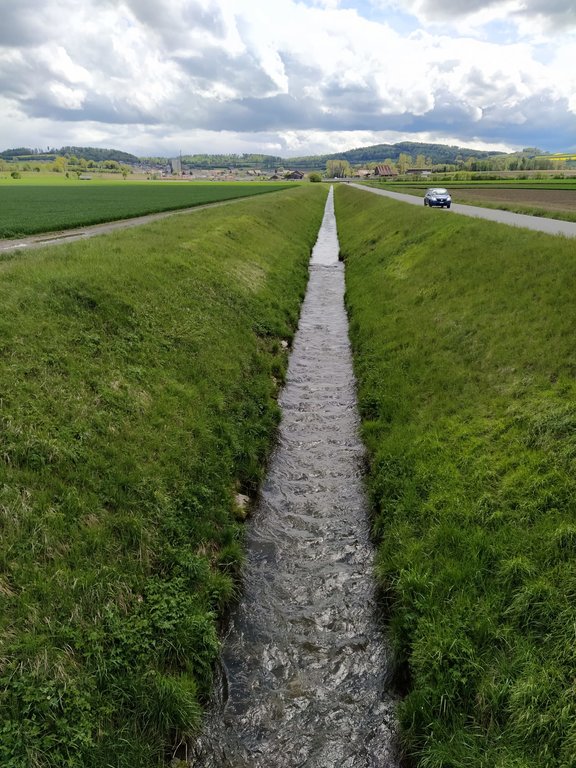
In the 19th and early 20th centuries nearly all Swiss rivers were "corrected" (straightened, channelised and diked) to reduce flood damage and reclaim land for agriculture. In the late 20th century the adverse effects of these corrections became increasingly clear, and there was a paradigm shift towards more sustainable river management. There are many current “revitalization” projects, among them the restoration of the Petite Glâne, which started in 2022 and is expected to be completed in 2026. The project perimeter consists of the last 7 kilometres of the Petite Glâne stream and the costs are estimated at CHF 21.5 million.
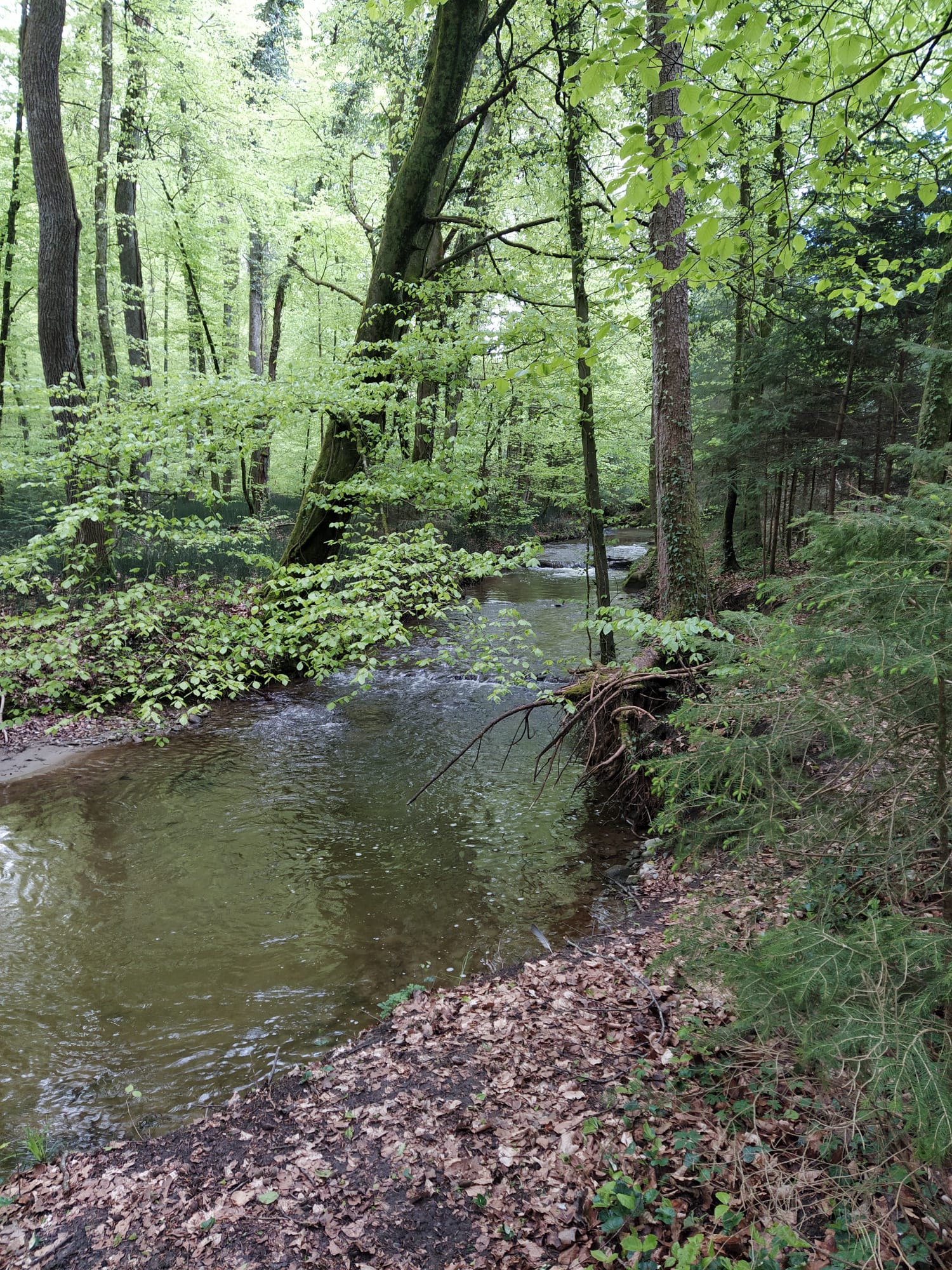
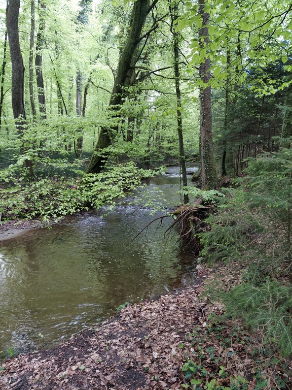
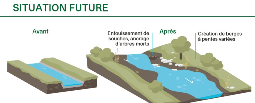
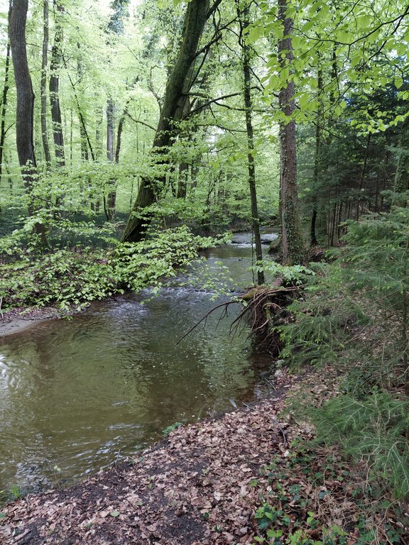
The main characteristics of revitalization are widening the riverbed and reducing the slopes of the riverbanks, thus giving the river space for meandering and changing the morphology in a natural way. Where riparian forests do not occur naturally anymore, it can make sense to re-establish them so that biodiversity can flourish. The planting of trees and bushes gives many animals a habitat and can serve as a wildlife corridor between different areas. Additionally, shading of the water reduces its temperature fluctuations which - especially in summer - is important to many species that are dependent on cold water for their survival. With climate change this threat will become even worse. The main purpose of revitalization is to recreate near-natural conditions in artificially straightened reaches to ensure provision of riparian ecosystem services.
Considerable planning is involved in implementing this technology in Switzerland partly because of legal reasons (watercourses are closely protected and land rights require negotiation) and because effects on downstream areas need to be taken into account. Depending on the length of the river segment where riparian forests are to be restored, there are many stakeholders involved, all of whom need to give their approval: this takes time and effort. Inputs are mostly in the form of trees and bushes. Depending on the degree of revitalization, built-up river sections need to be freed again and infrastructure like bridges, buildings and roads may be affected. In theory, there is no maintenance necessary because revitalized rivers are intended to reassume their natural form and be surrounded by natural vegetation. Nevertheless, in a highly modified and intensely used landscape, the cutting of grass and pruning of trees/bushes on a regular basis can be required. Wood harvesting may be an option. Driftwood might also have to be removed if there is danger of flooding or clogging of bottlenecks – for example under bridges.
Revitalization, theoretically, has larger effects on smaller rivers than on bigger ones due to a greater proportion of land draining into them compared to their size. Additionally, shading has larger effects on the water temperature of smaller rivers. Benefits accruing are mainly in regard to habitat provision and thus biodiversity enhancement, but also improvement of water quality (lower temperatures, less nutrient input) and water management in general as flooding is expected to be less frequent. A key disadvantage is that the measures are often implemented at the expense of agricultural land. Naturally, farmers are usually unhappy about the loss of land - even though alternative agricultural plots and direct payments are provided. In general, however, people appreciate the improvement in the quality of life (a pleasanter area for leisure) and improved biodiversity.
2.3 รูปภาพของเทคโนโลยี
2.5 ประเทศภูมิภาค หรือสถานที่ตั้งที่เทคโนโลยีได้นำไปใช้และได้รับการครอบคลุมโดยการประเมินนี้
ประเทศ:
สวิตเซอร์แลนด์
ภูมิภาค/รัฐ/จังหวัด:
FR/VD
ข้อมูลจำเพาะเพิ่มเติมของสถานที่ตั้ง :
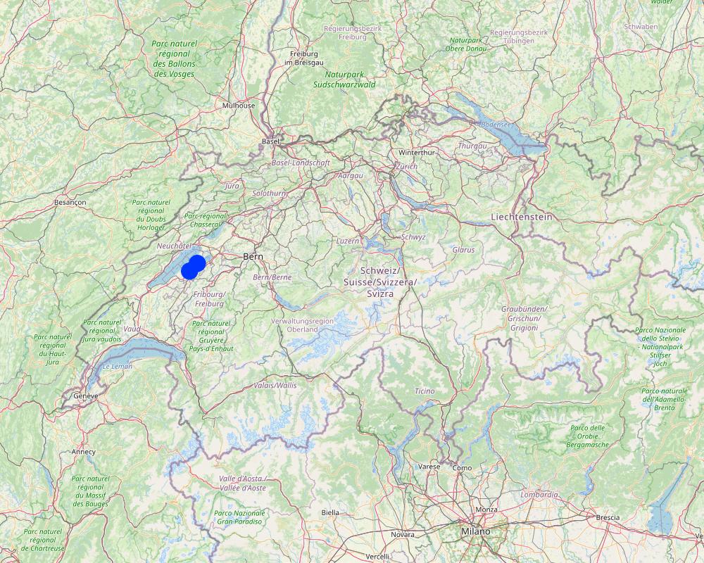
Petite Glâne watershed, 4 communities: Vallon, Missy, St. Aubin, Vully-le-Lac
ระบุการกระจายตัวของเทคโนโลยี:
- กระจายไปอย่างสม่ำเสมอในพื้นที่
If precise area is not known, indicate approximate area covered:
- 0.1-1 ตร.กม.
Is/are the technology site(s) located in a permanently protected area?
ไม่ใช่
แสดงความคิดเห็น:
The average enlargement of the river will be 15 m and then 35 - 60 m of a riparian zone over a length of 7 km.
Map
×2.6 วันที่การดำเนินการ
ระบุปีที่ใช้:
2022
2.7 คำแนะนำของเทคโนโลยี
ให้ระบุว่าเทคโนโลยีถูกแนะนำเข้ามาอย่างไร:
- ทางโครงการหรือจากภายนอก
ความคิดเห็น (ประเภทของโครงการ เป็นต้น) :
The communities wanted to improve the current situation with respect to the threat of flooding through more extreme rain events, and for improving the biodiversity in the area.
3. การจัดประเภทของเทคโนโลยี SLM
3.1 วัตถุประสงค์หลักของเทคโนโลยี
- อนุรักษ์ระบบนิเวศน์
- ป้องกันพื้นที่ลุ่มน้ำ/บริเวณท้ายน้ำ โดยร่วมกับเทคโนโลยีอื่นๆ
- รักษาสภาพหรือปรับปรุงความหลากหลายทางชีวภาพ
- ลดความเสี่ยงของภัยพิบัติ
- ปรับตัวเข้ากับการเปลี่ยนแปลงภูมิอากาศของโลก สภาพภูมิอากาศที่รุนแรงและผลกระทบ
3.2 ประเภทของการใช้ที่ดินในปัจจุบันที่ได้นำเทคโนโลยีไปใช้
Land use mixed within the same land unit:
ไม่ใช่

ป่า/พื้นที่ทำไม้
- ป่ากึ่งธรรมชาติ / พื้นที่ทำไม้
- ป่า/พื้นที่ทำไม้
Tree plantation, afforestation: Specify origin and composition of species:
- การปลูกหลายพันธุ์รวมกัน
Are the trees specified above deciduous or evergreen?
- deciduous
ผลิตภัณฑ์และบริการ:
- การอนุรักษ์ / ป้องกันธรรมชาติ
- นันทนาการ / การท่องเที่ยว
- การป้องกันภัยธรรมชาติ

ทางน้ำ แหล่งน้ำ พื้นที่ชุ่มน้ำ
- ทางระบายน้ำ ทางน้ำ
3.3 Has land use changed due to the implementation of the Technology?
Has land use changed due to the implementation of the Technology?
- Yes (Please fill out the questions below with regard to the land use before implementation of the Technology)
Land use mixed within the same land unit:
ไม่ใช่

พื้นที่ปลูกพืช
- การปลูกพืชล้มลุกอายุปีเดียว
Is crop rotation practiced?
ใช่

การตั้งถิ่นฐาน โครงสร้างพื้นฐาน
- การจราจร ทางถนน รถไฟ
ข้อสังเกต:
bridges, agricultural roads

ทางน้ำ แหล่งน้ำ พื้นที่ชุ่มน้ำ
- หนองบึง พื้นที่ชุ่มน้ำ
3.4 การใช้น้ำ
การใช้น้ำของที่ดินที่มีการใช้เทคโนโลยีอยู่:
- จากน้ำฝน
3.5 กลุ่ม SLM ที่ตรงกับเทคโนโลยีนี้
- การจัดการป่าธรรมชาติและกึ่งธรรมชาติ
- การจัดการน้ำผิวดิน (น้ำพุ แม่น้ำทะเลสาบ ทะเล)
- การลดความเสี่ยงจากภัยพิบัติบนพื้นฐานของระบบนิเวศ
3.6 มาตรการ SLM ที่ประกอบกันเป็นเทคโนโลยี

มาตรการอนุรักษ์ด้วยวิธีพืช
- V1: ต้นไม้และพุ่มไม้คลุมดิน

มาตรการอนุรักษ์ด้วยโครงสร้าง
- S2: ทำนบ เขื่อนดิน

มาตรการอนุรักษ์ด้วยการจัดการ
- M1: การเปลี่ยนรูปแบบของการใช้ประโยชน์ที่ดิน
- M2: การเปลี่ยนแปลงของการจัดการหรือระดับความเข้มข้น
3.7 รูปแบบหลักของการเสื่อมโทรมของที่ดินที่ได้รับการแก้ไขโดยเทคโนโลยี

การกัดกร่อนของดินโดยน้ำ
- Wr (Riverbank erosion): การกัดกร่อนริมฝั่งแม่น้ำ

การเสื่อมโทรมของดินทางด้านชีวภาพ
- Bh (Loss of habitat): การสูญเสียแหล่งที่อยู่
- Bs (Quality and species composition): องค์ประกอบหรือความหลากหลายทางคุณภาพและชนิดพันธุ์ลดลง

การเสื่อมโทรมของน้ำ
- Hs (Change in quantity of surface water): การเปลี่ยนแปลงปริมาณของน้ำที่ผิวดิน
- Hp (Decline of surface water quality): การลดลงของคุณภาพน้ำที่ผิวดิน
3.8 การป้องกัน การลดลง หรือการฟื้นฟูความเสื่อมโทรมของที่ดิน
ระบุเป้าหมายของเทคโนโลยีกับความเสื่อมโทรมของที่ดิน:
- ป้องกันความเสื่อมโทรมของที่ดิน
- ฟื้นฟูบำบัดที่ดินที่เสื่อมโทรมลงอย่างมาก
4. ข้อมูลจำเพาะด้านเทคนิค กิจกรรมการนำไปปฏิบัติใช้ ปัจจัยนำเข้า และค่าใช้จ่าย
4.1 แบบแปลนทางเทคนิคของเทคโนโลยี
ข้อมูลจำเพาะด้านเทคนิค (แบบแปลนทางเทคนิคของเทคโนโลยี):
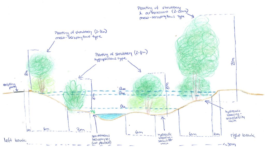
Between 2022 and 2026, the Petite Glâne is being revitalized on a length of 7 km with an average enlargement of the riparian zone of 15 m which totals in the riparian zone having a width between 35 and 60 m. 30,000 young trees and shrubs (from 37 species) and 100 larger trees are being planted. In addition, 200 small structures for wildlife will be provided. The very steep riverbanks are being reduced in their slope. Material used for the reconstruction of the river mainly comprises vegetation.
ผู้เขียน:
Nives Ramisberger
วันที่:
13/07/2022
4.2 ข้อมูลทั่วไปเกี่ยวกับการคำนวณปัจจัยนำเข้าและค่าใช้จ่าย
ให้ระบุว่าค่าใช้จ่ายและปัจจัยนำเข้าได้รับการคำนวณอย่างไร:
- ต่อพื้นที่ที่ใช้เทคโนโลยี
ระบุขนาดและหน่วยพื้นที่:
33 ha (medium width of riparian area ((35+60)/2) * length of river reach (7km))
อื่นๆ หรือสกุลเงินประจำชาติ (ระบุ):
CHF
If relevant, indicate exchange rate from USD to local currency (e.g. 1 USD = 79.9 Brazilian Real): 1 USD =:
0.98
4.3 กิจกรรมเพื่อการจัดตั้ง
| กิจกรรม | Timing (season) | |
|---|---|---|
| 1. | communication (with communities etc.) and looking for sponsoring | 2018 |
| 2. | completion of studies | 2018 |
| 3. | survey/planning/project execution | 2018 |
| 4. | Delays due to the Corona pandemic, start of reconstruction was originally planned for 2020 | |
| 5. | search for company | 2022 |
| 6. | implementation | 2022-2025 |
แสดงความคิดเห็น:
This list is basically a list of the different steps that are involved in any project and show how long it took from first thinking about implementing the revitalization until now realizing. The implementation is not bound to any season and expected to be carried out continuously.
4.4 ค่าใช้จ่ายของปัจจัยนำเข้าที่จำเป็นสำหรับการจัดตั้ง
| ปัจจัยนำเข้า | หน่วย | ปริมาณ | ค่าใช้จ่ายต่อหน่วย | ค่าใช้จ่ายทั้งหมดต่อปัจจัยนำเข้า | %ของค่าใช้จ่ายที่ก่อให้เกิดขึ้นโดยผู้ใช้ที่ดิน | |
|---|---|---|---|---|---|---|
| แรงงาน | engineers, purchase of land | 1.0 | 3000000.0 | 3000000.0 | ||
| วัสดุด้านพืช | trees, small structures | 30000.0 | 100.0 | 3000000.0 | ||
| วัสดุสำหรับก่อสร้าง | terracing, bridges | 1.0 | 15000000.0 | 15000000.0 | ||
| อื่น ๆ | unexpected | 1.0 | 500000.0 | 500000.0 | ||
| ค่าใช้จ่ายทั้งหมดของการจัดตั้งเทคโนโลยี | 21500000.0 | |||||
| Total costs for establishment of the Technology in USD | 21938775.51 | |||||
ถ้าผู้ใช้ที่ดินรับภาระน้อยกว่า 100% ของค่าใช้จ่าย ให้ระบุว่าใครเป็นผู้รับผิดชอบส่วนที่เหลือ:
80% are paid by the federal government, 20% by the adjacent municipalities and local sponsors.
แสดงความคิดเห็น:
The total cost is known and a broad estimation possible of how much is used for what but it was not possible to break it down into more detail because it is a big project and many stakeholders involved.
4.5 การบำรุงรักษาสภาพหรือกิจกรรมที่เกิดขึ้นเป็นประจำ
| กิจกรรม | ช่วงระยะเวลา/ความถี่ | |
|---|---|---|
| 1. | Checking riverbed | every 2-3 years |
| 2. | Mowing of grass | 1-2 per year |
| 3. | Cutting/ pruning of trees | every 5-10 years (usually around 30% of the area at once) |
| 4. | General maintenance period | 2025-2028 |
| 5. | Follow-up, control of revitalization effects | 2038 |
แสดงความคิดเห็น:
Grass needs to be cut 1-2 times a year. The other maintenance activities are not required so frequently. The watercourse must be checked every 2-3 years and every 5-10 years the trees may have to be cut. When cutting the trees 1/3 of the area should be done at once but not more to not disturb wildlife too much and give it space to retreat to. None of these activities are bound to any particular season. During the first 3 years after the finalization of the project, maintenance work will be carried out (checking if everything is still okay, how the river behaves, if plants grow, etc.).
4.6 ค่าใช้จ่ายของปัจจัยนำเข้าและกิจกรรมที่เกิดขึ้นเป็นประจำที่ต้องการการบำรุงรักษา (ต่อปี)
แสดงความคิดเห็น:
The project is not yet in a phase in which the costs for maintenance can be estimated because the implementation hasn't yet started and will not finish before 2025. Also, it depends on how much of the maintenance can be done by the farmers of the adjacent lands and how much will need to be done through community workers which would increase costs.
4.7 ปัจจัยสำคัญที่สุดที่มีผลกระทบต่อค่าใช้จ่าย
ปัจจัยสำคัญที่สุดที่มีผลกระทบต่อค่าใช้จ่ายต่างๆ:
The most expensive feature of this project is the volume of earth that will be removed from the now steep riverbanks to widen the riverbed. The earth removed will directly be used again for small hills and what is not used directly in the riparian zone will be distributed on the agriculturally used fields next to the rivers. Also, there are several bridges that cross the Petite Glâne, and by enlarging the riverbed the bridges need to be rebuilt as well - which drives up the price greatly.
5. สิ่งแวดล้อมทางธรรมชาติและของมนุษย์
5.1 ภูมิอากาศ
ฝนประจำปี
- < 250 ม.ม.
- 251-500 ม.ม.
- 501-750 ม.ม.
- 751-1,000 ม.ม.
- 1,001-1,500 ม.ม.
- 1,501-2,000 ม.ม.
- 2,001-3,000 ม.ม.
- 3,001-4,000 ม.ม.
- > 4,000 ม.ม.
ระบุปริมาณน้ำฝนเฉลี่ยรายปี (ถ้ารู้) :หน่วย ม.ม.
865.00
ระบุชื่อของสถานีตรวดวัดอากาศที่ใช้อ้างอิงคือ:
Payerne
เขตภูมิอากาศเกษตร
- กึ่งชุ่มชื้น
- กึ่งแห้งแล้ง
average maximum temperature 14.2°C, average minimum temperature 5.1°C
5.2 สภาพภูมิประเทศ
ค่าเฉลี่ยความลาดชัน:
- ราบเรียบ (0-2%)
- ลาดที่ไม่ชัน (3-5%)
- ปานกลาง (6-10%)
- เป็นลูกคลื่น (11-15%)
- เป็นเนิน (16-30%)
- ชัน (31-60%)
- ชันมาก (>60%)
ธรณีสัณฐาน:
- ที่ราบสูง/ที่ราบ
- สันเขา
- ไหล่เขา
- ไหล่เนินเขา
- ตีนเนิน
- หุบเขา
ระดับความสูง:
- 0-100 เมตร
- 101-500 เมตร
- 501-1,000 เมตร
- 1,001-1,500 เมตร
- 1,501-2,000 เมตร
- 2,001-2,500 เมตร
- 2,501-3,000 เมตร
- 3,001-4,000 เมตร
- > 4,000 เมตร
ให้ระบุถ้าเทคโนโลยีได้ถูกนำไปใช้:
- บริเวณแอ่งบนที่ราบ (concave situations)
5.3 ดิน
ค่าเฉลี่ยความลึกของดิน:
- ตื้นมาก (0-20 ซ.ม.)
- ตื้น (21-50 ซ.ม.)
- ลึกปานกลาง (51-80 ซ.ม.)
- ลึก (81-120 ซ.ม.)
- ลึกมาก (>120 ซ.ม.)
เนื้อดิน (ดินชั้นบน):
- ปานกลาง (ดินร่วน ทรายแป้ง)
เนื้อดินล่าง (> 20 ซ.ม.ต่ำจากผิวดิน):
- ปานกลาง (ดินร่วน ทรายแป้ง)
อินทรียวัตถุในดิน:
- ปานกลาง (1-3%)
5.4 ความเป็นประโยชน์และคุณภาพของน้ำ
ระดับน้ำใต้ดิน:
5-50 เมตร
น้ำไหลบ่าที่ผิวดิน:
ดี
คุณภาพน้ำ (ที่ยังไม่ได้บำบัด):
เป็นน้ำใช้เพื่อการเกษตรเท่านั้น (การชลประทาน)
Water quality refers to:
surface water
ความเค็มของน้ำเป็นปัญหาหรือไม่:
ไม่ใช่
กำลังเกิดน้ำท่วมในพื้นที่หรือไม่:
ใช่
บ่อยครั้ง:
เป็นครั้งเป็นคราว
ความคิดเห็นและข้อมูลจำเพาะเพิ่มเติมเรื่องคุณภาพและปริมาณน้ำ:
The increasing threat of heavy rainfall events due to climate change enhances the threat of flooding which is why the revitalization is being implemented. Through enlargement of the riverbed and increasing surface roughness through vegetation, flooding of adjacent agricultural areas is expected to be less frequent. The effect of the plants directly on water quality/quantity are expected to be minor.
5.5 ความหลากหลายทางชีวภาพ
ความหลากหลายทางชนิดพันธุ์:
- ต่ำ
ความหลากหลายของแหล่งที่อยู่:
- ต่ำ
ความคิดเห็นและข้อมูลจำเพาะเพิ่มเติมของความหลากหลายทางชีวภาพ:
Both are between low and medium, but low rather than medium.
5.6 ลักษณะของผู้ใช้ที่ดินที่นำเทคโนโลยีไปปฏิบัติใช้
อยู่กับที่หรือเร่ร่อน:
- อยู่กับที่
แนวทางการตลาดของระบบการผลิต:
- ทำการค้า/การตลาด
รายได้ที่มาจากนอกฟาร์ม:
- < 10% ของรายได้ทั้งหมด
ระดับของความมั่งคั่งโดยเปรียบเทียบ:
- พอมีพอกิน
เป็นรายบุคคล/ครัวเรือน:
- กลุ่ม/ชุมชน
- ลูกจ้าง (บริษัท รัฐบาล)
ระดับของการใช้เครื่องจักรกล:
- การใช้เครื่องจักรหรือเครื่องยนต์
เพศ:
- หญิง
- ชาย
อายุของผู้ใช้ที่ดิน:
- วัยกลางคน
ระบุลักษณะอื่นๆที่เกี่ยวข้องของผู้ใช้ที่ดิน:
The land users now are farmers that rent or own the land. For implementing the technology the lease agreement was terminated and the land up to now owned by the farmers has been bought by the communities.
5.7 Average area of land used by land users applying the Technology
- < 0.5 เฮกตาร์
- 0.5-1 เฮกตาร์
- 1-2 เฮกตาร์
- 2-5 เฮกตาร์
- 5-15 เฮกตาร์
- 15-50 เฮกตาร์
- 50-100 เฮกตาร์
- 100-500 เฮกตาร์
- 500-1,000 เฮกตาร์
- 1,000-10,000 เฮกตาร์
- >10,000 เฮกตาร์
พิจารณาว่าเป็นขนาดเล็ก กลาง หรือขนาดใหญ่ (ซึ่งอ้างอิงถึงบริบทระดับท้องถิ่น):
- ขนาดกลาง
แสดงความคิดเห็น:
The technology is applied by communities
5.8 กรรมสิทธิ์ในที่ดิน สิทธิในการใช้ที่ดินและสิทธิในการใช้น้ำ
กรรมสิทธิ์ในที่ดิน:
- เป็นแบบชุมชนหรือหมู่บ้าน
- รายบุคคล ได้รับสิทธิครอบครอง
สิทธิในการใช้ที่ดิน:
- เกี่ยวกับชุมชน (ถูกจัดระเบียบ)
สิทธิในการใช้น้ำ:
- เกี่ยวกับชุมชน (ถูกจัดระเบียบ)
Are land use rights based on a traditional legal system?
ใช่
ระบุ:
lease agreement
แสดงความคิดเห็น:
Where possible farmers got other areas to substitute for that lost by implementing the revitalization
5.9 การเข้าถึงบริการและโครงสร้างพื้นฐาน
สุขภาพ:
- จน
- ปานกลาง
- ดี
การศึกษา:
- จน
- ปานกลาง
- ดี
ความช่วยเหลือทางด้านเทคนิค:
- จน
- ปานกลาง
- ดี
การจ้างงาน (เช่น ภายนอกฟาร์ม):
- จน
- ปานกลาง
- ดี
ตลาด:
- จน
- ปานกลาง
- ดี
พลังงาน:
- จน
- ปานกลาง
- ดี
ถนนและการขนส่ง:
- จน
- ปานกลาง
- ดี
น้ำดื่มและการสุขาภิบาล:
- จน
- ปานกลาง
- ดี
บริการด้านการเงิน:
- จน
- ปานกลาง
- ดี
6. ผลกระทบและสรุปคำบอกกล่าว
6.1 ผลกระทบในพื้นที่ดำเนินการ (On-site) จากการใช้เทคโนโลยี
ผลกระทบทางด้านเศรษฐกิจและสังคม
การผลิต
การผลิตพืชผล
การผลิตไม้
พื้นที่สำหรับการผลิต
ความเป็นประโยชน์และคุณภาพของน้ำ
การมีน้ำไว้ให้สำหรับการชลประทาน
คุณภาพน้ำสำหรับการชลประทาน
รายได้และค่าใช้จ่าย
รายได้จากฟาร์ม
แสดงความคิดเห็น/ระบุ:
In the short term it is expected to decrease due to loss of land, in the long term not because of more resilience towards floods
ความหลากหลายของแหล่งผลิตรายได้
แสดงความคิดเห็น/ระบุ:
State subsidies for biodiversity areas
ผลกระทบด้านสังคมวัฒนธรรมอื่น ๆ
การใช้ที่ดิน / สิทธิในการใช้น้ำ
โอกาสทางวัฒนธรรม
โอกาสทางด้านสันทนาการ
แสดงความคิดเห็น/ระบุ:
The landscape becomes more beautiful and new places to stay are made, but on the other hand many places are deliberately made inaccessible for the protection of flora & fauna.
การบรรเทาความขัดแย้ง
แสดงความคิดเห็น/ระบุ:
Simultaneously, the threat of flooding for farmers is decreased and enhancement of habitat created which is expected to lead to improved acceptance by all stakeholders
ผลกระทบด้านนิเวศวิทยา
วัฐจักรน้ำหรือน้ำบ่า
ปริมาณน้ำ
คุณภาพน้ำ
การเก็บเกี่ยวหรือการกักเก็บน้ำ
น้ำไหลบ่าที่ผิวดิน
แสดงความคิดเห็น/ระบุ:
Will be slightly improved through reducing the gradient of riverbanks
การระบายน้ำส่วนเกิน
น้ำบาดาลหรือระดับน้ำในแอ่งน้ำบาดาล
การระเหย
แสดงความคิดเห็น/ระบุ:
Less evaporation but more evapotranspiration expected
ดิน
ความชื้นในดิน
สิ่งปกคลุมดิน
การสูญเสียดิน
ความหลากหลายทางชีวภาพของพืชและสัตว์
การปกคลุมด้วยพืช
มวลชีวภาพ/เหนือดินชั้น C
ความหลากหลายทางชีวภาพของพืช
พืชพันธุ์ต่างถิ่นที่รุกล้ำเข้ามา
ความหลากหลายทางชีวภาพของสัตว์
ชนิดพันธุ์ที่ให้ประโยชน์
ความหลากหลายของสัตว์
ลดความเสี่ยงของภัยพิบัติ
ผลกระทบจากน้ำท่วม
ผลกระทบจากภัยแล้ง
แสดงความคิดเห็น/ระบุ:
It is not known yet if there will be any difference for after the implementation but it is expected that the difference will be negligible
ผลกระทบของพายุไซโคลน พายุฝน
การปล่อยคาร์บอนและก๊าซเรือนกระจก
ความเร็วของลม
ภูมิอากาศจุลภาค
Specify assessment of on-site impacts (measurements):
Observations, measurements and projections
6.2 ผลกระทบนอกพื้นที่ดำเนินการ (Off-site) จากการใช้เทคโนโลยี
น้ำที่ใช้ประโยชน์ได้
การไหลของน้ำคงที่และสม่ำเสมอในช่วงฤดูแล้ง
น้ำท่วมพื้นที่ท้ายน้ำ
การทับถมของดินตะกอนพื้นที่ท้ายน้ำ
การเกิดมลพิษในน้ำบาดาลหรือแม่น้ำ
ความสามารถต้านทานการเปลี่ยนแปลง / ความสามารถในการคัดกรอง
ตะกอนที่ถูกพัดพามาโดยลม
ความเสียหายต่อพื้นที่เพาะปลูกของเพื่อนบ้าน
ความเสียหายต่อโครงสร้างพื้นฐานของรัฐหรือของเอกชน
Specify assessment of off-site impacts (measurements):
Observations, measurements and projections
6.3 การเผชิญและความตอบสนองของเทคโนโลยีต่อการเปลี่ยนแปลงสภาพภูมิอากาศที่ค่อยเป็นค่อยไป และสภาพรุนแรงของภูมิอากาศ / ภัยพิบัติ (ที่รับรู้ได้โดยผู้ใช้ที่ดิน)
การเปลี่ยนแปลงสภาพภูมิอากาศที่ค่อยเป็นค่อยไป
การเปลี่ยนแปลงสภาพภูมิอากาศที่ค่อยเป็นค่อยไป
| ฤดู | increase or decrease | เทคโนโลยีมีวิธีการรับมืออย่างไร | |
|---|---|---|---|
| อุณหภูมิประจำปี | เพิ่มขึ้น | ปานกลาง |
สภาพรุนแรงของภูมิอากาศ (ภัยพิบัติ)
ภัยพิบัติทางอุตุนิยมวิทยา
| เทคโนโลยีมีวิธีการรับมืออย่างไร | |
|---|---|
| พายุฝนฟ้าคะนองประจำท้องถิ่น | ดี |
| พายุลูกเห็บประจำท้องถิ่น | ปานกลาง |
ภัยพิบัติจากสภาพภูมิอากาศ
| เทคโนโลยีมีวิธีการรับมืออย่างไร | |
|---|---|
| คลื่นความร้อน | ปานกลาง |
| ภัยจากฝนแล้ง | ปานกลาง |
ภัยพิบัติจากน้ำ
| เทคโนโลยีมีวิธีการรับมืออย่างไร | |
|---|---|
| น้ำท่วมตามปกติ (แม่น้ำ) | ดีมาก |
| น้ำท่วมฉับพลัน | ดีมาก |
6.4 การวิเคราะห์ค่าใช้จ่ายและผลประโยชน์ที่ได้รับ
ผลประโยชน์ที่ได้รับเปรียบเทียบกับค่าใช้จ่ายในการจัดตั้งเป็นอย่างไร (จากมุมมองของผู้ใช้ที่ดิน)
ผลตอบแทนระยะสั้น:
ด้านบวก
ผลตอบแทนระยะยาว:
ด้านบวก
ผลประโยชน์ที่ได้รับเปรียบเทียบกับค่าใช้จ่ายในการบำรุงรักษาหรือต้นทุนที่เกิดขึ้นซ้ำอีก เป็นอย่างไร (จากมุมมองของผู้ใช้ที่ดิน)
ผลตอบแทนระยะสั้น:
ด้านบวก
ผลตอบแทนระยะยาว:
ด้านบวก
แสดงความคิดเห็น:
The short term benefits (1-3 years after implementation) are considered positive as the technology shows positive effects on ecosystem services (e.g. flood protection) within a short period of time despite the high establishment costs.
6.5 การปรับตัวของเทคโนโลยี
- ครั้งเดียวหรือเป็นการทดลอง
แสดงความคิดเห็น:
The communities were initiating the revitalization and did not do so before finding sponsors and subventions
6.6 การปรับตัว
เทคโนโลยีได้รับการปรับเปลี่ยนเมื่อเร็วๆนี้ เพื่อให้ปรับตัวเข้ากับสภาพที่กำลังเปลี่ยนแปลงหรือไม่:
ไม่ใช่
6.7 จุดแข็ง / ข้อได้เปรียบ / โอกาสของเทคโนโลยี
| จุดแข็ง / ข้อได้เปรียบ / โอกาสในทัศนคติของผู้ใช้ที่ดิน |
|---|
| Less flooding |
| Small improvement in soil quality |
| จุดแข็ง / ข้อได้เปรียบ / โอกาสในทัศนคติของผู้รวบรวมหรือวิทยากรหลัก |
|---|
| Biodiversity |
| Positive measure against warming waters |
| Improvement of the landscape and therefore of the quality for recreational purposes |
| Flood protection |
6.8 จุดอ่อน / ข้อเสียเปรียบ / ความเสี่ยงของเทคโนโลยีและวิธีการแก้ไข
| จุดอ่อน / ข้อเสียเปรียบ / ความเสี่ยงในทัศนคติของผู้ใช้ที่ดิน | มีวิธีการแก้ไขได้อย่างไร |
|---|---|
| Loss of agricultural land |
Exchange of plots (next to river taken; elsewhere, another given) Financial compensation |
| จุดอ่อน / ข้อเสียเปรียบ / ความเสี่ยงในทัศนคติของผู้รวบรวมหรือวิทยากรหลัก | มีวิธีการแก้ไขได้อย่างไร |
|---|---|
| High costs | Sponsoring/subsidies needed |
7. การอ้างอิงและการเชื่อมต่อ
7.1 วิธีการและแหล่งข้อมูล
- ไปเยี่ยมชมภาคสนาม การสำรวจพื้นที่ภาคสนาม
Visit with specialists
- การสัมภาษณ์ผู้เชี่ยวชาญด้าน SLM หรือผู้ชำนาญ
2 key persons > engineers from different companies
วันที่เก็บรวบรวมข้อมูล(ภาคสนาม) :
13/07/2022
7.4 General comments
The municipality owns the land that is now used by the farmers. To make up for the lost land the municipality provided other plots for them to use. Nevertheless, the total loss of agricultural land amounts to 11 ha.
ลิงก์และโมดูล
ขยายทั้งหมด ย่อทั้งหมดลิงก์
ไม่มีลิงก์
โมดูล
ไม่มีโมดูล


