Agroforestry and Reforestation for Improved Livelihoods and Ecosystem Services [อินโดนีเซีย]
- ผู้สร้างสรรค์:
- การอัพเดท:
- ผู้รวบรวม: Siti Indriani
- ผู้เรียบเรียง: –
- ผู้ตรวจสอบ: William Critchley, Rima Mekdaschi Studer
Tree Planting or Agroforestry
technologies_7142 - อินโดนีเซีย
ดูส่วนย่อย
ขยายทั้งหมด ย่อทั้งหมด1. ข้อมูลทั่วไป
1.2 รายละเอียดที่ติดต่อได้ของผู้รวบรวมและองค์กรที่เกี่ยวข้องในการประเมินและการจัดเตรียมทำเอกสารของเทคโนโลยี
ชื่อของโครงการซึ่งอำนวยความสะดวกในการทำเอกสารหรือการประเมินเทคโนโลยี (ถ้าเกี่ยวข้อง)
Land Use Based Mitigation for Resilient Climate Pathways (LANDMARC)ชื่อขององค์กรซึ่งอำนวยความสะดวกในการทำเอกสารหรือการประเมินเทคโนโลยี (ถ้าเกี่ยวข้อง)
Sustainability & Resilience company (su-re.co) - อินโดนีเซีย1.3 เงื่อนไขการใช้ข้อมูลที่ได้บันทึกผ่านทาง WOCAT
ผู้รวบรวมและวิทยากรหลักยอมรับเงื่อนไขเกี่ยวกับการใช้ข้อมูลที่ถูกบันทึกผ่านทาง WOCAT:
ใช่
1.4 การเปิดเผยเรื่องความยั่งยืนของเทคโนโลยีที่ได้อธิบายไว้
เทคโนโลยีที่ได้อธิบายไว้นี้เป็นปัญหาของความเสื่อมโทรมโทรมของที่ดินหรือไม่ จึงไม่ได้รับการยอมรับว่าเป็นเทคโนโลยีเพื่อการจัดการที่ดินอย่างยั่งยืน:
ไม่ใช่
แสดงความคิดเห็น:
It can be declared a sustainable land management technology
2. การอธิบายลักษณะของเทคโนโลยี SLM
2.1 การอธิบายแบบสั้น ๆ ของเทคโนโลยี
คำจำกัดความของเทคโนโลยี:
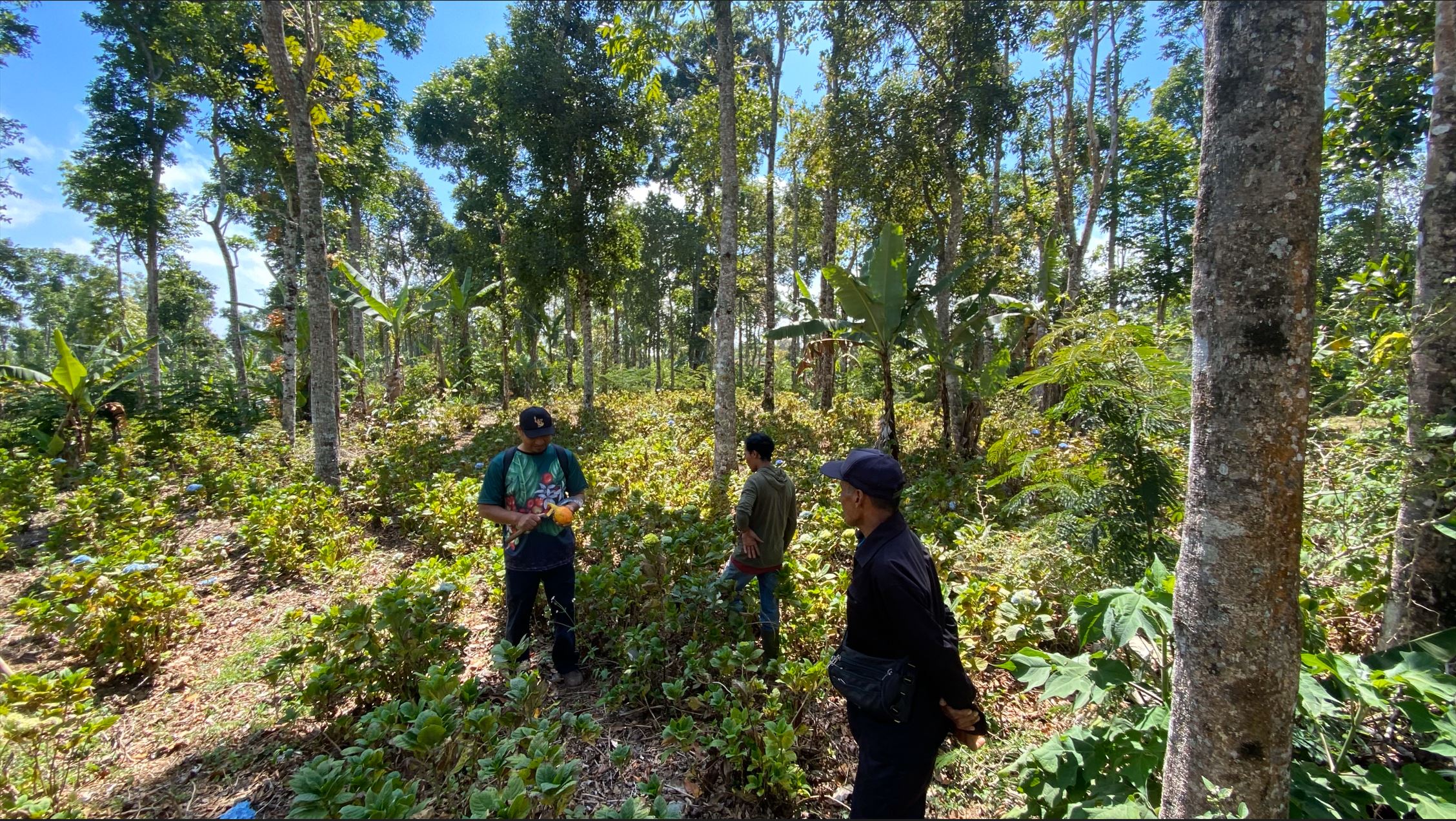
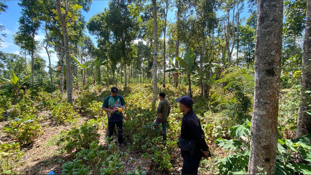
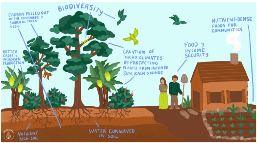
Approximately 20,000 hectares of degraded land is being rehabilitated land using assisted natural regeneration, enrichment planting and agroforestry. The resultant secondary forests and agroforests will have high values for ecotourism, sequester substantial amounts of carbon, produce a range of in-demand commodities (e.g., coffee, spices), generate bioenergy, and offer improved ecosystem services.
2.2 การอธิบายแบบละเอียดของเทคโนโลยี
คำอธิบาย:
A partnership of local communities and governments is, in collaboration with international and national development organizations, donors and investors, rehabilitating approximately 20,000 hectares of degraded forest and agricultural land using assisted natural regeneration, enrichment planting and agroforestry. The resultant secondary forests and agroforests will have high values for ecotourism, sequester substantial amounts of carbon, produce a range of in-demand commodities (e.g., coffee, spices), and generate bioenergy. They will also offer improved ecosystem services to Bali as a whole, which will be very valuable for the tourism industry, representing an opportunity for investment and payment for ecosystem services (PES).
In the first 20 hectares, around 1,600 trees were planted per hectare, consisting of Coffee Arabica Katimor and Local Avocado trees. In between, shrubs such as local cassava and root species already existed. The spacing followed recommendations from ICCRI (Indonesian Coffee and Cacao Research Institute) whereby 2-3 meters distance are placed in between coffee trees, with much further distances for the shade trees. For fertilization, local goat manure is primarily used and filled in the planting holes the size of 30cm x 30cm x 30cm.
Northeast Bali, Indonesia — which includes the Batur UNESCO Global Geopark — features approximately 135,000 ha of degraded land in the Government’s Forest Estate (‘Kawasan Hutan’), which is managed by the provincial government’s Forestry and Environment Agency (Dinas Kehutanan Dan Lingkungan Hidup Provinsi Bali/DKLH).
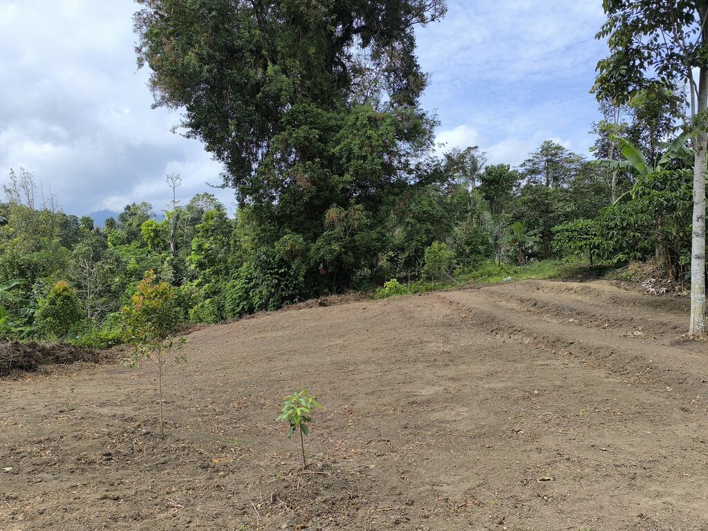
The vegetation, soils and water resources are designated as ‘potentially’ to ‘very severely’ degraded on 463,500 hectares. This is steadily increasing owing to unsustainable forestry and farming practices. Local communities within and surrounding the Kawasan Hutan — among the poorest in Bali — are affected by droughts, flash floods, landslides and poor water quality.
The Geopark in Northeast Bali was established in 2012 on the active volcanic landscape of Mt Batur, which features not only unique and dramatic geological formations, protected forests and endemic flora and fauna but also 15 villages. Approximately 90% of the Geopark is classified as severely degraded owing to a lack of post-eruption rehabilitation and unsustainable farming practices. The Geopark received almost one million visitors in 2019.
The ten-year project will be implemented by a consortium consisting of Sustainability and Resilience Co. (a local NGO), Indonesian government (through DKLH), local university (Udayana), international research-in-development organization (CIFOR-ICRAF), specialist national research organizations, intergovernmental organization, larger private sector and investment partners, each bringing a specific set of skills and expertise.
The work will be carried out through four major components.
1. Establishment of a coordinated enabling environment through a multistakeholder forum of local governments, national and provincial government agencies, communities, larger private sector and project consortium members.
2. Co-designing and co-implementing models of integrated ecosystem and livelihoods restoration that suit local socio-economic and environmental conditions with staged expansion over the ten years.
3. Training communities, local small businesses and Government staff in co-design, establishment and management of restored, productive ecosystems and value chains.
4. Strengthening and further introducing partnerships between the community, public and private sectors in all aspects of the landscape, including co-developing and co-implementing an enabling investment environment for continuing financial flows.
2.3 รูปภาพของเทคโนโลยี
2.4 วีดีโอของเทคโนโลยี
ความคิดเห็น/อธิบายสั้นๆ:
Degraded area in Wanagiri, Bali, as a pilot location
วันที่:
04/06/2024
สถานที่:
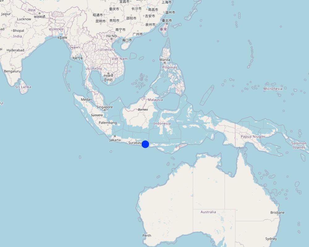
Wanagiri, Bali, Indonesia
ชื่อผู้ถ่ายวีดีโอ:
Fabian Wiropranoto
2.5 ประเทศภูมิภาค หรือสถานที่ตั้งที่เทคโนโลยีได้นำไปใช้และได้รับการครอบคลุมโดยการประเมินนี้
ประเทศ:
อินโดนีเซีย
ภูมิภาค/รัฐ/จังหวัด:
Bali
ข้อมูลจำเพาะเพิ่มเติมของสถานที่ตั้ง :
Wanagiri, Northeast Bali
ระบุการกระจายตัวของเทคโนโลยี:
- กระจายไปอย่างสม่ำเสมอในพื้นที่
If precise area is not known, indicate approximate area covered:
- 0.1-1 ตร.กม.
Is/are the technology site(s) located in a permanently protected area?
ใช่
ถ้าใช่ ระบุ:
Batur UNESCO Global Geopark
แสดงความคิดเห็น:
Batur UNESCO Global Geopark
Map
×2.6 วันที่การดำเนินการ
ระบุปีที่ใช้:
2024
ถ้าไม่รู้ปีที่แน่นอน ให้ระบุวันที่โดยประมาณ:
- น้อยกว่า 10 ปี (ไม่นานนี้)
2.7 คำแนะนำของเทคโนโลยี
ให้ระบุว่าเทคโนโลยีถูกแนะนำเข้ามาอย่างไร:
- ทางโครงการหรือจากภายนอก
ความคิดเห็น (ประเภทของโครงการ เป็นต้น) :
Training communities, local small businesses, and Government staff in the co-design, establishment, and management of restored, productive ecosystems and value chains.
3. การจัดประเภทของเทคโนโลยี SLM
3.1 วัตถุประสงค์หลักของเทคโนโลยี
- ลด ป้องกัน ฟื้นฟู การเสื่อมโทรมของที่ดิน
- รักษาสภาพหรือปรับปรุงความหลากหลายทางชีวภาพ
- ชะลอการเปลี่ยนแปลงภูมิอากาศของโลกและผลกระทบ
- สร้างผลกระทบทางด้านเศรษฐกิจที่เป็นประโยชน์
- สร้างผลกระทบทางด้านสังคมที่เป็นประโยชน์
3.2 ประเภทของการใช้ที่ดินในปัจจุบันที่ได้นำเทคโนโลยีไปใช้
Land use mixed within the same land unit:
ใช่
Specify mixed land use (crops/ grazing/ trees):
- วนเกษตร (Agroforestry)

ป่า/พื้นที่ทำไม้
- ป่ากึ่งธรรมชาติ / พื้นที่ทำไม้
(Semi-)natural forests/ woodlands: Specify management type:
- การเกษตรแบบไร่เลื่อยลอย (Shifting cultivation)
Type of (semi-)natural forest:
- tropical mountain systems natural vegetation
Type of tree:
- Acacia species
- Leucaena leucocephala
- Swietenia macrophylla
Are the trees specified above deciduous or evergreen?
- evergreen
ผลิตภัณฑ์และบริการ:
- ไม้ซุง
- ผลไม้และถั่ว
- การอนุรักษ์ / ป้องกันธรรมชาติ
- นันทนาการ / การท่องเที่ยว
แสดงความคิดเห็น:
Degraded or unproductive land in Wanagiri, Bali, Indonesia
3.3 Has land use changed due to the implementation of the Technology?
Has land use changed due to the implementation of the Technology?
- Yes (Please fill out the questions below with regard to the land use before implementation of the Technology)
Land use mixed within the same land unit:
ใช่
Specify mixed land use (crops/ grazing/ trees):
- วนเกษตร (Agroforestry)

ที่ดินที่ไม่ให้ผลผลิต
ระบุ:
Underutilized forest land
แสดงความคิดเห็น:
Agroforestry
3.4 การใช้น้ำ
การใช้น้ำของที่ดินที่มีการใช้เทคโนโลยีอยู่:
- จากน้ำฝน
3.5 กลุ่ม SLM ที่ตรงกับเทคโนโลยีนี้
- การปลูกป่าร่วมกับพืช
3.6 มาตรการ SLM ที่ประกอบกันเป็นเทคโนโลยี

มาตรการจัดการพืช
- A1: พืช/สิ่งปกคลุมดิน
- A2: อินทรียวัตถุในดิน/ความอุดมสมบูรณ์ในดิน
- A5: การจัดการเมล็ดพันธุ์ การปรับปรุงพันธุ์

มาตรการอนุรักษ์ด้วยวิธีพืช
- V1: ต้นไม้และพุ่มไม้คลุมดิน
- V3: กำจัดพืชออกให้หมด
- V5: อื่นๆ

มาตรการอนุรักษ์ด้วยโครงสร้าง
- S6: กำแพง สิ่งกีดขวาง รั้วไม้ รั้วต่างๆ
- S9: ที่พักพิงสำหรับพืชและสัตว์

มาตรการอนุรักษ์ด้วยการจัดการ
- M1: การเปลี่ยนรูปแบบของการใช้ประโยชน์ที่ดิน
- M2: การเปลี่ยนแปลงของการจัดการหรือระดับความเข้มข้น
แสดงความคิดเห็น:
Agroforestry practices
3.7 รูปแบบหลักของการเสื่อมโทรมของที่ดินที่ได้รับการแก้ไขโดยเทคโนโลยี

การกัดกร่อนของดินโดยน้ำ
- Wt (Loss of topsoil): การสูญเสียดินชั้นบนหรือการกัดกร่อนที่ผิวดิน

การเสื่อมโทรมของดินทางด้านชีวภาพ
- Bc (Reduction of vegetation cover): การลดลงของจำนวนพืชที่ปกคลุมดิน
3.8 การป้องกัน การลดลง หรือการฟื้นฟูความเสื่อมโทรมของที่ดิน
ระบุเป้าหมายของเทคโนโลยีกับความเสื่อมโทรมของที่ดิน:
- ฟื้นฟูบำบัดที่ดินที่เสื่อมโทรมลงอย่างมาก
- ปรับตัวกับสภาพความเสื่อมโทรมของที่ดิน
4. ข้อมูลจำเพาะด้านเทคนิค กิจกรรมการนำไปปฏิบัติใช้ ปัจจัยนำเข้า และค่าใช้จ่าย
4.1 แบบแปลนทางเทคนิคของเทคโนโลยี
ข้อมูลจำเพาะด้านเทคนิค (แบบแปลนทางเทคนิคของเทคโนโลยี):
In the first 20 hectares, around 1,600 trees were planted per hectare, consisting of coffee arabica Katimor and local avocado trees. In between, shrubs such as local cassava and root species already existed. The spacing followed recommendations from ICCRI (Indonesian Coffee and Cacao Research Institute) whereby 2-3 meters distance are placed in between coffee trees, with much further distances for the shade trees. For fertilization, local goat manure is primarily used and filled in the planting holes the size of 30cm x 30cm x 30cm
20 ha is the pilot area
Spacing between plants [m]
Avocado: 5x5
Coffee: 3x3
Vertical vegetative measures [m]
Avocado:
Coffee:
Lateral gradient of structures
Density of plants per ha
Avocado: 20
Coffee: 50
ผู้เขียน:
Bruno Bordoni
วันที่:
30/05/2024
4.2 ข้อมูลทั่วไปเกี่ยวกับการคำนวณปัจจัยนำเข้าและค่าใช้จ่าย
ให้ระบุว่าค่าใช้จ่ายและปัจจัยนำเข้าได้รับการคำนวณอย่างไร:
- ต่อพื้นที่ที่ใช้เทคโนโลยี
ระบุขนาดและหน่วยพื้นที่:
20 ha as the pilot case
If using a local area unit, indicate conversion factor to one hectare (e.g. 1 ha = 2.47 acres): 1 ha =:
1 ha = 2.47 acres
ระบุสกุลเงินที่ใช้คำนวณค่าใช้จ่าย:
- USD
If relevant, indicate exchange rate from USD to local currency (e.g. 1 USD = 79.9 Brazilian Real): 1 USD =:
600.0
4.3 กิจกรรมเพื่อการจัดตั้ง
| กิจกรรม | Timing (season) | |
|---|---|---|
| 1. | Survey | Month 1-2 |
| 2. | Stakeholders Engagement | Month 3-4 |
| 3. | Climate Field School | Month 4 |
| 4. | Nursing Establishment | Month 5-7 |
| 5. | Initial Tree Plantation | Month 8 |
| 6. | Fertilizing and Biocides | Month 8 |
| 7. | Maintenance | Month 9-12 |
| 8. | Tree Planting | Month 13 |
| 9. | Fertilizing and Biocides | Month 13 |
| 10. | Maintenance | Month 14-17 |
4.4 ค่าใช้จ่ายของปัจจัยนำเข้าที่จำเป็นสำหรับการจัดตั้ง
| ปัจจัยนำเข้า | หน่วย | ปริมาณ | ค่าใช้จ่ายต่อหน่วย | ค่าใช้จ่ายทั้งหมดต่อปัจจัยนำเข้า | %ของค่าใช้จ่ายที่ก่อให้เกิดขึ้นโดยผู้ใช้ที่ดิน | |
|---|---|---|---|---|---|---|
| แรงงาน | Workers and Researchers | 1000 | 20.0 | 1000.0 | 20000.0 | |
| วัสดุด้านพืช | Seedlings | 500 | 40.0 | 500.0 | 20000.0 | |
| ปุ๋ยและสารฆ่า/ยับยั้งการเจริญเติบโตของสิ่งมีชีวิต (ไบโอไซด์) | Organic fertilizer | 60 | 100.0 | 60.0 | 6000.0 | |
| วัสดุสำหรับก่อสร้าง | Nursery | 1000 | 14.0 | 1000.0 | 14000.0 | |
| ค่าใช้จ่ายทั้งหมดของการจัดตั้งเทคโนโลยี | 60000.0 | |||||
| Total costs for establishment of the Technology in USD | 100.0 | |||||
If you are unable to break down the costs in the table above, give an estimation of the total costs of establishing the Technology:
60000.0
ถ้าผู้ใช้ที่ดินรับภาระน้อยกว่า 100% ของค่าใช้จ่าย ให้ระบุว่าใครเป็นผู้รับผิดชอบส่วนที่เหลือ:
Project donors and grants will cover all costs
4.5 การบำรุงรักษาสภาพหรือกิจกรรมที่เกิดขึ้นเป็นประจำ
| กิจกรรม | ช่วงระยะเวลา/ความถี่ | |
|---|---|---|
| 1. | Fertilizer | Once per year |
| 2. | Transportation, accommodation for fertilizing and stakeholders engagement | Once per year |
4.6 ค่าใช้จ่ายของปัจจัยนำเข้าและกิจกรรมที่เกิดขึ้นเป็นประจำที่ต้องการการบำรุงรักษา (ต่อปี)
| ปัจจัยนำเข้า | หน่วย | ปริมาณ | ค่าใช้จ่ายต่อหน่วย | ค่าใช้จ่ายทั้งหมดต่อปัจจัยนำเข้า | %ของค่าใช้จ่ายที่ก่อให้เกิดขึ้นโดยผู้ใช้ที่ดิน | |
|---|---|---|---|---|---|---|
| แรงงาน | Transportation, accommodation in the 1st year | Package | 1.0 | 250.0 | 250.0 | |
| แรงงาน | Transportation, accommodation in the 2nd year | Package | 1.0 | 250.0 | 250.0 | |
| แรงงาน | Transportation, accommodation in the 2nd year | Package | 1.0 | 250.0 | 250.0 | |
| ปุ๋ยและสารฆ่า/ยับยั้งการเจริญเติบโตของสิ่งมีชีวิต (ไบโอไซด์) | Goat manure in the 1st year | kg | 400.0 | 0.2 | 80.0 | |
| ปุ๋ยและสารฆ่า/ยับยั้งการเจริญเติบโตของสิ่งมีชีวิต (ไบโอไซด์) | Chicken manure in the 1st year | kg | 400.0 | 0.1 | 40.0 | |
| ปุ๋ยและสารฆ่า/ยับยั้งการเจริญเติบโตของสิ่งมีชีวิต (ไบโอไซด์) | Goat manure in the 2nd year | kg | 400.0 | 0.2 | 80.0 | |
| ปุ๋ยและสารฆ่า/ยับยั้งการเจริญเติบโตของสิ่งมีชีวิต (ไบโอไซด์) | Chicken manure in the 2nd year | kg | 400.0 | 0.1 | 40.0 | |
| ปุ๋ยและสารฆ่า/ยับยั้งการเจริญเติบโตของสิ่งมีชีวิต (ไบโอไซด์) | Goat manure in the 3rd year | kg | 400.0 | 0.2 | 80.0 | |
| ปุ๋ยและสารฆ่า/ยับยั้งการเจริญเติบโตของสิ่งมีชีวิต (ไบโอไซด์) | Chicken manure in the 3rd year | kg | 400.0 | 0.1 | 40.0 | |
| ค่าใช้จ่ายทั้งหมดของการบำรุงรักษาสภาพเทคโนโลยี | 1110.0 | |||||
| Total costs for maintenance of the Technology in USD | 1.85 | |||||
If you are unable to break down the costs in the table above, give an estimation of the total costs of maintaining the Technology:
1110.0
ถ้าผู้ใช้ที่ดินรับภาระน้อยกว่า 100% ของค่าใช้จ่าย ให้ระบุว่าใครเป็นผู้รับผิดชอบส่วนที่เหลือ:
The project donors and grants will cover all the cost
4.7 ปัจจัยสำคัญที่สุดที่มีผลกระทบต่อค่าใช้จ่าย
ปัจจัยสำคัญที่สุดที่มีผลกระทบต่อค่าใช้จ่ายต่างๆ:
Climate or seasonal change will affect the fertilizing time and will affect the annual cost for fertilizer
5. สิ่งแวดล้อมทางธรรมชาติและของมนุษย์
5.1 ภูมิอากาศ
ฝนประจำปี
- < 250 ม.ม.
- 251-500 ม.ม.
- 501-750 ม.ม.
- 751-1,000 ม.ม.
- 1,001-1,500 ม.ม.
- 1,501-2,000 ม.ม.
- 2,001-3,000 ม.ม.
- 3,001-4,000 ม.ม.
- > 4,000 ม.ม.
ระบุชื่อของสถานีตรวดวัดอากาศที่ใช้อ้างอิงคือ:
Staklim Bali
เขตภูมิอากาศเกษตร
- ชื้น
Lenght of Growing Period > 270
Tropical
Oct-March: wet season
April-Sept: dry season
5.2 สภาพภูมิประเทศ
ค่าเฉลี่ยความลาดชัน:
- ราบเรียบ (0-2%)
- ลาดที่ไม่ชัน (3-5%)
- ปานกลาง (6-10%)
- เป็นลูกคลื่น (11-15%)
- เป็นเนิน (16-30%)
- ชัน (31-60%)
- ชันมาก (>60%)
ธรณีสัณฐาน:
- ที่ราบสูง/ที่ราบ
- สันเขา
- ไหล่เขา
- ไหล่เนินเขา
- ตีนเนิน
- หุบเขา
ระดับความสูง:
- 0-100 เมตร
- 101-500 เมตร
- 501-1,000 เมตร
- 1,001-1,500 เมตร
- 1,501-2,000 เมตร
- 2,001-2,500 เมตร
- 2,501-3,000 เมตร
- 3,001-4,000 เมตร
- > 4,000 เมตร
ให้ระบุถ้าเทคโนโลยีได้ถูกนำไปใช้:
- ไม่เกี่ยวข้อง
5.3 ดิน
ค่าเฉลี่ยความลึกของดิน:
- ตื้นมาก (0-20 ซ.ม.)
- ตื้น (21-50 ซ.ม.)
- ลึกปานกลาง (51-80 ซ.ม.)
- ลึก (81-120 ซ.ม.)
- ลึกมาก (>120 ซ.ม.)
เนื้อดิน (ดินชั้นบน):
- ปานกลาง (ดินร่วน ทรายแป้ง)
เนื้อดินล่าง (> 20 ซ.ม.ต่ำจากผิวดิน):
- ละเอียด/หนัก (ดินเหนียว)
อินทรียวัตถุในดิน:
- สูง (>3%)
(ถ้ามี) ให้แนบคำอธิบายเรื่องดินแบบเต็มหรือระบุข้อมูลที่มีอยู่ เช่น ชนิดของดิน ค่า pH ของดินหรือความเป็นกรดของดิน ความสามารถในการแลกเปลี่ยนประจุบวก ไนโตรเจน ความเค็ม เป็นต้น:
Andosols (volcanic soil)
Rich organic matter
Highly porous
Dark coloured
Developed from parent material of volcanic origin
Low pH
High porosity
5.4 ความเป็นประโยชน์และคุณภาพของน้ำ
ระดับน้ำใต้ดิน:
5-50 เมตร
น้ำไหลบ่าที่ผิวดิน:
ปานกลาง
คุณภาพน้ำ (ที่ยังไม่ได้บำบัด):
เป็นน้ำเพื่อการดื่มที่ไม่ดี (จำเป็นต้องได้รับการบำบัด)
Water quality refers to:
ground water
ความเค็มของน้ำเป็นปัญหาหรือไม่:
ไม่ใช่
กำลังเกิดน้ำท่วมในพื้นที่หรือไม่:
ไม่ใช่
5.5 ความหลากหลายทางชีวภาพ
ความหลากหลายทางชนิดพันธุ์:
- สูง
ความหลากหลายของแหล่งที่อยู่:
- ปานกลาง
ความคิดเห็นและข้อมูลจำเพาะเพิ่มเติมของความหลากหลายทางชีวภาพ:
Wanagiri forest
67 plant species
Agroforestry systems involve growing crops and trees together, which can increase the overall biodiversity of the area.
5.6 ลักษณะของผู้ใช้ที่ดินที่นำเทคโนโลยีไปปฏิบัติใช้
อยู่กับที่หรือเร่ร่อน:
- อยู่กับที่
แนวทางการตลาดของระบบการผลิต:
- mixed (subsistence/ commercial)
รายได้ที่มาจากนอกฟาร์ม:
- 10-50% ของรายได้ทั้งหมด
- > 50% ของรายได้ทั้งหมด
ระดับของความมั่งคั่งโดยเปรียบเทียบ:
- จน
- พอมีพอกิน
เป็นรายบุคคล/ครัวเรือน:
- กลุ่ม/ชุมชน
ระดับของการใช้เครื่องจักรกล:
- งานที่ใช้แรงกาย
เพศ:
- หญิง
- ชาย
อายุของผู้ใช้ที่ดิน:
- วัยกลางคน
- ผู้สูงอายุ
5.7 Average area of land used by land users applying the Technology
- < 0.5 เฮกตาร์
- 0.5-1 เฮกตาร์
- 1-2 เฮกตาร์
- 2-5 เฮกตาร์
- 5-15 เฮกตาร์
- 15-50 เฮกตาร์
- 50-100 เฮกตาร์
- 100-500 เฮกตาร์
- 500-1,000 เฮกตาร์
- 1,000-10,000 เฮกตาร์
- >10,000 เฮกตาร์
พิจารณาว่าเป็นขนาดเล็ก กลาง หรือขนาดใหญ่ (ซึ่งอ้างอิงถึงบริบทระดับท้องถิ่น):
- ขนาดกลาง
5.8 กรรมสิทธิ์ในที่ดิน สิทธิในการใช้ที่ดินและสิทธิในการใช้น้ำ
กรรมสิทธิ์ในที่ดิน:
- รัฐ
สิทธิในการใช้ที่ดิน:
- เกี่ยวกับชุมชน (ถูกจัดระเบียบ)
สิทธิในการใช้น้ำ:
- เข้าถึงได้แบบเปิด (ไม่ได้จัดระเบียบ)
Are land use rights based on a traditional legal system?
ไม่ใช่
5.9 การเข้าถึงบริการและโครงสร้างพื้นฐาน
สุขภาพ:
- จน
- ปานกลาง
- ดี
การศึกษา:
- จน
- ปานกลาง
- ดี
ความช่วยเหลือทางด้านเทคนิค:
- จน
- ปานกลาง
- ดี
การจ้างงาน (เช่น ภายนอกฟาร์ม):
- จน
- ปานกลาง
- ดี
ตลาด:
- จน
- ปานกลาง
- ดี
พลังงาน:
- จน
- ปานกลาง
- ดี
ถนนและการขนส่ง:
- จน
- ปานกลาง
- ดี
น้ำดื่มและการสุขาภิบาล:
- จน
- ปานกลาง
- ดี
บริการด้านการเงิน:
- จน
- ปานกลาง
- ดี
แสดงความคิดเห็น:
52.64% primary education
35.51% lower secondary and upper secondary
11.85% undergraduate and graduate school
Technical assistance
Employment
Markets
Energy
Road and transport
Drinking water and sanitation
6. ผลกระทบและสรุปคำบอกกล่าว
6.1 ผลกระทบในพื้นที่ดำเนินการ (On-site) จากการใช้เทคโนโลยี
ผลกระทบทางด้านเศรษฐกิจและสังคม
การผลิต
การจัดการที่ดิน
จำนวนก่อน SLM:
0 ha
หลังจาก SLM:
20 ha
แสดงความคิดเห็น/ระบุ:
This is calculated per 20 ha of the pilot area.
รายได้และค่าใช้จ่าย
ความหลากหลายของแหล่งผลิตรายได้
จำนวนก่อน SLM:
1 income source
หลังจาก SLM:
2 income sources
แสดงความคิดเห็น/ระบุ:
Per 20 ha
ผลกระทบด้านสังคมวัฒนธรรมอื่น ๆ
โอกาสทางวัฒนธรรม
จำนวนก่อน SLM:
0 activity
หลังจาก SLM:
3 activities
แสดงความคิดเห็น/ระบุ:
Traditional rituals in 20 ha of the pilot area
ผลกระทบด้านนิเวศวิทยา
ความหลากหลายทางชีวภาพของพืชและสัตว์
การปกคลุมด้วยพืช
จำนวนก่อน SLM:
30%
หลังจาก SLM:
75%
ความหลากหลายทางชีวภาพของพืช
จำนวนก่อน SLM:
5 types
หลังจาก SLM:
10 types
ลดความเสี่ยงของภัยพิบัติ
การปล่อยคาร์บอนและก๊าซเรือนกระจก
6.2 ผลกระทบนอกพื้นที่ดำเนินการ (Off-site) จากการใช้เทคโนโลยี
Organisational Support
จำนวนก่อน SLM:
0 organisation
หลังจาก SLM:
10 organisations
แสดงความคิดเห็น/ระบุ:
Per 20 ha
6.3 การเผชิญและความตอบสนองของเทคโนโลยีต่อการเปลี่ยนแปลงสภาพภูมิอากาศที่ค่อยเป็นค่อยไป และสภาพรุนแรงของภูมิอากาศ / ภัยพิบัติ (ที่รับรู้ได้โดยผู้ใช้ที่ดิน)
การเปลี่ยนแปลงสภาพภูมิอากาศที่ค่อยเป็นค่อยไป
การเปลี่ยนแปลงสภาพภูมิอากาศที่ค่อยเป็นค่อยไป
| ฤดู | increase or decrease | เทคโนโลยีมีวิธีการรับมืออย่างไร | |
|---|---|---|---|
| ฝนประจำปี | ลดลง | ปานกลาง |
สภาพรุนแรงของภูมิอากาศ (ภัยพิบัติ)
ภัยพิบัติจากสภาพภูมิอากาศ
| เทคโนโลยีมีวิธีการรับมืออย่างไร | |
|---|---|
| ภัยจากฝนแล้ง | ปานกลาง |
ผลลัพธ์ตามมาที่เกี่ยวข้องกับภูมิอากาศอื่น ๆ
ผลลัพธ์ตามมาที่เกี่ยวข้องกับภูมิอากาศอื่น ๆ
| เทคโนโลยีมีวิธีการรับมืออย่างไร | |
|---|---|
| ช่วงการปลูกพืชที่ลดลงมา | ไม่ทราบ |
6.4 การวิเคราะห์ค่าใช้จ่ายและผลประโยชน์ที่ได้รับ
ผลประโยชน์ที่ได้รับเปรียบเทียบกับค่าใช้จ่ายในการจัดตั้งเป็นอย่างไร (จากมุมมองของผู้ใช้ที่ดิน)
ผลตอบแทนระยะสั้น:
เป็นกลางหรือสมดุล
ผลตอบแทนระยะยาว:
ด้านบวก
ผลประโยชน์ที่ได้รับเปรียบเทียบกับค่าใช้จ่ายในการบำรุงรักษาหรือต้นทุนที่เกิดขึ้นซ้ำอีก เป็นอย่างไร (จากมุมมองของผู้ใช้ที่ดิน)
ผลตอบแทนระยะสั้น:
เป็นกลางหรือสมดุล
ผลตอบแทนระยะยาว:
ด้านบวก
แสดงความคิดเห็น:
Enabling environment for investment in tree-product supply chains
Readily investable business plans and economically viable restoration models targeting profitable species, such as Pongamia, Bamboo, Coffee
Carbon credits
A landscape of integrated restoration, bioenergy, and payment for ecosystem services.
At least 10,000 male and female farmers trained in assisted natural regeneration, enrichment planting, climate-smart agroforestry, bioenergy and other productive practices.
6.5 การปรับตัวของเทคโนโลยี
- 11-50%
Of all those who have adopted the Technology, how many did so spontaneously, i.e. without receiving any material incentives/ payments?
- 11-50%
แสดงความคิดเห็น:
Yes, they voluntarily did the tree planting
6.6 การปรับตัว
เทคโนโลยีได้รับการปรับเปลี่ยนเมื่อเร็วๆนี้ เพื่อให้ปรับตัวเข้ากับสภาพที่กำลังเปลี่ยนแปลงหรือไม่:
ใช่
ถ้าตอบว่าใช่ ให้ระบุว่าเงื่อนไขการเปลี่ยนแปลงใดที่ถูกปรับตัว:
- การเปลี่ยนแปลงของตลาด
ให้ระบุการปรับตัวของเทคโนโลยี (การออกแบบ วัสดุหรือชนิดพันธุ์ เป็นต้น):
By applying intercropping, farmers will have more products variants, e.g. potatoes, chillies
6.7 จุดแข็ง / ข้อได้เปรียบ / โอกาสของเทคโนโลยี
| จุดแข็ง / ข้อได้เปรียบ / โอกาสในทัศนคติของผู้ใช้ที่ดิน |
|---|
| Quality germplasm from commercially viable nurseries (coffee, avocado, cassava, jackfruit, lamtoro) |
| Landscape restoration |
| จุดแข็ง / ข้อได้เปรียบ / โอกาสในทัศนคติของผู้รวบรวมหรือวิทยากรหลัก |
|---|
| Community engagement |
| Carbon credits |
6.8 จุดอ่อน / ข้อเสียเปรียบ / ความเสี่ยงของเทคโนโลยีและวิธีการแก้ไข
| จุดอ่อน / ข้อเสียเปรียบ / ความเสี่ยงในทัศนคติของผู้ใช้ที่ดิน | มีวิธีการแก้ไขได้อย่างไร |
|---|---|
| Reduced crops production due to lack of capacity and resources to maintain | Monitoring, evaluation, and maintenance |
| จุดอ่อน / ข้อเสียเปรียบ / ความเสี่ยงในทัศนคติของผู้รวบรวมหรือวิทยากรหลัก | มีวิธีการแก้ไขได้อย่างไร |
|---|---|
| Natural Disaster | Risk Mitigation |
7. การอ้างอิงและการเชื่อมต่อ
7.1 วิธีการและแหล่งข้อมูล
- ไปเยี่ยมชมภาคสนาม การสำรวจพื้นที่ภาคสนาม
30
- การสัมภาษณ์กับผู้ใช้ที่ดิน
20
- การสัมภาษณ์ผู้เชี่ยวชาญด้าน SLM หรือผู้ชำนาญ
10
วันที่เก็บรวบรวมข้อมูล(ภาคสนาม) :
21/10/2024
7.2 การอ้างอิงถึงสิ่งตีพิมพ์
หัวข้อ, ผู้เขียน, ปี, หมายเลข ISBN:
N/A
7.3 Links to relevant online information
ชื่อเรื่องหรือคำอธิบาย:
Let's restore 43,000 ha of Bali
URL:
https://www.su-re.co/tree-planting
7.4 General comments
Envision a revitalized Bali where degraded lands bloom once more, fostering sustainable farming, robust ecotourism, and enhanced ecosystem services.
ลิงก์และโมดูล
ขยายทั้งหมด ย่อทั้งหมดลิงก์
ไม่มีลิงก์
โมดูล
ไม่มีโมดูล


