
Dug-out sunken pond cum countour bund [India]
- Creation:
- Update:
- Compiler: Unknown User
- Editor: –
- Reviewers: Fabian Ottiger, Alexandra Gavilano
Buda Gata with Adibandha
technologies_1086 - India
View sections
Expand all Collapse all1. General information
1.2 Contact details of resource persons and institutions involved in the assessment and documentation of the Technology
Key resource person(s)
SLM specialist:
Mohanty Rajib Kumar
India
1.3 Conditions regarding the use of data documented through WOCAT
The compiler and key resource person(s) accept the conditions regarding the use of data documented through WOCAT:
Yes
1.5 Reference to Questionnaire(s) on SLM Approaches (documented using WOCAT)
Community based sustainable livelihoods [India]
Sustainable livelihoods enhanced through people's organisations by linking with other resource organisations prticularly for resource poor.
- Compiler: Unknown User
2. Description of the SLM Technology
2.1 Short description of the Technology
Definition of the Technology:
It can be defined as combination of structural & vegetative measures where contour bunds are constructed from the excavated sandy loam soil of cultivated wastelands in semi-arid climatic(?) zone with moderate slope in medium soil depth conditions in order to link with self-subsistance & market oriented production systems from private lands.
2.2 Detailed description of the Technology
Description:
The area is located at the foot-slopes & hill slopes area where run-off is at peaks very often at the time of rainy season. Therefore, sand casting came as a first order priorities by the farmers of this patch. At the outset, a livelihood focused micro-plan had been prepared by the villagers stating the details of the base-line data along with problems & alternative solutions. The patch was identified to be the worst affected, concentraton of poor people (defined by villagers), people of this patch ready to contibute at least 20% of the cost. In the mean time project sent the PIA to BAIF, Bangalore to study the linking of farm ponds & its relevance in this context of our situation. As a demonstration, PIA & other technical team facilitated the villagers. One water harvesting structure was constructed by line deptt of soil conservation just at the down hills to harvest rain water & protect the lands below from sand casting. But there were no alternatives for the land users of that patch about the optimum utilisation recharged water. The surrounding area was totally unbunded with sandy loam soil. Therefore, land users are of opinion to go fo field bunding. Earlier the practice was to dig a trench at upper gadient & put a bund below it out of the excavated soil from trench. But the requirement of land users was to get some water in each farmers land to protect the Kharif & some early rabi crop.(june-dec). By which the lands where, farmers take up only minor millets for their subsistance, that too less production & land So the main purpose of this technology was to convert the land into bunded lands along with to fetch some water at the time of dry spell in between the monsoon period. A four days in field training was conducted by the project to community link workers(SWC), particularly on patch treatment, use of levelling instruments like A-frame, proper planning, design, lay-out of different type of structure in a map & ground. After many rounds of discussion with the land users, one of them ( rich farmers with more land) was ready to do it in his own land. But, the SWC specialist did a detail transact along with land users, although results of first round tansact was mentioned in the micro-plan. The main pupose was to looking at problems & demarkating on the map. After that estimate was prepared & lay-out of key contour was done by SWC specialist with the help of community link workers & land users. The work was implemented by by the labourers with the supervision of the respective User's group leade & monitoring was done by the SWC specialist. The prioty ranking by the land users vegetaive measures like vertiver & Sabai (grass plantation on the bund along the side of the bund. For that, the necessary requirement like nursery, seedling collection was done by agriculture specialist. Training was conducted on the probable alternatives of agronomic measures like taking of crop which is of little longer duration, intercrops & cash crops etc. The vegetaive & structructural measures are subsidised by the project & the agronomic measures was taken up on loan basis. The development fund was also generated out of contribution from the land users which was deposited in a separate account for future maintainance cost.
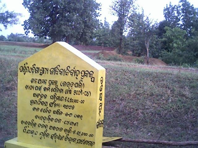
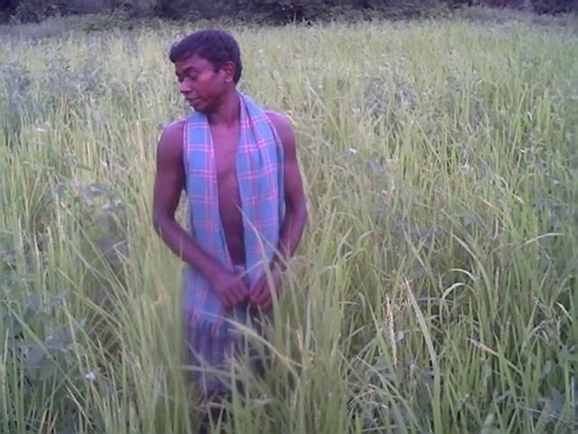
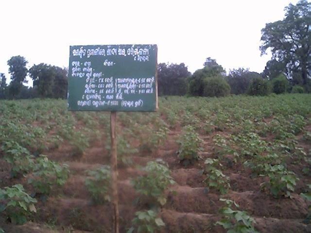
2.3 Photos of the Technology
Media Gallery

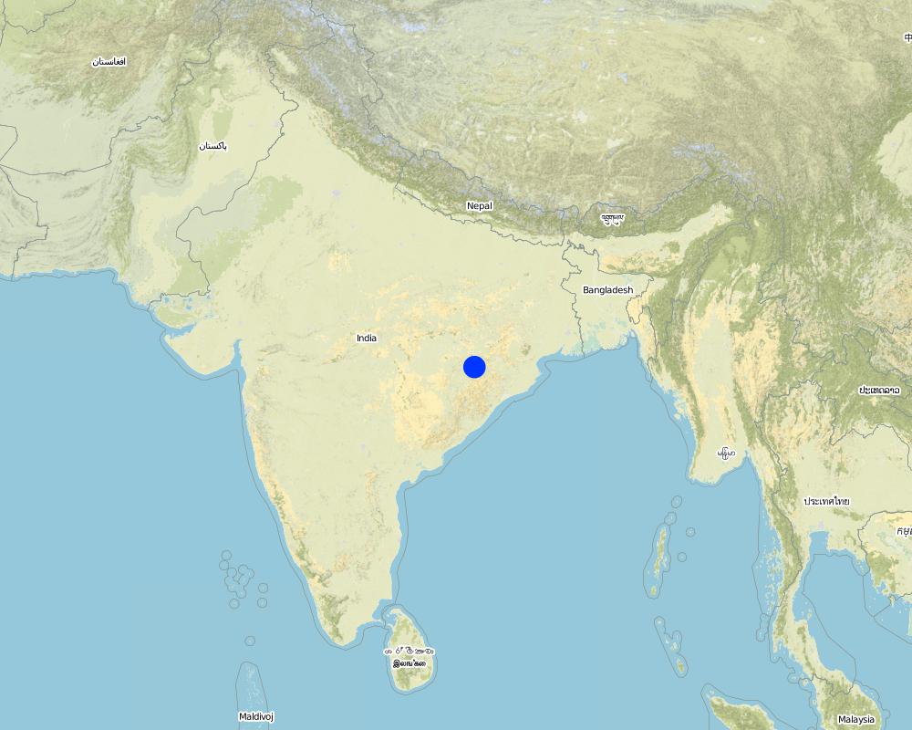
2.5 Country/ region/ locations where the Technology has been applied and which are covered by this assessment
Country:
India
Region/ State/ Province:
Orissa
Further specification of location:
Khaparakhol
Specify the spread of the Technology:
- evenly spread over an area
If the Technology is evenly spread over an area, specify area covered (in km2):
0.7
If precise area is not known, indicate approximate area covered:
- 0.1-1 km2
Comments:
Total area covered by the SLM Technology is 0.7 km2.
The concerned watershed is a subsidiary system of the Suktel river drainage sytem. The area of operation is micro watershed , i.e. 500 hac as a unit of the tributary of the Suktel river.
Map
×2.6 Date of implementation
If precise year is not known, indicate approximate date:
- less than 10 years ago (recently)
2.7 Introduction of the Technology
Specify how the Technology was introduced:
- through projects/ external interventions
Comments (type of project, etc.):
A group of SWC proffessionals were sent to BAIF Karnatka to study the replication of ' Linking of farm ponds models. After a detail study we concluded that the climate in particular & rainfall in general of our area is not fit for that technolgy. When SWC specialist share their experience to land users, some of the farmers agreed to have a experimentation of the technology. Therefore, modification has been done by the SWC specialists as per the suitability & requirement of the land users.
3. Classification of the SLM Technology
3.1 Main purpose(s) of the Technology
- reduce, prevent, restore land degradation
3.2 Current land use type(s) where the Technology is applied
Land use mixed within the same land unit:
Yes
Specify mixed land use (crops/ grazing/ trees):
- Agro-silvopastoralism

Cropland
- Annual cropping
- Tree and shrub cropping
Annual cropping - Specify crops:
- cereals - millet
- cereals - rice (upland)
- fibre crops - cotton
- oilseed crops - groundnuts
- rice
Tree and shrub cropping - Specify crops:
- mango, mangosteen, guava
- pome fruits (apples, pears, quinces, etc.)
Number of growing seasons per year:
- 2
Specify:
Longest growing period in days: 90Longest growing period from month to month: Jun - SepSecond longest growing period in days: 75Second longest growing period from month to month: Sep - Dec

Grazing land
Comments:
Major cash crop: Ground nut
Major food crop: Paddy/minormillets
Major other crop: Cotton
Major cash crop: Fruit like mango/Custard apple
Major land use problems (compiler’s opinion): This patch of the land is poor in the nutrient status in comparison to other lands of the village, with high concentration of marginal farmer. Heavy top soil erosion over the years yields to decreasing of productivity of land. The main requirement of water is in the dry spell in between the monsoon period.
Major land use problems (land users’ perception): 1. Run-off was severe at the time of rainy season which causes heavy soil erosion. 2. Sand casting on down below lands . 3. Long duration crops is not possible, ex- Ground nut, paddy, cotton etc. 3. Lands was not levelled for smoothening of ploughing operation. 4. The uncultivated wasteland(according the record of rights) was distributed to some landless persons who are unable to take up any productive cultivation in these lands.
Ranching: Although technolgy is not directly applied, but indirect effect is there on grazing.
Grazingland comments: The major cause of loss in livestock is that there is no option for the villagers for stall feeding. Example- in summer no availability of green fodder or less availabity.
Type of cropping system and major crops comments: Minor Millets/ Paddy(june-Sept)- Black gram or pulses(Sep-Dec) or cotton as the sole crop for nine months.
3.4 Water supply
Water supply for the land on which the Technology is applied:
- rainfed
3.5 SLM group to which the Technology belongs
- cross-slope measure
- water harvesting
3.6 SLM measures comprising the Technology

vegetative measures

structural measures
Comments:
Main measures: vegetative measures, structural measures
Secondary measures: agronomic measures, management measures
Type of agronomic measures: better crop cover, relay cropping, mixed cropping / intercropping, contour planting / strip cropping, legume inter-planting, manure / compost / residues, rotations / fallows, minimum tillage, pits
Type of vegetative measures: aligned: -contour, aligned: -graded strips *<sup>3</sup>
3.7 Main types of land degradation addressed by the Technology

soil erosion by water
- Wt: loss of topsoil/ surface erosion
- Wg: gully erosion/ gullying
- Wm: mass movements/ landslides
- Wo: offsite degradation effects
Comments:
Main type of degradation addressed: Wt: loss of topsoil / surface erosion, Wg: gully erosion / gullying
Secondary types of degradation addressed: Wo: offsite degradation effects
Main causes of degradation: other human induced causes (specify) (agricultural causes - Suitable alternatives which will yield more benefit with less investments.), education, access to knowledge and support services (Knowledge sustainable livelihoods framework)
Secondary causes of degradation: deforestation / removal of natural vegetation (incl. forest fires) (Maintainance & responsibility sharing for protection), over-exploitation of vegetation for domestic use (Particularly vegetation which yields non-timber forest produce.), overgrazing (Uncontrolled & free grazing at the period Dec-June restricts the land users to go for second crop.), other natural causes (avalanches, volcanic eruptions, mud flows, highly susceptible natural resources, extreme topography, etc.) specify (Frequent drought occurs in every alternative 3rd year.), poverty / wealth (Initiation of any activities for sustainance of livelihoods need some capital)
3.8 Prevention, reduction, or restoration of land degradation
Specify the goal of the Technology with regard to land degradation:
- restore/ rehabilitate severely degraded land
Comments:
Secondary goals: prevention of land degradation, mitigation / reduction of land degradation
4. Technical specifications, implementation activities, inputs, and costs
4.1 Technical drawing of the Technology
Technical specifications (related to technical drawing):
Technical knowledge required for field staff / advisors: low
Technical knowledge required for land users: low
Main technical functions: control of dispersed runoff: retain / trap
Secondary technical functions: control of concentrated runoff: impede / retard, control of concentrated runoff: drain / divert, reduction of slope length
Better crop cover
Material/ species: paddy, minor millets, groundnut, vegetables
Quantity/ density: Average
Relay cropping
Material/ species: pulses after minor millets or short duration paddy
Mixed cropping / intercropping
Material/ species: Ground nut, green gram & fibre crop(Jute)
Remarks: Line sowing- 5 lines of green gram with one line of green gram & jute on the fence of the land.
Contour planting / strip cropping
Material/ species: Cotton as a demonstation practice.
Manure / compost / residues
Material/ species: The silt deposits in the sunken pond is used in the nearby land.
Rotations / fallows
Material/ species: After paddy the land is used for pulse
Minimum tillage
Remarks: Previously unbunded, now bunded upland rquires minimum tillage.
Pits
Remarks: Thecontour bunds & field bunds constructed out the excavated soil from the pits.
Agronomic measure: Soil moisture condition
Remarks: It is enhanced due to the technology
Aligned: -contour
Vegetative material: T : trees / shrubs
Number of plants per (ha): 40
Spacing between rows / strips / blocks (m): 15-20 ft
Aligned: -graded strips
Vegetative material: G : grass
Number of plants per (ha): 1250
Spacing between rows / strips / blocks (m): 6 inches
Vertical interval within rows / strips / blocks (m): 6 inches
Trees/ shrubs species: Teak
Fruit trees / shrubs species: Mango, Custard Apple
Grass species: Vertiver & Sabai
Slope (which determines the spacing indicated above): 5.00%
Bund/ bank: semi-circular/V shaped trapezoidal
Spacing between structures (m): 50 ft
Depth of ditches/pits/dams (m): 6 ft
Width of ditches/pits/dams (m): 25 ft
Length of ditches/pits/dams (m): 25 ft
Height of bunds/banks/others (m): 2 ft
Width of bunds/banks/others (m): 2 ft
Length of bunds/banks/others (m): 50ft
Construction material (earth): The earth from the dug-out sunken pond is used for the construction of contour bunding
Construction material (stone): Stone is used at the weak point for stabilisation
Change of land use type: Minor millets, long duration upland paddy, Grount nut, pulses after paddy/millets or cotton etc.
Change of land use practices / intensity level: After harvest of first crop like minor millets/ paddy, next crop is taken up by land users along with some vegetables(Horticulture crop).
Layout change according to natural and human environment: Grazing was restricted in these areas & land was optimally used, like bund cultivation.
Major change in timing of activities: Tthese lands were last option for the land users.But now the activities like summer plough has changed the time.
Control / change of species composition: Earlier sole crop, like only minor millets/Upland paddy. But now land users have started intercropping systems.
4.2 General information regarding the calculation of inputs and costs
other/ national currency (specify):
Rupee
If relevant, indicate exchange rate from USD to local currency (e.g. 1 USD = 79.9 Brazilian Real): 1 USD =:
50.0
4.3 Establishment activities
| Activity | Timing (season) | |
|---|---|---|
| 1. | Survey & alignment of key Contour & lay-out of tanks | Beginning of rainy season |
| 2. | Digging of pits for grass, fruit plants & timber | June |
| 3. | Collection of Vertiver & Sabai grass from external source | july |
| 4. | Collection of seedling of Trees/Plants | July |
| 5. | Survey & contour demarkation | April-May |
| 6. | Demarkation on map | April-May |
| 7. | Estimate & lay-Out | April-May |
| 8. | Implementation of work | June |
| 9. | Survey & Key Contour line demarkation at 75 ft interval | June |
| 10. | Digging of Sunken ponds | July |
| 11. | Top level dressing of bund | July |
| 12. | Water-way with connection Dug-out sunken ponds | August |
4.4 Costs and inputs needed for establishment
| Specify input | Unit | Quantity | Costs per Unit | Total costs per input | % of costs borne by land users | |
|---|---|---|---|---|---|---|
| Labour | Labour | ha | 1.0 | 90.0 | 90.0 | 20.0 |
| Equipment | Animal traction | ha | 1.0 | 5.0 | 5.0 | 20.0 |
| Plant material | Seedlings | ha | 1.0 | 25.0 | 25.0 | |
| Total costs for establishment of the Technology | 120.0 | |||||
| Total costs for establishment of the Technology in USD | 2.4 | |||||
Comments:
Duration of establishment phase: 12 month(s)
4.5 Maintenance/ recurrent activities
| Activity | Timing/ frequency | |
|---|---|---|
| 1. | Ploughing | April-May / annual |
| 2. | Intercultural operation with manure application | June / annual |
| 3. | Sowing | July & sep for two crops / each cropping season |
| 4. | weeding & intercultural operation, if required. | July / annual |
| 5. | Harvesting of paddy or minor millets or ground nut | Aug-sep / annual |
| 6. | Sowing of pulses as relay crop | Aug-sep / each cropping season |
| 7. | Harvesting of pulses | Nov-Dec / each cropping season |
| 8. | Collapsing of bunds may damage th evegetation | Rainy Season /annual |
| 9. | Checking against free grazing | Jan-June / |
| 10. | Watering to plants | Dec-May /annual |
| 11. | Management of surplus water | Rainy Season/Once in Year |
| 12. | Collapsing of bund | |
| 13. | Tanks must be desilted | Dry season/Once in Year |
| 14. | Control of surplus water-flow | Rainy season / once a year |
| 15. | Stabilisation of bund at weak points | August / once a year |
| 16. | Desiltation of ponds |
4.6 Costs and inputs needed for maintenance/ recurrent activities (per year)
| Specify input | Unit | Quantity | Costs per Unit | Total costs per input | % of costs borne by land users | |
|---|---|---|---|---|---|---|
| Labour | Labour | ha | 1.0 | 4.0 | 4.0 | 100.0 |
| Plant material | Seedlings | ha | 1.0 | 3.0 | 3.0 | 100.0 |
| Total costs for maintenance of the Technology | 7.0 | |||||
| Total costs for maintenance of the Technology in USD | 0.14 | |||||
Comments:
Machinery/ tools: in a typical area of 5 hac, around 30,000 has been spent in which 20% of the establishment cost is borned by the land users.
There are two types of dug-out sunken pits of specifications. The sunken pit was dug & the earth from the sunken pit was put on a contour bund. So the earth-work was calculated as per cubic ft. The seedlings were bought from nursery & planted with 20% contribution of labour.
4.7 Most important factors affecting the costs
Describe the most determinate factors affecting the costs:
Soil depth is very less, hard soil with slope variation because of undulating lands. The labour was also not sufficiently available at the time of establishment, because the work was implemented at time of main growing season. At that time land users are busy in their own field because of cultivation work.
5. Natural and human environment
5.1 Climate
Annual rainfall
- < 250 mm
- 251-500 mm
- 501-750 mm
- 751-1,000 mm
- 1,001-1,500 mm
- 1,501-2,000 mm
- 2,001-3,000 mm
- 3,001-4,000 mm
- > 4,000 mm
Specifications/ comments on rainfall:
1000-1500 mm: Ranked 1, Avg rainfall from liz kiff report. The study of 20 years of rainfall data shows that, drought comes in every alternative 3 years. The rainfall varies from a minimum of 715.6 mm to maximum of 1863 mm
500-750 mm: Ranked 2
1500-2000 mm: Ranked 3
Agro-climatic zone
- sub-humid
- semi-arid
5.2 Topography
Slopes on average:
- flat (0-2%)
- gentle (3-5%)
- moderate (6-10%)
- rolling (11-15%)
- hilly (16-30%)
- steep (31-60%)
- very steep (>60%)
Landforms:
- plateau/plains
- ridges
- mountain slopes
- hill slopes
- footslopes
- valley floors
Altitudinal zone:
- 0-100 m a.s.l.
- 101-500 m a.s.l.
- 501-1,000 m a.s.l.
- 1,001-1,500 m a.s.l.
- 1,501-2,000 m a.s.l.
- 2,001-2,500 m a.s.l.
- 2,501-3,000 m a.s.l.
- 3,001-4,000 m a.s.l.
- > 4,000 m a.s.l.
Comments and further specifications on topography:
Altitudinal zone: 101-500 m a.s.l. (as per the record in the topo-sheet No-64 P/1 with scale1:50,000)
Slopes on average: Gentle (As the stretch of land is at the hill slopes. The slope firstly from 5-8% where as the land where dug-out sunken ponds were dug is of slope 2-5%, ranked 1) and moderate (ranked 2)
5.3 Soils
Soil depth on average:
- very shallow (0-20 cm)
- shallow (21-50 cm)
- moderately deep (51-80 cm)
- deep (81-120 cm)
- very deep (> 120 cm)
Soil texture (topsoil):
- coarse/ light (sandy)
- medium (loamy, silty)
Topsoil organic matter:
- medium (1-3%)
- low (<1%)
If available, attach full soil description or specify the available information, e.g. soil type, soil PH/ acidity, Cation Exchange Capacity, nitrogen, salinity etc.
Soil depth on average: Shallow (ranked 1, due to continuos soil erosion the topsoil eroded completely which resulted into varied soil depth where only deep rooted crops & plants are possible) and moderately deep
Soil texture: Coarse/light (Ranked 1, the soil is basically reddish in colour with sandy loam texture) and medium (ranked 2)
Soil fertility: Low (ranked 1, the soil fertility of uplands is very low where the said technology is established. But the lands near to it some what medium land with medium soil fertility) and medium (ranked 2)
Soil drainage/infiltration: Good (the watershed map from the topo-sheet shows that there only one drainage line where two contributaries are there. That is the perinneal stream where water from the lands drain out to main drainage lei, ranked 1) and poor (ranked 2)
Soil water storage capacity: Low (the soil texture being the sandy loam category, the storage capacity is very low. Therefore, after monsoon rainfall the soil is unable to maintain the water requirement at the dry spell to high percol, ranked 1) and medium (ranked 2)
5.6 Characteristics of land users applying the Technology
Market orientation of production system:
- subsistence (self-supply)
- mixed (subsistence/ commercial)
Off-farm income:
- 10-50% of all income
Relative level of wealth:
- very poor
- average
Level of mechanization:
- manual work
- animal traction
Indicate other relevant characteristics of the land users:
Population density: > 500 persons/km2
Annual population growth: 0.5% - 1%
20% of the land users are very rich (1-2 farmers having more than 10-15 acre of land).
30% of the land users are average wealthy (land users having upto 5 acres(Little less in comparison to first categ).
50% of the land users are poor (land users having only0-2 acres(more in No. in this patch)).
Off-farm income specification: Others have also activities like NTFP collection, keeping small ruminants like goats, chicks etc.
Level of mechanization: Animal traction (ranked 1, wooden plough) and manual labour (ranked 2)
Market orientation cropland: subsistence (self-supply, minor millets/paddy/pulses, ranked 1) and mixed (ground nut & vegetables, ranked 2)
5.7 Average area of land used by land users applying the Technology
- < 0.5 ha
- 0.5-1 ha
- 1-2 ha
- 2-5 ha
- 5-15 ha
- 15-50 ha
- 50-100 ha
- 100-500 ha
- 500-1,000 ha
- 1,000-10,000 ha
- > 10,000 ha
Comments:
Cropland: 1-2 ha (micro-plan)
Grazing land: 0.5-1 ha (130 Households with 25 hac of grazing lands)
5.8 Land ownership, land use rights, and water use rights
Land ownership:
- individual, titled
Land use rights:
- communal (organized)
- individual
6. Impacts and concluding statements
6.1 On-site impacts the Technology has shown
Socio-economic impacts
Production
crop production
Comments/ specify:
Per hac production/economic cost.
fodder production
Comments/ specify:
Vertiver as fodder on bund.
fodder quality
Comments/ specify:
Vertiver as fodder on bund.
wood production
Comments/ specify:
Teak plants has been planted this year. The yeild is yet to come.
production area
Comments/ specify:
Land users believe that some land is wastage due the structure.
land management
Comments/ specify:
Ploughing operation.
Income and costs
farm income
Comments/ specify:
Resource rich & resource poor land users accrued double benefit by changing the crop.
diversity of income sources
Comments/ specify:
Farm employment at lean period. Income through labour
Other socio-economic impacts
Field Demonstration- living institution
Comments/ specify:
Alternatives to mitigate drought.
Socio-cultural impacts
community institutions
Comments/ specify:
Contribution labour from land users because of convincing benefit from the technology. The women also contributed in plantation activities.
national institutions
Comments/ specify:
Members from other areas of district also learnt the technology through exposure visit.
SLM/ land degradation knowledge
Comments/ specify:
Some of the land users of other patch of the village decided to take up similar activity.
conflict mitigation
Comments/ specify:
Transparency: The details of activity is shared amongst all the villagers.
situation of socially and economically disadvantaged groups
Comments/ specify:
Land users having land below 1 hac are getting more benefit out this technology.
Ecological impacts
Water cycle/ runoff
surface runoff
Quantity before SLM:
50
Quantity after SLM:
10
excess water drainage
Comments/ specify:
Earthen hume pipes.
Soil
soil moisture
Comments/ specify:
This condition help the land users to take up second crop.
soil cover
Comments/ specify:
Particularly top-soil.
soil loss
Quantity before SLM:
30
Quantity after SLM:
20
Biodiversity: vegetation, animals
plant diversity
animal diversity
habitat diversity
Other ecological impacts
Soil fertility
Comments/ specify:
Production/ Economic benefit becomes double.
Water availability in dry spell
6.2 Off-site impacts the Technology has shown
reliable and stable stream flows in dry season
downstream flooding
downstream siltation
6.4 Cost-benefit analysis
How do the benefits compare with the establishment costs (from land users’ perspective)?
Short-term returns:
positive
Long-term returns:
positive
How do the benefits compare with the maintenance/ recurrent costs (from land users' perspective)?
Short-term returns:
positive
Long-term returns:
positive
6.5 Adoption of the Technology
If available, quantify (no. of households and/ or area covered):
19
Of all those who have adopted the Technology, how many did so spontaneously, i.e. without receiving any material incentives/ payments?
- 0-10%
Comments:
100% of land user families have adopted the Technology with external material support
19 land user families have adopted the Technology with external material support
Comments on acceptance with external material support: survey results
There is a moderate trend towards spontaneous adoption of the Technology
Comments on adoption trend: Many farmers & SWC specialists visited the spot for the learning purpose. All we cannot say that it is a spontaneous adoption, but they have started taking up this technology in their own area.
6.7 Strengths/ advantages/ opportunities of the Technology
| Strengths/ advantages/ opportunities in the land user’s view |
|---|
|
Maintainance is very less How can they be sustained / enhanced? Only timely care is needed. |
|
Land users can have water in their field other than rain water to be used for different purpose. How can they be sustained / enhanced? Some demos agriculture was done in this patch which has to be repeated for the second year for confidence building of the land users. |
| Strengths/ advantages/ opportunities in the compiler’s or other key resource person’s view |
|---|
|
Water availability in the dry spell How can they be sustained / enhanced? If the land users will desilt the pond timely & care to plants grass on the bund. |
|
The land where only one crop is possible, vegetable & pulse crop can be taken up as second crop How can they be sustained / enhanced? Some methodology is to be applied to keep water in the pond for longer duration. |
6.8 Weaknesses/ disadvantages/ risks of the Technology and ways of overcoming them
| Weaknesses/ disadvantages/ risks in the land user’s view | How can they be overcome? |
|---|---|
| Ploughing operation will be difficult. | This is although difficult but th benefit is more, therefore land users will compromise with this type of difficulty. |
| Water availability in dry period & desiltaion process. | This can be overcomed by planting vertiver on the sides of the pond & low cost polythene can be used for prolonging percolation rate of water in sandy loam soil. |
| Weaknesses/ disadvantages/ risks in the compiler’s or other key resource person’s view | How can they be overcome? |
|---|---|
| The farmers started taking up cotton & paddy in stead of minor millets | Improved variety of minor millets is supplied to farmers for better yield in comparison to country variety. |
| Diversion of surplus water | The land users have to dig atleast one more feet & earthen pipes will be used for the diversion of surplus water. |
7. References and links
7.1 Methods/ sources of information
Links and modules
Expand all Collapse allLinks
Community based sustainable livelihoods [India]
Sustainable livelihoods enhanced through people's organisations by linking with other resource organisations prticularly for resource poor.
- Compiler: Unknown User
Modules
No modules