Rainfed paddy rice terraces [Philippines]
- Creation:
- Update:
- Compiler: Philippine Overview of Conservation Approaches and Technologies
- Editor: –
- Reviewers: Deborah Niggli, Alexandra Gavilano
Palayan
technologies_1422 - Philippines
View sections
Expand all Collapse all1. General information
1.2 Contact details of resource persons and institutions involved in the assessment and documentation of the Technology
Key resource person(s)
SLM specialist:
Rondal Jose
Bureau of Soils and Water Management
Philippines
Name of project which facilitated the documentation/ evaluation of the Technology (if relevant)
Book project: where the land is greener - Case Studies and Analysis of Soil and Water Conservation Initiatives Worldwide (where the land is greener)1.3 Conditions regarding the use of data documented through WOCAT
The compiler and key resource person(s) accept the conditions regarding the use of data documented through WOCAT:
Yes
1.4 Declaration on sustainability of the described Technology
Is the Technology described here problematic with regard to land degradation, so that it cannot be declared a sustainable land management technology?
No
2. Description of the SLM Technology
2.1 Short description of the Technology
Definition of the Technology:
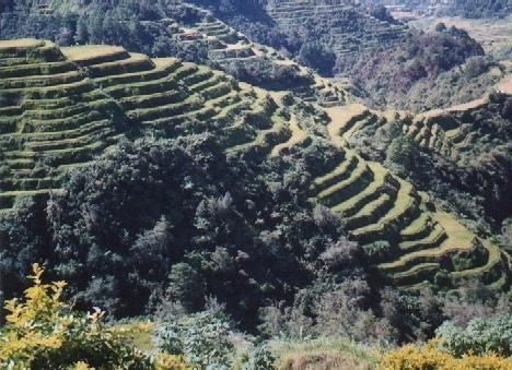
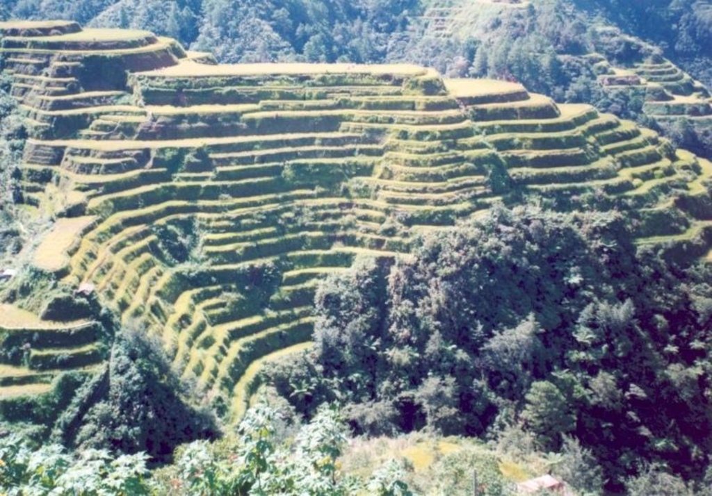
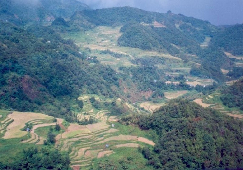
Terraces supporting rainfed paddy rice on steep mountain slopes: these have been in existence for more than a thousand years.
2.2 Detailed description of the Technology
Description:
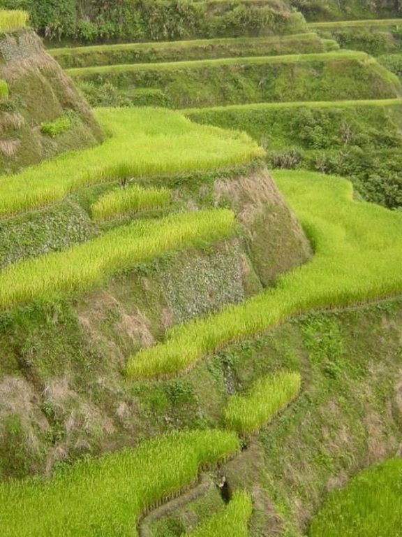
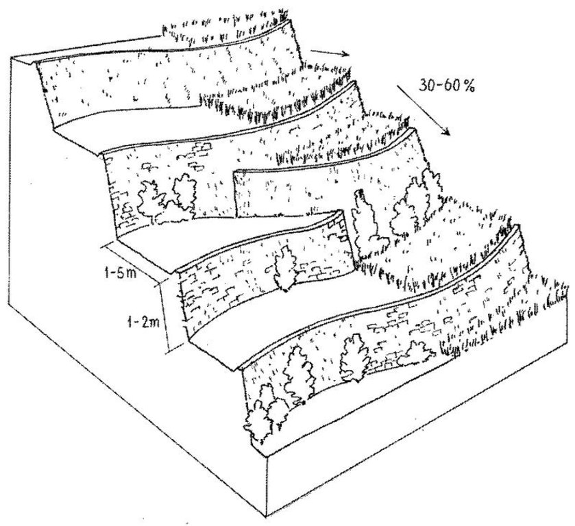
Terraced paddy rice on steep mountain slopes is the main method of rice cultivation in Cordillera Administrative Region (CAR) of the Philippines. This is a traditional technology: most of the terraces are at least a thousand years old. The terraces were constructed manually on steep hill slopes (30-60%) with small portions located in narrow valley bottoms. Farmers generally own one hectare or less of terraced land, and cultivation is intensive. The terraces (‘paddies’) curve along the contour, and are narrow, ranging from one to five meters in width, depending on the slope. The height of the riser is between one and two meters. Water supply for the rice crop depends on rainfall, and only one rice crop is grown per year.
The terraces impound rainwater - average rainfall is around 2,000 mm - and thus prevent soil erosion. Soil fertility is largely maintained because the impounded water and a zero rate of erosion preserve organic matter levels. Some nutrient loss occurs however with each harvest. The terraces are multi-functional: in addition to their agricultural use, they assist in environmental protection through flood mitigation, and they contribute to biodiversity. Furthermore they have become a tourist attraction.
Land preparation is mainly manual. Farmers puddle the soil with their bare feet. Excess water is drained to the terrace below by a small opening in the lip on top of the riser. Maintenance consists basically of repairing breached bunds/risers. Every planting season, a few centimetres of soil is added. To strengthen the bunds, some farmers plant grasses, which may be cut and carried for animal fodder: napier grass (Pennisetum purpureum) is an example. It is important not to disturb the soil of the bund, as this may encourage breaching.
The area where the technology is practiced is mostly between 2,000 and 2,500 m. Because of the cool climate caused by the high elevation, crop maturity takes longer than in the lowlands. In some cases, vegetables such as cabbages and sweet potatoes are grown after the rice is harvested. The farmers, indigenous to the area, have a distinct culture that is different to lowland rice farmers. Rituals connected with farming are widely practiced. There is an added economic benefit from tourism, as people from all over the Philippines - and beyond - travel there for the spectacular views and mild climate.
2.3 Photos of the Technology
2.5 Country/ region/ locations where the Technology has been applied and which are covered by this assessment
Country:
Philippines
Region/ State/ Province:
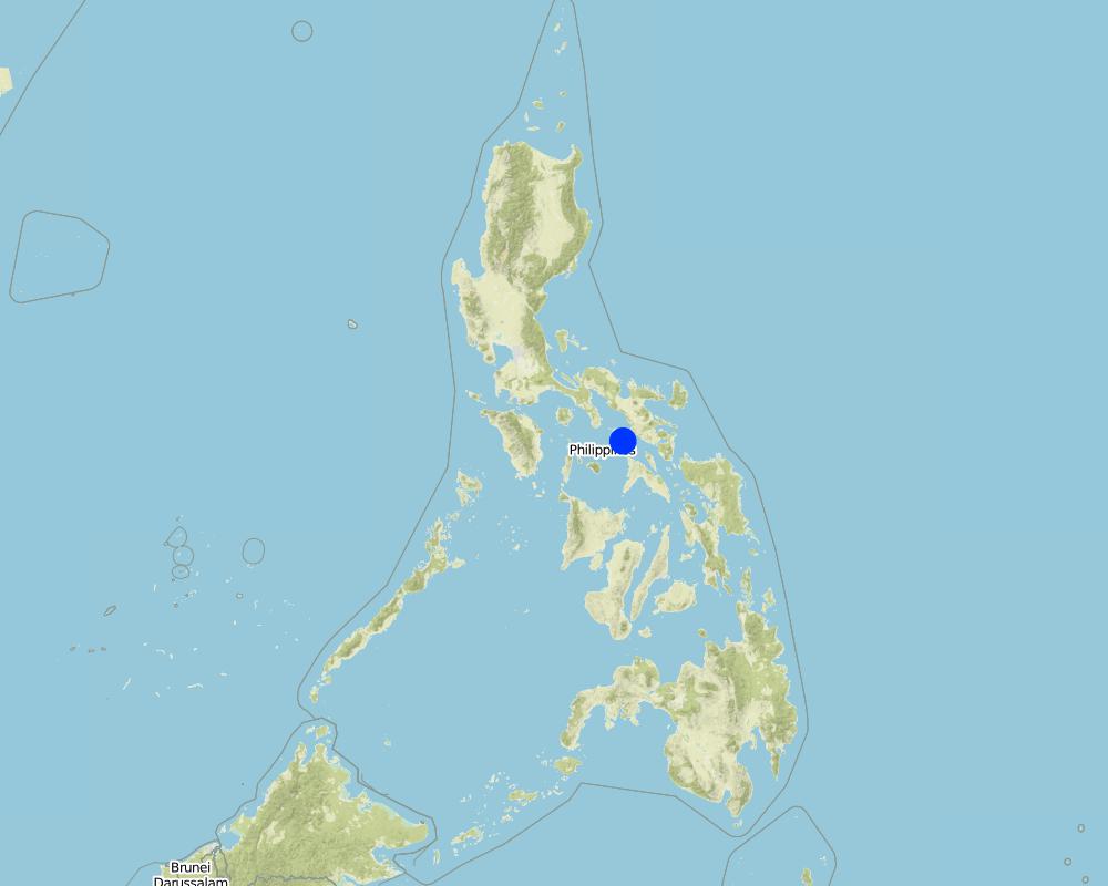
Cordillera Region
Further specification of location:
Cordillera Region
Specify the spread of the Technology:
- evenly spread over an area
If the Technology is evenly spread over an area, specify area covered (in km2):
15000.0
If precise area is not known, indicate approximate area covered:
- > 10,000 km2
Comments:
Total area covered by the SLM Technology is 15000 km2.
The above provinces are basically dependent on terraced paddy rice. Most of it are rainfed with some areas under irrigation
Map
×2.6 Date of implementation
If precise year is not known, indicate approximate date:
- more than 50 years ago (traditional)
2.7 Introduction of the Technology
Specify how the Technology was introduced:
- as part of a traditional system (> 50 years)
Comments (type of project, etc.):
Devised by the land users themselves due to extreme necessity
3. Classification of the SLM Technology
3.1 Main purpose(s) of the Technology
- reduce, prevent, restore land degradation
- conserve ecosystem
3.2 Current land use type(s) where the Technology is applied

Cropland
- Annual cropping
- rice
Number of growing seasons per year:
- 1
Specify:
Longest growing period in days: 240
Comments:
Major land use problems (compiler’s opinion): The terraces allow crop cultivation in an area characterised by steep slopes and high rainfall. However, farming in this marginal areas is labour intensive, mechanisation is not an option on the narrow paddies, and even animal traction is rarely possible due to the steepness of the terrain and the high terrace risers. Non-terraced hill slopes are prone to very high runoff and soil erosion, production is zero.
Major land use problems (land users’ perception): High runoff and soil erosion, zero productivity.
3.4 Water supply
Water supply for the land on which the Technology is applied:
- rainfed
3.5 SLM group to which the Technology belongs
- cross-slope measure
3.6 SLM measures comprising the Technology

vegetative measures
- V2: Grasses and perennial herbaceous plants

structural measures
- S1: Terraces
3.7 Main types of land degradation addressed by the Technology

soil erosion by water
- Wt: loss of topsoil/ surface erosion

chemical soil deterioration
- Cn: fertility decline and reduced organic matter content (not caused by erosion)
3.8 Prevention, reduction, or restoration of land degradation
Specify the goal of the Technology with regard to land degradation:
- prevent land degradation
- reduce land degradation
4. Technical specifications, implementation activities, inputs, and costs
4.1 Technical drawing of the Technology
Technical specifications (related to technical drawing):
Layout of rainfed paddy rice terraces. The level terraces allow cultivation of paddy rice (right) on steep slopes. In some places the terrace risers are as tall as the beds are wide.
Technical knowledge required for field staff / advisors: moderate
Technical knowledge required for land users: moderate
Main technical functions: control of dispersed runoff: retain / trap, increase / maintain water stored in soil
Secondary technical functions: reduction of slope angle, reduction of slope length, indirect maintenance of fertility
Vegetative measure: grass on bunds/risers (supp.)
Structural measure: level bench terrace
Author:
Mats Gurtner
4.3 Establishment activities
| Activity | Timing (season) | |
|---|---|---|
| 1. | Determination of contour lines by eye. | |
| 2. | Levelling by moving soil from the upslope to the downslope part | |
| 3. | Construction of bunds (lip at the terrace edge) of about 50-100 cm |
4.4 Costs and inputs needed for establishment
| Specify input | Unit | Quantity | Costs per Unit | Total costs per input | % of costs borne by land users | |
|---|---|---|---|---|---|---|
| Labour | labour | ha | 1.0 | 2500.0 | 2500.0 | 100.0 |
| Equipment | tools | ha | 1.0 | 200.0 | 200.0 | 100.0 |
| Total costs for establishment of the Technology | 2700.0 | |||||
| Total costs for establishment of the Technology in USD | 2700.0 | |||||
Comments:
Duration of establishment phase: 12 month(s)
4.5 Maintenance/ recurrent activities
| Activity | Timing/ frequency | |
|---|---|---|
| 1. | Weeding by cutting grasses on the bund/riser using hand tools. Hoeing | |
| 2. | Repairing breached portion of the bunds. Adding a few centimetres | |
| 3. | Land preparation by puddling. In most cases, the use of animal tractionis not possible because of the steepness of the slope and heightof the risers. |
4.6 Costs and inputs needed for maintenance/ recurrent activities (per year)
| Specify input | Unit | Quantity | Costs per Unit | Total costs per input | % of costs borne by land users | |
|---|---|---|---|---|---|---|
| Labour | labour | ha | 1.0 | 30.0 | 30.0 | 100.0 |
| Equipment | tools | ha | 1.0 | 10.0 | 10.0 | 100.0 |
| Total costs for maintenance of the Technology | 40.0 | |||||
| Total costs for maintenance of the Technology in USD | 40.0 | |||||
Comments:
The costs of establishment are estimates - as new terrace construction no longer takes place. The land has already been terraced for centuries. The 800 person days are for land levelling and bund construction, which comprises the main activity. The calculation was based on a land slope of 30-60%. The maintenance figure assumes regular light maintenance - and does not include major repairs to bunds.
5. Natural and human environment
5.1 Climate
Annual rainfall
- < 250 mm
- 251-500 mm
- 501-750 mm
- 751-1,000 mm
- 1,001-1,500 mm
- 1,501-2,000 mm
- 2,001-3,000 mm
- 3,001-4,000 mm
- > 4,000 mm
Agro-climatic zone
- humid
Thermal climate class: tropics
5.2 Topography
Slopes on average:
- flat (0-2%)
- gentle (3-5%)
- moderate (6-10%)
- rolling (11-15%)
- hilly (16-30%)
- steep (31-60%)
- very steep (>60%)
Landforms:
- plateau/plains
- ridges
- mountain slopes
- hill slopes
- footslopes
- valley floors
Altitudinal zone:
- 0-100 m a.s.l.
- 101-500 m a.s.l.
- 501-1,000 m a.s.l.
- 1,001-1,500 m a.s.l.
- 1,501-2,000 m a.s.l.
- 2,001-2,500 m a.s.l.
- 2,501-3,000 m a.s.l.
- 3,001-4,000 m a.s.l.
- > 4,000 m a.s.l.
5.3 Soils
Soil depth on average:
- very shallow (0-20 cm)
- shallow (21-50 cm)
- moderately deep (51-80 cm)
- deep (81-120 cm)
- very deep (> 120 cm)
Soil texture (topsoil):
- medium (loamy, silty)
- fine/ heavy (clay)
Topsoil organic matter:
- medium (1-3%)
- low (<1%)
5.6 Characteristics of land users applying the Technology
Market orientation of production system:
- subsistence (self-supply)
- mixed (subsistence/ commercial)
Off-farm income:
- 10-50% of all income
Indicate other relevant characteristics of the land users:
Off-farm income specification: carpentry, trading, labour for neighbouring farms, overseas employment, transport services, activities associated with tourism
5.7 Average area of land used by land users applying the Technology
- < 0.5 ha
- 0.5-1 ha
- 1-2 ha
- 2-5 ha
- 5-15 ha
- 15-50 ha
- 50-100 ha
- 100-500 ha
- 500-1,000 ha
- 1,000-10,000 ha
- > 10,000 ha
5.8 Land ownership, land use rights, and water use rights
Land ownership:
- individual, titled
Land use rights:
- individual
6. Impacts and concluding statements
6.1 On-site impacts the Technology has shown
Socio-economic impacts
Production
crop production
Comments/ specify:
compared with zero in the non-terraced scenario
fodder production
fodder quality
Income and costs
farm income
workload
Comments/ specify:
conflicting with other income generating opportunities
Socio-cultural impacts
community institutions
national institutions
conflict mitigation
Ecological impacts
Water cycle/ runoff
excess water drainage
Soil
soil moisture
soil loss
Biodiversity: vegetation, animals
plant diversity
6.2 Off-site impacts the Technology has shown
downstream flooding
downstream siltation
6.4 Cost-benefit analysis
How do the benefits compare with the maintenance/ recurrent costs (from land users' perspective)?
Short-term returns:
positive
Long-term returns:
very positive
6.5 Adoption of the Technology
Comments:
There is no trend towards spontaneous adoption of the Technology. The technology is widely accepted. As the terraces were constructed hundreds of years ago and construction of new terraces is no longer done the question of ‘adoption’ is not relevant.
6.7 Strengths/ advantages/ opportunities of the Technology
| Strengths/ advantages/ opportunities in the land user’s view |
|---|
| Know very well the agronomy of rice production |
| Strengths/ advantages/ opportunities in the compiler’s or other key resource person’s view |
|---|
| Low maintenance cost |
| Farmers are well versed (very familiar) with the rice production system – it is part of their culture |
| Terracing allows paddy rice production on very steep slopes, which are prone to very high erosion and water loss in such a monsoon area. It transforms steep unproductive slopes into productive land |
6.8 Weaknesses/ disadvantages/ risks of the Technology and ways of overcoming them
| Weaknesses/ disadvantages/ risks in the land user’s view | How can they be overcome? |
|---|---|
| Lack of irrigation facilities | Construction of water harvesting structure |
| Declining yield | Fertilizer application |
| Weaknesses/ disadvantages/ risks in the compiler’s or other key resource person’s view | How can they be overcome? |
|---|---|
| Lack of moisture for about six months | Moisture conservation (mulching): construction of water harvesting structures for supplementary irrigation. |
| Continuous mono-cropping | Crop diversification. Other crops (such as sweet potato, cabbage, chilli) could be grown after rice towards the end of the rainy season through minimum or zero tillage. |
| Severe soil fertility decline in some locations – and therefore declining yields | Fertility enhancement using organic and inorganic sources (manure, crop residues, compost, fertilizers etc). |
7. References and links
7.1 Methods/ sources of information
- field visits, field surveys
- interviews with land users
When were the data compiled (in the field)?
08/09/2003
7.2 References to available publications
Title, author, year, ISBN:
Breemen van N, Oldeman LR, Plantinga WJ and Wielemaker WG (1970) The Ifugao Rice Terraces. In: Miscellaneous papers (7) 1970,eds. N van Breemen et al Landbouwhogeschool, Wageningen, The Netherlands.
Links and modules
Expand all Collapse allLinks
No links
Modules
No modules


