Keeping natural riparian vegetation and stabilizing riparian with gabions at Naro Moru River [Kenya]
- Creation:
- Update:
- Compiler: Manuel Fischer
- Editor: –
- Reviewers: David Streiff, Alexandra Gavilano
technologies_1570 - Kenya
View sections
Expand all Collapse all1. General information
1.2 Contact details of resource persons and institutions involved in the assessment and documentation of the Technology
Cosmetic company:
Horsey John
Cinnabar Green Ltd.
Kenya
Name of the institution(s) which facilitated the documentation/ evaluation of the Technology (if relevant)
CDE Centre for Development and Environment (CDE Centre for Development and Environment) - SwitzerlandName of the institution(s) which facilitated the documentation/ evaluation of the Technology (if relevant)
Cinnabar Green Ltd. (CG) - Kenya1.3 Conditions regarding the use of data documented through WOCAT
The compiler and key resource person(s) accept the conditions regarding the use of data documented through WOCAT:
Yes
2. Description of the SLM Technology
2.1 Short description of the Technology
Definition of the Technology:
Structural riverbank protection by metal nets called gabion that are filled with stones
2.2 Detailed description of the Technology
Description:
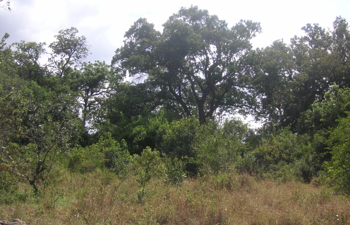
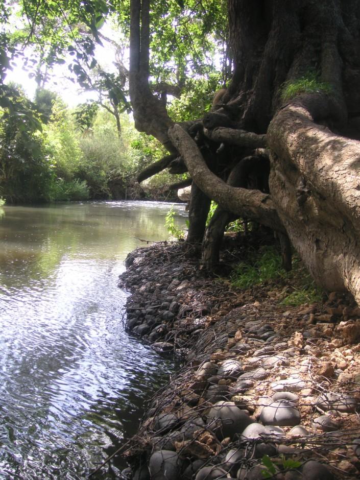
The studied land plot is situated in the semi-arid savannah zone of the Naro Moru sub-catchment at the foot of Mt. Kenya. A large-scale farmer owns a spacious land plot bordering Naro Moru River where he grows herbs and special plants to produce human care products. He rarely intervenes in the riparian area but is still interested in a good protection of water resources. Therefore, big stone control structures called gabions were installed to prevent big riparian trees from being undermined by water and destabilized by erosion. This method is cost intensive but can be applied locally for the protection of certain goods. The action was promoted by the Water Resource Users Association of the sub-catchment.
Purpose of the Technology: Despite semi-arid conditions, there is a high probability of flooding. Heavy rainfalls on upper slopes of Mt. Kenya lead to flood events in the semi-arid areas of Naro Moru River. These events have a destructive effect on the riverbanks, which have become instable by human induced activities such as overgrazing and deforestation. The instable riparian soils are eroded easily. The farmers lose their precious land and the water is polluted.
Establishment / maintenance activities and inputs: Big riparian trees are important for stabilizing the riverbed and riverbanks and for building a canopy that provides shade which enables the typical riparian conditions with its vast biodiversity. Thus, large metal nets (2x1x0.5 m) are filled with stones and placed in front of the roots to protect them from the direct current. These metal nets are called gabion and are placed at especially prone places. This structural measure contributes to mitigate or even stop riverbank degradation. High efforts are required to establish gabions. The costs for the metal net amount to 80 US-Dollar per net. Additionally, workforce must be found to fill the nets with stones from the river. Once installed, they ensure a good local protection. They are also used to protect bridge pillars. The life expectance of a gabion net is about 20 years if not destroyed by extreme events.
Natural / human environment: The plot is situated on a plateau at the western side of Mt. Kenya. There is not the same amount of precipitation as at the foot slopes of Mt. Kenya. However, the area still benefits from the runoff that is generated on the mountain. Precipitation in the so-called savannah zone ranges from 600mm to 900mm per year. Due to the high evaporation, rain-fed agriculture is only partly possible. Therefore most land users depend on irrigation using river water.
During the last decades, the region has experienced a still continuing population growth which increases population pressure in the area and removal and use of the vegetation along the rivers. The good accessibility and the moderate tourism allow even off-farm income-generation.
2.3 Photos of the Technology
Media Gallery
2.5 Country/ region/ locations where the Technology has been applied and which are covered by this assessment
Country:
Kenya
Region/ State/ Province:
Kenya/Central Province
Further specification of location:
Nyeri/Naro Moru
Specify the spread of the Technology:
- evenly spread over an area
If the Technology is evenly spread over an area, specify area covered (in km2):
2.15
If precise area is not known, indicate approximate area covered:
- < 0.1 km2 (10 ha)
Comments:
The riparian length as the crow flies is 2.15 km.
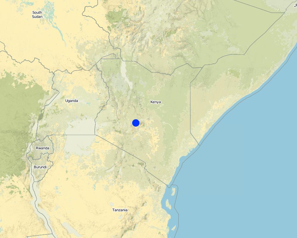
Map
×2.6 Date of implementation
If precise year is not known, indicate approximate date:
- less than 10 years ago (recently)
2.7 Introduction of the Technology
Specify how the Technology was introduced:
- during experiments/ research
Comments (type of project, etc.):
The WRUA talked to the farmer who introduced the technology
3. Classification of the SLM Technology
3.1 Main purpose(s) of the Technology
- reduce risk of disasters
3.2 Current land use type(s) where the Technology is applied

Cropland
- Annual cropping
- Tree and shrub cropping
Number of growing seasons per year:
- 2
Specify:
Longest growing period in days: 60 Longest growing period from month to month: april to may Second longest growing period in days: 60 Second longest growing period from month to month: october to november

Forest/ woodlands
- (Semi-)natural forests/ woodlands
(Semi-)natural forests/ woodlands: Specify management type:
- Non-wood forest use
Products and services:
- Grazing/ browsing
- Nature conservation/ protection
Comments:
Major land use problems (compiler’s opinion): Due to the decreasing river flows, the riparian vegetation is being diminished.
Major land use problems (land users’ perception): Big riparian trees are threatened because of being undermined by water. The canopy and the roots of the trees are a vital component of the riparian habitat.
Other type of forest: Preservation
Forest products and services: grazing / browsing, nature conservation / protection
3.5 SLM group to which the Technology belongs
- surface water management (spring, river, lakes, sea)
3.6 SLM measures comprising the Technology

structural measures
- S6: Walls, barriers, palisades, fences

management measures
- M2: Change of management/ intensity level
Comments:
Main measures: structural measures
Secondary measures: management measures
3.7 Main types of land degradation addressed by the Technology

soil erosion by water
- Wr: riverbank erosion

biological degradation
- Bh: loss of habitats
- Bs: quality and species composition/ diversity decline

water degradation
- Hp: decline of surface water quality
Comments:
Main type of degradation addressed: Wr: riverbank erosion, Hp: decline of surface water quality
Secondary types of degradation addressed: Bh: loss of habitats, Bs: quality and species composition /diversity decline
Main causes of degradation: over abstraction / excessive withdrawal of water (for irrigation, industry, etc.), floods, population pressure
3.8 Prevention, reduction, or restoration of land degradation
Specify the goal of the Technology with regard to land degradation:
- prevent land degradation
- reduce land degradation
Comments:
Secondary goals: mitigation / reduction of land degradation
4. Technical specifications, implementation activities, inputs, and costs
4.1 Technical drawing of the Technology
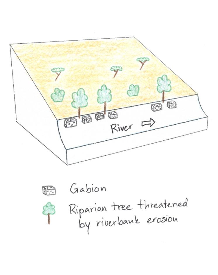
Technical specifications (related to technical drawing):
In the Savannah zone large riparian trees are threatened, thus gabions are used to protect them and to sustain the canopy. The gabions are applied at the roots of the riparian trees to protect them from the erosive power of the stream.
Location: Irioko. Nyeri / Central Province
Technical knowledge required for field staff / advisors: high
Technical knowledge required for land users: low
Main technical functions: stabilisation of soil (eg by tree roots against land slides), stabilisation of riverbank
Secondary technical functions: sediment retention / trapping, sediment harvesting
Wall/ barrier
Depth of ditches/pits/dams (m): 1
Width of ditches/pits/dams (m): 1
Length of ditches/pits/dams (m): 2
Construction material (stone): Stones are collected directly in the riverbed.
Other type of management: The farmer protected his riparian zone with a fence.
Author:
Manuel Fischer
4.2 General information regarding the calculation of inputs and costs
Specify how costs and inputs were calculated:
- per Technology unit
Specify unit:
Gabion
Specify dimensions of unit (if relevant):
2x1x0.5 m
other/ national currency (specify):
Kenyan Shilling
If relevant, indicate exchange rate from USD to local currency (e.g. 1 USD = 79.9 Brazilian Real): 1 USD =:
90.0
Indicate average wage cost of hired labour per day:
2.70
4.3 Establishment activities
| Activity | Timing (season) | |
|---|---|---|
| 1. | Installing and filling the metal wire with stones | during dry season |
4.4 Costs and inputs needed for establishment
| Specify input | Unit | Quantity | Costs per Unit | Total costs per input | % of costs borne by land users | |
|---|---|---|---|---|---|---|
| Labour | Installing and filling the metal wire with stones | Persons/day | 2.0 | 3.0 | 6.0 | 100.0 |
| Construction material | Wire | piece | 1.0 | 80.0 | 80.0 | 100.0 |
| Total costs for establishment of the Technology | 86.0 | |||||
| Total costs for establishment of the Technology in USD | 0.96 | |||||
4.5 Maintenance/ recurrent activities
| Activity | Timing/ frequency | |
|---|---|---|
| 1. | Control of the gabion nets | |
| 2. | Control of fences |
4.7 Most important factors affecting the costs
Describe the most determinate factors affecting the costs:
The price for the metal wire is the most cost determinant factor.
5. Natural and human environment
5.1 Climate
Annual rainfall
- < 250 mm
- 251-500 mm
- 501-750 mm
- 751-1,000 mm
- 1,001-1,500 mm
- 1,501-2,000 mm
- 2,001-3,000 mm
- 3,001-4,000 mm
- > 4,000 mm
Agro-climatic zone
- semi-arid
Thermal climate class: subtropics
5.2 Topography
Slopes on average:
- flat (0-2%)
- gentle (3-5%)
- moderate (6-10%)
- rolling (11-15%)
- hilly (16-30%)
- steep (31-60%)
- very steep (>60%)
Landforms:
- plateau/plains
- ridges
- mountain slopes
- hill slopes
- footslopes
- valley floors
Altitudinal zone:
- 0-100 m a.s.l.
- 101-500 m a.s.l.
- 501-1,000 m a.s.l.
- 1,001-1,500 m a.s.l.
- 1,501-2,000 m a.s.l.
- 2,001-2,500 m a.s.l.
- 2,501-3,000 m a.s.l.
- 3,001-4,000 m a.s.l.
- > 4,000 m a.s.l.
Comments and further specifications on topography:
Altitudinal zone: 1870 m a.s.l.
5.3 Soils
Soil depth on average:
- very shallow (0-20 cm)
- shallow (21-50 cm)
- moderately deep (51-80 cm)
- deep (81-120 cm)
- very deep (> 120 cm)
Soil texture (topsoil):
- medium (loamy, silty)
Topsoil organic matter:
- medium (1-3%)
If available, attach full soil description or specify the available information, e.g. soil type, soil PH/ acidity, Cation Exchange Capacity, nitrogen, salinity etc.
Soil fertility is medium
Soil drainage / infiltration is medium
Soil water storage capacity is low
5.4 Water availability and quality
Ground water table:
< 5 m
Availability of surface water:
good
Water quality (untreated):
poor drinking water (treatment required)
Comments and further specifications on water quality and quantity:
Availability of surface water: Just along the river, deeper ground water level 50-100m
5.5 Biodiversity
Species diversity:
- high
5.6 Characteristics of land users applying the Technology
Market orientation of production system:
- commercial/ market
Off-farm income:
- > 50% of all income
Relative level of wealth:
- very rich
Individuals or groups:
- employee (company, government)
Gender:
- women
- men
Indicate other relevant characteristics of the land users:
Land users applying the Technology are mainly Leaders / privileged
Population density: 200-500 persons/km2
1% of the land users are very rich and own 10% of the land.
Off-farm income specification: The land owner has a company that produces oils and herbs for care products. The company produces in a organic way and preserves the environment.
Market orientation of production system: Conservation/Preservation (But company produces care products for worldwide shipping)
5.7 Average area of land used by land users applying the Technology
- < 0.5 ha
- 0.5-1 ha
- 1-2 ha
- 2-5 ha
- 5-15 ha
- 15-50 ha
- 50-100 ha
- 100-500 ha
- 500-1,000 ha
- 1,000-10,000 ha
- > 10,000 ha
Is this considered small-, medium- or large-scale (referring to local context)?
- large-scale
Comments:
Average area of land owned or leased by land users applying the Technology: Also 15-50 ha for cropland
5.8 Land ownership, land use rights, and water use rights
Land ownership:
- company
- individual, not titled
Land use rights:
- individual
Water use rights:
- open access (unorganized)
- communal (organized)
Comments:
The land owner has a company that produces oils and herbs for care products. The company produces in a organic way and preserves the environment.
5.9 Access to services and infrastructure
health:
- poor
- moderate
- good
education:
- poor
- moderate
- good
technical assistance:
- poor
- moderate
- good
employment (e.g. off-farm):
- poor
- moderate
- good
markets:
- poor
- moderate
- good
energy:
- poor
- moderate
- good
roads and transport:
- poor
- moderate
- good
drinking water and sanitation:
- poor
- moderate
- good
financial services:
- poor
- moderate
- good
6. Impacts and concluding statements
6.1 On-site impacts the Technology has shown
Socio-economic impacts
Production
production area
Socio-cultural impacts
community institutions
Comments/ specify:
This was not mentioned by the interviewee, but seems to be the case
SLM/ land degradation knowledge
Livelihood and human well-being
Comments/ specify:
The discussions about water conservation increase education. Also, the dialogue between farmers is improved.
Ecological impacts
Water cycle/ runoff
water quality
surface runoff
groundwater table/ aquifer
Soil
soil moisture
Biodiversity: vegetation, animals
plant diversity
animal diversity
Comments/ specify:
monkeys
habitat diversity
Climate and disaster risk reduction
flood impacts
Other ecological impacts
Riverbank degradation
Preservation of canopy
6.2 Off-site impacts the Technology has shown
reliable and stable stream flows in dry season
downstream siltation
6.3 Exposure and sensitivity of the Technology to gradual climate change and climate-related extremes/ disasters (as perceived by land users)
Gradual climate change
Gradual climate change
| Season | increase or decrease | How does the Technology cope with it? | |
|---|---|---|---|
| annual temperature | increase | well |
Climate-related extremes (disasters)
Meteorological disasters
| How does the Technology cope with it? | |
|---|---|
| local rainstorm | well |
| local windstorm | well |
Climatological disasters
| How does the Technology cope with it? | |
|---|---|
| drought | well |
Hydrological disasters
| How does the Technology cope with it? | |
|---|---|
| general (river) flood | well |
Other climate-related consequences
Other climate-related consequences
| How does the Technology cope with it? | |
|---|---|
| reduced growing period | well |
6.4 Cost-benefit analysis
How do the benefits compare with the establishment costs (from land users’ perspective)?
Short-term returns:
negative
Long-term returns:
slightly positive
How do the benefits compare with the maintenance/ recurrent costs (from land users' perspective)?
Short-term returns:
neutral/ balanced
Long-term returns:
positive
Comments:
The establishment costs are quite high.
6.5 Adoption of the Technology
- single cases/ experimental
If available, quantify (no. of households and/ or area covered):
1 landowner
Of all those who have adopted the Technology, how many did so spontaneously, i.e. without receiving any material incentives/ payments?
- 91-100%
Comments:
100% of land user families have adopted the Technology without any external material support
There is no trend towards spontaneous adoption of the Technology
Comments on adoption trend: The costs are too high for an average farmer to adopt the technology.
6.7 Strengths/ advantages/ opportunities of the Technology
| Strengths/ advantages/ opportunities in the land user’s view |
|---|
|
Ensuring an intact environment to guarantee the organic origin of the company products. How can they be sustained / enhanced? Control that the riparian area is not being polluted or destroyed. |
| Strengths/ advantages/ opportunities in the compiler’s or other key resource person’s view |
|---|
|
Conservation of the unique riparian habitat How can they be sustained / enhanced? Continue the protective measures and hinder negative intervention in the riparian area. |
|
Through the environmental activities, the acceptance of the company increases. How can they be sustained / enhanced? Regular interaction improve neighborly relations. |
6.8 Weaknesses/ disadvantages/ risks of the Technology and ways of overcoming them
| Weaknesses/ disadvantages/ risks in the compiler’s or other key resource person’s view | How can they be overcome? |
|---|---|
| The implementation of the gabions is very cost-intensive. | Alternatives should be checked out. |
| The origin of the vegetation decline, the decreasing river flow, is not being combatted. | Water abstractions in the upper reaches should be diminished. |
7. References and links
7.1 Methods/ sources of information
Links and modules
Expand all Collapse allLinks
No links
Modules
No modules