Reshaping of gully erosion through integration of silt fences, erosion blankets and brush packing [South Africa]
- Creation:
- Update:
- Compiler: Dirk Pretorius
- Editor: –
- Reviewers: Alexandra Gavilano, Rima Mekdaschi Studer, Brigitte Zimmermann, Donia Mühlematter, Joana Eichenberger
Reshaping of gullies
technologies_3359 - South Africa
- Full summary as PDF
- Full summary as PDF for print
- Full summary in the browser
- Full summary (unformatted)
- Reshaping of gully erosion through integration of silt fences, erosion blankets and brush packing: Aug. 10, 2018 (inactive)
- Reshaping of gully erosion through integration of silt fences, erosion blankets and brush packing: Feb. 19, 2019 (inactive)
- Reshaping of gully erosion through integration of silt fences, erosion blankets and brush packing: Nov. 2, 2021 (public)
- Reshaping of gully erosion through integration of silt fences, erosion blankets and brush packing: April 20, 2018 (inactive)
- Reshaping of gully erosion through integration of silt fences, erosion blankets and brush packing: March 20, 2018 (inactive)
- Reshaping of gully erosion with integration of silt fences, erosion blankets and brush packing: Feb. 2, 2018 (inactive)
View sections
Expand all Collapse all1. General information
1.2 Contact details of resource persons and institutions involved in the assessment and documentation of the Technology
Key resource person(s)
SLM specialist:
Buckle Jacob
Department of Environmental Affairs - South Africa
South Africa
Name of project which facilitated the documentation/ evaluation of the Technology (if relevant)
Working on Ecosystems (Natural Resource Management Programmes – DEA, South Africa)Name of project which facilitated the documentation/ evaluation of the Technology (if relevant)
Book project: Guidelines to Rangeland Management in Sub-Saharan Africa (Rangeland Management)Name of the institution(s) which facilitated the documentation/ evaluation of the Technology (if relevant)
SMC Synergy (SMC Synergy) - South Africa1.3 Conditions regarding the use of data documented through WOCAT
The compiler and key resource person(s) accept the conditions regarding the use of data documented through WOCAT:
Yes
1.4 Declaration on sustainability of the described Technology
Is the Technology described here problematic with regard to land degradation, so that it cannot be declared a sustainable land management technology?
No
1.5 Reference to Questionnaire(s) on SLM Approaches (documented using WOCAT)
Working for Water [South Africa]
Government funded restoration/rehabilitation initiative as part of Working for Water project. Aim was to eradicate alien invasive.
- Compiler: Klaus Kellner
2. Description of the SLM Technology
2.1 Short description of the Technology
Definition of the Technology:
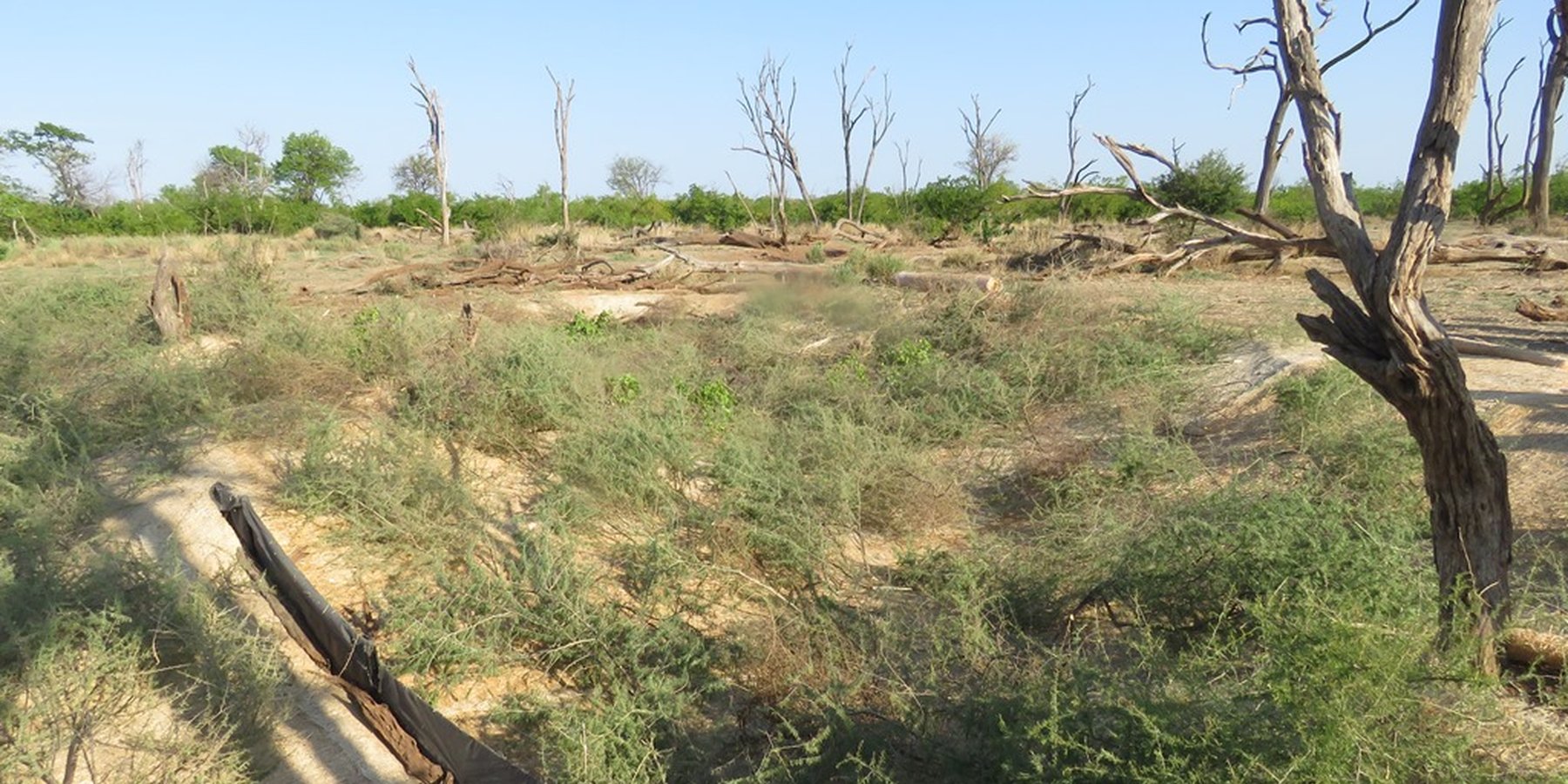
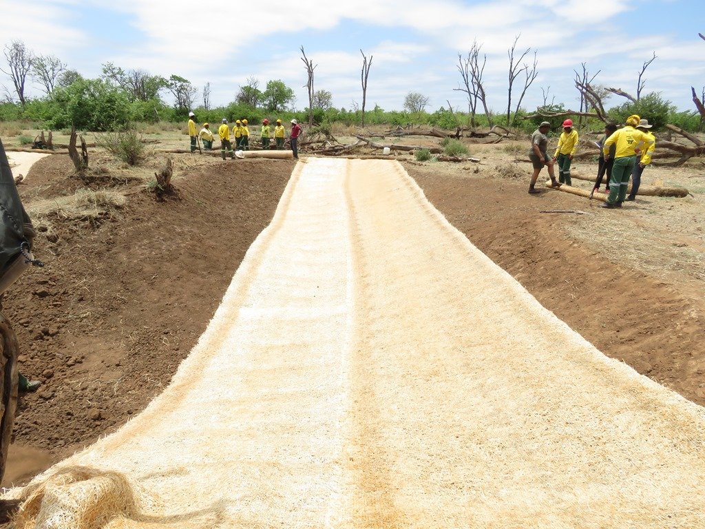
The rehabilitation of active gully erosion by re-sloping the banks of the gully in an effort to manage the energy of the water entering the system. Bare soil is protected from erosion by covering it with erosion blankets, brush packing and the establishment of silt fences.
2.2 Detailed description of the Technology
Description:
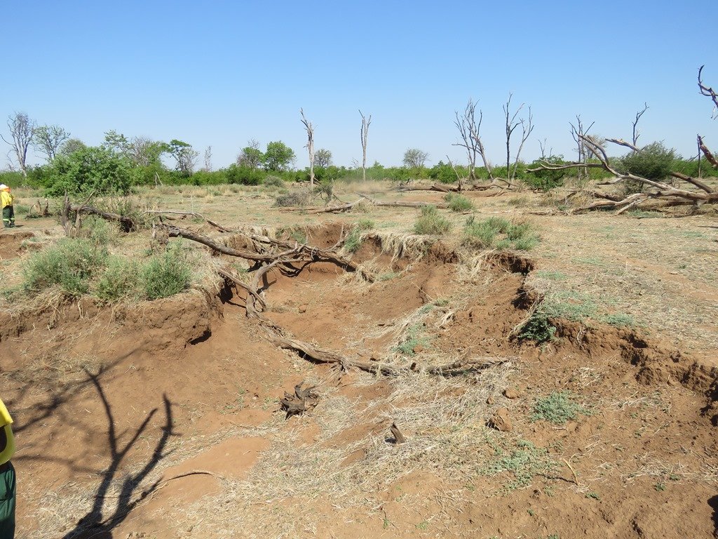
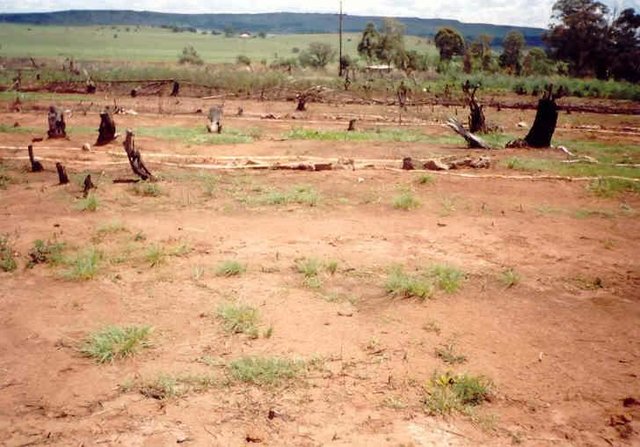
This gully reshaping project was conducted in the Mapungubwe National Park in the Limpopo Province of South Africa. The area receives summer rainfall with an annual average of around 600 to 700 mm. Thunderstorms are common. Due to overgrazing on highly erodible soils, gully headcuts are actively migrating upstream. The reshaping technology can be considered for any gully of up to 2 meters in depth (even on duplex - highly erodible soils - gypsum must, however, be added to the relocated topsoil in this case). The purpose of re-sloping is to reduce the gradient of gully heads and sidewalls, thereby reducing the energy of runoff water. This also leads to enhanced vegetation cover and reduced sediment transport in the gully. Resloping of gullies is performed in stages:
Stage One: Remove all viable and useful plants in and around the active gully system that will be affected by the reshaping – store these for replanting.
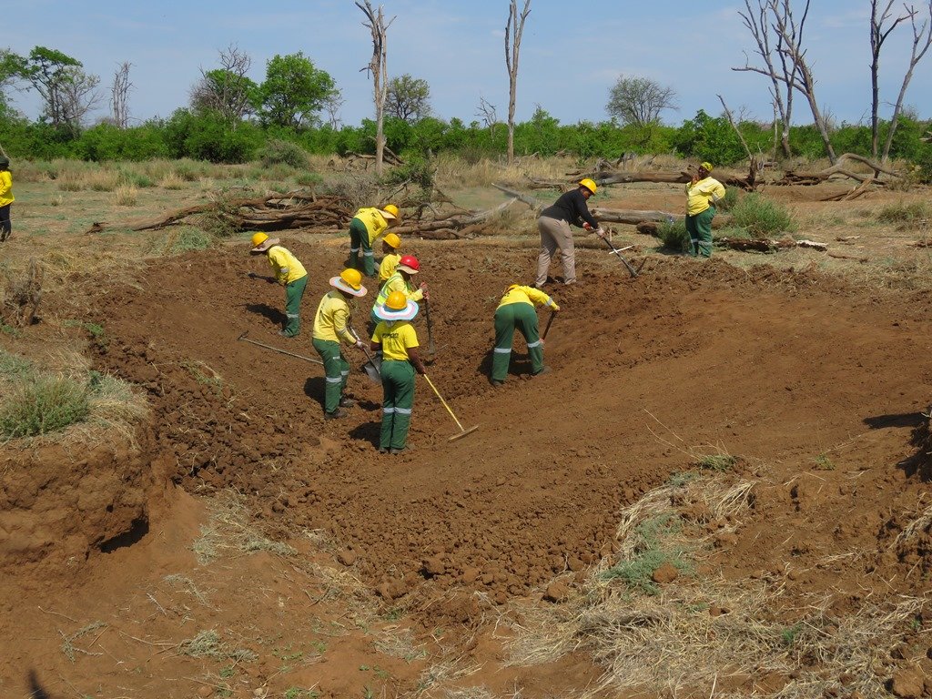
Stage Two: Relocate the usable topsoil to the edge of the gully reshape footprint.
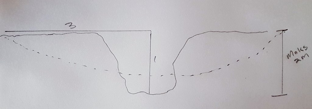
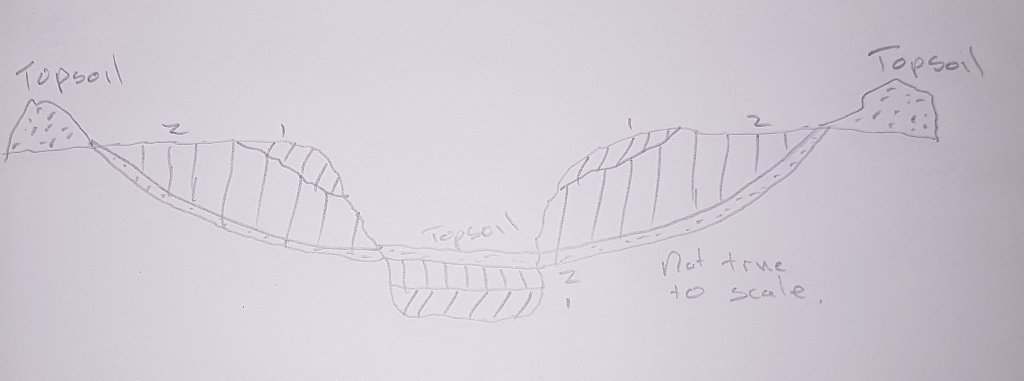
Stage Three: Reshaping of the gully banks to a 1:3 slope (relative to the new valley floor level after refilling with bank material - see figure). Start by removing the top of the bank and placing it on the gully floor. Make sure to compact the soil from the banks - breaking up clods to smaller particles. Continue to remove more of the bank material and compact it in layers to form a disk shape profile (cross section - see sketch).
Stage Four: Spread the topsoil evenly over the newly created gentle sloping profile. Add indigenous grass seed (if available: if not, exotic grasses).
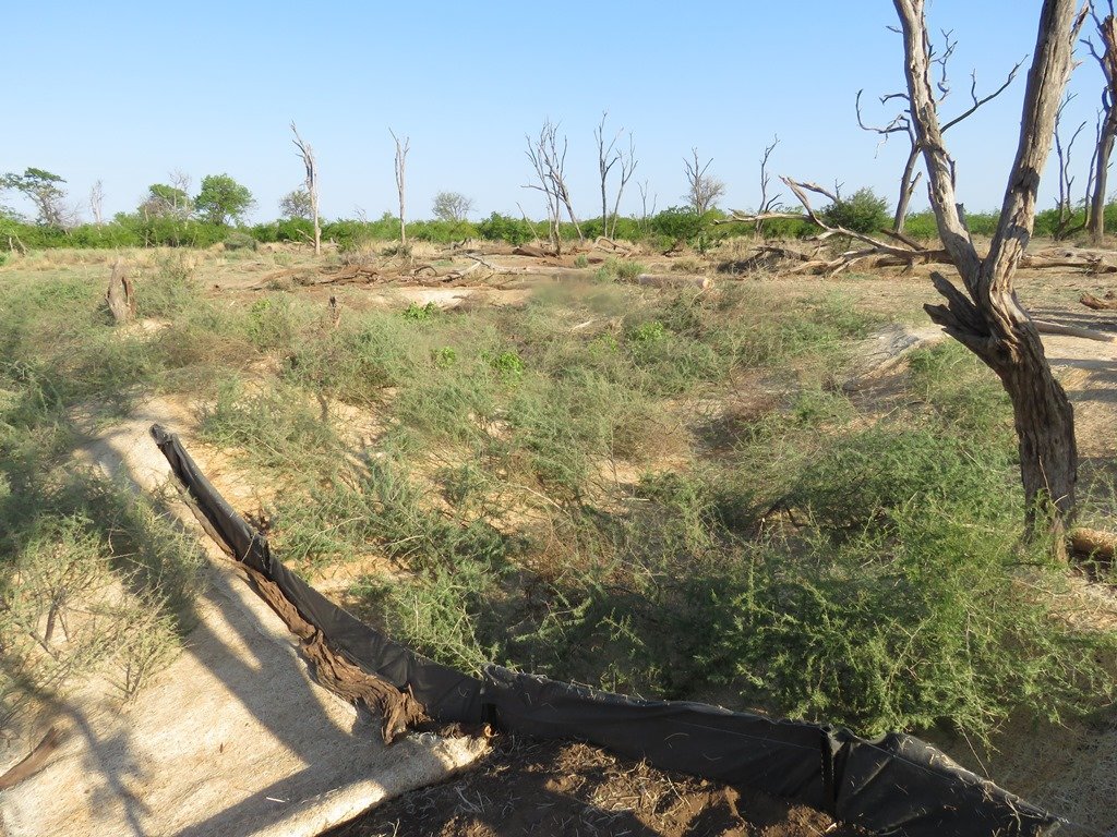
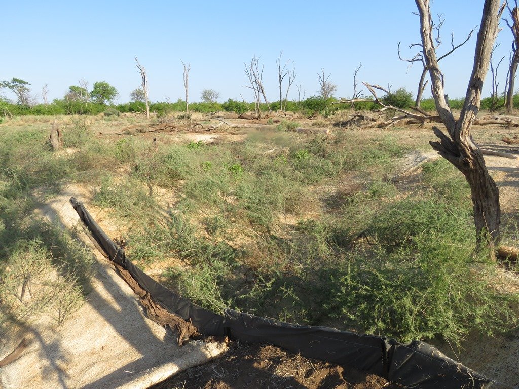
Stage Five: Construct silt fences (made of fabric filter cloth - Geotextile) above the water entry points and inside the newly formed profile (around 10 m apart).
Stage Six: Cover the area with soil erosion blankets (bio-jute) and/or mulch and/or brush packing with thorny local woody biomass.
Stage Seven: Replant recovered plants - protect the area with fences if possible until grass cover established.
2.3 Photos of the Technology
2.5 Country/ region/ locations where the Technology has been applied and which are covered by this assessment
Country:
South Africa
Region/ State/ Province:
Limpopo province
Further specification of location:
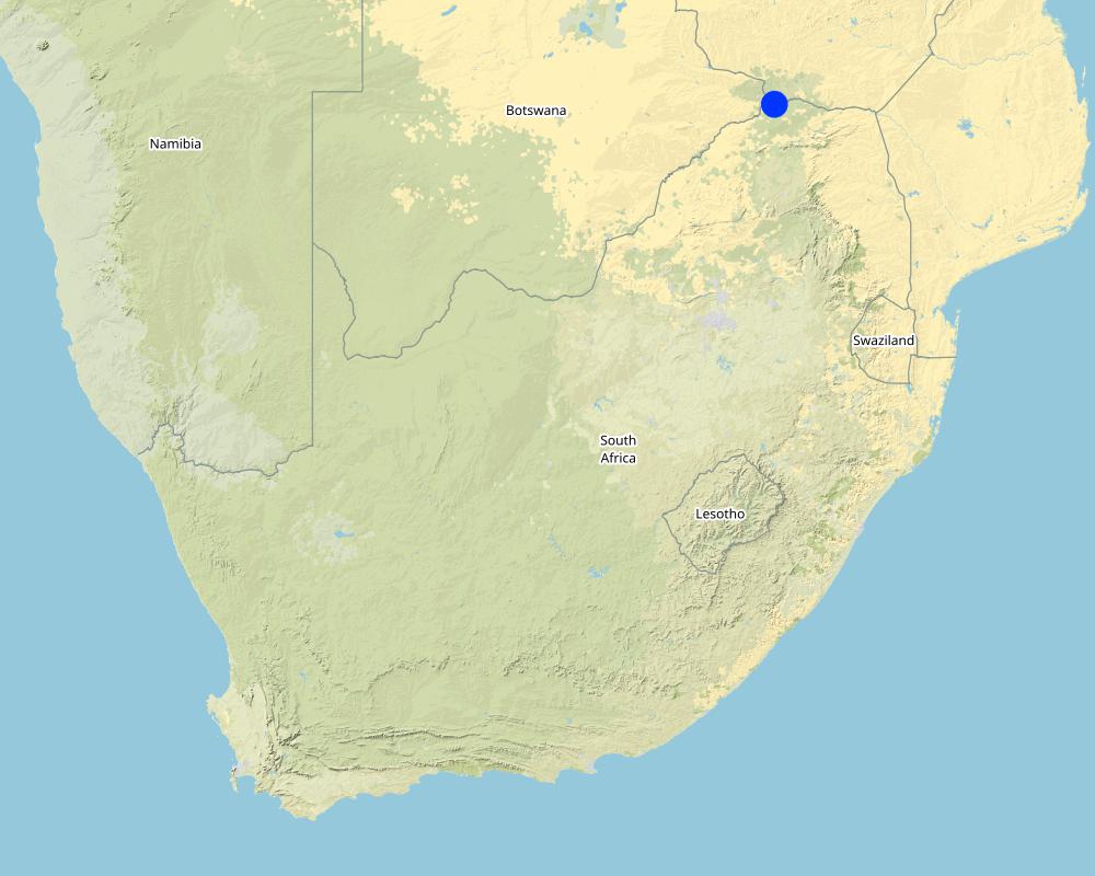
Mapungubwe National Park
Specify the spread of the Technology:
- applied at specific points/ concentrated on a small area
Is/are the technology site(s) located in a permanently protected area?
Yes
If yes, specify:
National park
Map
×2.6 Date of implementation
Indicate year of implementation:
2017
2.7 Introduction of the Technology
Specify how the Technology was introduced:
- through projects/ external interventions
Comments (type of project, etc.):
Working on Ecosystem Services
3. Classification of the SLM Technology
3.1 Main purpose(s) of the Technology
- reduce, prevent, restore land degradation
- conserve ecosystem
- protect a watershed/ downstream areas – in combination with other Technologies
- reduce risk of disasters
- create beneficial social impact
3.2 Current land use type(s) where the Technology is applied

Grazing land
Extensive grazing:
- Ranching

Waterways, waterbodies, wetlands
- Drainage lines, waterways
- Swamps, wetlands
Main products/ services:
Sediment trap, alluvial flood plain
Comments:
Number of growing seasons per year: 1
Summer rainfall - October to April
Livestock density: High - game (various species)
3.4 Water supply
Water supply for the land on which the Technology is applied:
- rainfed
3.5 SLM group to which the Technology belongs
- improved ground/ vegetation cover
- cross-slope measure
- surface water management (spring, river, lakes, sea)
3.6 SLM measures comprising the Technology

structural measures
- S6: Walls, barriers, palisades, fences

management measures
- M3: Layout according to natural and human environment
3.7 Main types of land degradation addressed by the Technology

soil erosion by water
- Wg: gully erosion/ gullying
- Wo: offsite degradation effects

water degradation
- Hp: decline of surface water quality
- Hw: reduction of the buffering capacity of wetland areas
3.8 Prevention, reduction, or restoration of land degradation
Specify the goal of the Technology with regard to land degradation:
- reduce land degradation
- restore/ rehabilitate severely degraded land
4. Technical specifications, implementation activities, inputs, and costs
4.1 Technical drawing of the Technology
Technical specifications (related to technical drawing):
Rehabilitation of gully erosion - 0.5 m to 2 m deep.
Reslope gully banks from vertical to an approximately 30-degree slope.
Silt fences are established above gull head-cut - silt fences inside the reshaped gully - in the region of 10 m apart.
Brush packing with thorny biomass to prevent grazing and provide a micro-climate for grass seed to germinate and establish.
Silt fences are temporary sediment control devices used on rehabilitation sites to reduce sediment movement downhill. A typical fence consists of a piece of synthetic filter fabric (also called a geotextile) stretched between a series of wooden or metal fence stakes along a horizontal contour level.
Author:
J Buckle
Date:
17/01/2018
4.2 General information regarding the calculation of inputs and costs
Specify how costs and inputs were calculated:
- per Technology area
Indicate size and area unit:
0.017 ha
If relevant, indicate exchange rate from USD to local currency (e.g. 1 USD = 79.9 Brazilian Real): 1 USD =:
12.0
Indicate average wage cost of hired labour per day:
R140/day
4.3 Establishment activities
| Activity | Timing (season) | |
|---|---|---|
| 1. | Remove plants | 2 to 3 months before the summer rain |
| 2. | Remove topsoil | 2 to 3 months before the summer rain |
| 3. | Reshaping, compacting, layering | 2 to 3 months before the summer rain |
| 4. | Reseeding | 2 to 3 months before the summer rain |
| 5. | Soil erosion blankets installation | 2 to 3 months before the summer rain |
| 6. | Silt fences | 2 to 3 months before the summer rain |
| 7. | Brush packing | 2 to 3 months before the summer rain |
4.4 Costs and inputs needed for establishment
| Specify input | Unit | Quantity | Costs per Unit | Total costs per input | % of costs borne by land users | |
|---|---|---|---|---|---|---|
| Labour | Unskilled labour (including transport) | per day | 60.0 | 240.0 | 14400.0 | |
| Equipment | Picks, spades, hand compactor, pliers, hopper, bow saws, hammer, wheel barrow (renting the equipment) | per day | 35.0 | 20.0 | 700.0 | |
| Plant material | Grass seed mix | per kilogram | 2.0 | 75.0 | 150.0 | |
| Construction material | Erosion blankets | per square meter | 170.0 | 15.0 | 2550.0 | |
| Construction material | Silt fences | per meter | 16.0 | 15.0 | 240.0 | |
| Total costs for establishment of the Technology | 18040.0 | |||||
| Total costs for establishment of the Technology in USD | 1503.33 | |||||
If land user bore less than 100% of costs, indicate who covered the remaining costs:
Department of Environmental Affairs - NRM programmes
4.5 Maintenance/ recurrent activities
| Activity | Timing/ frequency | |
|---|---|---|
| 1. | After floods restore site (silt fences and brush packing) | After floods |
4.6 Costs and inputs needed for maintenance/ recurrent activities (per year)
| Specify input | Unit | Quantity | Costs per Unit | Total costs per input | % of costs borne by land users | |
|---|---|---|---|---|---|---|
| Labour | Restoration of site after flooding events | per day | 6.0 | 240.0 | 1440.0 | |
| Equipment | Tools to restore fences and brush packing | per day | 3.0 | 20.0 | 60.0 | |
| Construction material | Silt fences | per day | 10.0 | 15.0 | 150.0 | |
| Total costs for maintenance of the Technology | 1650.0 | |||||
| Total costs for maintenance of the Technology in USD | 137.5 | |||||
If land user bore less than 100% of costs, indicate who covered the remaining costs:
Department of Environmental Affairs - NRM programmes
4.7 Most important factors affecting the costs
Describe the most determinate factors affecting the costs:
Labour availability, soil hardness, availability of material, transport cost
5. Natural and human environment
5.1 Climate
Annual rainfall
- < 250 mm
- 251-500 mm
- 501-750 mm
- 751-1,000 mm
- 1,001-1,500 mm
- 1,501-2,000 mm
- 2,001-3,000 mm
- 3,001-4,000 mm
- > 4,000 mm
Specify average annual rainfall (if known), in mm:
650.00
Specifications/ comments on rainfall:
Summer thunderstorms
Agro-climatic zone
- semi-arid
Hot summers and dry winters
5.2 Topography
Slopes on average:
- flat (0-2%)
- gentle (3-5%)
- moderate (6-10%)
- rolling (11-15%)
- hilly (16-30%)
- steep (31-60%)
- very steep (>60%)
Landforms:
- plateau/plains
- ridges
- mountain slopes
- hill slopes
- footslopes
- valley floors
Altitudinal zone:
- 0-100 m a.s.l.
- 101-500 m a.s.l.
- 501-1,000 m a.s.l.
- 1,001-1,500 m a.s.l.
- 1,501-2,000 m a.s.l.
- 2,001-2,500 m a.s.l.
- 2,501-3,000 m a.s.l.
- 3,001-4,000 m a.s.l.
- > 4,000 m a.s.l.
Indicate if the Technology is specifically applied in:
- concave situations
Comments and further specifications on topography:
Flood plane
5.3 Soils
Soil depth on average:
- very shallow (0-20 cm)
- shallow (21-50 cm)
- moderately deep (51-80 cm)
- deep (81-120 cm)
- very deep (> 120 cm)
Soil texture (topsoil):
- medium (loamy, silty)
Soil texture (> 20 cm below surface):
- fine/ heavy (clay)
Topsoil organic matter:
- high (>3%)
5.4 Water availability and quality
Ground water table:
< 5 m
Availability of surface water:
medium
Water quality (untreated):
unusable
Is water salinity a problem?
Yes
Is flooding of the area occurring?
Yes
Regularity:
episodically
5.5 Biodiversity
Species diversity:
- high
Habitat diversity:
- low
5.6 Characteristics of land users applying the Technology
other (specify):
Protected area
Market orientation of production system:
- mixed (subsistence/ commercial)
Off-farm income:
- less than 10% of all income
Relative level of wealth:
- poor
Individuals or groups:
- employee (company, government)
Level of mechanization:
- manual work
Gender:
- women
- men
Age of land users:
- middle-aged
Indicate other relevant characteristics of the land users:
People are brought into the protected areas to work on the rehabilitation projects.
5.7 Average area of land used by land users applying the Technology
- < 0.5 ha
- 0.5-1 ha
- 1-2 ha
- 2-5 ha
- 5-15 ha
- 15-50 ha
- 50-100 ha
- 100-500 ha
- 500-1,000 ha
- 1,000-10,000 ha
- > 10,000 ha
Is this considered small-, medium- or large-scale (referring to local context)?
- medium-scale
Comments:
National park
5.8 Land ownership, land use rights, and water use rights
Land ownership:
- state
Land use rights:
- communal (organized)
- State
- Government land
5.9 Access to services and infrastructure
health:
- poor
- moderate
- good
education:
- poor
- moderate
- good
technical assistance:
- poor
- moderate
- good
employment (e.g. off-farm):
- poor
- moderate
- good
markets:
- poor
- moderate
- good
energy:
- poor
- moderate
- good
roads and transport:
- poor
- moderate
- good
drinking water and sanitation:
- poor
- moderate
- good
financial services:
- poor
- moderate
- good
6. Impacts and concluding statements
6.1 On-site impacts the Technology has shown
Socio-economic impacts
Production
fodder production
Comments/ specify:
Natural fodder for game
land management
Comments/ specify:
Habitat for wildlife and plants improve
Water availability and quality
water availability for livestock
Comments/ specify:
Improved water quantity for game
water quality for livestock
Comments/ specify:
Better quality water for game
Income and costs
diversity of income sources
Comments/ specify:
Improve aesthetic value for tourism
Other socio-economic impacts
Job creation
Comments/ specify:
Job creation for communities outside the protected area
Improved skill levels
Comments/ specify:
Community receive training in rehabilitation methods
Socio-cultural impacts
food security/ self-sufficiency
Comments/ specify:
Improved income for communities
recreational opportunities
Comments/ specify:
Aesthetic improvement for tourism
national institutions
Comments/ specify:
Improvement of the protected area for SANPARKS
SLM/ land degradation knowledge
Comments/ specify:
Training received by communities
Ecological impacts
Water cycle/ runoff
water quantity
water quality
surface runoff
Soil
soil cover
soil loss
soil accumulation
soil crusting/ sealing
soil organic matter/ below ground C
Biodiversity: vegetation, animals
Vegetation cover
biomass/ above ground C
plant diversity
habitat diversity
Climate and disaster risk reduction
flood impacts
drought impacts
micro-climate
6.2 Off-site impacts the Technology has shown
downstream siltation
buffering/ filtering capacity
Specify assessment of off-site impacts (measurements):
The accumulative effect of treating all gully head-cut erosion in the floodplain will have an effect on sediment loads in the Limpopo river
6.3 Exposure and sensitivity of the Technology to gradual climate change and climate-related extremes/ disasters (as perceived by land users)
Gradual climate change
Gradual climate change
| Season | increase or decrease | How does the Technology cope with it? | |
|---|---|---|---|
| annual temperature | increase | well | |
| seasonal temperature | summer | increase | well |
| annual rainfall | decrease | well | |
| seasonal rainfall | summer | decrease | well |
Climate-related extremes (disasters)
Meteorological disasters
| How does the Technology cope with it? | |
|---|---|
| local thunderstorm | well |
Climatological disasters
| How does the Technology cope with it? | |
|---|---|
| land fire | well |
Hydrological disasters
| How does the Technology cope with it? | |
|---|---|
| flash flood | well |
6.4 Cost-benefit analysis
How do the benefits compare with the establishment costs (from land users’ perspective)?
Short-term returns:
slightly negative
Long-term returns:
slightly positive
How do the benefits compare with the maintenance/ recurrent costs (from land users' perspective)?
Short-term returns:
slightly negative
Long-term returns:
slightly positive
6.5 Adoption of the Technology
- single cases/ experimental
Of all those who have adopted the Technology, how many did so spontaneously, i.e. without receiving any material incentives/ payments?
- 0-10%
Comments:
This technology can be adopted only if funds are available from the government.
6.6 Adaptation
Has the Technology been modified recently to adapt to changing conditions?
Yes
If yes, indicate to which changing conditions it was adapted:
- climatic change/ extremes
Specify adaptation of the Technology (design, material/ species, etc.):
Preventative erosion measures above the intervention.
6.7 Strengths/ advantages/ opportunities of the Technology
| Strengths/ advantages/ opportunities in the land user’s view |
|---|
| Good technology to stabilise degraded landscapes |
| Technology helps to improve the habitat - biodiversity in the protected area |
| Technology helps to reduce the off-site effects of polluted surface water and sediment accumulation in rivers |
| Strengths/ advantages/ opportunities in the compiler’s or other key resource person’s view |
|---|
| Good technology to stabilise degraded landscapes |
| Technology helps to improve the habitat - biodiversity in the protected area |
| Technology helps to reduce the off-site effects of sediment accumulation in rivers |
6.8 Weaknesses/ disadvantages/ risks of the Technology and ways of overcoming them
| Weaknesses/ disadvantages/ risks in the land user’s view | How can they be overcome? |
|---|---|
| Sensitive to flooding | Better timing of intervention |
| Sensitive to fire | Construct fire breaks around interventions |
7. References and links
7.1 Methods/ sources of information
- interviews with SLM specialists/ experts
1
When were the data compiled (in the field)?
17/01/2018
7.2 References to available publications
Title, author, year, ISBN:
Wetland Rehabilitation Guidelines, W Russel, 2009, ISBN 978-1-77005-640-4
Available from where? Costs?
Water Research Commission - South Africa - WRC report TT 341/09
Title, author, year, ISBN:
Practical Techniques for Habitat & Wildlife Management: a guide for game ranches, conservation areas and farmland, Ken Coetzee, 2016,ISBN: 978-0-986-70844-9
Available from where? Costs?
New Voices Publishing
Links and modules
Expand all Collapse allLinks

Working for Water [South Africa]
Government funded restoration/rehabilitation initiative as part of Working for Water project. Aim was to eradicate alien invasive.
- Compiler: Klaus Kellner
Modules
No modules


