Laser leveling of the fields to increase the efficiency of on-farm use of irrigation water [Uzbekistan]
- Creation:
- Update:
- Compiler: Rustam Ibragimov
- Editor: –
- Reviewers: Alexandra Gavilano, Elizaveta Soloveyva, Olga Andreeva
Laser leveling of the fields to increase the efficiency of on-farm use of irrigation water
technologies_3634 - Uzbekistan
- Full summary as PDF
- Full summary as PDF for print
- Full summary in the browser
- Full summary (unformatted)
- Лазерная планировка поверхности поля для повышения эффективности внутрихозяйственного использования оросительной воды: Aug. 24, 2018 (inactive)
- Лазерная планировка поверхности поля для повышения эффективности внутрихозяйственного использования оросительной воды: March 18, 2019 (inactive)
- Laser leveling of the fields to increase the efficiency of on-farm use of irrigation water: Feb. 4, 2020 (public)
View sections
Expand all Collapse all1. General information
1.2 Contact details of resource persons and institutions involved in the assessment and documentation of the Technology
Key resource person(s)
SLM specialist:
Egamberdiev Oybek, Dzhangirovich
Urgench State University, Khorezm Agro-Consultative center "KRASS"
Uzbekistan
SLM specialist:
Akramkhanov Akmal, Farhadovich
Khorezm Agro-Consultative center "KRASS"
Uzbekistan
SLM specialist:
Rudenko Inna, Yurievna
Khorezm Agro-Consultative center "KRASS"
Uzbekistan
Name of project which facilitated the documentation/ evaluation of the Technology (if relevant)
Decision Support for Mainstreaming and Scaling out Sustainable Land Management (GEF-FAO / DS-SLM)1.3 Conditions regarding the use of data documented through WOCAT
The compiler and key resource person(s) accept the conditions regarding the use of data documented through WOCAT:
Yes
1.4 Declaration on sustainability of the described Technology
Is the Technology described here problematic with regard to land degradation, so that it cannot be declared a sustainable land management technology?
No
2. Description of the SLM Technology
2.1 Short description of the Technology
Definition of the Technology:
Preparation of fields for irrigation with the use of a laser planner ensures uniform surface leveling, which provides equal soil moisture throughout the field, provides water savings (20-25%), increased yield by 10%, and reduced greenhouse gas emissions.
2.2 Detailed description of the Technology
Description:
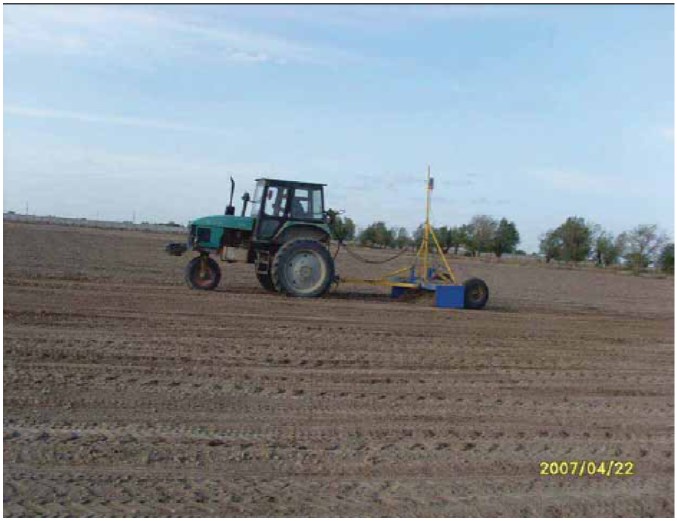
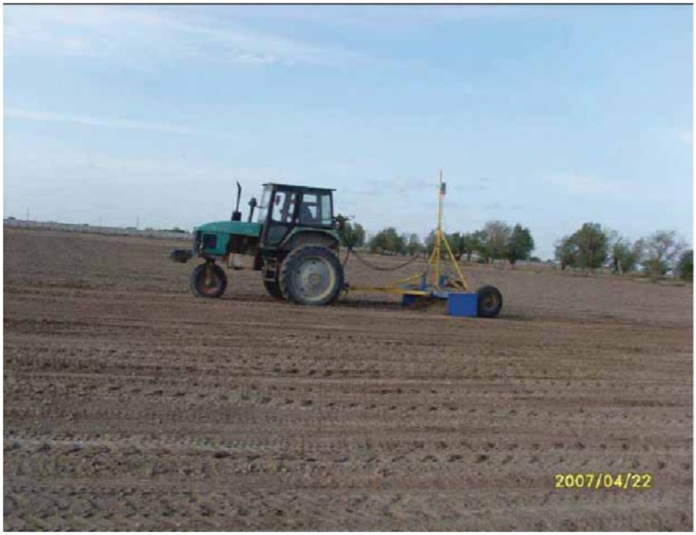
Land levelling using a long-base planner is a part of traditional farming practice in Uzbekistan. Nowadays, for many reasons (financial, technical), farmers do not always practice land levelling. There is weediness of crops, spotty salinization, uneven germination of plants where poor-quality levelling was carried out (or without levelling). Land leveling using a laser installation is a method of leveling of the field surface using an automated system for regulating the height of the scraper, when the final difference in the roughness on the surface reaches ± 3 cm or less. A flat field surface is one of the main factors ensuring the efficient use of water resources, obtaining a high yield and economic stability In irrigated agriculture. Due to the aggravation of problems with water supply and degradation of natural resources, the spread of laser levelling of agricultural lands is one of the modern innovative technological ways to increase the productivity of irrigated lands.
Costs of inputs needed for establishment:
Land levelling is carried out using a laser installation. Installation of laser equipment is possible on tractors with different traction class, which determines the efficiency of the laser planner.
Laser levelling requires additional preparation of the field: (i) clearing of stubble and large inclusions, (ii) rough alignment (levelling as usual), (iii) determining the directions of sowing and irrigation. The planning process includes a topographic survey with the use of a laser system, verification and device installation. Productivity is 1-3 ha / day. Land levelling is not recommended on wet soil to avoid soil compaction.
Natural / social environment: population growth increases the need in agricultural production. Since it is not possible to increase the sown area and the amount of available water resources, it is necessary to use them more efficiently. Since gaining independence, Uzbekistan has begun to implement promising reforms for sustainable development of agriculture. From this point of view, improving the efficiency of land and water resources is one of the urgent and important tasks of the agricultural sector. Almost half of irrigated land suffers from secondary salinization and near groundwater levels due to uneven distribution of water in the fields, which leads to soil degradation. An attempt to increase crop yields through more intensive soil cultivation, the use of fertilizers and pesticides was previously undertaken. However, long-term world practice shows that this inevitably leads to even greater depletion, degradation of soil structure, and a decrease in their ability to accumulate and retain moisture necessary for plant growth and development. Laser land levelling is one of the ways to improve the efficiency of irrigation water use with limited water resources, prevent the development of soil salinization processes, increase yields . The introduction of high-precision levelling will ensure a sustainable increase in land productivity and, consequently, improve the living standards of the rural population.
2.3 Photos of the Technology
General remarks regarding photos:
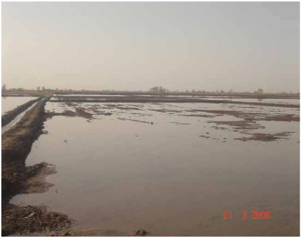
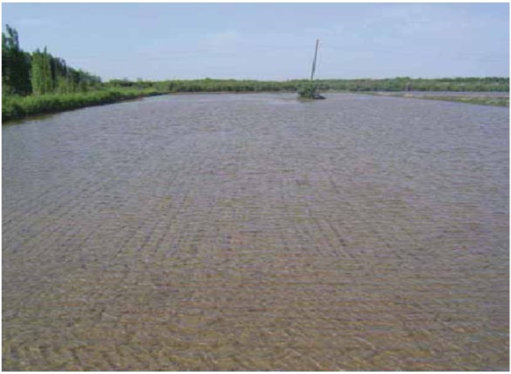
The photographs illustrate the effect of laser levelling - the equal distribution of water across the field during the preventive washing of saline lands
2.5 Country/ region/ locations where the Technology has been applied and which are covered by this assessment
Country:
Uzbekistan
Region/ State/ Province:
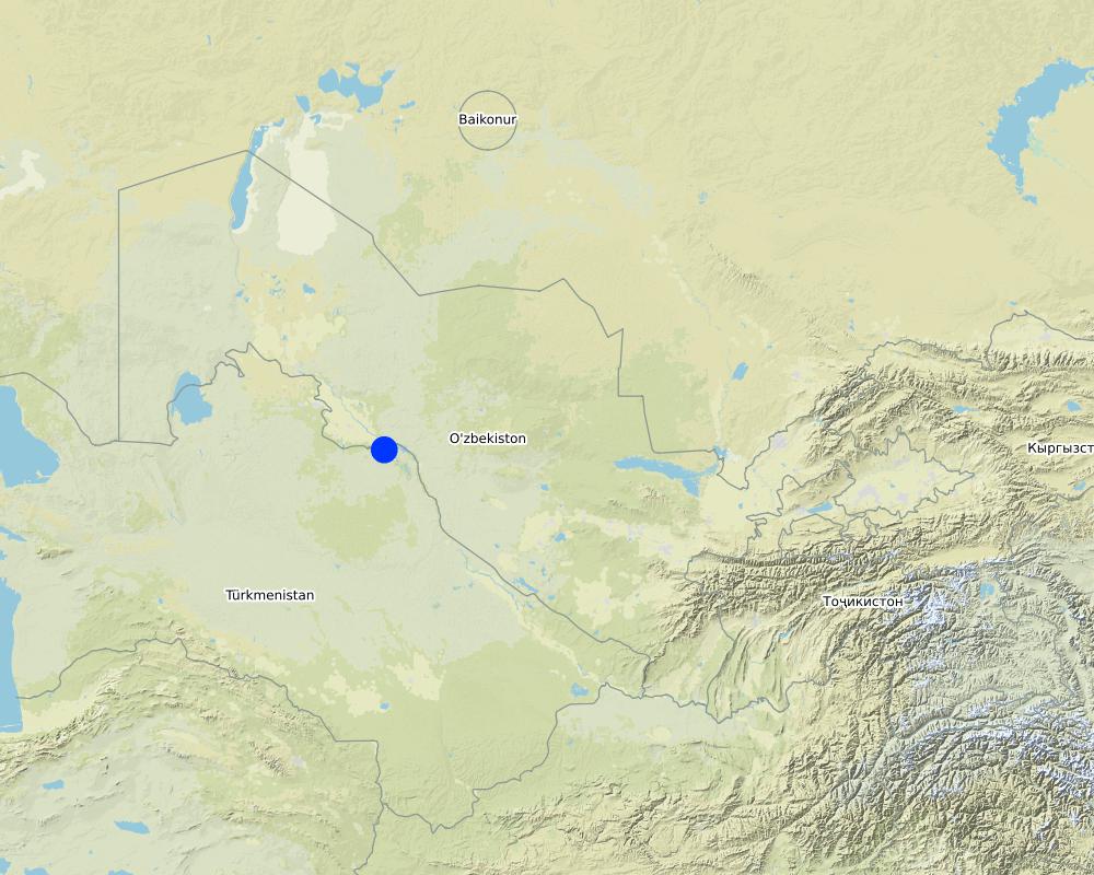
Khazarasp region, Khorezm region
Further specification of location:
Pitnok village
Specify the spread of the Technology:
- evenly spread over an area
If precise area is not known, indicate approximate area covered:
- 10-100 km2
Comments:
Materials were collected from various sources in various agroclimatic zones of Uzbekistan, where technology has been applied in recent decades within the framework of the GEF SGP, ICARDA, UNDP, GIC, Case New Holland Corporation, Uzselkhozmash Holding and BMKB-Agromash on average 50-200 ha.
Map
×2.6 Date of implementation
Indicate year of implementation:
2002
If precise year is not known, indicate approximate date:
- 10-50 years ago
2.7 Introduction of the Technology
Specify how the Technology was introduced:
- during experiments/ research
- through projects/ external interventions
Comments (type of project, etc.):
The technology is being introduced through projects aimed at increasing the land and water resources
3. Classification of the SLM Technology
3.1 Main purpose(s) of the Technology
- improve production
- reduce, prevent, restore land degradation
- increasing the efficiency of water use at the on-farm level and increasing crop yields are the main objectives
3.2 Current land use type(s) where the Technology is applied

Cropland
- Annual cropping
Number of growing seasons per year:
- 1
Specify:
the growing season allows to get only 1 crop per year of the main crops - cotton and wheat. It is possible to get a second crop if to plant a crop with a short growing season (legumes, potatoes and melons) after harvesting wheat
3.4 Water supply
Water supply for the land on which the Technology is applied:
- full irrigation
3.5 SLM group to which the Technology belongs
- irrigation management (incl. water supply, drainage)
3.6 SLM measures comprising the Technology

agronomic measures
- A7: Others
Comments:
High-precision leveling of the surface of agricultural fields
3.7 Main types of land degradation addressed by the Technology

chemical soil deterioration
- Cs: salinization/ alkalinization

biological degradation
- Bl: loss of soil life
Comments:
Secondary salinization is caused by natural conditions (arid climate, difficult groundwater outflow conditions) and anthropogenic activities (inefficient functioning of irrigation and drainage infrastructure, violation of agricultural technology and irrigation regime, poor field levellng). Biological degradation is caused by the deterioration of the habitat of soil organisms due to salinization and low humus content
3.8 Prevention, reduction, or restoration of land degradation
Specify the goal of the Technology with regard to land degradation:
- reduce land degradation
Comments:
Secondary salinization is caused by natural conditions (arid climate, difficult groundwater outflow conditions) and anthropogenic activities (inefficient functioning of irrigation and drainage infrastructure, violation of agricultural technology and irrigation regime, poor field levellng). Biological degradation is caused by the deterioration of the habitat of soil organisms due to salinization and low humus content
4. Technical specifications, implementation activities, inputs, and costs
4.1 Technical drawing of the Technology
Technical specifications (related to technical drawing):
From left to right: Сontrol panel - Laser receiver - Automatic hydraulic vent - Laser ray - Laser emitter - Hydraulic pump - Scraper
4.2 General information regarding the calculation of inputs and costs
Specify how costs and inputs were calculated:
- per Technology area
Indicate size and area unit:
1 ha
Specify currency used for cost calculations:
- USD
If relevant, indicate exchange rate from USD to local currency (e.g. 1 USD = 79.9 Brazilian Real): 1 USD =:
1620.0
Indicate average wage cost of hired labour per day:
about 10 USD (2010)
4.3 Establishment activities
| Activity | Timing (season) | |
|---|---|---|
| 1. | Clearing of stubble and large inclusions, rough alignment (levelling as usual), determining the directions of sowing and irrigation, topographic survey and laser planning, deep cultivation, harrowing, levelling | During June-September, after harvesting winter wheat, when the field is free from crops |
Comments:
Laser levelling is carried out only on dry soil to avoid compaction
4.4 Costs and inputs needed for establishment
| Specify input | Unit | Quantity | Costs per Unit | Total costs per input | % of costs borne by land users | |
|---|---|---|---|---|---|---|
| Labour | Labor costs | USD/ha | 1.0 | 30.3 | 30.3 | |
| Equipment | Mechanization costs | USD/ha | 1.0 | 314.1 | 314.1 | |
| Other | Acquisition of laser equipment | USD/unit | 1.0 | 11501.0 | 11501.0 | |
| Total costs for establishment of the Technology | 11845.4 | |||||
| Total costs for establishment of the Technology in USD | 7.31 | |||||
If land user bore less than 100% of costs, indicate who covered the remaining costs:
paid by the Project
Comments:
paid by the Project (100%)
4.5 Maintenance/ recurrent activities
| Activity | Timing/ frequency | |
|---|---|---|
| 1. | Plowing | Autumn |
| 2. | Harrowing, levelling | April |
Comments:
Laser planning is carried out 1 time in 5-8 years. Due to the even field surface in subsequent years, labor costs and the use of agricultural machinery are reduced
4.6 Costs and inputs needed for maintenance/ recurrent activities (per year)
| Specify input | Unit | Quantity | Costs per Unit | Total costs per input | % of costs borne by land users | |
|---|---|---|---|---|---|---|
| Labour | Hired labor | USD/ha | 1.0 | 10.0 | 10.0 | 100.0 |
| Equipment | Mechanization costs | USD/ha | 1.0 | 43.2 | 43.2 | 100.0 |
| Total costs for maintenance of the Technology | 53.2 | |||||
| Total costs for maintenance of the Technology in USD | 0.03 | |||||
4.7 Most important factors affecting the costs
Describe the most determinate factors affecting the costs:
The highest costs are related to acquiring a laser planner. However, it is possible to recoup the cost of laser planning equipment in 3 years. To achieve this, this technology should be applied on an area of 39 hectares of wheat field or 58 hectares of cotton field
5. Natural and human environment
5.1 Climate
Annual rainfall
- < 250 mm
- 251-500 mm
- 501-750 mm
- 751-1,000 mm
- 1,001-1,500 mm
- 1,501-2,000 mm
- 2,001-3,000 mm
- 3,001-4,000 mm
- > 4,000 mm
Specifications/ comments on rainfall:
90% of the precipitation falls in October-May
Indicate the name of the reference meteorological station considered:
Urgench, Khiva
Agro-climatic zone
- semi-arid
The duration of the growing season is 160 days
5.2 Topography
Slopes on average:
- flat (0-2%)
- gentle (3-5%)
- moderate (6-10%)
- rolling (11-15%)
- hilly (16-30%)
- steep (31-60%)
- very steep (>60%)
Landforms:
- plateau/plains
- ridges
- mountain slopes
- hill slopes
- footslopes
- valley floors
Altitudinal zone:
- 0-100 m a.s.l.
- 101-500 m a.s.l.
- 501-1,000 m a.s.l.
- 1,001-1,500 m a.s.l.
- 1,501-2,000 m a.s.l.
- 2,001-2,500 m a.s.l.
- 2,501-3,000 m a.s.l.
- 3,001-4,000 m a.s.l.
- > 4,000 m a.s.l.
Comments and further specifications on topography:
105-120 m above sea level
5.3 Soils
Soil depth on average:
- very shallow (0-20 cm)
- shallow (21-50 cm)
- moderately deep (51-80 cm)
- deep (81-120 cm)
- very deep (> 120 cm)
Soil texture (topsoil):
- medium (loamy, silty)
Soil texture (> 20 cm below surface):
- medium (loamy, silty)
Topsoil organic matter:
- low (<1%)
If available, attach full soil description or specify the available information, e.g. soil type, soil PH/ acidity, Cation Exchange Capacity, nitrogen, salinity etc.
Meadow soils, humus content in the arable layer is 00.77 % or less
5.4 Water availability and quality
Ground water table:
< 5 m
Availability of surface water:
good
Water quality (untreated):
good drinking water
Is water salinity a problem?
Yes
Specify:
Water suitable for irrigation
Is flooding of the area occurring?
No
Comments and further specifications on water quality and quantity:
Water in surface sources is polluted from discharges of drainage from irrigation fields
5.5 Biodiversity
Species diversity:
- medium
Habitat diversity:
- medium
Comments and further specifications on biodiversity:
vegetation is represented by cultivated plant species: cotton, wheat, vegetables, melons, perennial plantings of fruit and ornamental trees and shrubs
5.6 Characteristics of land users applying the Technology
Sedentary or nomadic:
- Sedentary
Market orientation of production system:
- mixed (subsistence/ commercial)
Off-farm income:
- 10-50% of all income
Relative level of wealth:
- average
Individuals or groups:
- individual/ household
Level of mechanization:
- mechanized/ motorized
Gender:
- men
Age of land users:
- middle-aged
5.7 Average area of land used by land users applying the Technology
- < 0.5 ha
- 0.5-1 ha
- 1-2 ha
- 2-5 ha
- 5-15 ha
- 15-50 ha
- 50-100 ha
- 100-500 ha
- 500-1,000 ha
- 1,000-10,000 ha
- > 10,000 ha
Is this considered small-, medium- or large-scale (referring to local context)?
- medium-scale
Comments:
The average size of farms is 35-75 hectares, dekhkan and household plots - up to 0.35 hectares
5.8 Land ownership, land use rights, and water use rights
Land ownership:
- state
Land use rights:
- leased
- limited
Comments:
limited water use due to limited water resources
5.9 Access to services and infrastructure
health:
- poor
- moderate
- good
education:
- poor
- moderate
- good
technical assistance:
- poor
- moderate
- good
employment (e.g. off-farm):
- poor
- moderate
- good
markets:
- poor
- moderate
- good
energy:
- poor
- moderate
- good
roads and transport:
- poor
- moderate
- good
drinking water and sanitation:
- poor
- moderate
- good
financial services:
- poor
- moderate
- good
6. Impacts and concluding statements
6.1 On-site impacts the Technology has shown
Socio-economic impacts
Production
crop production
Quantity before SLM:
4 tons / ha
Quantity after SLM:
4,4 tons / ha
Income and costs
expenses on agricultural inputs
farm income
Quantity before SLM:
777
Quantity after SLM:
855
workload
Ecological impacts
Soil
salinity
6.2 Off-site impacts the Technology has shown
impact of greenhouse gases
Specify assessment of off-site impacts (measurements):
Technology has no negative off-site impacts and helps to reduce greenhouse gas emissions
6.3 Exposure and sensitivity of the Technology to gradual climate change and climate-related extremes/ disasters (as perceived by land users)
Gradual climate change
Gradual climate change
| Season | increase or decrease | How does the Technology cope with it? | |
|---|---|---|---|
| annual temperature | increase | very well |
6.4 Cost-benefit analysis
How do the benefits compare with the establishment costs (from land users’ perspective)?
Short-term returns:
slightly positive
Long-term returns:
positive
How do the benefits compare with the maintenance/ recurrent costs (from land users' perspective)?
Short-term returns:
slightly positive
Long-term returns:
positive
Comments:
The benefits are already positive in the short term.
6.5 Adoption of the Technology
- 11-50%
Of all those who have adopted the Technology, how many did so spontaneously, i.e. without receiving any material incentives/ payments?
- 11-50%
6.6 Adaptation
Has the Technology been modified recently to adapt to changing conditions?
No
6.7 Strengths/ advantages/ opportunities of the Technology
| Strengths/ advantages/ opportunities in the land user’s view |
|---|
| Economical use of water and equal humidification of the field |
| Reduce watering time and labor |
| Yield increase |
| The decline in groundwater level |
| Reducing the cost of mechanized tillage in subsequent years |
| Strengths/ advantages/ opportunities in the compiler’s or other key resource person’s view |
|---|
| Efficient use of limited water resources |
| Equal wetting of the entire field, both in area and in depth |
| Prevention of salinization |
| Reducing greenhouse gas emissions |
6.8 Weaknesses/ disadvantages/ risks of the Technology and ways of overcoming them
| Weaknesses/ disadvantages/ risks in the land user’s view | How can they be overcome? |
|---|---|
| The relatively high cost of laser equipment | State assistance, cooperation of farmers, joint acquisition and use of laser equipment |
| Lack of knowledge on the laser equipment operation | Training |
| Limited time for the measures implementation (July-September), when the field is free from culture and the soil is dry | Streamline and adhere to deadlines for fieldwork |
| Weaknesses/ disadvantages/ risks in the compiler’s or other key resource person’s view | How can they be overcome? |
|---|---|
| The relatively high cost of laser equipment | State support (Document UP No. UP-3860 dated 14.03.03.2007, Imported laser planning equipment is exempt from customs duty and value-added tax. |
| Awareness of the costs and benefits of this technology: the laser planner pays for itself in 7-8 months of operation. Laser levelling is carried out 1 time in 3 years | Consulting services, trainings, information |
| Lack of technical equipment of farms | Loans, purchase on the basis of leasing |
7. References and links
7.1 Methods/ sources of information
- interviews with SLM specialists/ experts
5 persons
- compilation from reports and other existing documentation
When were the data compiled (in the field)?
17/08/2017
7.3 Links to relevant online information
Title/ description:
NGO KRASS Distribution of resource-saving technologies for sustainable agricultural development in the Khorezm region of Uzbekistan. Technical instruction Urgench, 2012
URL:
http://sgp.uz/userfiles/Lazer%20rus%20low%20resolution.pdf
Links and modules
Expand all Collapse allLinks
No links
Modules
No modules


