Resemis d’espèces pastorales locales [Tunisia]
- Creation:
- Update:
- Compiler: Donia Mühlematter
- Editor: –
- Reviewer: Donia Mühlematter
استزراع النباتات الرعوية المحلية
technologies_4053 - Tunisia
View sections
Expand all Collapse all1. General information
1.2 Contact details of resource persons and institutions involved in the assessment and documentation of the Technology
Name of project which facilitated the documentation/ evaluation of the Technology (if relevant)
Decision Support for Mainstreaming and Scaling out Sustainable Land Management (GEF-FAO / DS-SLM)Name of the institution(s) which facilitated the documentation/ evaluation of the Technology (if relevant)
CDE Centre for Development and Environment (CDE Centre for Development and Environment) - Switzerland1.3 Conditions regarding the use of data documented through WOCAT
The compiler and key resource person(s) accept the conditions regarding the use of data documented through WOCAT:
Yes
1.4 Declaration on sustainability of the described Technology
Is the Technology described here problematic with regard to land degradation, so that it cannot be declared a sustainable land management technology?
No
1.5 Reference to Questionnaire(s) on SLM Approaches (documented using WOCAT)
Réhabilitation des parcours par réintroduction d’espèces autochtones [Tunisia]
Dans les situations où la dégradation des parcours a atteint le seuil d’irréversibilité, les semenciers font défaut et où la reconstitution de l’écosystème par une simple mise en défens n’est plus possible, la réhabilitation par réintroduction des espèces pastorales ayant disparu devient la seule alternative pour revenir à l’écosystème pastoral …
- Compiler: Donia Mühlematter
2. Description of the SLM Technology
2.1 Short description of the Technology
Definition of the Technology:
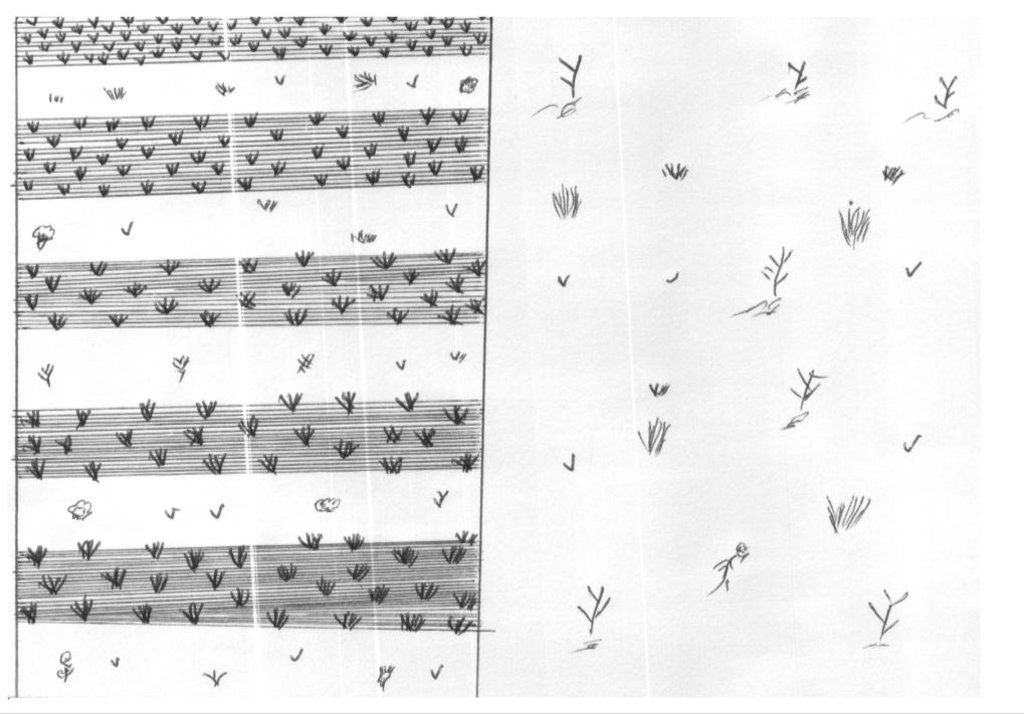
Le resemis des parcours est une technique utilisée pour l’amélioration pastorale lorsque la dégradation a atteint un état avancé et irréversible et dans les friches post-culturales et abandons. Elle consiste à réintroduire des espèces pastorales ayant disparu.
2.2 Detailed description of the Technology
Description:
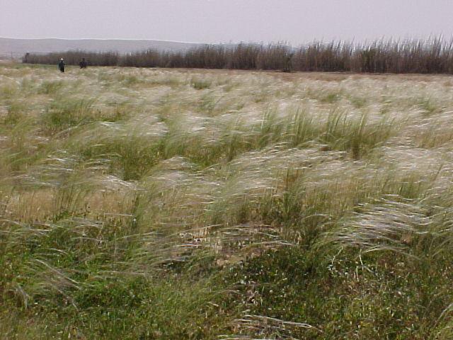
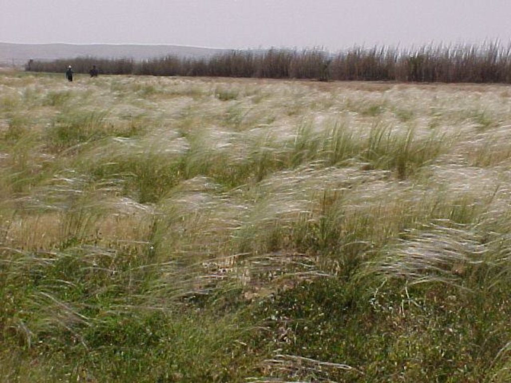
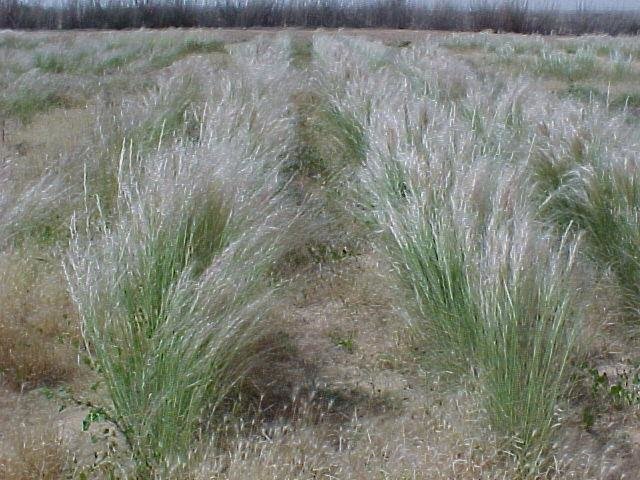
Les techniques de semis varient selon les espèces considérées et la nature de la parcelle à réhabiliter. Ainsi Au niveau des sites surpâturés, les plantes autochtones doivent être semées directement en favorisant les endroits où des reliques de ces espèces existent encore. Concernant les ligneux bas comme Rhanterium suaveolens et Salsola vermiculata, la technique consiste à scarifier le sol d’abord puis à épandre les semences sur la surface travaillée; alors que l’on doit semer d’abord puis scarifier le sol pour des espèces comme Argyrolobium uniflorum, Stipa lagascae, Plantago albicans, etc.
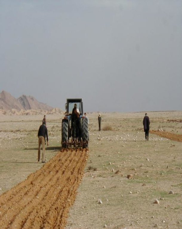
Au niveau des friches post-culturales, un scarifiage ou labour léger en planches est général utilisé dans les opérations de resemis.
L’époque de semis se situe entre début septembre et fin novembre, c’est à dire durant les pluies automnales et lorsque la température du sol est encore suffisamment élevée pour favoriser la germination. Les quantités de semences à l’ha varient avec l’espèce (environ 5 à 7 kg/ha de semences pures pour Argyrolobium uniflorum et Plantago albicans).
Les parcelles semées devront être gardées hors pâture durant les deux premières années.
2.3 Photos of the Technology
2.5 Country/ region/ locations where the Technology has been applied and which are covered by this assessment
Country:
Tunisia
Region/ State/ Province:
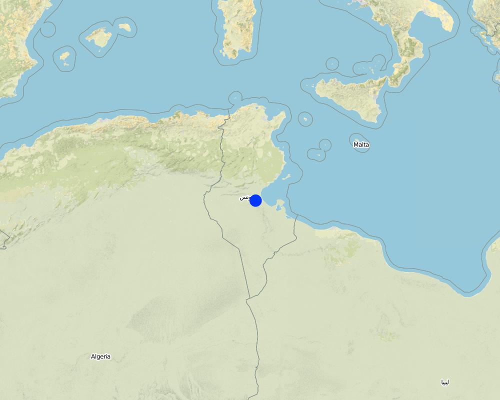
Chenchou- Gabes
Specify the spread of the Technology:
- evenly spread over an area
If precise area is not known, indicate approximate area covered:
- < 0.1 km2 (10 ha)
Map
×2.6 Date of implementation
If precise year is not known, indicate approximate date:
- 10-50 years ago
2.7 Introduction of the Technology
Specify how the Technology was introduced:
- during experiments/ research
- intervention de l’état
3. Classification of the SLM Technology
3.1 Main purpose(s) of the Technology
- improve production
- reduce, prevent, restore land degradation
- conserve ecosystem
- preserve/ improve biodiversity
3.2 Current land use type(s) where the Technology is applied
Land use mixed within the same land unit:
No

Grazing land
Extensive grazing:
- Nomadism
- Semi-nomadic pastoralism
3.3 Has land use changed due to the implementation of the Technology?
Has land use changed due to the implementation of the Technology?
- No (Continue with question 3.4)
3.4 Water supply
Water supply for the land on which the Technology is applied:
- rainfed
3.5 SLM group to which the Technology belongs
- pastoralism and grazing land management
- improved ground/ vegetation cover
- integrated soil fertility management
3.6 SLM measures comprising the Technology

management measures
- M2: Change of management/ intensity level
- M5: Control/ change of species composition
3.7 Main types of land degradation addressed by the Technology

chemical soil deterioration
- Cn: fertility decline and reduced organic matter content (not caused by erosion)

physical soil deterioration
- Pu: loss of bio-productive function due to other activities

biological degradation
- Bc: reduction of vegetation cover
- Bq: quantity/ biomass decline
- Bs: quality and species composition/ diversity decline
3.8 Prevention, reduction, or restoration of land degradation
Specify the goal of the Technology with regard to land degradation:
- restore/ rehabilitate severely degraded land
4. Technical specifications, implementation activities, inputs, and costs
4.1 Technical drawing of the Technology
4.2 General information regarding the calculation of inputs and costs
Specify how costs and inputs were calculated:
- per Technology area
Indicate size and area unit:
1 hectare
other/ national currency (specify):
Dinars Tunisien (DT)
If relevant, indicate exchange rate from USD to local currency (e.g. 1 USD = 79.9 Brazilian Real): 1 USD =:
2.5
Indicate average wage cost of hired labour per day:
10 DT
4.3 Establishment activities
| Activity | Timing (season) | |
|---|---|---|
| 1. | Délimitation de la parcelle à réhabiliter | |
| 2. | Collecte des semences | |
| 3. | Scarifiage et resemis | |
| 4. | Suivi-évaluation de l’état de la végétation pastorale pendant 3 années. |
4.4 Costs and inputs needed for establishment
| Specify input | Unit | Quantity | Costs per Unit | Total costs per input | % of costs borne by land users | |
|---|---|---|---|---|---|---|
| Labour | Main d’oeuvre (collecte et nettoyage des semences, semis) | personne/jour | 10.0 | 100.0 | 1000.0 | |
| Labour | Labour | personne/jour | 10.0 | 10.0 | 100.0 | |
| Total costs for establishment of the Technology | 1100.0 | |||||
| Total costs for establishment of the Technology in USD | 440.0 | |||||
4.5 Maintenance/ recurrent activities
| Activity | Timing/ frequency | |
|---|---|---|
| 1. | Interdiction du pâturage pendant 3 années à travers un gardien-nage sévère. |
Comments:
A l’heure actuelle cette technique n’est testée qu’à l’échelle expérimentale. Elle a également été pratiquée dans le cadre d’un certain nombre de projets de développement pastoral au Centre et au Sud de la Tunisie dans les parcours collectifs et non pas chez les privés. Le resemis est une technique relativement complexe qui demande un itinéraire technique fin partant de la collecte des semences et arrivant aux façons cultu-rales spécifiques à chaque espèce.
4.7 Most important factors affecting the costs
Describe the most determinate factors affecting the costs:
Coût de la main d'oeuvre.
5. Natural and human environment
5.1 Climate
Annual rainfall
- < 250 mm
- 251-500 mm
- 501-750 mm
- 751-1,000 mm
- 1,001-1,500 mm
- 1,501-2,000 mm
- 2,001-3,000 mm
- 3,001-4,000 mm
- > 4,000 mm
Agro-climatic zone
- arid
Climat Saharien Aride.
5.2 Topography
Slopes on average:
- flat (0-2%)
- gentle (3-5%)
- moderate (6-10%)
- rolling (11-15%)
- hilly (16-30%)
- steep (31-60%)
- very steep (>60%)
Landforms:
- plateau/plains
- ridges
- mountain slopes
- hill slopes
- footslopes
- valley floors
Altitudinal zone:
- 0-100 m a.s.l.
- 101-500 m a.s.l.
- 501-1,000 m a.s.l.
- 1,001-1,500 m a.s.l.
- 1,501-2,000 m a.s.l.
- 2,001-2,500 m a.s.l.
- 2,501-3,000 m a.s.l.
- 3,001-4,000 m a.s.l.
- > 4,000 m a.s.l.
Indicate if the Technology is specifically applied in:
- concave situations
5.3 Soils
Soil depth on average:
- very shallow (0-20 cm)
- shallow (21-50 cm)
- moderately deep (51-80 cm)
- deep (81-120 cm)
- very deep (> 120 cm)
Soil texture (topsoil):
- coarse/ light (sandy)
- medium (loamy, silty)
Soil texture (> 20 cm below surface):
- coarse/ light (sandy)
- medium (loamy, silty)
Topsoil organic matter:
- low (<1%)
5.4 Water availability and quality
Ground water table:
on surface
Availability of surface water:
poor/ none
Water quality (untreated):
for agricultural use only (irrigation)
Is water salinity a problem?
Yes
Is flooding of the area occurring?
No
5.5 Biodiversity
Species diversity:
- low
Habitat diversity:
- low
5.6 Characteristics of land users applying the Technology
Sedentary or nomadic:
- Sedentary
- Semi-nomadic
Market orientation of production system:
- subsistence (self-supply)
Off-farm income:
- less than 10% of all income
Relative level of wealth:
- very poor
Individuals or groups:
- groups/ community
Level of mechanization:
- manual work
- animal traction
Gender:
- men
Age of land users:
- middle-aged
- elderly
5.7 Average area of land used by land users applying the Technology
- < 0.5 ha
- 0.5-1 ha
- 1-2 ha
- 2-5 ha
- 5-15 ha
- 15-50 ha
- 50-100 ha
- 100-500 ha
- 500-1,000 ha
- 1,000-10,000 ha
- > 10,000 ha
Is this considered small-, medium- or large-scale (referring to local context)?
- small-scale
5.8 Land ownership, land use rights, and water use rights
Land ownership:
- communal/ village
Land use rights:
- open access (unorganized)
Water use rights:
- open access (unorganized)
5.9 Access to services and infrastructure
health:
- poor
- moderate
- good
education:
- poor
- moderate
- good
technical assistance:
- poor
- moderate
- good
employment (e.g. off-farm):
- poor
- moderate
- good
markets:
- poor
- moderate
- good
energy:
- poor
- moderate
- good
roads and transport:
- poor
- moderate
- good
drinking water and sanitation:
- poor
- moderate
- good
financial services:
- poor
- moderate
- good
6. Impacts and concluding statements
6.1 On-site impacts the Technology has shown
Socio-economic impacts
Production
fodder production
animal production
Income and costs
farm income
Socio-cultural impacts
SLM/ land degradation knowledge
situation of socially and economically disadvantaged groups
Ecological impacts
Soil
soil cover
Biodiversity: vegetation, animals
Vegetation cover
Climate and disaster risk reduction
drought impacts
6.3 Exposure and sensitivity of the Technology to gradual climate change and climate-related extremes/ disasters (as perceived by land users)
Gradual climate change
Gradual climate change
| Season | increase or decrease | How does the Technology cope with it? | |
|---|---|---|---|
| annual temperature | increase | moderately | |
| annual rainfall | increase | moderately |
6.4 Cost-benefit analysis
How do the benefits compare with the establishment costs (from land users’ perspective)?
Short-term returns:
slightly negative
Long-term returns:
slightly negative
How do the benefits compare with the maintenance/ recurrent costs (from land users' perspective)?
Short-term returns:
slightly negative
Long-term returns:
slightly positive
6.5 Adoption of the Technology
- 1-10%
Of all those who have adopted the Technology, how many did so spontaneously, i.e. without receiving any material incentives/ payments?
- 0-10%
Comments:
Le resemis est une technique relativement complexe qui demande un itinéraire technique fin partant de la collecte des semences et arri-vant aux façons culturales spécifiques à chaque espèce. De plus le resemis a d’autres objectifs de restauration de l’écosystème et de relance de la dynamique biologique qui peuvent ne pas concerner l’usager actuel de l’espace.
6.6 Adaptation
Has the Technology been modified recently to adapt to changing conditions?
No
6.7 Strengths/ advantages/ opportunities of the Technology
| Strengths/ advantages/ opportunities in the land user’s view |
|---|
| Technologie permettant l’amélioration de la productivité des parcours et la conservation de la biodiversité. |
6.8 Weaknesses/ disadvantages/ risks of the Technology and ways of overcoming them
| Weaknesses/ disadvantages/ risks in the land user’s view | How can they be overcome? |
|---|---|
| Cette technique n’est pas encore adoptée par la population. | sensibiliser la population sur l’importance d’une réintroduction des espèces locales qui peuvent durablement conserver les sols et amé-liorer la productivité des parcours. |
| C’est une opération coûteuse et sa réussite est doutée. | Appliquer l’approche au cours d’une année humide et assurer une meilleure gestion pour compenser ces coûts. |
7. References and links
7.1 Methods/ sources of information
- compilation from reports and other existing documentation
7.2 References to available publications
Title, author, year, ISBN:
Ouled Belgacem A., Neffati M., Chaieb M., Visser M. 2004. Réhabilitation des parcours dégradés en Tunisie présaharienne par réintroduction d’espèces autochtones: cas de Stipa lagascae R. & Sch. Cah. Options Méditerr. ISSN : 1022-1379. p 437-441.
Title, author, year, ISBN:
Visser M., Ouled Belgacem A., Neffati M. 2009. Reseeding Mediterranean dryland cereal fallows using Stipa lagascae R. & Sch.: influence of cutting regime during the establishment phase. Grass and forage Science, 65:23-27.
Links and modules
Expand all Collapse allLinks

Réhabilitation des parcours par réintroduction d’espèces autochtones [Tunisia]
Dans les situations où la dégradation des parcours a atteint le seuil d’irréversibilité, les semenciers font défaut et où la reconstitution de l’écosystème par une simple mise en défens n’est plus possible, la réhabilitation par réintroduction des espèces pastorales ayant disparu devient la seule alternative pour revenir à l’écosystème pastoral …
- Compiler: Donia Mühlematter
Modules
No modules


