Protection of water resources [Haiti]
- Creation:
- Update:
- Compiler: Antoine Kocher
- Editor: Eveline Studer
- Reviewers: Alexandra Gavilano, Joana Eichenberger, Eveline Studer
technologies_583 - Haiti
View sections
Expand all Collapse all1. General information
1.2 Contact details of resource persons and institutions involved in the assessment and documentation of the Technology
Key resource person(s)
SLM specialist:
Focal person EPA HELVETAS
Helvetas
Haiti
Name of project which facilitated the documentation/ evaluation of the Technology (if relevant)
Book project: where people and their land are safer - A Compendium of Good Practices in Disaster Risk Reduction (DRR) (where people and their land are safer)1.3 Conditions regarding the use of data documented through WOCAT
The compiler and key resource person(s) accept the conditions regarding the use of data documented through WOCAT:
Yes
1.4 Declaration on sustainability of the described Technology
Is the Technology described here problematic with regard to land degradation, so that it cannot be declared a sustainable land management technology?
No
1.5 Reference to Questionnaire(s) on SLM Approaches (documented using WOCAT)
Local consultation to protect water resources [Haiti]
Consultation for natural resource management involves communities, authorities and other actors in collective decision-making to protect water resources in particular, and to institutionalize the management of these.
- Compiler: Antoine Kocher
2. Description of the SLM Technology
2.1 Short description of the Technology
Definition of the Technology:
The protection of water resources is essential for the supply of drinking water in the rural zones of Haiti, by enabling to preserve the water quality and facilitate the recharge of the resource. Organizing the actors related to the water resource and to the economic, environmental and communal challenges is crucial. This implies, apart from management, the implementation of various technical measures.
2.2 Detailed description of the Technology
Description:
The majority of water resources in Haiti is subject to bacterial contamination, which endangers the health of the consumers. The infrastructure for the abstraction and conveyance of water is periodically put to the test by the large variation of discharge, like floods, but also by low flows. The protection of water resources aims to strengthen local actors to better manage water resources. The objective is to take care of the protection of water resources at local level according to rules which are established and accepted by the actors with regard to legal, sociocultural and biophysical aspects.
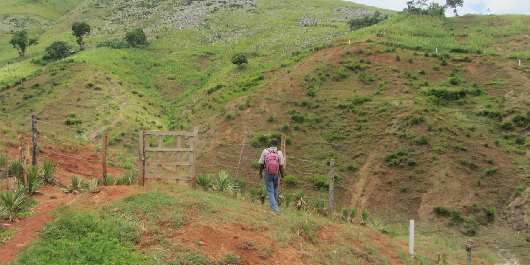
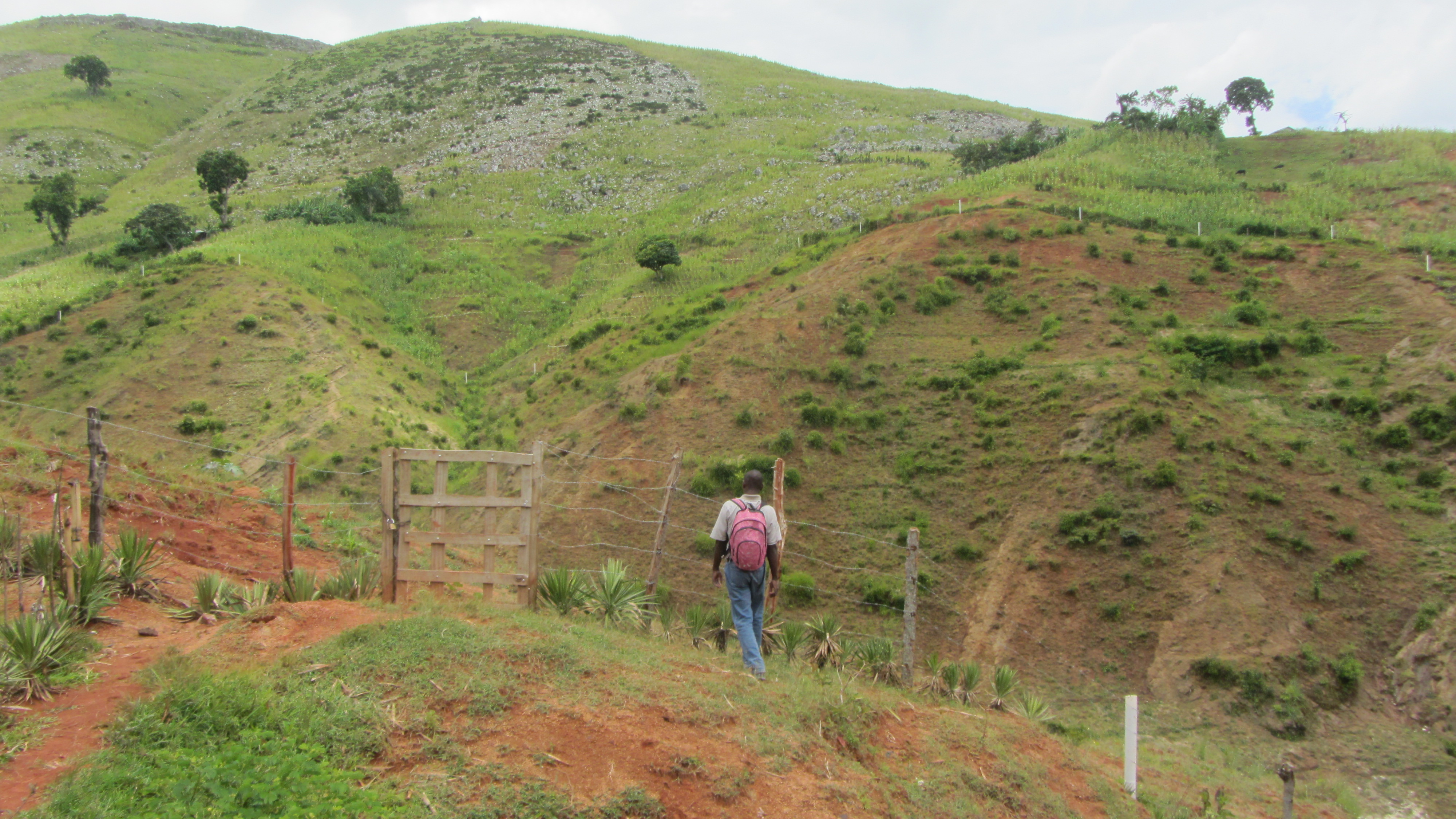
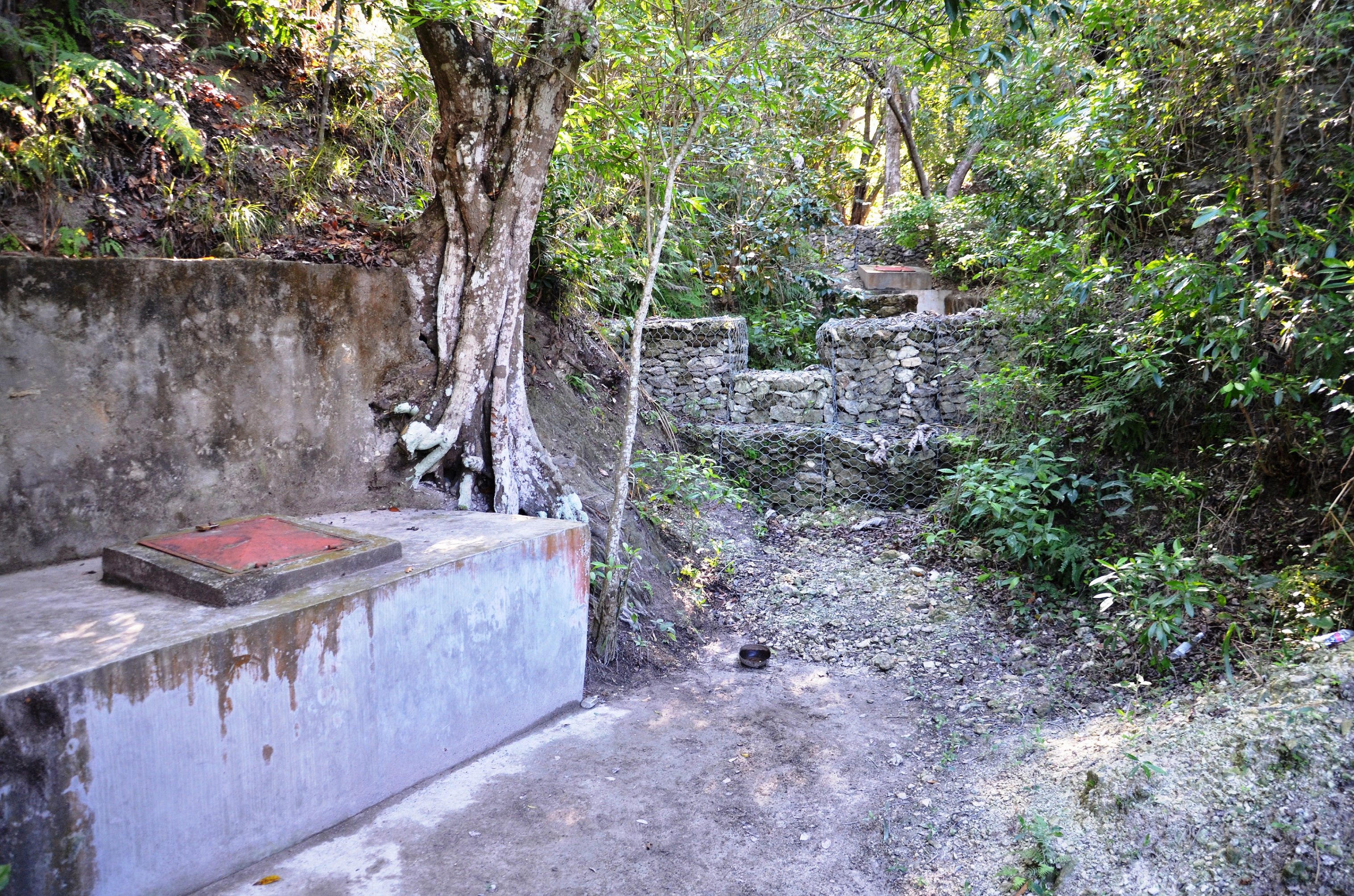
The protection of water resources also implies that technical measures are implemented to conserve and protect catchments, in order to ensure the quality and quantity of the required water and the recharge of groundwater bodies. The technical measures are defined for different zones. Three categories of zones are established with specific restrictions and recommendations, and formalized in a municipal decree which is published by the town councils. A first zone of 1000 m2 directly upstream of the water resource is brought into the domain of the state, fenced, reforested and totally protected from human activities.
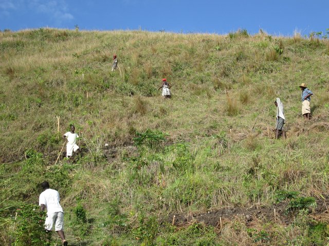
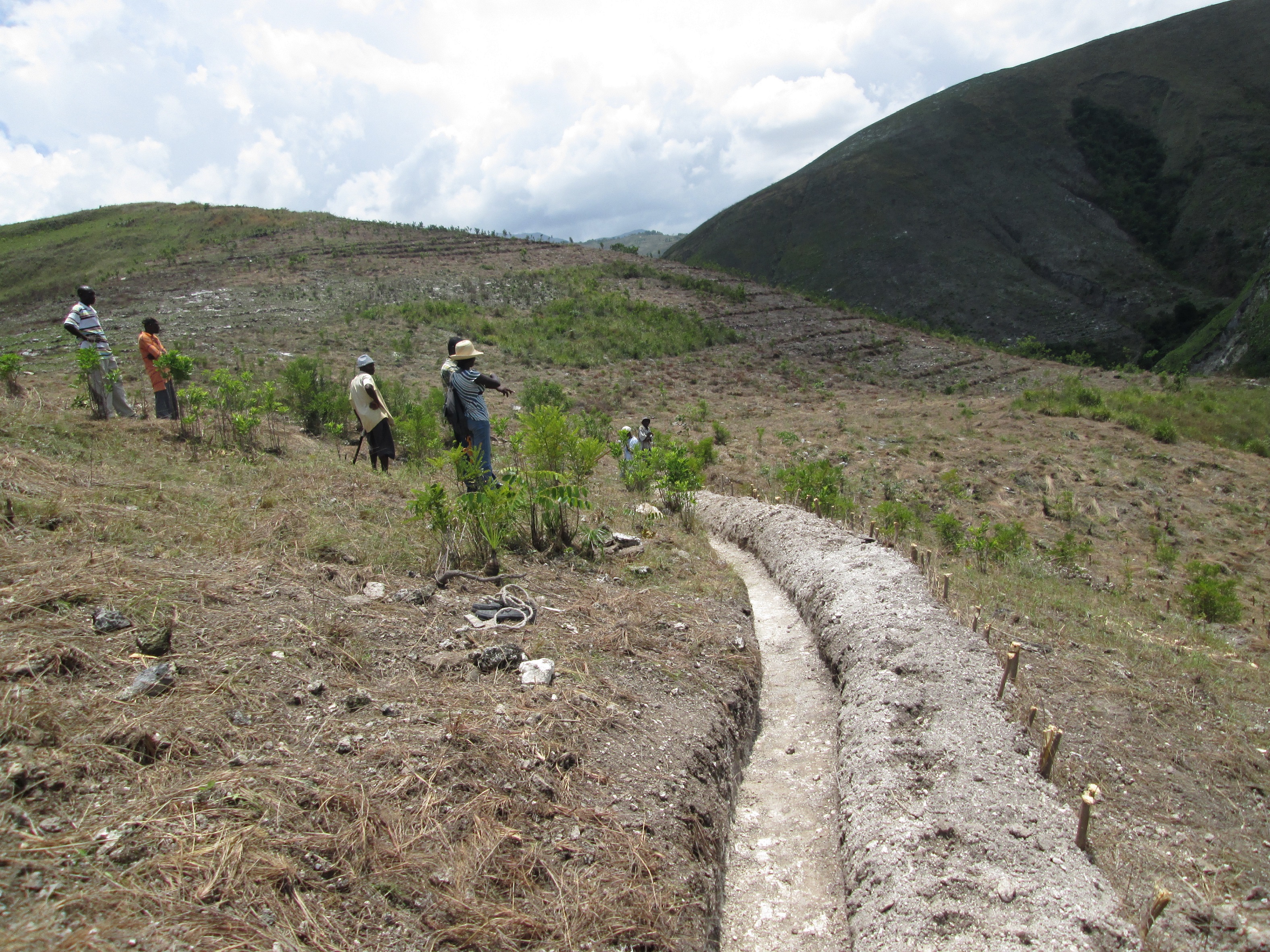
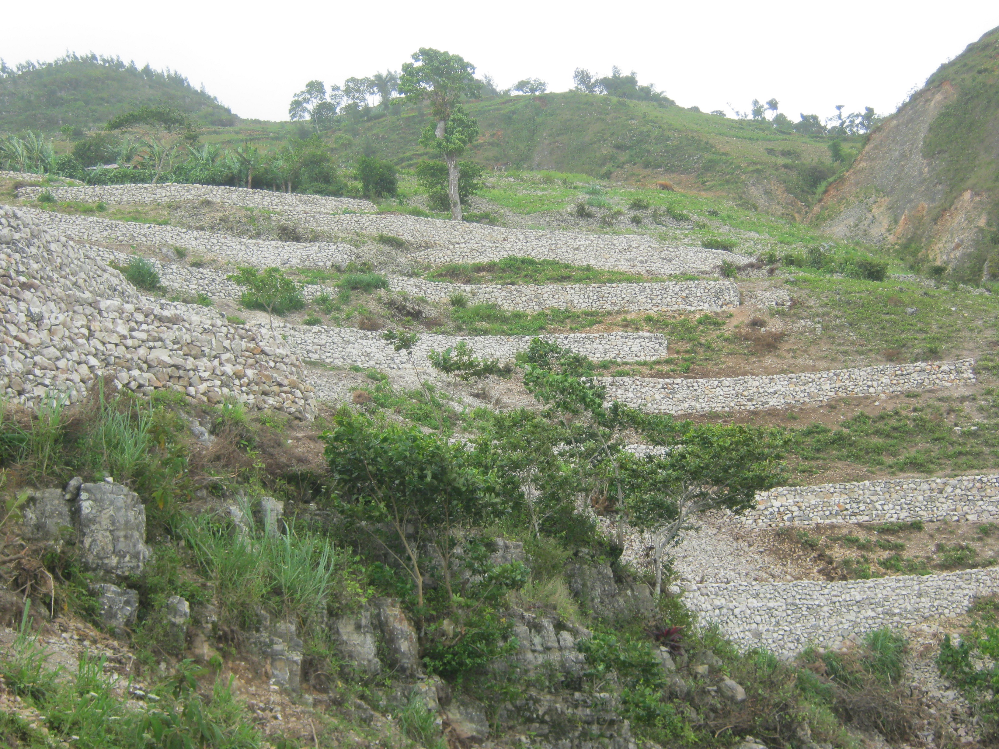
In a second zone of a minimum of 5 ha upstream of the resource, restrictions to the use of the terrain apply, notably with regard to defecation, free-range livestock farming and other harmful human activities, in order to protect the soil and the water quality. The terrain is managed so as to guarantee a good conservation of the soils by reforestation (agroforestry) with different varieties of fruit trees and timber. A third zone can be established if supported by the community, with restrictions on slash-and-burn and free-range grazing, as well as means to preserve the soils and to manage the vegetation cover. This latter zone can cover the whole catchment, and is meant to promote groundwater recharge. The restoration of the catchment through the zoning and the implementation of physical structures includes different techniques such as vegetative barriers and stone walls.
The restrictions on the use of zone 2 are not necessarily in contrast with the interests of the producers. It turns out that the rainfed crops are too much exposed to climatic hazards, and that forestry is a more reliable alternative. Therefore they perceive the development and reforestation of their land as an exploitation of their heritage, and as a profitable investment in the long term, when they will be able to manage the exploitation of the trees and their fruit production. In the first two years, a total maximum grant of 400 USD per ha is paid to the producers in different terms, depending on the success of the conservation activities. These experiences have inspired the setting of national standards on the protection of drinking water resources.
2.3 Photos of the Technology
Media Gallery
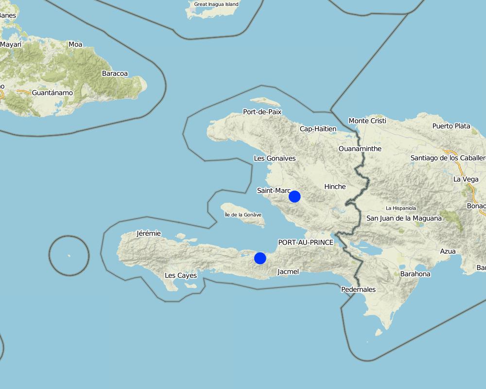
2.5 Country/ region/ locations where the Technology has been applied and which are covered by this assessment
Country:
Haiti
Region/ State/ Province:
Artibonite, Central West
Further specification of location:
Municipalities of Petit-Goâve, Verrettes, Savanette and Lachapelle
Specify the spread of the Technology:
- applied at specific points/ concentrated on a small area
Comments:
The conservation measures are locally applied on the hillslopes, but the restrictions on the use of the protected zones apply uniformly.
Map
×2.6 Date of implementation
If precise year is not known, indicate approximate date:
- less than 10 years ago (recently)
2.7 Introduction of the Technology
Specify how the Technology was introduced:
- through projects/ external interventions
Comments (type of project, etc.):
Support and incentives through various projects from HELVETAS, in particular projects focused on water services, risk management and support to local governance.
3. Classification of the SLM Technology
3.1 Main purpose(s) of the Technology
- reduce, prevent, restore land degradation
- protect a watershed/ downstream areas – in combination with other Technologies
- reduce risk of disasters
- adapt to climate change/ extremes and its impacts
- create beneficial economic impact
- create beneficial social impact
3.2 Current land use type(s) where the Technology is applied
Land use mixed within the same land unit:
Yes
Specify mixed land use (crops/ grazing/ trees):
- Silvo-pastoralism

Grazing land
Extensive grazing:
- Ranching
Animal type:
- goats
- cattle

Forest/ woodlands
- (Semi-)natural forests/ woodlands
- Tree plantation, afforestation
(Semi-)natural forests/ woodlands: Specify management type:
- Selective felling
Tree plantation, afforestation: Specify origin and composition of species:
- Mixed varieties
Products and services:
- Timber
- Fuelwood
Comments:
Number of growing seasons per year: 2
Two agricultural seasons with different crop species
3.3 Has land use changed due to the implementation of the Technology?
Has land use changed due to the implementation of the Technology?
- Yes (Please fill out the questions below with regard to the land use before implementation of the Technology)

Cropland
- Annual cropping
Comments:
Some zones were cultivated with annual crop varieties, and were subsequently transformed into protected zones, where selective felling is only authorized if natural regeneration is guaranteed, and if the vegetation cover provides an effective soil protection.
3.4 Water supply
Water supply for the land on which the Technology is applied:
- rainfed
3.5 SLM group to which the Technology belongs
- improved ground/ vegetation cover
- cross-slope measure
- ground water management
3.6 SLM measures comprising the Technology

vegetative measures
- V1: Tree and shrub cover

structural measures
- S1: Terraces
- S2: Bunds, banks
- S6: Walls, barriers, palisades, fences

management measures
- M1: Change of land use type
3.7 Main types of land degradation addressed by the Technology

soil erosion by water
- Wt: loss of topsoil/ surface erosion
- Wg: gully erosion/ gullying
- Wo: offsite degradation effects

biological degradation
- Bc: reduction of vegetation cover
- Bf: detrimental effects of fires

water degradation
- Hg: change in groundwater/aquifer level
- Hq: decline of groundwater quality
3.8 Prevention, reduction, or restoration of land degradation
Specify the goal of the Technology with regard to land degradation:
- prevent land degradation
- reduce land degradation
4. Technical specifications, implementation activities, inputs, and costs
4.1 Technical drawing of the Technology
Technical specifications (related to technical drawing):
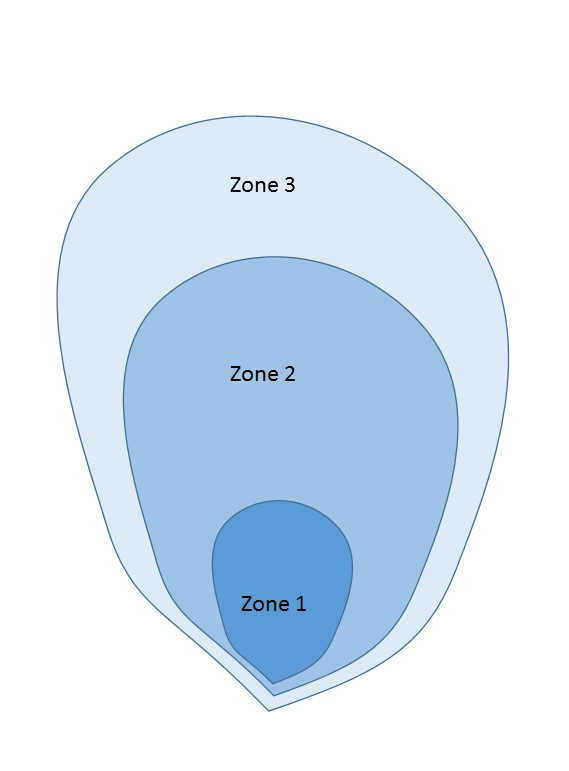
Three protection zones:
Zone 1: 1000 m2, public property, prohibition of any activity;
Zone 2: 50.000 m2, private property destined for agroforestry and protected by soil protection measures. Prohibition on housing, livestock farming, chemical fertilisation, latrines, waste disposal, slash-and-burn, etc.
Zone 3: all areas in the catchment upstream of zone 2, depending on agreements with the land owners and farmers, oriented on agroforestry and protected by sustainable land management measures.
Author:
Helvetas Haiti
4.2 General information regarding the calculation of inputs and costs
Specify how costs and inputs were calculated:
- per Technology area
Indicate size and area unit:
from 0,1 to 5 ha (reference unit 1 ha) - protection of one spring
Specify currency used for cost calculations:
- USD
Indicate average wage cost of hired labour per day:
5
4.3 Establishment activities
| Activity | Timing (season) | |
|---|---|---|
| 1. | Discussion on legal provisions with the different actors | To be finalised in the dry period |
| 2. | Elaboration of a municipal decree | To be finalised in the dry period |
| 3. | Acquisition of zone 1 | To be finalised in the dry period |
| 4. | Fencing of zone 1 | To be finalised in the dry period |
| 5. | Development of the land plots in zones 1 and 2 | During the dry period (availability of farmers and stability of the slopes) |
| 6. | Treatment of gullies | During the dry period (availability of farmers and absence of surface runoff) |
| 7. | Training of farmers on conservation practices | Before the rainy season |
| 8. | Afforestation | At the start of the rainy season |
| 9. | Maintenance of physical structures | On the long term |
| 10. | Monitoring and inspection | On the long term |
4.4 Costs and inputs needed for establishment
| Specify input | Unit | Quantity | Costs per Unit | Total costs per input | % of costs borne by land users | |
|---|---|---|---|---|---|---|
| Labour | Afforestation, gully correction, land management, fencing | person days | 300.0 | 6.0 | 1800.0 | 100.0 |
| Equipment | shovel, hammer, etc. | None | 1.0 | 80.0 | 80.0 | |
| Plant material | Seedlings (lump sum for grass and bushes for slope stabilization) | average per site | 1.0 | 100.0 | 100.0 | 4.0 |
| Construction material | Cement, iron, PVC, piles | average per site | 1.0 | 200.0 | 200.0 | |
| Other | Acquisition of zone 1 (1000 m2) | lump sum | 1.0 | 300.0 | 300.0 | |
| Other | Rehabilitation and legalization (zone 1) | site | 1.0 | 200.0 | 200.0 | |
| Total costs for establishment of the Technology | 2680.0 | |||||
| Total costs for establishment of the Technology in USD | 2680.0 | |||||
If land user bore less than 100% of costs, indicate who covered the remaining costs:
The supporting project
4.5 Maintenance/ recurrent activities
| Activity | Timing/ frequency | |
|---|---|---|
| 1. | Maintenance of physical structures (dry stone walls, etc.) | after the rainy seasons (two times per year) |
| 2. | Control and monitoring of the zoning regulation (the municipal decree) | Long-term monitoring |
4.6 Costs and inputs needed for maintenance/ recurrent activities (per year)
| Specify input | Unit | Quantity | Costs per Unit | Total costs per input | % of costs borne by land users | |
|---|---|---|---|---|---|---|
| Labour | Maintenance of physical structures (1 person-day) | person day | 5.0 | 5.0 | 25.0 | 100.0 |
| Total costs for maintenance of the Technology | 25.0 | |||||
| Total costs for maintenance of the Technology in USD | 25.0 | |||||
4.7 Most important factors affecting the costs
Describe the most determinate factors affecting the costs:
The maintenance operations depend on the meteorological conditions (in particular heavy rainfall) and on the type and quantity of structural measures. The topography and geomorphology influence the stability of the structures and hence the maintenance. The maintenance costs are carried by the farmers, or in certain cases by the committee for the provision of drinking water. The control on the restrictions of use of the protected zones is carried out by the local authorities together with the committee for the provision of drinking water. Hence, the costs are distributed over the community funds and financial resources from the water services.
5. Natural and human environment
5.1 Climate
Annual rainfall
- < 250 mm
- 251-500 mm
- 501-750 mm
- 751-1,000 mm
- 1,001-1,500 mm
- 1,501-2,000 mm
- 2,001-3,000 mm
- 3,001-4,000 mm
- > 4,000 mm
Specify average annual rainfall (if known), in mm:
1500.00
Specifications/ comments on rainfall:
Very variable between the regions of the country (from 500 to 3000 mm and above)
Agro-climatic zone
- sub-humid
5.2 Topography
Slopes on average:
- flat (0-2%)
- gentle (3-5%)
- moderate (6-10%)
- rolling (11-15%)
- hilly (16-30%)
- steep (31-60%)
- very steep (>60%)
Landforms:
- plateau/plains
- ridges
- mountain slopes
- hill slopes
- footslopes
- valley floors
Altitudinal zone:
- 0-100 m a.s.l.
- 101-500 m a.s.l.
- 501-1,000 m a.s.l.
- 1,001-1,500 m a.s.l.
- 1,501-2,000 m a.s.l.
- 2,001-2,500 m a.s.l.
- 2,501-3,000 m a.s.l.
- 3,001-4,000 m a.s.l.
- > 4,000 m a.s.l.
Indicate if the Technology is specifically applied in:
- concave situations
5.3 Soils
Soil depth on average:
- very shallow (0-20 cm)
- shallow (21-50 cm)
- moderately deep (51-80 cm)
- deep (81-120 cm)
- very deep (> 120 cm)
Soil texture (topsoil):
- medium (loamy, silty)
- fine/ heavy (clay)
Soil texture (> 20 cm below surface):
- medium (loamy, silty)
- fine/ heavy (clay)
Topsoil organic matter:
- high (>3%)
- medium (1-3%)
5.4 Water availability and quality
Ground water table:
< 5 m
Availability of surface water:
excess
Water quality (untreated):
poor drinking water (treatment required)
Is water salinity a problem?
No
Is flooding of the area occurring?
No
Comments and further specifications on water quality and quantity:
Intensive rainfalls lead to temporary excess of water, contributing to superficial erosion.
5.5 Biodiversity
Species diversity:
- medium
Habitat diversity:
- medium
5.6 Characteristics of land users applying the Technology
Sedentary or nomadic:
- Sedentary
Market orientation of production system:
- mixed (subsistence/ commercial)
Off-farm income:
- > 50% of all income
Relative level of wealth:
- very poor
Individuals or groups:
- individual/ household
Level of mechanization:
- manual work
Gender:
- women
- men
Age of land users:
- middle-aged
5.7 Average area of land used by land users applying the Technology
- < 0.5 ha
- 0.5-1 ha
- 1-2 ha
- 2-5 ha
- 5-15 ha
- 15-50 ha
- 50-100 ha
- 100-500 ha
- 500-1,000 ha
- 1,000-10,000 ha
- > 10,000 ha
Is this considered small-, medium- or large-scale (referring to local context)?
- medium-scale
5.8 Land ownership, land use rights, and water use rights
Land ownership:
- individual, not titled
- individual, titled
Land use rights:
- communal (organized)
Water use rights:
- communal (organized)
Comments:
Access to drinking water and irrigation water is arranged by different rules. In general any individual has access to drinking water, but the rights to use water for irrigation are restricted. The capturing of sources for water supply to downstream areas most often causes difficult negotiations between the communities upstream and downstream in the catchment.
5.9 Access to services and infrastructure
health:
- poor
- moderate
- good
education:
- poor
- moderate
- good
technical assistance:
- poor
- moderate
- good
employment (e.g. off-farm):
- poor
- moderate
- good
markets:
- poor
- moderate
- good
energy:
- poor
- moderate
- good
roads and transport:
- poor
- moderate
- good
drinking water and sanitation:
- poor
- moderate
- good
financial services:
- poor
- moderate
- good
6. Impacts and concluding statements
6.1 On-site impacts the Technology has shown
Socio-economic impacts
Water availability and quality
drinking water availability
Quantity before SLM:
No facility for water extraction
Quantity after SLM:
Water extracted from source
Comments/ specify:
Extraction and conveyance of water
drinking water quality
Quantity before SLM:
Contamination by human activities
Quantity after SLM:
Decreasing contamination according to the monitoring of behavior
Comments/ specify:
Defecation in the open air is practiced by half of the households in the rural areas. The restrictions on access of the protected zones must be accompanied by raising awareness on the hygiene and by improving the availability of sanitation services.
water availability for livestock
Socio-cultural impacts
health situation
Comments/ specify:
The zoning and bio-engineering measures improve the water quality, which diminishes problems related to fecal contamination etc.
land use/ water rights
Comments/ specify:
The zoning and bio-engineering measures improve the water quality, which diminishes problems related to water rights, considering that water is a limited resource, and is often disputed.
Ecological impacts
Water cycle/ runoff
surface runoff
Comments/ specify:
Increase of infiltration, reduction of runoff and surface erosion, which conserves the soil fertility.
groundwater table/ aquifer
Quantity before SLM:
High surface runoff
Quantity after SLM:
Improved recharge
Comments/ specify:
Increase of infiltration and hence recharge of the groundwater table
Soil
soil loss
Comments/ specify:
Reduction of erosion by surface runoff
Climate and disaster risk reduction
landslides/ debris flows
Comments/ specify:
Better infiltration and controlled deviation of surface runoff, which diminishes the risk of landslides.
drought impacts
Comments/ specify:
Increase of soil moisture and recharge of the groundwater table, which diminishes the impact of droughts.
impacts of cyclones, rain storms
Comments/ specify:
The measures diminish the effects of storms and heavy rainfall events by a reduction of surface erosion and a more controlled drainage of water in the gullies, which are stabilized by walls and vegetative barriers.
fire risk
Quantity before SLM:
practice of slash-and-burn
Quantity after SLM:
elimination of slash-and-burn practice
Comments/ specify:
Certain bio-engineering measures such as dry stone walls or vegetative barriers can limit the propagation of fires.
6.2 Off-site impacts the Technology has shown
downstream flooding
Comments/ specify:
Surface runoff and discharge upstream reduce the risk of flooding downstream.
buffering/ filtering capacity
Comments/ specify:
The conservation of soils and woodland in the protected zones reduces and delays the surface runoff, and therefore flood events are less intense. Yet, the area covered by protection measures is still insufficient to manage flood risks.
6.3 Exposure and sensitivity of the Technology to gradual climate change and climate-related extremes/ disasters (as perceived by land users)
Gradual climate change
Gradual climate change
| Season | increase or decrease | How does the Technology cope with it? | |
|---|---|---|---|
| seasonal rainfall | wet/ rainy season | increase | moderately |
Climate-related extremes (disasters)
Meteorological disasters
| How does the Technology cope with it? | |
|---|---|
| extra-tropical cyclone | moderately |
Climatological disasters
| How does the Technology cope with it? | |
|---|---|
| drought | moderately |
Hydrological disasters
| How does the Technology cope with it? | |
|---|---|
| flash flood | well |
| landslide | moderately |
6.4 Cost-benefit analysis
How do the benefits compare with the establishment costs (from land users’ perspective)?
Short-term returns:
slightly negative
Long-term returns:
very positive
How do the benefits compare with the maintenance/ recurrent costs (from land users' perspective)?
Short-term returns:
neutral/ balanced
Long-term returns:
positive
Comments:
The measures should be promoted as an investment with an initial cost but a positive return in the medium and long term.
6.5 Adoption of the Technology
- 11-50%
If available, quantify (no. of households and/ or area covered):
Protection of 34 water resources; 27 ha in zone 1 have been fenced and afforested, 281 ha in zone 2 have been afforested and protected. More than 500 farmers were trained to implement and replicate the various protection measures.
Of all those who have adopted the Technology, how many did so spontaneously, i.e. without receiving any material incentives/ payments?
- 0-10%
Comments:
The number of replications is low due to the widespread poverty in the region.
6.6 Adaptation
Has the Technology been modified recently to adapt to changing conditions?
No
6.7 Strengths/ advantages/ opportunities of the Technology
| Strengths/ advantages/ opportunities in the land user’s view |
|---|
| The farmers are supported to implement a cost-effective forestry system to replace a very vulnerable rainfed agricultural production system. But it is the population in the downstream part of the catchment who benefits from the protection of the sources, since the quality and quantity of the water is improving. Therefore an equilibrium must be found between the two populations, in order to make both benefit. The water services can be profitable, and hence encourage participation in the efforts of protection upstream in the catchment, by supporting the producers and/or by financing jobs for the protection of land and water. |
| The protection of water resources increases the value of the common heritage and therefore calls for a community-based management. |
| Strengths/ advantages/ opportunities in the compiler’s or other key resource person’s view |
|---|
| On the basis of the vulnerability of the population and the environment in the rural environment of Haiti, the protection of water resources should be established to guarantee a secure and profitable use of water. The participatory methods implemented allow to create a supportive environment, suitable for a community-based effort for local rural development. These mechanisms inspire a culture of citizenship in a local democratic context under development. |
6.8 Weaknesses/ disadvantages/ risks of the Technology and ways of overcoming them
| Weaknesses/ disadvantages/ risks in the land user’s view | How can they be overcome? |
|---|---|
| The management of state land in zone 1 poses a challenge because this land has to be integrated into the property of the state. The purchase or compensation of these lots can require a long negotiation between the local authorities and the owners. | It is important that the local actors resolve these matters among themselves, and that there is no interference from a project, in order to not distort the negotiation. |
| Weaknesses/ disadvantages/ risks in the compiler’s or other key resource person’s view | How can they be overcome? |
|---|---|
| The sustainability of the measures and the cost of maintenance are largely dependent on the quality of the measures. | Ensure a good technical instruction and follow-up on-site by trained staff. |
7. References and links
7.1 Methods/ sources of information
- field visits, field surveys
Monitoring of all sites by the actors, during the entire project.
- interviews with land users
Participatory process of capitalization.
- compilation from reports and other existing documentation
Existing document on the capitalization of protecting water resources.
When were the data compiled (in the field)?
20/09/2016
7.3 Links to relevant online information
Title/ description:
Boire l’eau et penser à la source (long version)
URL:
https://assets.helvetas.org/downloads/capex_hsi_protection_des_source_vlongue.pdf
Title/ description:
Boire l’eau et penser à la source (short version)
URL:
https://assets.helvetas.org/downloads/capex_hsi_protection_des_sources_vcourte.pdf
Links and modules
Expand all Collapse allLinks
Local consultation to protect water resources [Haiti]
Consultation for natural resource management involves communities, authorities and other actors in collective decision-making to protect water resources in particular, and to institutionalize the management of these.
- Compiler: Antoine Kocher
Modules
No modules