Brachiaria Grass Strips [Madagascar]
- Creation:
- Update:
- Compiler: Harifidy RAKOTO RATSIMBA
- Editors: Felana Nantenaina RAMALASON, Dimby RAHERINJATOVOARISON, Siagbé Golli, Tahiry Ravivonandrasana, Natacha Rabeary, Tabitha Nekesa, Ahmadou Gaye
- Reviewers: William Critchley, Rima Mekdaschi Studer
Akatan'omby, Brachiaria amin'ny ligne, Brachiaria amin'ny courbe, Voly manarapenitra, Bandes enherbées Brachiaria
technologies_6471 - Madagascar
View sections
Expand all Collapse all1. General information
1.2 Contact details of resource persons and institutions involved in the assessment and documentation of the Technology
Key resource person(s)
land user:
FARANTSA
Madagascar
land user:
DAMY
Madagascar
land user:
BEMIAFARA
Madagascar
land user:
JAONA Jean de Dieu
Madagascar
land user:
RAMANATSALAMA Aurélien
Madagascar
1.3 Conditions regarding the use of data documented through WOCAT
The compiler and key resource person(s) accept the conditions regarding the use of data documented through WOCAT:
Yes
1.4 Declaration on sustainability of the described Technology
Is the Technology described here problematic with regard to land degradation, so that it cannot be declared a sustainable land management technology?
No
2. Description of the SLM Technology
2.1 Short description of the Technology
Definition of the Technology:
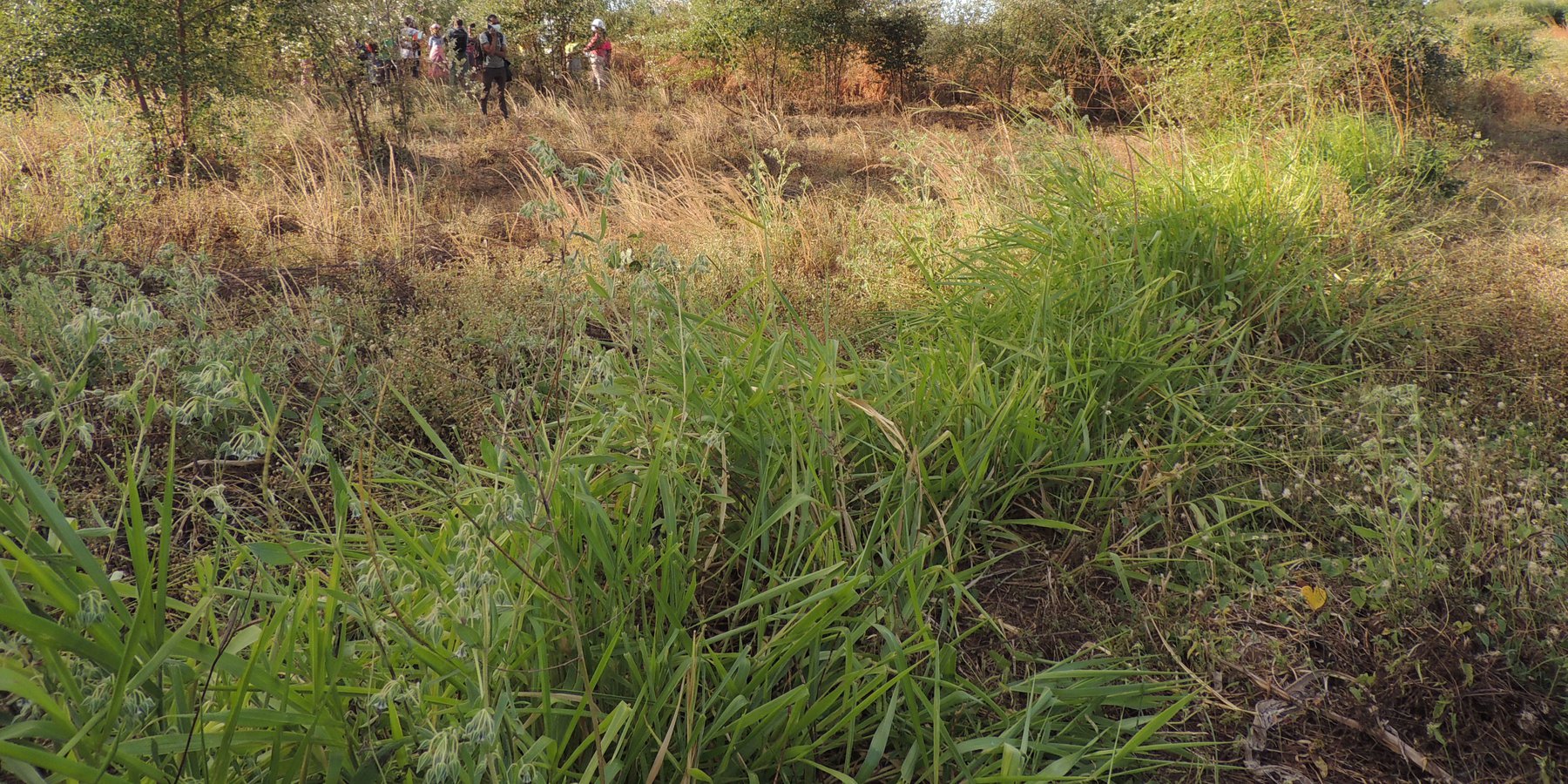
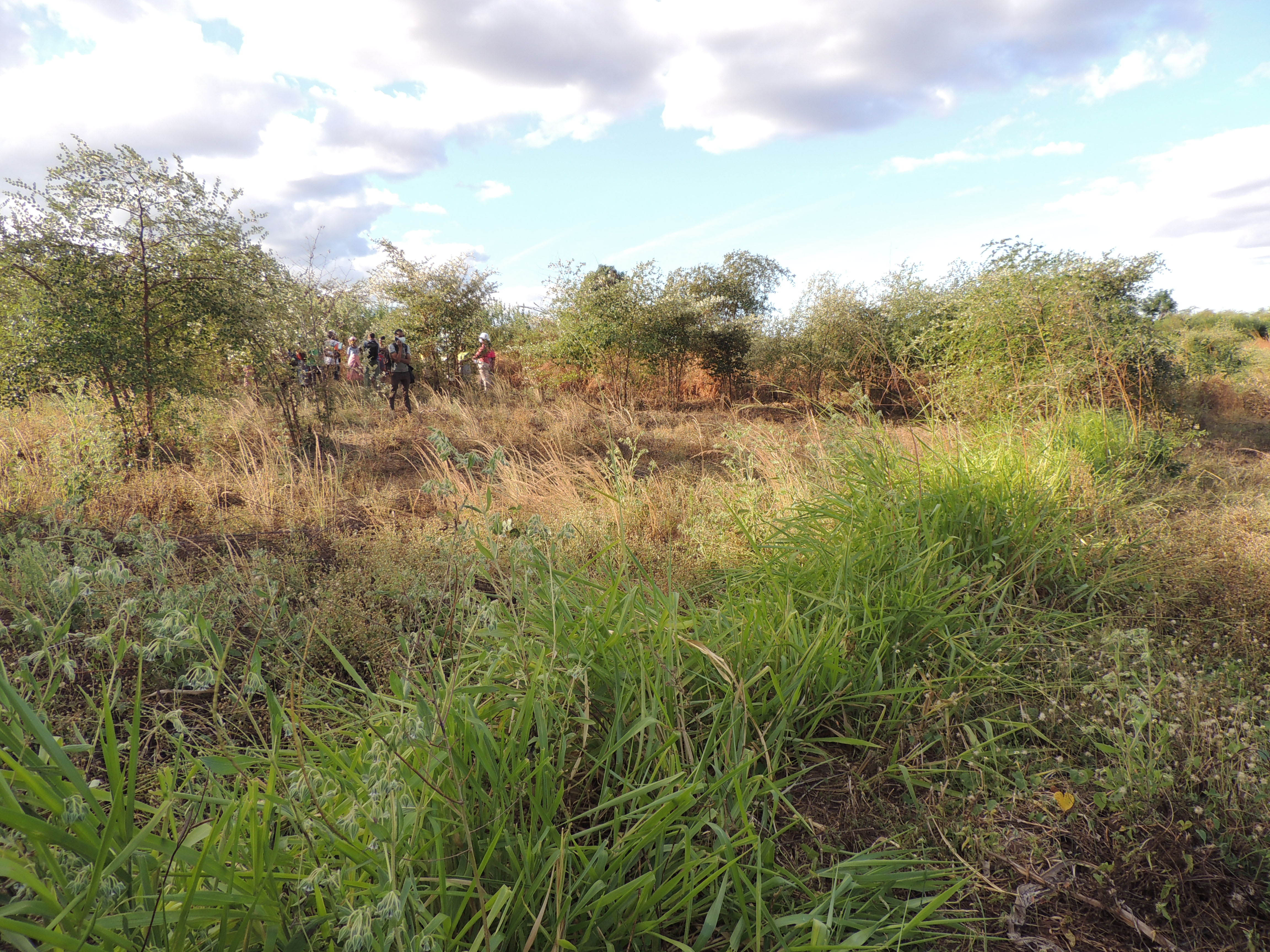
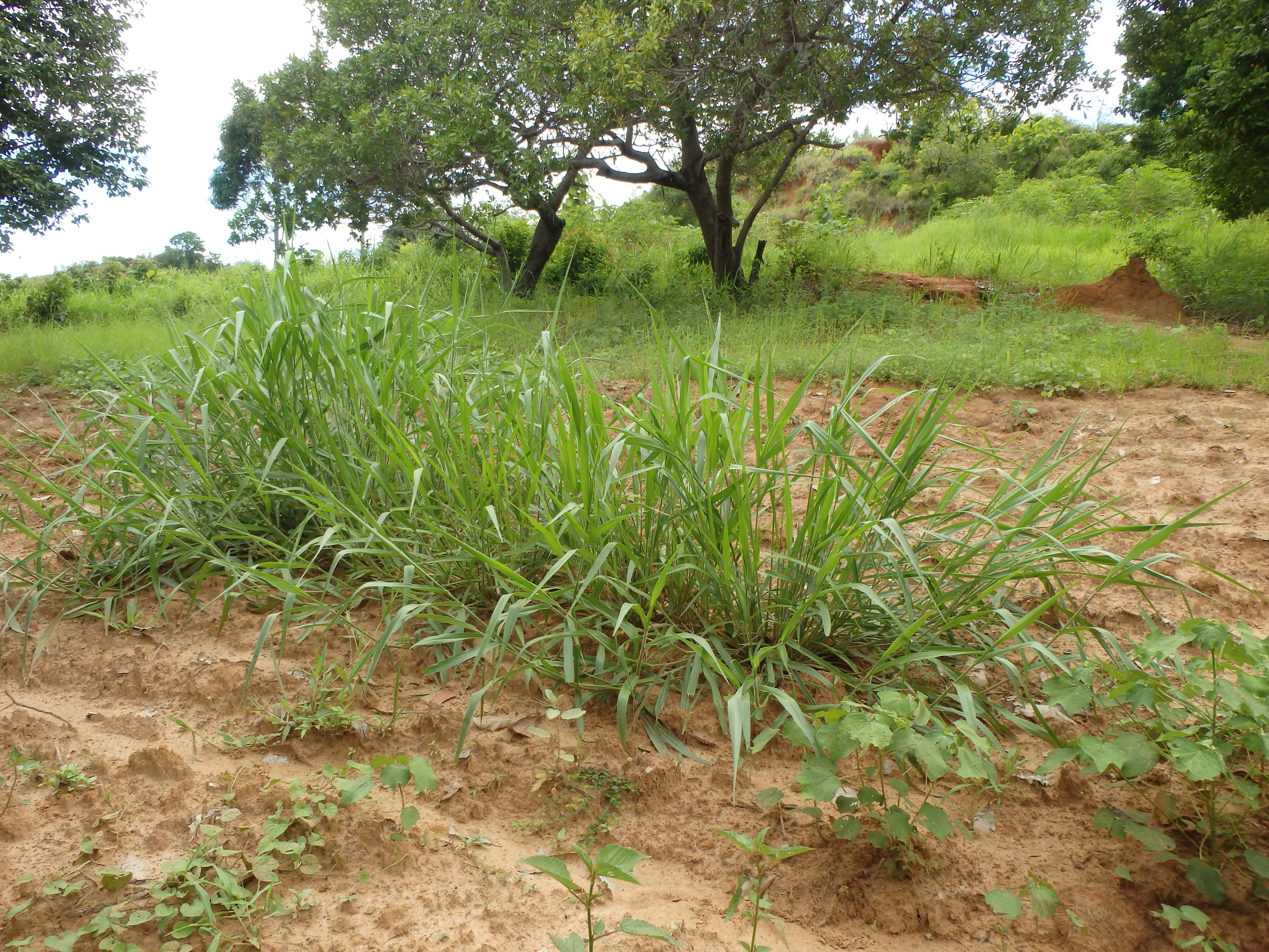
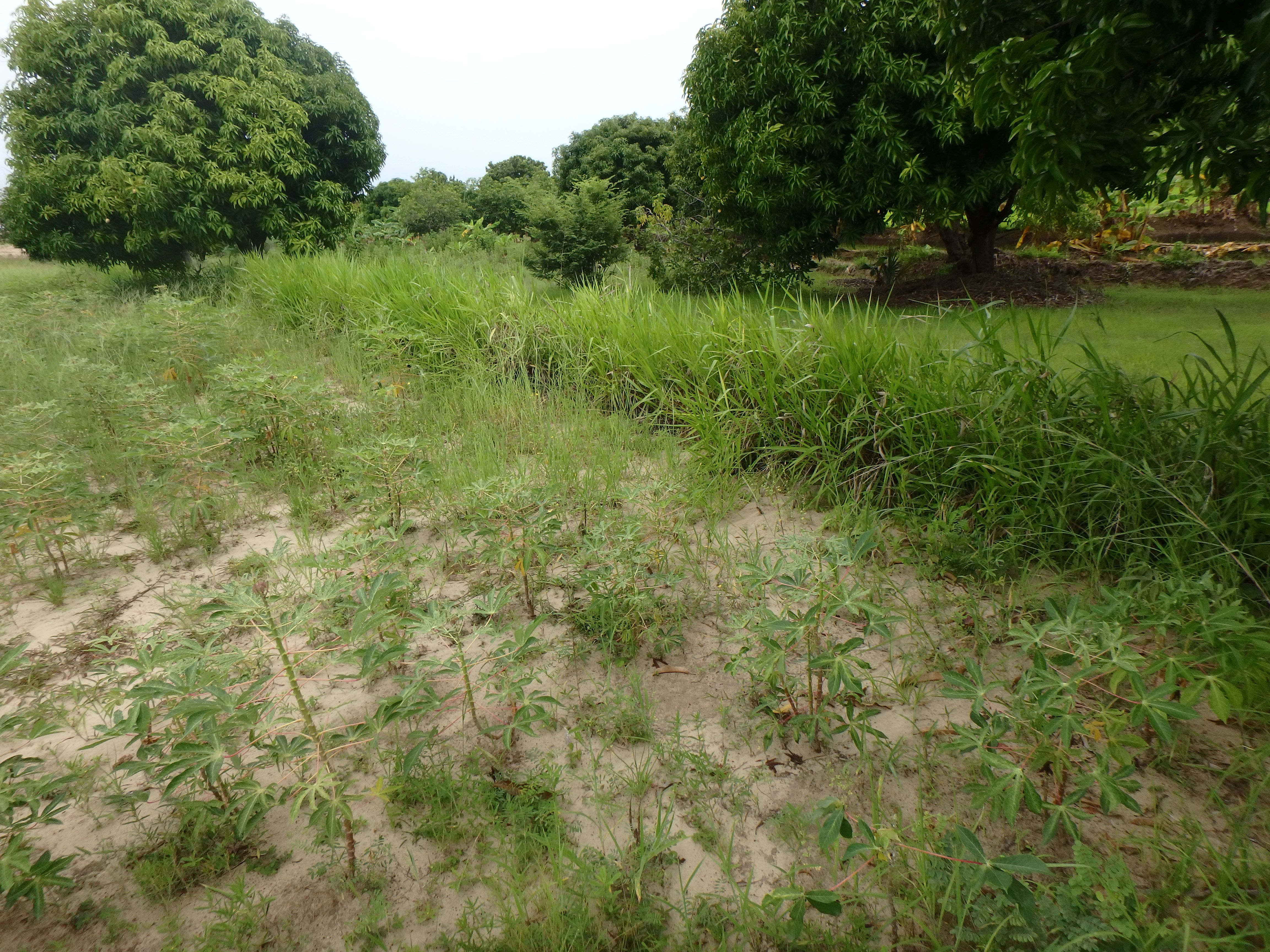
Grass strips are spaced at regular intervals along contour lines. These strips are not ploughed during soil preparation, and Brachiaria grass is used to form barriers to reduce water-induced erosion. Over time, the plots evolve naturally into terraces.
2.2 Detailed description of the Technology
Description:
Grass strips formed from Barachiaria sp. are spaced at regular intervals along contour lines. This system is applied on gently to moderately sloping land (tanety) and is not suitable for steeply sloping plots. It can be used by all farmers, especially those with cattle, as it provides good quality forage. To ensure successful implementation, plots must be protected from livestock.
Ploughing is typically carried out in the dry season or at the onset of the rainy season. Land is either ploughed approximately across the slope, or by following contours where these have been marked out. In the latter case, contour lines should be surveyed at intervals of around 20 metres (or less), using stakes as landmarks during ploughing. Where grass strips have been established, ploughing is carried out parallel with these.
Brachiaria splits are planted in staggered lines along the contours. Alternatively seeds are used. This step is carried out at the start of the rainy season (December). The strips need to be protected against livestock throughout. These strips are left in place during the dry season, without burning or weeding. Over time, the plots evolve naturally into terraces.
This technology protects the soil against erosion by reducing runoff and increasing infiltration. It also helps maintain soil fertility, resulting in higher crop yields. Brachiaria provides excellent fodder for cattle and the strips become biodiverse. These plants are also relatively resilient to fire, maintaining their greenery even in the dry season. They can be a source of high-quality green matter for the manufacture of compost (especially “basket compost”). From a practical standpoint, they have a high cost/benefit ratio, requiring minimal maintenance. After the initial year, no resowing is necessary; the grass strips can endure for several years. Despite their merits, these strips have not been widely adopted, possibly due to limited awareness or a lack of Brachiaria cuttings among some farmers.
2.3 Photos of the Technology
Media Gallery
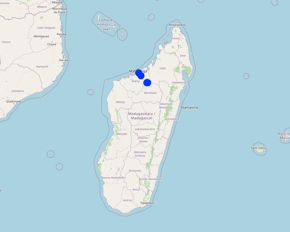
2.5 Country/ region/ locations where the Technology has been applied and which are covered by this assessment
Country:
Madagascar
Region/ State/ Province:
Boeny
Further specification of location:
Tsaramandroso, Belobaka
Specify the spread of the Technology:
- evenly spread over an area
If precise area is not known, indicate approximate area covered:
- < 0.1 km2 (10 ha)
Is/are the technology site(s) located in a permanently protected area?
No
Map
×2.6 Date of implementation
Indicate year of implementation:
2020
If precise year is not known, indicate approximate date:
- less than 10 years ago (recently)
2.7 Introduction of the Technology
Specify how the Technology was introduced:
- through projects/ external interventions
Comments (type of project, etc.):
Prosoil Project
3. Classification of the SLM Technology
3.1 Main purpose(s) of the Technology
- improve production
- reduce, prevent, restore land degradation
- protect a watershed/ downstream areas – in combination with other Technologies
3.2 Current land use type(s) where the Technology is applied
Land use mixed within the same land unit:
No

Cropland
- Annual cropping
- Perennial (non-woody) cropping
Annual cropping - Specify crops:
- cereals - sorghum
- legumes and pulses - beans
- legumes and pulses - other
- legumes and pulses - soya
- root/tuber crops - cassava
- Cowpea (lojy), Vigna radiata
Perennial (non-woody) cropping - Specify crops:
- fodder crops - grasses
- Brachiaria
Number of growing seasons per year:
- 1
Is intercropping practiced?
Yes
If yes, specify which crops are intercropped:
Intercropping of cereals (maize or sorghum) and legumes (cowpea, Vigna radiata) or cassava with legumes
Is crop rotation practiced?
Yes
If yes, specify:
Maize and legumes/ Sorghum and legumes/ Cassava and legumes
3.3 Has land use changed due to the implementation of the Technology?
Has land use changed due to the implementation of the Technology?
- No (Continue with question 3.4)
3.4 Water supply
Water supply for the land on which the Technology is applied:
- rainfed
3.5 SLM group to which the Technology belongs
- integrated crop-livestock management
- improved ground/ vegetation cover
- cross-slope measure
3.6 SLM measures comprising the Technology

vegetative measures
- V2: Grasses and perennial herbaceous plants
3.7 Main types of land degradation addressed by the Technology

soil erosion by water
- Wt: loss of topsoil/ surface erosion
3.8 Prevention, reduction, or restoration of land degradation
Specify the goal of the Technology with regard to land degradation:
- prevent land degradation
- reduce land degradation
4. Technical specifications, implementation activities, inputs, and costs
4.1 Technical drawing of the Technology
Technical specifications (related to technical drawing):
A grass strip should have a minimum width of 50 cm. The recommended distances between these strips vary based on the slope:
-For gentle slopes, a distance of around 20 m is advised.
-On steeper slopes, it is recommended to reduce the distance between strips. Maintain a minimum distance of 5 m to facilitate cultivation between the strips.
-On highly steep slopes, it is recommended to use fencing instead of creating grassed strips separated by crops.
The distance between two rows of Brachiaria in the same strip must not exceed 50 cm.
The space between Brachiaria seedlings or plants is 20 cm, staggered.
Author:
GIZ ProSoil Madagascar
Date:
01/02/2023
4.2 General information regarding the calculation of inputs and costs
Specify how costs and inputs were calculated:
- per Technology area
Indicate size and area unit:
1 hectare
other/ national currency (specify):
Ariary
If relevant, indicate exchange rate from USD to local currency (e.g. 1 USD = 79.9 Brazilian Real): 1 USD =:
4300.0
Indicate average wage cost of hired labour per day:
5000
4.3 Establishment activities
| Activity | Timing (season) | |
|---|---|---|
| 1. | Marking out the line of grass strips (usually following contour lines approximately 20 metres apart) | August-December |
| 2. | Ploughing the soil, while preserving strips of natural vegetation | August-January |
| 3. | Planting of Brachiaria or transplanting of Bracharia splits on the edges of the strips at 50 cm intervals in staggered rows. | Beginning of the rainy season (November - December) |
4.4 Costs and inputs needed for establishment
| Specify input | Unit | Quantity | Costs per Unit | Total costs per input | % of costs borne by land users | |
|---|---|---|---|---|---|---|
| Labour | Marking out the line of the grass strip | man-days | 2.0 | 5000.0 | 10000.0 | 100.0 |
| Labour | Soil ploughing | man-days | 15.0 | 5000.0 | 75000.0 | 100.0 |
| Labour | Sowing Brachiaria seeds | man-days | 10.0 | 5000.0 | 50000.0 | 100.0 |
| Plant material | Brachiaria seeds | kg | 1.0 | |||
| Total costs for establishment of the Technology | 135000.0 | |||||
| Total costs for establishment of the Technology in USD | 31.4 | |||||
If land user bore less than 100% of costs, indicate who covered the remaining costs:
The Brachiaria seeds were procured by the Prosol project.
Comments:
Most of the farmers interviewed practiced direct seeding, which is why the costs applied are specific to this technical pathway. However, Brachiaria can also be transplanted using splits.
4.5 Maintenance/ recurrent activities
| Activity | Timing/ frequency | |
|---|---|---|
| 1. | Protecting Bachiaria strips from livestock | All year round except after mowing |
| 2. | Leaving the strips without burning or weeding them | Dry season |
| 3. | Cutting Brachiaria (harvesting) | Dry season (once a year) |
Comments:
Brachiaria is cut to provide cattle fodder or for composting.
4.6 Costs and inputs needed for maintenance/ recurrent activities (per year)
| Specify input | Unit | Quantity | Costs per Unit | Total costs per input | % of costs borne by land users | |
|---|---|---|---|---|---|---|
| Labour | Brachiara cutting (harvesting) | man-days | 15.0 | 5000.0 | 75000.0 | 100.0 |
| Total costs for maintenance of the Technology | 75000.0 | |||||
| Total costs for maintenance of the Technology in USD | 17.44 | |||||
Comments:
Cutting Brachiaria here is a form of harvesting, but also contributes to maintaining the grass strip.
5. Natural and human environment
5.1 Climate
Annual rainfall
- < 250 mm
- 251-500 mm
- 501-750 mm
- 751-1,000 mm
- 1,001-1,500 mm
- 1,501-2,000 mm
- 2,001-3,000 mm
- 3,001-4,000 mm
- > 4,000 mm
Specify average annual rainfall (if known), in mm:
1400.00
Agro-climatic zone
- sub-humid
5.2 Topography
Slopes on average:
- flat (0-2%)
- gentle (3-5%)
- moderate (6-10%)
- rolling (11-15%)
- hilly (16-30%)
- steep (31-60%)
- very steep (>60%)
Landforms:
- plateau/plains
- ridges
- mountain slopes
- hill slopes
- footslopes
- valley floors
Altitudinal zone:
- 0-100 m a.s.l.
- 101-500 m a.s.l.
- 501-1,000 m a.s.l.
- 1,001-1,500 m a.s.l.
- 1,501-2,000 m a.s.l.
- 2,001-2,500 m a.s.l.
- 2,501-3,000 m a.s.l.
- 3,001-4,000 m a.s.l.
- > 4,000 m a.s.l.
Indicate if the Technology is specifically applied in:
- not relevant
5.3 Soils
Soil depth on average:
- very shallow (0-20 cm)
- shallow (21-50 cm)
- moderately deep (51-80 cm)
- deep (81-120 cm)
- very deep (> 120 cm)
Soil texture (topsoil):
- coarse/ light (sandy)
- medium (loamy, silty)
Soil texture (> 20 cm below surface):
- coarse/ light (sandy)
- fine/ heavy (clay)
Topsoil organic matter:
- high (>3%)
- low (<1%)
5.4 Water availability and quality
Ground water table:
< 5 m
Availability of surface water:
good
Water quality (untreated):
good drinking water
Water quality refers to:
ground water
Is water salinity a problem?
No
Is flooding of the area occurring?
No
5.5 Biodiversity
Species diversity:
- medium
Habitat diversity:
- low
Comments and further specifications on biodiversity:
This region boasts a diverse array of plant and animal species, with some being native. However, this biodiversity is relatively moderate when compared to other parts of the island. In terms of habitats, approximately 20% of the region comprises suitable environments for supporting this biodiversity, including forests, water bodies, mangroves, and more, although this percentage remains relatively low.
5.6 Characteristics of land users applying the Technology
Sedentary or nomadic:
- Sedentary
Market orientation of production system:
- subsistence (self-supply)
- mixed (subsistence/ commercial)
Off-farm income:
- less than 10% of all income
- > 50% of all income
Relative level of wealth:
- poor
- average
Individuals or groups:
- individual/ household
- groups/ community
Level of mechanization:
- manual work
- animal traction
Gender:
- women
- men
Age of land users:
- youth
- middle-aged
5.7 Average area of land used by land users applying the Technology
- < 0.5 ha
- 0.5-1 ha
- 1-2 ha
- 2-5 ha
- 5-15 ha
- 15-50 ha
- 50-100 ha
- 100-500 ha
- 500-1,000 ha
- 1,000-10,000 ha
- > 10,000 ha
Is this considered small-, medium- or large-scale (referring to local context)?
- small-scale
- large-scale
5.8 Land ownership, land use rights, and water use rights
Land ownership:
- individual, not titled
- individual, titled
Land use rights:
- leased
- individual
Water use rights:
- open access (unorganized)
Are land use rights based on a traditional legal system?
Yes
Specify:
Most villagers can identify the cultivated lands of each their fellow village residents.
5.9 Access to services and infrastructure
health:
- poor
- moderate
- good
education:
- poor
- moderate
- good
technical assistance:
- poor
- moderate
- good
employment (e.g. off-farm):
- poor
- moderate
- good
markets:
- poor
- moderate
- good
energy:
- poor
- moderate
- good
roads and transport:
- poor
- moderate
- good
drinking water and sanitation:
- poor
- moderate
- good
financial services:
- poor
- moderate
- good
6. Impacts and concluding statements
6.1 On-site impacts the Technology has shown
Socio-economic impacts
Production
crop production
fodder production
fodder quality
Income and costs
workload
Socio-cultural impacts
food security/ self-sufficiency
Ecological impacts
Water cycle/ runoff
surface runoff
Soil
soil moisture
soil loss
Specify assessment of on-site impacts (measurements):
These are estimates provided by the farmers interviewed.
6.2 Off-site impacts the Technology has shown
downstream flooding
downstream siltation
Specify assessment of off-site impacts (measurements):
These are the estimates provided by the farmers interviewed.
6.3 Exposure and sensitivity of the Technology to gradual climate change and climate-related extremes/ disasters (as perceived by land users)
Gradual climate change
Gradual climate change
| Season | increase or decrease | How does the Technology cope with it? | |
|---|---|---|---|
| annual rainfall | decrease | moderately |
6.4 Cost-benefit analysis
How do the benefits compare with the establishment costs (from land users’ perspective)?
Short-term returns:
positive
Long-term returns:
very positive
How do the benefits compare with the maintenance/ recurrent costs (from land users' perspective)?
Short-term returns:
positive
Long-term returns:
very positive
6.5 Adoption of the Technology
- single cases/ experimental
6.6 Adaptation
Has the Technology been modified recently to adapt to changing conditions?
No
6.7 Strengths/ advantages/ opportunities of the Technology
| Strengths/ advantages/ opportunities in the land user’s view |
|---|
| Protection against water erosion. |
| Improved soil fertility and quality |
| Production of fodder for livestock in the dry season, reducing livestock mortality |
6.8 Weaknesses/ disadvantages/ risks of the Technology and ways of overcoming them
| Weaknesses/ disadvantages/ risks in the land user’s view | How can they be overcome? |
|---|---|
| Unavailability of Brachiaria seeds on the market | Setting up nurseries where Brachiaria can be collected. These areas will serve as a source of cuttings / splits for local farmers. |
| Grazing of cattle from nearby areas |
7. References and links
7.1 Methods/ sources of information
- field visits, field surveys
Five (5) fields visited
- interviews with land users
Five (5) farmers interviewed
- compilation from reports and other existing documentation
GIZ ProSoil Madagascar technical sheet
When were the data compiled (in the field)?
31/01/2023
7.2 References to available publications
Title, author, year, ISBN:
Région Boeny, 2016, "Schéma Régional d’Aménagement du Territoire de la Région Boeny"
Available from where? Costs?
Boeny Region Hotel
Title, author, year, ISBN:
GIZ ProSol Madagascar, 2022, "Livret des Paysans Relais"
Available from where? Costs?
GIZ ProSol Madagascar
Title, author, year, ISBN:
GIZ ProSol Madagascar, 2022, Poster "Culture de Brachiaria"
Available from where? Costs?
GIZ ProSol Madagascar
Title, author, year, ISBN:
O Husan et Al, 2008, "Brachiaria sp. B. ruziziensis, B. brizantha, B. decumbens, B. humidicola"
Available from where? Costs?
http://open-library.cirad.fr/files/2/139__1221575727.pdf
Title, author, year, ISBN:
GRET, 2015, "Pratiques agroécologiques et agroforestières en zone tropicale humide", Fiche N°15 Bandes enherbées en courbe de niveau
Available from where? Costs?
https://gret.org/publication/pratiques-agroecologiques-et-agroforestieres-en-zone-tropicale-humide/
7.3 Links to relevant online information
Title/ description:
Fambolena Brachiaria ho sakafon’omby no hanarenana ny tsiron’ny tany
URL:
gsdm-mg.org
Links and modules
Expand all Collapse allLinks
No links
Modules
No modules