Geocoding of Million Fruit Trees for Monitoring and Tracking [Bhutan]
- Creation:
- Update:
- Compiler: Nima Dolma Tamang
- Editor: Haka Drukpa
- Reviewers: William Critchley, Rima Mekdaschi Studer
Not Applicable (NA)
technologies_6829 - Bhutan
View sections
Expand all Collapse all1. General information
1.2 Contact details of resource persons and institutions involved in the assessment and documentation of the Technology
Key resource person(s)
Agriculture Extension Officer:
Penjor Thuji
Geog Renewable Natural Resources (RNR) Center, Agriculture Office, Mewang Gewog, Thimphu Dzongkhag
Bhutan
Name of the institution(s) which facilitated the documentation/ evaluation of the Technology (if relevant)
National Soil Services Center, Department of Agric (National Soil Services Center, Department of Agric) - Bhutan1.3 Conditions regarding the use of data documented through WOCAT
The compiler and key resource person(s) accept the conditions regarding the use of data documented through WOCAT:
Yes
1.4 Declaration on sustainability of the described Technology
Is the Technology described here problematic with regard to land degradation, so that it cannot be declared a sustainable land management technology?
No
Comments:
The technology enables remote monitoring of the growth and development of fruit trees ensuring the sustainable use of land and its resources. Further, the technology aids in the success of the Million Fruit Tree Plantation Project reducing the risk of converting cultivable land to fallow.
2. Description of the SLM Technology
2.1 Short description of the Technology
Definition of the Technology:
Geocoding of fruit trees allows remote monitoring and progress tracking of the growth of seedlings. The Smart App MoDA (Mobile Operation and Data Acquisition) is used in geocoding.
2.2 Detailed description of the Technology
Description:
Geocoding of the “million fruit trees” initiative has been carried out across Bhutan. Different fruit trees suitable for particular agroecological zones were planted in farmers' fields in twenty districts and each sapling was geocoded.
The main elements of geocoding fruit trees involve assigning unique geographical codes or coordinates to individual trees within an orchard, utilizing technical specifications and equipment such as handheld GPS to accurately determine the location. The potential benefits of this form of geocoding include:
1. Location Mapping: Geocoding allows fruit trees to be accurately located on a map, providing a visual representation of their spatial distribution. This mapping can help identify patterns, clusters, and gaps in tree distribution.
2. Data Integration: Geocoded data can be integrated with geographic information systems (GIS) and other data sources, such as climate data, soil information, and topography. This integration provides a holistic view of the factors influencing fruit tree growth and productivity.
3. Precision: Geocoding provides precise coordinates for each fruit tree, enhancing the accuracy of data collection and analysis. This precision is crucial for making informed decisions regarding tree management and resource allocation.
4. Monitoring and Management: Geocoded fruit tree data enables efficient monitoring of tree health, growth, and potential issues. It facilitates targeted interventions, such as irrigation, fertilization, and pest control, based on the specific needs of individual trees or clusters.
5. Yield Estimation: By combining geocoded data with relevant environmental and growth information, it's possible to estimate the potential fruit yield in specific areas. This information aids in resource planning and harvest predictions.
6. Disease and Pest Management: Geocoded data can help identify patterns of disease or pest infestations. Early detection through geocoded monitoring can enable prompt intervention and prevent the spread of pests or diseases.
7. Biodiversity Analysis: Geocoding allows researchers to study the diversity of fruit tree species in different regions. This analysis can be useful for conservation efforts and understanding the ecological impact of specific tree species.
8. Research and Analysis: Geocoded fruit tree data serves as a valuable resource for scientific research. Researchers can study the effects of climate change, urbanization, and land use changes on fruit tree populations and ecosystems.
9. Decision-Making: Geocoded data assists farmers, agricultural agencies, and policymakers in making informed decisions about land use, tree planting initiatives, and resource allocation for sustainable agriculture.
10. Community Engagement: Geocoded maps of fruit trees can be shared with communities, promoting awareness of local resources, fostering community engagement, and encouraging initiatives like urban orchards or community gardens.
11. Data Visualization: Geocoded data can be visualized using maps and spatial tools, making it easier to interpret and communicate information to various stakeholders.
12. Long-Term Tracking: Geocoded data allows for long-term tracking of changes in fruit tree populations, aiding in the assessment of the success of planting initiatives and the overall health of the environment.
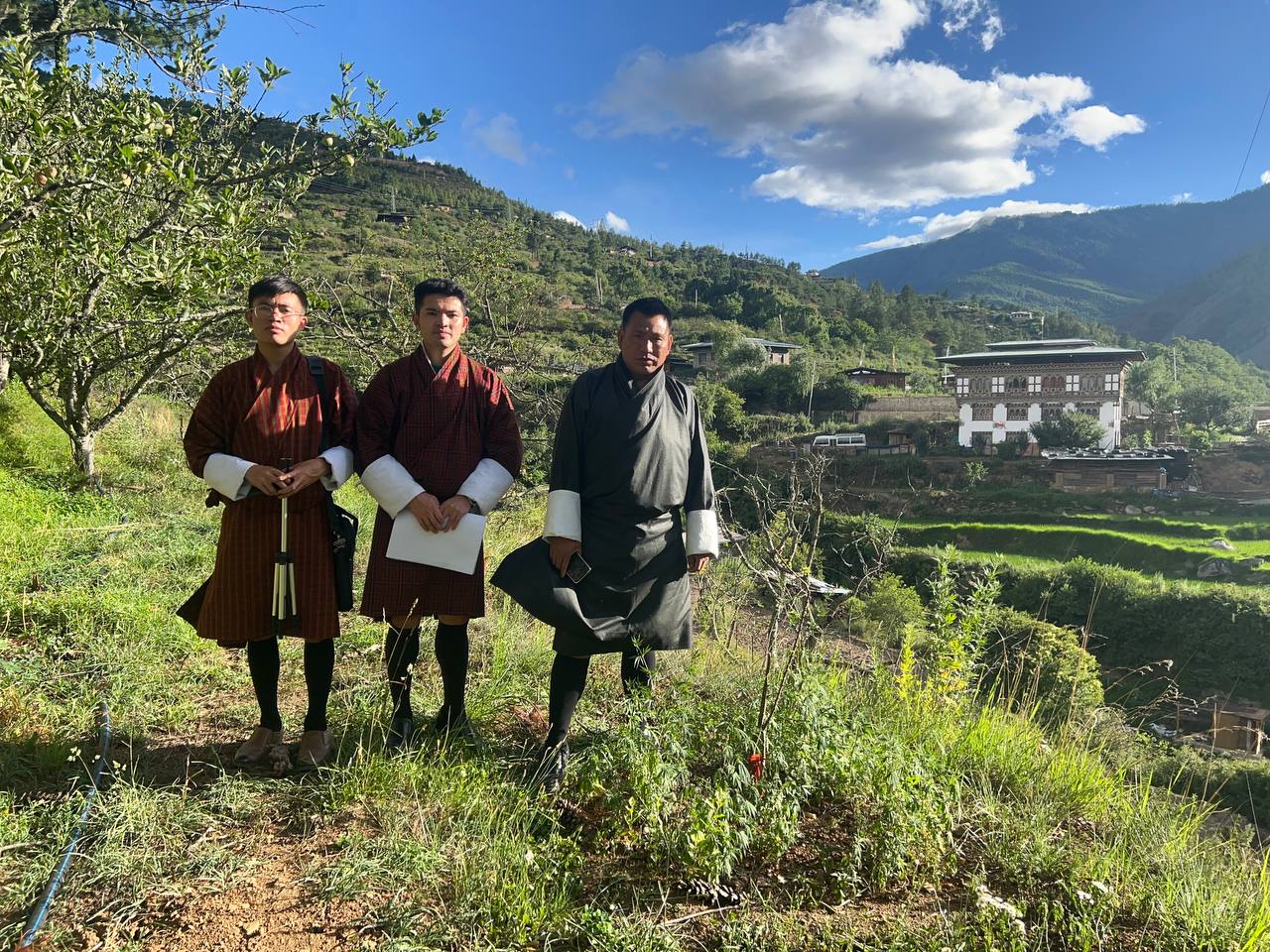
The major activity of the technology is marking the fruit trees with the help of GPS so that these geocoordinates can be useful in tracking down the exact location of the plant. Geocoding is labour-intensive as the field workers need to be physically present in the field while carrying out the activity. Then the data recorded in GPS is transferred to the computer and analyzed using ArcGIS. This information is available to the policymakers and Agriculture officers and is shared with the Extension Agents through which it is disseminated to the land users.
2.3 Photos of the Technology
Media Gallery
General remarks regarding photos:
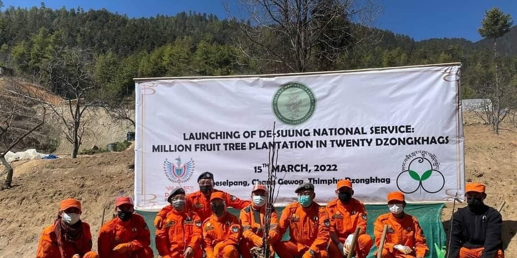
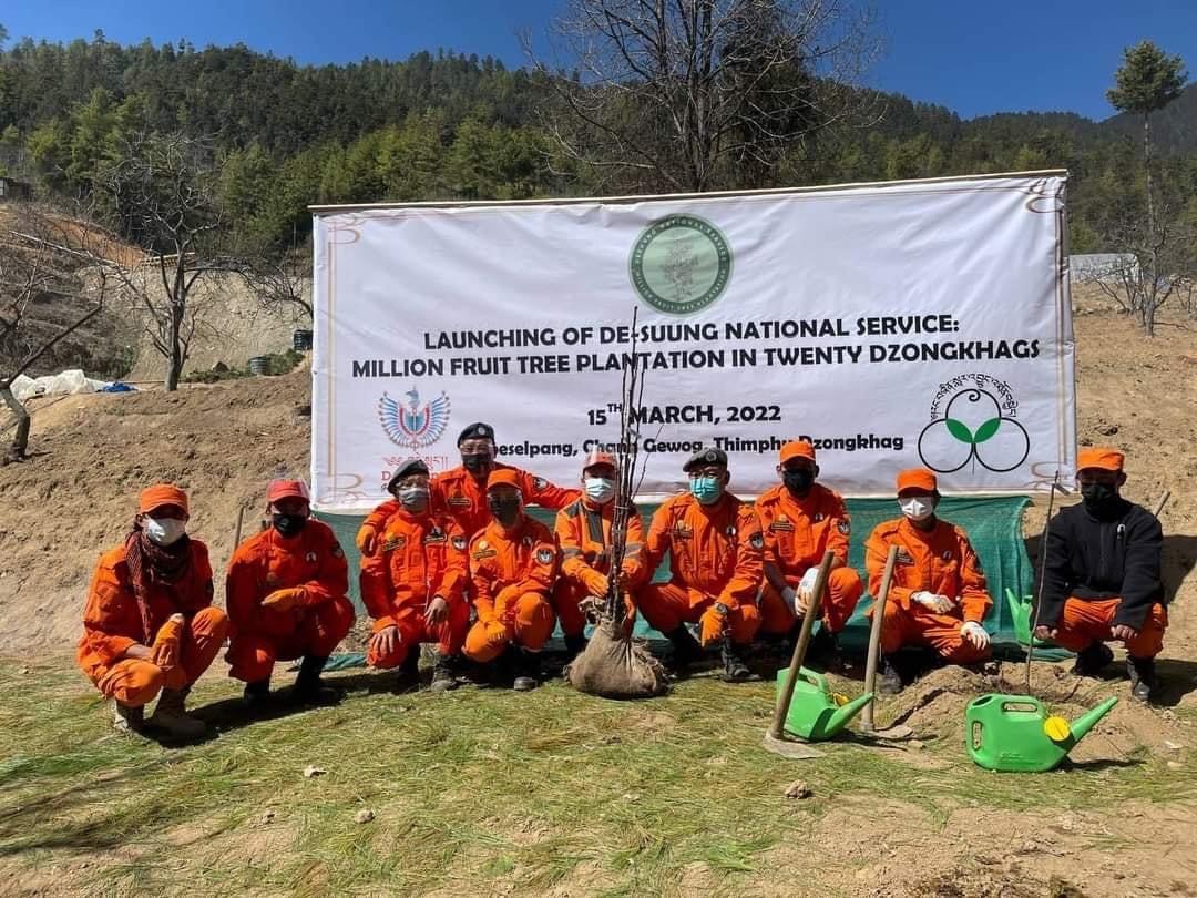
The Photo does not directly depicts the technology described here.
2.5 Country/ region/ locations where the Technology has been applied and which are covered by this assessment
Country:
Bhutan
Region/ State/ Province:
Thimphu Dzongkhag
Further specification of location:
Sigay Chiwog, Mewang Gewog
Specify the spread of the Technology:
- applied at specific points/ concentrated on a small area
Is/are the technology site(s) located in a permanently protected area?
No
Comments:
The geocoding of fruits are in the land users field. Therefore, the area does not fall under any of the protected area or national parks.
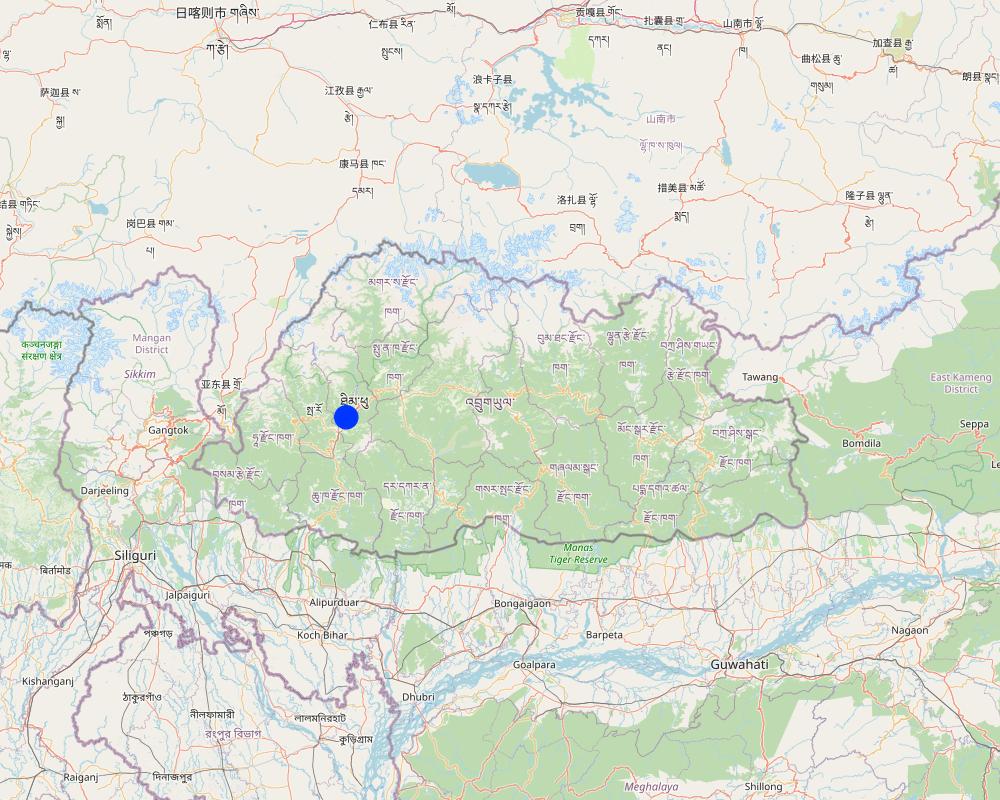
Map
×2.6 Date of implementation
Indicate year of implementation:
2022
2.7 Introduction of the Technology
Specify how the Technology was introduced:
- through projects/ external interventions
Comments (type of project, etc.):
The geocoding of the million fruit trees in the country was initiated as per the directives of His Majesty the 5th King of Bhutan where all the saplings are funded by the Royal Government of Bhutan. Plantation and geocoding were done by the Desuups (Desuup is the highest form of the voluntary act in Bhutan. They wear orange uniforms and are also known as the Guardians of Peace).
3. Classification of the SLM Technology
3.1 Main purpose(s) of the Technology
- improve production
- reduce, prevent, restore land degradation
- conserve ecosystem
- create beneficial economic impact
- create beneficial social impact
3.2 Current land use type(s) where the Technology is applied
Land use mixed within the same land unit:
Yes
Specify mixed land use (crops/ grazing/ trees):
- Agroforestry

Cropland
- Annual cropping
- Perennial (non-woody) cropping
Annual cropping - Specify crops:
- cereals - rice (upland)
Annual cropping system:
Wetland rice - wheat
- Apple
Number of growing seasons per year:
- 2
Specify:
Paddy in summer is followed by winter wheat or vegetables
Is intercropping practiced?
Yes
If yes, specify which crops are intercropped:
They intercrop vegetables with lugumes.
Is crop rotation practiced?
Yes
If yes, specify:
The land used for paddy cultivation is used for planting vegetables such as potatoes.
3.3 Has land use changed due to the implementation of the Technology?
Has land use changed due to the implementation of the Technology?
- No (Continue with question 3.4)
3.4 Water supply
Water supply for the land on which the Technology is applied:
- mixed rainfed-irrigated
3.5 SLM group to which the Technology belongs
- agroforestry
- improved plant varieties/ animal breeds
3.6 SLM measures comprising the Technology

vegetative measures
- V1: Tree and shrub cover
Comments:
The technology aids in maintaining land cover by ensuring vegetative coverage of the land in which geocoding enhances easy management and improved health of the fruit trees such as apples, dragon fruit, banana, areca nut, kiwi, avocado and others.
3.7 Main types of land degradation addressed by the Technology

soil erosion by water
- Wt: loss of topsoil/ surface erosion
- Wg: gully erosion/ gullying

soil erosion by wind
- Et: loss of topsoil

biological degradation
- Bc: reduction of vegetation cover
3.8 Prevention, reduction, or restoration of land degradation
Specify the goal of the Technology with regard to land degradation:
- prevent land degradation
- reduce land degradation
Comments:
Fruit tree plantations will potentially prevent land degradation in the long term by giving cover and strengthening soil structure by its roots.
4. Technical specifications, implementation activities, inputs, and costs
4.1 Technical drawing of the Technology
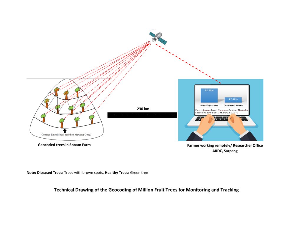
Technical specifications (related to technical drawing):
The technical drawing represents the general method of million fruit tree plantation and geocoding done on each tree. It depicts how geocoding enables the researcher or farmer to remotely check the health of the trees using satellite data. ARDC stands for Agriculture Research and Development Center.
Author:
Nima Dolma Tamang, Singye Dorji, Tshering Gyeltshen
Date:
07/07/2023
4.2 General information regarding the calculation of inputs and costs
Specify how costs and inputs were calculated:
- per Technology unit
Specify unit:
No of Seedlings
Specify dimensions of unit (if relevant):
8000 seedlings (Only in Mewang Geog)
other/ national currency (specify):
Ngultrum (Bhutanese Currency)
If relevant, indicate exchange rate from USD to local currency (e.g. 1 USD = 79.9 Brazilian Real): 1 USD =:
82.62
Indicate average wage cost of hired labour per day:
800
4.3 Establishment activities
| Activity | Timing (season) | |
|---|---|---|
| 1. | Meeting between Gewog leaders and land users | NA |
| 2. | Identified a village for planation | NA |
| 3. | Identified households that wanted the seedings and number of seedlings | NA |
| 4. | Site identification | NA |
| 5. | Orchard layout | NA |
| 6. | Pit digging | NA |
| 7. | Plantation | March- April |
| 8. | Basin making | After planation |
| 9. | Geocoding | After one month of orchard establishment |
| 10. | Growth Tracking | After every six months |
Comments:
The above information is limited to only Mewang Gewog, Thimphu Dzongkhag.
4.4 Costs and inputs needed for establishment
| Specify input | Unit | Quantity | Costs per Unit | Total costs per input | % of costs borne by land users | |
|---|---|---|---|---|---|---|
| Labour | Desuup (Guardians of peace) - Volunteers | Person-days | 6.0 | |||
| Labour | Farmers | Person-days | 10.0 | 800.0 | 8000.0 | 100.0 |
| Equipment | Shovel | No. | 10.0 | 100.0 | ||
| Equipment | crow-bar | No. | 5.0 | 100.0 | ||
| Equipment | Spade | No. | 20.0 | 100.0 | ||
| Equipment | GPS remote | No | 6.0 | 12000.0 | 72000.0 | |
| Equipment | Tabs/ mobile phones | No. | 6.0 | 15000.0 | 90000.0 | |
| Plant material | Apple | No. | 3500.0 | 70.0 | 245000.0 | |
| Plant material | Walnut | No. | 1000.0 | 120.0 | 120000.0 | |
| Plant material | Almond | No. | 500.0 | 120.0 | 60000.0 | |
| Plant material | Peach | No. | 1000.0 | 70.0 | 70000.0 | |
| Plant material | Pear | No. | 2000.0 | 70.0 | 140000.0 | |
| Fertilizers and biocides | Manure and fertillizers | Metric Tonnes | 16.0 | 1600.0 | 25600.0 | 100.0 |
| Total costs for establishment of the Technology | 830600.0 | |||||
| Total costs for establishment of the Technology in USD | 10053.26 | |||||
If land user bore less than 100% of costs, indicate who covered the remaining costs:
Almost all the cost were covered by the Million Fruit Tree Project of Desuung National Service and Ministry of Agriculture and Livestock jointly.
Comments:
The total cost calculated is for planting and geocoding. The actual costs borne by land users are very minimal. The only cost the land users have to bear is labour cost and fertilizer cost. The high cost of the project is contributed mainly by seedling cost, GPS remote, tablets and mobile phones which was used during the marking position of fruit trees.
Cost for shovel spade and crowbar is not included as they are available at the farm and are reused.
4.5 Maintenance/ recurrent activities
| Activity | Timing/ frequency | |
|---|---|---|
| 1. | Weeding | Twice a year |
| 2. | Fertillizer application | Twice a year |
| 3. | Irrigation | Once a week |
| 4. | Replacement of dead plants | After 6 months from plantation |
| 5. | Growth tracking | After every six month |
Comments:
The information obtained are through verbal communication with the Agriculture Extension Officer of Mewang Gewog.
4.6 Costs and inputs needed for maintenance/ recurrent activities (per year)
| Specify input | Unit | Quantity | Costs per Unit | Total costs per input | % of costs borne by land users | |
|---|---|---|---|---|---|---|
| Labour | Weeding and fertilizer application | Per year | 4.0 | 1600.0 | 6400.0 | 100.0 |
| Labour | Irrigation | Litres | ||||
| Labour | Geocoding | per plant | 8000.0 | |||
| Plant material | Replacement of plants | per plant | 10.0 | 70.0 | 700.0 | |
| Total costs for maintenance of the Technology | 7100.0 | |||||
| Total costs for maintenance of the Technology in USD | 85.94 | |||||
Comments:
The geocoding was done by the Desuung volunteers. so, the exact costs cannot be deduced.
4.7 Most important factors affecting the costs
Describe the most determinate factors affecting the costs:
Most important factors affecting the costs are seedling and labour cost.
5. Natural and human environment
5.1 Climate
Annual rainfall
- < 250 mm
- 251-500 mm
- 501-750 mm
- 751-1,000 mm
- 1,001-1,500 mm
- 1,501-2,000 mm
- 2,001-3,000 mm
- 3,001-4,000 mm
- > 4,000 mm
Specify average annual rainfall (if known), in mm:
2076.00
Specifications/ comments on rainfall:
The rainfall data for Mewang Gewog is not available. The provided data is for Thimphu Dzongkhag as Mewang Gewog is under Thimphu Dzongkhag (Gewog is one of the geographic units below Dzongkhag). Thimphu falls under a temperate region and experiences minimal rainfall compared to the other parts of Bhutan. Thimphu had the wettest month in July with 497 mm and experienced the least rainfall in December with 5 mm.
Indicate the name of the reference meteorological station considered:
National Center for Hydrology and Metoerology, Thimphu.
Agro-climatic zone
There are six Agro-ecological Zones (AEZ) in Bhutan and the current place of study falls under warm temperate zone which occurs between 1,800 – 2,500 m. Rainfall is low but the temperature is moderately warm in summer with frost in winter.
5.2 Topography
Slopes on average:
- flat (0-2%)
- gentle (3-5%)
- moderate (6-10%)
- rolling (11-15%)
- hilly (16-30%)
- steep (31-60%)
- very steep (>60%)
Landforms:
- plateau/plains
- ridges
- mountain slopes
- hill slopes
- footslopes
- valley floors
Altitudinal zone:
- 0-100 m a.s.l.
- 101-500 m a.s.l.
- 501-1,000 m a.s.l.
- 1,001-1,500 m a.s.l.
- 1,501-2,000 m a.s.l.
- 2,001-2,500 m a.s.l.
- 2,501-3,000 m a.s.l.
- 3,001-4,000 m a.s.l.
- > 4,000 m a.s.l.
Indicate if the Technology is specifically applied in:
- convex situations
Comments and further specifications on topography:
The area was characterized by a steep valley near the river with minimal slope as the valley widened.
5.3 Soils
Soil depth on average:
- very shallow (0-20 cm)
- shallow (21-50 cm)
- moderately deep (51-80 cm)
- deep (81-120 cm)
- very deep (> 120 cm)
Soil texture (topsoil):
- medium (loamy, silty)
Soil texture (> 20 cm below surface):
- medium (loamy, silty)
Topsoil organic matter:
- medium (1-3%)
5.4 Water availability and quality
Availability of surface water:
medium
Water quality (untreated):
for agricultural use only (irrigation)
Water quality refers to:
surface water
Is water salinity a problem?
No
Is flooding of the area occurring?
No
Comments and further specifications on water quality and quantity:
The availability of water in Mewang Gewog was a concern since a decade ago. Irrigation water was not enough for every farmers which resulted in delayed paddy plantation.
5.5 Biodiversity
Species diversity:
- low
Habitat diversity:
- medium
Comments and further specifications on biodiversity:
The species of flora and fauna diversity cannot be quantified under "high" as per the field observation. The area was surrounded by coniferous forest which generally has low biodiversity.
5.6 Characteristics of land users applying the Technology
Sedentary or nomadic:
- Sedentary
Market orientation of production system:
- mixed (subsistence/ commercial)
Off-farm income:
- 10-50% of all income
Relative level of wealth:
- average
Individuals or groups:
- individual/ household
Level of mechanization:
- mechanized/ motorized
Gender:
- women
Age of land users:
- middle-aged
Indicate other relevant characteristics of the land users:
The majority of the land users who were part of the Geocoding of million fruit plantation had already established apple orchards.
5.7 Average area of land used by land users applying the Technology
- < 0.5 ha
- 0.5-1 ha
- 1-2 ha
- 2-5 ha
- 5-15 ha
- 15-50 ha
- 50-100 ha
- 100-500 ha
- 500-1,000 ha
- 1,000-10,000 ha
- > 10,000 ha
Is this considered small-, medium- or large-scale (referring to local context)?
- medium-scale
Comments:
An average land holding capacity for Bhutanese household as per the Land Act is 3 acres. The land holding that exceeds 3 acres are categorized in large scale in Bhutanese context.
5.8 Land ownership, land use rights, and water use rights
Land ownership:
- individual, titled
Land use rights:
- leased
- individual
Water use rights:
- communal (organized)
Are land use rights based on a traditional legal system?
Yes
5.9 Access to services and infrastructure
health:
- poor
- moderate
- good
education:
- poor
- moderate
- good
technical assistance:
- poor
- moderate
- good
employment (e.g. off-farm):
- poor
- moderate
- good
markets:
- poor
- moderate
- good
energy:
- poor
- moderate
- good
roads and transport:
- poor
- moderate
- good
drinking water and sanitation:
- poor
- moderate
- good
financial services:
- poor
- moderate
- good
Internet:
- poor
- moderate
- good
Comments:
The drinking water is insufficient as some households face scarcity of drinking water.
6. Impacts and concluding statements
6.1 On-site impacts the Technology has shown
Socio-economic impacts
Production
crop production
Comments/ specify:
The technology aids in the monitoring and improves health and ease management of the already established orchard. Therefore, it indirectly increases crop production.
crop quality
Comments/ specify:
Remote or constant monitoring ensures timely management to prevent biotic and abiotic factors deteriorate the crop quality.
fodder production
fodder quality
risk of production failure
Comments/ specify:
Geocoding enables land user to determine potential risk so that the land user can use appropriate methods to prevent crop failure.
product diversity
Comments/ specify:
The technology is not directly related to the product diversity. However, it provides data on existing fruit tree diversity so that the land user can plan and plant different fruit trees based on the market need which indirectly increases diversity.
production area
Comments/ specify:
Geocoding enables the land user to remotely view the cropped area and the area where the crop failed (could be due to dying of the seedlings/diseased). It enables the land user to narrow their focus on the specific area, learn about the issues causing the crop loss, provide appropriate management, and conduct plantation in that area which indirectly increases production area.
Water availability and quality
irrigation water availability
Comments/ specify:
Due to increased production area with no increase in the quantity of irrigation water, water availability is likely to reduce.
demand for irrigation water
Comments/ specify:
There is increased demand for irrigation water for new plantations. However, with the use of technology land users can monitor the water requirement and use efficiently based on the need of the tree whereby the land users can avoid watering the trees that require less water and provide to those that require more water.
Income and costs
expenses on agricultural inputs
Comments/ specify:
Minimal increase in expenses on agriculture inputs as planting materials (except manure) were provided to the land users for free of cost.
farm income
Comments/ specify:
Once the fruit trees starts bearing fruits, income is expected to increase.
diversity of income sources
Comments/ specify:
It adds to farmers sources of income other than vegetable and dairy product sale.
economic disparities
Comments/ specify:
The technology is expected to reduce economic disparity by providing equal opportunity for the land users to generate income.
workload
Comments/ specify:
Workload for the project implementors or land users are significantly reduced as they need not go to the actual site to determine the progress of the Million Fruit Trees Plantation Project.
Socio-cultural impacts
food security/ self-sufficiency
Comments/ specify:
The technology indirectly aids in the increased production making an individual land user and the nation self-sufficient in fruits.
recreational opportunities
Comments/ specify:
With reduced workload, land users can engage in recreational activities.
SLM/ land degradation knowledge
Comments/ specify:
The technology will enable the project implementors to determine specific knowledge gaps and provide training in that particular field to the land users. Improving knowledge of both project implementors and land users.
situation of socially and economically disadvantaged groups
Comments/ specify:
Land users willing to be involved in fruit tree plantation are supported without discrimination of their social status or economic background and geocoding services are provided. This leads to the improved situation of socially and economically disadvantaged groups.
Ecological impacts
Water cycle/ runoff
water quantity
Comments/ specify:
The total water quantity remains same. However, the available water per tree or sapling is reduced.
surface runoff
Comments/ specify:
Due to the absorption of water by the roots of the fruit trees, surface run-off is decreased.
evaporation
Comments/ specify:
Evaporation will be decreased due to an increase in the vegetation cover from the plantation of the fruit trees.
Soil
soil moisture
Comments/ specify:
Slight increase in the soil moisture in long run due to addition of soil organic matter and monitored irrigation.
soil cover
Comments/ specify:
The technology enhances easy monitoring of the trees and encourages increased soil cover.
soil loss
Comments/ specify:
The technology enhances soil cover reducing the soil loss from erosion.
nutrient cycling/ recharge
Comments/ specify:
Geocoding enables the land user to have overview of the nutrient content of the production area aiding land users to add nutrient based on the need.
soil organic matter/ below ground C
Comments/ specify:
Generally, there will be an increase in the soil organic matter due to an increase in production area and management practice such as the addition of manures by the land user.
Biodiversity: vegetation, animals
Vegetation cover
Comments/ specify:
Increase due to the scheduled irrigation applied to the fruit trees.
biomass/ above ground C
Comments/ specify:
Slight increase due to proper management and care provided to the orchard.
animal diversity
Comments/ specify:
Animal diversity in the case of pollinators such as bees increases as the fruit trees mature and start flowering.
beneficial species
Comments/ specify:
Beneficial species such as bees are attracted to the orchards.
pest/ disease control
Comments/ specify:
Pest and diseases control improves with the use of remote monitoring facilitated by this technology.
Climate and disaster risk reduction
landslides/ debris flows
Comments/ specify:
Once the fruit trees establish themselves, landslides can be reduced significantly due to vegetation cover.
emission of carbon and greenhouse gases
Comments/ specify:
This technology could potentially reduce greenhouse gas as trees utilize carbon dioxide for photosynthesis.
wind velocity
Comments/ specify:
In the long run, a well-established orchard can act as a windbreak and reduce wind velocity and damage it poses to the property.
micro-climate
Comments/ specify:
An orchard can act as a micro-climate harbouring many plants and insect species.
6.2 Off-site impacts the Technology has shown
water availability
Comments/ specify:
Fruit trees require irrigation which reduces the availability of water for other purposes.
impact of greenhouse gases
Comments/ specify:
Having a land cover with vegetation compared to barren land reduces greenhouse gases.
6.3 Exposure and sensitivity of the Technology to gradual climate change and climate-related extremes/ disasters (as perceived by land users)
Gradual climate change
Gradual climate change
| Season | increase or decrease | How does the Technology cope with it? | |
|---|---|---|---|
| annual temperature | increase | very well | |
| seasonal temperature | summer | increase | very well |
| annual rainfall | increase | very well | |
| seasonal rainfall | summer | decrease | very well |
Climate-related extremes (disasters)
Meteorological disasters
| How does the Technology cope with it? | |
|---|---|
| local hailstorm | very well |
Biological disasters
| How does the Technology cope with it? | |
|---|---|
| epidemic diseases | very well |
Comments:
The technology copes very well with gradual climate change because it sends rapid messages to farmers on actions to take (e.g., concerning pests and diseases). In a way it’s a form of early warning systems (EWS).
6.4 Cost-benefit analysis
How do the benefits compare with the establishment costs (from land users’ perspective)?
Short-term returns:
negative
Long-term returns:
positive
How do the benefits compare with the maintenance/ recurrent costs (from land users' perspective)?
Short-term returns:
neutral/ balanced
Long-term returns:
positive
Comments:
Although the initial establishment of the orchard is costly considering the labour charge, it is expected to have positive income and impact once the fruit trees start bearing.
6.5 Adoption of the Technology
- > 50%
If available, quantify (no. of households and/ or area covered):
Total 8000 fruit trees are planted in the five Chiwogs (third level administrative division under Gewog) under Mewang Gewog.
Of all those who have adopted the Technology, how many did so spontaneously, i.e. without receiving any material incentives/ payments?
- 0-10%
Comments:
Almost all those who adopted the technology are funded by the government.
6.6 Adaptation
Has the Technology been modified recently to adapt to changing conditions?
No
6.7 Strengths/ advantages/ opportunities of the Technology
| Strengths/ advantages/ opportunities in the land user’s view |
|---|
| 1. Precision Mapping: Geocoding allows for accurate mapping and identification of fruit trees. By assigning specific geographic coordinates to each tree, it becomes easier to locate and monitor individual trees or orchards. |
| 2. Efficient Resource Allocation: Geocoding helps optimize resource allocation by providing information on tree density and distribution. Land users can identify areas with high fruit tree concentrations and strategically allocate resources such as labour, water, fertilizers, and pesticides, leading to improved productivity and reduced costs. |
| 3. Data-driven Decision Making: Geocoded data on fruit trees can be analyzed to gain insights into their distribution patterns, growth rates, and health status. This information enables land users, researchers, and policymakers to make informed decisions regarding fruit tree cultivation, pest control, and disease management. |
| Strengths/ advantages/ opportunities in the compiler’s or other key resource person’s view |
|---|
| 1. Conservation and Biodiversity Analysis: Geocoded fruit tree data aids in the conservation and analysis of biodiversity. By mapping the locations of different fruit tree species, experts can assess the distribution and abundance of specific varieties, identify endangered local or traditional landraces varieties, and develop strategies for their preservation. |
| 2. Targeted Marketing and Distribution: Geocoded fruit tree data facilitates targeted marketing and distribution strategies. By understanding the location of fruit trees and their yields, producers can identify potential markets and plan transportation logistics more effectively, minimizing waste and ensuring timely delivery to consumers. |
6.8 Weaknesses/ disadvantages/ risks of the Technology and ways of overcoming them
| Weaknesses/ disadvantages/ risks in the land user’s view | How can they be overcome? |
|---|---|
| Geocoding large numbers of fruit trees can be a time-consuming and resource-intensive task, particularly when manual processes are involved. It may require extensive fieldwork and manual data entry, making it impractical or costly for large-scale fruit tree inventories. | |
| Privacy Concerns: Geocoding fruit trees raises privacy concerns, particularly when tree locations are associated with specific individuals or properties. Care must be taken to ensure that privacy is respected and sensitive information is appropriately handled | An updated and secured security-protected website can be used. |
| Lack of knowledge of geocoding by the farmers. | Provide awareness trainings |
| Weaknesses/ disadvantages/ risks in the compiler’s or other key resource person’s view | How can they be overcome? |
|---|---|
| The higher expense of the geocoding in terms of labour cost for geo-coding | Train land users on geocoding, instead of using trained professionals. |
| Difficult to constantly update information on time. |
7. References and links
7.1 Methods/ sources of information
- field visits, field surveys
The information documented was from the field visit to orchards near the RNR center.
- interviews with SLM specialists/ experts
The information collected are from first-hand interview with the Agriculture Extension Officer who was engaged fully during the implementation of the technology.
When were the data compiled (in the field)?
07/07/2023
7.2 References to available publications
Title, author, year, ISBN:
De-suung National Service (DNS). (n.d.). Million Fruit Trees Plantation
Available from where? Costs?
https://desuung.org.bt/25978-2/#:~:text=In%20order%20to%20monitor%20the,from%20the%20date%20of%20plantation.
7.3 Links to relevant online information
Title/ description:
Million Fruit Trees Plantation Initiative launched
URL:
http://www.bbs.bt/news/?p=166763
Title/ description:
Kuensel. (2022). Million Fruit Trees Plantation Initiative launched. Thimphu.
URL:
Website: https://kuenselonline.com/414000-fruit-trees-planted-in-45-days/
Title/ description:
Geocoding of trees from street addresses and street-level images
URL:
https://www.fs.usda.gov/psw/publications/vandoorn/psw_2020_vandoorn001_laumer.pdf
Links and modules
Expand all Collapse allLinks
No links
Modules
No modules