Contour Grass Hedgerows on Steep Slopes [Bhutan]
- Creation:
- Update:
- Compiler: ONGPO LEPCHA
- Editor: Kuenzang Nima
- Reviewers: William Critchley, Rima Mekdaschi Studer
Tsa yi gaytshig (རྩའི་གད་ཚིགས)
technologies_6854 - Bhutan
View sections
Expand all Collapse all1. General information
1.2 Contact details of resource persons and institutions involved in the assessment and documentation of the Technology
Key resource person(s)
land user:
Daza Khemo
Boucholing village
Bhutan
land user:
Dorji Ugyen
Boucholing village
Bhutan
Name of project which facilitated the documentation/ evaluation of the Technology (if relevant)
Strengthening national-level institutional and professional capacities of country Parties towards enhanced UNCCD monitoring and reporting – GEF 7 EA Umbrella II (GEF 7 UNCCD Enabling Activities_Umbrella II)Name of the institution(s) which facilitated the documentation/ evaluation of the Technology (if relevant)
National Soil Services Centre, Department of Agriculture, Ministry of Agriculture & Livestock (NSSC) - Bhutan1.3 Conditions regarding the use of data documented through WOCAT
The compiler and key resource person(s) accept the conditions regarding the use of data documented through WOCAT:
Yes
1.4 Declaration on sustainability of the described Technology
Is the Technology described here problematic with regard to land degradation, so that it cannot be declared a sustainable land management technology?
No
Comments:
The technology described is not problematic with regard to land degradation.
2. Description of the SLM Technology
2.1 Short description of the Technology
Definition of the Technology:
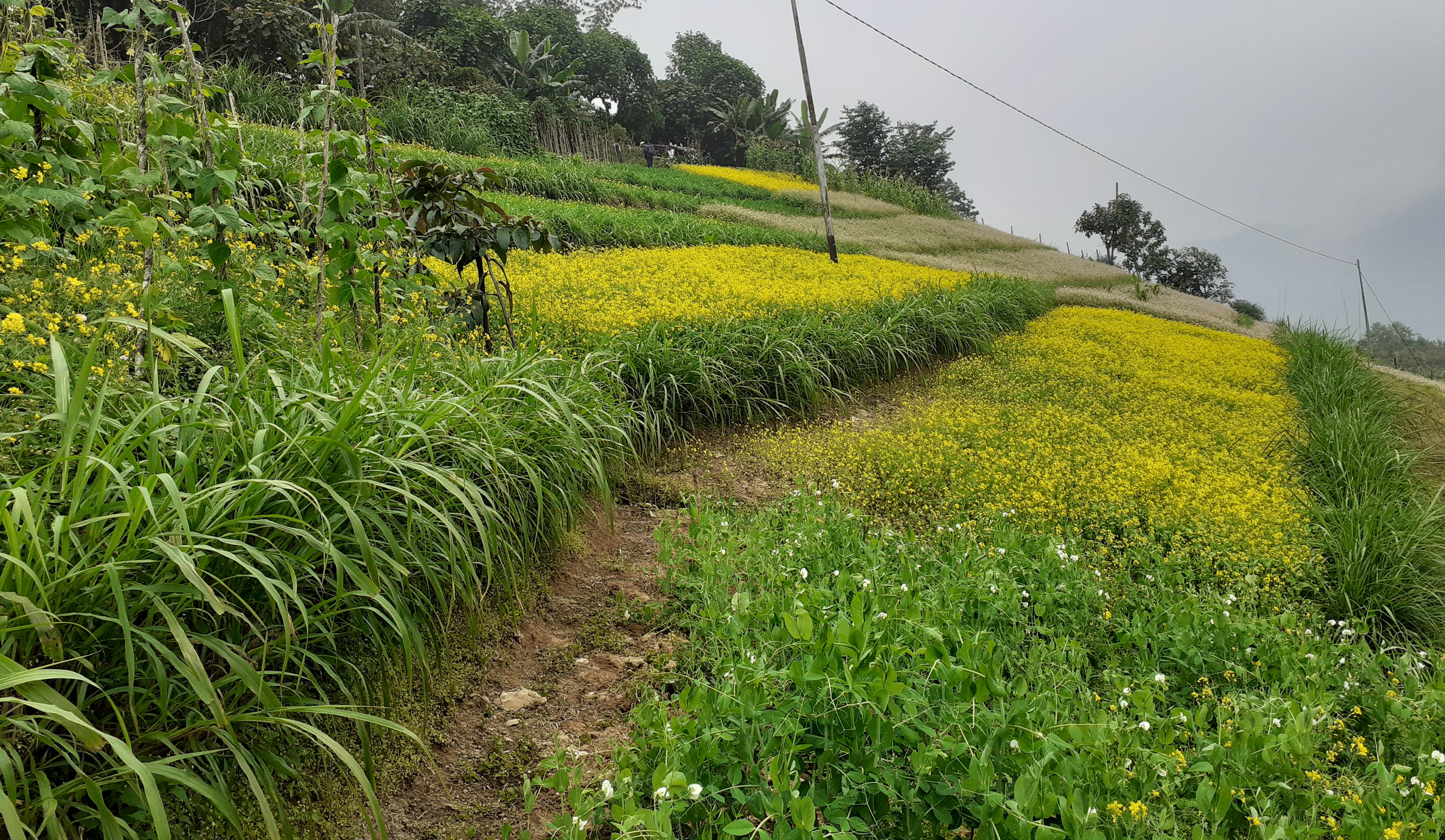
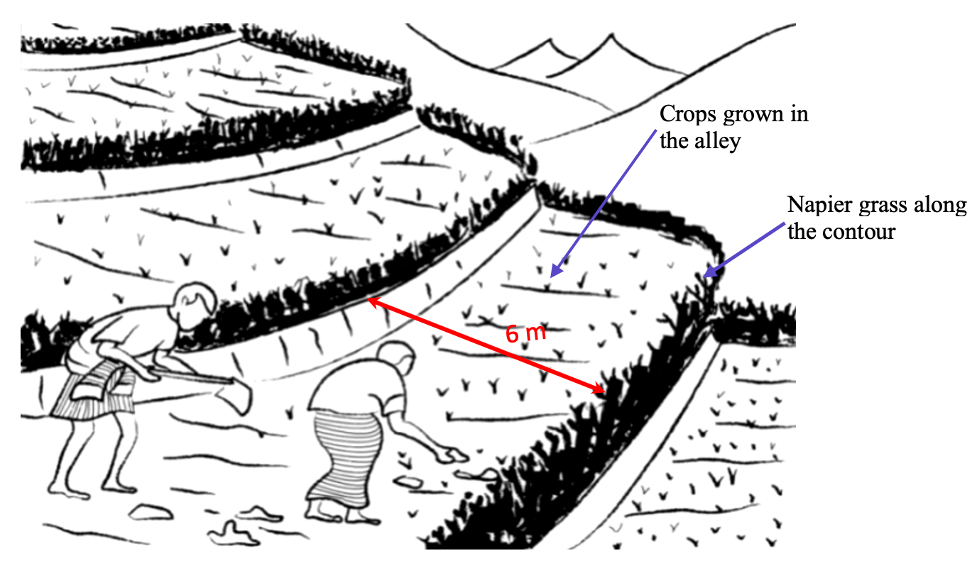
Contour hedgerows are a soil and water conservation technology that involve planting of Napier grass cuttings along contour lines on the slope at a horizontal distance of 6 m. The area between the contour hedgerows is used for crop cultivation.
2.2 Detailed description of the Technology
Description:
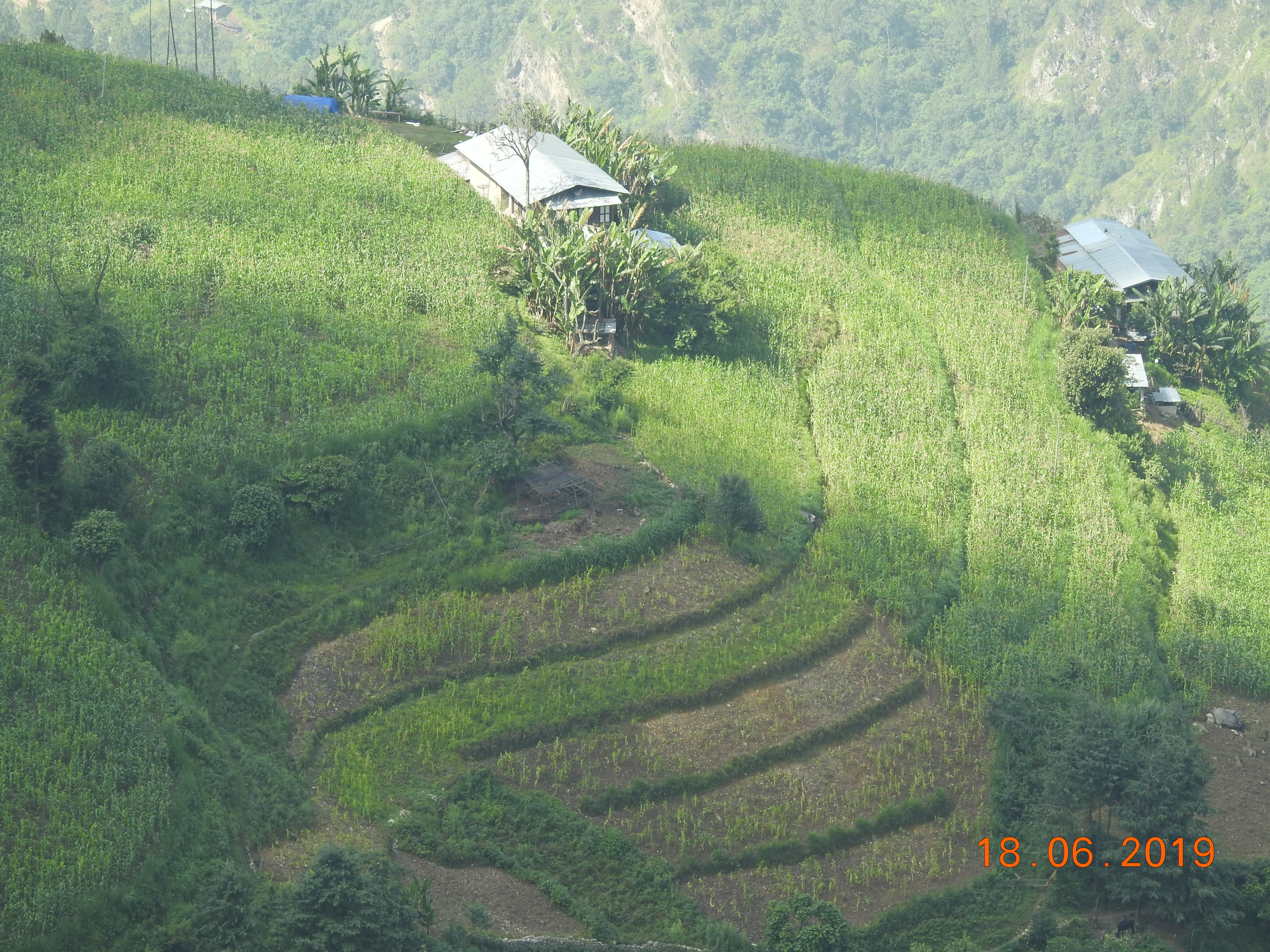
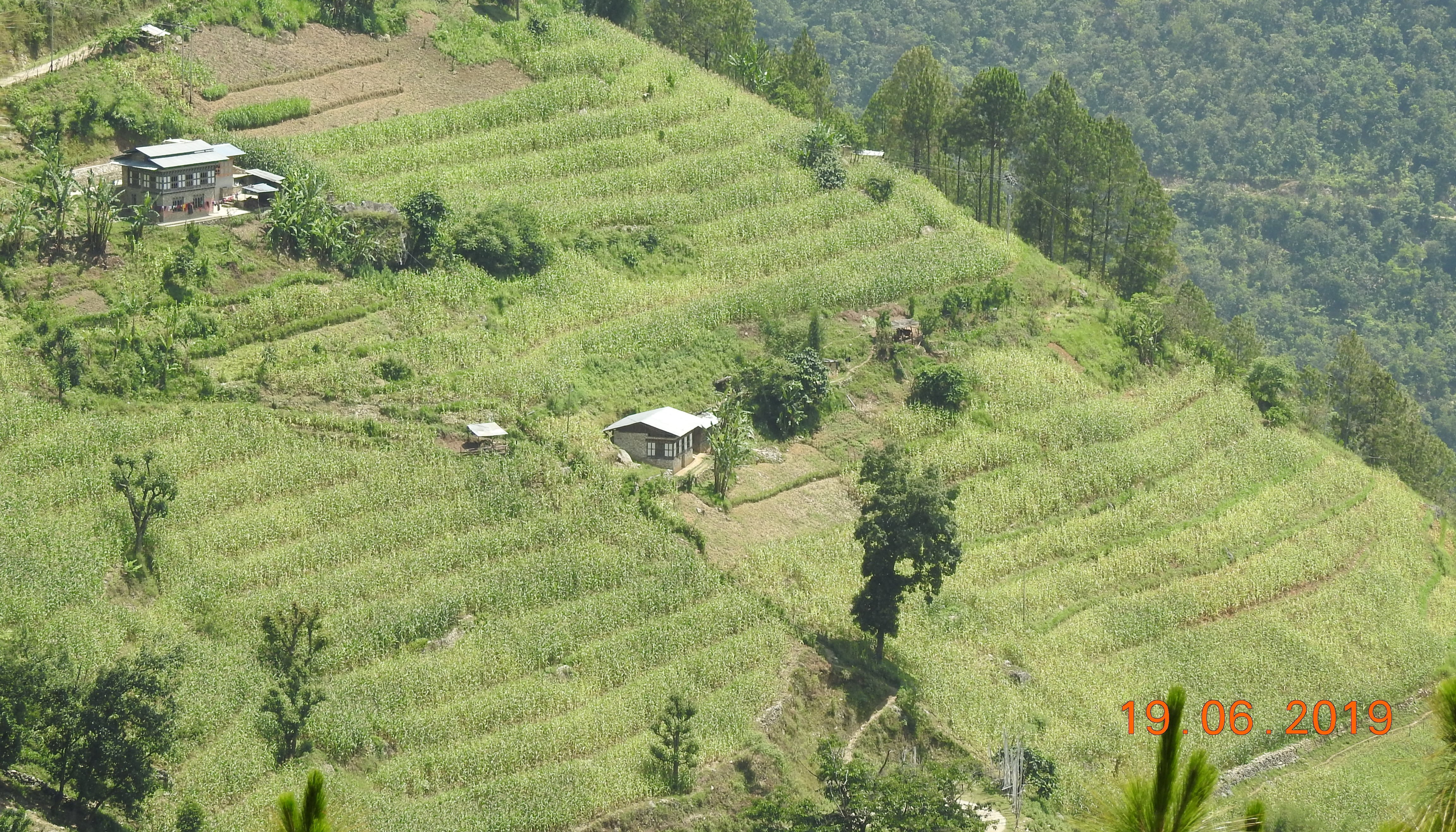
Contour hedgerows are a soil and water conservation technology that involves planting Napier stem cuttings along contour lines on slopes. They are planted at a horizontal distance of 6 meters between rows and 15-20 centimeters between cuttings within lines. On average it requires 3500-4000 Napier slips to cover one acre (0.4 ha). Hedgerows form living barriers that trap sediment and reduce surface runoff. With time, as the sediment builds up behind the hedges, the area between the hedgerows develops into flat alleys or “terrace beds”. This technology is effective in reducing soil erosion and conserving water. The hedgerows also boost crop productivity. The contour hedgerow system is widely used in hilly terrain in Bhutan and elsewhere.
The main purposes of the technology are to 1) serve as a barrier to check the movement of soil and water down the slope, 2) effectively utilize sloping areas for agricultural purposes, and 3) increase crop and fodder production.
The major activities/ inputs needed to establish/ maintain contour hedgerows are: 1) surveying of the area by an SLM specialist (planning and site assessment), 2) selecting suitable hedgerow planting materials, 3) registration of interested farmers, 4) training of farmers, 5) layout of contour lines using A-frames, 6) distribution of planting materials and establishment of hedgerows in farmland, 7) monitoring and evaluation of hedgerows, and 8) maintenance of hedgerows. Maintenance includes replacement of cuttings in gaps - either damaged by cattle or natural mortality and trimming of grass back to 15 centimeters after reaching 1 meter. Inputs required include: 1) planting materials (Napier grass), 2) A-Frame for contour lines, 3) spades, pickaxes, shovels, crowbars, etc., and 4) human resource input by SLM specialists.
Contour hedgerows have many benefits/ impacts on the livelihood of the land users including 1) soil and water conservation, 2) use of the sloping areas for crop or fodder production, 3) effective conservation through using local materials with a 90% survival rate, 4) habitat for natural predators, pollinators, insect-eating birds, and rodent predators, 5) groundwater recharge, and 6) they beautify the overall agricultural landscape. Another important benefit of the hedgerows is the availability of fodder grass for livestock, which otherwise would have to be collected from the forest. The disadvantages include the need for regular maintenance and gapping up. At times, conflicts arise within the community due to grazing of hedges by neighbors’ cattle.
2.3 Photos of the Technology
Media Gallery
2.5 Country/ region/ locations where the Technology has been applied and which are covered by this assessment
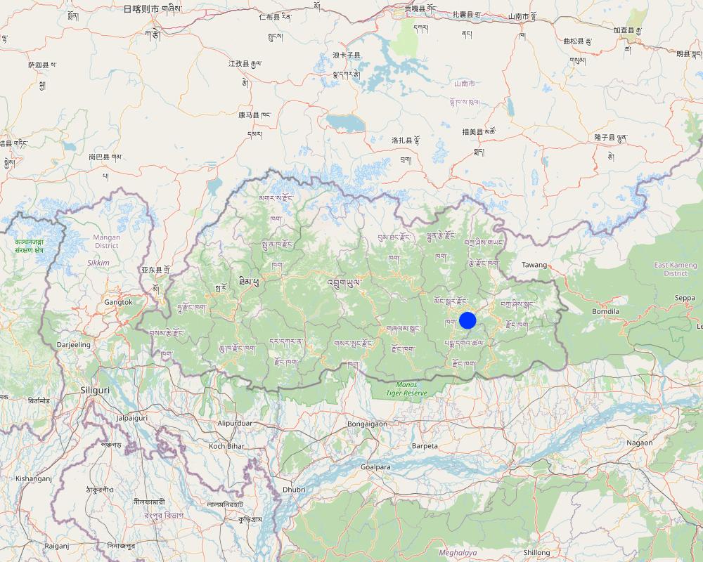
Country:
Bhutan
Region/ State/ Province:
Mongar
Further specification of location:
Boucholing village, Thangrong gewog (block), Mongar Dzongkhag (district)
Specify the spread of the Technology:
- evenly spread over an area
If precise area is not known, indicate approximate area covered:
- 10-100 km2
Is/are the technology site(s) located in a permanently protected area?
No
Map
×2.6 Date of implementation
Indicate year of implementation:
2014
2.7 Introduction of the Technology
Specify how the Technology was introduced:
- through projects/ external interventions
Comments (type of project, etc.):
The project was funded by UNDP and technical support was provided by the SLM Specialists from the National Soil Service Center and the agriculture extension agent of Thangrong gewog.
3. Classification of the SLM Technology
3.1 Main purpose(s) of the Technology
- improve production
- reduce, prevent, restore land degradation
- reduce risk of disasters
- adapt to climate change/ extremes and its impacts
- create beneficial economic impact
3.2 Current land use type(s) where the Technology is applied
Land use mixed within the same land unit:
No

Cropland
- Annual cropping
Annual cropping - Specify crops:
- cereals - maize
- root/tuber crops - sweet potatoes, yams, taro/cocoyam, other
- vegetables - leafy vegetables (salads, cabbage, spinach, other)
- chilli
Number of growing seasons per year:
- 2
Specify:
Vegetables are grown for two times in a year but the cereal crops are grown for only one time.
Is intercropping practiced?
Yes
If yes, specify which crops are intercropped:
Maize and legumes
Is crop rotation practiced?
Yes
If yes, specify:
Maize followed by vegetables
3.3 Has land use changed due to the implementation of the Technology?
Has land use changed due to the implementation of the Technology?
- No (Continue with question 3.4)
Land use mixed within the same land unit:
No
3.4 Water supply
Water supply for the land on which the Technology is applied:
- rainfed
Comments:
Water is a major constraint and land users mostly depend on rain for irrigation.
3.5 SLM group to which the Technology belongs
- cross-slope measure
3.6 SLM measures comprising the Technology

vegetative measures
- V2: Grasses and perennial herbaceous plants
Comments:
Napier grass were planted on the bunds if the already constructed terrace.
3.7 Main types of land degradation addressed by the Technology

soil erosion by water
- Wt: loss of topsoil/ surface erosion
- Wg: gully erosion/ gullying
Comments:
The technology addresses the issue of soil erosion through rain and prevented the degradation the top soil.
3.8 Prevention, reduction, or restoration of land degradation
Specify the goal of the Technology with regard to land degradation:
- prevent land degradation
- reduce land degradation
Comments:
The main goal of the technology is to combat farm land degradation and prevent soil erosion.
4. Technical specifications, implementation activities, inputs, and costs
4.1 Technical drawing of the Technology
Technical specifications (related to technical drawing):
Technical drawing as per the specification given in the SLM Guidelines 2021. See steps for the establishment of hedgerows below:
a)Determine the hedgerow interval for each landform based on the gradient (but based on farmers feedback, the interval is generally set at 6 meters) and then lay out the contour lines. Along the contours, prepare a strip of land with a width of about 40-50cm wide to plant the grass slips or broadcast fodder grass seeds. Napier (Pennisetum spp.) and Pakchong grass spp. is recommended as hedgerow plants for areas that are below 1600 m. However, for areas above 1600 m, temperate grass mixture should be considered;
b)A row of fodder grass slips or seedlings should be planted with a spacing of 15-20 cm. If grass slips are used, at least two nodes should be inserted into the soil for proper establishment/rooting. On the other hand, if grass seeds are used, the seed rate should be 25g per square metre;
c)Mulching should be done right after the grass slip planting or grass seeding to reduce surface erosion, conserve soil moisture, and aid proper germination;
d)Gap filling and trimming of hedgerows should be done as and when required. The trimmed materials can either be used as fodder or mulching materials; and
e)If desired, improved fruit trees suitable at the proposed site can be planted along the hedges at 5 x 5 m spacing. Fruit trees in two adjacent hedgerows should be planted in staggered position to avoid competition for sunlight, water, and soil nutrients.
Author:
NSSC
Date:
10/09/2021
4.2 General information regarding the calculation of inputs and costs
Specify how costs and inputs were calculated:
- per Technology area
Indicate size and area unit:
Ha
If using a local area unit, indicate conversion factor to one hectare (e.g. 1 ha = 2.47 acres): 1 ha =:
0.4
other/ national currency (specify):
Ngultrum
If relevant, indicate exchange rate from USD to local currency (e.g. 1 USD = 79.9 Brazilian Real): 1 USD =:
82.08
Indicate average wage cost of hired labour per day:
250
4.3 Establishment activities
| Activity | Timing (season) | |
|---|---|---|
| 1. | Planning | done between the stakeholders several times |
| 2. | Community meeting and member agreement | twice |
| 3. | Training and workshop | for almost a week |
| 4. | Demonstration | once |
| 5. | Implementation (Planting of napier in the field in groups) | based on the land users convenience and season of plantation |
4.4 Costs and inputs needed for establishment
| Specify input | Unit | Quantity | Costs per Unit | Total costs per input | % of costs borne by land users | |
|---|---|---|---|---|---|---|
| Labour | Labours | person-days | 4.0 | 250.0 | 1000.0 | 100.0 |
| Plant material | Napier | bundle | 35.0 | 200.0 | 7000.0 | |
| Other | Payment for resource persons | No of days | 5.0 | 1500.0 | 7500.0 | |
| Total costs for establishment of the Technology | 15500.0 | |||||
| Total costs for establishment of the Technology in USD | 188.84 | |||||
If land user bore less than 100% of costs, indicate who covered the remaining costs:
The funding was provided by UNDP, with technical support from the National Soil Services Center and the Dzongkhag.
Comments:
The cost breakdown of the technology establishment was for one acre of land.
The total grant amount was Nu. 2,834,416, however, the total budget for Boucholing specifically was not available.
4.5 Maintenance/ recurrent activities
| Activity | Timing/ frequency | |
|---|---|---|
| 1. | Harvesting, cutting of napier and maintaining the height of the plant | when the napier reaches a height of one meter |
| 2. | Replacing of missing and damaged hills | whenever possible |
4.6 Costs and inputs needed for maintenance/ recurrent activities (per year)
| Specify input | Unit | Quantity | Costs per Unit | Total costs per input | % of costs borne by land users | |
|---|---|---|---|---|---|---|
| Labour | labour | person-days | 2.0 | 250.0 | 500.0 | 100.0 |
| Plant material | Napier slips | Bundle | 10.0 | 200.0 | 2000.0 | |
| Total costs for maintenance of the Technology | 2500.0 | |||||
| Total costs for maintenance of the Technology in USD | 30.46 | |||||
Comments:
Minimal cost go into the maintenance of the hedgerows.
4.7 Most important factors affecting the costs
Describe the most determinate factors affecting the costs:
Labour cost and cost of the planting materials.
5. Natural and human environment
5.1 Climate
Annual rainfall
- < 250 mm
- 251-500 mm
- 501-750 mm
- 751-1,000 mm
- 1,001-1,500 mm
- 1,501-2,000 mm
- 2,001-3,000 mm
- 3,001-4,000 mm
- > 4,000 mm
Specifications/ comments on rainfall:
The data used was from the nearest weather station of the National Center for Hydrology and Meteorology (NCHM).
Indicate the name of the reference meteorological station considered:
https://www.nchm.gov.bt/home/pageMenu/906
Agro-climatic zone
- sub-humid
Dry subtropical zone
5.2 Topography
Slopes on average:
- flat (0-2%)
- gentle (3-5%)
- moderate (6-10%)
- rolling (11-15%)
- hilly (16-30%)
- steep (31-60%)
- very steep (>60%)
Landforms:
- plateau/plains
- ridges
- mountain slopes
- hill slopes
- footslopes
- valley floors
Altitudinal zone:
- 0-100 m a.s.l.
- 101-500 m a.s.l.
- 501-1,000 m a.s.l.
- 1,001-1,500 m a.s.l.
- 1,501-2,000 m a.s.l.
- 2,001-2,500 m a.s.l.
- 2,501-3,000 m a.s.l.
- 3,001-4,000 m a.s.l.
- > 4,000 m a.s.l.
Indicate if the Technology is specifically applied in:
- not relevant
Comments and further specifications on topography:
Contour hedgerows can be applied in both concave and convex situations, so not relevant
5.3 Soils
Soil depth on average:
- very shallow (0-20 cm)
- shallow (21-50 cm)
- moderately deep (51-80 cm)
- deep (81-120 cm)
- very deep (> 120 cm)
Soil texture (topsoil):
- coarse/ light (sandy)
Soil texture (> 20 cm below surface):
- medium (loamy, silty)
Topsoil organic matter:
- medium (1-3%)
5.4 Water availability and quality
Availability of surface water:
medium
Water quality (untreated):
for agricultural use only (irrigation)
Water quality refers to:
surface water
Is water salinity a problem?
No
Is flooding of the area occurring?
Yes
Regularity:
episodically
Comments and further specifications on water quality and quantity:
The flooding of the area occurs mostly due to heavy rainfall and some surface water.
5.5 Biodiversity
Species diversity:
- high
Habitat diversity:
- high
Comments and further specifications on biodiversity:
Higher diversity because Napier grass adds to diversity to already existing crops.
5.6 Characteristics of land users applying the Technology
Sedentary or nomadic:
- Sedentary
Market orientation of production system:
- mixed (subsistence/ commercial)
Off-farm income:
- 10-50% of all income
Relative level of wealth:
- average
Individuals or groups:
- individual/ household
Level of mechanization:
- mechanized/ motorized
Gender:
- men
Age of land users:
- middle-aged
5.7 Average area of land used by land users applying the Technology
- < 0.5 ha
- 0.5-1 ha
- 1-2 ha
- 2-5 ha
- 5-15 ha
- 15-50 ha
- 50-100 ha
- 100-500 ha
- 500-1,000 ha
- 1,000-10,000 ha
- > 10,000 ha
Is this considered small-, medium- or large-scale (referring to local context)?
- small-scale
Comments:
There are a total of 130 acres of land with an average area of around 2.3 acres for each household.
5.8 Land ownership, land use rights, and water use rights
Land ownership:
- individual, titled
Land use rights:
- individual
Water use rights:
- open access (unorganized)
Are land use rights based on a traditional legal system?
Yes
Specify:
The traditional legal system in our country is as per the land act and rules and regulations which dictate the land use in the country.
5.9 Access to services and infrastructure
health:
- poor
- moderate
- good
education:
- poor
- moderate
- good
technical assistance:
- poor
- moderate
- good
employment (e.g. off-farm):
- poor
- moderate
- good
markets:
- poor
- moderate
- good
energy:
- poor
- moderate
- good
roads and transport:
- poor
- moderate
- good
drinking water and sanitation:
- poor
- moderate
- good
financial services:
- poor
- moderate
- good
6. Impacts and concluding statements
6.1 On-site impacts the Technology has shown
Socio-economic impacts
Production
crop production
Comments/ specify:
Crop production is higher than in the past since the contour hedgerows have helped control soil erosion and allowed for proper land utilization. The land user reported about a 25% increase compared to the past.
crop quality
Comments/ specify:
The crop quality is also relatively better now compared to the past when the technology was not applied. The land users reported that crops near the hedgerows were found more greener.
fodder production
Quantity before SLM:
No fodder was produced
Quantity after SLM:
After napier plantation, napier are harvested as fodder for cattle.
Comments/ specify:
Napier grass was not planted in the past. It was introduced by the National Soil Services Center as part of this technology. The Napier grass planted along the contour has helped not only with soil erosion control but also provided fodder grass for the cattle. The land user reported that there was a 100% increase in fodder because unlike in the past now they don't have to send their cow for grazing in the forest.
fodder quality
Comments/ specify:
Compared to normal grass that the cattle would graze on, napier is nutrient-rich and of better quality than the normal grass.
risk of production failure
Comments/ specify:
The napier plantation has helped prevent soil erosion that would normally occur in the farm lands thereby preventing crop failure due to soil fertility and moisture conservation.
product diversity
Comments/ specify:
With the help of the project, the land users were able to utilise the sloping land. This enabled land users to grow crops other than maize.
production area
Comments/ specify:
The contour hedgerows have allowed for the sloping and degraded lands to be revitalised into usable cultivable lands.
land management
Quantity before SLM:
Hard manual land management
Quantity after SLM:
mechanization of the agriculture in the community
Comments/ specify:
With the help of the project, farm lands in the community were made into terraces and made land management easier compared to the past.
Income and costs
expenses on agricultural inputs
Comments/ specify:
The expenses on agricultural inputs have stayed relatively the same, however, has made working on the farm land easier.
farm income
Comments/ specify:
With fodder availability, land users can now focus more on agriculture instead of herding cattle for grazing. The project has also allowed for land users to diversify their products.
workload
Comments/ specify:
Workload has decreased due to farm mechanization through use of power tillers, which was not possible prior to the SLM intervention.
Ecological impacts
Water cycle/ runoff
surface runoff
Comments/ specify:
Prior to hedgerow establishemt, there was serious surface erosion, which is not the case now.
Biodiversity: vegetation, animals
plant diversity
Quantity before SLM:
primarily maize was cultivated
Quantity after SLM:
maize, cole crops, tubers and chilies are cultivated
Comments/ specify:
In the past, the community members would normally cultivate maize and small amounts of vegetables for self consumption, but now a diverse variety of crops are cultivated.
Climate and disaster risk reduction
landslides/ debris flows
Quantity before SLM:
More prominent in the summer season
Quantity after SLM:
occurrence is very minimal
Comments/ specify:
The presence of a terrace and hedgerows in the bunds of the terrace has prevented the erosion of the soil in the farm lands of the farmers.
6.2 Off-site impacts the Technology has shown
downstream flooding
Comments/ specify:
Downstream flooding is relatively less, since the hedgerows has prevented or reduced surface eorsion which would otherwise impact the downstream settlements and water bodies.
6.3 Exposure and sensitivity of the Technology to gradual climate change and climate-related extremes/ disasters (as perceived by land users)
Gradual climate change
Gradual climate change
| Season | increase or decrease | How does the Technology cope with it? | |
|---|---|---|---|
| annual temperature | increase | well | |
| annual rainfall | decrease | well |
Climate-related extremes (disasters)
Meteorological disasters
| How does the Technology cope with it? | |
|---|---|
| local rainstorm | well |
| local thunderstorm | very well |
| local hailstorm | well |
| local windstorm | well |
Climatological disasters
| How does the Technology cope with it? | |
|---|---|
| drought | well |
Hydrological disasters
| How does the Technology cope with it? | |
|---|---|
| landslide | well |
6.4 Cost-benefit analysis
How do the benefits compare with the establishment costs (from land users’ perspective)?
Short-term returns:
positive
Long-term returns:
positive
How do the benefits compare with the maintenance/ recurrent costs (from land users' perspective)?
Short-term returns:
very positive
Long-term returns:
very positive
Comments:
Since the project was fully funded and minimal cost went into its establishment by the land users, the benefits are higher.
6.5 Adoption of the Technology
- > 50%
If available, quantify (no. of households and/ or area covered):
40 households
Of all those who have adopted the Technology, how many did so spontaneously, i.e. without receiving any material incentives/ payments?
- 0-10%
Comments:
Since the program was supported by project, the labor were contributed by the land user while the inputs in all sites were provided by the project at every household level.
6.6 Adaptation
Has the Technology been modified recently to adapt to changing conditions?
No
6.7 Strengths/ advantages/ opportunities of the Technology
| Strengths/ advantages/ opportunities in the land user’s view |
|---|
| Hedgerow requires less management |
| Napier are also used as fodder for livestock |
| Prevents the land from erosion due to heavy rain |
| Helps in build up of terraces and facilitates in mechanization of farm |
| Strengths/ advantages/ opportunities in the compiler’s or other key resource person’s view |
|---|
| Additional income opportunities through the production of marketable products from hedgerow vegetation. |
| Improved livelihoods for communities through long-term agricultural productivity. |
| Support for sustainable agricultural practices and resilient farming systems. |
| Preservation of fertile land and protection of agricultural resources. |
6.8 Weaknesses/ disadvantages/ risks of the Technology and ways of overcoming them
| Weaknesses/ disadvantages/ risks in the land user’s view | How can they be overcome? |
|---|---|
| Grazing of hedges by free cattle in absence of fences in farm land | Establish community byelaws not to let their cattle free in the fields or install fencing aroung the field. |
| Weaknesses/ disadvantages/ risks in the compiler’s or other key resource person’s view | How can they be overcome? |
|---|---|
| Shading and potential competition with crops for soil nutrients by hedges | Maintaining height and width of hedges |
| The establishment and maintenance of contour hedgerows require time, effort, and financial resources | The funding for the establishment of technology has already been provided and for maintenance, the expenditure is minimal. |
7. References and links
7.1 Methods/ sources of information
- field visits, field surveys
1 household
- interviews with land users
2 individuals
7.2 References to available publications
Title, author, year, ISBN:
ICIMOD. (1999). Manual on Contour Hedgerow Inter-cropping Technology. ICIMOD.
Available from where? Costs?
https://lib.icimod.org/record/31840/files/manual_on_contour_hedgerow_inter-cropping_technology.pdf
Title, author, year, ISBN:
Pellek, R. (1992). Contour hedgerows and other soil conservation interventions for hilly terrain. Agroforestry Systems, 17, 135-152.
Available from where? Costs?
https://link.springer.com/article/10.1007/BF00053118
Title, author, year, ISBN:
Kaushal, R., Mandal, D., Panwar, P., Rajkumar, Kumar, P., Tomar, J. M. S. & Mehta, H. (2021). Chapter 20 - Soil and water conservation benefits of agroforestry.
Available from where? Costs?
https://www.sciencedirect.com/science/article/abs/pii/B9780128229316000204
7.3 Links to relevant online information
Title/ description:
Sustainable Land Management for improved land productivity and community livelihood in Thangrong, Mongar
URL:
https://sgp.undp.org/spacial-itemid-projects-landing-page/spacial-itemid-project-search-results/spacial-itemid-project-detailpage.html?view=projectdetail&id=27647
Title/ description:
Soil erosion control with contour planting
URL:
https://apps.worldagroforestry.org/Units/Library/Books/Book%2082/imperata%20grassland/html/4.1_soil.htm?n=20
Title/ description:
Sustainable Land Management: Guidelines and Best Practices 2021
URL:
https://www.nssc.gov.bt
Links and modules
Expand all Collapse allLinks
No links
Modules
No modules