Contour Grass Hedgerows on Steep Slopes [ภูฏาน]
- ผู้สร้างสรรค์:
- การอัพเดท:
- ผู้รวบรวม: ONGPO LEPCHA
- ผู้เรียบเรียง: Kuenzang Nima
- ผู้ตรวจสอบ: William Critchley, Rima Mekdaschi Studer
Tsa yi gaytshig (རྩའི་གད་ཚིགས)
technologies_6854 - ภูฏาน
ดูส่วนย่อย
ขยายทั้งหมด ย่อทั้งหมด1. ข้อมูลทั่วไป
1.2 รายละเอียดที่ติดต่อได้ของผู้รวบรวมและองค์กรที่เกี่ยวข้องในการประเมินและการจัดเตรียมทำเอกสารของเทคโนโลยี
วิทยากรหลัก
ผู้ใช้ที่ดิน:
Daza Khemo
Boucholing village
ภูฏาน
ผู้ใช้ที่ดิน:
Dorji Ugyen
Boucholing village
ภูฏาน
ชื่อของโครงการซึ่งอำนวยความสะดวกในการทำเอกสารหรือการประเมินเทคโนโลยี (ถ้าเกี่ยวข้อง)
Strengthening national-level institutional and professional capacities of country Parties towards enhanced UNCCD monitoring and reporting – GEF 7 EA Umbrella II (GEF 7 UNCCD Enabling Activities_Umbrella II)ชื่อขององค์กรซึ่งอำนวยความสะดวกในการทำเอกสารหรือการประเมินเทคโนโลยี (ถ้าเกี่ยวข้อง)
National Soil Services Centre, Department of Agriculture, Ministry of Agriculture & Livestock (NSSC) - ภูฏาน1.3 เงื่อนไขการใช้ข้อมูลที่ได้บันทึกผ่านทาง WOCAT
ผู้รวบรวมและวิทยากรหลักยอมรับเงื่อนไขเกี่ยวกับการใช้ข้อมูลที่ถูกบันทึกผ่านทาง WOCAT:
ใช่
1.4 การเปิดเผยเรื่องความยั่งยืนของเทคโนโลยีที่ได้อธิบายไว้
เทคโนโลยีที่ได้อธิบายไว้นี้เป็นปัญหาของความเสื่อมโทรมโทรมของที่ดินหรือไม่ จึงไม่ได้รับการยอมรับว่าเป็นเทคโนโลยีเพื่อการจัดการที่ดินอย่างยั่งยืน:
ไม่ใช่
แสดงความคิดเห็น:
The technology described is not problematic with regard to land degradation.
2. การอธิบายลักษณะของเทคโนโลยี SLM
2.1 การอธิบายแบบสั้น ๆ ของเทคโนโลยี
คำจำกัดความของเทคโนโลยี:
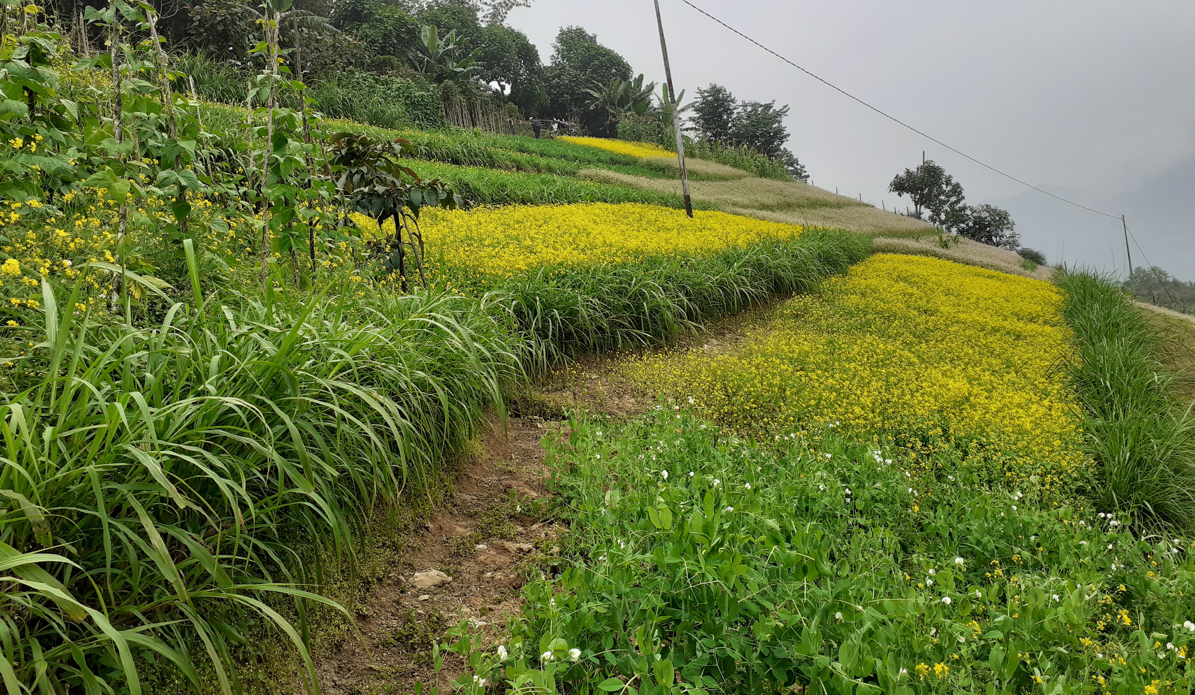
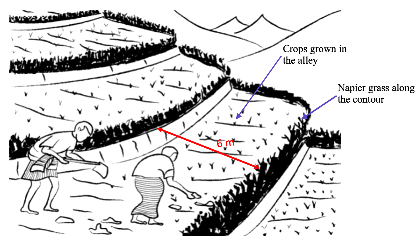
Contour hedgerows are a soil and water conservation technology that involve planting of Napier grass cuttings along contour lines on the slope at a horizontal distance of 6 m. The area between the contour hedgerows is used for crop cultivation.
2.2 การอธิบายแบบละเอียดของเทคโนโลยี
คำอธิบาย:
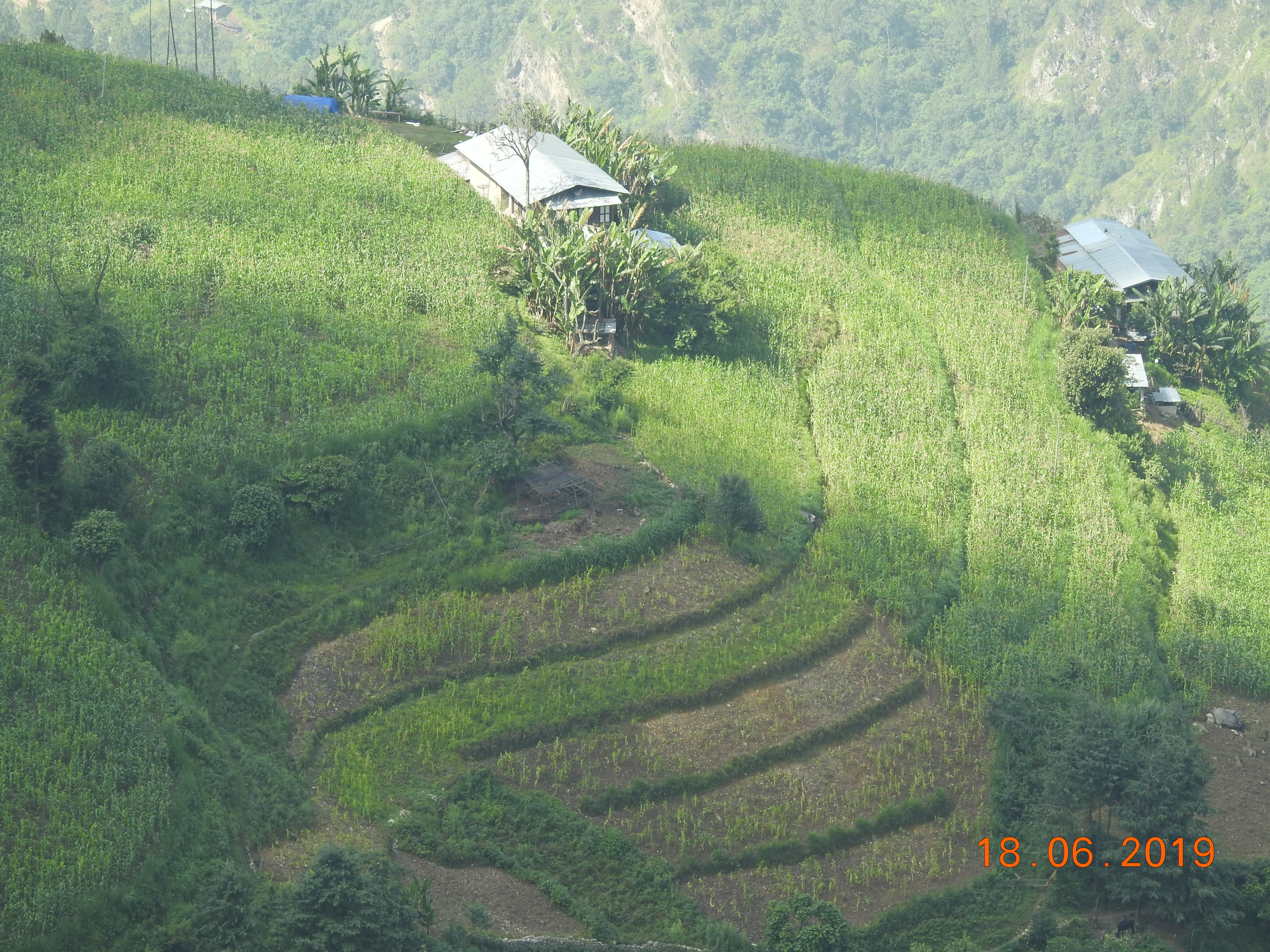
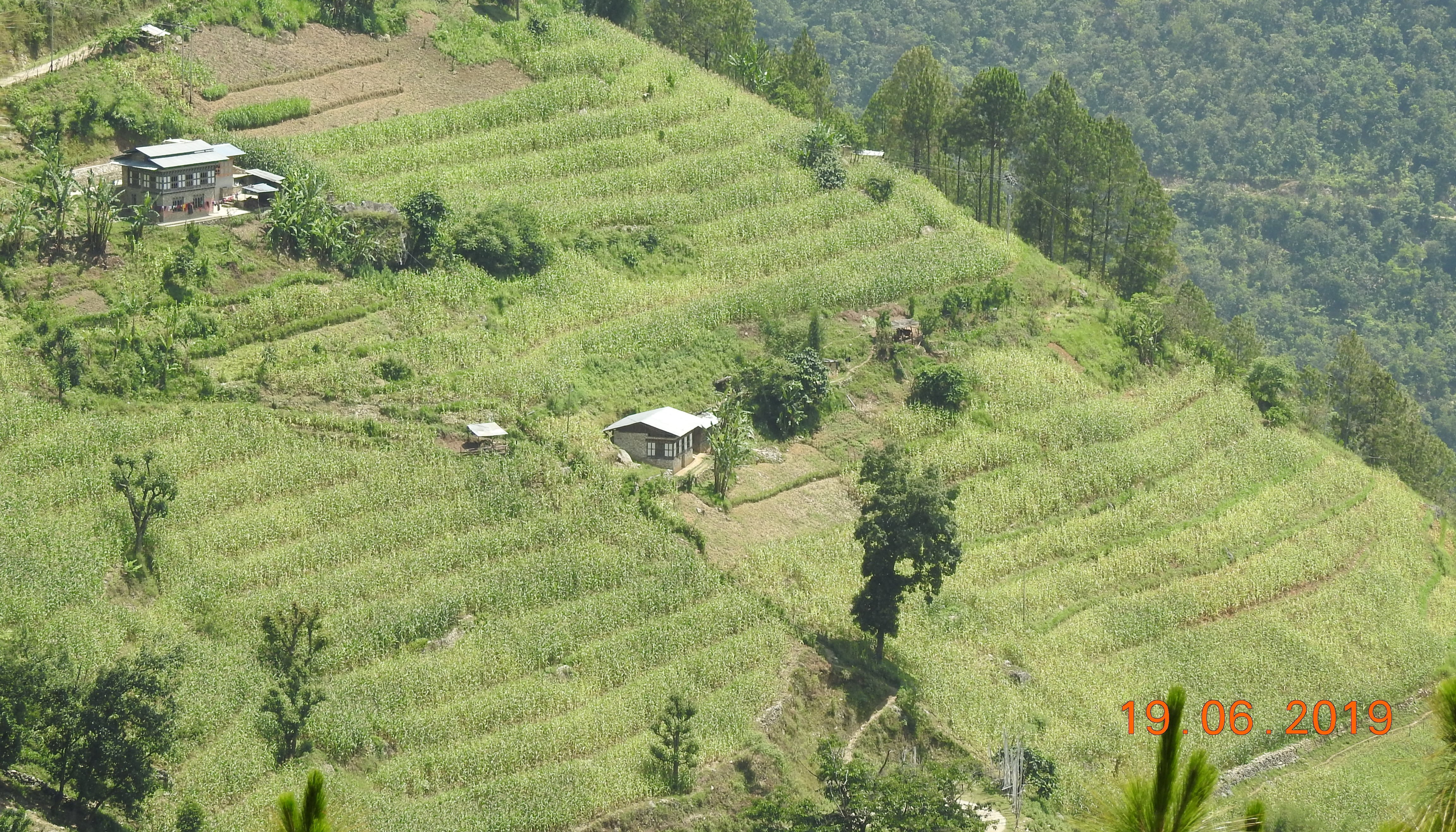
Contour hedgerows are a soil and water conservation technology that involves planting Napier stem cuttings along contour lines on slopes. They are planted at a horizontal distance of 6 meters between rows and 15-20 centimeters between cuttings within lines. On average it requires 3500-4000 Napier slips to cover one acre (0.4 ha). Hedgerows form living barriers that trap sediment and reduce surface runoff. With time, as the sediment builds up behind the hedges, the area between the hedgerows develops into flat alleys or “terrace beds”. This technology is effective in reducing soil erosion and conserving water. The hedgerows also boost crop productivity. The contour hedgerow system is widely used in hilly terrain in Bhutan and elsewhere.
The main purposes of the technology are to 1) serve as a barrier to check the movement of soil and water down the slope, 2) effectively utilize sloping areas for agricultural purposes, and 3) increase crop and fodder production.
The major activities/ inputs needed to establish/ maintain contour hedgerows are: 1) surveying of the area by an SLM specialist (planning and site assessment), 2) selecting suitable hedgerow planting materials, 3) registration of interested farmers, 4) training of farmers, 5) layout of contour lines using A-frames, 6) distribution of planting materials and establishment of hedgerows in farmland, 7) monitoring and evaluation of hedgerows, and 8) maintenance of hedgerows. Maintenance includes replacement of cuttings in gaps - either damaged by cattle or natural mortality and trimming of grass back to 15 centimeters after reaching 1 meter. Inputs required include: 1) planting materials (Napier grass), 2) A-Frame for contour lines, 3) spades, pickaxes, shovels, crowbars, etc., and 4) human resource input by SLM specialists.
Contour hedgerows have many benefits/ impacts on the livelihood of the land users including 1) soil and water conservation, 2) use of the sloping areas for crop or fodder production, 3) effective conservation through using local materials with a 90% survival rate, 4) habitat for natural predators, pollinators, insect-eating birds, and rodent predators, 5) groundwater recharge, and 6) they beautify the overall agricultural landscape. Another important benefit of the hedgerows is the availability of fodder grass for livestock, which otherwise would have to be collected from the forest. The disadvantages include the need for regular maintenance and gapping up. At times, conflicts arise within the community due to grazing of hedges by neighbors’ cattle.
2.3 รูปภาพของเทคโนโลยี
อัลบั้มสื่อบันทึก
2.5 ประเทศภูมิภาค หรือสถานที่ตั้งที่เทคโนโลยีได้นำไปใช้และได้รับการครอบคลุมโดยการประเมินนี้
ประเทศ:
ภูฏาน
ภูมิภาค/รัฐ/จังหวัด:
Mongar
ข้อมูลจำเพาะเพิ่มเติมของสถานที่ตั้ง :
Boucholing village, Thangrong gewog (block), Mongar Dzongkhag (district)
ระบุการกระจายตัวของเทคโนโลยี:
- กระจายไปอย่างสม่ำเสมอในพื้นที่
If precise area is not known, indicate approximate area covered:
- 10-100 ตร.กม.
Is/are the technology site(s) located in a permanently protected area?
ไม่ใช่
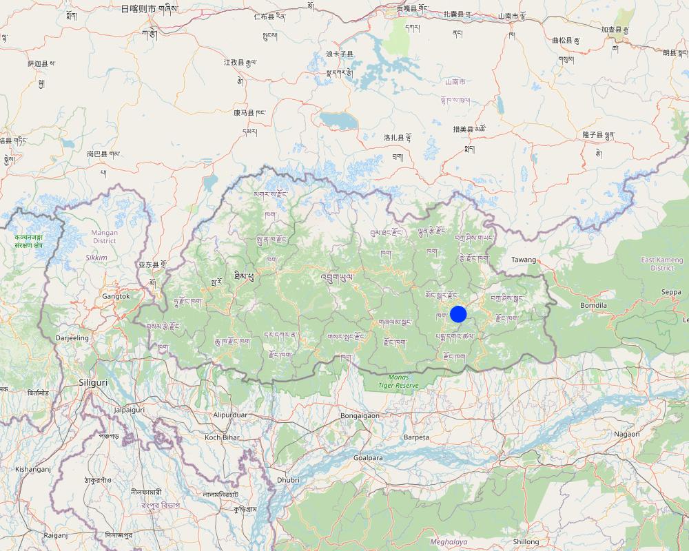
Map
×2.6 วันที่การดำเนินการ
ระบุปีที่ใช้:
2014
2.7 คำแนะนำของเทคโนโลยี
ให้ระบุว่าเทคโนโลยีถูกแนะนำเข้ามาอย่างไร:
- ทางโครงการหรือจากภายนอก
ความคิดเห็น (ประเภทของโครงการ เป็นต้น) :
The project was funded by UNDP and technical support was provided by the SLM Specialists from the National Soil Service Center and the agriculture extension agent of Thangrong gewog.
3. การจัดประเภทของเทคโนโลยี SLM
3.1 วัตถุประสงค์หลักของเทคโนโลยี
- ปรับปรุงการผลิตให้ดีขึ้น
- ลด ป้องกัน ฟื้นฟู การเสื่อมโทรมของที่ดิน
- ลดความเสี่ยงของภัยพิบัติ
- ปรับตัวเข้ากับการเปลี่ยนแปลงภูมิอากาศของโลก สภาพภูมิอากาศที่รุนแรงและผลกระทบ
- สร้างผลกระทบทางด้านเศรษฐกิจที่เป็นประโยชน์
3.2 ประเภทของการใช้ที่ดินในปัจจุบันที่ได้นำเทคโนโลยีไปใช้
Land use mixed within the same land unit:
ไม่ใช่

พื้นที่ปลูกพืช
- การปลูกพืชล้มลุกอายุปีเดียว
Annual cropping - Specify crops:
- cereals - maize
- root/tuber crops - sweet potatoes, yams, taro/cocoyam, other
- vegetables - leafy vegetables (salads, cabbage, spinach, other)
- chilli
จำนวนของฤดูเพาะปลูกต่อปี:
- 2
ระบุ:
Vegetables are grown for two times in a year but the cereal crops are grown for only one time.
Is intercropping practiced?
ใช่
If yes, specify which crops are intercropped:
Maize and legumes
Is crop rotation practiced?
ใช่
ถ้าใช่ ระบุ:
Maize followed by vegetables
3.3 Has land use changed due to the implementation of the Technology?
Has land use changed due to the implementation of the Technology?
- No (Continue with question 3.4)
Land use mixed within the same land unit:
ไม่ใช่
3.4 การใช้น้ำ
การใช้น้ำของที่ดินที่มีการใช้เทคโนโลยีอยู่:
- จากน้ำฝน
แสดงความคิดเห็น:
Water is a major constraint and land users mostly depend on rain for irrigation.
3.5 กลุ่ม SLM ที่ตรงกับเทคโนโลยีนี้
- มาตรการปลูกพืชขวางความลาดชัน (cross-slope measure)
3.6 มาตรการ SLM ที่ประกอบกันเป็นเทคโนโลยี

มาตรการอนุรักษ์ด้วยวิธีพืช
- V2: หญ้าและไม้ยืนต้น
แสดงความคิดเห็น:
Napier grass were planted on the bunds if the already constructed terrace.
3.7 รูปแบบหลักของการเสื่อมโทรมของที่ดินที่ได้รับการแก้ไขโดยเทคโนโลยี

การกัดกร่อนของดินโดยน้ำ
- Wt (Loss of topsoil): การสูญเสียดินชั้นบนหรือการกัดกร่อนที่ผิวดิน
- Wg (Gully erosion): การกัดกร่อนแบบร่องธารหรือการทำให้เกิดร่องน้ำเซาะ
แสดงความคิดเห็น:
The technology addresses the issue of soil erosion through rain and prevented the degradation the top soil.
3.8 การป้องกัน การลดลง หรือการฟื้นฟูความเสื่อมโทรมของที่ดิน
ระบุเป้าหมายของเทคโนโลยีกับความเสื่อมโทรมของที่ดิน:
- ป้องกันความเสื่อมโทรมของที่ดิน
- ลดความเสื่อมโทรมของดิน
แสดงความคิดเห็น:
The main goal of the technology is to combat farm land degradation and prevent soil erosion.
4. ข้อมูลจำเพาะด้านเทคนิค กิจกรรมการนำไปปฏิบัติใช้ ปัจจัยนำเข้า และค่าใช้จ่าย
4.1 แบบแปลนทางเทคนิคของเทคโนโลยี
ข้อมูลจำเพาะด้านเทคนิค (แบบแปลนทางเทคนิคของเทคโนโลยี):
Technical drawing as per the specification given in the SLM Guidelines 2021. See steps for the establishment of hedgerows below:
a)Determine the hedgerow interval for each landform based on the gradient (but based on farmers feedback, the interval is generally set at 6 meters) and then lay out the contour lines. Along the contours, prepare a strip of land with a width of about 40-50cm wide to plant the grass slips or broadcast fodder grass seeds. Napier (Pennisetum spp.) and Pakchong grass spp. is recommended as hedgerow plants for areas that are below 1600 m. However, for areas above 1600 m, temperate grass mixture should be considered;
b)A row of fodder grass slips or seedlings should be planted with a spacing of 15-20 cm. If grass slips are used, at least two nodes should be inserted into the soil for proper establishment/rooting. On the other hand, if grass seeds are used, the seed rate should be 25g per square metre;
c)Mulching should be done right after the grass slip planting or grass seeding to reduce surface erosion, conserve soil moisture, and aid proper germination;
d)Gap filling and trimming of hedgerows should be done as and when required. The trimmed materials can either be used as fodder or mulching materials; and
e)If desired, improved fruit trees suitable at the proposed site can be planted along the hedges at 5 x 5 m spacing. Fruit trees in two adjacent hedgerows should be planted in staggered position to avoid competition for sunlight, water, and soil nutrients.
ผู้เขียน:
NSSC
วันที่:
10/09/2021
4.2 ข้อมูลทั่วไปเกี่ยวกับการคำนวณปัจจัยนำเข้าและค่าใช้จ่าย
ให้ระบุว่าค่าใช้จ่ายและปัจจัยนำเข้าได้รับการคำนวณอย่างไร:
- ต่อพื้นที่ที่ใช้เทคโนโลยี
ระบุขนาดและหน่วยพื้นที่:
Ha
If using a local area unit, indicate conversion factor to one hectare (e.g. 1 ha = 2.47 acres): 1 ha =:
0.4
อื่นๆ หรือสกุลเงินประจำชาติ (ระบุ):
Ngultrum
If relevant, indicate exchange rate from USD to local currency (e.g. 1 USD = 79.9 Brazilian Real): 1 USD =:
82.08
ระบุค่าเฉลี่ยของค่าจ้างในการจ้างแรงงานต่อวัน:
250
4.3 กิจกรรมเพื่อการจัดตั้ง
| กิจกรรม | Timing (season) | |
|---|---|---|
| 1. | Planning | done between the stakeholders several times |
| 2. | Community meeting and member agreement | twice |
| 3. | Training and workshop | for almost a week |
| 4. | Demonstration | once |
| 5. | Implementation (Planting of napier in the field in groups) | based on the land users convenience and season of plantation |
4.4 ค่าใช้จ่ายของปัจจัยนำเข้าที่จำเป็นสำหรับการจัดตั้ง
| ปัจจัยนำเข้า | หน่วย | ปริมาณ | ค่าใช้จ่ายต่อหน่วย | ค่าใช้จ่ายทั้งหมดต่อปัจจัยนำเข้า | %ของค่าใช้จ่ายที่ก่อให้เกิดขึ้นโดยผู้ใช้ที่ดิน | |
|---|---|---|---|---|---|---|
| แรงงาน | Labours | person-days | 4.0 | 250.0 | 1000.0 | 100.0 |
| วัสดุด้านพืช | Napier | bundle | 35.0 | 200.0 | 7000.0 | |
| อื่น ๆ | Payment for resource persons | No of days | 5.0 | 1500.0 | 7500.0 | |
| ค่าใช้จ่ายทั้งหมดของการจัดตั้งเทคโนโลยี | 15500.0 | |||||
| Total costs for establishment of the Technology in USD | 188.84 | |||||
ถ้าผู้ใช้ที่ดินรับภาระน้อยกว่า 100% ของค่าใช้จ่าย ให้ระบุว่าใครเป็นผู้รับผิดชอบส่วนที่เหลือ:
The funding was provided by UNDP, with technical support from the National Soil Services Center and the Dzongkhag.
แสดงความคิดเห็น:
The cost breakdown of the technology establishment was for one acre of land.
The total grant amount was Nu. 2,834,416, however, the total budget for Boucholing specifically was not available.
4.5 การบำรุงรักษาสภาพหรือกิจกรรมที่เกิดขึ้นเป็นประจำ
| กิจกรรม | ช่วงระยะเวลา/ความถี่ | |
|---|---|---|
| 1. | Harvesting, cutting of napier and maintaining the height of the plant | when the napier reaches a height of one meter |
| 2. | Replacing of missing and damaged hills | whenever possible |
4.6 ค่าใช้จ่ายของปัจจัยนำเข้าและกิจกรรมที่เกิดขึ้นเป็นประจำที่ต้องการการบำรุงรักษา (ต่อปี)
| ปัจจัยนำเข้า | หน่วย | ปริมาณ | ค่าใช้จ่ายต่อหน่วย | ค่าใช้จ่ายทั้งหมดต่อปัจจัยนำเข้า | %ของค่าใช้จ่ายที่ก่อให้เกิดขึ้นโดยผู้ใช้ที่ดิน | |
|---|---|---|---|---|---|---|
| แรงงาน | labour | person-days | 2.0 | 250.0 | 500.0 | 100.0 |
| วัสดุด้านพืช | Napier slips | Bundle | 10.0 | 200.0 | 2000.0 | |
| ค่าใช้จ่ายทั้งหมดของการบำรุงรักษาสภาพเทคโนโลยี | 2500.0 | |||||
| Total costs for maintenance of the Technology in USD | 30.46 | |||||
แสดงความคิดเห็น:
Minimal cost go into the maintenance of the hedgerows.
4.7 ปัจจัยสำคัญที่สุดที่มีผลกระทบต่อค่าใช้จ่าย
ปัจจัยสำคัญที่สุดที่มีผลกระทบต่อค่าใช้จ่ายต่างๆ:
Labour cost and cost of the planting materials.
5. สิ่งแวดล้อมทางธรรมชาติและของมนุษย์
5.1 ภูมิอากาศ
ฝนประจำปี
- < 250 ม.ม.
- 251-500 ม.ม.
- 501-750 ม.ม.
- 751-1,000 ม.ม.
- 1,001-1,500 ม.ม.
- 1,501-2,000 ม.ม.
- 2,001-3,000 ม.ม.
- 3,001-4,000 ม.ม.
- > 4,000 ม.ม.
ข้อมูลจำเพาะ/ความคิดเห็นเรื่องปริมาณน้ำฝน:
The data used was from the nearest weather station of the National Center for Hydrology and Meteorology (NCHM).
ระบุชื่อของสถานีตรวดวัดอากาศที่ใช้อ้างอิงคือ:
https://www.nchm.gov.bt/home/pageMenu/906
เขตภูมิอากาศเกษตร
- กึ่งชุ่มชื้น
Dry subtropical zone
5.2 สภาพภูมิประเทศ
ค่าเฉลี่ยความลาดชัน:
- ราบเรียบ (0-2%)
- ลาดที่ไม่ชัน (3-5%)
- ปานกลาง (6-10%)
- เป็นลูกคลื่น (11-15%)
- เป็นเนิน (16-30%)
- ชัน (31-60%)
- ชันมาก (>60%)
ธรณีสัณฐาน:
- ที่ราบสูง/ที่ราบ
- สันเขา
- ไหล่เขา
- ไหล่เนินเขา
- ตีนเนิน
- หุบเขา
ระดับความสูง:
- 0-100 เมตร
- 101-500 เมตร
- 501-1,000 เมตร
- 1,001-1,500 เมตร
- 1,501-2,000 เมตร
- 2,001-2,500 เมตร
- 2,501-3,000 เมตร
- 3,001-4,000 เมตร
- > 4,000 เมตร
ให้ระบุถ้าเทคโนโลยีได้ถูกนำไปใช้:
- ไม่เกี่ยวข้อง
ความคิดเห็นและข้อมูลจำเพาะเพิ่มเติมเรื่องสภาพภูมิประเทศ:
Contour hedgerows can be applied in both concave and convex situations, so not relevant
5.3 ดิน
ค่าเฉลี่ยความลึกของดิน:
- ตื้นมาก (0-20 ซ.ม.)
- ตื้น (21-50 ซ.ม.)
- ลึกปานกลาง (51-80 ซ.ม.)
- ลึก (81-120 ซ.ม.)
- ลึกมาก (>120 ซ.ม.)
เนื้อดิน (ดินชั้นบน):
- หยาบ/เบา (ดินทราย)
เนื้อดินล่าง (> 20 ซ.ม.ต่ำจากผิวดิน):
- ปานกลาง (ดินร่วน ทรายแป้ง)
อินทรียวัตถุในดิน:
- ปานกลาง (1-3%)
5.4 ความเป็นประโยชน์และคุณภาพของน้ำ
น้ำไหลบ่าที่ผิวดิน:
ปานกลาง
คุณภาพน้ำ (ที่ยังไม่ได้บำบัด):
เป็นน้ำใช้เพื่อการเกษตรเท่านั้น (การชลประทาน)
Water quality refers to:
surface water
ความเค็มของน้ำเป็นปัญหาหรือไม่:
ไม่ใช่
กำลังเกิดน้ำท่วมในพื้นที่หรือไม่:
ใช่
บ่อยครั้ง:
เป็นครั้งเป็นคราว
ความคิดเห็นและข้อมูลจำเพาะเพิ่มเติมเรื่องคุณภาพและปริมาณน้ำ:
The flooding of the area occurs mostly due to heavy rainfall and some surface water.
5.5 ความหลากหลายทางชีวภาพ
ความหลากหลายทางชนิดพันธุ์:
- สูง
ความหลากหลายของแหล่งที่อยู่:
- สูง
ความคิดเห็นและข้อมูลจำเพาะเพิ่มเติมของความหลากหลายทางชีวภาพ:
Higher diversity because Napier grass adds to diversity to already existing crops.
5.6 ลักษณะของผู้ใช้ที่ดินที่นำเทคโนโลยีไปปฏิบัติใช้
อยู่กับที่หรือเร่ร่อน:
- อยู่กับที่
แนวทางการตลาดของระบบการผลิต:
- mixed (subsistence/ commercial)
รายได้ที่มาจากนอกฟาร์ม:
- 10-50% ของรายได้ทั้งหมด
ระดับของความมั่งคั่งโดยเปรียบเทียบ:
- พอมีพอกิน
เป็นรายบุคคล/ครัวเรือน:
- เป็นรายบุคคล/ครัวเรือน
ระดับของการใช้เครื่องจักรกล:
- การใช้เครื่องจักรหรือเครื่องยนต์
เพศ:
- ชาย
อายุของผู้ใช้ที่ดิน:
- วัยกลางคน
5.7 Average area of land used by land users applying the Technology
- < 0.5 เฮกตาร์
- 0.5-1 เฮกตาร์
- 1-2 เฮกตาร์
- 2-5 เฮกตาร์
- 5-15 เฮกตาร์
- 15-50 เฮกตาร์
- 50-100 เฮกตาร์
- 100-500 เฮกตาร์
- 500-1,000 เฮกตาร์
- 1,000-10,000 เฮกตาร์
- >10,000 เฮกตาร์
พิจารณาว่าเป็นขนาดเล็ก กลาง หรือขนาดใหญ่ (ซึ่งอ้างอิงถึงบริบทระดับท้องถิ่น):
- ขนาดเล็ก
แสดงความคิดเห็น:
There are a total of 130 acres of land with an average area of around 2.3 acres for each household.
5.8 กรรมสิทธิ์ในที่ดิน สิทธิในการใช้ที่ดินและสิทธิในการใช้น้ำ
กรรมสิทธิ์ในที่ดิน:
- รายบุคคล ได้รับสิทธิครอบครอง
สิทธิในการใช้ที่ดิน:
- รายบุคคล
สิทธิในการใช้น้ำ:
- เข้าถึงได้แบบเปิด (ไม่ได้จัดระเบียบ)
Are land use rights based on a traditional legal system?
ใช่
ระบุ:
The traditional legal system in our country is as per the land act and rules and regulations which dictate the land use in the country.
5.9 การเข้าถึงบริการและโครงสร้างพื้นฐาน
สุขภาพ:
- จน
- ปานกลาง
- ดี
การศึกษา:
- จน
- ปานกลาง
- ดี
ความช่วยเหลือทางด้านเทคนิค:
- จน
- ปานกลาง
- ดี
การจ้างงาน (เช่น ภายนอกฟาร์ม):
- จน
- ปานกลาง
- ดี
ตลาด:
- จน
- ปานกลาง
- ดี
พลังงาน:
- จน
- ปานกลาง
- ดี
ถนนและการขนส่ง:
- จน
- ปานกลาง
- ดี
น้ำดื่มและการสุขาภิบาล:
- จน
- ปานกลาง
- ดี
บริการด้านการเงิน:
- จน
- ปานกลาง
- ดี
6. ผลกระทบและสรุปคำบอกกล่าว
6.1 ผลกระทบในพื้นที่ดำเนินการ (On-site) จากการใช้เทคโนโลยี
ผลกระทบทางด้านเศรษฐกิจและสังคม
การผลิต
การผลิตพืชผล
แสดงความคิดเห็น/ระบุ:
Crop production is higher than in the past since the contour hedgerows have helped control soil erosion and allowed for proper land utilization. The land user reported about a 25% increase compared to the past.
คุณภาพพืชผล
แสดงความคิดเห็น/ระบุ:
The crop quality is also relatively better now compared to the past when the technology was not applied. The land users reported that crops near the hedgerows were found more greener.
การผลิตพืชที่ใช้เลี้ยงปศุสัตว์
จำนวนก่อน SLM:
No fodder was produced
หลังจาก SLM:
After napier plantation, napier are harvested as fodder for cattle.
แสดงความคิดเห็น/ระบุ:
Napier grass was not planted in the past. It was introduced by the National Soil Services Center as part of this technology. The Napier grass planted along the contour has helped not only with soil erosion control but also provided fodder grass for the cattle. The land user reported that there was a 100% increase in fodder because unlike in the past now they don't have to send their cow for grazing in the forest.
คุณภาพพืชที่ใช้เลี้ยงปศุสัตว์
แสดงความคิดเห็น/ระบุ:
Compared to normal grass that the cattle would graze on, napier is nutrient-rich and of better quality than the normal grass.
การเสี่ยงต่อความล้มเหลวในการผลิต
แสดงความคิดเห็น/ระบุ:
The napier plantation has helped prevent soil erosion that would normally occur in the farm lands thereby preventing crop failure due to soil fertility and moisture conservation.
ความหลากหลายของผลิตภัณฑ์
แสดงความคิดเห็น/ระบุ:
With the help of the project, the land users were able to utilise the sloping land. This enabled land users to grow crops other than maize.
พื้นที่สำหรับการผลิต
แสดงความคิดเห็น/ระบุ:
The contour hedgerows have allowed for the sloping and degraded lands to be revitalised into usable cultivable lands.
การจัดการที่ดิน
จำนวนก่อน SLM:
Hard manual land management
หลังจาก SLM:
mechanization of the agriculture in the community
แสดงความคิดเห็น/ระบุ:
With the help of the project, farm lands in the community were made into terraces and made land management easier compared to the past.
รายได้และค่าใช้จ่าย
ค่าใช่จ่ายของปัจจัยการผลิตทางการเกษตร
แสดงความคิดเห็น/ระบุ:
The expenses on agricultural inputs have stayed relatively the same, however, has made working on the farm land easier.
รายได้จากฟาร์ม
แสดงความคิดเห็น/ระบุ:
With fodder availability, land users can now focus more on agriculture instead of herding cattle for grazing. The project has also allowed for land users to diversify their products.
ภาระงาน
แสดงความคิดเห็น/ระบุ:
Workload has decreased due to farm mechanization through use of power tillers, which was not possible prior to the SLM intervention.
ผลกระทบด้านนิเวศวิทยา
วัฐจักรน้ำหรือน้ำบ่า
น้ำไหลบ่าที่ผิวดิน
แสดงความคิดเห็น/ระบุ:
Prior to hedgerow establishemt, there was serious surface erosion, which is not the case now.
ความหลากหลายทางชีวภาพของพืชและสัตว์
ความหลากหลายทางชีวภาพของพืช
จำนวนก่อน SLM:
primarily maize was cultivated
หลังจาก SLM:
maize, cole crops, tubers and chilies are cultivated
แสดงความคิดเห็น/ระบุ:
In the past, the community members would normally cultivate maize and small amounts of vegetables for self consumption, but now a diverse variety of crops are cultivated.
ลดความเสี่ยงของภัยพิบัติ
ดินถล่ม/ ซากต่าง ๆ ที่ถูกพัดพามา
จำนวนก่อน SLM:
More prominent in the summer season
หลังจาก SLM:
occurrence is very minimal
แสดงความคิดเห็น/ระบุ:
The presence of a terrace and hedgerows in the bunds of the terrace has prevented the erosion of the soil in the farm lands of the farmers.
6.2 ผลกระทบนอกพื้นที่ดำเนินการ (Off-site) จากการใช้เทคโนโลยี
น้ำท่วมพื้นที่ท้ายน้ำ
แสดงความคิดเห็น/ระบุ:
Downstream flooding is relatively less, since the hedgerows has prevented or reduced surface eorsion which would otherwise impact the downstream settlements and water bodies.
6.3 การเผชิญและความตอบสนองของเทคโนโลยีต่อการเปลี่ยนแปลงสภาพภูมิอากาศที่ค่อยเป็นค่อยไป และสภาพรุนแรงของภูมิอากาศ / ภัยพิบัติ (ที่รับรู้ได้โดยผู้ใช้ที่ดิน)
การเปลี่ยนแปลงสภาพภูมิอากาศที่ค่อยเป็นค่อยไป
การเปลี่ยนแปลงสภาพภูมิอากาศที่ค่อยเป็นค่อยไป
| ฤดู | increase or decrease | เทคโนโลยีมีวิธีการรับมืออย่างไร | |
|---|---|---|---|
| อุณหภูมิประจำปี | เพิ่มขึ้น | ดี | |
| ฝนประจำปี | ลดลง | ดี |
สภาพรุนแรงของภูมิอากาศ (ภัยพิบัติ)
ภัยพิบัติทางอุตุนิยมวิทยา
| เทคโนโลยีมีวิธีการรับมืออย่างไร | |
|---|---|
| พายุฝนประจำท้องถิ่น | ดี |
| พายุฝนฟ้าคะนองประจำท้องถิ่น | ดีมาก |
| พายุลูกเห็บประจำท้องถิ่น | ดี |
| พายุลมประจำท้องถิ่น | ดี |
ภัยพิบัติจากสภาพภูมิอากาศ
| เทคโนโลยีมีวิธีการรับมืออย่างไร | |
|---|---|
| ภัยจากฝนแล้ง | ดี |
ภัยพิบัติจากน้ำ
| เทคโนโลยีมีวิธีการรับมืออย่างไร | |
|---|---|
| ดินถล่ม | ดี |
6.4 การวิเคราะห์ค่าใช้จ่ายและผลประโยชน์ที่ได้รับ
ผลประโยชน์ที่ได้รับเปรียบเทียบกับค่าใช้จ่ายในการจัดตั้งเป็นอย่างไร (จากมุมมองของผู้ใช้ที่ดิน)
ผลตอบแทนระยะสั้น:
ด้านบวก
ผลตอบแทนระยะยาว:
ด้านบวก
ผลประโยชน์ที่ได้รับเปรียบเทียบกับค่าใช้จ่ายในการบำรุงรักษาหรือต้นทุนที่เกิดขึ้นซ้ำอีก เป็นอย่างไร (จากมุมมองของผู้ใช้ที่ดิน)
ผลตอบแทนระยะสั้น:
ด้านบวกอย่างมาก
ผลตอบแทนระยะยาว:
ด้านบวกอย่างมาก
แสดงความคิดเห็น:
Since the project was fully funded and minimal cost went into its establishment by the land users, the benefits are higher.
6.5 การปรับตัวของเทคโนโลยี
- > 50%
ถ้ามีข้อมูลให้บอกปริมาณด้วย (จำนวนของครัวเรือนหรือครอบคลุมพื้นที่):
40 households
Of all those who have adopted the Technology, how many did so spontaneously, i.e. without receiving any material incentives/ payments?
- 0-10%
แสดงความคิดเห็น:
Since the program was supported by project, the labor were contributed by the land user while the inputs in all sites were provided by the project at every household level.
6.6 การปรับตัว
เทคโนโลยีได้รับการปรับเปลี่ยนเมื่อเร็วๆนี้ เพื่อให้ปรับตัวเข้ากับสภาพที่กำลังเปลี่ยนแปลงหรือไม่:
ไม่ใช่
6.7 จุดแข็ง / ข้อได้เปรียบ / โอกาสของเทคโนโลยี
| จุดแข็ง / ข้อได้เปรียบ / โอกาสในทัศนคติของผู้ใช้ที่ดิน |
|---|
| Hedgerow requires less management |
| Napier are also used as fodder for livestock |
| Prevents the land from erosion due to heavy rain |
| Helps in build up of terraces and facilitates in mechanization of farm |
| จุดแข็ง / ข้อได้เปรียบ / โอกาสในทัศนคติของผู้รวบรวมหรือวิทยากรหลัก |
|---|
| Additional income opportunities through the production of marketable products from hedgerow vegetation. |
| Improved livelihoods for communities through long-term agricultural productivity. |
| Support for sustainable agricultural practices and resilient farming systems. |
| Preservation of fertile land and protection of agricultural resources. |
6.8 จุดอ่อน / ข้อเสียเปรียบ / ความเสี่ยงของเทคโนโลยีและวิธีการแก้ไข
| จุดอ่อน / ข้อเสียเปรียบ / ความเสี่ยงในทัศนคติของผู้ใช้ที่ดิน | มีวิธีการแก้ไขได้อย่างไร |
|---|---|
| Grazing of hedges by free cattle in absence of fences in farm land | Establish community byelaws not to let their cattle free in the fields or install fencing aroung the field. |
| จุดอ่อน / ข้อเสียเปรียบ / ความเสี่ยงในทัศนคติของผู้รวบรวมหรือวิทยากรหลัก | มีวิธีการแก้ไขได้อย่างไร |
|---|---|
| Shading and potential competition with crops for soil nutrients by hedges | Maintaining height and width of hedges |
| The establishment and maintenance of contour hedgerows require time, effort, and financial resources | The funding for the establishment of technology has already been provided and for maintenance, the expenditure is minimal. |
7. การอ้างอิงและการเชื่อมต่อ
7.1 วิธีการและแหล่งข้อมูล
- ไปเยี่ยมชมภาคสนาม การสำรวจพื้นที่ภาคสนาม
1 household
- การสัมภาษณ์กับผู้ใช้ที่ดิน
2 individuals
7.2 การอ้างอิงถึงสิ่งตีพิมพ์
หัวข้อ, ผู้เขียน, ปี, หมายเลข ISBN:
ICIMOD. (1999). Manual on Contour Hedgerow Inter-cropping Technology. ICIMOD.
ชื่อเรื่อง ผู้เขียน ปี ISBN:
https://lib.icimod.org/record/31840/files/manual_on_contour_hedgerow_inter-cropping_technology.pdf
หัวข้อ, ผู้เขียน, ปี, หมายเลข ISBN:
Pellek, R. (1992). Contour hedgerows and other soil conservation interventions for hilly terrain. Agroforestry Systems, 17, 135-152.
ชื่อเรื่อง ผู้เขียน ปี ISBN:
https://link.springer.com/article/10.1007/BF00053118
หัวข้อ, ผู้เขียน, ปี, หมายเลข ISBN:
Kaushal, R., Mandal, D., Panwar, P., Rajkumar, Kumar, P., Tomar, J. M. S. & Mehta, H. (2021). Chapter 20 - Soil and water conservation benefits of agroforestry.
ชื่อเรื่อง ผู้เขียน ปี ISBN:
https://www.sciencedirect.com/science/article/abs/pii/B9780128229316000204
7.3 Links to relevant online information
ชื่อเรื่องหรือคำอธิบาย:
Sustainable Land Management for improved land productivity and community livelihood in Thangrong, Mongar
URL:
https://sgp.undp.org/spacial-itemid-projects-landing-page/spacial-itemid-project-search-results/spacial-itemid-project-detailpage.html?view=projectdetail&id=27647
ชื่อเรื่องหรือคำอธิบาย:
Soil erosion control with contour planting
URL:
https://apps.worldagroforestry.org/Units/Library/Books/Book%2082/imperata%20grassland/html/4.1_soil.htm?n=20
ชื่อเรื่องหรือคำอธิบาย:
Sustainable Land Management: Guidelines and Best Practices 2021
URL:
https://www.nssc.gov.bt
ลิงก์และโมดูล
ขยายทั้งหมด ย่อทั้งหมดลิงก์
ไม่มีลิงก์
โมดูล
ไม่มีโมดูล