Permeable rock dams [布基纳法索]
- 创建:
- 更新:
- 编制者: Dieter Nill
- 编辑者: –
- 审查者: Alexandra Gavilano, Fabian Ottiger, Joana Eichenberger
Digues filtrantes (French)
technologies_1617 - 布基纳法索
查看章节
全部展开 全部收起1. 一般信息
1.2 参与该技术评估和文件编制的资源人员和机构的联系方式
SLM专业人员:
Dorlöchter-Sulser Sabine
Misereor
德国
SLM专业人员:
Mamadou Abdou Sani
Programme d’Appui à l’agriculture Productive (PROMAP)/GIZ
尼日尔
有助于对技术进行记录/评估的项目名称(如相关)
Manual of Good Practices in Small Scale Irrigation in the Sahel (GIZ )有助于对技术进行记录/评估的机构名称(如相关)
Deutsche Gesellschaft für Internationale Zusammenarbeit (GIZ) GmbH (GIZ) - 德国有助于对技术进行记录/评估的机构名称(如相关)
Misereor - 德国1.3 关于使用通过WOCAT记录的数据的条件
编制者和关键资源人员接受有关使用通过WOCAT记录数据的条件。:
是
1.4 所述技术的可持续性声明
这里所描述的技术在土地退化方面是否存在问题,导致无法被认为是一种可持续的土地管理技术?:
否
2. SLM技术的说明
2.1 技术简介
技术定义:
Permeable rock dams serve to restore seriously degraded farmland and forest/rangeland and are used to fill in gullies and control water flow.
2.2 技术的详细说明
说明:
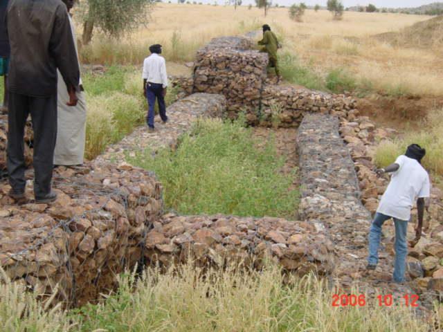
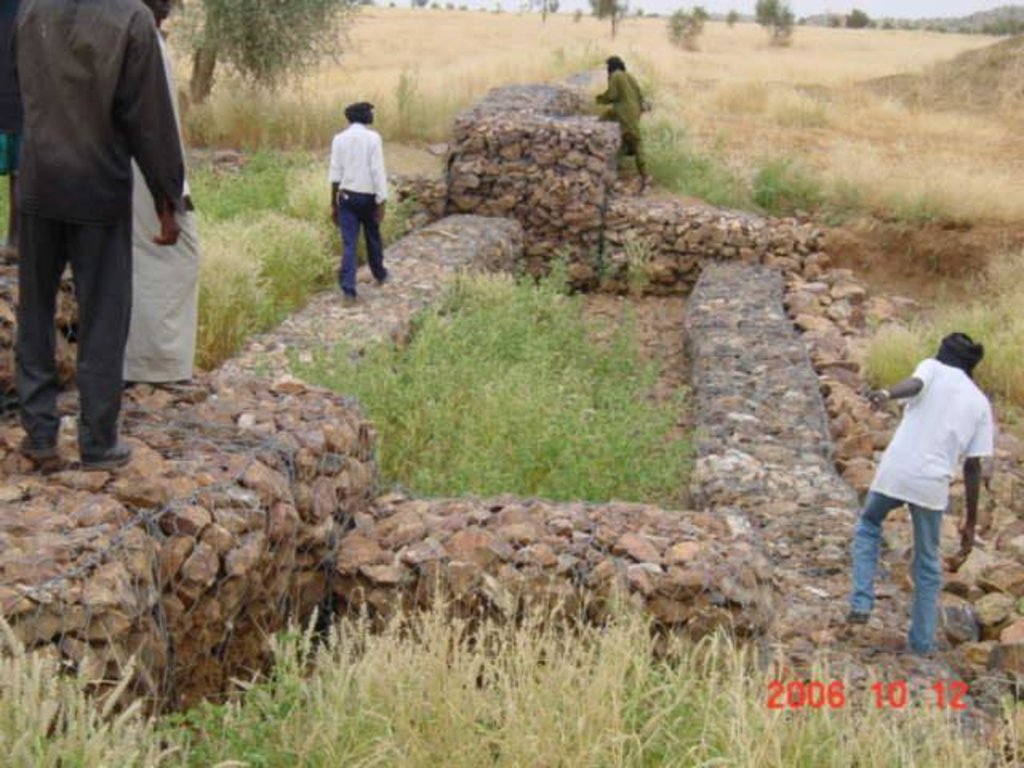
The permeable rock dam is a structure built in gullies using loose rocks and stones and sometimes reinforced with gabions. A filtering layer (blanket of gravel or small stones) is laid in a foundation trench. Further layers of medium-sized and large stones and rocks are laid on top. They are between 0.50 and 3 metres high, and the width of the foundation and the crest depends on the estimated volume of water flow. The structure built across the gully is extended to the sides with the construction of wingwalls that spread the water over a larger area to the sides of the dam. The total width of the structure is generally at least three times its height. The dams can be constructed with or without a spillway. A spillway is required when flood water flow is stronger.
Purpose of the Technology: Permeable rock dams are used to fill in gullies and control water flow. They slow the flow of floodwaters and spread the water over adjacent land. This improves infiltration, and sediment builds up behind the dams. In time, the sediment fills in the gully. This stops lateral drainage from the land on either side, increasing its productivity. High infiltration upstream of the dam contributes to recharging the groundwater system. These structures are therefore also effective in raising the water table in wells and in protecting the bottom-lands from sand filling and gully erosion. They are used in combination with other measures, such as reforestation and stone bunds, to protect and improve the surrounding area, and to increase the area of land that can be used for growing crops.
By dissipating the flow of floodwaters, they ensure better use of rainwater and are therefore important in dry periods. The conservation of water for longer periods and the fine particles of earth trapped by the structure favour the establishment of natural vegetation along it, which helps to stabilise the dam. Seeds are also trapped, favouring the spontaneous growth of grass and trees upstream and downstream, which contributes to restoring and conserving biodiversity.
Establishment / maintenance activities and inputs: The sustainability of permeable rock dams depends on the quality of construction and whether they are maintained regularly. A certain amount of expertise and good community organisation is required to repair any cracks in
the dam. Biological measures (sowing grass and planting trees) increase the stability of the structure.
The size of a permeable rock dam can vary considerably from one site to another. The cost is also affected by the distance of the site from the quarry, the topography of the terrain and the actual amount of rock carried in each lorryload. It costs less to construct this type of structure with loose stones and rocks than with gabions.
2.3 技术照片
2.5 已应用该技术的、本评估所涵盖的国家/地区/地点
国家:
布基纳法索
区域/州/省:
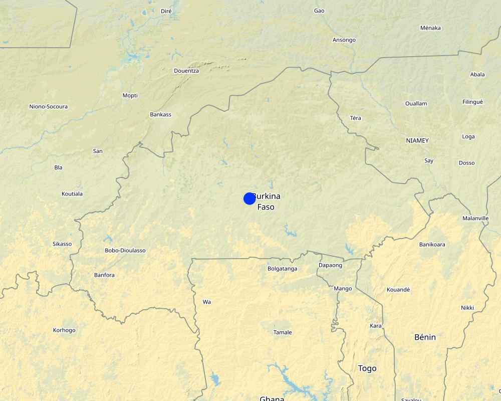
Burkina Faso, Chad
注释:
Burkina Faso & Chad
Map
×2.6 实施日期
如果不知道确切的年份,请说明大概的日期:
- 10-50年前
2.7 技术介绍
详细说明该技术是如何引入的:
- 通过项目/外部干预
注释(项目类型等):
developed, implemented and disseminated as part of projects and programmes undertaken from the 1980s onwards to combat desertification and improve natural resource management. Implemented by GIZ (German Federal Enterprise for International Cooperation), and PATECORE (project for land development and resource conservation in Plateau Central Burkina Faso)
3. SLM技术的分类
3.1 该技术的主要目的
- 减少、预防、恢复土地退化
3.2 应用该技术的当前土地利用类型
同一土地单元内混合使用的土地::
是
具体说明混合土地使用(作物/放牧/树木):
- 农牧业(包括农牧结合)

农田
- 一年一作
每年的生长季节数:
- 1
具体说明:
Longest growing period in days: 120, Longest growing period from month to month: August to October

牧场
注释:
Major land use problems (compiler’s opinion): soil erosion, surface runoff, unfertile land
Constraints of common grazing land
Constraints of forested government-owned land or commons
3.5 该技术所属的SLM组
- 横坡措施
- 引水和排水
- 地表水管理(泉、河、湖、海)
3.6 包含该技术的可持续土地管理措施

结构措施
- S5:大坝、集水斗、水池
3.7 该技术强调的主要土地退化类型

土壤水蚀
- Wt:表土流失/地表侵蚀
- Wg:冲沟侵蚀/沟蚀
- Wc:海岸侵蚀

化学性土壤退化
- Cn:肥力下降和有机质含量下降(非侵蚀所致)

生物性退化
- Bc:植被覆盖的减少

水质恶化
- Ha:干旱化
- Hg:地下水/含水层水位的变化
注释:
Main causes of degradation: soil management (Unadapted land use methods, reduced or abandoned fallow periods), floods, droughts, population pressure (rapidly growing population increasing pressure on land), land tenure (insecure access to land)
3.8 防止、减少或恢复土地退化
具体数量名该技术与土地退化有关的目标:
- 防止土地退化
- 修复/恢复严重退化的土地
4. 技术规范、实施活动、投入和成本
4.1 该技术的技术图纸
技术规范(与技术图纸相关):
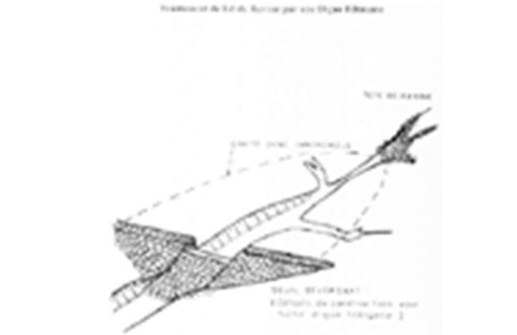
Permeable rock dam with spillway
Technical knowledge required for field staff / advisors: moderate
Technical knowledge required for land users: low
Main technical functions: control of dispersed runoff: retain / trap, control of dispersed runoff: impede / retard, control of concentrated runoff: retain / trap, control of concentrated runoff: impede / retard, control of concentrated runoff: drain / divert, stabilisation of soil (eg by tree roots against land slides), increase in nutrient availability (supply, recycling,…), increase of infiltration, increase / maintain water stored in soil, increase of groundwater level / recharge of groundwater, water harvesting / increase water supply, sediment retention / trapping, sediment harvesting
Dam/ pan/ pond
Depth of ditches/pits/dams (m): 0.5-3
Width of ditches/pits/dams (m): 9
作者:
PATECORE
4.7 影响成本的最重要因素
描述影响成本的最决定性因素:
The size of a permeable rock dam can vary considerably from one site to another. The cost is also affected by the distance of the site from the quarry, the topography of the terrain and the actual amount of rock carried in each lorryload. The use of gabions also increases the cost considerably.
cost items:
- Topographical surveying
- supply of quarry rock/stones: 113 m3 per 100 linear metres.
- Labour: depends on the size of the dam.
- Transportation by lorry: 23 lorryloads (skip loader – 4.5 m3 per load).
Other costs: Equipment (pickaxes, shovels, wheelbarrows, water-tube level, etc.).
5. 自然和人文环境
5.1 气候
年降雨量
- < 250毫米
- 251-500毫米
- 501-750毫米
- 751-1,000毫米
- 1,001-1,500毫米
- 1,501-2,000毫米
- 2,001-3,000毫米
- 3,001-4,000毫米
- > 4,000毫米
农业气候带
- 半干旱
Thermal climate class: subtropics
5.2 地形
平均坡度:
- 水平(0-2%)
- 缓降(3-5%)
- 平缓(6-10%)
- 滚坡(11-15%)
- 崎岖(16-30%)
- 陡峭(31-60%)
- 非常陡峭(>60%)
地形:
- 高原/平原
- 山脊
- 山坡
- 山地斜坡
- 麓坡
- 谷底
垂直分布带:
- 0-100 m a.s.l.
- 101-500 m a.s.l.
- 501-1,000 m a.s.l.
- 1,001-1,500 m a.s.l.
- 1,501-2,000 m a.s.l.
- 2,001-2,500 m a.s.l.
- 2,501-3,000 m a.s.l.
- 3,001-4,000 m a.s.l.
- > 4,000 m a.s.l.
关于地形的注释和进一步规范:
Slopes on average: Also moderate (6-10%), rolling (11-15%)
Landforms: Also valley floors
Altitudinal zone: Also 1000-1500 m a.s.l.
5.3 土壤
平均土层深度:
- 非常浅(0-20厘米)
- 浅(21-50厘米)
- 中等深度(51-80厘米)
- 深(81-120厘米)
- 非常深(> 120厘米)
土壤质地(表土):
- 中粒(壤土、粉土)
- 细粒/重质(粘土)
如有可能,附上完整的土壤描述或具体说明可用的信息,例如土壤类型、土壤酸碱度、阳离子交换能力、氮、盐度等。:
Soil fertility: Medium and low
Soil drainage/infiltration: Medium and poor
Soil water storage capacity: Medium and low
5.4 水资源可用性和质量
地下水位表:
5-50米
地表水的可用性:
中等
5.5 生物多样性
物种多样性:
- 低
5.6 应用该技术的土地使用者的特征
相对财富水平:
- 非常贫瘠
- 贫瘠
性别:
- 男人
说明土地使用者的其他有关特征:
Population density: 10-50 persons/km2
Annual population growth: 3% - 4% (mostly poor households below poverty line).
Off-farm income specification: men migrate temporarily or permanently to cities for off-farm income
5.7 应用该技术的土地使用者使用的平均土地面积
- < 0.5 公顷
- 0.5-1 公顷
- 1-2 公顷
- 2-5公顷
- 5-15公顷
- 15-50公顷
- 50-100公顷
- 100-500公顷
- 500-1,000公顷
- 1,000-10,000公顷
- > 10,000公顷
这被认为是小规模、中规模还是大规模的(参照当地实际情况)?:
- 小规模的
5.8 土地所有权、土地使用权和水使用权
土地所有权:
- 州
土地使用权:
- 社区(有组织)
用水权:
- 社区(有组织)
注释:
traditional land use rights on fields, common lands on pasture and forest land
5.9 进入服务和基础设施的通道
健康:
- 贫瘠
- 适度的
- 好
教育:
- 贫瘠
- 适度的
- 好
技术援助:
- 贫瘠
- 适度的
- 好
就业(例如非农):
- 贫瘠
- 适度的
- 好
市场:
- 贫瘠
- 适度的
- 好
能源:
- 贫瘠
- 适度的
- 好
道路和交通:
- 贫瘠
- 适度的
- 好
饮用水和卫生设施:
- 贫瘠
- 适度的
- 好
金融服务:
- 贫瘠
- 适度的
- 好
6. 影响和结论性说明
6.1 该技术的现场影响
社会经济效应
生产
作物生产
饲料生产
木材生产
生产区域
收入和成本
农业收入
社会文化影响
食品安全/自给自足
SLM/土地退化知识
Improved livelihoods and human well-being
注释/具体说明:
As these dams are used in valley bottoms and the beds of seasonal streams to increase infiltration, they can also contribute to raising the water table. Such sites are particularly suitable for horticulture and market gardening, which is important in the off-season. The produce supplements the food available and is an extra source of income.
生态影响
水循环/径流
水的回收/收集
地表径流
地下水位/含水层
土壤
土壤水分
土壤覆盖层
土壤流失
养分循环/补给
生物多样性:植被、动物
植物多样性
6.2 该技术的场外影响已经显现
下游洪水
下游淤积
6.3 技术对渐变气候以及与气候相关的极端情况/灾害的暴露和敏感性(土地使用者认为的极端情况/灾害)
渐变气候
渐变气候
| 季节 | 增加或减少 | 该技术是如何应对的? | |
|---|---|---|---|
| 年温度 | 增加 | 好 |
气候有关的极端情况(灾害)
气象灾害
| 该技术是如何应对的? | |
|---|---|
| 局地暴雨 | 不好 |
| 局地风暴 | 好 |
气候灾害
| 该技术是如何应对的? | |
|---|---|
| 干旱 | 好 |
水文灾害
| 该技术是如何应对的? | |
|---|---|
| 比较和缓的(河道)洪水 | 不好 |
其他气候相关的后果
其他气候相关的后果
| 该技术是如何应对的? | |
|---|---|
| 缩短生长期 | 好 |
注释:
Physical structures can be biologically stabilized through planting of grass, bushes or trees. Damages are generally small but need to be repaired quickly.
6.4 成本效益分析
技术收益与技术建立成本相比如何(从土地使用者的角度看)?
短期回报:
积极
长期回报:
积极
技术收益与技术维护成本/经常性成本相比如何(从土地使用者的角度看)?
短期回报:
积极
长期回报:
非常积极
6.5 技术采用
注释:
There is a little trend towards spontaneous adoption of the Technology
Comments on adoption trend: The potential for replication depends on the type of terrain and whether there is a supply of rocks nearby.
6.7 该技术的优点/长处/机会
| 编制者或其他关键资源人员认为的长处/优势/机会 |
|---|
| Permeable rock dams are used to fill in gullies and control water flow. They slow the flow of floodwaters and spread the water over adjacent land. This improves infiltration, and sediment builds up behind the dams. In time, the sediment fills in the gully which favours the establishment of natural vegetation along it, which helps to stabilise the dam. Seeds are also trapped, favouring the spontaneous growth of grass and trees upstream and downstream, which contributes to restoring and conserving biodiversity. |
| By dissipating floodwater flow, they also contribute to reducing sand filling in valleys further downstream. |
| As these dams are used in valley bottoms and the beds of seasonal streams to increase infiltration, they can also contribute to raising the water table. Such sites are particularly suitable for horticulture and market gardening, which is important in the off-season. The produce supplements the food available and is an extra source of income. |
| increase the area of land that can be used for growing crops |
6.8 技术的弱点/缺点/风险及其克服方法
| 编制者或其他关键资源人员认为的弱点/缺点/风险 | 如何克服它们? |
|---|---|
| Depending on the size of the dam, the construction of this type of structure may require a high level of engineering expertise (topographical surveying, calculation of floodwater flow).It also requires a large amount of quarry rocks, which means that the cost of the structure and the labour and transport required is significantly higher than for structures made with stones. As the data required for calculating floodwater flow is often unavailable, the dams must be observed during the first few years, so that they can be reinforced and repaired if necessary. | It is important for farmers to have access to partners providing the necessary know-how, means of transport and support for community organisation. The community must be trained to carry out repair work. |
7. 参考和链接
7.1 信息的方法/来源
- 实地考察、实地调查
- 与土地使用者的访谈
(现场)数据是什么时候汇编的?:
01/07/2012
7.3 链接到网络上的相关信息
标题/说明:
Good Practices in Soil and Water Conservation. A contribution to adaptation and farmers´ resilience towards climate change in the Sahel. Published by GIZ in 2012.
URL:
http://agriwaterpedia.info/wiki/Main_Page
链接和模块
全部展开 全部收起链接
无链接
模块
无模块


