Технология управлениия пастбищами в условиях Западного Памира [Tajikistan]
- Creation:
- Update:
- Compiler: Aslam Qadamov
- Editor: –
- Reviewers: David Streiff, Alexandra Gavilano
технологияия идоракунии чарогоххо дар шароити Помири Гарби
technologies_1363 - Tajikistan
View sections
Expand all Collapse all1. General information
1.2 Contact details of resource persons and institutions involved in the assessment and documentation of the Technology
SLM specialist:
Tajikistan
Name of the institution(s) which facilitated the documentation/ evaluation of the Technology (if relevant)
Pamir Biological Institute (Pamir Biological Institute) - Tajikistan1.3 Conditions regarding the use of data documented through WOCAT
The compiler and key resource person(s) accept the conditions regarding the use of data documented through WOCAT:
Ja
1.5 Reference to Questionnaire(s) on SLM Approaches

Pasture inclination used for developing grazing plan [Tajikistan]
In this approach the inclination of pasture land and its effect on the spread of sun and shadow is used to identify different periods for grazing. This simple approach will raise awareness and provides biological aspects in pasture management. In this approach the vegetation cover of the pasture is linked …
- Compiler: Askarsho Zevarshoev

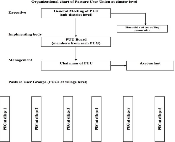
Cluster Level Pasture User Union [Tajikistan]
Pasture User Unions (PUUs) at cluster level is consolidating several communities to jointly plan and implement pasture and livestock management related interventions. This approach is supporting to cover big area of pasture lands, which is used by several communities and do not have physical boundaries to define. Therefore joint planning …
- Compiler: Askarsho Zevarshoev

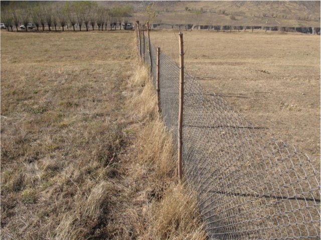
Rehabilitation of Pasture Land through fencing [Tajikistan]
The approach demonstrates the effect and importance of rotational grazing by fencing certain areas of land in pasture areas as well as it demonstrates the rehabilitation process in comparison to the open space which is overgrazed. The approach involves mobilizing communities to observe the rehabilitation process by not grasing in …
- Compiler: Askarsho Zevarshoev
2. Description of the SLM Technology
2.1 Short description of the Technology
Definition of the Technology:
Управление пастбищных угодий путем внедрения новой техники пастбищеоборота с учетом емкости пастбища
2.2 Detailed description of the Technology
Description:
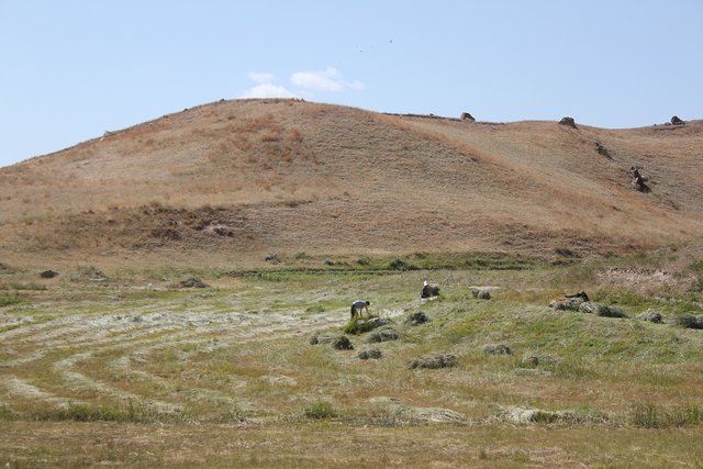
На Восточном Памирме имеется более 1 млн. га пастбищных угодий однако они малопродуктивны, что отрицательно сказывается на развитие животноводство в этом районе. В Советское время широко использовались отдаленные пастбища поэтому и их ротация в течение года, что способстововало рациональному использованию пастбищных угодий. В последние годы из за нарушения пастбищеоборота близко расположенные пастбища сильно деградированы. Технология предусматривает возможность рационального использования близко расположенных пастбищ путем перекачки скота 2-3 раза по каждому ущелью с промежутками в 30 дней. При этом необходимо соблюдать норму содержание скота в каждой отаре и их размешать в каждом пастбище и перекачивать с учетом емкости пастбища
Назначение технологии: Предотвращение процессов опустынивания и эрозии почвы пастбищных угодий.
Основные действия и вложения: Особенность технологии заключается в том, что для каждого фермера отводится определенная площадь, где определяется продуктивность пастбища, питательная ценность произрастающих там кормовых растений, а также определяется емкость площади. С учетом емкости пастбища на этой площади размещают определенное количество скота на определенный период. После истечения срока скот перегоняют на расположенные сверху пастбища, продолжая этот процесс до конца осени. Через 50-60 дней перекачки скота травостой достигает определенной высоты и доступен для стравливания скотом. На каждом пастбищном участке ежегодно проводят оборот пастбища с учетом их визуального состояния
Природная\социальная обстановка: Жесткие климатические условия, долгая зима, но малоснежная, лето короткое и прохладное. Среднегодовая температура воздуха от -1 до -4,3*С. Почвенный покров - высокогорный, пустынный. Население занимается исключительно скотоводством. Численность населения 14 тыс. Безработица более 60 %.
2.5 Country/ region/ locations where the Technology has been applied and which are covered by this assessment
Country:
Tajikistan
Region/ State/ Province:
ГБАО
Further specification of location:
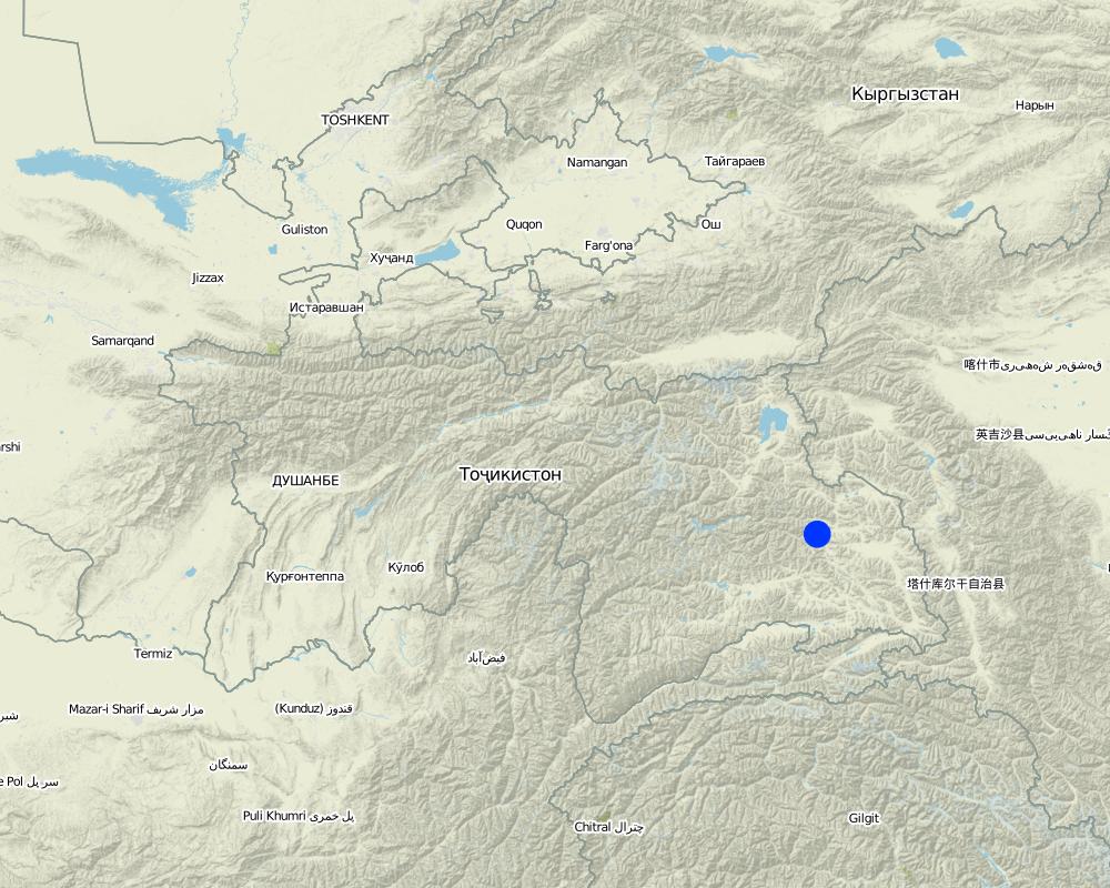
Мургаб
Map
×2.6 Date of implementation
If precise year is not known, indicate approximate date:
- less than 10 years ago (recently)
2.7 Introduction of the Technology
Specify how the Technology was introduced:
- during experiments/ research
Comments (type of project, etc.):
технология была внедрена в 2010 году
3. Classification of the SLM Technology
3.1 Main purpose(s) of the Technology
- reduce, prevent, restore land degradation
3.2 Current land use type(s) where the Technology is applied

Grazing land
Extensive grazing land:
- Nomadism
Comments:
Основные проблемы землепользования (по мнению составителя): Снижение продуктивности естественных пастбищ, сокращение плодородие почвы, ускорение процессов опустынивания
Основные проблемы землепользования (по мнению землепользователя): усиление эрозии почвы и снижение продуктивности пастбищ
Скот: яки и овцы
Землепользование после внедрения УЗП технологии: Пастбище: Ge: Экстенсивное пастбище
3.3 Further information about land use
Number of growing seasons per year:
- 1
Specify:
Вегетативный период (дни): 120Вегетативный период по месяцам: май по август
Livestock density (if relevant):
< 1 УГ/км2
3.4 SLM group to which the Technology belongs
- pastoralism and grazing land management
3.5 Spread of the Technology
Comments:
Общая площадь, на которой задействована технология, 0.1 m2.
3.6 SLM measures comprising the Technology

management measures
- M1: Change of land use type
Comments:
Основные мероприятия: управленческие
3.7 Main types of land degradation addressed by the Technology

biological degradation
- Bc: reduction of vegetation cover
Comments:
Основные типы деградации: Бр (Bc): уменьшение растительного покрова
Основные причины деградации: управление землеи, чрезмерное использование растительного покрова для бытовых целей (корчевка терескена), чрезмерный выпас (рост поголовье скота), изменение сезонных дождей (уменьшение количество осадков в летнее время), интенсивная эксплуатация населением (рост численности населения), бедность / богатство (нехватки горючего)
Второстепенные причины деградации: землепользование
3.8 Prevention, reduction, or restoration of land degradation
Specify the goal of the Technology with regard to land degradation:
- prevent land degradation
- restore/ rehabilitate severely degraded land
Comments:
Основная цель: предупреждение деградации земель
Второстепенные цели: реабилитация / восстановление голых земель
4. Technical specifications, implementation activities, inputs, and costs
4.1 Technical drawing of the Technology
Author:
Акназаров Худодод, г. Хорог, ул Холдорова 1
4.2 Technical specifications/ explanations of technical drawing
Место расположения: Мургаб. ГБАО
Дата: 20 июля 2010
Необходимые технические навыки для работников: средний
Необходимые технические навыки для землепользователей: низкий
Основные технические функции: улучшение земляного покрова, содействие росту видов и сортов растительности (качество, например поедаемые кормовые культуры)
4.3 General information regarding the calculation of inputs and costs
Specify currency used for cost calculations:
- US Dollars
other/ national currency (specify):
сомони
Indicate average wage cost of hired labour per day:
5.00
4.5 Costs and inputs needed for establishment
| Specify input | Unit | Quantity | Costs per Unit | Total costs per input | % of costs borne by land users | |
|---|---|---|---|---|---|---|
| Labour | труд | га | 1.0 | 100.0 | 100.0 | 100.0 |
| Equipment | Инструменты | га | 1.0 | 50.0 | 50.0 | 50.0 |
| Total costs for establishment of the Technology | 150.0 | |||||
Comments:
Сроки создания: 5 месяцев
5. Natural and human environment
5.1 Climate
Annual rainfall
- < 250 mm
- 251-500 mm
- 501-750 mm
- 751-1,000 mm
- 1,001-1,500 mm
- 1,501-2,000 mm
- 2,001-3,000 mm
- 3,001-4,000 mm
- > 4,000 mm
Agro-climatic zone
- arid
Термический класс климата: умеренный
5.2 Topography
Slopes on average:
- flat (0-2%)
- gentle (3-5%)
- moderate (6-10%)
- rolling (11-15%)
- hilly (16-30%)
- steep (31-60%)
- very steep (>60%)
Landforms:
- plateau/plains
- ridges
- mountain slopes
- hill slopes
- footslopes
- valley floors
Altitudinal zone:
- 0-100 m a.s.l.
- 101-500 m a.s.l.
- 501-1,000 m a.s.l.
- 1,001-1,500 m a.s.l.
- 1,501-2,000 m a.s.l.
- 2,001-2,500 m a.s.l.
- 2,501-3,000 m a.s.l.
- 3,001-4,000 m a.s.l.
- > 4,000 m a.s.l.
5.3 Soils
Soil depth on average:
- very shallow (0-20 cm)
- shallow (21-50 cm)
- moderately deep (51-80 cm)
- deep (81-120 cm)
- very deep (> 120 cm)
Soil texture (topsoil):
- medium (loamy, silty)
Topsoil organic matter:
- medium (1-3%)
5.4 Water availability and quality
Ground water table:
5-50 m
Availability of surface water:
medium
Water quality (untreated):
good drinking water
Comments and further specifications on water quality and quantity:
Доступность поверхностной влаги: средняя, плохая/ отсутствует
5.5 Biodiversity
Species diversity:
- medium
5.6 Characteristics of land users applying the Technology
Market orientation of production system:
- subsistence (self-supply)
Off-farm income:
- less than 10% of all income
Relative level of wealth:
- very poor
- poor
Individuals or groups:
- groups/ community
Gender:
- women
- men
Indicate other relevant characteristics of the land users:
Землепользователи, применяющие данную технологию, в основном среднестатистические
Плотность населения: < 10 человек/км2
Годовой прирост населения: < 0.5%
5% землепользователей богатые и владеют 20% земли
5% землепользователей среднего достатка и владеют 20% земли
80% землепользователей бедные и владеют 50% земли
10% землепользователей бедные и владеют 10% земли
5.7 Average area of land owned or leased by land users applying the Technology
- < 0.5 ha
- 0.5-1 ha
- 1-2 ha
- 2-5 ha
- 5-15 ha
- 15-50 ha
- 50-100 ha
- 100-500 ha
- 500-1,000 ha
- 1,000-10,000 ha
- > 10,000 ha
Is this considered small-, medium- or large-scale (referring to local context)?
- small-scale
5.8 Land ownership, land use rights, and water use rights
Land ownership:
- state
Land use rights:
- communal (organized)
Water use rights:
- open access (unorganized)
5.9 Access to services and infrastructure
health:
- poor
- moderate
- good
education:
- poor
- moderate
- good
technical assistance:
- poor
- moderate
- good
employment (e.g. off-farm):
- poor
- moderate
- good
markets:
- poor
- moderate
- good
energy:
- poor
- moderate
- good
roads and transport:
- poor
- moderate
- good
drinking water and sanitation:
- poor
- moderate
- good
financial services:
- poor
- moderate
- good
6. Impacts and concluding statements
6.1 On-site impacts the Technology has shown
Socio-economic impacts
Production
fodder production
Quantity before SLM:
0,05
Quantity after SLM:
1,3 т/га
fodder quality
Quantity before SLM:
5%
Quantity after SLM:
50%
animal production
Quantity before SLM:
20%
Quantity after SLM:
40%
6.3 Exposure and sensitivity of the Technology to gradual climate change and climate-related extremes/ disasters (as perceived by land users)
Gradual climate change
Gradual climate change
| Season | Type of climatic change/ extreme | How does the Technology cope with it? | |
|---|---|---|---|
| annual temperature | increase | not well |
Other climate-related consequences
Other climate-related consequences
| How does the Technology cope with it? | |
|---|---|
| reduced growing period | not well |
6.7 Strengths/ advantages/ opportunities of the Technology
| Strengths/ advantages/ opportunities in the land user’s view |
|---|
|
возможность кормопроизводства Как можно сохранять устойчивость или усилить? все время |
| Strengths/ advantages/ opportunities in the compiler’s or other key resource person’s view |
|---|
|
предотвращение эрозии почвы путем поддержания оптимальной нагрузки на почвенную растительность Как можно сохранять устойчивость или усилить? все время |
|
низкая себестоимость кормов для животноводство Как можно сохранять устойчивость или усилить? все время |
Links and modules
Expand all Collapse allLinks

Pasture inclination used for developing grazing plan [Tajikistan]
In this approach the inclination of pasture land and its effect on the spread of sun and shadow is used to identify different periods for grazing. This simple approach will raise awareness and provides biological aspects in pasture management. In this approach the vegetation cover of the pasture is linked …
- Compiler: Askarsho Zevarshoev

Cluster Level Pasture User Union [Tajikistan]
Pasture User Unions (PUUs) at cluster level is consolidating several communities to jointly plan and implement pasture and livestock management related interventions. This approach is supporting to cover big area of pasture lands, which is used by several communities and do not have physical boundaries to define. Therefore joint planning …
- Compiler: Askarsho Zevarshoev

Rehabilitation of Pasture Land through fencing [Tajikistan]
The approach demonstrates the effect and importance of rotational grazing by fencing certain areas of land in pasture areas as well as it demonstrates the rehabilitation process in comparison to the open space which is overgrazed. The approach involves mobilizing communities to observe the rehabilitation process by not grasing in …
- Compiler: Askarsho Zevarshoev
Modules
No modules


