'Forage Christine' [Burkina Faso]
- Creation:
- Update:
- Compiler: Nouhoun Zampaligré
- Editor: –
- Reviewers: Rima Mekdaschi Studer, Simone Verzandvoort, Donia Mühlematter
Forage Christine
technologies_2994 - Burkina Faso
View sections
Expand all Collapse all1. General information
1.2 Contact details of resource persons and institutions involved in the assessment and documentation of the Technology
Name of project which facilitated the documentation/ evaluation of the Technology (if relevant)
Book project: Guidelines to Rangeland Management in Sub-Saharan Africa (Rangeland Management)Name of the institution(s) which facilitated the documentation/ evaluation of the Technology (if relevant)
INERA Institut de l'environnement et de recherches agricoles (INERA Institut de l'environnement et de recherches agricoles) - Burkina Faso1.3 Conditions regarding the use of data documented through WOCAT
When were the data compiled (in the field)?
01/06/2017
The compiler and key resource person(s) accept the conditions regarding the use of data documented through WOCAT:
Ja
1.4 Declaration on sustainability of the described Technology
Is the Technology described here problematic with regard to land degradation, so that it cannot be declared a sustainable land management technology?
Nee
2. Description of the SLM Technology
2.1 Short description of the Technology
Definition of the Technology:
A modern hydraulic complex in the centre of the Sahelian region of Burkina Faso for watering livestock in the dry season.
2.2 Detailed description of the Technology
Description:
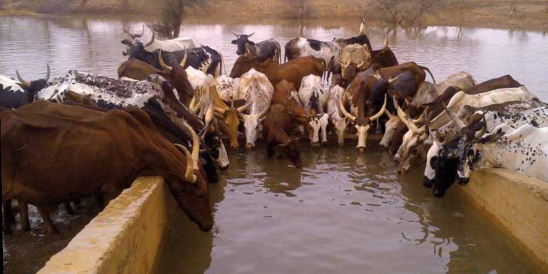
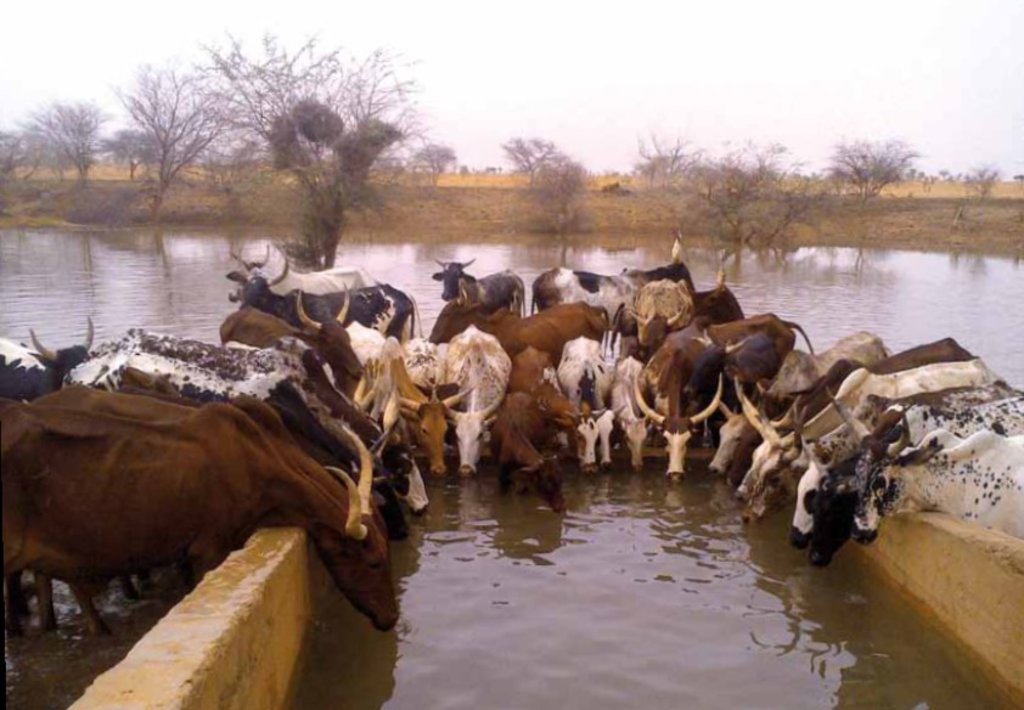
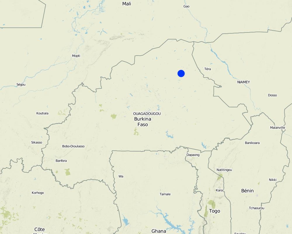
'Forage Christine' is a major water infrastructure, established in the northern part of the Sahel region in Burkina Faso between longitude 0°45’W and latitude 14°48’N, providing drinking water to herds within an area of 100 to 300 km from its central location between Burkina Faso, Mali and Niger. It was established in 1971 in the context of major droughts that had affected the Sahel, and it was opened for the first time in 1972. It is located in the middle of the Sahel region of Burkina Faso, at two km from the pond of Tin-Arkachen in the department of Déou, at approximately 45 km from the capital of the department, and 85 km from Gorom-Gorom. At the sub-regional level, the well is a around ten km from the border with Mali, and at 100 km from the border with Niger. The climate is of Sahelian type, and has a rainy season of 3 to 4 months (from June-July to September), which is subject to strong temporal and spatial variations in precipitation, and a dry season of 8 to 9 months. The climatic conditions are characterized by highly irregular winds, precipitation, evapotranspiration and moisture due to fluctuations in atmospheric circulation patterns. Annual precipitation is around 500 mm on average, with roughly 30 rainy days, and is marked by significant inter-annual variations. The stream network of the region consists of several streams, with one permanent river: Béli. To this river, ponds and many depressions are connected, which disappear after the month of January. The soils are very diverse in general, and mostly of sandy texture. They do not provide a good medium for plant growth due to the low permeability, which reduces water infiltration. Therefore water availability appears to be one of the major limitations for rainfed agriculture, in addition to the limited retention and availability of nutrients. According to the phytogeographic division of Burkina Faso (Fontes and Guinko, 1995), the area of 'Forage Christine' is situated in the northern or strict Sahelian phytogeographic sector. This sector is characterized by a set of typical Saharan and Sahelian vegetation species which mainly occur in shrub and woody steppes (48.85%) and grassy steppes (24.37%), which form the larger part of the rangelands (***). This vegetation provides the most important natural grazing land to livestock.
With regard to the human environment, the last General Population and Housing Census mentions a population of 25321 inhabitants for the municipality of Déou. Yet this number varies significantly due to the seasonal migration of people from other regions to use water and forage resources. The ethnic groups in the region are mainly Fulbé, Kurumba, Songhai, Tuareg, Mossi and Hausa people.
Economic activities in the region are livestock keeping, farming, craftmanship, fishing, trade, tourism and hunting. Several socio-economic groups are guiding these activities. Some 60 farmer groups, 53 groups of livestock keepers, six of which for female livestock keepers, and three organisations for environmental protection. With regard to infrastructure for education, sanitation and socio-economical conditions, the municipality of Déou has three markets, 18 schools, one middle school, 47 permanent functional literacy centers (CPAF), one recreation center, six cereal banks, three healthcare and welfare centers (CSPS), three medical stores, one tourist camp and one financial institution.
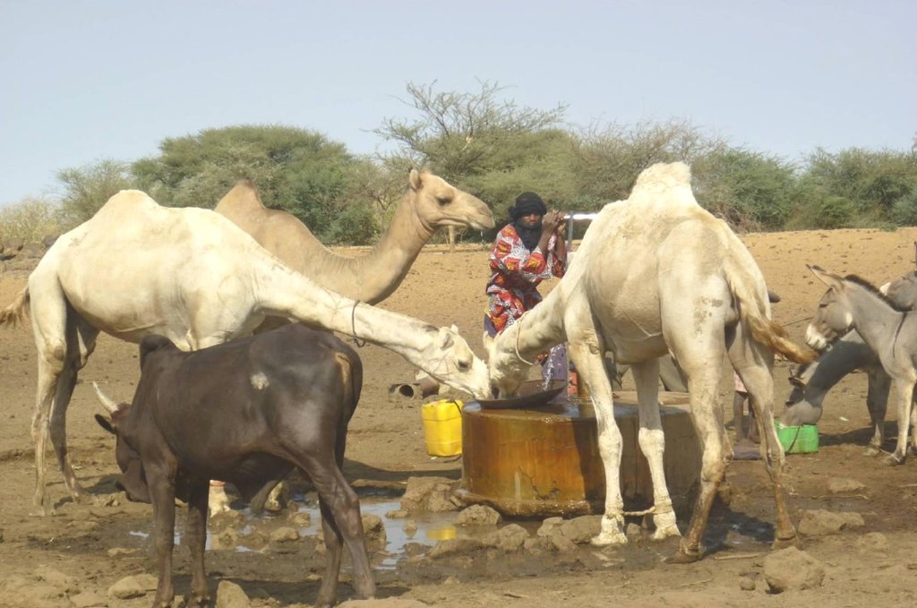
Farming and livestock keeping continue to be the most important socio-economic activities. The agricultural crops produced include millet, sorghum, maize, cowpea, rice and groundnut. In 2009, a total area of 345.5 ha was sown for these crops. The Sahel region in Burkina Faso has excellent conditions for livestock keeping. The animal species found in the region are mainly cattle, sheep, goats, pigs, camels, donkeys and horses and poultry. Several facilities and installations for water supply to pastoral areas are available in the region, as well as storage facilities for agricultural and agro-industrial by-products (SPAI) and infrastructure for trade and animal health care. The municipality of Déou disposes of one reservoir, five artificial ponds, 43 firm wells, ten vaccination centers, one store for agricultural and agro-industrial by-products (SPAI), one animal shelter, a facility for slaughtering and a livestock market.
The well called 'Forage Christine' was constructed in 1971 by a French engineer, which named it after his wife, and opened it for the first time in 1972. Due to conflicts between Burkina and Mali it was ruined in 1976, and then again in 1985. In 1996 the National Office for Wells and Boreholes (ONFP), a government agency, rehabilitated the well and made two supplementary boreholes. The complex consists of a main well with an operating flow rate of 120 m3/h, having a submersible pump of brand KSB, type OPA 150s-65/8, and a pump capacity of 60 m3/h. Next to the main well there is a secondary well, which is equipped with a hand-operated pump with a capacity of 18 m3/h.
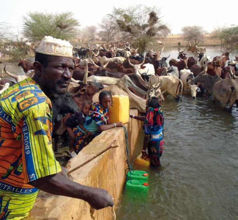
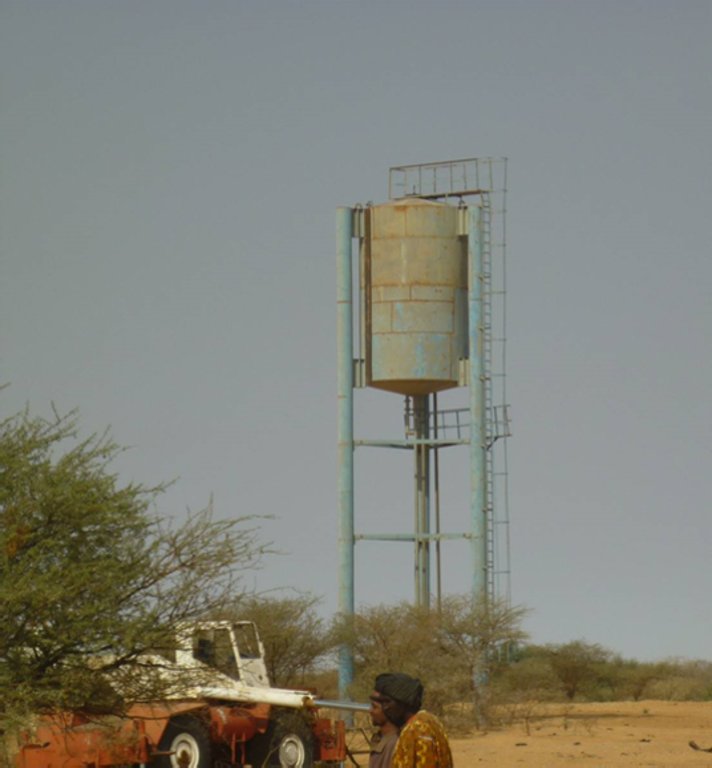
The energy for pumping water from the wells is provided by a generator with an engine of brand DEUTZ (type: F3 - 6L 912) and a switch of brand LEROY SOMER – Type LSA 42.1 L8L C1/4, a voltage of 400 V and continuous power of 50 kW. The generator has a switch and a battery. A diesel tank with a volume of approximately 9 m3 was installed for the power supply to the generator. The pumped water is stored in an elevated water tank, which is located at a distance of about 200 m from the well, and has a volume of 50 m3. The water from the elevated water tank is distributed to four artificial ponds with a dimension of 50 m x 50 m x 1.5 m at equal distances on all sides of the central reservoir. The water is conducted to the artificial ponds through PVC piping, which is buried underground over a distance of 8 km, or 2 km for each pond. The water flow is controlled by nine valves of type Nr. 4000, Reg. Nr. W 1.129, installed on the pipes. The hydraulic complex was installed in 1996 by the National Agency for Water and Sanitation (ONEA). The complex is managed by the livestock keepers through the User Association of 'Forage Christine' (AUFC). The statutes of this organisation were adopted on 2 May 2014. The well is managed according to a set of requirements which specify the terms for access to water: date of opening and closure of the well, the amount to be paid per animal and the management of the cash money provided.
2.3 Photos of the Technology
General remarks regarding photos:
The dates of the picture and the photographer are unknown.
2.4 Videos of the Technology
Comments, short description:
No video
2.5 Country/ region/ locations where the Technology has been applied and which are covered by this assessment
Country:
Burkina Faso
Region/ State/ Province:
Sahel/Oudalan
Further specification of location:
Déou
Comments:
The infrastructure was created in 1971, but the facilities for use were installed in 1996.
Map
×2.6 Date of implementation
Indicate year of implementation:
1971
2.7 Introduction of the Technology
Specify how the Technology was introduced:
- through projects/ external interventions
Comments (type of project, etc.):
A French aid worker introduced the technology with support from the government of Burkina Faso, through the National Agency for Water and Sanitation (ONEA).
3. Classification of the SLM Technology
3.1 Main purpose(s) of the Technology
- adapt to climate change/ extremes and its impacts
- create beneficial economic impact
- create beneficial social impact
3.2 Current land use type(s) where the Technology is applied

Cropland

Grazing land
Extensive grazing land:
- Semi-nomadism/ pastoralism
Main animal species and products:
Animal species: cattle, sheep, camels, donkeys and goats.
Comments:
In addition to livestock keeping, subsistence farming is practiced. The main crops are sorghum, millet, groundnut and cowpea. The size of the fields varies between 0.5 and 3 ha. The farm type is family-based.
If land use has changed due to the implementation of the Technology, indicate land use before implementation of the Technology:
No change in land use due to the implementation of the technology.
3.3 Further information about land use
Water supply for the land on which the Technology is applied:
- rainfed
Number of growing seasons per year:
- 1
Specify:
Mid-June to September
3.4 SLM group to which the Technology belongs
- pastoralism and grazing land management
- ground water management
3.5 Spread of the Technology
Specify the spread of the Technology:
- applied at specific points/ concentrated on a small area
Comments:
The well is located in the municipality of Déou, but is used for livestock from the entire Sahel region in Burkina Faso, Mali and Niger.
3.6 SLM measures comprising the Technology

structural measures
- S7: Water harvesting/ supply/ irrigation equipment
3.7 Main types of land degradation addressed by the Technology

water degradation
- Ha: aridification
- Hs: change in quantity of surface water
- Hg: change in groundwater/aquifer level
- Hp: decline of surface water quality

other
Comments:
The technology aims to remediate water scarcity for livestock during the dry season.
3.8 Prevention, reduction, or restoration of land degradation
Specify the goal of the Technology with regard to land degradation:
- reduce land degradation
4. Technical specifications, implementation activities, inputs, and costs
4.1 Technical drawing of the Technology
4.2 Technical specifications/ explanations of technical drawing
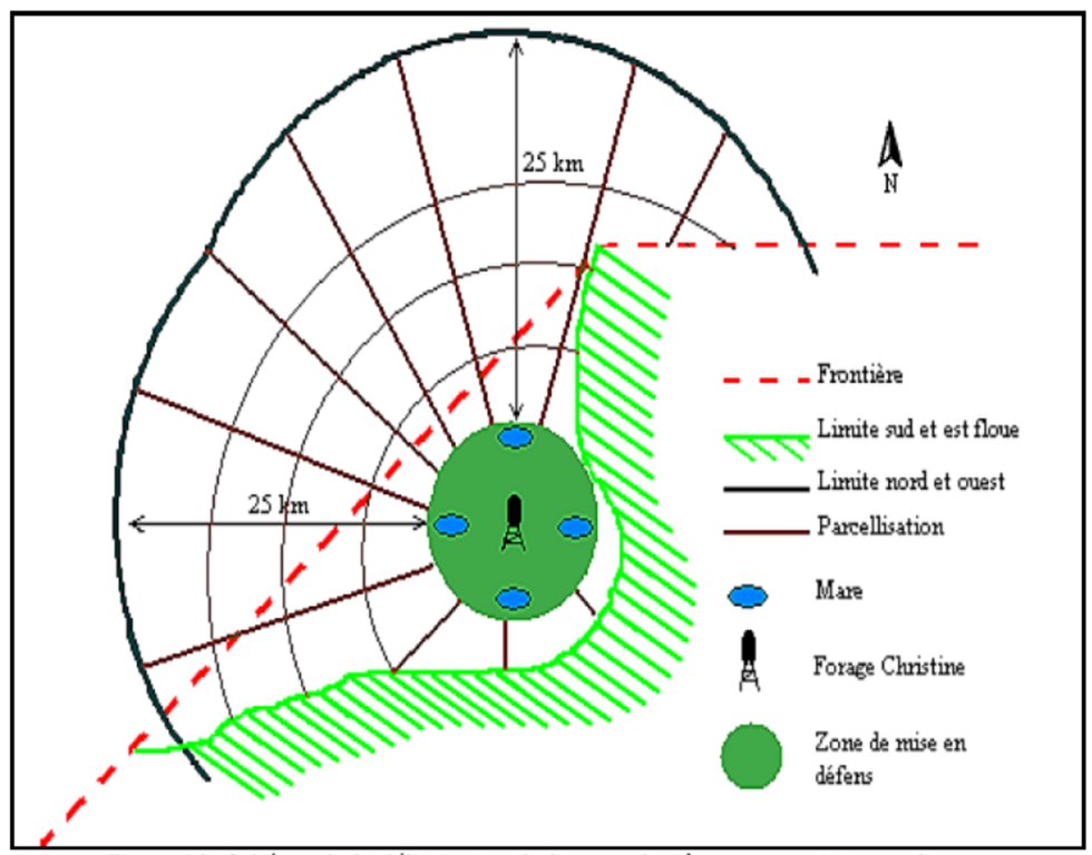
1. Main well, flow rate 120 m3/h.
2. Secondary well, flow rate 18 m3/h.
3. Submersible pump, brand KSB, type OPA 150s-65/8, flow rate 60m3/h, year of constrcuction1996
4. Elevated water storage tank, volume 50 m3.
5. Four ponds of 50 m x 50 m x 1.5 m.
4.3 General information regarding the calculation of inputs and costs
Specify how costs and inputs were calculated:
- per Technology unit
other/ national currency (specify):
FCFA
Indicate exchange rate from USD to local currency (if relevant): 1 USD =:
550.0
Indicate average wage cost of hired labour per day:
35 000 per month
4.4 Establishment activities
| Activity | Type of measure | Timing | |
|---|---|---|---|
| 1. | Main well | Structural | |
| 2. | Elevated water storage tank | Structural | |
| 3. | Artificial ponds | Structural |
Comments:
Not evaluated.
4.5 Costs and inputs needed for establishment
Comments:
Not applicable.
4.6 Maintenance/ recurrent activities
| Activity | Type of measure | Timing/ frequency | |
|---|---|---|---|
| 1. | Use of diesel | Management | year |
| 2. | Use of oil and filters | Management | year |
| 3. | Periodic maintenance of the generator | Management | year |
| 4. | Fuel delivery | Management | year |
| 5. | Transport costs of the maintenance operator | Management | year |
| 6. | Wage of the guard | Management | year |
| 7. | Compensation of the manager of the generator | Management | year |
| 8. | Charges for accounting | Management | year |
4.7 Costs and inputs needed for maintenance/ recurrent activities (per year)
| Specify input | Unit | Quantity | Costs per Unit | Total costs per input | % of costs borne by land users | |
|---|---|---|---|---|---|---|
| Labour | Periodic maintenance of the generator | season | 1.0 | 150000.0 | 150000.0 | |
| Labour | Compensation of the GE manager | person-month | 12.0 | 37500.0 | 450000.0 | |
| Labour | Charges for accounting | person-month | 12.0 | 175.0 | 2100.0 | |
| Labour | Wage of the guard | person-month | 12.0 | 50000.0 | 600000.0 | |
| Other | Use of diesel | season | 1.0 | 2921000.0 | 2921000.0 | |
| Other | Use of oil, filters | season | 1.0 | 68000.0 | 68000.0 | |
| Other | Reparations to the hydraulic complex | season | ||||
| Other | Fuel delivery | season | 1.0 | 125000.0 | 125000.0 | |
| Other | Transport costs of maintenance operator | season | 1.0 | 60000.0 | 60000.0 | |
| Total costs for maintenance of the Technology | 4376100.0 | |||||
If land user bore less than 100% of costs, indicate who covered the remaining costs:
The municipality, the management committee and the NGOs operating in the area (SNV).
4.8 Most important factors affecting the costs
Describe the most determinate factors affecting the costs:
1. Availability of fuel for the generator.
2. Failures in the functioning of the generator to fill the storage tanks.
5. Natural and human environment
5.1 Climate
Annual rainfall
- < 250 mm
- 251-500 mm
- 501-750 mm
- 751-1,000 mm
- 1,001-1,500 mm
- 1,501-2,000 mm
- 2,001-3,000 mm
- 3,001-4,000 mm
- > 4,000 mm
Specify average annual rainfall (if known), in mm:
500.00
Specifications/ comments on rainfall:
Mean annual rainfall is around 500 mm, with approximately 30 rainy days and characterized by a strong variation between years. The water system has many streams, of which only one is permanent (the Béli river). To this river, ponds and many depressions are connected, which disappear after the month of January.
Indicate the name of the reference meteorological station considered:
Station of Gorom-Gorom
Agro-climatic zone
- semi-arid
The climate is of Sahelian type, and has a rainy season of 3 to 4 months (from June-July to September), which is subject to strong temporal and spatial variations in precipitation, and a dry season of 8 to 9 months. The climatic conditions are characterized by highly irregular winds, precipitation, evapotranspiration and moisture due to fluctuations in atmospheric circulation patterns.
5.2 Topography
Slopes on average:
- flat (0-2%)
- gentle (3-5%)
- moderate (6-10%)
- rolling (11-15%)
- hilly (16-30%)
- steep (31-60%)
- very steep (>60%)
Landforms:
- plateau/plains
- ridges
- mountain slopes
- hill slopes
- footslopes
- valley floors
Altitudinal zone:
- 0-100 m a.s.l.
- 101-500 m a.s.l.
- 501-1,000 m a.s.l.
- 1,001-1,500 m a.s.l.
- 1,501-2,000 m a.s.l.
- 2,001-2,500 m a.s.l.
- 2,501-3,000 m a.s.l.
- 3,001-4,000 m a.s.l.
- > 4,000 m a.s.l.
5.3 Soils
Soil depth on average:
- very shallow (0-20 cm)
- shallow (21-50 cm)
- moderately deep (51-80 cm)
- deep (81-120 cm)
- very deep (> 120 cm)
Soil texture (topsoil):
- coarse/ light (sandy)
Soil texture (> 20 cm below surface):
- coarse/ light (sandy)
Topsoil organic matter:
- low (<1%)
If available, attach full soil description or specify the available information, e.g. soil type, soil PH/ acidity, Cation Exchange Capacity, nitrogen, salinity etc.
The soils are very diverse in general, and mostly of sandy texture. They do not provide a good medium for plant growth due to the low permeability, which reduces water infiltration.
5.4 Water availability and quality
Ground water table:
on surface
Availability of surface water:
poor/ none
Water quality (untreated):
poor drinking water (treatment required)
Is water salinity a problem?
Nee
Is flooding of the area occurring?
Nee
Comments and further specifications on water quality and quantity:
Limited water availability appears to be one of the major limitations for rainfed agriculture, in addition to the low retention and availability of nutrients.
5.5 Biodiversity
Species diversity:
- medium
Habitat diversity:
- low
Comments and further specifications on biodiversity:
The area around the 'Forage Christine' is characterized by a variety of typical Saharan and Sahelian vegetation units which mainly occur in shrub and woody steppes (48.85%) and grassy steppes (24.37%), and which form the larger part of the rangelands.
5.6 Characteristics of land users applying the Technology
Sedentary or nomadic:
- Sedentary
- Semi-nomadic
Market orientation of production system:
- subsistence (self-supply)
Off-farm income:
- less than 10% of all income
Relative level of wealth:
- very poor
- poor
Individuals or groups:
- individual/ household
- groups/ community
Level of mechanization:
- manual work
- animal traction
Gender:
- women
- men
Age of land users:
- youth
- middle-aged
Indicate other relevant characteristics of the land users:
Several socio-economic groups are guiding the activities of land users. These include 60 farmer groups, 53 groups of livestock keepers, six of which for female livestock keepers, and three organisations for environmental protection.
5.7 Average area of land owned or leased by land users applying the Technology
- < 0.5 ha
- 0.5-1 ha
- 1-2 ha
- 2-5 ha
- 5-15 ha
- 15-50 ha
- 50-100 ha
- 100-500 ha
- 500-1,000 ha
- 1,000-10,000 ha
- > 10,000 ha
Is this considered small-, medium- or large-scale (referring to local context)?
- small-scale
- medium-scale
Comments:
Most of the agro pastoralist are smallholder farmers, livestock keeping is their main livelihood activity.
5.8 Land ownership, land use rights, and water use rights
Land ownership:
- state
- communal/ village
Land use rights:
- open access (unorganized)
- communal (organized)
Water use rights:
- open access (unorganized)
- communal (organized)
5.9 Access to services and infrastructure
health:
- poor
- moderate
- good
education:
- poor
- moderate
- good
technical assistance:
- poor
- moderate
- good
employment (e.g. off-farm):
- poor
- moderate
- good
markets:
- poor
- moderate
- good
energy:
- poor
- moderate
- good
roads and transport:
- poor
- moderate
- good
drinking water and sanitation:
- poor
- moderate
- good
financial services:
- poor
- moderate
- good
6. Impacts and concluding statements
6.1 On-site impacts the Technology has shown
Socio-economic impacts
Production
animal production
Water availability and quality
water availability for livestock
water quality for livestock
Socio-cultural impacts
land use/ water rights
Ecological impacts
Climate and disaster risk reduction
drought impacts
6.2 Off-site impacts the Technology has shown
water availability
reliable and stable stream flows in dry season
6.3 Exposure and sensitivity of the Technology to gradual climate change and climate-related extremes/ disasters (as perceived by land users)
Climate-related extremes (disasters)
Climatological disasters
| How does the Technology cope with it? | |
|---|---|
| drought | very well |
6.4 Cost-benefit analysis
How do the benefits compare with the establishment costs (from land users’ perspective)?
Short-term returns:
very positive
Long-term returns:
very positive
How do the benefits compare with the maintenance/ recurrent costs (from land users' perspective)?
Short-term returns:
very positive
Long-term returns:
very positive
6.5 Adoption of the Technology
- more than 50%
Comments:
Not applicable
6.6 Adaptation
Has the Technology been modified recently to adapt to changing conditions?
Nee
6.7 Strengths/ advantages/ opportunities of the Technology
| Strengths/ advantages/ opportunities in the land user’s view |
|---|
| Existence of a temporary coordinating committee on the site of the well, acting as an interface between the authorities and the livestock keepers using the well. |
| The arrangement of the use of the artificial ponds according to the terms set by the authorities and the technical services. |
| Monitoring of animal health and informing the livestock keeping service in case of suspected infectious diseases. |
| Strengths/ advantages/ opportunities in the compiler’s or other key resource person’s view |
|---|
| Water availability and access to water for users when the well is operational; potential users are willing to contribute to the operation of the well. |
| Water availability for livestock. |
| Strong involvement of the authorities and the technical services in issues relating to 'Forage Christine'. |
| Implementation of several methods to solve management problems. |
| Good organisation of the management of the water source. |
6.8 Weaknesses/ disadvantages/ risks of the Technology and ways of overcoming them
| Weaknesses/ disadvantages/ risks in the land user’s view | How can they be overcome? |
|---|---|
| Lack of transparency in the use and management of contributions intended to cover the functioning and the maintenance of the generator and the wage of the guard, who also operates the generator and supervises the related installations. | Good functioning of the management committee and committee meetings will enable to overcome this disadvantage. |
| A low level of representation of the different population groups in the management committee (only the Djelgobé of Gandéfabou are members; these people settled in the area in Boula and claim to be the indigenous people in the area). | Involving all groups using the well more closely in order to have an appropriate representative in the management committee. |
| Lack of consultation between the management committee and the livestock keepers having their residence in the area. | Stimulating the management committee to communicate more closely with the neighboring livestock keepers through a framework for consultation on the way in which they manage the infrastructure of the 'Forage Christine'. |
| Insufficient awareness of the roles and responsibilities of the management committee by the livestock keepers (only the role of the guard is known to the livestock keepers). | |
| The undemocratic establishment of the management committee (self-appointed members), which explains why livestock keepers consider the committee as an imposed structure. |
| Weaknesses/ disadvantages/ risks in the compiler’s or other key resource person’s view | How can they be overcome? |
|---|---|
| The non-involvement of livestock keepers (potential users) in the management of the well in some management methods (concession to RMC); their weak involvement in the management of the well, and their continued low representation in the committees (2 to 3 persons). | Involving livestock keepers more closely in the management committees and in the decision-making bodies related to 'Forage Christine'. Increasing the number of representatives of livestock keepers in the management bodies of the well. |
| The failure to address the concerns of livestock keepers in the implementation of the management methods. | Ensuring that the livestock keepers are considered by the management committee, and that they can effectively participate in the committee. |
| The inappropriate use of contributions from users of the well for operating the facilities of the well in a sustainable way. | Ensuring that the funds generated by the well are managed properly by the management committee. |
| Competition for water between humans and animals. | Providing wells or pumps for human consumption of water. |
| Huge inflow of animals which overgraze the area, thereby threatening the environment. | Raising awareness among livestock keepers and herders on the need to manage the natural resources properly in the area influenced by 'Forage Christine', with the aim to mitigate the environmental degradation that could result from overgrazing. |
7. References and links
7.1 Methods/ sources of information
- field visits, field surveys
03
- compilation from reports and other existing documentation
03
7.2 References to available publications
Title, author, year, ISBN:
Boundaoné et al., 2015. Textes fondamentaux et outils de gestion du forage Christine, PGP-FC/GRP, SVN, 60 p.
Title, author, year, ISBN:
SNV, 2011. Etude pour la sécurisation des ressources foncières pastorales autour du Forage Christine dans la province de l’Oudalan. Final report, 142 p.
7.3 Links to relevant information which is available online
Title/ description:
News paper article: Elevage dans le Sahel : "Christine" ou le symbole de l’hydraulique pastorale.
URL:
http://lefaso.net/spip.php?article31821
Links and modules
Expand all Collapse allLinks
No links
Modules
No modules


