Integrated disaster risk reduction in flood-affected areas by local communities [طاجيكستان]
- تاريخ الإنشاء:
- تحديث:
- جامع المعلومات: Stefan Michel
- المحرر: –
- المُراجع: Umed Vahobov
Интегрированный подход к снижению риска стихийных бедствий местными сообществами, в местностях подверженным селевым потокам
approaches_4319 - طاجيكستان
عرض الأقسام
توسيع الكل طي الكل1. معلومات عامة
1.2 تفاصيل الاتصال بالأشخاص الرئيسيين لمصدر المعلومات والمؤسسات المعنية بتقييم وتوثيق النهج
الشخص (الأشخاص) الرئيسي لمصدر المعلومات
متخصص في الإدارة المستدامة للأراضي:
Muhidinov Nodir
nodir.sfl@gmail.com
Deutsche Gesellschaft für Internationale Zusammenarbeit (GIZ)
طاجيكستان
اسم المشروع الذي سهّل توثيق/تقييم النهج (إذا كان ذلك على صلة)
Strengthening of Livelihoods through Climate Change Adaptation in Kyrgyzstan and Tajikistanاسم المؤسسة (المؤسسات) التي سهلت توثيق/تقييم النهج (إذا كان ذلك على صلة)
GIZ Tajikistan (GIZ Tajikistan) - طاجيكستان1.3 الشروط المتعلقة باستخدام البيانات الموثقة من خلال WOCAT
يوافق جامع المعلومات والشخص (لاشخاص) الرئيسي لمصدر المعلومات على الشروط المتعلقة باستخدام البيانات الموثقة من خلال WOCAT:
نعم
1.4 المراجع الخاصة باستبيان(استبيانات) تقنيات الإدارة المستدامة للأراضي
Prevention of riverbank erosion by combination of green … [طاجيكستان]
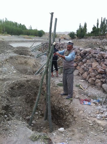
Flashfloods in riverbeds cause intensive riverbank erosion, which threatens villages, infrastructure and productive lands. Preventive measures combining "grey" (physical structures) and "green" (living trees) elements are more effective, sustainable and cost efficient than constructive measures only.
- جامع المعلومات: Stefan Michel
2. وصف نهج الإدارة المستدامة للأراضي
2.1 وصف موجز للنهج
Climate change and land degradation in upper catchment areas cause an increasing frequency and intensity of flash flood and debris flows affecting settlements and productive areas. GIZ in collaboration with the Committee on Emergency Situations assisted local communities in the implementation of integrated preventive measures.
2.2 وصف تفصيلي للنهج
وصف تفصيلي للنهج:
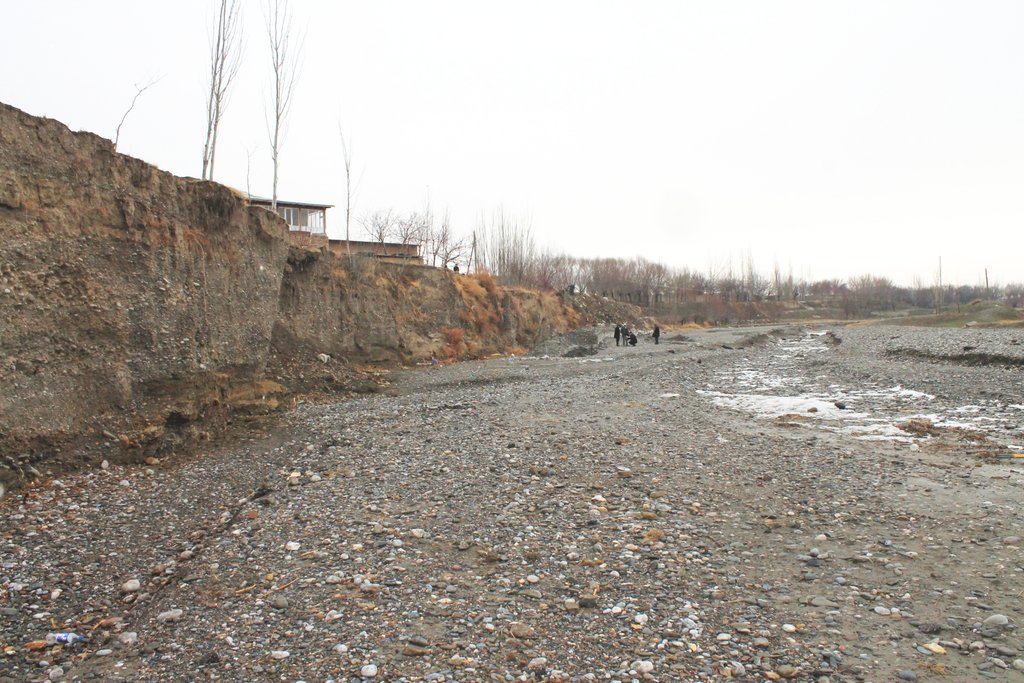
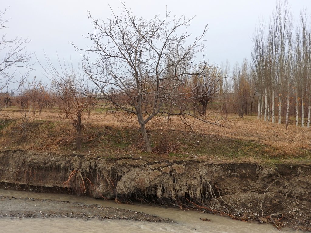
Villages and associated productive lands like orchards, gardens and arable fields in the lower parts of the northern main slope of the Turkestan mountain range are typically located in the valleys of rivers and streams. Water discharge in these rivers and streams is seasonally highly variable. During the wet season water flow is very high, while during the dry summer and fall months almost no water is visible at the surface and the limited discharge takes place in the gravel of the riverbed. After rainfall and during snowmelt extreme flow events happen with discharges several times exceeding the average of the wet season. Flashfloods with high speed and energy typically cause the transportation of large amounts of debris. These debris flows can be much more destructive than ordinary high water events. The resulting riverbank erosion is in some extent a natural element of the morphological dynamic of rivers and streams.
Land-use related factors have increased the vulnerability of communities to these flashfloods and debris flows as well as their destructiveness. Population growth, the expansion of settlements and the reclamation of more lands for irrigated orchards, gardens and arable fields have brought more people and values into potentially risky areas. The degradation of the vegetation in upper catchments has contributed to reduced infiltration of water and high and fast surface runoff. The riparian forests and woodlands which in some extent slow down flashfloods and keep sediment have been largely destroyed by clearing, livestock grazing and by the increasing intensity of flashflood events.
These problems are increasingly exacerbated by the impact of climate change. The already visible trends and predictions show higher levels of aridity, higher temperatures during the vegetation season, reduced overall precipitation in catchment areas – all affecting the retention potential of upper catchment areas – and more irregular rainfall patterns, reduced snow packs and accelerated snow melt as well as the loss of glaciers as buffers of water flow. These factors all contribute to a higher frequency and intensity of flashflood and debris flows.
These events threaten settlements, infrastructure and human lives, but they also pose substantial risks to the stability and functioning of irrigation canals, cause irreversibly losses of productive lands and thus threaten livelihoods of farmers and food security.
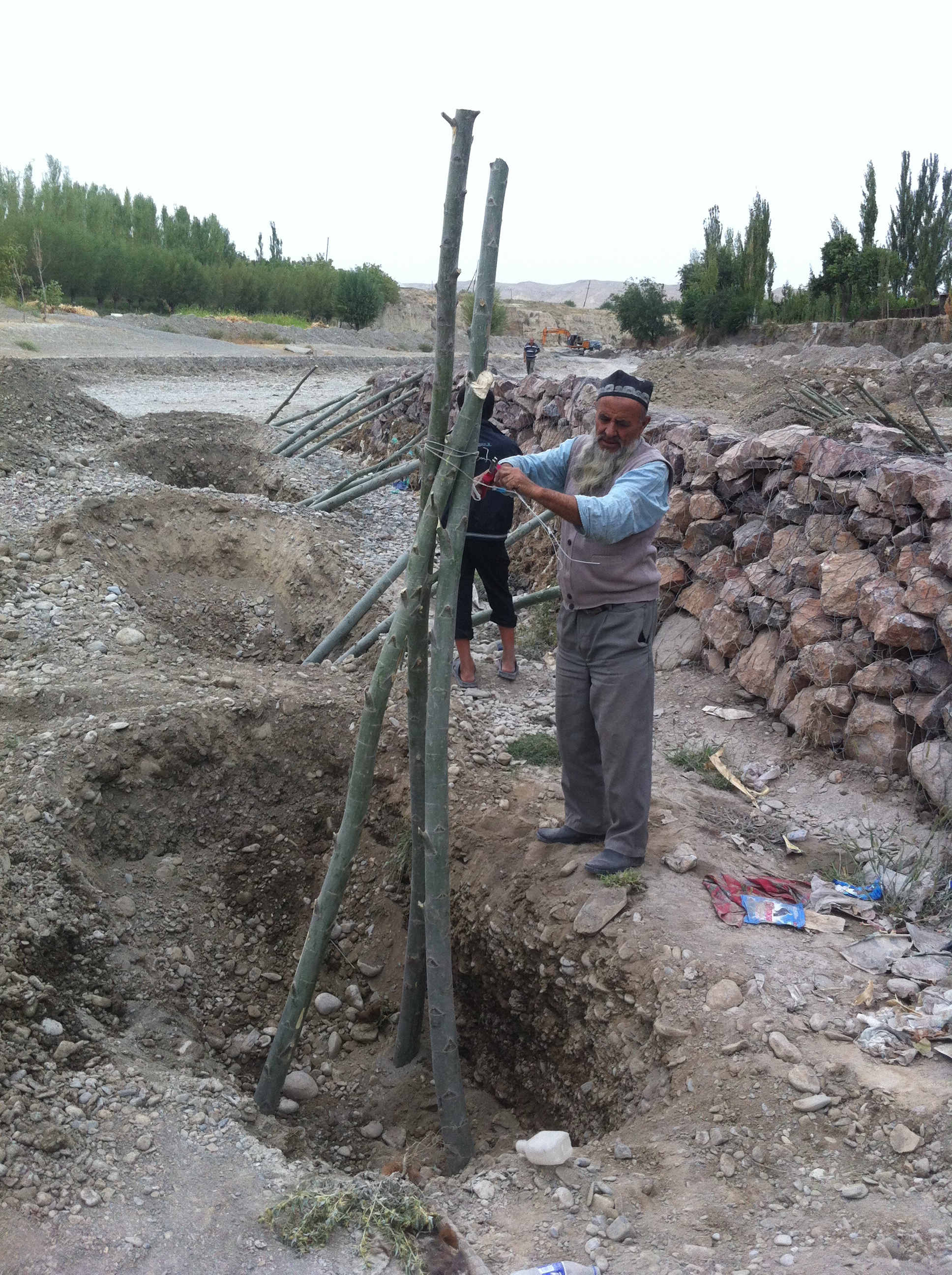
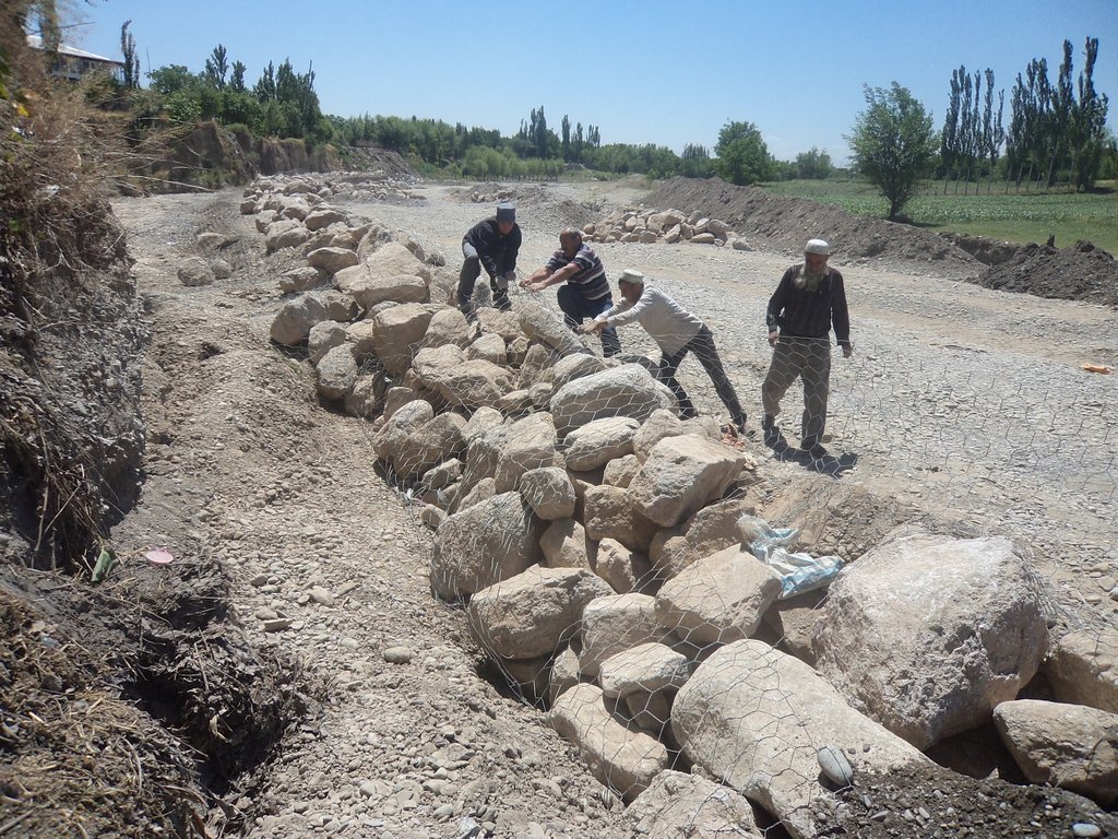
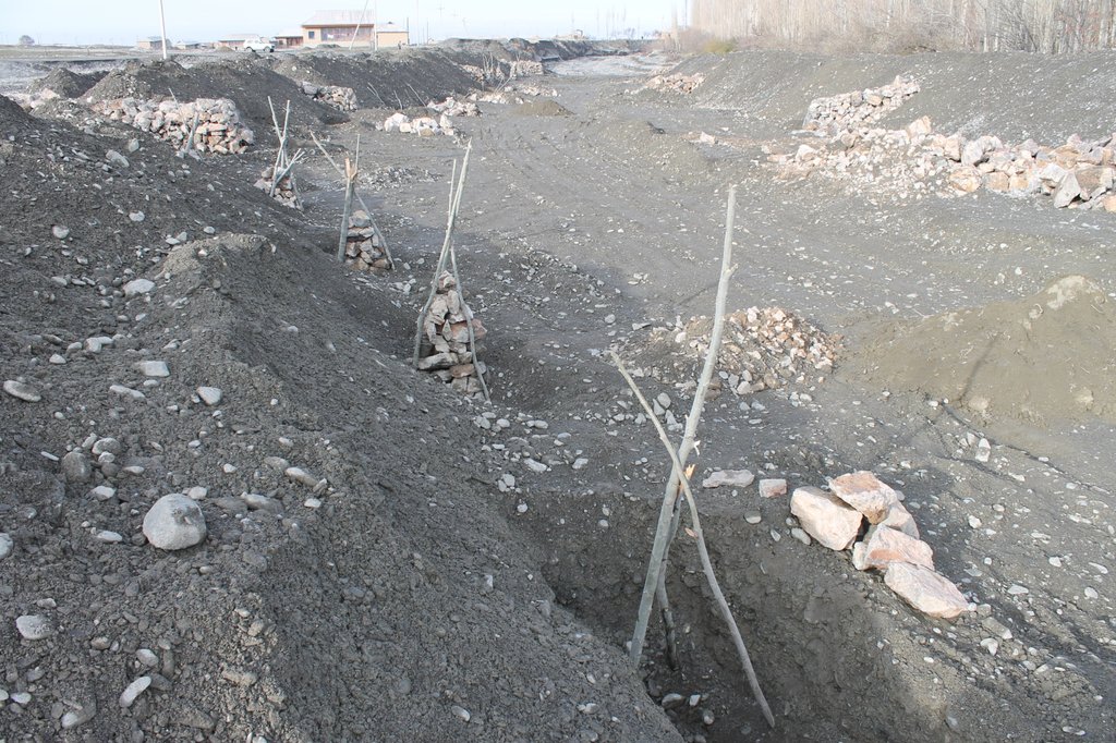
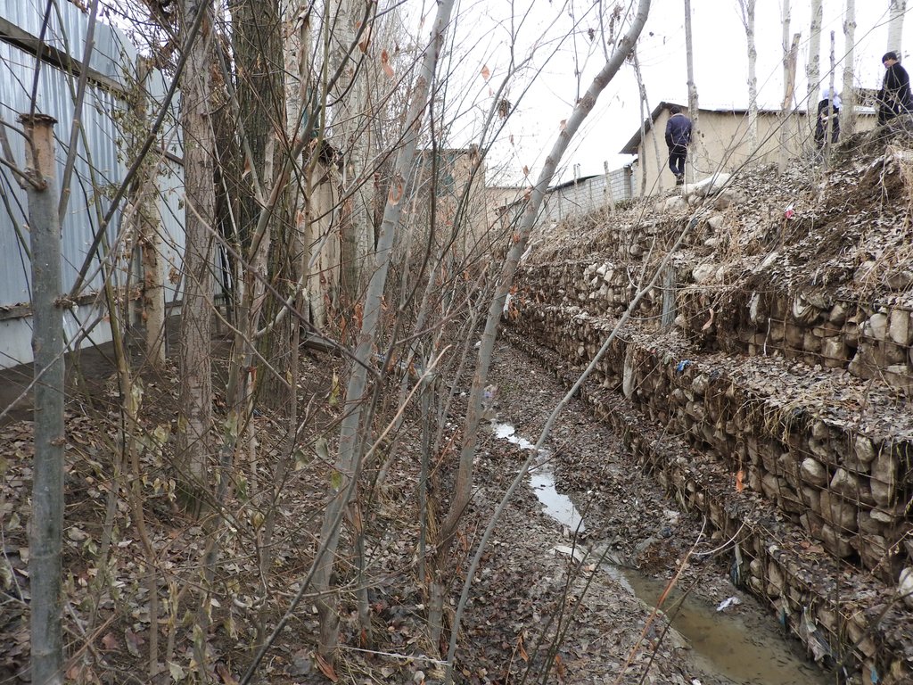
The approach brought together the Committee of Emergency Situations, affected local people and the administrative communities, the mahalla committees, which represent the inhabitants of one village or a section of a larger village. These institutions are called communal self-governance structures, but are subordinated to the government as they are reporting to the sub-district or jamoat. Assisted by experts provided by the project, the situation was jointly analyzed; risks identified and integrated intervention planned. Typically the interventions consisted of a combination of “grey” (i.e. constructive structures) and “green” (i.e. protective vegetation) measures. Most of the upper catchment areas belong to different communities, often to different districts and substantial parts are located in neighboring Kyrgyzstan. Therefore addressing the degradation of these areas and a reduction of disaster risk through integrated watershed management in the entire catchments was rarely possible.
The project assisted with technical planning, construction supervision, purchase and transportation of construction materials. The communities would contribute about 30% of the overall costs, mainly in form of voluntary communal work, the so called hashar, as well as in form of locally available construction materials. The community is also in charge of future operation and maintenance of the riverbank protection structures.
2.3 صور عن النهج
2.5 البلد/المنطقة/المواقع التي تم تطبيق النهج فيها
البلد:
طاجيكستان
المنطقة/الولاية/المحافظة:
Sughd region
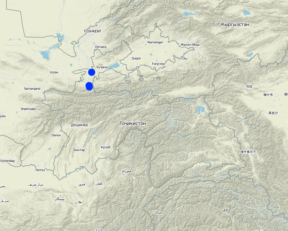
مزيد من التفاصيل حول الموقع:
Spitamen district, Devashtich district
Map
×2.6 تواريخ بدء وإنهاء تنفيذ النهج
أشر إلى سنة البدء:
2014
في حالة عدم معرفة السنة بالتحديد، يرجى الإشارة إلى التاريخ التقريبي لبدء النهج:
منذ أقل من 10 سنوات (مؤخرًا)
2.7 نوع النهج
- قائم على مشروع/برنامج
2.8 الغايات/الأهداف الرئيسية للنهج
Prevention of disasters caused by flashfloods and debris flows
2.9 الظروف التي تمكن أو تعيق تنفيذ التقنية/التقنيات المطبقة بموجب النهج
توفر/الوصول إلى الموارد والخدمات المالية
- معيق
Communities and Committee of Emergency Situations without external assistance not able to implement effective integrated measures.
الإطار المؤسساتي
- تمكين/تمكيني
Good collaboration between communities and Committee of Emergency Situations.
التعاون/التنسيق بين الجهات الفاعلة
- تمكين/تمكيني
Good collaboration between communities and Committee of Emergency Situations.
المعرفة حول الإدارة المستدامة للأراضي، والوصول إلى الدعم الفني
- معيق
Insufficient knowledge in communities about effective technololgy.
عبء العمل، توفر القوى العاملة
- تمكين/تمكيني
Traditional joint volunteer work in communities for addressing common problems (hashar).
3. المشاركة وأدوار الأطراف المعنية
3.1 أصحاب المصلحة المعنيون بالنهج وأدوارهم
- مستخدمو الأراضي المحليون/المجتمعات المحلية
Inhabitants of village
Participation in identification of risk sites;
Volunteer work
- متخصصون في الإدارة المستدامة للأراضي / مستشارون زراعيون
Engineers provided by GIZ
Identification of risk sites;
Design, planning and supervision of interventions.
- الحكومة المحلية
District branches of Committee for Emergency Situations
Participation in identification of risk sites;
Agreement of plans for interventions
3.2 انخراط مستخدمي الأراضي المحليين/المجتمعات المحلية في المراحل المختلفة للنهج
| انخراط مستخدمي الأراضي المحليين/المجتمعات المحلية | حدد من شارك وصف الأنشطة | |
|---|---|---|
| المبادرة/التحفيز | تفاعلي | Participation in identification of risk sites; |
| التخطيط | تفاعلي | Participation in discussion of interventions; |
| التنفيذ | تفاعلي | Volunteer work |
| الرصد/التقييم | تفاعلي | Control of conditions and functioning of protective structures |
3.4 اتخاذ القرار بشأن اختيار تقنية/تقنيات الإدارة المستدامة للأراضي
حدد من الذي قرر اختيار التقنية/التقنيات التي سيتم تنفيذها:
- جميع الجهات الفاعلة ذات الصلة، كجزء من نهج تشاركي
4. الدعم الفني وبناء القدرات وإدارة المعرفة
4.1 بناء القدرات/التدريب
هل تم تقديم التدريب لمستخدمي الأراضي / الأطراف المعنيين الآخرين؟:
كلا
4.2 خدمة استشارية
هل يملك مستخدمو الأراضي وصولا إلى خدمة استشارية؟:
نعم
وصف/تعليقات:
Not involved in this approach
4.3 تعزيز المؤسسات (التطوير التنظيمي)
هل تم إنشاء أو تعزيز مؤسسات من خلال هذا النهج؟:
- نعم، قليلا
حدد المستوى (المستويات) التي تم فيها تعزيز أو إنشاء المؤسسات:
- محلي
صف المؤسسة والأدوار والمسؤوليات والأعضاء وما إلى ذلك.
Strengthening of community institutions in addressing issues of common concern.
حدد نوع الدعم:
- بناء القدرات/التدريب
4.4 الرصد والتقييم
هل يشكل الرصد والتقييم جزءا من النهج؟:
نعم
إذا كانت الإجابة بنعم، فهل من المقصود استخدام هذه الوثائق للمراقبة والتقييم؟:
كلا
4.5 البحوث
هل كانت البحوث جزءًا من النهج؟:
كلا
5. التمويل والدعم المادي الخارجي
5.1 الميزانية السنوية لمكون الإدارة المستدامة للأراضي في النهج المذكور
إذا لم تكن الميزانية السنوية الدقيقة معروفة، قم بالإشارة إلى نطاقها:
- 100,000-10,000
التعليقات (على سبيل المثال المصادر الرئيسية للتمويل/الجهات المانحة الرئيسية):
Government of Germany, implemented via Deutsche Gesellschaft für Internationale Zusammenarbeit (GIZ). The approach has been implemented in the frame of a much larger program and the specific budget for the SLM component of the Approach cannot be determined.
5.2 الدعم المالي/المادي المقدم لمستخدمي الأراضي
هل حصل مستخدمو الأراضي على دعم مالي/ مادي لتنفيذ التقنية/ التقنيات؟:
نعم
إذا كانت الإجابة بنعم، حدد نوع (أنواع) الدعم والشروط والمزودين:
Costs of planning, design and supervision, costs of materials, transportation and machinery covered by GIZ.
5.3 إعانات لمدخلات محددة (بما في ذلك العمالة)
- معدات
| حدد المدخلات التي تم دعمها | إلى أي مدى | حدد الإعانات |
|---|---|---|
| الآلات | ممول بالكامل | |
- بناء
| حدد المدخلات التي تم دعمها | إلى أي مدى | حدد الإعانات |
|---|---|---|
| حجر | ممول جزئيا | |
| Gabion nets | ممول بالكامل | |
إذا كان العمل من قبل مستخدمي الأراضي مدخلاً جوهريًا، فهل كان:
- تطوعي
5.4 الائتمان
هل تم توفير ائتمان في إطار نهج أنشطة الإدارة المستدامة للأراضي؟:
كلا
5.5 حوافز أو وسائل أخرى
هل تم استخدام حوافز أو أدوات أخرى لتشجيع تنفيذ تقنيات الإدارة المستدامة للأراضي؟:
كلا
6. تحليل الأثر والتصريحات الختامية
6.1 آثار النهج
هل ساهم النهج في تمكين مستخدمي الأراضي المحليين وتحسين مشاركة الأطراف المعنية؟:
- لا
- نعم، قليلا
- نعم، باعتدال
- نعم، إلى حد كبير
People mobilized to address common issues.
هل ساعد النهج مستخدمي الأراضي على تنفيذ وصيانة تقنيات الإدارة المستدامة للأراضي؟:
- لا
- نعم، قليلا
- نعم، باعتدال
- نعم، إلى حد كبير
Grey and geeen measures for prevention of riverbank erosion
هل نجح النهج في تحسين التنسيق والتنفيذ الفعال من حيث التكلفة لأنشطة الإدارة المستدامة للأراضي؟:
- لا
- نعم، قليلا
- نعم، باعتدال
- نعم، إلى حد كبير
هل نجح النهج في تعبئة/تحسين الوصول إلى الموارد المالية لتنفيذ الإدارة المستدامة للأراضي؟:
- لا
- نعم، قليلا
- نعم، باعتدال
- نعم، إلى حد كبير
Combination of financial and technical support by GIZ and contributions in form of work and locally available materials by community members.
هل أدى النهج إلى تحسين معرفة وقدرات مستخدمي الأراضي على تنفيذ الإدارة المستدامة للأراضي؟:
- لا
- نعم، قليلا
- نعم، باعتدال
- نعم، إلى حد كبير
Community members capable of replicating the technologies.
هل أدى النهج إلى تحسين معرفة وقدرات الأطراف المعنية الأخرى؟:
- لا
- نعم، قليلا
- نعم، باعتدال
- نعم، إلى حد كبير
Committee of Emergency Situations capable of replicating the technologies.
Improved collaboration between Committe of Emergency Situations, communal self-governance and community members.
هل شجع النهج الشباب/الجيل القادم من مستخدمي الأراضي على الانخراط في الإدارة المستدامة للأراضي؟:
- لا
- نعم، قليلا
- نعم، باعتدال
- نعم، إلى حد كبير
Involvement of young people in joint work
هل أدى هذا النهج إلى تحسين الأمن الغذائي / تحسين التغذية؟:
- لا
- نعم، قليلا
- نعم، باعتدال
- نعم، إلى حد كبير
Reduced risk of destruction of irrigation infrastructure and of loss of productive lands.
هل أدى النهج إلى تحسين قدرة مستخدمي الأراضي على التكيف مع التغيرات المناخية/الظواهر المناخية المتطرفة والتخفيف من الكوارث المرتبطة بالمناخ؟:
- لا
- نعم، قليلا
- نعم، باعتدال
- نعم، إلى حد كبير
Reduced risk of destructive impacts of flashfloods and debris flows, which due to climate change are increasing in frequency and intensity.
6.2 المحفز الرئيسي لقيام مستخدمي الأراضي بتنفيذ الإدارة المستدامة للأراضي
- الحد من مخاطر الكوارث
6.3 استدامة أنشطة النهج
هل يمكن لمستخدمي الأراضي المحافظة على استدامة ما تم تنفيذه من خلال النهج (بدون دعم خارجي)؟:
- نعم
6.4 نقاط قوة/مزايا النهج
| نقاط القوة/ المزايا/ الفرص من وجهة نظر مستخدمي الأراضي |
|---|
| Reduced disaster risk |
| Availability of wood from green measures |
| نقاط القوة/ المزايا/ الفرص من وجهة نظر جامع المعلومات أو غيره من الاشخاص الرئيسيين لمصدر المعلومات |
|---|
| Same as land-users |
| Improved collaboration at local level and strengthened institutions |
| Ownership feeling among community members |
6.5 نقاط الضعف/ العيوب في المنهج وطرق التغلب عليها
| نقاط الضعف/ المساوىء/ المخاطر من وجهة نظر مستخدم الأراضي | كيف يمكن التغلب عليها؟ |
|---|---|
| None |
| نقاط الضعف/ المساوىء/ المخاطر من وجهة نظر جامع المعلومات أو غيره من الاشخاص الرئيسيين لمصدر المعلومات | كيف يمكن التغلب عليها؟ |
|---|---|
| None |
7. المراجع والروابط
7.1 طرق جمع/مصادر المعلومات
- زيارات ميدانية، مسوحات ميدانية
- مقابلات مع مستخدمي الأراضي
- مقابلات مع المتخصصين/الخبراء في الإدارة المستدامة للأراضي
- التجميع من التقارير والوثائق الأخرى الموجودة
الروابط والوحدات المواضيعية
توسيع الكل طي الكلالروابط

Prevention of riverbank erosion by combination of green … [طاجيكستان]
Flashfloods in riverbeds cause intensive riverbank erosion, which threatens villages, infrastructure and productive lands. Preventive measures combining "grey" (physical structures) and "green" (living trees) elements are more effective, sustainable and cost efficient than constructive measures only.
- جامع المعلومات: Stefan Michel
الوحدات المواضيعية
لا يوجد وحدات مواضيعية


