Regional Environmental program [النرويج]
- تاريخ الإنشاء:
- تحديث:
- جامع المعلومات: Kamilla Skaalsveen
- المحرر: –
- المُراجع: Fabian Ottiger
Regionalt miljøprogram
approaches_2596 - النرويج
عرض الأقسام
توسيع الكل طي الكل1. معلومات عامة
1.2 تفاصيل الاتصال بالأشخاص الرئيسيين لمصدر المعلومات والمؤسسات المعنية بتقييم وتوثيق النهج
اسم المؤسسة (المؤسسات) التي سهلت توثيق/تقييم النهج (إذا كان ذلك على صلة)
Norwegian Institute for Agricultural and Environme (Norwegian Institute for Agricultural and Environme) - النرويج1.3 الشروط المتعلقة باستخدام البيانات الموثقة من خلال WOCAT
متى تم تجميع البيانات (ميدانيا)؟:
25/02/2015
يوافق جامع المعلومات والشخص (لاشخاص) الرئيسي لمصدر المعلومات على الشروط المتعلقة باستخدام البيانات الموثقة من خلال WOCAT:
نعم
1.4 المراجع الخاصة باستبيان(استبيانات) تقنيات الإدارة المستدامة للأراضي
Small constructed wetland [النرويج]
A small constructed wetland is a combination of ponds and vegetation filters, designed mainly to remove sediment and nutrients from streams. It is usually located in first and second order streams in agricultural landscapes.
- جامع المعلومات: Dominika Krzeminska
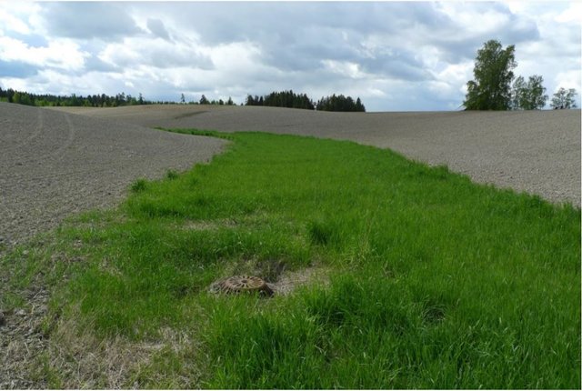
Grassed waterways [النرويج]
Grassed waterways are shallow channels (natural or constructed) with grass cover, used to drain surface runoff from cropland and prevent erosion.
- جامع المعلومات: Dominika Krzeminska
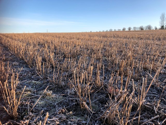
Reduced tillage: no tillage in autumn [النرويج]
Reduced tillage, involving no plowing in the autumn, preserves stubble or plant cover during the autumn and winter to prevent soil erosion, and particle and nutrient loss from cropland to watercourses.
- جامع المعلومات: Kamilla Skaalsveen
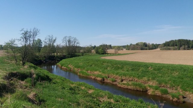
Grass buffer zones alongside waterways in cropland [النرويج]
Grass buffer zones are established along waterways in cropland to reduce the surface runoff rate, and the amounts of sediment, nutrients and pesticides in the runoff.
- جامع المعلومات: Kamilla Skaalsveen
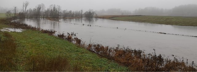
Grass or stubble in areas prone to flooding … [النرويج]
Establishment of grass - or retaining stubble - on arable land that is prone to erosion and flooding to reduce the risk of soil and nutrient losses.
- جامع المعلومات: Dominika Krzeminska
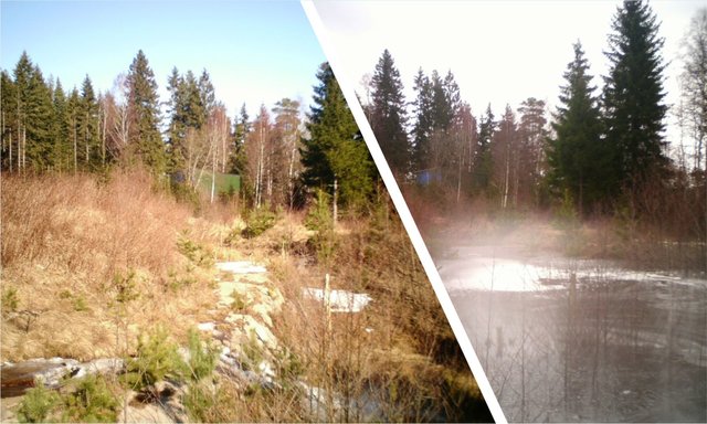
Small retention ponds in the forest [النرويج]
Small retention ponds, located in the forest, are ponds or pools with sufficient storage capacity to store the surface runoff to prevent flooding during heavy rainfall events. Ponds contain limited or no water during dry weather, but are designed to retain water during rain events.
- جامع المعلومات: Dominika Krzeminska
2. وصف نهج الإدارة المستدامة للأراضي
2.1 وصف موجز للنهج
Regulations and financial grants for reduction of pollution and promotion of the cultural landscape.
2.2 وصف تفصيلي للنهج
وصف تفصيلي للنهج:
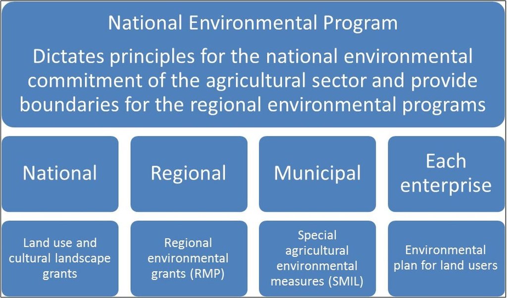
Aims / objectives: The Regional Environmental Program (RMP) is a part of the Regional Rural Development Program provided by County Governors, in this case the County Governors of Østfold and Akershus. The programs differ somewhat between counties and the one for Østfold is used as an example here. The program aims to target environmental efforts in the agricultural sector, mainly focusing on
agricultural runoff, reduced usage of pesticides, cultural landscapes, biological diversity, cultural monuments and environments, outdoor recreation and availability. Measures related to reduction of runoff from agricultural land to waterbodies has resent years been given the highest priority, and the greatest part of the financial grants. Improvement of soil structure to maintain soil functions and prevention of soil loss and nutrient leaching, are some of the main goals of the approach.
Methods: Management plans and local regulations for different catchments are implemented through the Regional Environmental Program. Funds to finance measures are provided from both this program and other sources, such as the Grant Scheme for Special Agricultural Environmental Measures (SMIL). The latter is allocated by the County Governor and managed by local municipalities. In order to receive production subsidies the land users have to carry out the regulation measures. In areas of
prioritized watercourses the soil tillage regulations are stricter, and the financial support higher. Around especially vulnerable waterbodies the measures are compulsory. Agricultural areas are classified by their susceptibility to water erosion (four erosion risk classes), with different soil management requirements. High erosion risk classes normally provide higher grant rates.
Stages of implementation: The Regional Environmental Program was first introduced in 2005, followed by a rollover in 2009. It
was at the agricultural settlement in 2012 decided to continue the program in the same path as settled in 2004/2005, with improvements from the evaluation in 2007/2008 and 2011. The County Governor continues the ongoing work of targeting the economical funds to measures of high environmental benefit. The Regional Environmental Program is also influenced by guidelines from the National Environmental Program of 2013-2016. Random controls are carried out and falsely reported measures lead to reduction and repayment of production grants.
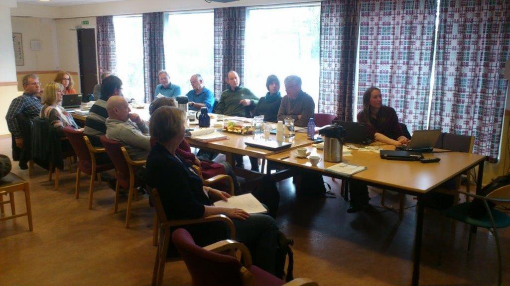
Role of stakeholders: The farmers are mainly conducting the measures by changing their land use practices, but the Regional
Environmental Program is developed in collaboration between municipalities, the county, the Farmers’ Organization, industry, and the County Governor. The measures are revised annually, mainly based on inputs from the Farmers’ Organization and the municipality. Other measures are included by the Regional Environmental Program than shown in the QT (Grass Covered Riparian Buffer Strips and Reduced Tillage), but these were evaluated to be less relevant for the prevention of soil loss.
Other important information: Other measures are included by the Regional Environmental Program than shown in the QT (Grass Covered Riparian Buffer Strips and Reduced Tillage), but these were evaluated to be less relevant for the prevention of soil loss.
For more information: http://www.fylkesmannen.no/en/Ostfold/Agriculture-and-food/Environmental-measures/Tilskudd-til-regionale-miljotiltak-RMP-2014/ (In Norwegian only)
Regional regulations: https://lovdata.no/dokument/JB/forskrift/2011-06-01-716?q=morsa
2.3 صور عن النهج
2.5 البلد/المنطقة/المواقع التي تم تطبيق النهج فيها
البلد:
النرويج
المنطقة/الولاية/المحافظة:
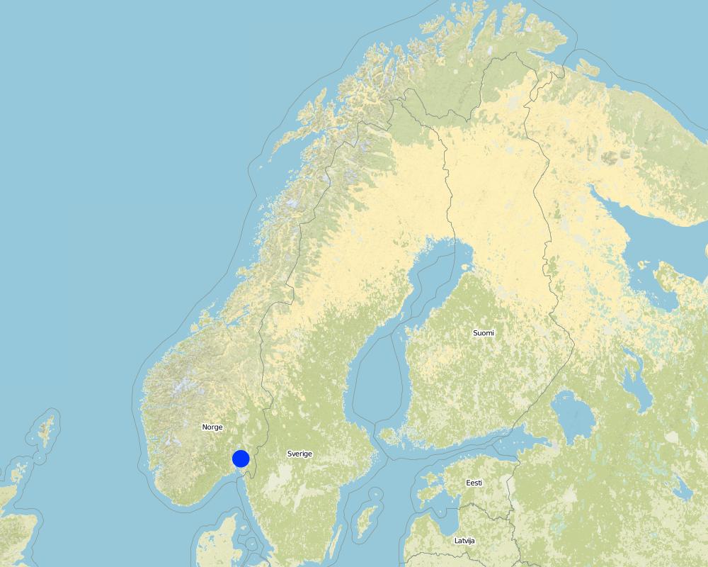
Østfold
مزيد من التفاصيل حول الموقع:
The Morsa Catchment
Map
×2.6 تواريخ بدء وإنهاء تنفيذ النهج
أشر إلى سنة البدء:
2004
2.7 نوع النهج
- قائم على مشروع/برنامج
2.8 الغايات/الأهداف الرئيسية للنهج
The Approach focused on SLM only
Target the environmental initiatives and provide increased visibility.
The SLM Approach addressed the following problems: Agricultural runoff and erosion, usage of pesticides, degradation of cultural landscapes, loss of biological diversity, degradation of cultural monuments and environments, decreased availability to outdoor recreational areas.
2.9 الظروف التي تمكن أو تعيق تنفيذ التقنية/التقنيات المطبقة بموجب النهج
توفر/الوصول إلى الموارد والخدمات المالية
- معيق
Measures may lead to income loss for land users.
Treatment through the SLM Approach: Financial grants.
الإطار القانوني (حيازة الأراضي، وحقوق استخدام الأراضي والمياه)
- معيق
The existing land ownership, land use rights / water rights hindered a little the approach implementation Not all land users implemented the technologies.
عبء العمل، توفر القوى العاملة
- معيق
The workload may increase with land use changes and implementation of erosion risk classes and regulations.
Treatment through the SLM Approach: Higher financial grants for high risk areas.
3. المشاركة وأدوار الأطراف المعنية
3.1 أصحاب المصلحة المعنيون بالنهج وأدوارهم
- مستخدمو الأراضي المحليون/المجتمعات المحلية
- متخصصون في الإدارة المستدامة للأراضي / مستشارون زراعيون
- الحكومة المحلية
- الحكومة الوطنية (المخططون، صانعو القرار)
3.2 انخراط مستخدمي الأراضي المحليين/المجتمعات المحلية في المراحل المختلفة للنهج
انخراط مستخدمي الأراضي المحليين/المجتمعات المحلية | حدد من شارك وصف الأنشطة | |
---|---|---|
المبادرة/التحفيز | سلبي | Regulations initiated by politicians and management, governed by the Agricultural Authority |
التخطيط | سلبي | Involvement of specialists |
التنفيذ | الدعم الخارجي | Changes in land use practices implemented by land users |
الرصد/التقييم | سلبي | Monitoring and evaluation of measures by specialists and management |
Research | سلبي | Results evaluated and reported by specialists |
3.3 مخطط التدفق (إذا كان متاحًا)
3.4 اتخاذ القرار بشأن اختيار تقنية/تقنيات الإدارة المستدامة للأراضي
حدد من الذي قرر اختيار التقنية/التقنيات التي سيتم تنفيذها:
- متخصصون في الإدارة المستدامة للأراضي بمفردهم
اشرح:
The choice of SLM Technology was made on the basis of recommendations from specialists.
Decisions on the method of implementing the SLM Technology were made by by politicians / leaders. Decisions on the method were made on county and management level.
4. الدعم الفني وبناء القدرات وإدارة المعرفة
4.1 بناء القدرات/التدريب
هل تم تقديم التدريب لمستخدمي الأراضي / الأطراف المعنيين الآخرين؟:
نعم
حدد من تم تدريبه:
- مستخدمو الأراضي
- موظفون ميدانيون/ مستشارون
شكل التدريب:
- في العمل
4.2 خدمة استشارية
هل يملك مستخدمو الأراضي وصولا إلى خدمة استشارية؟:
نعم
- Through information
وصف/تعليقات:
Name of method used for advisory service: Guidelines and circulars from the County Governor; Key elements: Information, Guidance, Environmental standards
Advisory service is quite adequate to ensure the continuation of land conservation activities; Requires land conservation measures for disbursement of subsidies.
4.3 تعزيز المؤسسات (التطوير التنظيمي)
هل تم إنشاء أو تعزيز مؤسسات من خلال هذا النهج؟:
- لا
4.4 الرصد والتقييم
هل يشكل الرصد والتقييم جزءا من النهج؟:
نعم
التعليقات:
bio-physical aspects were ad hoc monitored by project staff through observations; indicators: Landslides
bio-physical aspects were regular monitored by other through measurements; indicators: P content in soil, water quality, runoff
technical aspects were ad hoc monitored by project staff through measurements; indicators: Infiltration rate/soil compaction
economic / production aspects were regular monitored by government, land users through observations; indicators: Production rate, increase/decrease in income
area treated aspects were regular monitored by government through observations; indicators: Evaluation of measures
no. of land users involved aspects were regular monitored by government through observations; indicators: None
management of Approach aspects were ad hoc monitored by project staff, government, land users through observations; indicators: None
There were several changes in the Approach as a result of monitoring and evaluation: Annual revision
There were few changes in the Technology as a result of monitoring and evaluation: Evaluation and modification proposals in progress
4.5 البحوث
هل كانت البحوث جزءًا من النهج؟:
نعم
حدد المواضيع:
- تكنولوجيا
أعط تفاصيل إضافية وأشر إلى من قام بالبحوث:
Research of the effectiveness of the technologies have been carried out and discussed with land users and management.
Research was carried out on-farm
5. التمويل والدعم المادي الخارجي
5.1 الميزانية السنوية لمكون الإدارة المستدامة للأراضي في النهج المذكور
إذا لم تكن الميزانية السنوية الدقيقة معروفة، قم بالإشارة إلى نطاقها:
- > 1,000,000
التعليقات (على سبيل المثال المصادر الرئيسية للتمويل/الجهات المانحة الرئيسية):
Approach costs were met by the following donors: local government (district, county, municipality, village etc) (Regional level): 100.0%
5.2 الدعم المالي/المادي المقدم لمستخدمي الأراضي
هل حصل مستخدمو الأراضي على دعم مالي/ مادي لتنفيذ التقنية/ التقنيات؟:
نعم
إذا كانت الإجابة بنعم، حدد نوع (أنواع) الدعم والشروط والمزودين:
Contributions were provided by the state from the Regional Environmental Program and other sources as the Grant Scheme for Special Agricultural Environmental Measures (SMIL).
5.3 إعانات لمدخلات محددة (بما في ذلك العمالة)
إذا كان العمل من قبل مستخدمي الأراضي مدخلاً جوهريًا، فهل كان:
- مدفوع نقدا
التعليقات:
Economical benefits for the land user to implement measures and loss if they reject, according to local regulations.
5.4 الائتمان
هل تم توفير ائتمان في إطار نهج أنشطة الإدارة المستدامة للأراضي؟:
كلا
6. تحليل الأثر والتصريحات الختامية
6.1 آثار النهج
هل ساعد النهج مستخدمي الأراضي على تنفيذ وصيانة تقنيات الإدارة المستدامة للأراضي؟:
- لا
- نعم، قليلا
- نعم، باعتدال
- نعم، إلى حد كبير
Regulations to prevent soil and water degradation.
هل ساهم النهج في تمكين الفئات المحرومة اجتماعيا واقتصاديا؟:
- لا
- نعم، قليلا
- نعم، باعتدال
- نعم، إلى حد كبير
هل أدى النهج إلى تحسن في مسائل حيازة الأراضي / حقوق المستخدمين التي أعاقت تنفيذ تقنيات الإدارة المستدامة للأراضي؟:
- لا
- نعم، قليلا
- نعم، باعتدال
- نعم، إلى حد كبير
Did other land users / projects adopt the Approach?
- لا
- نعم، قليلا
- نعم، باعتدال
- نعم، إلى حد كبير
Similar approaches are applied on watercourses in other counties, but regulations and financial support varies.
Did the Approach lead to improved livelihoods / human well-being?
- لا
- نعم، قليلا
- نعم، باعتدال
- نعم، إلى حد كبير
Somewhat better water quality in drinking water recipients.
Did the Approach help to alleviate poverty?
- لا
- نعم، قليلا
- نعم، باعتدال
- نعم، إلى حد كبير
6.2 المحفز الرئيسي لقيام مستخدمي الأراضي بتنفيذ الإدارة المستدامة للأراضي
- المدفوعات/ الإعانات
Subsidies
- القواعد واللوائح (الغرامات) / الإنفاذ
Regulations
- الانتماء إلى حركة/ مشروع/ مجموعة/ شبكات
Cooperation between farmers
- الوعي البيئي
Pollution awareness
6.3 استدامة أنشطة النهج
هل يمكن لمستخدمي الأراضي المحافظة على استدامة ما تم تنفيذه من خلال النهج (بدون دعم خارجي)؟:
- لا
إذا كان الجواب لا أو غير متأكد، حدد ذلك وعلق عليه:
Production and income loss.
6.4 نقاط قوة/مزايا النهج
نقاط القوة/ المزايا/ الفرص من وجهة نظر جامع المعلومات أو غيره من الاشخاص الرئيسيين لمصدر المعلومات |
---|
Good guidance and free maps for land users available on the internet |
Annual repport (both strength and weekness) |
Financial grants graded by erosion risk classes |
Regular evaluation through agricultural negotiations (How to sustain/ enhance this strength: A management committee has recently suggested simplifications to the program, but this has not yet been evaluated by the Ministry of Food and Agriculture) |
6.5 نقاط الضعف/ العيوب في المنهج وطرق التغلب عليها
نقاط الضعف/ المساوىء/ المخاطر من وجهة نظر جامع المعلومات أو غيره من الاشخاص الرئيسيين لمصدر المعلومات | كيف يمكن التغلب عليها؟ |
---|---|
Complicated system with a variety of details | There is a group who is working on a report to the ministry on how to simplify the program |
7. المراجع والروابط
7.1 طرق جمع/مصادر المعلومات
- زيارات ميدانية، مسوحات ميدانية
- مقابلات مع مستخدمي الأراضي
الروابط والوحدات المواضيعية
توسيع الكل طي الكلالروابط
Small constructed wetland [النرويج]
A small constructed wetland is a combination of ponds and vegetation filters, designed mainly to remove sediment and nutrients from streams. It is usually located in first and second order streams in agricultural landscapes.
- جامع المعلومات: Dominika Krzeminska
Grassed waterways [النرويج]
Grassed waterways are shallow channels (natural or constructed) with grass cover, used to drain surface runoff from cropland and prevent erosion.
- جامع المعلومات: Dominika Krzeminska
Reduced tillage: no tillage in autumn [النرويج]
Reduced tillage, involving no plowing in the autumn, preserves stubble or plant cover during the autumn and winter to prevent soil erosion, and particle and nutrient loss from cropland to watercourses.
- جامع المعلومات: Kamilla Skaalsveen
Grass buffer zones alongside waterways in cropland [النرويج]
Grass buffer zones are established along waterways in cropland to reduce the surface runoff rate, and the amounts of sediment, nutrients and pesticides in the runoff.
- جامع المعلومات: Kamilla Skaalsveen
Grass or stubble in areas prone to flooding … [النرويج]
Establishment of grass - or retaining stubble - on arable land that is prone to erosion and flooding to reduce the risk of soil and nutrient losses.
- جامع المعلومات: Dominika Krzeminska
Small retention ponds in the forest [النرويج]
Small retention ponds, located in the forest, are ponds or pools with sufficient storage capacity to store the surface runoff to prevent flooding during heavy rainfall events. Ponds contain limited or no water during dry weather, but are designed to retain water during rain events.
- جامع المعلومات: Dominika Krzeminska
الوحدات المواضيعية
لا يوجد وحدات مواضيعية