Gully control and catchment protection [بوليفيا، دولة بوليفيا المتعددة القوميات]
- تاريخ الإنشاء:
- تحديث:
- جامع المعلومات: Georg Heim
- المحرر: –
- المُراجع: Fabian Ottiger
Control de cárcavas (spanish)
technologies_1350 - بوليفيا، دولة بوليفيا المتعددة القوميات
عرض الأقسام
توسيع الكل طي الكل1. معلومات عامة
1.2 تفاصيل الاتصال بالأشخاص الرئيسيين لمصدر المعلومات والمؤسسات المشاركة في تقييم وتوثيق التقنية
متخصص في الإدارة المستدامة للأراضي:
Vargas Ivan
Cochabamba
بوليفيا، دولة بوليفيا المتعددة القوميات
اسم المشروع الذي سهّل توثيق/تقييم التقنية (إذا كان ذلك على صلة)
Book project: where the land is greener - Case Studies and Analysis of Soil and Water Conservation Initiatives Worldwide (where the land is greener)اسم المؤسسة (المؤسسات) التي سهلت توثيق/تقييم التقنية (إذا كان ذلك على صلة)
GEOTEST AG (GEOTEST AG) - سويسرا1.3 الشروط المتعلقة باستخدام البيانات الموثقة من خلال WOCAT
متى تم تجميع البيانات (ميدانيا)؟:
01/09/2003
يوافق جامع المعلومات والشخص (لاشخاص) الرئيسي لمصدر المعلومات على الشروط المتعلقة باستخدام البيانات الموثقة من خلال WOCAT:
نعم
1.5 الإشارة إلى الاستبيان (الاستبيانات) حول مناهج الإدارة المستدامة للأراضي
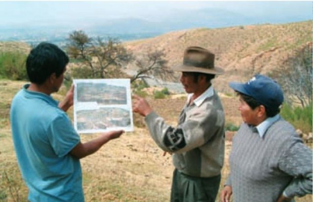
Incentive-based catchment treatment [بوليفيا، دولة بوليفيا المتعددة القوميات]
A project supported, incentive-based approach: farmers are sensitised about erosion, and involved in gully control and other measures to protect catchments.
- جامع المعلومات: Unknown User
2. وصف تقنيةالإدارة المستدامي للأراضي
2.1 وصف مختصر للتقنية
تعريف التقنية:
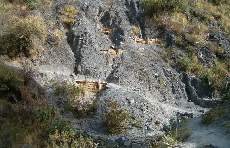
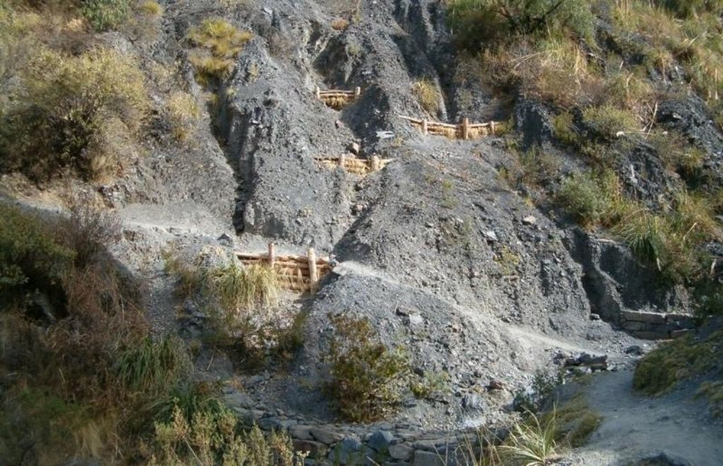
Integrated gully treatment consisting of several simple practices including stone and wooden check dams, cut-off drains and reforestation in sediment traps (biotrampas).
2.2 وصف تفصيلي للتقنية
الوصف:
The focus of the case study is a degraded catchment, located at high altitude (2,800–4,200 m a.s.l.), home to 37 households, which is characterised by severe gullies and landslides. Gullies are continuously expanding, and constitute a significant proportion of the catchment. These cause considerable loss of cropland as well as downstream damage to the city of Cochabamba.
A combination of structural and vegetative measures was designed and implemented with the purpose of: (1) preventing affected areas from further degradation by safely discharging runoff from the surrounding area through the main gullies down to the valley; (2) gradually stabilising the land through the regeneration of vegetative cover; (3) reducing downstream damage through floods and siltation; (4) ensuring accessibility to the mountainous agricultural area during the rainy season.
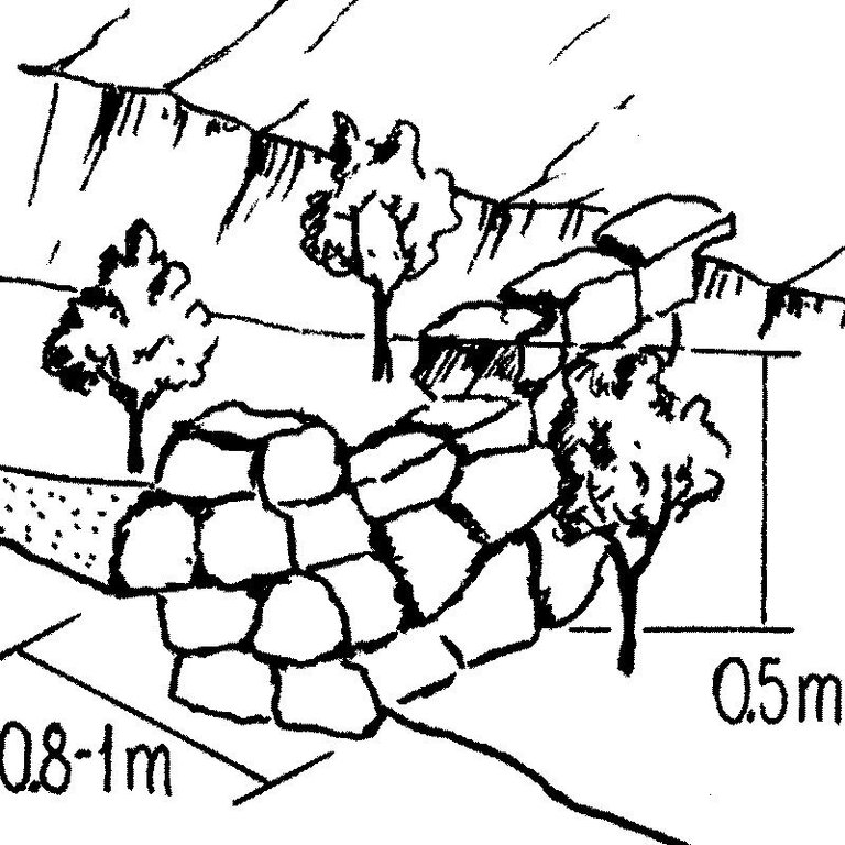
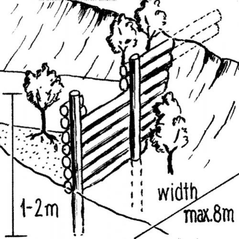
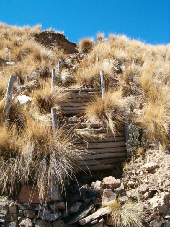
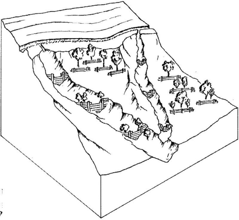
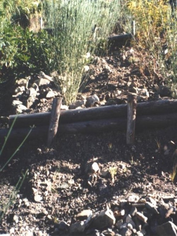
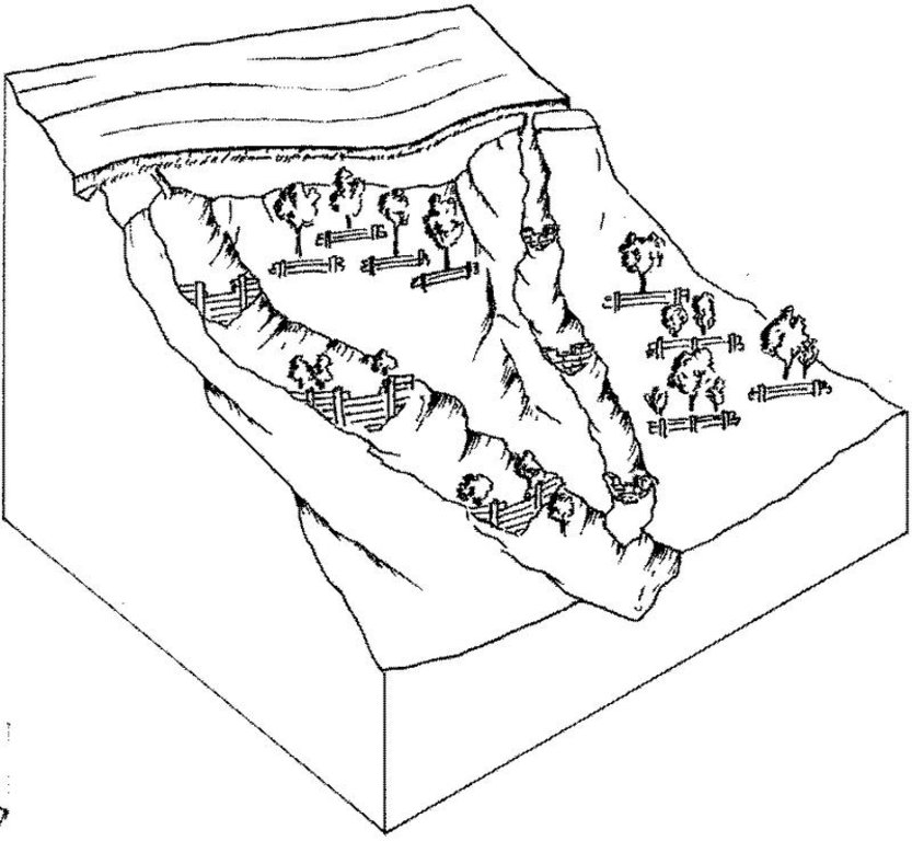
Cut-off drains at the heads of the gullies, reinforced with stones inside the channel and grassed bunds below, concentrate runoff and cascade it down over stone steps back into the waterways. Flow is controlled by stone and wooden check dams and discharged safely. Sediment is trapped behind these structures and terraces develop. Bushes or trees are planted above and below the check dams. Depending on availability of materials, wooden check dams are sometimes used and associated with tree planting (four trees above and four below each check dam).
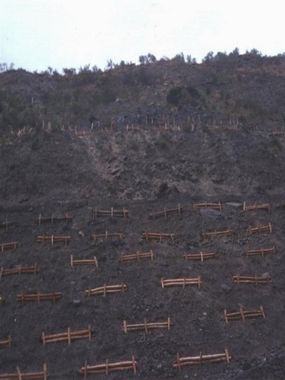
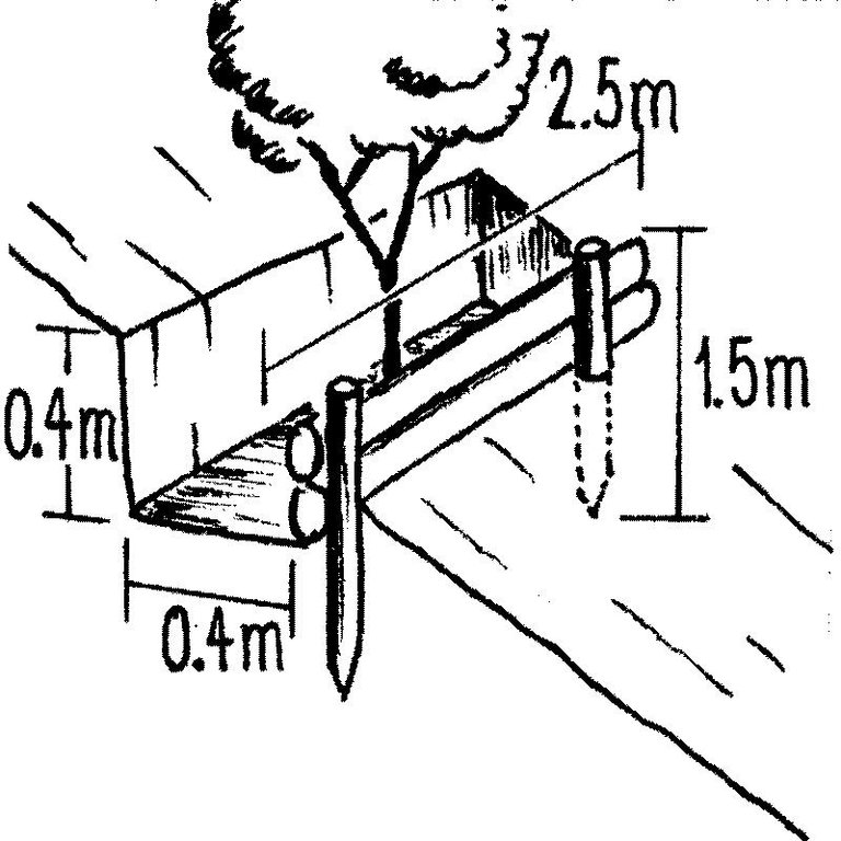
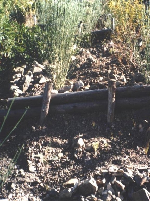
These practices are complemented by SWC measures throughout the catchment: biotrampas are staggered sediment traps located on the steep lateral slopes. They comprise ditches behind wooden barriers where soil accumulates. Biotrampas create suitable sites for tree/bush planting while stabilising the hillsides, reducing erosion, increasing infiltration and slowing siltation of the check dams in the watercourses. Supporting technologies include fenced-off areas for reforestation of the lateral slopes/upper edge of the gully, and finally large gabion dams at the outlets of the gullies, usually 10-25 m in length, but exceptionally up to 200 m.
After a few years vegetation should have stabilised the system, and effectively replaced the wooden and stone constructions. The various practices enhance each other. Establishment is labour demanding, but other costs are low, as long as the material in question is locally obtainable. Maintenance costs are also low. The technology was implemented over a period of six years, starting in 1996, through the Programa de Manejo Integral de Cuencas (PROMIC).
2.3 صور التقنية
2.5 البلد/المنطقة/المواقع التي تم تنفيذ التقنية فيها والتي يغطيها هذا التقييم
البلد:
بوليفيا، دولة بوليفيا المتعددة القوميات
المنطقة/الولاية/المحافظة:
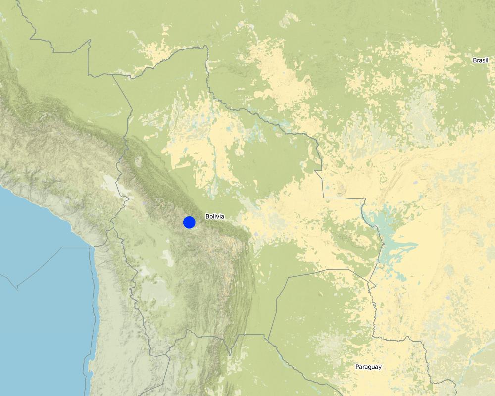
Cochabamba District,
مزيد من التفاصيل حول الموقع:
Pajcha Watershed Cordillera del Tunari
Map
×2.7 إدخال التقنية
حدد كيف تم إدخال التقنية:
- من خلال المشاريع/ التدخلات الخارجية
3. تصنيف تقنية الإدارة المستدامي للأراضي
3.1 الغرض الرئيسي ( الأغراض الرئيسية) للتقنية
- الحد من تدهور الأراضي ومنعه وعكسه
3.2 نوع (أنواع) استخدام الأراضي الحالية حيث يتم تطبيق التقنية

الأراضي الزراعية
- زراعة سنوية

أراضي الرعي
التعليقات:
Major land use problems (compiler’s opinion): Deforestation, overgrazing and poorly managed channel irrigation in areas with steep slopes: poorly structured soils and
extreme climatic variability causing erosion gullies, landslides, downstream flooding and sedimentation of agricultural land and settlements - including the city of Cochabamba.
Other grazingland: extensive grazing
3.3 مزيد من المعلومات حول استخدام الأراضي
إمدادات المياه للأرض التي يتم تنفيذ التقنية عليها:
- بعلية
حدد:
Longest growing period in days: 210 Longest growing period from month to month: Oct - Apr
3.4 مجموعةالإدارة المستدامة للأراضي التي تنتمي إليها هذه التقنية
- التدابير المتقاطعة للمنحدرات
- تحويل المياه والصرف
- Sediment traps
3.5 انتشار التقنية
التعليقات:
Total area covered by the SLM Technology is 6 m2.
3.6 التدابير التقنية في مجال إلادارة المستدامة للأراضي
3.7 الأنواع الرئيسية من تدهور الأراضي التي تناولتها التقنية

تآكل التربة بالمياه
- (Wg):الانجراف الخلجاني/ الخلجان
- (Wm): مجموعة كبيرة من الحركات الأرضية/انزلاقات أرضية
- (Wo:) تأثيرات التدهور من مواقع أخرى

التدهور البيولوجي
- (Bq): انخفاض الكمية/الكتلة الحيوية
التعليقات:
Main type of degradation addressed: Wg: gully erosion / gullying, Wm: mass movements / landslides, Wo: offsite degradation effects, Bq: quantity / biomass decline
3.8 منع أو حد أو عكس تدهور الأراضي
تحديد هدف التقنية فيما يتعلق بتدهور الأراضي:
- اصلاح/إعادة تأهيل الأراضي المتدهورة بشدة
4. المواصفات الفنية، وأنشطة التنفيذ، والمدخلات، والتكاليف
4.1 الرسم الفني للتقنية
4.2 المواصفات الفنية/شروحات الرسم الفني
Gully control and catchment protection: an overview of the integrated measures.
Technical knowledge required for field staff / advisors: moderate
Technical knowledge required for land users: moderate
Main technical functions: reduction of slope angle, reduction of slope length, improvement of ground cover, increase in organic matter, sediment retention / trapping, sediment harvesting, control of concentrated runoff
Secondary technical functions: increase of infiltration, control of dispersed runoff
Vegetative measure: grassed bunds
Vegetative material: G : grass
Vegetative measure: aligned trees
Vegetative material: G : grass
Vegetative measure: Vegetative material: G : grass
Vegetative measure: Vegetative material: G : grass
Structural measure: cut-off drains
4.4 أنشطة التأسيس
| النشاط | نوع التدبير | التوقيت | |
|---|---|---|---|
| 1. | Plant local bushes and trees in front and behind the biotrampas andthe check dams (after sedimentation). Altitude acclimatisation (2 weeks)is required for the trees before planting. | نباتية | |
| 2. | Cut-off drains: excavate channel above the gully. Lay stones in the bedand plant local bushes or grass on the bund below the ditch. The outletof the ditch into the gully is stabilised by a few stone steps. | بنيوية أو هيكلية | |
| 3. | Stone check dams: excavate a ditch perpendicular to the water channel | بنيوية أو هيكلية | during the dry season |
| 4. | Wooden check dams (up to 8 m long, 15–20 cm wide and 1 m high):soil excavation (see 2.). Fix logs with wire or nails to vertical poles.Position a bio-fibre fleece behind the dam to prevent sediment fromflowing through. | بنيوية أو هيكلية | |
| 5. | Biotrampas: excavate soil, hammer wooden posts into the soil andfix 2–3 horizontal logs with nails or wire to the wooden posts. | بنيوية أو هيكلية | (During dry season) |
| 6. | Plant local bushes and trees in front and behind the biotrampas andthe check dams (after sedimentation). Altitude acclimatisation (2 weeks)is required for the trees before planting. Establish fences to protect the plants. | بنيوية أو هيكلية |
4.5 التكاليف والمدخلات اللازمة للتأسيس
| تحديد المدخلات | الوحدة | الكمية | التكاليف لكل وحدة | إجمالي التكاليف لكل مدخل | % من التكاليف التي يتحملها مستخدمو الأراضي | |
|---|---|---|---|---|---|---|
| العمالة | Labour | ha | 1,0 | 48,0 | 48,0 | |
| معدات | Tools | ha | 1,0 | 4,0 | 4,0 | |
| المواد النباتية | Seedlings | ha | 1,0 | 19,0 | 19,0 | |
| مواد البناء | Stone | ha | 1,0 | |||
| مواد البناء | Wood | ha | 1,0 | 33,0 | 33,0 | |
| مواد البناء | Nails, wire | ha | 1,0 | 2,0 | 2,0 | |
| مواد البناء | Bio-fibre fleece | ha | 1,0 | 4,0 | 4,0 | |
| إجمالي تكاليف إنشاء التقنية | 110,0 | |||||
4.6 الصيانة/الأنشطة المتكررة
| النشاط | نوع التدبير | التوقيت/الوتيرة | |
|---|---|---|---|
| 1. | Biotrampas: pruning the trees | نباتية | /every three years. |
| 2. | Cut-off drains: clearing of sediment, cutting bushes and grasses. | نباتية | |
| 3. | Stone check dams: pruning trees and bushes. After full sedimentation, the dam may be increased in height. | نباتية | /every three years. |
| 4. | Wooden check dams: pruning trees and bushes | نباتية | /every three years |
4.7 التكاليف والمدخلات اللازمة للصيانة/للأنشطة المتكررة (سنويًا)
| تحديد المدخلات | الوحدة | الكمية | التكاليف لكل وحدة | إجمالي التكاليف لكل مدخل | % من التكاليف التي يتحملها مستخدمو الأراضي | |
|---|---|---|---|---|---|---|
| العمالة | Labour | ha | 1,0 | 12,0 | 12,0 | 100,0 |
| معدات | Tools | ha | 1,0 | 1,0 | 1,0 | 100,0 |
| المواد النباتية | Seedlings | ha | 1,0 | 1,0 | 1,0 | 100,0 |
| مواد البناء | Stone | ha | 1,0 | |||
| مواد البناء | Wood | ha | 1,0 | 1,0 | 1,0 | 100,0 |
| مواد البناء | Nails, wire | ha | 1,0 | 1,0 | 1,0 | 100,0 |
| إجمالي تكاليف صيانة التقنية | 16,0 | |||||
التعليقات:
Costs have been calculated for the whole catchment (6 km2) – including 100 m of cut-off drains, 6,750 m of stone
check dams, 1,500 m of wooden check dams and 770 biotrampas – and then divided by the number of hectares. Wood is not locally available (because of national park laws) and needs to be brought into the area. Establishment and maintenance costs were paid by PROMIC during their intervention period of 6 years. The (high) costs of the gabion weirs further downstream are not included as these are not always required and vary considerably in size from site to site.
5. البيئة الطبيعية والبشرية
5.1 المناخ
هطول الأمطار السنوي
- < 250 مم
- 251- 500 ملم
- 501 - 750ملم
- 1,000-751 ملم
- 1,500-1,100 ملم
- 2,000-1,500 ملم
- 3,000-2,001 ملم
- 4,000-3,100 ملم
- > 4000 ملم
المنطقة المناخية الزراعية
- شبه رطبة
- شبه قاحلة
5.2 طوبوغرافيا
متوسط الانحدارات:
- مسطح (0-2%)
- بسيط (3-5%)
- معتدل (6-10%)
- متدحرج (11-15%)
- تلال (16-30%)
- شديدة الانحدار(31-60%)
- فائقة الانحدار (>60%)
التضاريس:
- هضاب/سهول
- أثلام مرتفعة
- المنحدرات الجبلية
- منحدرات التلال
- منحدرات في السفوح
- قاع الوادي
المنطقة الارتفاعية:
- 100-0 متر فوق سطح البحر
- 500-101 متر فوق سطح البحر
- 1,000-501 متر فوق سطح البحر
- 1,500-1,001 متر فوق سطح البحر
- 2,000-1,501 متر فوق سطح البحر
- 2,500-2,100 متر فوق سطح البحر
- 3,000-2,501 متر فوق سطح البحر
- 4,000-3,001 متر فوق سطح البحر
- > 4000 متر فوق سطح البحر
التعليقات والمواصفات الإضافية بشأن التضاريس:
Slopes on average: Also very steep and hilly (both ranked 2) and moderate and rolling (both ranked 3)
5.3 التربة
متوسط عمق التربة:
- ضحل جدًا (0-20 سم)
- ضحلة (21-50 سم)
- متوسطة العمق (51-80 سم)
- عميقة (81-120 سم)
- عميقة جدًا (> 120 سم)
قوام التربة (التربة السطحية):
- متوسط ( طميي، سلتي)
المواد العضوية في التربة السطحية:
- عالية (>3%)
- منخفضة (<1%)
إذا كان متاحًا، قم بإرفاق وصف كامل للتربة أو تحديد المعلومات المتوفرة، على سبيل المثال نوع التربة، الرقم الهيدروجيني/ درجة حموضة التربة، قدرة التبادل الكاتيوني، النيتروجين، الملوحة وما إلى ذلك.
Soil depth on average: Also Very shallow (ranked 2) and shallow as well as deep (both ranked 3)
Soil fertility: Low and very low
Topsoil organic matter: High (on the cropland at high altitudes) and low (in the gullies)
Soil drainage/infiltration: Medium
5.6 خصائص مستخدمي الأراضي الذين يطبقون التقنية
التوجه السوقي لنظام الإنتاج:
- الكفاف (الإمداد الذاتي)
الدخل من خارج المزرعة:
- 10-50% من جميع الإيرادات
اذكر الخصائص الأخرى ذات الصلة لمستخدمي الأراضي:
Market orientation: Subsistence (mostly subsistence (self-supply) with low market income)
5.7 متوسط مساحة الأرض المملوكة أو المستأجرة من قبل مستخدمي الأراضي الذين يطبقون التقنية
- < 0.5 هكتارا
- 0.5 - 1 هكتار
- 1 -2 هكتار
- 2 - 5 هكتار
- 5 - 15 هكتار
- 15 - 50 هكتار
- 50 - 100هكتار
- 500-100 هكتار
- 1,000-500 هكتار
- 10,000-1,000 هكتار
- > 10,000 هكتار
5.8 ملكية الأراضي، وحقوق استخدام الأراضي، وحقوق استخدام المياه
ملكية الارض:
- فردية، يوجد سند ملكية
- communal grassland
حقوق استخدام الأراضي:
- مجتمعي (منظم)
- فردي
6. الآثار والتصريحات الختامية
6.1 الآثار التي أظهرتها التقنية في الموقع
الآثار الاجتماعية والاقتصادية
الإنتاج
إنتاج المحاصيل
التعليقات/ حدد:
Maintained: Due to prevention of further land loss
إنتاج الأعلاف
التعليقات/ حدد:
Maintained: Due to prevention of further land loss
الدخل والتكاليف
عبء العمل
التعليقات/ حدد:
High labour input for establishment (though paid in this instance)
الآثار الاجتماعية والثقافية
المؤسسات المجتمعية
المعرفة بالإدارة المستدامة للأراضي/تدهور الأراضي
الآثار الايكولوجية
التربة
رطوبة التربة
غطاء التربة
فقدان التربة
6.2 الآثار التي أظهرتها التقنية خارج الموقع
الفيضان في اتجاه مجرى النهر
تراكم الطمي باتجاه مصب النهر
Benefit not for implementing farmers
التعليقات/ حدد:
farmers implementing SWC are not those benefiting most from the impact in the short term
6.4 تحليل التكلفة والعائد
كيف يمكن مقارنة العوائد نسبة لتكاليف الإنشاء (من وجهة نظر مستخدمي الأراضي)؟
عوائد قصيرة الأجل:
ايجابي جدا
عوائد طويلة الأجل:
ايجابي جدا
كيف تتم مقارنة العوائدمع كلفة الصيانة/التكاليف المتكررة (من وجهة نظر مستخدمي الأراضي)؟
عوائد قصيرة الأجل:
ايجابي جدا
عوائد طويلة الأجل:
ايجابي جدا
6.5 اعتماد التقنية
من بين جميع الذين تبنوا التقنية، كم عدد الذين فعلوا ذلك بشكل تلقائي، أي دون تلقي أي حوافز مادية/مدفوعات؟:
- 10-0%
التعليقات:
100% of land user families have adopted the Technology with external material support
There is no trend towards spontaneous adoption of the Technology
Comments on adoption trend: Only a few farmers have built new structures post-project. This is due to different reasons: (1) PROMIC stopped its financial support; (2) the gullied areas are not used by farmers, therefore they have little reason to protect them; (3) the catchment is w
6.7 نقاط القوة / المزايا / الفرص التي توفرها التقنية
| نقاط القوة/ المزايا/ الفرص من وجهة نظر جامع المعلومات أو غيره من الاشخاص الرئيسيين لمصدر المعلومات |
|---|
|
Reduction of landslips and flooding in the valley How can they be sustained / enhanced? New small gullies may originate inside an existing gully or around it. It is important to continue to maintain the current measures and construct new, even though the subsidies of PROMIC have been terminated. |
|
The technology could be implemented by the farmers themselves as materials (except for wood) and tools are locally available How can they be sustained / enhanced? Prolong the sensitisation work to convince the farmers of the necessity and benefits of the technology. |
|
Reduction of soil loss in the watershed How can they be sustained / enhanced? Do not apply the mentioned practices in isolation but always in combination. |
| Simple technology with high positive long-term impact, especially downstream. |
6.8 نقاط ضعف / مساوىء / مخاطر التقنية وسبل التغلب عليها
| نقاط الضعف/ المساوىء/ المخاطر من وجهة نظر جامع المعلومات أو غيره من الاشخاص الرئيسيين لمصدر المعلومات | كيف يمكن التغلب عليها؟ |
|---|---|
| The technology doesn’t address the root cause of human induced gully erosion | Alongside the gully control technology it is necessary to apply complementary conservation measures on the cropland above the gully to prevent new gully development. |
| High labour input for establishment of SWC measures. | An agreement on sustainable use of trees should be made with the national park authority. |
| The technology partly depends on inputs that are not available locally: timber for establishment of wooden structures (which is a significant quantity) are brought in from outside (since the area is within a national park tree felling is not allowed) |
7. المراجع والروابط
7.2 المراجع للمنشورات المتاحة
العنوان، المؤلف، السنة، النظام القياسي الدولي لترقيم الكتب ISBN:
Documentation of PROMIC (see address above)
متاح من أين؟كم التكلفة؟:
PROMIC, Programa de Manejo Integral
de Cuencas, Av. Atahuallpa final, Parque Tunari, casilla 4909, Cochabamba, Bolivia; promic@promic-bolivia.org; www.promic-bolivia.org
الروابط والوحدات المواضيعية
توسيع الكل طي الكلالروابط

Incentive-based catchment treatment [بوليفيا، دولة بوليفيا المتعددة القوميات]
A project supported, incentive-based approach: farmers are sensitised about erosion, and involved in gully control and other measures to protect catchments.
- جامع المعلومات: Unknown User
الوحدات المواضيعية
لا يوجد وحدات مواضيعية


