Ex-post and ex-ante soil sealing maps [بولندا]
- تاريخ الإنشاء:
- تحديث:
- جامع المعلومات: Tomasz Miturski
- المحرر: –
- المراجعون: Fabian Ottiger, Alexandra Gavilano
Mapy procesu zasklepiania gleb (Polish)
technologies_1716 - بولندا
عرض الأقسام
توسيع الكل طي الكل1. معلومات عامة
1.2 تفاصيل الاتصال بالأشخاص الرئيسيين لمصدر المعلومات والمؤسسات المشاركة في تقييم وتوثيق التقنية
اسم المشروع الذي سهّل توثيق/تقييم التقنية (إذا كان ذلك على صلة)
Preventing and Remediating degradation of soils in Europe through Land Care (EU-RECARE )اسم المؤسسة (المؤسسات) التي سهلت توثيق/تقييم التقنية (إذا كان ذلك على صلة)
Institute of Soil Science and Plant Cultivation (Institute of Soil Science and Plant Cultivation) - بولندا1.3 الشروط المتعلقة باستخدام البيانات الموثقة من خلال WOCAT
يوافق جامع المعلومات والشخص (لاشخاص) الرئيسي لمصدر المعلومات على الشروط المتعلقة باستخدام البيانات الموثقة من خلال WOCAT:
نعم
1.4 إعلان بشأن استدامة التقنية الموصوفة
هل التقنية الموصوفة هنا تمثل مشكلة فيما يتعلق بتدهور الأراضي، بحيث لا يمكن إعلانها تقنية مستدامة لإدارة الأراضي؟:
كلا
1.5 الإشارة إلى الاستبيان (الاستبيانات) حول مناهج الإدارة المستدامة للأراضي (موثقة باستخدام WOCAT)

The prevention of soil sealing [بولندا]
The prevention of soil sealing is an approach in which stakeholders are making spatial planning decisions based on the new map of soil sealing, in case of protecting the most valuable soils.
- جامع المعلومات: Tomasz Miturski
2. وصف تقنيةالإدارة المستدامي للأراضي
2.1 وصف مختصر للتقنية
تعريف التقنية:
Ex-post and ex-ante soil sealing maps
2.2 وصف تفصيلي للتقنية
الوصف:
The technology utilizes soil agricultural maps and provides information on quality of sealed soils.
It involves cellular automata software to build the model of land use change and produce the forecasts for various soil protection scenarios.
Spatial development of the functional areas. These are mostly areas of soil protection for food production purposes. The delineation is based on land productivity information (present on soil-agricultural maps), distribution of high nature value areas, need for establishment of “green rings” around the bigger cities.
The maps will be sent to the municipal authorities, with a scientific comment on the problem. The technology enables determining the scale of the soil sealing threat in the province, also what is the soil quality class of the area of interest. In the municipalities with the greatest soil sealing problem and with perspective to expand in the future, there is a need for new legal regulations to force soil protection in local spatial plans. The regional spatial planning office should become a coordinator for the local spatial planning offices, to raise the knowledge about how to use soil digital maps in spatial planning, especially in the case of protecting the soil against soil sealing process. For the municipalities, large scale maps are produced, which contain results of soil sealing forecasting model.
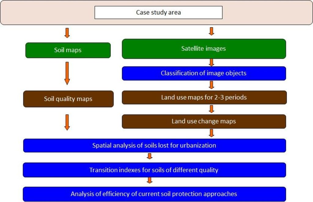
Land use maps of at least 10-meter resolution are produced for two historical periods through classification of the satellite images and using available local land use information. The information on land use change is superimposed on maps characterizing soil quality in order to detect to what extend the urbanization took place on valuable soils. The new sealed area, reflecting the built up sprawl of at least last 15 years, consists with expansion of the following land use classes: continuous residential area, commercial/industrial area and transport facilities. The soils under these new land use types fully lost their environmental functions.
In the soil sealing forecasts the Cellular Automata-based Metronamica model is used. The software was developed and provided by the Research Institute from Knowledge Systems (RIKS) from Maastricht, The Netherlands. The software utilizes cellular automata model to spatially distribute areas of particular land use classes with assumption that the neighborhood of a cell (surrounding cells) influences the transition of this cell into other land use class in the next time step. The method utilizes land use maps and soil quality maps.
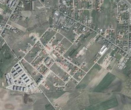
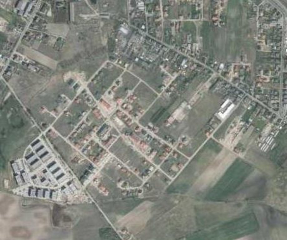
2.3 صور التقنية
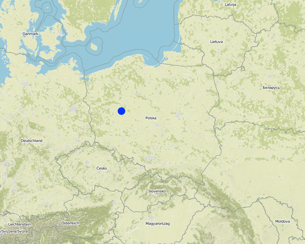
2.5 البلد/المنطقة/المواقع التي تم تنفيذ التقنية فيها والتي يغطيها هذا التقييم
البلد:
بولندا
المنطقة/الولاية/المحافظة:
Poland/Great Poland province
مزيد من التفاصيل حول الموقع:
Poznań
حدد انتشار التقنية:
- منتشرة بالتساوي على مساحة
إذا كانت التقنيةا موزعة بالتساوي على منطقة ما، حدد المساحة المغطاة (بالكيلومتر المربع):
199,0
إذا كانت المساحة الدقيقة غير معروفة، فيرجى الإشارة إلى المنطقة التقريبية المغطاة:
- 1,000-100 كم2
التعليقات:
Total area covered by the SLM Technology is 199 km2.
Map
×2.6 تاريخ التنفيذ
في حالة عدم معرفة السنة بالتحديد، يرجى الإشارة إلى التاريخ التقريبي:
- منذ أقل من 10 سنوات (مؤخرًا)
2.7 إدخال التقنية
حدد كيف تم إدخال التقنية:
- أثناء التجارب/الأبحاث
- من خلال المشاريع/ التدخلات الخارجية
3. تصنيف تقنية الإدارة المستدامي للأراضي
3.1 الغرض الرئيسي ( الأغراض الرئيسية) للتقنية
- خلق أثر اقتصادي مفيد
- خلق أثر اجتماعي مفيد
- Create and spread knowledge
3.2 نوع (أنواع) استخدام الأراضي الحالية حيث يتم تطبيق التقنية

الأراضي الزراعية
- زراعة سنوية
عدد مواسم الزراعة في السنة:
- 1
حدد:
Longest growing period in days: 215, Longest growing period from month to month: April - October

أراضي الرعي
التعليقات:
Major land use problems (compiler’s opinion): Preferential sealing of most productive soils.
3.5 مجموعةالإدارة المستدامة للأراضي التي تنتمي إليها هذه التقنية
- الحد من مخاطر الكوارث بالاستناد على النظام البيئي
- Creating and sharing knowledge
3.6 التدابير التقنية في مجال إلادارة المستدامة للأراضي

التدابير الإدارية
- M2: تغيير في مستوى الإدارة/الكثافة
3.7 الأنواع الرئيسية من تدهور الأراضي التي تناولتها التقنية

التدهور المادي أو الفيزيائي للتربة
- (Pu): فقدان الوظيفة الإنتاجية الحيوية بسبب أنشطة أخرى
التعليقات:
Main causes of degradation: urbanisation and infrastructure development, population pressure, governance / institutional
Secondary causes of degradation: inputs and infrastructure: (roads, markets, distribution of water points, other, …)
3.8 منع أو حد أو عكس تدهور الأراضي
تحديد هدف التقنية فيما يتعلق بتدهور الأراضي:
- منع تدهور الأراضي
- الحد من تدهور الأراضي
4. المواصفات الفنية، وأنشطة التنفيذ، والمدخلات، والتكاليف
4.1 الرسم الفني للتقنية
المواصفات الفنية (المتعلقة بالرسم الفني):
This is a schema for soil sealing maps developement.
Technical knowledge required for land users: moderate (Developers)
Technical knowledge required for Administration: high
Technical knowledge required for Researchers: high
Main technical functions: improvement of surface structure (crusting, sealing), increase of infiltration, spatial arrangement and diversification of land use
Secondary technical functions: improvement of water quality, buffering / filtering water
Change of land use type: Limited conversion of agricultural land into urban purposes.
Change of land use practices / intensity level: Steering new constructions to soils with less functions. Limited sealing of high quality soils.
5. البيئة الطبيعية والبشرية
5.1 المناخ
هطول الأمطار السنوي
- < 250 مم
- 251- 500 ملم
- 501 - 750ملم
- 1,000-751 ملم
- 1,500-1,100 ملم
- 2,000-1,500 ملم
- 3,000-2,001 ملم
- 4,000-3,100 ملم
- > 4000 ملم
المنطقة المناخية الزراعية
- شبه رطبة
Thermal climate class: temperate
5.2 طوبوغرافيا
متوسط الانحدارات:
- مسطح (0-2%)
- بسيط (3-5%)
- معتدل (6-10%)
- متدحرج (11-15%)
- تلال (16-30%)
- شديدة الانحدار(31-60%)
- فائقة الانحدار (>60%)
التضاريس:
- هضاب/سهول
- أثلام مرتفعة
- المنحدرات الجبلية
- منحدرات التلال
- منحدرات في السفوح
- قاع الوادي
المنطقة الارتفاعية:
- 100-0 متر فوق سطح البحر
- 500-101 متر فوق سطح البحر
- 1,000-501 متر فوق سطح البحر
- 1,500-1,001 متر فوق سطح البحر
- 2,000-1,501 متر فوق سطح البحر
- 2,500-2,100 متر فوق سطح البحر
- 3,000-2,501 متر فوق سطح البحر
- 4,000-3,001 متر فوق سطح البحر
- > 4000 متر فوق سطح البحر
وضح ما إذا كانت التقنية مطبقة على وجه التحديد في:
- غير ذات صلة
5.3 التربة
متوسط عمق التربة:
- ضحل جدًا (0-20 سم)
- ضحلة (21-50 سم)
- متوسطة العمق (51-80 سم)
- عميقة (81-120 سم)
- عميقة جدًا (> 120 سم)
قوام التربة (التربة السطحية):
- متوسط ( طميي، سلتي)
المواد العضوية في التربة السطحية:
- متوسطة (1-3%)
إذا كان متاحًا، قم بإرفاق وصف كامل للتربة أو تحديد المعلومات المتوفرة، على سبيل المثال نوع التربة، الرقم الهيدروجيني/ درجة حموضة التربة، قدرة التبادل الكاتيوني، النيتروجين، الملوحة وما إلى ذلك.
Soil fertility: High
Soil drainage/infiltration: Medium (ranked 1) and poor (ranked 2)
Soil water storage capacity: Medium
5.4 توافر المياه ونوعيتها
منسوب المياه الجوفية:
< 5 م
توافر المياه السطحية:
جيد
5.6 خصائص مستخدمي الأراضي الذين يطبقون التقنية
التوجه السوقي لنظام الإنتاج:
- مختلط (كفاف/ تجاري)
أفراداً أو مجموعات:
- موظف (شركة، حكومة)
اذكر الخصائص الأخرى ذات الصلة لمستخدمي الأراضي:
Population density: > 500 persons/km2
5.7 متوسط مساحة الأرض التي يستخدمها مستخدمو الأراضي الذين يطبقون التقنية
- < 0.5 هكتارا
- 0.5 - 1 هكتار
- 1 -2 هكتار
- 2 - 5 هكتار
- 5 - 15 هكتار
- 15 - 50 هكتار
- 50 - 100هكتار
- 500-100 هكتار
- 1,000-500 هكتار
- 10,000-1,000 هكتار
- > 10,000 هكتار
هل يعتبر هذا نطاقًا صغيرًا أو متوسطًا أو واسعا (في إشارة إلى السياق المحلي)؟:
- على نطاق واسع
5.8 ملكية الأراضي، وحقوق استخدام الأراضي، وحقوق استخدام المياه
ملكية الارض:
- فردية، يوجد سند ملكية
حقوق استخدام الأراضي:
- فردي
5.9 الوصول إلى الخدمات والبنية التحتية
الصحة:
- ضعيف
- معتدل
- جيد
التعليم:
- ضعيف
- معتدل
- جيد
المساعدة التقنية:
- ضعيف
- معتدل
- جيد
العمل (على سبيل المثال خارج المزرعة):
- ضعيف
- معتدل
- جيد
الأسواق:
- ضعيف
- معتدل
- جيد
الطاقة:
- ضعيف
- معتدل
- جيد
الطرق والنقل:
- ضعيف
- معتدل
- جيد
مياه الشرب وخدمات الصرف الصحي:
- ضعيف
- معتدل
- جيد
الخدمات المالية:
- ضعيف
- معتدل
- جيد
6. الآثار والتصريحات الختامية
6.1 الآثار التي أظهرتها التقنية في الموقع
الآثار الاجتماعية والاقتصادية
الإنتاج
إنتاج الأعلاف
التعليقات/ حدد:
comparing to baseline scenario
منطقة الإنتاج
التعليقات/ حدد:
comparing to baseline scenario
توافر المياه ونوعيتها
توافر مياه الري
التعليقات/ حدد:
comparing to baseline scenario
نوعية مياه الري
التعليقات/ حدد:
comparing to baseline scenario
الآثار الاجتماعية والثقافية
الأمن الغذائي / الاكتفاء الذاتي
التعليقات/ حدد:
comparing to baseline scenario
الفرص الترفيهية
التعليقات/ حدد:
comparing to baseline scenario
المعرفة بالإدارة المستدامة للأراضي/تدهور الأراضي
الآثار الايكولوجية
دورة المياه / الجريان السطحي
الجريان السطحي
التربة
فقدان التربة
تكون قشرة التربة السطحية/انسداد مسام التربة
تراص التربة
التنوع البيولوجي: الغطاء النباتي، الحيوانات
تنوع الموائل
6.2 الآثار التي أظهرتها التقنية خارج الموقع
توافر المياه
الفيضان في اتجاه مجرى النهر
6.5 اعتماد التقنية
التعليقات:
There are examples of land use and soil maps for spatial planing in cities of Central Europe, e.g. Stuttgart. it is impossible to assess the percentage of users.
6.7 نقاط القوة / المزايا / الفرص التي توفرها التقنية
| نقاط القوة/ المزايا/ الفرص من وجهة نظر جامع المعلومات أو غيره من الاشخاص الرئيسيين لمصدر المعلومات |
|---|
| Analysis of various scenarios possible |
| Decisions in spatial planning based on empirical data in spatial format |
6.8 نقاط ضعف / مساوىء / مخاطر التقنية وسبل التغلب عليها
| نقاط الضعف/ المساوىء/ المخاطر من وجهة نظر جامع المعلومات أو غيره من الاشخاص الرئيسيين لمصدر المعلومات | كيف يمكن التغلب عليها؟ |
|---|---|
| Lack of regulations forcing use of the technology | Pressenting examples of implementation in order to encourage to apply at local level strategies |
| Potential errors in forecasts | Improving the data quality and model effectiveness. |
7. المراجع والروابط
7.1 طرق جمع/مصادر المعلومات
- زيارات ميدانية، مسوحات ميدانية
- مقابلات مع مستخدمي الأراضي
متى تم تجميع البيانات (ميدانيا)؟:
28/02/2015
الروابط والوحدات المواضيعية
توسيع الكل طي الكلالروابط

The prevention of soil sealing [بولندا]
The prevention of soil sealing is an approach in which stakeholders are making spatial planning decisions based on the new map of soil sealing, in case of protecting the most valuable soils.
- جامع المعلومات: Tomasz Miturski
الوحدات المواضيعية
لا يوجد وحدات مواضيعية


