Small Irrigation System for Highland Rice Terraces [تايلاند]
- تاريخ الإنشاء:
- تحديث:
- جامع المعلومات: Pitayakon Limtong
- المحرر: –
- المراجعون: Rima Mekdaschi Studer, William Critchley
Checkdam for highland rice terrace
technologies_4114 - تايلاند
عرض الأقسام
توسيع الكل طي الكل1. معلومات عامة
1.2 تفاصيل الاتصال بالأشخاص الرئيسيين لمصدر المعلومات والمؤسسات المشاركة في تقييم وتوثيق التقنية
الشخص (الأشخاص) الرئيسي لمصدر المعلومات
متخصص في الإدارة المستدامة للأراضي:
Srisomkhew Sasirin
662 579 1409 / 669 8269 6410
sasirin0928@gmail.com / sasirin0928@gmail.com
Land Development Department
Paholyothin Road, Chatuchak, Bangkok 10999, Thailand
تايلاند
SLM Consultant:
Limtong Pitayakon
66 89 444 6599
pitaya@ldd.go.th / pitaya49@msn.com
Land Development Department
Paholyothin Road, Chatuchak, Bangkok 10999, Thailand
تايلاند
مستخدم الأرض:
Kayanyaiyie Mr.Vitoon
668 7188 0798
Soil Doctor Volunteer
Moo 5, Ban Don Village, Mae La Noi Sub-district, Huay Hom District, Mae Hong Son Province 58120
تايلاند
مستخدم الأرض:
Kongvili Mr.Boonpan
668 4740 1550
47 Moo 5, Ban Don Village, Mae La Noi Sub-district, Huay Hom District, Mae Hong Son Province 58120
تايلاند
مستخدم الأرض:
khangJing Mr.Suchat
668 3660 0272
1/2 Moo 5, Ban Don Village, Mae La Noi Sub-district, Huay Hom District, Mae Hong Son Province 58120
تايلاند
مستخدم الأرض:
KangJing Mr.Somnuek
668 8764 1683
Village Headman
1 Moo 5, Ban Don Village, Mae La Noi Sub-district, Huay Hom District, Mae Hong Son Province 58120
تايلاند
اسم المؤسسة (المؤسسات) التي سهلت توثيق/تقييم التقنية (إذا كان ذلك على صلة)
Land Development Department LDD (Land Development Department LDD) - تايلاند1.3 الشروط المتعلقة باستخدام البيانات الموثقة من خلال WOCAT
متى تم تجميع البيانات (ميدانيا)؟:
11/09/2018
يوافق جامع المعلومات والشخص (لاشخاص) الرئيسي لمصدر المعلومات على الشروط المتعلقة باستخدام البيانات الموثقة من خلال WOCAT:
نعم
1.4 إعلان بشأن استدامة التقنية الموصوفة
هل التقنية الموصوفة هنا تمثل مشكلة فيما يتعلق بتدهور الأراضي، بحيث لا يمكن إعلانها تقنية مستدامة لإدارة الأراضي؟:
كلا
التعليقات:
Water supply systems in the high landscape rice terraces can prevent land degradation and also land users can utilize this area for producing rice in limited agricultural land. Because this system slows down the water flow, it reduces soil erosion into water courses and controls the amount of water that flows from the forest upstream to the rice terraces. This system increases water available to the rice terraces and improves the utilization of water, thus maximizing benefits for growth and yield of rice.
2. وصف تقنيةالإدارة المستدامي للأراضي
2.1 وصف مختصر للتقنية
تعريف التقنية:
An irrigation distribution system to highland rice terraces is required for agriculture on these highland slopes. It is based on the principles of water management in the area by diversion of water from natural watersheds upstream to the agricultural land - with regulation by village community consensus.
2.2 وصف تفصيلي للتقنية
الوصف:
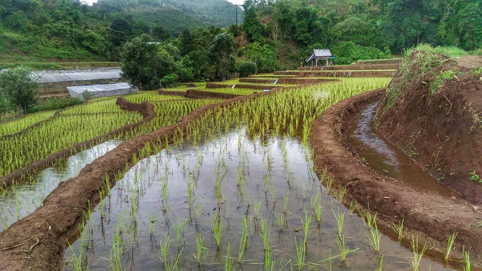
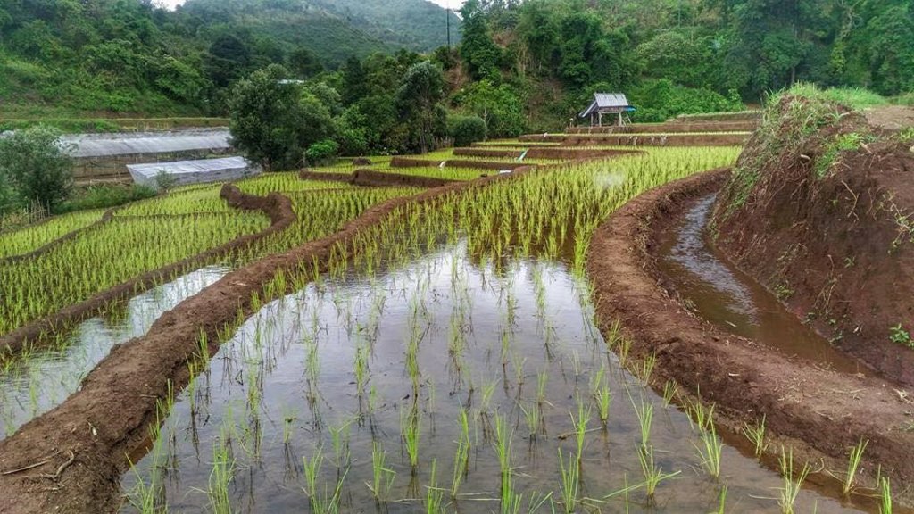
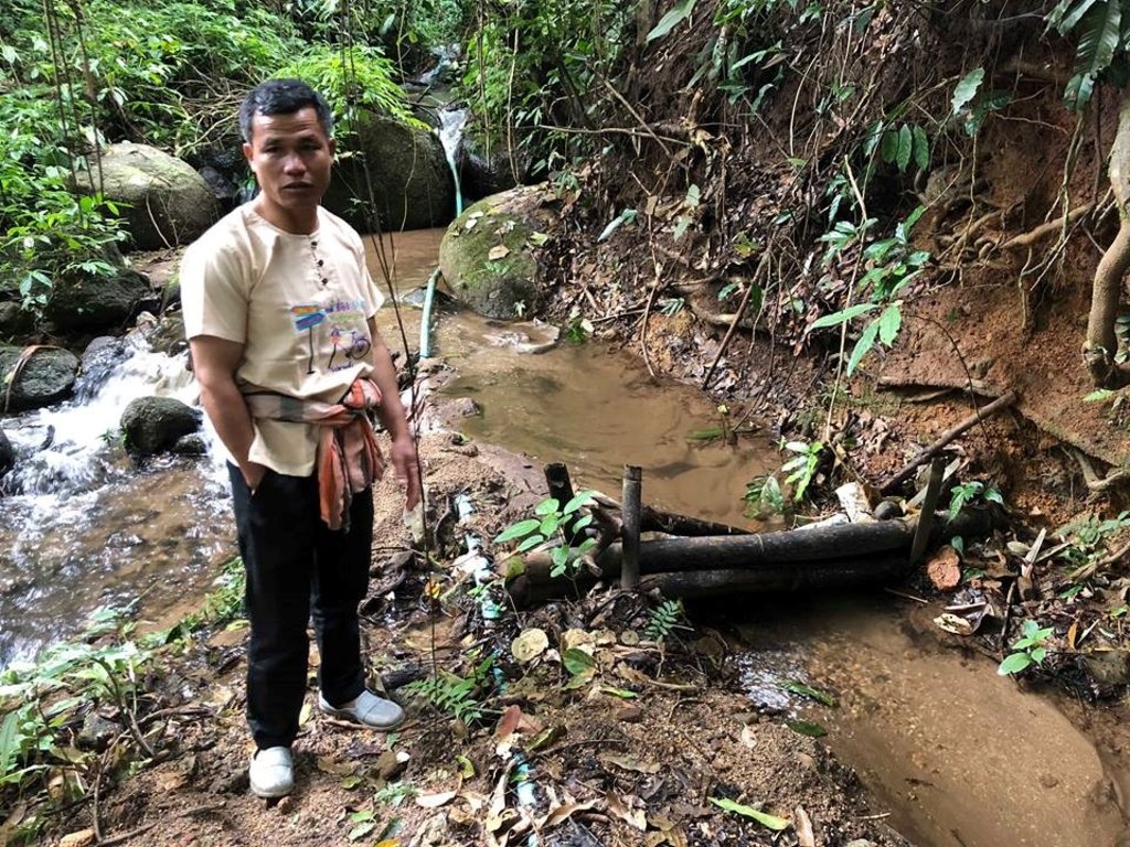
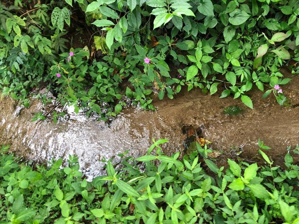
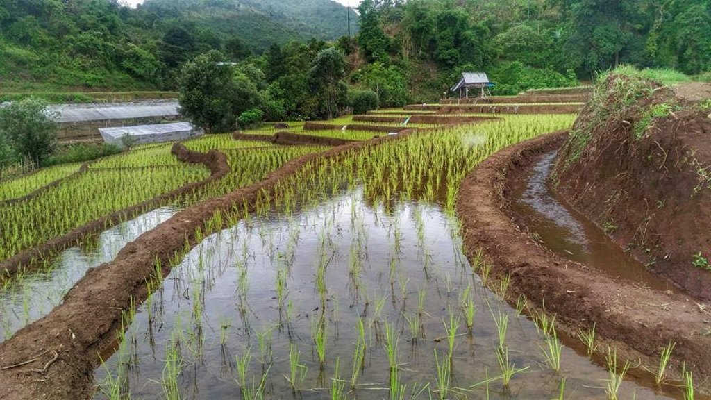
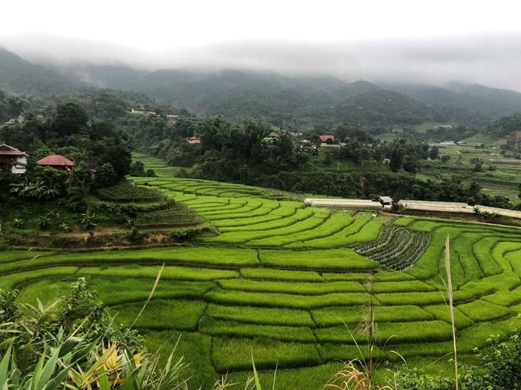
The topography of this mountainous area, Mae La Noi District, Mae Hong Son Province, is complex. The height ranges from 994 -1,100 m above sea level (m asl). The main river is Mae La Noi. The climate is cool all year round. The annual average temperature is 25 degrees Celsius (⁰C), maximum temperature is 37⁰C in April, and minimum temperature is 8⁰C during December. The annual average rainfall is 1,500 mm and lasts from June to October. The number of households is 147, with total population of approx 763, 400 (Mae La Noi Royal Project Development Center, 2561). An irrigation distribution system to highland rice terraces is required for agriculture on these highland slopes. It is based on the principles of water management in the area by diversion of water from natural watersheds in the upstream areas to the agricultural land - with regulation by village community consensus. The steps of preparation are as follows. 1. Site selection: Rice terraces should be on suitable slopes, not more than 60 degrees, otherwise it will be difficult to excavate the slope and rice fields become very narrow. 2. Reshaping and leveling the slope: The sloping land for rice terrace should be reshaped and levelled by either manpower or mechanical means. The terraces can extend up to 50 m long, be as little as 1 m wide and 0.5 m deep, depending on the slope. The leveling of soil surface in the plot is done by releasing water into that plot and adjust the soil surface until a good level is attained. 3. Soil improvement: Generally, soil structure and fertility in the plots is very low because of reshaping and leveling. It is therefore necessary to restore and improve by application of organic matter, compost, animal manure, legumes, etc. Soil pH must be adjusted, and nutrients such as phosphorus and potassium should be added based on soil analytical results. 4. Rice cultivation: In the first years of cultivation, the terraces may not store water at the desired level, so rice is planted in small holes. Normally, farmers plant rice seedlings (3-5 seedlings per hole) at a spacing of 20 x 20 cm. 5. Fertilizer application: In this highland area focus should be on organic fertilizers to reduce costs, because people can find materials locally such as animal manure and plant residues. 6. Water supply system: Distribution of water to the rice terraces is managed by small dams or weirs to release suitable amount of water through a small water channel to rice terraces. This water distribution system will spread water to all land users in this area, and there is sufficient water for farming throughout the year. 7. Disease and insect control: Most rice varieties are native, so they have high resistance. But there could be some disease/insect outbreaks; they have to be protected according to instructions. The submerged condition in the paddy field can help control weeds, but some labour is still needed. 8. Maintenance: For small dams or weirs, small water channels and terraces, it is necessary to restore and maintain twice a year, i.e. before and after harvest.
2.3 صور التقنية
2.4 فيديوهات عن التقنية
التاريخ:
11/09/2018
الموقع:
Mae La Noi District, Mae Hong Son Province, Thailand
اسم مصور الفيديو:
Ms.Sasirin Srisomkhew
التاريخ:
21/03/2018
الموقع:
Mae La Noi District, Mae Hong Son Province, Thailand
التاريخ:
11/09/2018
الموقع:
Mae La Noi District, Mae Hong Son Province, Thailand
اسم مصور الفيديو:
Ms.Sasirin Srisomkhew
2.5 البلد/المنطقة/المواقع التي تم تنفيذ التقنية فيها والتي يغطيها هذا التقييم
البلد:
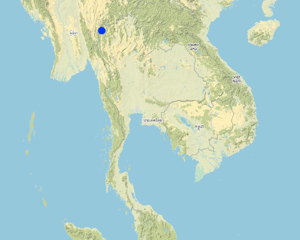
تايلاند
المنطقة/الولاية/المحافظة:
Mae La Noi District, Mae Hong Son Province, Thailand
Map
×2.6 تاريخ التنفيذ
في حالة عدم معرفة السنة بالتحديد، يرجى الإشارة إلى التاريخ التقريبي:
- منذ أكثر من 50 عامًا (تقليدي)
2.7 إدخال التقنية
حدد كيف تم إدخال التقنية:
- كجزء من النظام التقليدي (> 50 عامًا)
3. تصنيف تقنية الإدارة المستدامي للأراضي
3.1 الغرض الرئيسي ( الأغراض الرئيسية) للتقنية
- الحد من تدهور الأراضي ومنعه وعكسه
- حماية مستجمعات المياه / المناطق الواقعة في اتجاه مجرى النهر - مع تقنيات أخرى
- الحد من مخاطر الكوارث
- التكيف مع تغير المناخ/الظواهر المتطرفة وآثارها
- التخفيف من تغير المناخ وآثاره
3.2 نوع (أنواع) استخدام الأراضي الحالية حيث يتم تطبيق التقنية

الأراضي الزراعية
- زراعة سنوية
المحاصيل الرئيسية (المحاصيل النقدية والغذائية):
Paddy rice and vegetables such as chili, cabbage

المجاري المائية، المسطحات المائية، الأراضي الرطبة
- خطوط الصرف، الممرات المائية
المنتجات / الخدمات الرئيسية:
Small dams or weirs with small water channels to supply/distribute water to rice terraces.
التعليقات:
Farmers in the area will grow rice in the rainy season for household consumption. The duration of cultivation until harvesting is about 6 months. In the dry season, the farms are converted to several kind of vegetables under support by the Royal Project Foundation.
3.3 مزيد من المعلومات حول استخدام الأراضي
إمدادات المياه للأرض التي يتم تنفيذ التقنية عليها:
- بعلية
التعليقات:
The system of water supply of this technology distributes water resources from forest upstream to the rice terrace.
عدد مواسم الزراعة في السنة:
- 3
حدد:
Paddy rice once a year and vegetables 1-2 crops a year
3.4 مجموعةالإدارة المستدامة للأراضي التي تنتمي إليها هذه التقنية
- التدابير المتقاطعة للمنحدرات
- تحويل المياه والصرف
3.5 انتشار التقنية
حدد انتشار التقنية:
- يتم تطبيقها في نقاط محددة/ تتركز على مساحة صغيرة
التعليقات:
This water system covered around 200 households, each household covers an area of 0.5 hectare.
3.6 التدابير التقنية في مجال إلادارة المستدامة للأراضي

التدابير البنيوية
- S1: المصاطب المتدرجة

التدابير الإدارية
- M7: أخرى
3.7 الأنواع الرئيسية من تدهور الأراضي التي تناولتها التقنية

تآكل التربة بالمياه
3.8 منع أو حد أو عكس تدهور الأراضي
تحديد هدف التقنية فيما يتعلق بتدهور الأراضي:
- منع تدهور الأراضي
4. المواصفات الفنية، وأنشطة التنفيذ، والمدخلات، والتكاليف
4.1 الرسم الفني للتقنية
المؤلف:
Ms.Sasirin Srisomkhew
التاريخ:
25/09/2018
4.2 المواصفات الفنية/شروحات الرسم الفني
The irrigation water distribution system for highland rice terraces by farmers in the village is suitable for highland, sloping agriculture, with slopes ranging from 5-60 degrees. It is based on the principles of water management in the area by diversion of water from natural watersheds in the upstream zone to the agricultural land through the consensus of community members. Distribution of water to the rice terraces is managed by small dams or weir which are used to divert and release suitable amount of water through small water channels to rice terraces. The terraces can extend up to 50m long, 1m (or more) wide and 0.5m deep, depending on the degree of the slope. This water distribution system will spread water to all land users in this area, and there is sufficient water for farming throughout the year.
4.3 معلومات عامة بخصوص حساب المدخلات والتكاليف
حدد كيفية احتساب التكاليف والمدخلات:
- حسب مساحة تنفيذ التقنية
الإشارة إلى حجم ووحدة المساحة:
0.48 hectare for each farmer
عملة أخرى/ عملة وطنية (حدد):
Baht (THB)
أشر إلى سعر الصرف من الدولار الأمريكي إلى العملة المحلية (إذا كان ذا صلة): 1 دولار أمريكي =:
32,0
اذكر متوسط تكلفة أجر العمالة المستأجرة في اليوم الواحد:
300
4.4 أنشطة التأسيس
| النشاط | نوع التدبير | التوقيت | |
|---|---|---|---|
| 1. | prepare small dam and water canal | بنيوية أو هيكلية | in the first year |
| 2. | prepare terraces and land leveling | بنيوية أو هيكلية | in the first year |
| 3. | cultivation | بنيوية أو هيكلية | before rainny season |
| 4. | soil improvement | إدارية | after preparing and cultivating the soil |
| 5. | rice planting | نباتية | rainy season |
| 6. | fertilizer application | إدارية | after planting |
| 7. | irrigation | إدارية | after planting |
| 8. | disease, pest and weed control | إدارية | after planting |
| 9. | havesting | زراعية | when rice grains are mature |
| 10. | None | None |
4.5 التكاليف والمدخلات اللازمة للتأسيس
إذا كان ذلك ممكنًا، قم بتفصيل تكاليف التأسيس وفقًا للجدول التالي، مع تحديد المدخلات والتكاليف لكل مدخل. إذا لم تتمكن من تفصيل التكاليف، فقدم تقديرًا للتكاليف الإجمالية لإنشاء التقنية:
98100,0
| تحديد المدخلات | الوحدة | الكمية | التكاليف لكل وحدة | إجمالي التكاليف لكل مدخل | % من التكاليف التي يتحملها مستخدمو الأراضي | |
|---|---|---|---|---|---|---|
| العمالة | prepare dam and canal | 7x10 | 70,0 | 300,0 | 21000,0 | 100,0 |
| العمالة | planting | 7x1 | 7,0 | 300,0 | 2100,0 | 100,0 |
| العمالة | maintainance | 20x2 | 40,0 | 300,0 | 12000,0 | 100,0 |
| العمالة | harvesting | 20x7 | 140,0 | 300,0 | 42000,0 | 100,0 |
| معدات | tractor | set | 1,0 | 3000,0 | 3000,0 | 100,0 |
| معدات | fuel | liter | 20,0 | 30,0 | 600,0 | 100,0 |
| المواد النباتية | rice seed | bag | 3,0 | 100,0 | 300,0 | 100,0 |
| المواد النباتية | chili seed | plant | 5000,0 | 2,0 | 10000,0 | 100,0 |
| الأسمدة والمبيدات الحيوية | fertilizer 21-0-0 | bag | 3,0 | 400,0 | 1200,0 | 100,0 |
| الأسمدة والمبيدات الحيوية | fertilizer 15-15-15 | bag | 3,0 | 700,0 | 2100,0 | 100,0 |
| الأسمدة والمبيدات الحيوية | fertilizer 16-20-0 | bag | 3,0 | 600,0 | 1800,0 | 100,0 |
| الأسمدة والمبيدات الحيوية | animal manure | bag | 10,0 | 200,0 | 2000,0 | 100,0 |
| إجمالي تكاليف إنشاء التقنية | 98100,0 | |||||
التعليقات:
Labour of small and canal preparation was paid in the first year, after that paid for maintain all of these structuer.
4.6 الصيانة/الأنشطة المتكررة
| النشاط | نوع التدبير | التوقيت/الوتيرة | |
|---|---|---|---|
| 1. | restoration and maintain dam, canal and terrace | بنيوية أو هيكلية | 2 times a year |
4.7 التكاليف والمدخلات اللازمة للصيانة/للأنشطة المتكررة (سنويًا)
إذا كان ذلك ممكنًا، قم بتفصيل تكاليف الصيانة وفقًا للجدول التالي، مع تحديد المدخلات والتكاليف لكل مدخل. إذا لم تتمكن من تفصيل التكاليف، قدم تقديرًا للتكاليف الإجمالية لصيانة التقنية:
1800,0
| تحديد المدخلات | الوحدة | الكمية | التكاليف لكل وحدة | إجمالي التكاليف لكل مدخل | % من التكاليف التي يتحملها مستخدمو الأراضي | |
|---|---|---|---|---|---|---|
| العمالة | restoring and maintaining the dam, water canal and terraces | 2dx3m | 6,0 | 300,0 | 1800,0 | 100,0 |
| إجمالي تكاليف صيانة التقنية | 1800,0 | |||||
إذا تحمل مستخدم الأرض أقل من 100% من التكاليف، حدد من قام بتغطية التكاليف المتبقية:
Land user spend their money for 100% of costs
4.8 أهم العوامل المؤثرة على التكاليف
قدم وصفا لأهم العوامل التي تؤثر على التكاليف:
The most important factors that affect the costs is the labour factor, where farmers need to hire labourers for rice cultivation such as planting, fertilizer application, maintaining the system and harvesting, including, the excavation and restoration of the small dam, water channels and terraces.
5. البيئة الطبيعية والبشرية
5.1 المناخ
هطول الأمطار السنوي
- < 250 مم
- 251- 500 ملم
- 501 - 750ملم
- 1,000-751 ملم
- 1,500-1,100 ملم
- 2,000-1,500 ملم
- 3,000-2,001 ملم
- 4,000-3,100 ملم
- > 4000 ملم
حدد متوسط هطول الأمطار السنوي (إذا كان معروفًا)، بالملليمتر:
1500,00
المنطقة المناخية الزراعية
- شبه رطبة
5.2 طوبوغرافيا
متوسط الانحدارات:
- مسطح (0-2%)
- بسيط (3-5%)
- معتدل (6-10%)
- متدحرج (11-15%)
- تلال (16-30%)
- شديدة الانحدار(31-60%)
- فائقة الانحدار (>60%)
التضاريس:
- هضاب/سهول
- أثلام مرتفعة
- المنحدرات الجبلية
- منحدرات التلال
- منحدرات في السفوح
- قاع الوادي
المنطقة الارتفاعية:
- 100-0 متر فوق سطح البحر
- 500-101 متر فوق سطح البحر
- 1,000-501 متر فوق سطح البحر
- 1,500-1,001 متر فوق سطح البحر
- 2,000-1,501 متر فوق سطح البحر
- 2,500-2,100 متر فوق سطح البحر
- 3,000-2,501 متر فوق سطح البحر
- 4,000-3,001 متر فوق سطح البحر
- > 4000 متر فوق سطح البحر
وضح ما إذا كانت التقنية مطبقة على وجه التحديد في:
- حالات محدبة أو نتؤات
5.3 التربة
متوسط عمق التربة:
- ضحل جدًا (0-20 سم)
- ضحلة (21-50 سم)
- متوسطة العمق (51-80 سم)
- عميقة (81-120 سم)
- عميقة جدًا (> 120 سم)
قوام التربة (التربة السطحية):
- متوسط ( طميي، سلتي)
قوام التربة (> 20 سم تحت السطح):
- متوسط ( طميي، سلتي)
المواد العضوية في التربة السطحية:
- عالية (>3%)
5.4 توافر المياه ونوعيتها
منسوب المياه الجوفية:
سطحية
توافر المياه السطحية:
جيد
نوعية المياه (غير المعالجة):
مياه شرب جيدة
هل تعتبر ملوحة الماء مشكلة؟:
كلا
هل تحدث فيضانات في المنطقة؟:
كلا
5.5 التنوع البيولوجي
تنوع الأنواع:
- متوسط
تنوع الموائل:
- متوسط
5.6 خصائص مستخدمي الأراضي الذين يطبقون التقنية
مستقر أو مرتحل:
- غير المترحل
التوجه السوقي لنظام الإنتاج:
- الكفاف (الإمداد الذاتي)
- تجاري/سوق
الدخل من خارج المزرعة:
- 10-50% من جميع الإيرادات
المستوى النسبي للثروة:
- متوسط
أفراداً أو مجموعات:
- فرد/أسرة معيشية
مستوى المكننة:
- عمل يدوي
- ميكانيكية/ مزودة بمحرك
الجنس:
- نساء
- رجال
عمر مستخدمي الأرضي:
- متوسط العمر
- كبار السن
5.7 متوسط مساحة الأرض المملوكة أو المستأجرة من قبل مستخدمي الأراضي الذين يطبقون التقنية
- < 0.5 هكتارا
- 0.5 - 1 هكتار
- 1 -2 هكتار
- 2 - 5 هكتار
- 5 - 15 هكتار
- 15 - 50 هكتار
- 50 - 100هكتار
- 500-100 هكتار
- 1,000-500 هكتار
- 10,000-1,000 هكتار
- > 10,000 هكتار
هل يعتبر هذا نطاقًا صغيرًا أو متوسطًا أو واسعا (في إشارة إلى السياق المحلي)؟:
- على نطاق متوسط
5.8 ملكية الأراضي، وحقوق استخدام الأراضي، وحقوق استخدام المياه
ملكية الارض:
- فردية، لا يوجد سند ملكية
حقوق استخدام الأراضي:
- مجتمعي (منظم)
حقوق استخدام المياه:
- مجتمعي (منظم)
5.9 الوصول إلى الخدمات والبنية التحتية
العمل (على سبيل المثال خارج المزرعة):
- ضعيف
- معتدل
- جيد
الطاقة:
- ضعيف
- معتدل
- جيد
- ضعيف
- معتدل
- جيد
6. الآثار والتصريحات الختامية
6.1 الآثار التي أظهرتها التقنية في الموقع
الآثار الاجتماعية والاقتصادية
الإنتاج
إنتاج المحاصيل
جودة المحاصيل
توافر المياه ونوعيتها
توافر مياه الشرب
نوعية مياه الشرب
توافر مياه الري
نوعية مياه الري
الدخل والتكاليف
النفقات على المدخلات الزراعية
عبء العمل
الآثار الاجتماعية والثقافية
الأمن الغذائي / الاكتفاء الذاتي
الوضع الصحي
استخدام الأراضي / حقوق المياه
الفرص الثقافية
الفرص الترفيهية
المؤسسات المجتمعية
المعرفة بالإدارة المستدامة للأراضي/تدهور الأراضي
الآثار الايكولوجية
دورة المياه / الجريان السطحي
كمية المياه
جودة المياه
حصاد / جمع المياه
الجريان السطحي
تصريف المياه الزائدة
مستوى المياه الجوفية/ الطبقة المائية الجوفية
التربة
فقدان التربة
تراكم التربة
المادة العضوية في التربة/تحت الطبقة c
الحموضة
التنوع البيولوجي: الغطاء النباتي، الحيوانات
الكتلة الحيوية/ طبقة الكربون فوق التربة
التنوع النباتي
التنوع الحيواني
الأنواع المفيدة
الحد من مخاطر المناخ والكوارث
آثار الفيضانات
آثار الجفاف
انبعاث الكربون والغازات المسببة للاحتباس الحراري
6.2 الآثار التي أظهرتها التقنية خارج الموقع
توافر المياه
تدفقات مائية موثوقة ومستقرة في موسم الجفاف
الفيضان في اتجاه مجرى النهر
تراكم الطمي باتجاه مصب النهر
تلوث المياه الجوفية/الأنهار
آثار الغازات الدفيئة
6.3 تعرض التقنية وحساسيتها لتغير المناخ التدريجي والظواهر المتطرفة/الكوارث المرتبطة بالمناخ (كما يراها مستخدمو الأراضي)
تغير مناخ تدريجي
تغير مناخ تدريجي
| الموسم | نوع التغير المناخي/ المتطرف | كيف تتعامل التقنية مع ذلك؟ | |
|---|---|---|---|
| درجة الحرارة السنوية | باعتدال | ||
| درجة الحرارة الموسمية | الصيف | ليس جيدا | |
| هطول الأمطار السنوي | جيدا |
الظواهر المتطرفة / الكوارث المرتبطة بالمناخ
الكوارث الجوية
| كيف تتعامل التقنية مع ذلك؟ | |
|---|---|
| عاصفة ممطرة محلية | باعتدال |
| عاصفة رعدية محلية | باعتدال |
| عاصفةبَرَد محلية | باعتدال |
الكوارث المناخية
| كيف تتعامل التقنية مع ذلك؟ | |
|---|---|
| حريق الغابة | باعتدال |
الكوارث البيولوجية
| كيف تتعامل التقنية مع ذلك؟ | |
|---|---|
| أمراض وبائية | ليس جيدا على الاطلاق |
| الإصابة بالحشرات/الديدان | ليس جيدا على الاطلاق |
6.4 تحليل التكلفة والعائد
كيف يمكن مقارنة العوائد نسبة لتكاليف الإنشاء (من وجهة نظر مستخدمي الأراضي)؟
عوائد طويلة الأجل:
ايجابي جدا
كيف تتم مقارنة العوائدمع كلفة الصيانة/التكاليف المتكررة (من وجهة نظر مستخدمي الأراضي)؟
عوائد طويلة الأجل:
ايجابي جدا
6.5 اعتماد التقنية
- أكثر من 50%
من بين جميع الذين تبنوا التقنية، كم عدد الذين فعلوا ذلك بشكل تلقائي، أي دون تلقي أي حوافز مادية/مدفوعات؟:
- 100-90%
6.6 التكيف
هل تم تعديل التقنية مؤخرًا لتتكيف مع الظروف المتغيرة؟:
كلا
6.7 نقاط القوة / المزايا / الفرص التي توفرها التقنية
| نقاط القوة/ المزايا/ الفرص من وجهة نظر مستخدمي الأراضي |
|---|
| The villagers are self-reliant by living in balance between demand and supply to meet their own needs. So every household will grow rice for their consumption and solve some problems in water management of these rice terraces by their community. |
| Villagers have knowledge and technology of water management and systematically and continuously transfer to other land users from generation to generation, causing a connection between kinship and community. There are groups to solve the main problems of the community. |
| Villagers have a stable and strong mental state with the hard thinking to fight the obstacle in the way of living, to achieve a more prosperous life. Individual communities have strength in self-reliance, and also have strong mind in learning, having virtue and rationality in thinking and decision-making. |
| They have the ability to promote agriculture with natural resources and ecological tourism and develop the communication system for visitors to access the local information and facilities. |
| نقاط القوة/ المزايا/ الفرص من وجهة نظر جامع المعلومات أو غيره من الاشخاص الرئيسيين لمصدر المعلومات |
|---|
| The selection of appropriate technology can solve the problem of soil degradation, reduce soil erosion and manage adequate water supply to agricultural area for the whole year. |
| The villagers have to rely and trust on each other with high willingness to share their knowledge and experience. |
| Communities have the ability to use existing natural resources in maximizing benefits, and at the same time they try to conserve and prevent soil degradation in this area. |
| Community networking allows them to conduct activities to achieve self-reliance. |
6.8 نقاط ضعف / مساوىء / مخاطر التقنية وسبل التغلب عليها
| نقاط الضعف/ المساوىء/ المخاطر من وجهة نظر مستخدم الأراضي | كيف يمكن التغلب عليها؟ |
|---|---|
| Land users’ lack of ownership of the land that cannot be legally owned by individuals, as the area is located in a preserved forest. The villagers therefore might be afraid to move out of the area in the future. | The community leaders and villagers need to solve this problem, one thing being that they should ask the government to help. |
| Lack of opportunities for children to have education caused by the poverty of their parents. | Schools in the area have increased educational opportunities for poor children by sponsoring underprivileged children. |
| Lack of social and health welfare because this area is far from the city. Villagers will not be able to reach the hospital in time in the case of emergency. | Villagers take the right treatment from the gold card or project 30 baht free treatment of all diseases for emergency situations. |
| Lack the coverage of energy and communication system in this area. Some areas still lack electricity, telephone and internet facilities. | Some villagers purchased and installed solar panels for their own use. |
| نقاط الضعف/ المساوىء/ المخاطر من وجهة نظر جامع المعلومات أو غيره من الاشخاص الرئيسيين لمصدر المعلومات | كيف يمكن التغلب عليها؟ |
|---|---|
| The villagers lack the ownership of the land, which located in the conserved forest. That means they do not have right to hold the land. | The government has a policy to solve these problems, and at the same time serve and arrange this preserved forest as natural resource. |
| Lack of educational opportunities, The study site is located in a remote area. Children living there lack opportunities in education. | The government has a policy to give underprivileged children equal education to children. |
| Villagers lack social and health welfare because of the remoteness of the place that they live. It is difficult to access medical treatment and hospital. | The government has set up and supported the budget to develop district health promotion hospitals in the sub-district level. |
7. المراجع والروابط
7.1 طرق جمع/مصادر المعلومات
- زيارات ميدانية، مسوحات ميدانية
- مقابلات مع مستخدمي الأراضي
- مقابلات مع المتخصصين/الخبراء في الإدارة المستدامة للأراضي
- التجميع من التقارير والوثائق الأخرى الموجودة
7.3 روابط للمعلومات ذات الصلة المتوفرة على الإنترنت
العنوان/الوصف:
Ecological tourism of Mae La Noi Development Center, Royal Project
عنوان الرابط URL:
https://www.youtube.com/watch?v=818zn7JMKsU
العنوان/الوصف:
Mae La Noi Royal Project Foundation
عنوان الرابط URL:
https://www.youtube.com/watch?v=M8pFfl18fC8
العنوان/الوصف:
Mae La Noi Development Center of Royal Project Foundation
عنوان الرابط URL:
http://www.mhsdc.org/interest510.htm
العنوان/الوصف:
History of Mae La Noi Development Center
عنوان الرابط URL:
http://www.mhsdc.org/rypmaenoi.htm
العنوان/الوصف:
Mae La Noi Project for tourism of beautiful paddy rice terrace
عنوان الرابط URL:
https://mgronline.com/travel/detail/9590000106920
العنوان/الوصف:
Mae La Noi Development Center of Royal Project Foundation
عنوان الرابط URL:
http://royalprojectthailand.com/maelanoi
العنوان/الوصف:
Rice terrace in highland
عنوان الرابط URL:
http://www.ricethailand.go.th/rkb/management/index.php
الروابط والوحدات المواضيعية
توسيع الكل طي الكلالروابط
لا يوجد روابط
الوحدات المواضيعية
لا يوجد وحدات مواضيعية


