Afforestation /Tree planting [Uganda]
- Creation:
- Update:
- Compiler: Wilson Bamwerinde
- Editor: –
- Reviewers: Fabian Ottiger, Alexandra Gavilano
Okubyara emiti ahiyabire etari (Runyankore)
technologies_1577 - Uganda
View sections
Expand all Collapse all1. General information
1.2 Contact details of resource persons and institutions involved in the assessment and documentation of the Technology
SLM specialist:
SLM specialist:
Mpiirwe Emmy
Dept. of Agriculture, Mbarara District Local Government
Uganda
SLM specialist:
Mazimakwo Kukundakwe
Kabale District
Uganda
Name of project which facilitated the documentation/ evaluation of the Technology (if relevant)
The Transboundary Agro-ecosystem Management Project for the Kagera River Basin (GEF-FAO / Kagera TAMP )Name of the institution(s) which facilitated the documentation/ evaluation of the Technology (if relevant)
Food and Agriculture Organization of the United Nations (FAO) - ItalyName of the institution(s) which facilitated the documentation/ evaluation of the Technology (if relevant)
Ministry of Agriculture, Animal Industry, and Fisheries of Uganda (MAAIF) - Uganda1.3 Conditions regarding the use of data documented through WOCAT
The compiler and key resource person(s) accept the conditions regarding the use of data documented through WOCAT:
Yes
1.5 Reference to Questionnaire(s) on SLM Approaches (documented using WOCAT)

Afforestation/Tree planting [Uganda]
Tree planting carried out by individual land users on hilly slopes to improve soil cover ,reduce wind strength , provide wood fuel & household income.
- Compiler: Wilson Bamwerinde
2. Description of the SLM Technology
2.1 Short description of the Technology
Definition of the Technology:
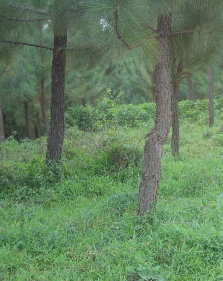
Pine tree forests have been strategically planted on previously bare ridges and slopes to mitigate mass soil movement.
2.2 Detailed description of the Technology
Description:
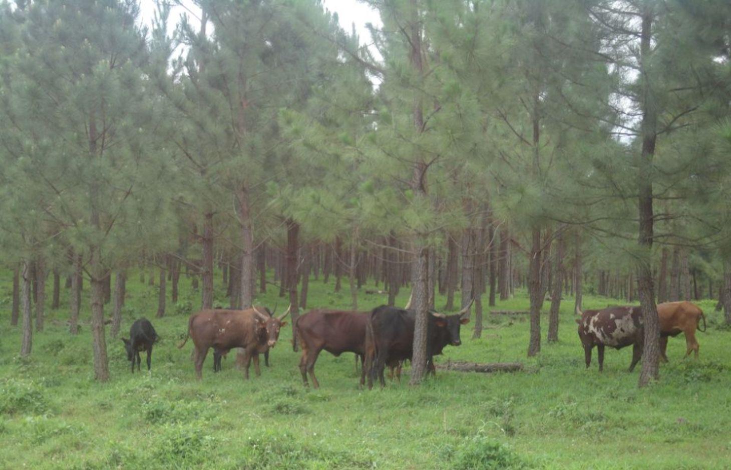
The technology has mitigated soil erosion and damage on road infrastructure by fast flowing runoff, and rejuvenated biodiversity in the area. Much forest cover in Mwizi has been decimated as the need for fuel wood, charcoal and land for agriculture has increased. Coupled with changing weather patterns, human and livestock pressure, many ridges and hilly slopes have been left bare. With annual rainfall of over 1200 mm, runoff often causes extensive damage to cropland and road infrastructure.
In Rubagano, the Forest Department of the Government of Uganda set aside over 20 km2 of degraded ridges and hilly slopes for tree planting. The department planted the first part as a demonstration. The other part is being planted by individuals. Projects such as ULAMP (5 to 10 years ago) and Kagera TAMP (since 2011) have worked with the communities in the area, encouraging the technology by supplying Pinus spp seedlings, training farmers to start their own tree nurseries and forming Farmer Field Schools as vehicles for generation of community consensus on sustainable land management interventions.
Purpose of the Technology: The objectives of afforestation are to provide protection of the land against soil erosion, to return productivity to degraded hilly slopes, to reduce crop (banana) devastation caused by strong winds during rainy season, to grow the capacity of available fuel wood in the area, to diversify future households incomes and protect public infrastructure, especially the road network during the rainy season.
Establishment / maintenance activities and inputs: Most of the older trees, 3 years and over, were planted from seedlings bought from established tree growers. Currently, the Farmer Field Schools are planting seedlings from their own nurseries. In the nursery, plastic sleeves called poly-pots are packed with top-soil mixed with animal manure to provide a growing medium. A calculated amount of sand is added to enhance drainage. Sowing, watering and root pruning are carried out manually.
Out on the hilly slopes, the land user establishes the woodlot and maintains the trees using his own resources. Field trainers facilitated by Kagera TAMP provide technical guidance to farmers regularly.
Natural / human environment: Woodlots are established on degraded hilly slopes or any other land use type that is not under crop production. The trees need to be protected against destruction by wild fires and livestock.
2.3 Photos of the Technology
Media Gallery
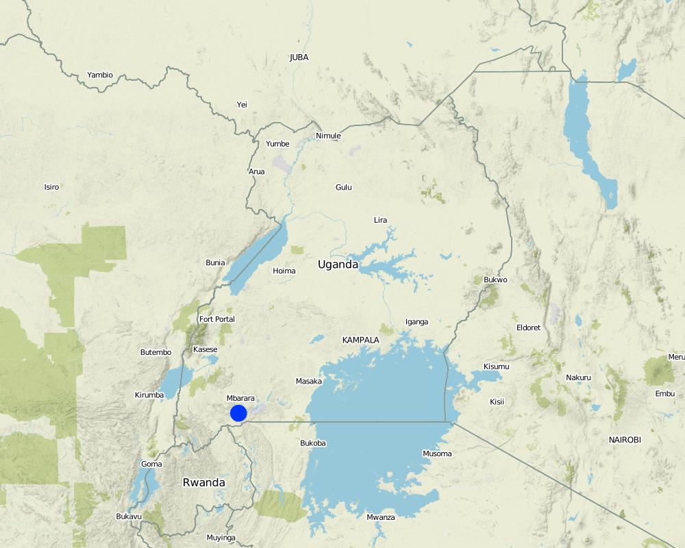
2.5 Country/ region/ locations where the Technology has been applied and which are covered by this assessment
Country:
Uganda
Region/ State/ Province:
Uganda
Further specification of location:
Mbarara
Comments:
Boundary points of the Technology area: -0.85203 30.62232; -0.85792 30.62021; -0.85850 30.62204
Total area covered by the SLM Technology is 3.5 km2.
Tree planting is continuous over a 20 km2 area.
Map
×2.6 Date of implementation
If precise year is not known, indicate approximate date:
- less than 10 years ago (recently)
2.7 Introduction of the Technology
Specify how the Technology was introduced:
- through projects/ external interventions
Comments (type of project, etc.):
2 years for concerted project initiative but more than 10 years for land user initiative.
3. Classification of the SLM Technology
3.1 Main purpose(s) of the Technology
- reduce, prevent, restore land degradation
- create beneficial economic impact
3.2 Current land use type(s) where the Technology is applied
Land use mixed within the same land unit:
Yes
Specify mixed land use (crops/ grazing/ trees):
- Agro-silvopastoralism

Cropland
Number of growing seasons per year:
- 2
Specify:
Longest growing period in days: 120 Longest growing period from month to month: September to December Second longest growing period in days: 90 Second longest growing period from month to month: March to May

Grazing land

Forest/ woodlands
Type of tree:
- Pinus species (pine)
Products and services:
- Timber
- Fuelwood
- Protection against natural hazards
Comments:
Major land use problems (compiler’s opinion): Soil erosion on hilly slopes denuded by livestock overgrazing.
Major land use problems (land users’ perception): Continuous loss of soil and livestock pasture due to lack of, or inadequate vegetation cover
Plantation forestry: It takes long to harvest.
Problems / comments regarding forest use: The adoption is slow because trees take long period to mature and it is expensive in establishment stage.
3.4 Water supply
Water supply for the land on which the Technology is applied:
- rainfed
3.5 SLM group to which the Technology belongs
- agroforestry
3.6 SLM measures comprising the Technology

agronomic measures
- A1: Vegetation/ soil cover

vegetative measures
- V1: Tree and shrub cover
Comments:
Main measures: vegetative measures
Type of vegetative measures: aligned: -against wind
3.7 Main types of land degradation addressed by the Technology

soil erosion by water
- Wt: loss of topsoil/ surface erosion

biological degradation
- Bc: reduction of vegetation cover
Comments:
Main type of degradation addressed: Wt: loss of topsoil / surface erosion, Bc: reduction of vegetation cover
Main causes of degradation: deforestation / removal of natural vegetation (incl. forest fires) (Cutting of short savannah trees for fuel & agricuture land .), overgrazing (Communal and with large herds (over 150 per household)), droughts (Extended droughts over several years in the past decade)
Secondary causes of degradation: over-exploitation of vegetation for domestic use (Thatch, mulch, etc.)
3.8 Prevention, reduction, or restoration of land degradation
Specify the goal of the Technology with regard to land degradation:
- prevent land degradation
- reduce land degradation
Comments:
Main goals: mitigation / reduction of land degradation
Secondary goals: prevention of land degradation
4. Technical specifications, implementation activities, inputs, and costs
4.1 Technical drawing of the Technology
Technical specifications (related to technical drawing):
Location: Rubagano, Mwizi, Mbarara District. Uganda
Date: 5-DEC-2013
Technical knowledge required for field staff / advisors: high (A good grounding in planted forest management including best practices and what could go wrong.)
Technical knowledge required for land users: high (Needs technical knowledge on seedling, planting, thinning weeding and spacing; maintenance including protection from fires and disease)
Main technical functions: control of concentrated runoff: impede / retard, improvement of ground cover, improvement of surface structure (crusting, sealing)
Secondary technical functions: control of raindrop splash, control of dispersed runoff: retain / trap, increase of infiltration, increase / maintain water stored in soil, reduction in wind speed, increase of biomass (quantity)
Aligned: -against wind
Vegetative material: T : trees / shrubs
Number of plants per (ha): 1000
Vertical interval between rows / strips / blocks (m): 3
Spacing between rows / strips / blocks (m): 3
Trees/ shrubs species: Trees (pine spp.) planted from seedlings
Slope (which determines the spacing indicated above): 15-25%
Author:
Byonabye Proscovia, Kagera TAMP, Kabale
4.2 General information regarding the calculation of inputs and costs
other/ national currency (specify):
UGX
If relevant, indicate exchange rate from USD to local currency (e.g. 1 USD = 79.9 Brazilian Real): 1 USD =:
2600.0
Indicate average wage cost of hired labour per day:
3.85
4.3 Establishment activities
| Activity | Timing (season) | |
|---|---|---|
| 1. | Digging holes | Beginning of rainy season |
| 2. | Buying tree seedlings | Beginning of rainy season |
| 3. | Transporting seedlings to the site | Beginning of rainy season |
| 4. | Planting tree seedlings | Beginning of rainy season |
| 5. | Fencing | Any time before the beginning of relevant rainy season |
4.4 Costs and inputs needed for establishment
| Specify input | Unit | Quantity | Costs per Unit | Total costs per input | % of costs borne by land users | |
|---|---|---|---|---|---|---|
| Labour | Labour | ha | 1.0 | 18.63 | 18.63 | 100.0 |
| Equipment | Tools | ha | 1.0 | 3.0 | 3.0 | 100.0 |
| Plant material | Seedlings | ha | 1.0 | 6.8 | 6.8 | |
| Total costs for establishment of the Technology | 28.43 | |||||
| Total costs for establishment of the Technology in USD | 0.01 | |||||
Comments:
Duration of establishment phase: 12 month(s)
US $ per unit and US$ per hectare is not quantified because labour was contracted yearly at a cost of Shs 3,000,000.
4.5 Maintenance/ recurrent activities
| Activity | Timing/ frequency | |
|---|---|---|
| 1. | Weeding | Once every rainy season |
| 2. | Pruning |
4.6 Costs and inputs needed for maintenance/ recurrent activities (per year)
| Specify input | Unit | Quantity | Costs per Unit | Total costs per input | % of costs borne by land users | |
|---|---|---|---|---|---|---|
| Labour | Labour | ha | 1.0 | 9.0 | 9.0 | 100.0 |
| Equipment | Tools | ha | 1.0 | 3.0 | 3.0 | 100.0 |
| Plant material | Seedlings | ha | 1.0 | 0.7 | 0.7 | |
| Total costs for maintenance of the Technology | 12.7 | |||||
Comments:
Machinery/ tools: pangas, hand hoes
Planting 900 pine tree seedlings per hectare (on average), at 3m by 3m spacing.
4.7 Most important factors affecting the costs
Describe the most determinate factors affecting the costs:
Availability and cost of labour are the most determinate factors affecting establishment and maintenance of the technology.
5. Natural and human environment
5.1 Climate
Annual rainfall
- < 250 mm
- 251-500 mm
- 501-750 mm
- 751-1,000 mm
- 1,001-1,500 mm
- 1,501-2,000 mm
- 2,001-3,000 mm
- 3,001-4,000 mm
- > 4,000 mm
Specifications/ comments on rainfall:
September to December and March to May rains. Altit
Agro-climatic zone
- sub-humid
Thermal climate class: tropics. Average annual temperature 18°C to 24°C, very close to the equator.
5.2 Topography
Slopes on average:
- flat (0-2%)
- gentle (3-5%)
- moderate (6-10%)
- rolling (11-15%)
- hilly (16-30%)
- steep (31-60%)
- very steep (>60%)
Landforms:
- plateau/plains
- ridges
- mountain slopes
- hill slopes
- footslopes
- valley floors
Altitudinal zone:
- 0-100 m a.s.l.
- 101-500 m a.s.l.
- 501-1,000 m a.s.l.
- 1,001-1,500 m a.s.l.
- 1,501-2,000 m a.s.l.
- 2,001-2,500 m a.s.l.
- 2,501-3,000 m a.s.l.
- 3,001-4,000 m a.s.l.
- > 4,000 m a.s.l.
Indicate if the Technology is specifically applied in:
- concave situations
Comments and further specifications on topography:
Altitudinal zone: The plantation area ranges between 1650 and 1850 m a.s.l.
5.3 Soils
Soil depth on average:
- very shallow (0-20 cm)
- shallow (21-50 cm)
- moderately deep (51-80 cm)
- deep (81-120 cm)
- very deep (> 120 cm)
Soil texture (topsoil):
- coarse/ light (sandy)
Topsoil organic matter:
- low (<1%)
If available, attach full soil description or specify the available information, e.g. soil type, soil PH/ acidity, Cation Exchange Capacity, nitrogen, salinity etc.
Soil depth on average: Very shallow (it is easy to reach the underground rock)
Soil texture: Coarse/light (rocky and coarse)
Soil fertility: Very low (ranked 1, soil fertility was poor) and low (ranked 2)
Topsoil organic matter: Low (the land was bare with rocky soil)
Soil drainage/infiltration: Medium (water infiltrates slowly/easily)
Soil water storage capacity: Low (the soil drains easily)
5.4 Water availability and quality
Ground water table:
> 50 m
Availability of surface water:
poor/ none
Water quality (untreated):
poor drinking water (treatment required)
Comments and further specifications on water quality and quantity:
Ground water table: >50m (It is very hard to reach ground water table)
Availability of surface water: Poor/none (while the rainfall is good, permanent wells are scarce. Runoff dams behind natural rock formations or concrete walls on a rock base, but quickly drys up after the rainy season)
Water quality (untreated): Poor drinking water (treatement required, while it looks a muddy brown, it has been used for drinking and other domestic purposes without observable harm to the users)
5.5 Biodiversity
Species diversity:
- low
Comments and further specifications on biodiversity:
Slowly rejuvenating since the establishment of the technology.
5.6 Characteristics of land users applying the Technology
Market orientation of production system:
- mixed (subsistence/ commercial)
Off-farm income:
- 10-50% of all income
Relative level of wealth:
- average
- rich
Individuals or groups:
- individual/ household
Gender:
- men
Indicate other relevant characteristics of the land users:
Land users applying the Technology are mainly common / average land users
Difference in the involvement of women and men: In Rubagano, the women are mostly involved in ensuring food security of the household and are not normally involved in aforestation. However, the Farmer Field School methodology has brought many women on board and, helped by the understanding that fuel wood collection is a women's role, women are developing interest in the technology.
Population density: 100-200 persons/km2
Annual population growth: 3% - 4%
10% of the land users are very rich and own 40% of the land.
40% of the land users are rich and own 30% of the land.
40% of the land users are average wealthy and own 20% of the land.
10% of the land users are poor and own 10% of the land.
Off-farm income specification: The technology is new and apart from providing grazing land in the short to medium term, it will yield dividends in 20 to 25 years. Meanwhile, those who are keen on the technology continue to depend on their usual income generating activities, on-farm or off-farm.
Market orientation: Mixed (Land user wanted to reduce soil erosion , increase fuel wood , diversify future income of households)
5.7 Average area of land used by land users applying the Technology
- < 0.5 ha
- 0.5-1 ha
- 1-2 ha
- 2-5 ha
- 5-15 ha
- 15-50 ha
- 50-100 ha
- 100-500 ha
- 500-1,000 ha
- 1,000-10,000 ha
- > 10,000 ha
Is this considered small-, medium- or large-scale (referring to local context)?
- small-scale
Comments:
Most households have less than 1 ha. Few land users have 5-15 ha.
5.8 Land ownership, land use rights, and water use rights
Land ownership:
- individual, not titled
- individual, titled
Land use rights:
- individual
Comments:
The land users own land individually inherited or bought by the holders. Water harvesting and storage in underground tanks is slowly introducing individual water rights and household water security.
5.9 Access to services and infrastructure
health:
- poor
- moderate
- good
education:
- poor
- moderate
- good
technical assistance:
- poor
- moderate
- good
employment (e.g. off-farm):
- poor
- moderate
- good
markets:
- poor
- moderate
- good
energy:
- poor
- moderate
- good
roads and transport:
- poor
- moderate
- good
drinking water and sanitation:
- poor
- moderate
- good
financial services:
- poor
- moderate
- good
6. Impacts and concluding statements
6.1 On-site impacts the Technology has shown
Socio-economic impacts
Production
wood production
Comments/ specify:
Quantification of benefits is difficult at the moment because there is no harvest from the planted trees now.
product diversity
Income and costs
farm income
diversity of income sources
workload
Comments/ specify:
The costs of maintainance.
Socio-cultural impacts
SLM/ land degradation knowledge
Comments/ specify:
The land was bare before, land slides were destroying infrastructure like roads. Problem well mitigated.
Improved livelihoods and human well-being
Comments/ specify:
Not yet to reap the economic benefits of tree planting because trees have not matured.
Ecological impacts
Water cycle/ runoff
surface runoff
excess water drainage
groundwater table/ aquifer
evaporation
Soil
soil moisture
soil cover
soil loss
Biodiversity: vegetation, animals
biomass/ above ground C
plant diversity
habitat diversity
Climate and disaster risk reduction
fire risk
Comments/ specify:
With dense forest come the risk of fire. this is common in a neighboring district (Kiruhura) but is not yet a problem in Rubagano.
wind velocity
6.2 Off-site impacts the Technology has shown
downstream flooding
downstream siltation
damage on neighbours' fields
damage on public/ private infrastructure
6.3 Exposure and sensitivity of the Technology to gradual climate change and climate-related extremes/ disasters (as perceived by land users)
Gradual climate change
Gradual climate change
| Season | increase or decrease | How does the Technology cope with it? | |
|---|---|---|---|
| annual temperature | increase | well |
Climate-related extremes (disasters)
Meteorological disasters
| How does the Technology cope with it? | |
|---|---|
| local rainstorm | well |
| local windstorm | well |
Climatological disasters
| How does the Technology cope with it? | |
|---|---|
| drought | well |
Other climate-related consequences
Other climate-related consequences
| How does the Technology cope with it? | |
|---|---|
| reduced growing period | well |
Comments:
Once established, the pine trees can tolerate all kinds of weather extremes. However, before the initial 12 or so months of establishment, the seedlings are very sensitive to drought and dry spells and will likely dry up because irrigation is not an option in Rubagano, water sources being quite scarce. Mulching helps in preserving soil moisture but the mulch should be at least 30cm away from the plant to avoid destruction by pests.
6.4 Cost-benefit analysis
How do the benefits compare with the establishment costs (from land users’ perspective)?
Short-term returns:
neutral/ balanced
Long-term returns:
very positive
How do the benefits compare with the maintenance/ recurrent costs (from land users' perspective)?
Short-term returns:
neutral/ balanced
Long-term returns:
very positive
Comments:
The land users expect to benefit from the technology when fully established.
6.5 Adoption of the Technology
If available, quantify (no. of households and/ or area covered):
125
Of all those who have adopted the Technology, how many did so spontaneously, i.e. without receiving any material incentives/ payments?
- 0-10%
Comments:
100% of land user families have adopted the Technology with external material support
125 land user families have adopted the Technology with external material support
Comments on acceptance with external material support: While the external material contribution was by way of tree seedlings and contributed probably just 5%, all seedlings were supplied by the project.
Comments on spontaneous adoption: Land users have committed their own resources (over 95% of total establishment costs) but all received the seedlings, at least initially, form the project. The incentive was a wake-up call and the farmers have adopted the technology with enthusiasm.
There is a moderate trend towards spontaneous adoption of the Technology
Comments on adoption trend: The trend is slow due to high cost of initial investment and limited land for tree planting.
6.7 Strengths/ advantages/ opportunities of the Technology
| Strengths/ advantages/ opportunities in the land user’s view |
|---|
|
Protection of soil cover. How can they be sustained / enhanced? Fencing off the woodlots from livestock and other land users. |
|
Provision of fuel woodl. How can they be sustained / enhanced? Regular pruning and thinning. |
| Strengths/ advantages/ opportunities in the compiler’s or other key resource person’s view |
|---|
|
The technology has improved soil cover and reduced soil erosion. How can they be sustained / enhanced? More effort should be put into mobilization of land users in order to scale up best practices onto other areas with bare hills and slopes. |
|
The technology provides an easier alternative source of fuel wood from the remaining pockets of natural woodland. How can they be sustained / enhanced? Regular thinning should provide even more fuel wood and convince land users, especially women, of the advantages accruing from adopting the technology. |
|
Diversification of future household income. How can they be sustained / enhanced? Regular monitoring of the growth of trees to check for pests & diseases. |
|
improvement of micro climate conditions. How can they be sustained / enhanced? Planting trees that have little negative effects on other crops in other land use types. |
6.8 Weaknesses/ disadvantages/ risks of the Technology and ways of overcoming them
| Weaknesses/ disadvantages/ risks in the compiler’s or other key resource person’s view | How can they be overcome? |
|---|---|
| Loss of biodiversity due to trees suppressing under growth of other species. | Copicing to raise the canopy and experimenting with multistory cropping could improve sunlight penetration and improve the emergence of undergrowth. |
7. References and links
7.2 References to available publications
Title, author, year, ISBN:
Kagera TAMP project website
Available from where? Costs?
http://www.fao.org/nr/kagera/en/
Links and modules
Expand all Collapse allLinks
Afforestation/Tree planting [Uganda]
Tree planting carried out by individual land users on hilly slopes to improve soil cover ,reduce wind strength , provide wood fuel & household income.
- Compiler: Wilson Bamwerinde
Modules
No modules