Pipe Irrigation [Nepal]
- Creation:
- Update:
- Compiler: Sabita Aryal
- Editor: –
- Reviewers: Fabian Ottiger, Alexandra Gavilano
Pipe Sinchai
technologies_1599 - Nepal
View sections
Expand all Collapse all1. General information
1.2 Contact details of resource persons and institutions involved in the assessment and documentation of the Technology
SLM specialist:
Karki Nimisha
Kathmandu University
Nepal
SLM specialist:
Niraula Archana
Kathmandu University
Nepal
SLM specialist:
Anish Adhikari
Kathmandu University
Nepal
Name of the institution(s) which facilitated the documentation/ evaluation of the Technology (if relevant)
Kathmandu University (KU) - Nepal1.3 Conditions regarding the use of data documented through WOCAT
The compiler and key resource person(s) accept the conditions regarding the use of data documented through WOCAT:
Yes
1.4 Declaration on sustainability of the described Technology
Is the Technology described here problematic with regard to land degradation, so that it cannot be declared a sustainable land management technology?
No
1.5 Reference to Questionnaire(s) on SLM Approaches (documented using WOCAT)
Pipeline Irrigation [Nepal]
The process and measures taken to draw water from nearby rivers for irrigation and household purposes.
- Compiler: Sabita Aryal
2. Description of the SLM Technology
2.1 Short description of the Technology
Definition of the Technology:
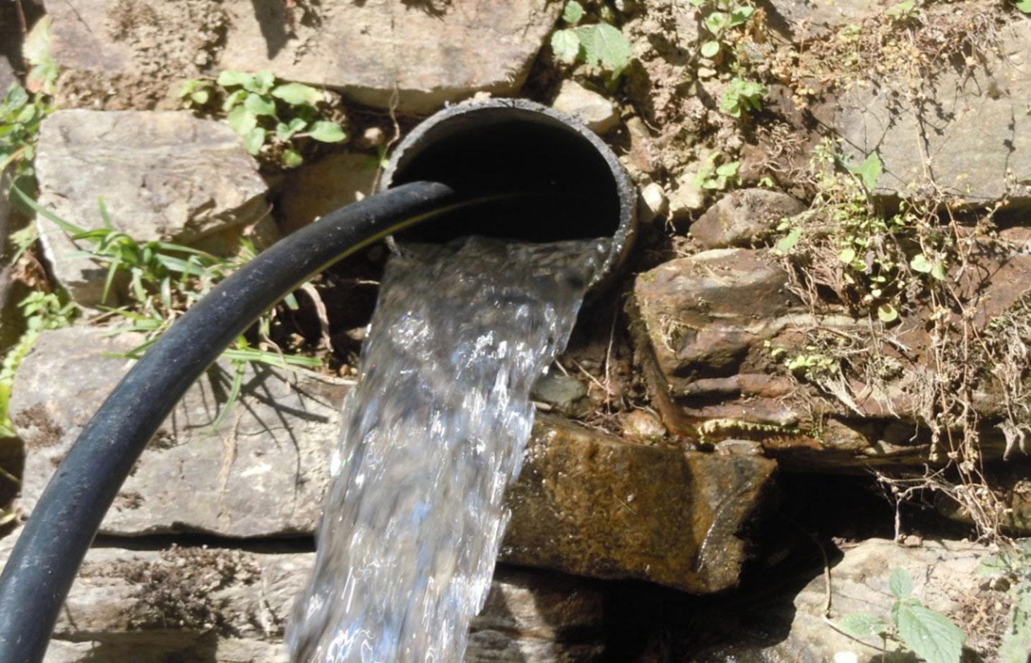
Waterways and pipelines to draw water from closeby rivers for irrigation and household purposes.
2.2 Detailed description of the Technology
Description:
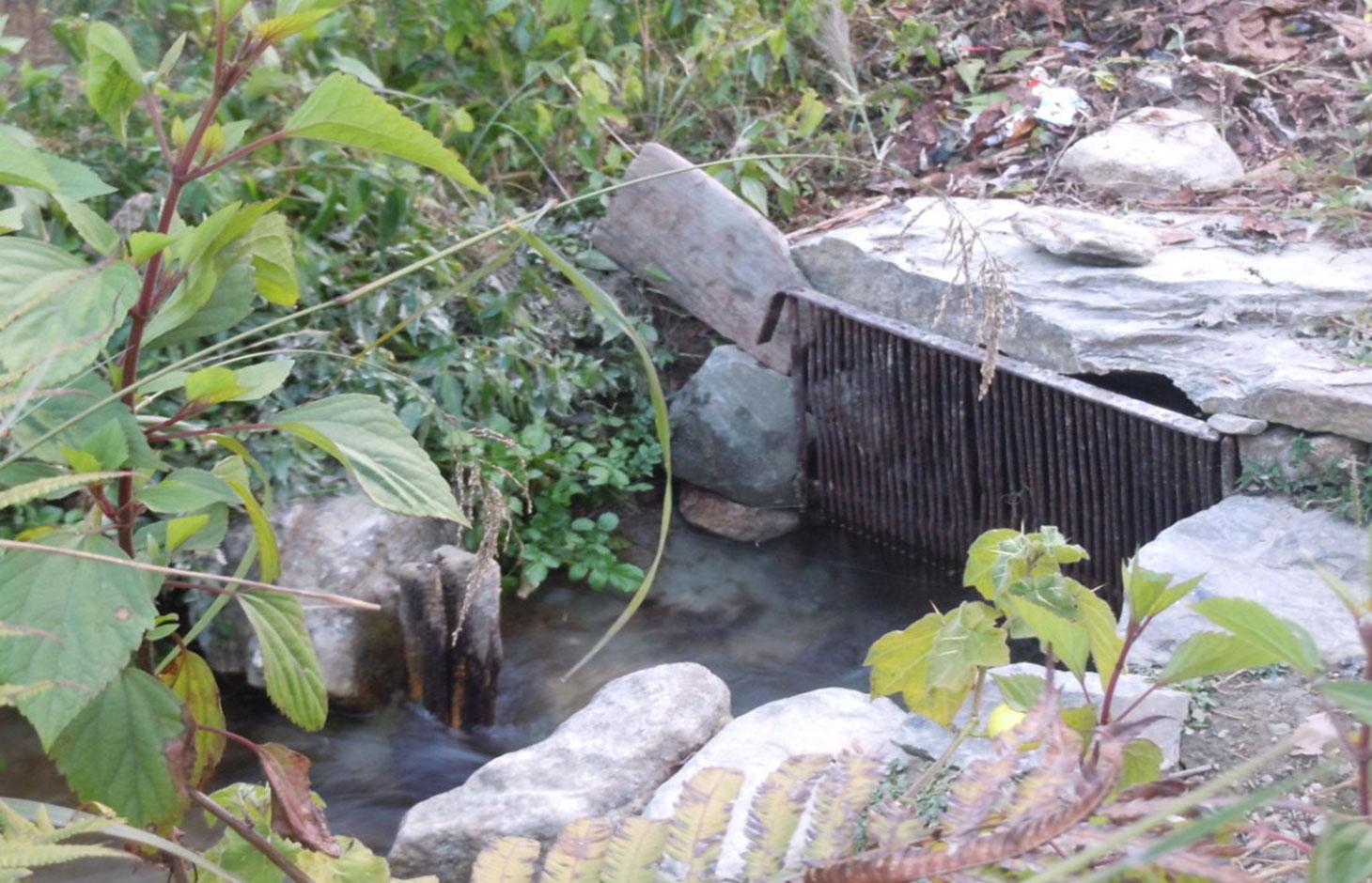
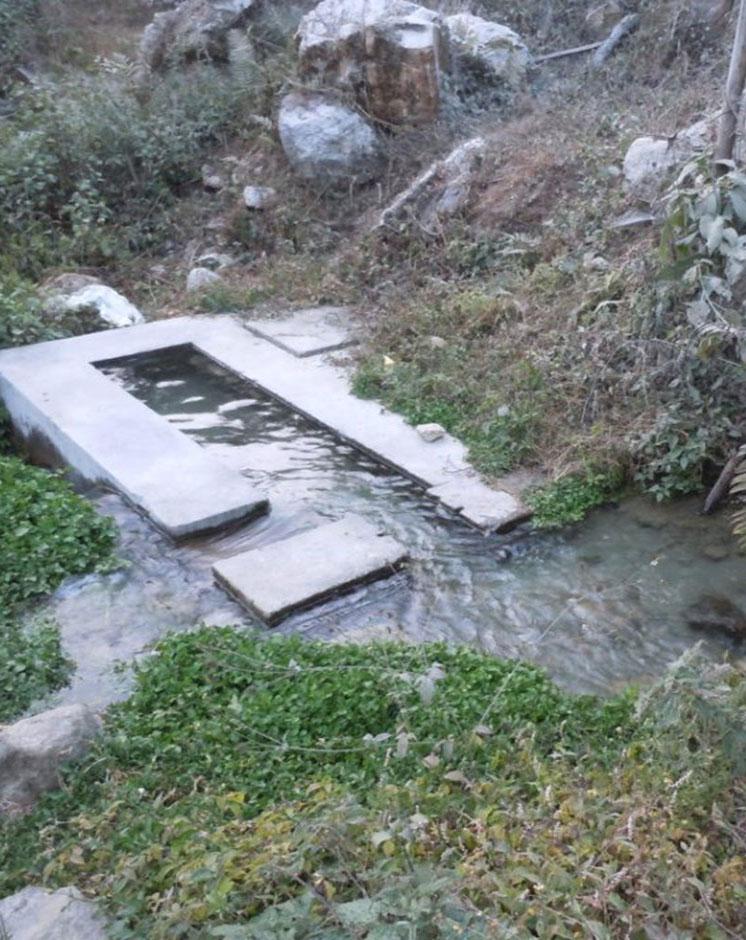
The technology involves the construction of diversion and waterways from the rivers to draw ample water sufficient for distribution to the different houses of the V.D.C .
Water is drawn from two rivers via three routes, one route from 'Polsing' river and the two other from 'Ghatte river' .
In the upper areas, open digging is done up to 700 meters from the source and waterways are created.
However, in lower areas due to more stones, creation of waterways was not possible, hence pipelines had to be created over 425 meters.
The pipeline opens in each house into a small reservoir for use in irrigation and household.
Purpose of the Technology: Mainly for conservation of land and soil along with provision of water to agricultural land.
Before the implementation of this technology, land was semi arid with few perennial crops.
Establishment / maintenance activities and inputs: Initially established and then managed by the combined effort of the users. All activities done voluntarily using easily available tools of daily usage by members of the households who benefit and make use of the technology. The only costs made were for the purpose of making pipelines which was borne half by the government and half by the land-users themselves.
No maintenance activities have been carried out so far, yet monthly collection of Rs 20 is done from each house which is stored for future use.
Natural / human environment: Chyamrangbesi VDC is a valley with subtropical type of climate. Precipitation level ranges from 750mm to 1500mm for about four months during the monsoons. The winters are dry however and hence the growing period is from 79 to 179 days, making the area semi-arid depending on the agro-climate division. Since the area falls on hill slopes with 8.16% steep so the technology is applied with convex manner.
2.3 Photos of the Technology
Media Gallery
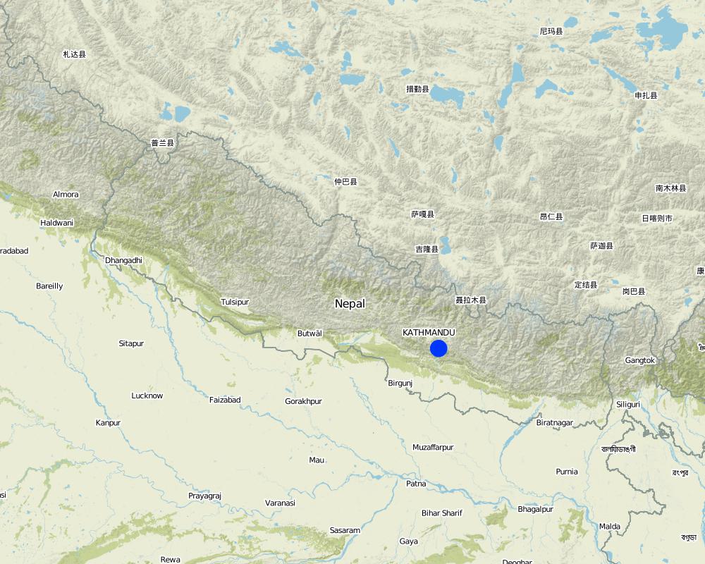
2.5 Country/ region/ locations where the Technology has been applied and which are covered by this assessment
Country:
Nepal
Region/ State/ Province:
Chyamrangbesi
Further specification of location:
Kavre
Specify the spread of the Technology:
- evenly spread over an area
If the Technology is evenly spread over an area, specify area covered (in km2):
28.97
Comments:
Total area covered by the SLM Technology is 28.97 km2.
Same technology covers entire area with water source
Map
×2.6 Date of implementation
If precise year is not known, indicate approximate date:
- less than 10 years ago (recently)
2.7 Introduction of the Technology
Specify how the Technology was introduced:
- through land users' innovation
Comments (type of project, etc.):
Initial work started in 2004, improvements in the technology each year
3. Classification of the SLM Technology
3.1 Main purpose(s) of the Technology
- improve production
- create beneficial economic impact
3.2 Current land use type(s) where the Technology is applied

Cropland
- Perennial (non-woody) cropping
Number of growing seasons per year:
- 3
Specify:
Longest growing period in days: 150, Longest growing period from month to month: Karthik (October) - Chaitra (April) Second longest growing period in days: 120, Second longest growing period from month to month: Asadh(June) - Ashwin (September)

Waterways, waterbodies, wetlands
- Drainage lines, waterways
Comments:
Major land use problems (compiler’s opinion): Land semi-arid and dry, hence only few selected crops could be grown due to lack of sufficient water.
Major land use problems (land users’ perception): Land could not be utilised properly due to lack of sufficient water for crops, dry condition.
Future (final) land use (after implementation of SLM Technology): Other: Ow: Waterways, drainage lines, ponds, dams
3.3 Has land use changed due to the implementation of the Technology?
Has land use changed due to the implementation of the Technology?
- Yes (Please fill out the questions below with regard to the land use before implementation of the Technology)
Cropland
- Annual cropping
3.5 SLM group to which the Technology belongs
- irrigation management (incl. water supply, drainage)
- water diversion and drainage
3.6 SLM measures comprising the Technology

structural measures
- S3: Graded ditches, channels, waterways
- S5: Dams, pans, ponds
3.7 Main types of land degradation addressed by the Technology

soil erosion by water
- Wt: loss of topsoil/ surface erosion

chemical soil deterioration
- Cn: fertility decline and reduced organic matter content (not caused by erosion)

biological degradation
- Bc: reduction of vegetation cover

water degradation
- Ha: aridification
Comments:
Main causes of degradation: urbanisation and infrastructure development (Construction of roads, not properly engineered, difficult to travel by and highly risky.), Heavy / extreme rainfall (intensity/amounts) (In the 3 months of monsoon), inputs and infrastructure: (roads, markets, distribution of water points, other, …) (Roads construction and its use by large vehicles frequently)
3.8 Prevention, reduction, or restoration of land degradation
Specify the goal of the Technology with regard to land degradation:
- prevent land degradation
4. Technical specifications, implementation activities, inputs, and costs
4.1 Technical drawing of the Technology
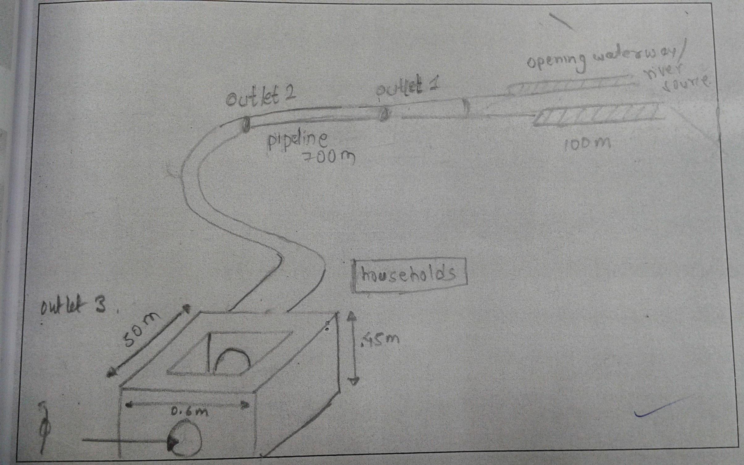
Technical specifications (related to technical drawing):
The drawing shows the path followed by the pipe irrigation, the various feautres
Location: Chamryangbesi VDC
Technical knowledge required for field staff / advisors: high (Designed by engineers
Technical knowledge required for land users: moderate (Constructed by land users)
Main technical functions: improvement of ground cover, water harvesting / increase water supply, promotion of vegetation species and varieties (quality, eg palatable fodder)
Secondary technical functions: stabilisation of soil (eg by tree roots against land slides), water spreading, increase of biomass (quantity)
Diversion ditch/ drainage
Vertical interval between structures (m): n/a
Spacing between structures (m): n/a
Depth of ditches/pits/dams (m): 0.6
Width of ditches/pits/dams (m): 0.6
Length of ditches/pits/dams (m): 100
Waterway
Vertical interval between structures (m): n/a
Spacing between structures (m): n/a
Depth of ditches/pits/dams (m): 0.6
Width of ditches/pits/dams (m): 0.6
Length of ditches/pits/dams (m): 700
Dam/ pan/ pond
Vertical interval between structures (m): n/a
Spacing between structures (m): 50
Depth of ditches/pits/dams (m): 0.45
Width of ditches/pits/dams (m): 0.6
Length of ditches/pits/dams (m): 50
Construction material (earth): soil excavated and used to make bunds of the water ways
Construction material (concrete): used to make small reservoirs in houses
Construction material (other): pipes : to transfer water from the source to houses
Slope (which determines the spacing indicated above): 15%
If the original slope has changed as a result of the Technology, the slope today is: 0%
Author:
Anish Adhikari
4.2 General information regarding the calculation of inputs and costs
other/ national currency (specify):
rupees
If relevant, indicate exchange rate from USD to local currency (e.g. 1 USD = 79.9 Brazilian Real): 1 USD =:
98.47
4.3 Establishment activities
| Activity | Timing (season) | |
|---|---|---|
| 1. | Farmers cut into land from the source in suitable directions to bring water to their houses | Dry season |
| 2. | Fitting of pipes | dry season |
| 3. | Construct small openings/reservoirs | dry season |
4.4 Costs and inputs needed for establishment
| Specify input | Unit | Quantity | Costs per Unit | Total costs per input | % of costs borne by land users | |
|---|---|---|---|---|---|---|
| Labour | Farmers cut into land from the source in suitable directions to bring water to their houses | mandays | 45.0 | |||
| Labour | Fitting of pipes | mandays | 15.0 | |||
| Labour | Construct small openings/reservoirs | mandays | 15.0 | |||
| Construction material | Pipe + cement | ha | 1.0 | 50.0 |
Comments:
Duration of establishment phase: 2 month(s)
4.7 Most important factors affecting the costs
Describe the most determinate factors affecting the costs:
Area to be covered by the pipeline and distance from the source are the most determinate factors.
5. Natural and human environment
5.1 Climate
Annual rainfall
- < 250 mm
- 251-500 mm
- 501-750 mm
- 751-1,000 mm
- 1,001-1,500 mm
- 1,501-2,000 mm
- 2,001-3,000 mm
- 3,001-4,000 mm
- > 4,000 mm
Specifications/ comments on rainfall:
Monsoon rains, dry winter
Agro-climatic zone
- semi-arid
Thermal climate class: subtropics
5.2 Topography
Slopes on average:
- flat (0-2%)
- gentle (3-5%)
- moderate (6-10%)
- rolling (11-15%)
- hilly (16-30%)
- steep (31-60%)
- very steep (>60%)
Landforms:
- plateau/plains
- ridges
- mountain slopes
- hill slopes
- footslopes
- valley floors
Altitudinal zone:
- 0-100 m a.s.l.
- 101-500 m a.s.l.
- 501-1,000 m a.s.l.
- 1,001-1,500 m a.s.l.
- 1,501-2,000 m a.s.l.
- 2,001-2,500 m a.s.l.
- 2,501-3,000 m a.s.l.
- 3,001-4,000 m a.s.l.
- > 4,000 m a.s.l.
Indicate if the Technology is specifically applied in:
- convex situations
5.3 Soils
Soil depth on average:
- very shallow (0-20 cm)
- shallow (21-50 cm)
- moderately deep (51-80 cm)
- deep (81-120 cm)
- very deep (> 120 cm)
Soil texture (topsoil):
- coarse/ light (sandy)
- medium (loamy, silty)
Topsoil organic matter:
- medium (1-3%)
If available, attach full soil description or specify the available information, e.g. soil type, soil PH/ acidity, Cation Exchange Capacity, nitrogen, salinity etc.
Soil depth on average: Varies from shallow to deep
Soil texture: Soil texture varies from place to place
Soil fertility: Medium (ranked 1, varies according to water availability) and low (ranked 2)
Topsoil organic matter: Use of manure necessary for maintaining productivity
Soil drainage/infiltration: Good
Soil water storage capacity: Medium (No groundwater found)
5.4 Water availability and quality
Ground water table:
on surface
Availability of surface water:
excess
Water quality (untreated):
good drinking water
Comments and further specifications on water quality and quantity:
Ground water table: On surface (ranked 1, Groundwater use not much evident) and <5m (ranked 2)
Availability of surface water: Excess (ranked 1, Floods occurs in case of heavy seasonal rainfall; supply of water is good and sufficient) and good (ranked 2)
Water quality (untreated): Good drinking water (perennial surface water distributed through pipelines)
5.5 Biodiversity
Species diversity:
- high
5.6 Characteristics of land users applying the Technology
Off-farm income:
- less than 10% of all income
Relative level of wealth:
- average
- rich
Individuals or groups:
- individual/ household
Gender:
- women
- men
Indicate other relevant characteristics of the land users:
Land users applying the Technology are mainly common / average land users
Population density: 100-200 persons/km2
Annual population growth: > 4%; 5%
40% of the land users are rich.
60% of the land users are average wealthy.
5.7 Average area of land used by land users applying the Technology
- < 0.5 ha
- 0.5-1 ha
- 1-2 ha
- 2-5 ha
- 5-15 ha
- 15-50 ha
- 50-100 ha
- 100-500 ha
- 500-1,000 ha
- 1,000-10,000 ha
- > 10,000 ha
Is this considered small-, medium- or large-scale (referring to local context)?
- medium-scale
5.8 Land ownership, land use rights, and water use rights
Land ownership:
- individual, not titled
Land use rights:
- individual
Water use rights:
- open access (unorganized)
- communal (organized)
5.9 Access to services and infrastructure
health:
- poor
- moderate
- good
education:
- poor
- moderate
- good
technical assistance:
- poor
- moderate
- good
employment (e.g. off-farm):
- poor
- moderate
- good
markets:
- poor
- moderate
- good
energy:
- poor
- moderate
- good
roads and transport:
- poor
- moderate
- good
drinking water and sanitation:
- poor
- moderate
- good
financial services:
- poor
- moderate
- good
6. Impacts and concluding statements
6.1 On-site impacts the Technology has shown
Socio-economic impacts
Production
crop production
fodder production
fodder quality
animal production
wood production
risk of production failure
production area
energy generation
Comments/ specify:
Water Mill ('Pani Ghatta')
Water availability and quality
drinking water availability
drinking water quality
water availability for livestock
water quality for livestock
Income and costs
farm income
Socio-cultural impacts
food security/ self-sufficiency
health situation
cultural opportunities
recreational opportunities
community institutions
national institutions
SLM/ land degradation knowledge
conflict mitigation
situation of socially and economically disadvantaged groups
Ecological impacts
Water cycle/ runoff
water quantity
water quality
harvesting/ collection of water
surface runoff
excess water drainage
groundwater table/ aquifer
evaporation
Soil
soil moisture
soil cover
soil loss
soil crusting/ sealing
soil compaction
nutrient cycling/ recharge
salinity
soil organic matter/ below ground C
Biodiversity: vegetation, animals
biomass/ above ground C
plant diversity
animal diversity
beneficial species
habitat diversity
pest/ disease control
Climate and disaster risk reduction
emission of carbon and greenhouse gases
fire risk
wind velocity
6.2 Off-site impacts the Technology has shown
water availability
reliable and stable stream flows in dry season
downstream flooding
downstream siltation
groundwater/ river pollution
buffering/ filtering capacity
wind transported sediments
damage on neighbours' fields
damage on public/ private infrastructure
6.3 Exposure and sensitivity of the Technology to gradual climate change and climate-related extremes/ disasters (as perceived by land users)
Gradual climate change
Gradual climate change
| Season | increase or decrease | How does the Technology cope with it? | |
|---|---|---|---|
| annual temperature | increase | well |
Climate-related extremes (disasters)
Meteorological disasters
| How does the Technology cope with it? | |
|---|---|
| local rainstorm | not well |
| local windstorm | not known |
Climatological disasters
| How does the Technology cope with it? | |
|---|---|
| drought | well |
Hydrological disasters
| How does the Technology cope with it? | |
|---|---|
| general (river) flood | not well |
Other climate-related consequences
Other climate-related consequences
| How does the Technology cope with it? | |
|---|---|
| reduced growing period | not known |
Comments:
In cases of excess water availability, pipelines have been made to divert water to mills , that uses water to rotate blades and grind crops.
6.4 Cost-benefit analysis
How do the benefits compare with the establishment costs (from land users’ perspective)?
Short-term returns:
neutral/ balanced
Long-term returns:
positive
How do the benefits compare with the maintenance/ recurrent costs (from land users' perspective)?
Short-term returns:
positive
Long-term returns:
positive
6.5 Adoption of the Technology
Comments:
There is a strong trend towards spontaneous adoption of the Technology. Every year the irrigation line is being increased to encompass more houses of the VDC
6.7 Strengths/ advantages/ opportunities of the Technology
| Strengths/ advantages/ opportunities in the compiler’s or other key resource person’s view |
|---|
| Water is equally available to all the households, with minor level decrease in the dry season. |
| The crop, fodder production has increased |
| Reduced top soil loss due to erosion |
| Maintenance requirement minimum |
6.8 Weaknesses/ disadvantages/ risks of the Technology and ways of overcoming them
| Weaknesses/ disadvantages/ risks in the compiler’s or other key resource person’s view | How can they be overcome? |
|---|---|
| More houses could be Incorporated in the technology | Involvement of more local inhabitants so more households could benefit from the technology |
| Lack of Monitoring by Experts | Monitoring of SLM Experts could help improve the existing system to make it more sustainable and efficient. |
7. References and links
7.1 Methods/ sources of information
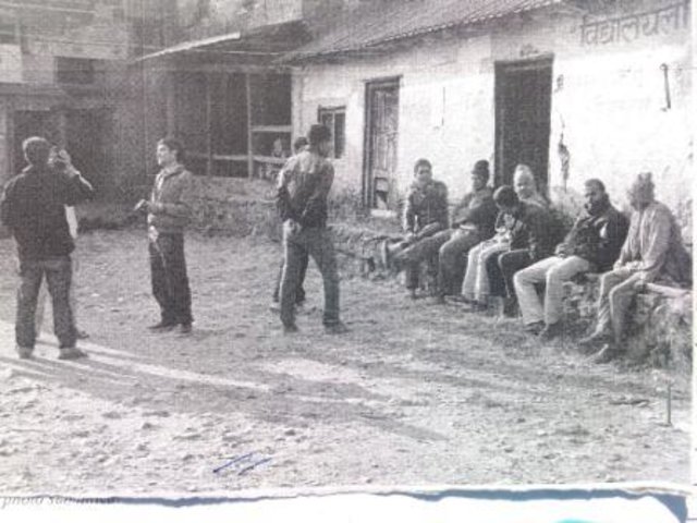
- field visits, field surveys
- interviews with land users
When were the data compiled (in the field)?
02/12/2012
Links and modules
Expand all Collapse allLinks
Pipeline Irrigation [Nepal]
The process and measures taken to draw water from nearby rivers for irrigation and household purposes.
- Compiler: Sabita Aryal
Modules
No modules